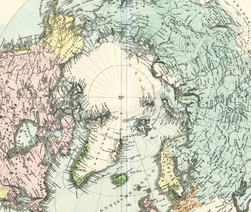
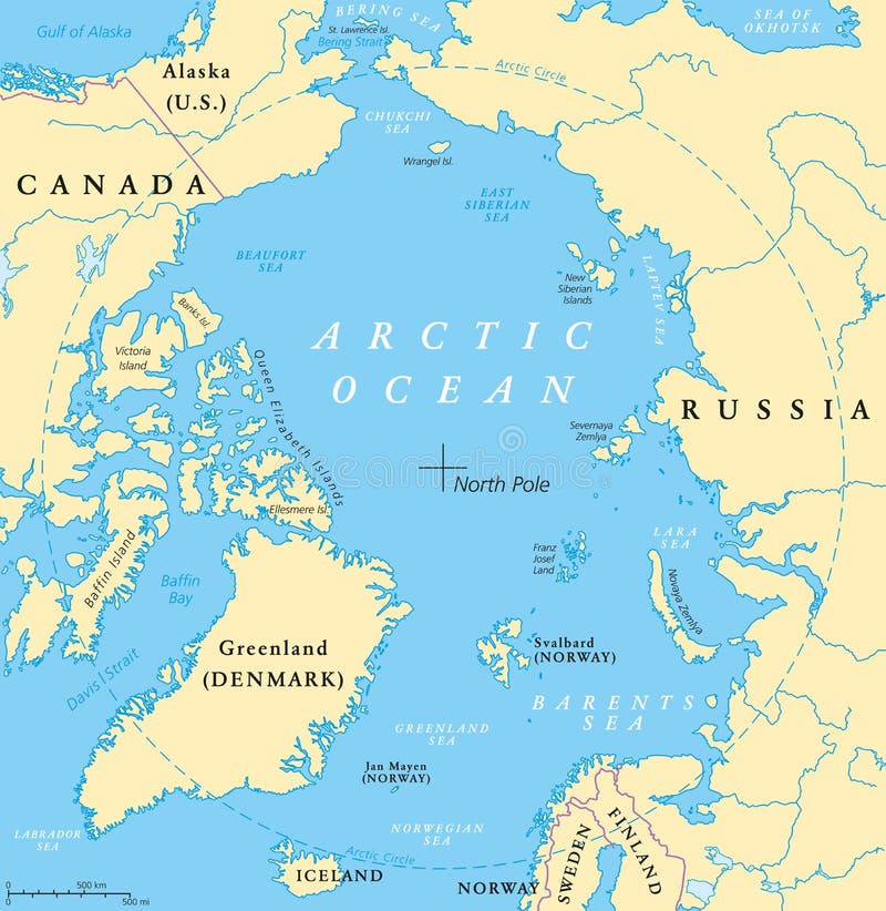
Free with trial 1875 Antique Map of North Pole Region, Canada, Alaska, Siberia, Greenland. Alaska region illustrations Antique Map of North Pole
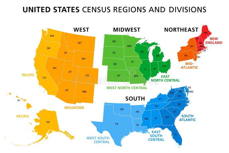
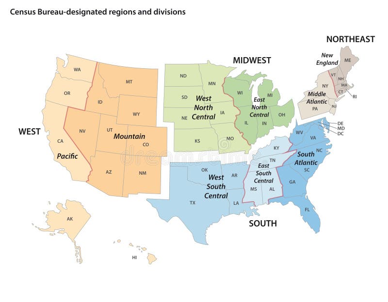
Free with trial United States, Census regions and divisions, political map. Region definition widely used for data collection and analysis. The most commonly used classification system. English. Illustration. Vector. Alaska region vectors United States, Census regions and divisions, political map
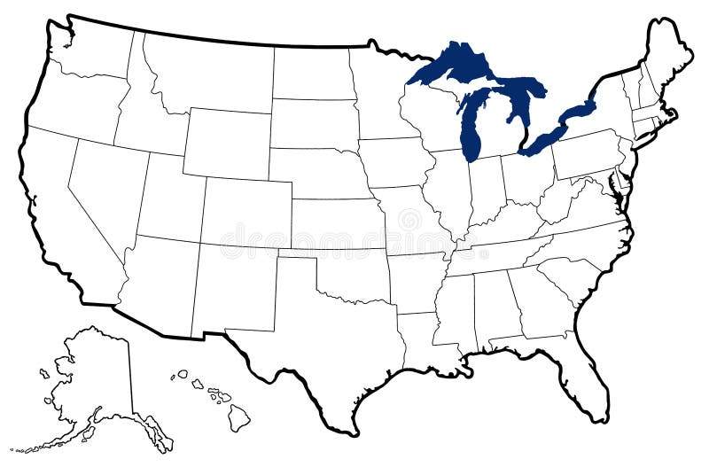
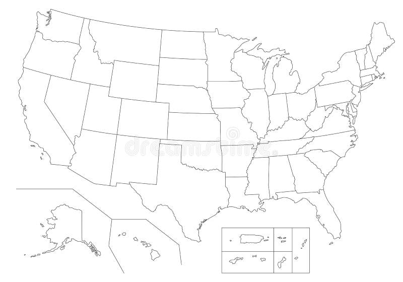
Free with trial Detailed outline map of United States showing state borders, Great Lakes, and major bays. Alaska region illustrations Outline Map of United States
Free with trial USA - United States of America - colored vector map with the division into states. Alaska region vectors USA - United States of America - colored vector map with the division into states
Free with trial Administrative division of Canada. Map of Quebec with regions and main cities, vector illustration. Alaska region vectors Province of Canada - Quebec. Administrative division of Canada. Map of Quebec with regions and main cities, vector illustration
Free with trial Administrative division of Canada with regions and main cities. Alaska region vectors Canada map. Administrative division of Canada with regions and main cities.
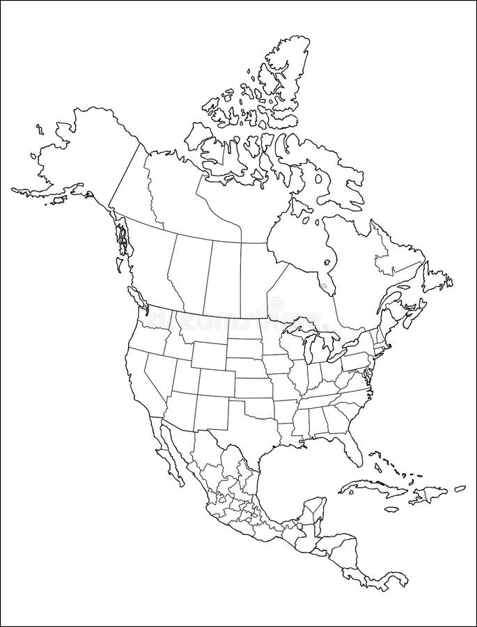
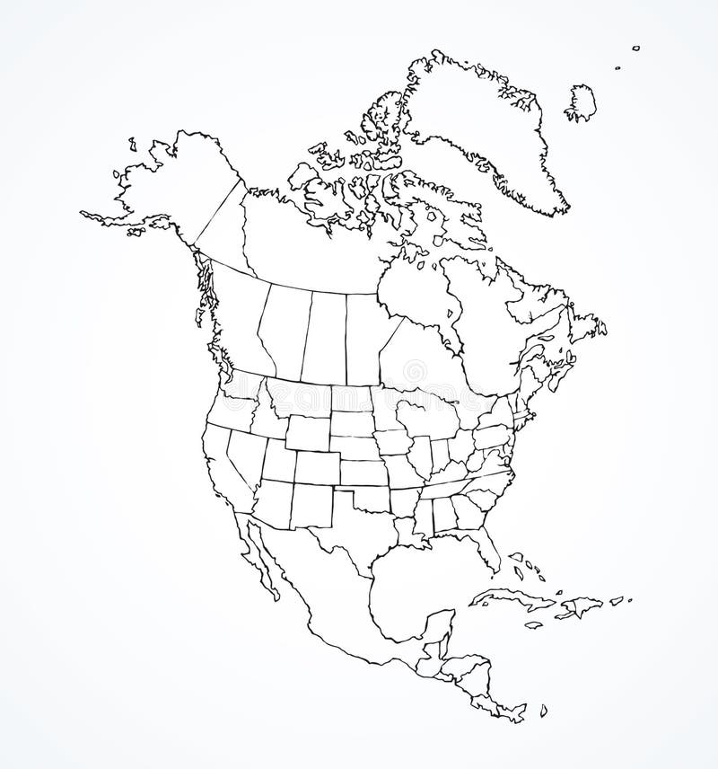
Free with trial White Outline map of North America with counties, borders on white background. Alaska region illustrations Map of North America
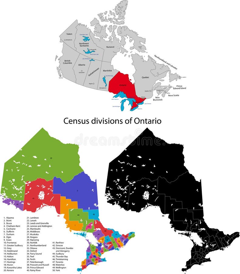
Free with trial Administrative division of Canada. Map of Ontario with census divisions, vector illustration. Alaska region vectors Province of Canada - Ontario. Administrative division of Canada. Map of Ontario with census divisions, vector illustration
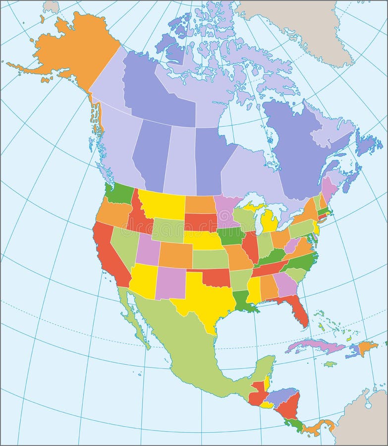
Free with trial Political map of North America with coordinates, present states borders, detailed vector map. Alaska region vectors North America political map. Political map of North America with coordinates, present states borders, detailed vector map.
Free with trial 3D Map of United state of america. Alaska region vectors 3D Map of United state of america
Free with trial Photo from Original 1870 Antique Map of North America showing the United States, Canada, Mexico and a nice vignette of Niagara Falls. Alaska region illustrations Antique 1870 Map of North America. Photo from Original 1870 Antique Map of North America showing the United States, Canada, Mexico and a nice vignette of Niagara Falls
Free with trial Detailed outline map of United States showing state borders, Great Lakes, and major bays; map uses six bright colors. Alaska region illustrations Map of United States with state names. Detailed outline map of United States showing state borders, Great Lakes, and major bays; map uses six bright colors
Free with trial Administrative division of Canada. Map of New Brunswick with counties and main cities, vector illustration. Alaska region vectors Province of Canada - New Brunswick. Administrative division of Canada. Map of New Brunswick with counties and main cities, vector illustration
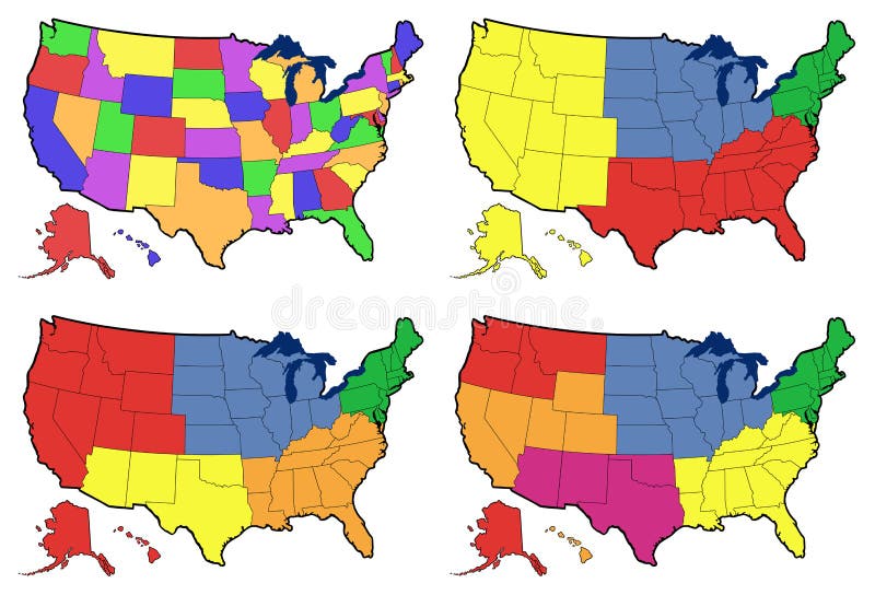
Free with trial Detailed outline map of United States showing state borders, Great Lakes, and major bays; maps divide US into individual states, four regions, five regions, and six regions. Alaska region illustrations Four versions of regional map of United States. Detailed outline map of United States showing state borders, Great Lakes, and major bays; maps divide US into individual states, four regions, five regions, and six regions
Free with trial Outline United States Of America map. US background template. Map of America with separated countries and interstate borders. All states and regions are named in the layer panel. Alaska region vectors Outline United States Of America map.
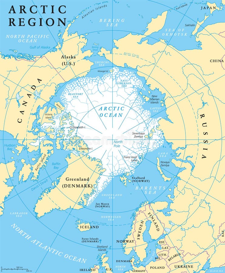
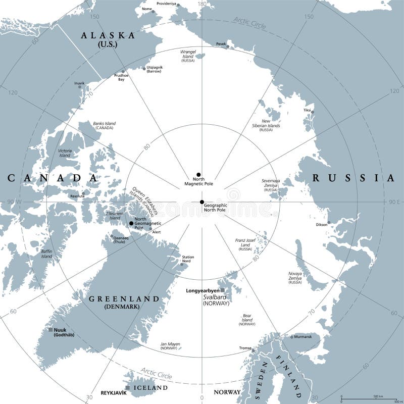
Free with trial Arctic region map with countries, capitals, national borders, rivers and lakes. Arctic Ocean with average minimum extent of sea ice. English labeling and scaling. Alaska region vectors Arctic Region Map
Free with trial Arctic region political map with countries, capitals, national borders, important cities, rivers and lakes. Arctic Ocean with average minimum extent of sea ice. English labeling and scaling. Alaska region vectors Arctic Region Political Map
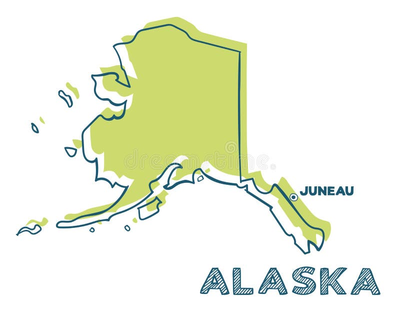
Free with trial Map of Alaska, USA with small location map. Vector illustration. Alaska region illustrations Alaska map. Map of Alaska, USA with small location map. Vector illustration.
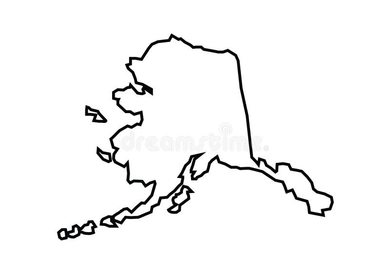
Free with trial Alaska outline map state shape vector illustration. Alaska region vectors Alaska outline map state shape
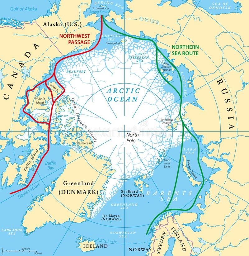
Free with trial Arctic Ocean sea routes map with Northwest Passage and Northern Sea Route. Arctic Region map with countries, national borders, rivers, lakes and average minimum extent of sea ice. English labeling. Alaska region vectors Arctic Ocean Sea Routes Map
Free with trial Map of United States split into Census regions and divisions. Region definition, widely used for data collection and analysis. Most commonly used classification system. English. Illustration. Vector. Alaska region vectors Map of United States split into Census regions and divisions
Free with trial Administrative division of Canada. Map of British Columbia with regions and main cities, vector illustration. Alaska region vectors Province of Canada - British Columbia. Administrative division of Canada. Map of British Columbia with regions and main cities, vector illustration
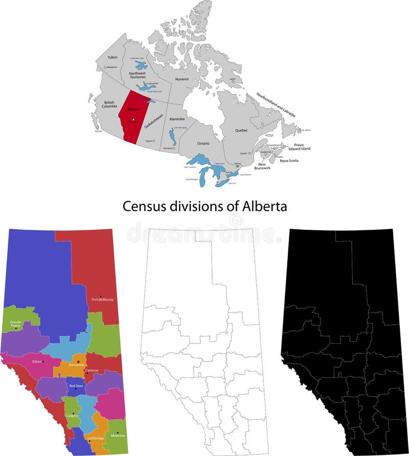
Free with trial Administrative division of Canada. Map of Alberta with regions and main cities, vector illustration. Alaska region vectors Province of Canada - Alberta. Administrative division of Canada. Map of Alberta with regions and main cities, vector illustration
Free with trial Administrative division of Canada. Map of Nova Scotia with regions and main cities, vector illustration. Alaska region vectors Province of Canada - Nova Scotia. Administrative division of Canada. Map of Nova Scotia with regions and main cities, vector illustration
Free with trial Administrative division of Canada. Map of Manitoba with regions and main cities, vector illustration. Alaska region vectors Province of Canada - Manitoba. Administrative division of Canada. Map of Manitoba with regions and main cities, vector illustration
Free with trial America map. handwritten illustration. separated states of USA. Alaska region vectors USA map with states. brush strokes. America map. handwritten illustration. separated states of USA.
Free with trial Administrative division of Canada. Map of Prince Edward Island with regions and main cities, vector illustration. Alaska region vectors Province of Canada - Prince Edward Island. Administrative division of Canada. Map of Prince Edward Island with regions and main cities, vector illustration
Free with trial Husky dog breed vector illustration, dog show sign symbol set. Dogs of this breed take part in the Sled dog racing, winter dog sport in the Arctic regions of the United States, Canada, Russia, and some North Europe. Alaska region vectors Husky dog breed vector illustration
Free with trial Administrative division of Canada. Map of Newfoundland and Labrador with regions and main cities, vector illustration. Alaska region vectors Province of Canada - Newfoundland and Labrador. Administrative division of Canada. Map of Newfoundland and Labrador with regions and main cities, vector illustration
Free with trial United States map with all 50 states separated - Vector. Alaska region vectors United States map with all 50 states separated
Free with trial United States of America map. USA map with states and state names isolated – stock vector. Alaska region illustrations United States of America map. USA map with states and state names isolated – vector
Free with trial Detailed vintage map of the United States of America split into individual states with the abbreviations 50 states, vector illustration travel postcard. Alaska region vectors Detailed vintage map of the United States of America split into individual states with the abbreviations 50 states, vector
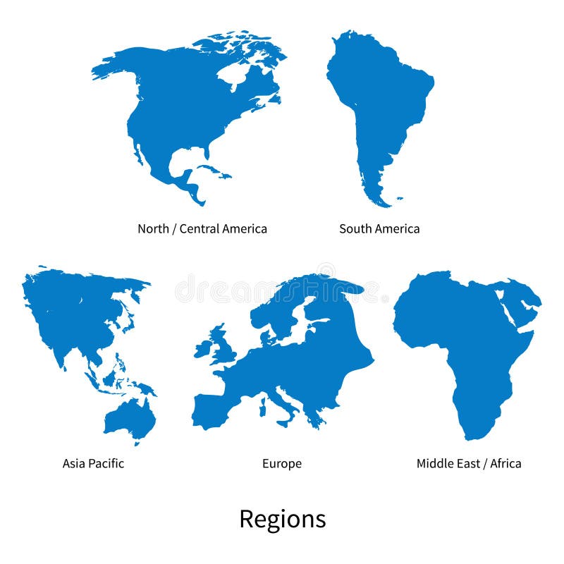
Free with trial Detailed vector map of North - Central America, Asia Pacific, Europe, South America, Middle and East Africa, Regions on white. Alaska region vectors Detailed vector map of North - Central America, Asia Pacific, Europe, South America, Middle and East Africa Regions
Free with trial Blue Outline map of North America with counties, borders on white background. Alaska region illustrations Map of North America
Free with trial United States of America 50 states and 1 federal district. US states map. Alaska region vectors United States of America 50 states and 1 federal district. US st
Free with trial USA map with borders and abbreviations for US states. Black color states with white inscriptions. Flat style vector illustration isolated on white background. Alaska region vectors USA map with borders and abbreviations for US states. Black color states with white inscriptions. Flat style vector
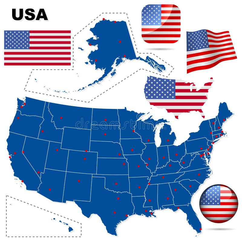
Free with trial This is an illustration of all flags with of USA with clipping path. Alaska region illustrations Flags of the USA with clipping path. This is an illustration of all flags with of USA with clipping path
Free with trial USA set. Detailed country shape with region borders, flags and icons isolated on white background. Alaska region vectors USA vector set. USA set. Detailed country shape with region borders, flags and icons isolated on white background.
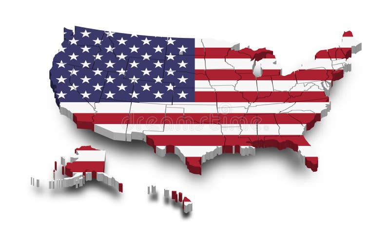
Free with trial United states of america map and flag. 3D shape design. Independence day of USA concept. Perspective view. Vector. Alaska region vectors United states of america map and flag . 3D shape design . Independence day of USA concept . Perspective view . Vector
Free with trial Traditional man-made stone landmark used by Inuit and other native peoples of Arctic region of North America, northern Canada, Greenland, Alaska. Cutout clipart element. Alaska region illustrations Inuksuk watercolour drawing. Traditional man-made stone landmark used by Inuit and other native peoples of Arctic region of North America, northern Canada, Greenland, Alaska. Cutout clipart element.
Free with trial Arctic region, gray political map. Polar region around North Pole of Earth. The Arctic Ocean region, with North Magnetic Pole and North Geomagnetic Pole, longitudes and latitudes. Illustration. Vector. Alaska region vectors Arctic region, polar region around North Pole, gray political map. Arctic region, gray political map. Polar region around North Pole of Earth. The Arctic Ocean region, with North Magnetic Pole and North Geomagnetic Pole, longitudes and latitudes. Illustration. Vector
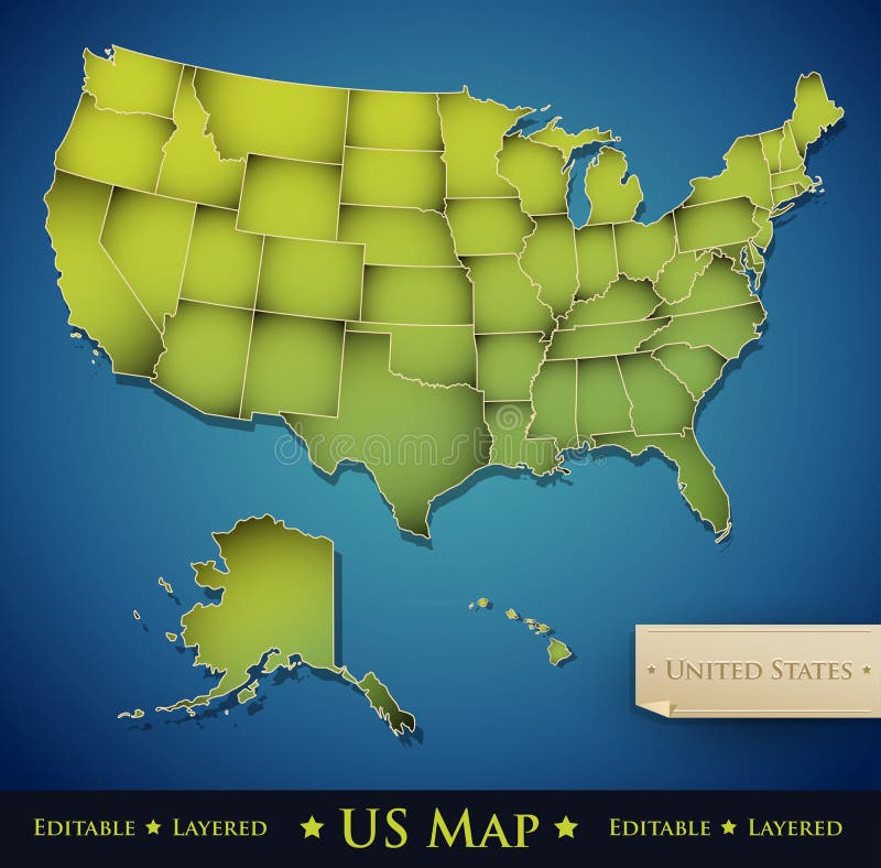
Free with trial USA map with Alaska and Hawaii map separate states individual names card paper 3D natural vector. Alaska region vectors USA map with Alaska and Hawaii map separate individual card paper 3D natural. USA map with Alaska and Hawaii map separate states individual names card paper 3D natural vector
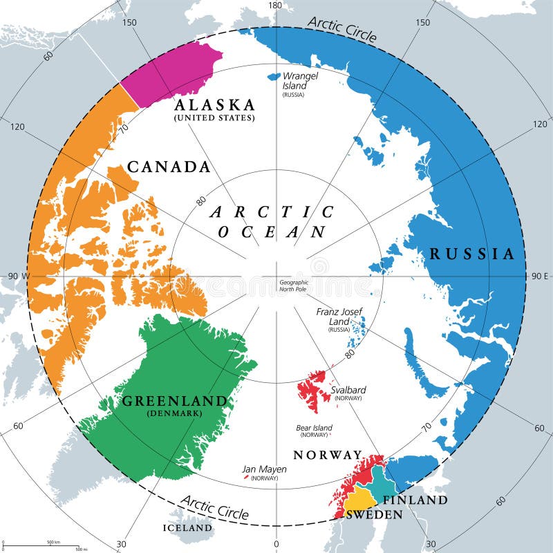
Free with trial Countries within the Arctic Circle, political map. Countries within about 66 degrees north the Equator and North Pole. Alaska (U. S. ), Canada, Finland, Greenland (Denmark), Norway, Sweden and Russia. Alaska region vectors Countries within the Arctic Circle, Arctic Region countries, political map. Countries within the Arctic Circle, political map. Countries within about 66 degrees north the Equator and North Pole. Alaska (U.S.), Canada, Finland, Greenland (Denmark), Norway, Sweden and Russia.
Free with trial Map of the Arctic region, the northwest passage and the northern sea route. Alaska region vectors Map of the Arctic region, the northwest passage and the northern sea route
Free with trial USA map with Alaska and Hawaii map, new political detailed map, separate individual states, with state names, isolated on white background 3D blank vector. Alaska region vectors USA map with Alaska and Hawaii map, new political detailed map, separate individual states, with state names, isolated on white
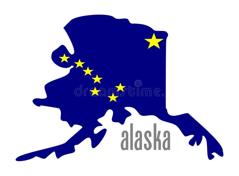
Free with trial Alaska map silhouette isolated on white background silhouette. High detailed illustration. United state of America country. Alaska region illustrations Alaska map silhouette. Alaska map silhouette isolated on white background silhouette. High detailed illustration. United state of America country.
Free with trial Arctic Ocean map with North Pole and Arctic Circle. Arctic region map with countries, national borders, rivers and lakes. Map without sea ice. English labeling and scaling. Alaska region vectors Arctic Ocean Map
Free with trial Eskimo man in traditional snow fur coat. People inhabited Siberia, Alaska, the northern region. Vector flat style cartoon illustration isolated on white background. Alaska region vectors Eskimo man in fur coat. Eskimo man in traditional snow fur coat. People inhabited Siberia, Alaska, the northern region. Vector flat style cartoon illustration isolated on white background
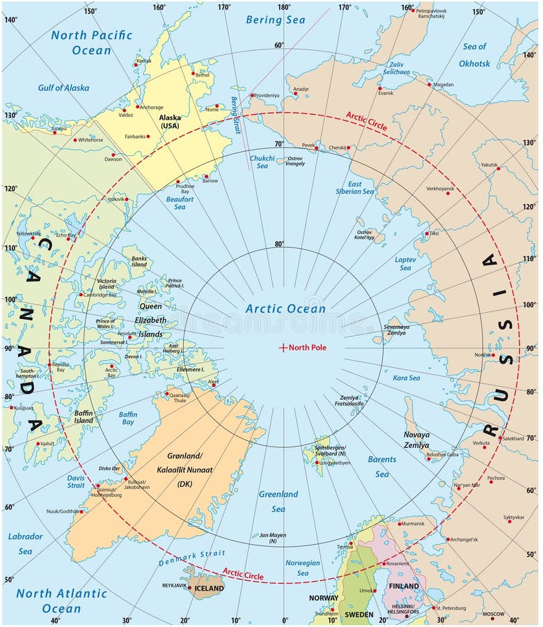
Free with trial Highly detailed map of the Arctic region. Alaska region illustrations Arctic map. Highly detailed map of the Arctic region
Free with trial Administrative division of Canada. Map of Nunavut with regions and main cities, vector illustration. Alaska region vectors Province of Canada - Nunavut. Administrative division of Canada. Map of Nunavut with regions and main cities, vector illustration
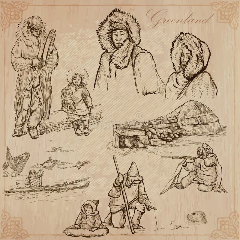
Free with trial Travel series: POLAR REGIONS - GREENLAND (set no. 7) - Collection of an hand drawn vector illustrations. Each drawing comprise three layers of lines, the colored background is. Editable in layers and groups. Alaska region vectors Greenland: Travel around the World. Vector drawings. Travel series: POLAR REGIONS - GREENLAND (set no.7) - Collection of an hand drawn vector illustrations. Each drawing comprise three layers of lines, the colored background is . Editable in layers and groups.
Free with trial Administrative division of Canada. Map of Northwest Territories with regions and main cities, vector illustration. Alaska region vectors Province of Canada - Northwest Territories. Administrative division of Canada. Map of Northwest Territories with regions and main cities, vector illustration
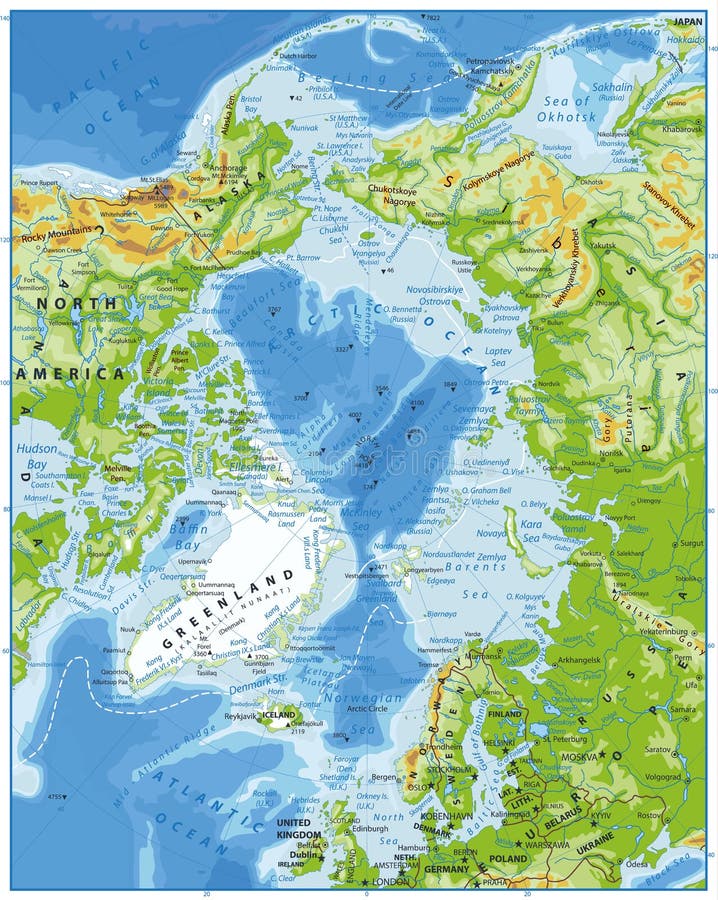
Free with trial Arctic Ocean Physical Map. Highly detailed vector illustration. Alaska region vectors Arctic Ocean Physical Map
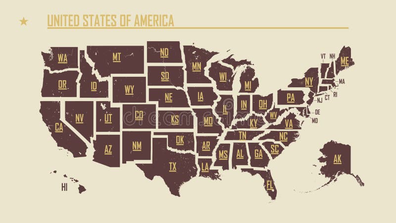
Free with trial United States of America map. USA map with states and state names. Map of USA with state abbreviations - vector. Alaska region vectors United States of America map. USA map with states and state names. Map of USA with state abbreviations
Free with trial United States, geographic regions, colored political map. Five regions, according to their geographic position on the continent. Common but unofficial way of referring to regions of the United States. Alaska region vectors United States of America, geographic regions, colored political map. United States, geographic regions, colored political map. Five regions, according to their geographic position on the continent. Common but unofficial way of referring to regions of the United States.
Free with trial Arctic Ocean Political Map. Retro colors. Highly detailed vector illustration. Alaska region vectors Arctic Ocean Political Map. Retro colors
Free with trial Travel series: POLAR REGIONS (Antarctica and Greenland) - Collection (no. 2) of an hand drawn illustrations. Description: Full sized hand drawn illustrations drawing on white background. Alaska region illustrations Polar Regions: Travel around the World. Freehand drawings. Travel series: POLAR REGIONS (Antarctica and Greenland) - Collection (no.2) of an hand drawn illustrations. Description: Full sized hand drawn illustrations drawing on white background.
Free with trial Geographic position of the North Pole of the Earth, political map. Magnetic, Geomagnetic and Geographic North Pole. Map of the Arctic Ocean and the Arctic Circle with latitudes and longitudes. Vector. Alaska region vectors Geographic position of the North Pole of the Earth, political map
Free with trial United States of America 50 states and 1 federal district. US states map. Alaska region vectors United States of America 50 states and 1 federal district. US st
Free with trial Vector map of the United States census bureau designated regions and divisions. Alaska region vectors Vector map of the United States census bureau designated regions and divisions
Free with trial Great US district zone shape on white backdrop. Freehand line dark black ink hand drawn symbolic web logo emblem pictogram frame in art modern grunge doodle cartoon style pen on paper. Alaska region vectors North American continent with contours of countries. Vector drawing. Great US district zone shape on white backdrop. Freehand line dark black ink hand drawn symbolic web logo emblem pictogram frame in art modern grunge doodle cartoon style pen on paper
Free with trial Usa states map isolated for infographic blank usa map template. Alaska region vectors Usa states map
Free with trial Hawaii outline map state shape USA America borders black and white. Alaska region vectors Hawaii outline map state shape USA America borders
Free with trial Great social physical US republic zone shape on white backdrop. Freehand line black ink hand drawn web global planet logo emblem pictogram frame in art modern grunge doodle cartoon style pen on paper. Alaska region vectors North American continent with contours of countries. Vector drawing. Great social physical US republic zone shape on white backdrop. Freehand line black ink hand drawn web global planet logo emblem pictogram frame in art modern grunge doodle cartoon style pen on paper
Free with trial Usa, United States of America map. Colorful orange vector illustration. Alaska region vectors Usa, United States of America map. Colorful orange vector illustration
Free with trial Colorado outline map state shape USA America borders black and white. Alaska region vectors Colorado outline map state shape USA America borders
Free with trial Vector of USA map and american flag. Outline style. Alaska region vectors Vector of USA map and american flag . Outline style
Free with trial Map of the United States of America isolated on white background. 3D render. Alaska region illustrations Map of the United States of America
Free with trial WPA poster art of the Kobuk Valley National Park, an American national park in the Arctic region of northwestern Alaska, United States done in works project administration federal art project style. Alaska region vectors Kobuk Valley National Park in Arctic region of northwestern Alaska United States WPA Poster Art Color. WPA poster art of the Kobuk Valley National Park, an American national park in the Arctic region of northwestern Alaska, United States done in works project administration federal art project style
Free with trial West Coast region of the United States, with Alaska and Hawaii, political map. Also known as Pacific Coast, Pacific Seaboard and Western Seaboard. Alaska, California, Hawaii, Oregon, and Washington. Alaska region vectors West Coast region of the United States, with Alaska and Hawaii, political map
Free with trial Alaska state silhouette. USA map icon set in outline, solid, dotted and red fill styles. State border sign. American region symbol. Geographic territory pictogram. Political map illustration. Alaska region vectors Alaska state silhouette. USA map icon set in outline, solid, dotted and red fill styles. State border sign. American region symbol. Geographic territory
Free with trial Witness the raw beauty of Denali National Park, Alaska, as a majestic moose grazes peacefully against a backdrop of towering mountains and pristine wilderness. This stunning panoramic landscape captures the essence of Alaska's untamed spirit, showcasing the incredible wildlife that thrives in this remote region. The moose, a symbol of the Alaskan wilderness, stands majestically in the foreground. Alaska region illustrations Breathtaking Panoramic View of a Majestic Moose in Denali National Park Alaska A Wildlife Encounter in the Alaskan. Witness the raw beauty of Denali National Park, Alaska, as a majestic moose grazes peacefully against a backdrop of towering mountains and pristine wilderness. This stunning panoramic landscape captures the essence of Alaska's untamed spirit, showcasing the incredible wildlife that thrives in this remote region. The moose, a symbol of the Alaskan wilderness, stands majestically in the foreground
Free with trial Bald eagle (Haliaeetus leucocephalus) in mid-flight, capturing a fish from the water. The bird's wings are fully spread, and its talons clutch the fish tightly. The eagle's white head contrasts with its dark brown body and wings. Background features snow-capped mountains and a blue sky, indicating a possible location in a northern region like Alaska. The water below is dark and slightly turbulent, with splashes where the fish was caught. Alaska Bald Eagle Attacking A Fish. A mature Bald Eagle swooping in and catching a fish off. Al Generated. Alaska region illustrations Alaska Bald Eagle Attacking A Fish. A mature Bald Eagle swooping in and catching a fish off
Free with trial Alaska, state of United States of America. Grayscale elevation map with lakes and rivers. Locations and names of major cities of the region. Corner auxiliary location maps. Alaska region illustrations Alaska, United States of America. Grayscale. Labelled points of. Alaska, state of United States of America. Grayscale elevation map with lakes and rivers. Locations and names of major cities of the region. Corner auxiliary location maps
Free with trial Arctic region political map. Polar region around the North Pole at the northernmost part of Earth. The Arctic Ocean without ice. Gray illustration with English labeling on white background. Vector. Alaska region vectors Arctic region political map
Free with trial Vector posters with highly detailed silhouettes of maps of the states of America, Division Pacific - Alaska, Hawaii - set 17 of 17 travel postcard. Alaska region vectors Vector posters with highly detailed silhouettes of maps of the states of America, Division Pacific - Alaska, Hawaii - set 17 of 17
Free with trial Doodle vector map of Alaska state of USA. With legends of state and capital. Alaska region vectors Doodle map of Alaska state of USA. Doodle vector map of Alaska state of USA. With legends of state and capital
Free with trial Arctic region countries and North Pole political map with national borders and country names. Arctic ocean without sea ice. English labeling and scaling. Illustration. Alaska region vectors Arctic region countries and North Pole political map