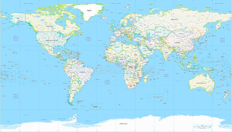
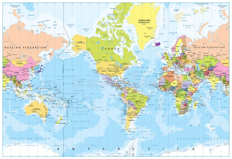
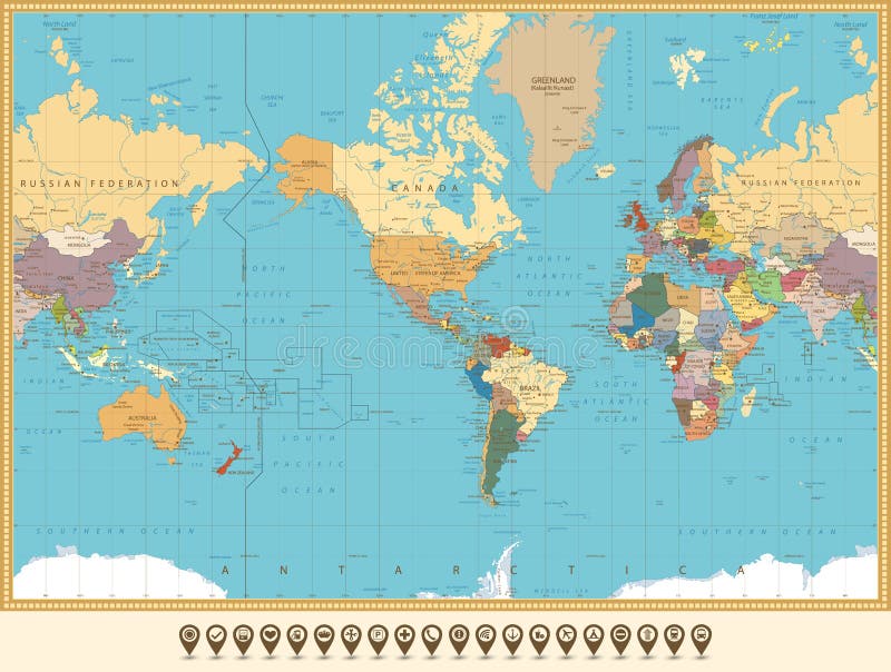
Free with trial Detailed Political World Map with all names of countries, cities and capitals, river, lake, oceans, seas, islands, South Pole and North Pole. Antarctica map new vectors World Map Detailed Political Map. Detailed Political World Map with all names of countries, cities and capitals, river, lake, oceans, seas, islands, South Pole and North Pole
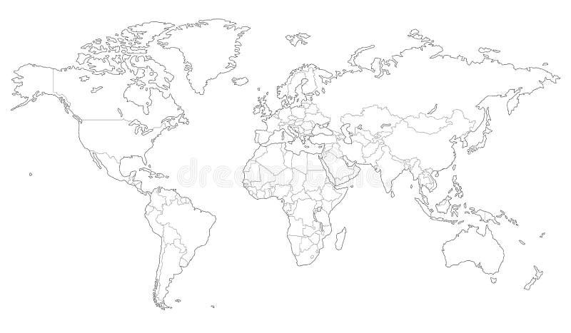
Free with trial High quality Outlined vector map of the world with only straight lines. Antarctica map new vectors Outlined vector map of the world
Free with trial Detailed Physical World Map with all names of countries, cities and capitals, river, lake, oceans, seas, islands, South Pole and North Pole. Antarctica map new vectors World Map Detailed Physical Map. Detailed Physical World Map with all names of countries, cities and capitals, river, lake, oceans, seas, islands, South Pole and North Pole
Free with trial Antarctica Political Map with south pole, scientific research stations and ice shelfs. English labeling and scaling. Illustration. Antarctica map new vectors Antarctica Political Map
Free with trial Vector set of blue World map and five kinds of globe. Antarctica map new vectors World map and globe. Vector set of blue World map and five kinds of globe
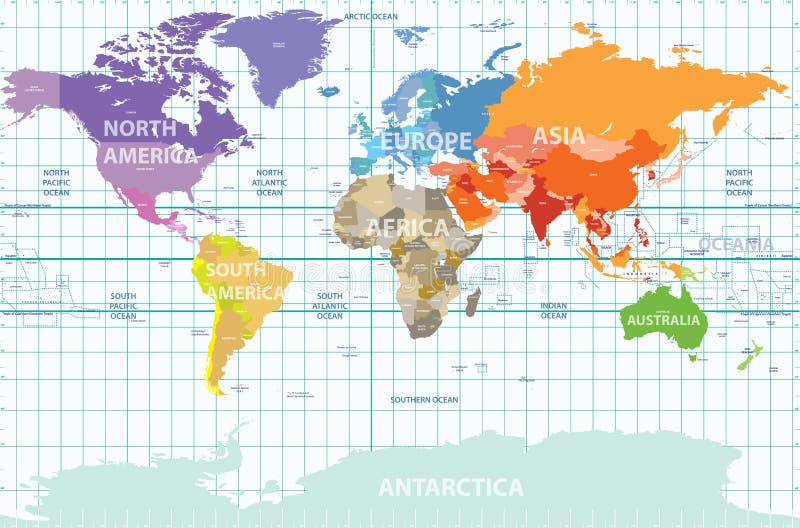
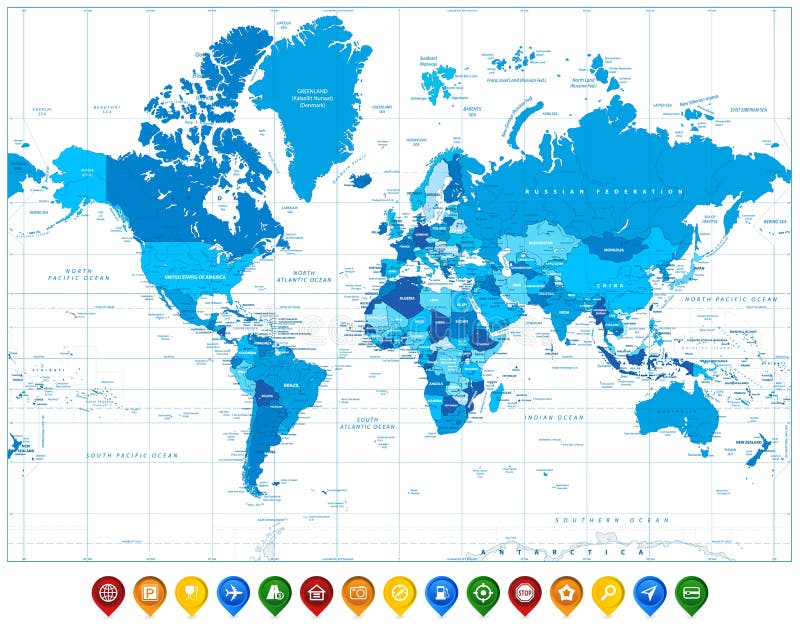
Free with trial Vector political map of the world with all continents separated by color, labeled countries and oceans, and with enumerated longitudes and latitudes on background. Antarctica map new vectors Political map of the world with all continents separated by color, labeled countries and oceans, and with enumerated longitudes an
Free with trial Vector color Map of Antarctica. Antarctica map new vectors Antarctica Map. Vector color Map of Antarctica
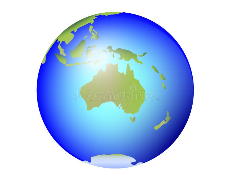
Free with trial Globe, centered on Australia. Shaded relief colored according to dominant vegetation. Shows polar and pack ice. Isolated on white, with clipping path. Antarctica map new illustrations Globe, shaded relief, centered on Africa. Globe, centered on Australia. Shaded relief colored according to dominant vegetation. Shows polar and pack ice. Isolated on white, with clipping path.
Free with trial Vector World Map and Globe with Compass Icon. Antarctica map new vectors World Map and Globe Icons. Vector World Map and Globe with Compass Icon
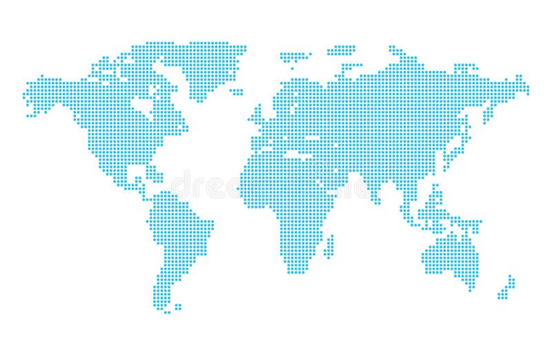
Free with trial Abstract computer graphic dotted world map. Vector illustration. Antarctica map new vectors Dotted World Map
Free with trial An high quality world map in tones of grey with a cool flat shaded Shadow. Antarctica map new vectors Flat Shadow World map with globes. An high quality world map in tones of grey with a cool flat shaded Shadow.
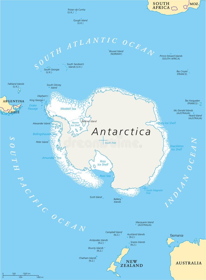
Free with trial Antarctic Region Political Map with south pole, ice shelfs and islands. English labeling and scaling. Illustration. Antarctica map new vectors Antarctic Region Political Map
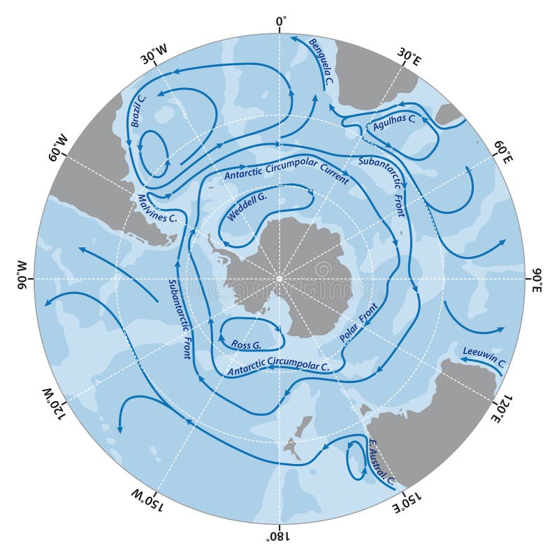
Free with trial Vector map of the Antarctic Circumpolar Current. Antarctica map new vectors Map of the Antarctic Circumpolar Current
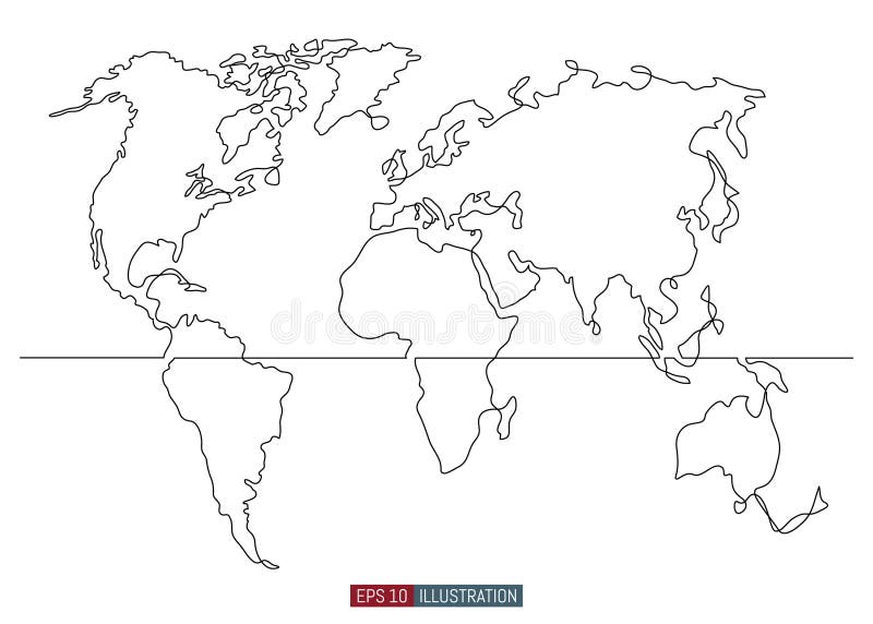
Free with trial Continuous line drawing of world map. Template for your design. Vector illustration. Antarctica map new vectors Continuous line drawing of world map. Vector illustration. Continuous line drawing of world map. Template for your design. Vector illustration.
Free with trial World Map - America in center - Bathymetry. Highly detailed illustration of World Map. Antarctica map new vectors World Map - America in center - Bathymetry
Free with trial America Centered Political World Map. Highly detailed illustration of World Map. Antarctica map new vectors America Centered Political World Map
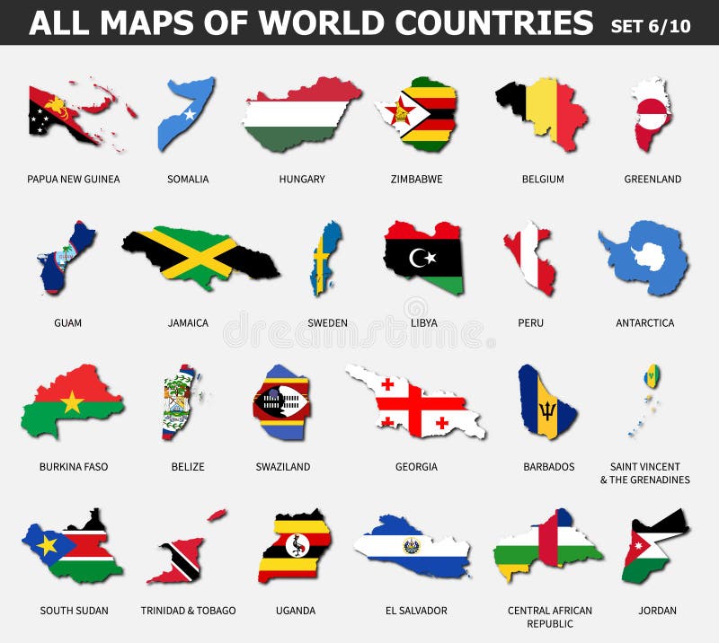
Free with trial All maps of world countries and flags. Set 6 of 10. Collection of outline shape of international country map with shadow. Flat design. Vector. Antarctica map new vectors All maps of world countries and flags . Set 6 of 10 . Collection of outline shape of international country map with shadow . Flat
Free with trial Man holding a glowing globe. Antarctica map new illustrations Man with globe. Man holding a glowing globe
Free with trial Vector Map Icon of the World Earth Globe of the Southern Hemisphere showing Australia, New Zealand and the South Pole. Antarctica map new vectors Australia and New Zealand, South Pole, Antarctica, Global World. Vector Map Icon of the World Earth Globe of the Southern Hemisphere showing Australia, New Zealand and the South Pole
Free with trial Planet Earth showing Australia and New Zealand, South Pole, Antarctica, Global World. Antarctica map new vectors Australia and New Zealand, South Pole, Antarctica, Global World
Free with trial Political map of Antarctica with the territory claims. Antarctica map new illustrations Political map of Antarctica
Free with trial Antarctica editable map with countries cities and bases and geographic sites. Vector EPS-10 file. Antarctica map new vectors Antarctica editable map
Free with trial South Pole map. Antarctica, ice, melting, climate change. Climate emergency. Scientific expedition. Satellite view of the globe. 3d render. Element of this images are furnished by Nasa. Antarctica map new illustrations South Pole map. Antarctica, ice, melting, climate change. Climate emergency. Scientific expedition. Satellite view of the globe.
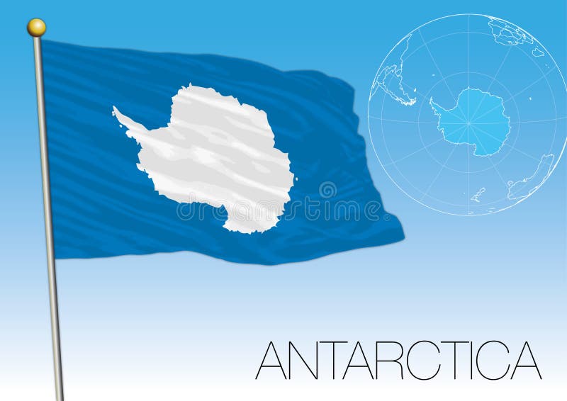
Free with trial Antarctica Flag of the territory and map, vector illustration. Antarctica map new vectors Antarctica Flag of the territory and map
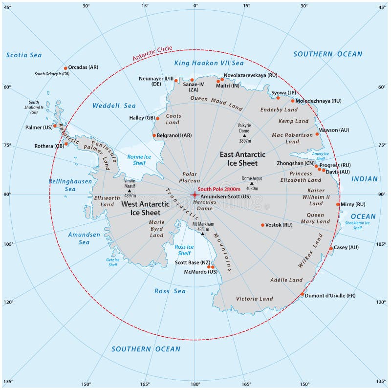
Free with trial Antarctica political map. The Antarctic polar region around the Earth South Pole with islands and ice shelves. Gray illustration with English labeling on white background. Vector. Antarctica map new vectors Antarctic region political map. Antarctica political map. The Antarctic polar region around the Earth South Pole with islands and ice shelves. Gray illustration with English labeling on white background. Vector.
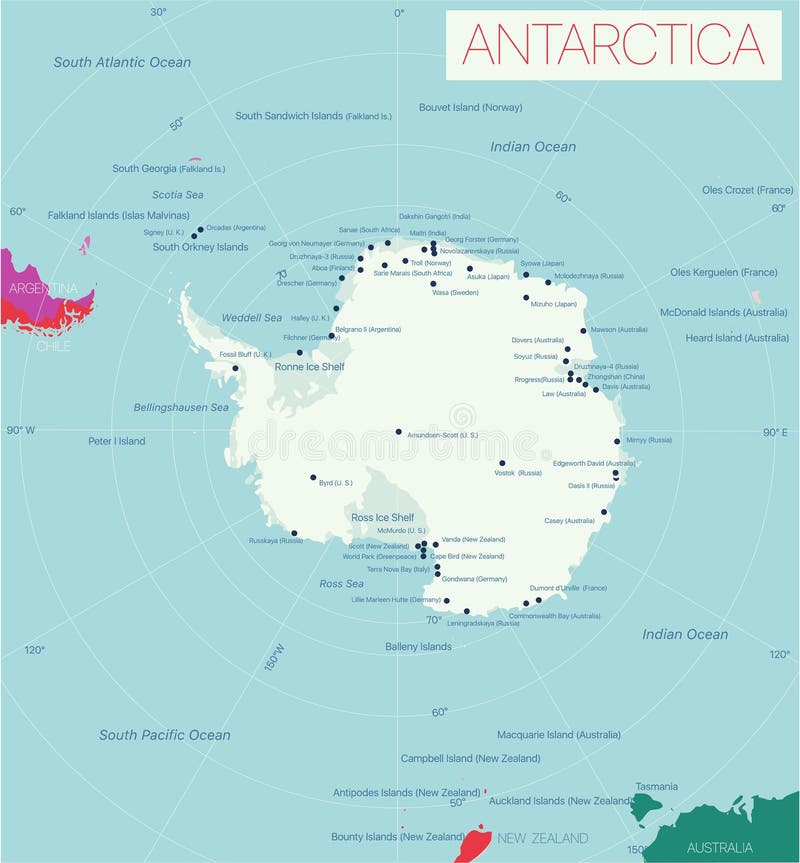
Free with trial Highly detailed map of the Antarctica region. Antarctica map new illustrations Antarctic map. Highly detailed map of the Antarctica region
Free with trial Collection of all seven continents Asia,Europe,south America,north America,Oceania,Africa,Antarctica map with countries name and border. Vector illustration icon set design. Use for website,template. Antarctica map new vectors Collection of all seven continents Asia,Europe,south America,north America,Oceania,Africa,Antarctica map with countries name
Free with trial Vector illustration of the LGBT Rainbow Map of New Brunswick. Antarctica map new vectors LGBT Rainbow Map of New Brunswick
Free with trial World Map in colors of blue and colorful map pointers. Highly detailed illustration of World Map. Antarctica map new vectors World Map in colors of blue and colorful map pointers
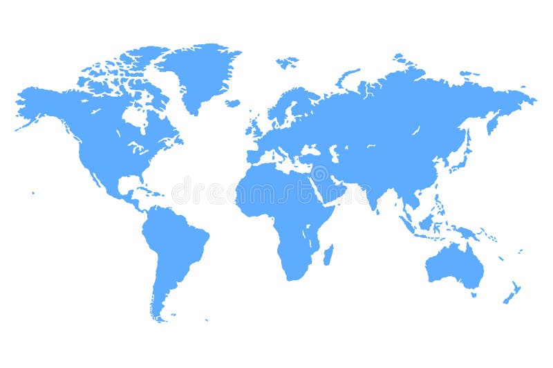
Free with trial High quality Blue simple vector map of the world. Antarctica map new vectors Blue Vector World Map. High quality Blue simple vector map of the world
Free with trial World Map in colors of blue isolated on white. Highly detailed vector illustration of World Map. Antarctica map new vectors World Map in colors of blue isolated on white
Free with trial The red colour map of the world with lining background with clipping path. Antarctica map new illustrations Map of the world
Free with trial Retro Color America Centered Political World Map. Highly detailed illustration of World Map. Antarctica map new vectors Retro Color America Centered Political World Map
Free with trial Vintage Color Map America Centered Political World Map. Highly detailed illustration of World Map. Antarctica map new vectors Vintage Color Map America Centered Political World Map
Free with trial World Map America Centered and map pointers. Retro color. All elements are separated in layers clearly labeled. Antarctica map new vectors World Map America Centered and map pointers. Retro color
Free with trial America Centered World Map Blue Color and flat icons. Highly detailed vector illustration of World Map. Antarctica map new vectors America Centered World Map Blue Color and flat icons
Free with trial America Centered Political World Map isolated on white. Highly detailed illustration of World Map. Antarctica map new vectors America Centered Political World Map isolated on white
Free with trial America Centered Political World Map Blue Colors. Highly detailed vector illustration of World Map. Antarctica map new vectors America Centered Political World Map Blue Colors
Free with trial America Centered Political World Map isolated on white. No text. Highly detailed illustration of World Map. Antarctica map new vectors America Centered Political World Map isolated on white. No text
Free with trial Flat world map divided into editable contours of countries. Country names. Template for your design works. Vector illustration. Antarctica map new vectors Flat world map divided into editable contours of countries. Country names.
Free with trial America Centered Political World Map Blue Colors. No text. Highly detailed vector illustration of World Map. Antarctica map new vectors America Centered Political World Map Blue Colors. No text
Free with trial Earth from space, concept of astronaut view, , slowly moving away with stars in space. UHD 3840 2160 footage. Elements of this 3d animation furnished by NASA. Antarctica map new illustrations Earth from space, concept of astronaut view, , slowly moving away with stars in space. UHD 3840 2160 footage . Elements
Free with trial Vector illustration of a globe showing the south eastern side of the world, Australia at the center. Visible in the map are the South Pole, Oceania, South East Asia, and Parts of North East Asia. Antarctica map new vectors Globe Earth East Pacific Side Map Antarctica Asia Australia Japan Indonesia Malaysia Philippines Thailand Korea New Zealand. Vector illustration of a globe showing the south eastern side of the world, Australia at the center. Visible in the map are the South Pole, Oceania, South East Asia, and Parts of North East Asia.
Free with trial Detailed world map illustration with continents and countries on a dark background. this image is perfect for travel, geography, or educational projects. use it to showcase global connections!. Antarctica map new illustrations World map illustration geography earth continents countries travel global exploration atlas background 3d render. Detailed world map illustration with continents. detailed world map illustration with continents and countries on a dark background. this image is perfect for travel, geography, or educational projects. use it to showcase global connections!
Free with trial New trending landscape world map vector infographic atlas design and arts. A modern Gray flat dotted world map vector showcasing continents, countries, and connections on white background. Antarctica map new vectors Trending Landscape World Map Vector Infographic Atlas Design and Arts
Free with trial New tending dotted squire world map vector infographic earth design and arts. A modern Gray flat dotted world map vector showcasing continents, countries, and connections on white background. Antarctica map new vectors Trending World Map Vector Infographic Design and Arts. New tending dotted squire world map vector infographic earth design and arts. A modern Gray flat dotted world map vector showcasing continents, countries, and connections on white background.
Free with trial Ross island New Zealand, Antarctica map vector illustration, scribble sketch Ross map,. Antarctica map new vectors Ross island New Zealand, Antarctica map vector illustration, scribble sketch Ross map
Free with trial Ross island New Zealand, Antarctica map vector illustration, scribble sketch Ross map,. Antarctica map new vectors Ross island New Zealand, Antarctica map vector illustration, scribble sketch Ross map
Free with trial Ross island New Zealand, Antarctica map vector illustration, scribble sketch Ross map,. Antarctica map new vectors Ross island New Zealand, Antarctica map vector illustration, scribble sketch Ross map
Free with trial Australia, New Zealand, Tasmania on the planet Earth. Globe with continent Australia and Oceania - full color vector world map. Oceans and continents and islands. Antarctica. Antarctica map new vectors Australia, New Zealand, Tasmania on the planet Earth. Globe with continent Australia and Oceania - full color vector world map.
Free with trial Antarctica map, old paper background blank template. Antarctica map new vectors Antarctica map, old paper background blank
Free with trial Antarctica map, old paper background vector. Antarctica map new vectors Antarctica map, old paper background
Free with trial Detailed vector map of the volcanic Ross Island in Antarctica. Antarctica map new vectors Detailed vector map of the volcanic Ross Island in Antarctica
Free with trial New Caledonia 3d map with borders of regions. Vector illustration The map of New Caledonia isolated on white and rendered in 3D in white color. A stylized map of New Caledonia showing the different provinces. All isolated on white background. Antarctica map new illustrations New Caledonia map in 3D. 3d map with borders of regions. New Caledonia 3d map with borders of regions. Vector illustration The map of New Caledonia isolated on white and rendered in 3D in white color. A stylized map of New Caledonia showing the different provinces. All isolated on white background.
Free with trial 3D map green of Papua New Guinea on White background , 3D illustration. Antarctica map new illustrations 3D map green of Papua New Guinea on White background
Free with trial 3D map green of New Zealand on white background , 3D illustration. Antarctica map new illustrations 3D map green of New Zealand on white background
Free with trial Papua New Guinea 3d map with borders of regions. Vector illustration The map of Papua New Guinea isolated on white and rendered in 3D in white color. A stylized map of Papua New Guinea showing the different provinces. All isolated on white background. Antarctica map new illustrations Papua New Guinea map in 3D. 3d map with borders of regions. Papua New Guinea 3d map with borders of regions. Vector illustration The map of Papua New Guinea isolated on white and rendered in 3D in white color. A stylized map of Papua New Guinea showing the different provinces. All isolated on white background.
Free with trial New Zealand 3d map with borders of regions. Vector illustration The map of New Zealand isolated on white and rendered in 3D in white color. A stylized map of New Zealand showing the different provinces. All isolated on white background. Antarctica map new illustrations New Zealand map in 3D. 3d map with borders of regions. New Zealand 3d map with borders of regions. Vector illustration The map of New Zealand isolated on white and rendered in 3D in white color. A stylized map of New Zealand showing the different provinces. All isolated on white background.
Free with trial 3D map green of New Caledonia on white background , 3D illustration. Antarctica map new illustrations 3D map green of New Caledonia on white background
Free with trial Antarctica geometric map. Stencil shape of Antarctica in low poly style. Creative country vector illustration. Antarctica map new vectors Antarctica geometric map.
Free with trial Abstract vector map of Antarctica. Technology in the country geometric style poster. Polygonal Antarctica map on 3d triangular mesh backgound. EPS10 Vector. Antarctica map new vectors Abstract vector map of Antarctica.
Free with trial Joinville island Antarctica map vector illustration, scribble sketch Joinville map,. Antarctica map new vectors Joinville island Antarctica map vector illustration, scribble sketch Joinville map
Free with trial Abstract New Caledonia map is shaped. Abstract New Caledonia1 map is shaped with flag. New Caledonia country gray map, vector illustration isolated on white background. Antarctica map new vectors New Caledonia map with flag. Abstract New Caledonia map is shaped. Abstract New Caledonia1 map is shaped with flag. New Caledonia country gray map, vector illustration isolated on white background.
Free with trial Abstract Papua New Guinea map is shaped. Abstract Papua New Guinea3 map is shaped with flag. Papua New Guinea country gray map, vector illustration isolated on white background. Antarctica map new vectors Papua New Guinea map with flag. Abstract Papua New Guinea map is shaped. Abstract Papua New Guinea3 map is shaped with flag. Papua New Guinea country gray map, vector illustration isolated on white background.
Free with trial Abstract New Zealand map is shaped. Abstract New Zealand map is shaped with flag. New Zealand country gray map, vector illustration isolated on white background. Antarctica map new vectors New Zealand map with flag. Abstract New Zealand map is shaped. Abstract New Zealand map is shaped with flag. New Zealand country gray map, vector illustration isolated on white background.
Free with trial Abstract Papua New Guinea dots map is shaped. Abstract Papua New Guinea map is shaped with flag. Papua New Guinea country gray map, illustration isolated on white background. Antarctica map new vectors Papua New Guinea map with flag. Abstract Papua New Guinea dots map is shaped. Abstract Papua New Guinea map is shaped with flag. Papua New Guinea country gray map, illustration isolated on white background.
Free with trial Glossy, Shiny Sphere with Global Map in Subtle Blues giving a transparent feel. Antarctica map new vectors Australia and New Zealand, South Pole, Antarctica, Background wi. Glossy, Shiny Sphere with Global Map in Subtle Blues giving a transparent feel
Free with trial Antarctica low poly logo. Colorful gradient travel logo of the country in geometric style. Multicolored polygonal Antarctica rounded sign with map for your infographics. Antarctica map new vectors Antarctica low poly logo.
Free with trial Antarctica icon. Colorful gradient logo of the country. Purple red Antarctica rounded sign with map for your design. Vector illustration. Antarctica map new vectors Antarctica icon.
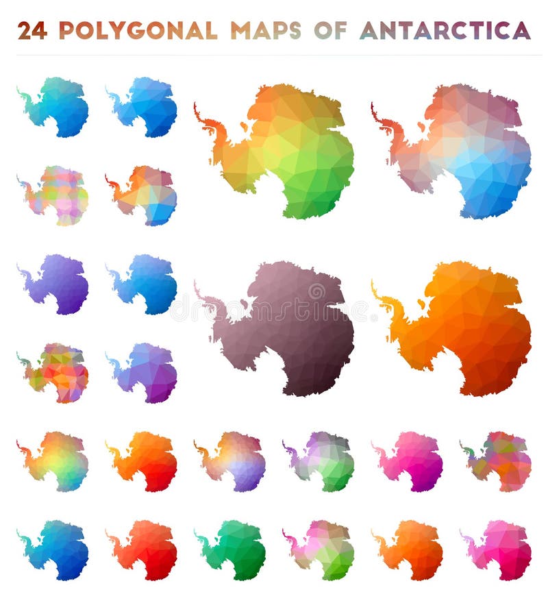
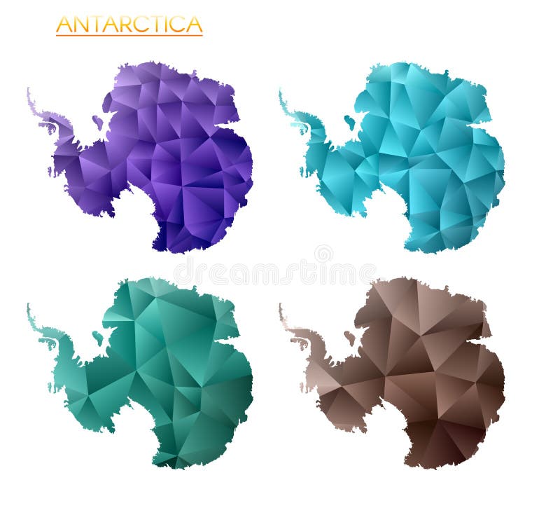
Free with trial Set of vector polygonal maps of Antarctica. Bright gradient map of country in low poly style. Multicolored Antarctica map in geometric style for your infographics. Antarctica map new vectors Set of vector polygonal maps of Antarctica.
Free with trial Antarctica badge. Bright gradient logo of country in low poly style. Multicolored Antarctica rounded sign with map in geometric style for your infographics. Antarctica map new vectors Antarctica badge.
Free with trial Antarctica Reopening Stamp. Green round badge of country with map of Antarctica. Country opening after lockdown. Vector illustration. Antarctica map new vectors Antarctica Reopening Stamp.
Free with trial High quality map of Antarctica with borders of the regions on white background. Antarctica map new vectors High quality map
Free with trial Set of vector polygonal maps of Antarctica. Bright gradient map of country in low poly style. Multicolored Antarctica map in geometric style for your infographics. Creative vector illustration. Antarctica map new vectors Set of vector polygonal maps of Antarctica.
Free with trial Sunrise above Antarctica. Concept of new beginning, hope, light. 3D illustration with detailed planet surface, atmosphere and city lights. Elements of this image furnished by NASA. Antarctica map new illustrations Antarctica from space during sunrise. Sunrise above Antarctica. Concept of new beginning, hope, light. 3D illustration with detailed planet surface, atmosphere and city lights. Elements of this image furnished by NASA.
Free with trial Vector mosaic map of Antarctica combined for New Year, Christmas celebration, and winter. Mosaic map of Antarctica is created from light blue snow items. Antarctica map new vectors Frost Collage Map of Antarctica of Snow Flakes. Vector mosaic map of Antarctica combined for New Year, Christmas celebration, and winter. Mosaic map of Antarctica is created from light blue snow items.
Free with trial Freezing map of Antarctica and grunge stamp seals in blue colors with Winter Fresh and Winter Frost texts. Mosaic map of Antarctica is designed with ice elements. Antarctica map new vectors Winter Map of Antarctica and Winter Fresh and Frost Grunge Stamps. Freezing map of Antarctica and grunge stamp seals in blue colors with Winter Fresh and Winter Frost texts. Mosaic map of Antarctica is designed with ice elements.
Free with trial Vector mosaic map of Antarctica organized for New Year, Christmas, and winter. Mosaic map of Antarctica is organized of snow and fir forest. Antarctica map new vectors Winter Composition Map of Antarctica of Snow and Fir Forest. Vector mosaic map of Antarctica organized for New Year, Christmas, and winter. Mosaic map of Antarctica is organized of snow and fir forest.
Free with trial Globe of Earth with borders of all countries. 3d icon Globe in gray. High quality world map in gray. South Asia, Australia with all states, New Zealand. EPS10. Antarctica map new vectors Globe of Earth with borders of all countries. 3d icon Globe in gray. High quality world map in gray. South Asia, Australia with al
Free with trial New Flag of Antarctica, The consultative members of the Antarctic Treaty System officially adopted an emblem in 2002 which is sometimes used in the form of a flag. Officially this emblem represents the Antarctic Treaty System and not the continent itself. Antarctic Treaty members used the emblem for at least 30 years prior to its formal adoption, having used it on a 1971 commemorative stamp. Antarctica map new illustrations Glossy glass New Flag of Antarctica. New Flag of Antarctica, The consultative members of the Antarctic Treaty System officially adopted an emblem in 2002 which is sometimes used in the form of a flag. Officially this emblem represents the Antarctic Treaty System and not the continent itself. Antarctic Treaty members used the emblem for at least 30 years prior to its formal adoption, having used it on a 1971 commemorative stamp