Free with trial Detailed monochrome map of Serbia, gray territory of the country with geographical borders and administrative divisions on white background, set of travel icons, vector illustratio, for your design. Balkans peninsula vectors Detailed monochrome map of Serbia, gray territory of the country with geographical borders and administrative divisions on white
Free with trial Ancient map of Balkan Peninsula in Southeast Europe and the seas and islands surrounding it with geographical Italian names and descriptions. Balkans peninsula illustrations Ancient map of Balkan Peninsula
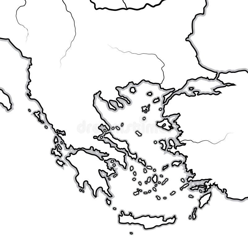
Free with trial Map of The BALKAN/GREEK Lands: Greece (Hellas), Balkans, Peloponnese, Thessalia, Thracia, Macedonia, Albania, Illyria, Ionia, Anatolia, The Aegean Sea & Archipelago. Geographic chart with sea coastline and isles. Balkans peninsula vectors Map of The GREEK Lands: Greece, Peloponnese, Thrace, Macedonia, Balkans, Aegean Sea. Geographic chart. Map of The BALKAN/GREEK Lands: Greece (Hellas), Balkans, Peloponnese, Thessalia, Thracia, Macedonia, Albania, Illyria, Ionia, Anatolia, The Aegean Sea & Archipelago. Geographic chart with sea coastline and isles.
Free with trial The Balkans and the Balkan Peninsula, multi colored political map, with country borders and capitals. Geographical area in southeastern Europe, bordered by the Adriatic, Ionian, Aegean, and Black Sea. Balkans peninsula vectors The Balkans and the Balkan Peninsula, multi colored political map
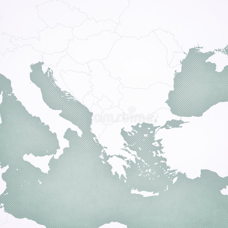
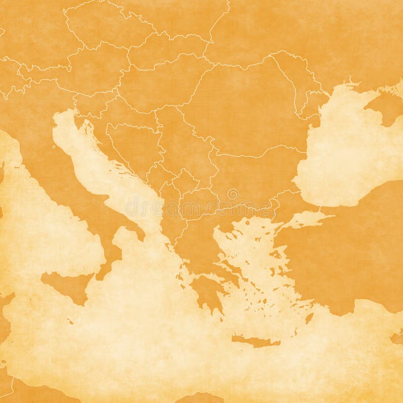
Free with trial Blank map of Balkans with softly striped vintage background. Balkans peninsula illustrations Blank Map of Balkans
Free with trial Blank map of Balkans with country borders in soft grunge and vintage style, like old paper with watercolor painting. Balkans peninsula illustrations Blank Map of Balkans
Free with trial Slovakia on the map of Balkans in soft grunge and vintage style, like old paper with watercolor painting. Balkans peninsula illustrations Map of Balkans - Slovakia. Slovakia on the map of Balkans in soft grunge and vintage style, like old paper with watercolor painting.
Free with trial Greece on the map of Balkans in soft grunge and vintage style, like old paper with watercolor painting. Balkans peninsula illustrations Map of Balkans - Greece. Greece on the map of Balkans in soft grunge and vintage style, like old paper with watercolor painting.
Free with trial Serbia on the map of Balkans in soft grunge and vintage style, like old paper with watercolor painting. Balkans peninsula illustrations Map of Balkans - Serbia. Serbia on the map of Balkans in soft grunge and vintage style, like old paper with watercolor painting.
Free with trial Romania on the map of Balkans in soft grunge and vintage style, like old paper with watercolor painting. Balkans peninsula illustrations Map of Balkans - Romania. Romania on the map of Balkans in soft grunge and vintage style, like old paper with watercolor painting.
Free with trial Bulgaria on the map of Balkans in soft grunge and vintage style, like old paper with watercolor painting. Balkans peninsula illustrations Map of Balkans - Bulgaria. Bulgaria on the map of Balkans in soft grunge and vintage style, like old paper with watercolor painting.
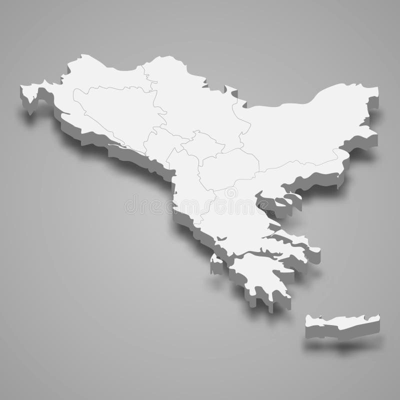
Free with trial 3d isometric map of Balkans region, isolated with shadow vector illustration. Balkans peninsula vectors 3d isometric map of Balkans region, isolated with shadow
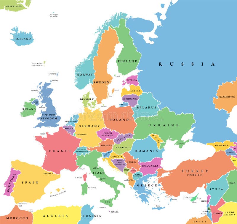
Free with trial Europe with a part of the Middle East countries, political map. Western part of continent Eurasia, located in the Northern Hemisphere. Countries with international borders and English labeling. Vector. Balkans peninsula vectors Europe with a part of the Middle East countries, political map
Free with trial Travel destination Albania, tourism mockup with travel equipment and world map with magnifying glass on a Albania. Trip template. Balkans peninsula vectors Travel destination Albania, tourism mockup with travel equipment and world map with magnifying glass on a Albania
Free with trial Journey to Bosnia and Herzegovina, illustration with a map of Bosnia and Herzegovina. Background with airplane, cell phone, passport, compass and tickets. Vector mockup. Balkans peninsula vectors Journey to Bosnia and Herzegovina, illustration with a map of Bosnia and Herzegovina. Background with airplane, cell phone
Free with trial Detailed blue map of Serbia with administrative divisions, major cities on a white background, vector illustration, for your design. Balkans peninsula vectors Detailed blue map of Serbia with administrative divisions, major cities on a white background, vector illustration
Free with trial Detailed map of Serbia with administrative divisions on a dark background, big cities of the country and icons set, vector illustration, for your design. Balkans peninsula vectors Detailed map of Serbia with administrative divisions on a dark background, big cities of the country and icons set, vector
Free with trial Detailed color vector map of the administrative divisions of Serbia into static regions showing the location country on the map Europe, for your design. Balkans peninsula vectors Detailed color vector map of the administrative divisions of Serbia into static regions showing the location country on the map
Free with trial 3d rendering of Macedonia flag on a button. Balkans peninsula illustrations Macedonia button. 3d rendering of Macedonia flag on a button
Free with trial Serbia map, black and white detailed outline regions of the country. Vector illustration. Balkans peninsula illustrations Serbia map, black and white detailed outline regions of the country
Free with trial Serbia administrative blue-green map with country flag and location on a globe. Vector illustration. Balkans peninsula illustrations Serbia administrative blue-green map with country flag and location on a globe
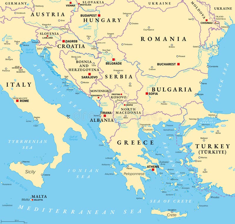
Free with trial The Balkans, and the Balkan Peninsula, political map, with country borders, capitals, and largest cities. Geographical area in southeastern Europe, bordered by Adriatic, Ionian, Aegean, and Black Sea. Balkans peninsula vectors The Balkans, and the Balkan Peninsula, political map
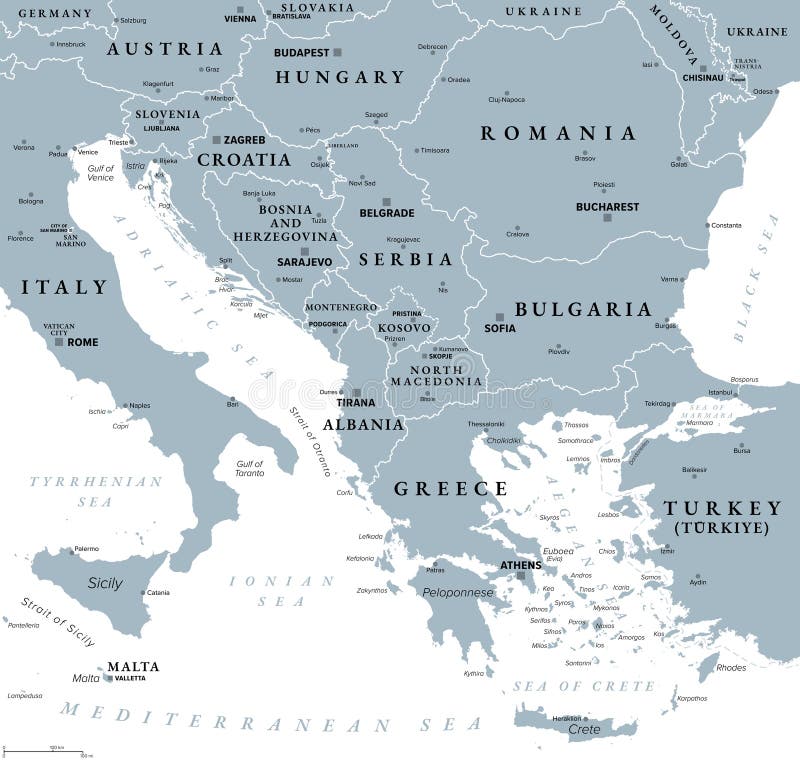
Free with trial The Balkans and Balkan Peninsula, gray political map, with country borders, capitals, and largest cities. Geographical area in southeastern Europe, bordered by Adriatic, Ionian, Aegean, and Black Sea. Balkans peninsula vectors The Balkans and Balkan Peninsula, gray political map
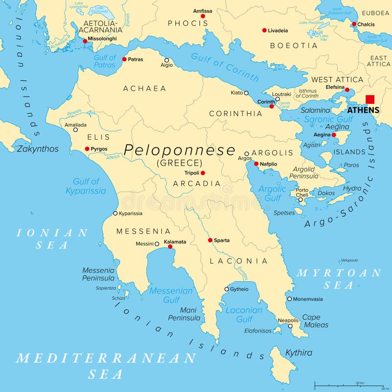
Free with trial Peloponnese, a peninsula and geographic region in Southern Greece. Gray political map with regional units and their seats. Southernmost region of the Balkans, also known as Peloponnesus or Morea. Balkans peninsula vectors Peloponnese, Greek peninsula and region, gray political map. Peloponnese, a peninsula and geographic region in Southern Greece. Gray political map with regional units and their seats. Southernmost region of the Balkans, also known as Peloponnesus or Morea.
Free with trial Peloponnese, a peninsula and geographic region in Southern Greece. Political map with regional units and their seats. Southernmost region of the Balkans, also known as Peloponnesus or Morea. Vector. Balkans peninsula vectors Peloponnese, Greek peninsula and geographic region, political map. Peloponnese, a peninsula and geographic region in Southern Greece. Political map with regional units and their seats. Southernmost region of the Balkans, also known as Peloponnesus or Morea. Vector
Free with trial Vector map of the Balkan Peninsula featuring country borders, transportation networks, and coastal geography in a modern minimalist cartographic style. Balkans peninsula vectors Map of the Balkan Peninsula
Free with trial Map of Balkans WITHOUT BORDERS in soft grunge and vintage style, like old paper with watercolor painting. Balkans peninsula illustrations Map of Balkans WITHOUT BORDERS
Free with trial Greece and Croatia on the map of Balkans in soft grunge and vintage style, like old paper with watercolor painting. Balkans peninsula illustrations Map of Balkans - Greece and Croatia. Greece and Croatia on the map of Balkans in soft grunge and vintage style, like old paper with watercolor painting
Free with trial Bulgaria and Serbia on the map of Balkans in soft grunge and vintage style, like old paper with watercolor painting. Balkans peninsula illustrations Map of Balkans - Bulgaria and Serbia. Bulgaria and Serbia on the map of Balkans in soft grunge and vintage style, like old paper with watercolor painting
Free with trial Austria and Greece on the map of Balkans in soft grunge and vintage style, like old paper with watercolor painting. Balkans peninsula illustrations Map of Balkans - Austria and Greece. Austria and Greece on the map of Balkans in soft grunge and vintage style, like old paper with watercolor painting
Free with trial Serbia and Croatia on the map of Balkans in soft grunge and vintage style, like old paper with watercolor painting. Balkans peninsula illustrations Map of Balkans - Serbia and Croatia. Serbia and Croatia on the map of Balkans in soft grunge and vintage style, like old paper with watercolor painting
Free with trial Hungary and Greece on the map of Balkans in soft grunge and vintage style, like old paper with watercolor painting. Balkans peninsula illustrations Map of Balkans - Hungary and Greece. Hungary and Greece on the map of Balkans in soft grunge and vintage style, like old paper with watercolor painting
Free with trial Map with countries of Balkans in soft grunge and vintage style, like old paper with watercolor painting. Balkans peninsula illustrations Map of Balkans - All countries. Map with countries of Balkans in soft grunge and vintage style, like old paper with watercolor painting
Free with trial Slovakia and Greece on the map of Balkans in soft grunge and vintage style, like old paper with watercolor painting. Balkans peninsula illustrations Map of Balkans - Slovakia and Greece. Slovakia and Greece on the map of Balkans in soft grunge and vintage style, like old paper with watercolor painting
Free with trial Hungary and Croatia on the map of Balkans in soft grunge and vintage style, like old paper with watercolor painting. Balkans peninsula illustrations Map of Balkans - Hungary and Croatia. Hungary and Croatia on the map of Balkans in soft grunge and vintage style, like old paper with watercolor painting
Free with trial This image is a map of Europe and part of western Asia with certain regions highlighted in red. The highlighted areas include most of the British Isles, Scandinavia, parts of Western and Central Europe, the entire Italian peninsula, the Balkans, and some regions in Turkey and the Caucasus. This could be indicative of a thematic focus such as political, economic, or cultural relevance, possibly. Balkans peninsula illustrations Geographical map highlighting specific regions in red across europe and parts of asia. This image is a map of Europe and part of western Asia with certain. This image is a map of Europe and part of western Asia with certain regions highlighted in red. The highlighted areas include most of the British Isles, Scandinavia, parts of Western and Central Europe, the entire Italian peninsula, the Balkans, and some regions in Turkey and the Caucasus. This could be indicative of a thematic focus such as political, economic, or cultural relevance, possibly
Free with trial Aerial view capturing the peljesac bridge, a cable-stayed structure in croatia, connecting komarna to the peljesac peninsula while bypassing bosnia and herzegovina's coastline. Balkans peninsula illustrations Peljesac bridge connecting croatian mainland and peninsula over the adriatic sea. Aerial view capturing the peljesac bridge, a cable-stayed structure in croatia, connecting komarna to the peljesac peninsula while bypassing bosnia and herzegovina's coastline
Free with trial Aerial view capturing the peljesac bridge, a modern cable-stayed structure connecting croatia's mainland to the peljesac peninsula, boosting transportation and tourism. Balkans peninsula illustrations Peljesac bridge connecting croatian mainland and peljesac peninsula. Aerial view capturing the peljesac bridge, a modern cable-stayed structure connecting croatia's mainland to the peljesac peninsula, boosting transportation and tourism
Free with trial Athens on the map of Balkans in soft grunge and vintage style, like old paper with watercolor painting. Balkans peninsula illustrations Map of Balkans - Athens. Athens on the map of Balkans in soft grunge and vintage style, like old paper with watercolor painting
Free with trial Istanbul on the map of Balkans in soft grunge and vintage style, like old paper with watercolor painting. Balkans peninsula illustrations Map of Balkans - Istanbul. Istanbul on the map of Balkans in soft grunge and vintage style, like old paper with watercolor painting
Free with trial Belgrade on the map of Balkans in soft grunge and vintage style, like old paper with watercolor painting. Balkans peninsula illustrations Map of Balkans - Belgrade. Belgrade on the map of Balkans in soft grunge and vintage style, like old paper with watercolor painting
Free with trial Dubrovnik on the map of Balkans in soft grunge and vintage style, like old paper with watercolor painting. Balkans peninsula illustrations Map of Balkans - Dubrovnik. Dubrovnik on the map of Balkans in soft grunge and vintage style, like old paper with watercolor painting
Free with trial Bucharest on the map of Balkans in soft grunge and vintage style, like old paper with watercolor painting. Balkans peninsula illustrations Map of Balkans - Bucharest. Bucharest on the map of Balkans in soft grunge and vintage style, like old paper with watercolor painting
Free with trial Tegucigalpa on the map of Balkans in soft grunge and vintage style, like old paper with watercolor painting. Balkans peninsula illustrations Map of Balkans - Tegucigalpa. Tegucigalpa on the map of Balkans in soft grunge and vintage style, like old paper with watercolor painting
Free with trial Italy on an ocher retro map of the Balkans on old vintage paper. Balkans peninsula illustrations Ocher map of Balkans - Italy. Italy on an ocher retro map of the Balkans on old vintage paper
Free with trial Malta on an ocher retro map of the Balkans on old vintage paper. Balkans peninsula illustrations Ocher map of Balkans - Malta. Malta on an ocher retro map of the Balkans on old vintage paper
Free with trial Ocher retro blank map of the Balkans on old vintage paper. Balkans peninsula illustrations Ocher blank map of Balkans. Ocher retro blank map of the Balkans on old vintage paper
Free with trial Turkey on an ocher retro map of the Balkans on old vintage paper. Balkans peninsula illustrations Ocher map of Balkans - Turkey. Turkey on an ocher retro map of the Balkans on old vintage paper
Free with trial Austria on an ocher retro map of the Balkans on old vintage paper. Balkans peninsula illustrations Ocher map of Balkans - Austria. Austria on an ocher retro map of the Balkans on old vintage paper
Free with trial Croatia on an ocher retro map of the Balkans on old vintage paper. Balkans peninsula illustrations Ocher map of Balkans - Croatia. Croatia on an ocher retro map of the Balkans on old vintage paper
Free with trial Moldova on an ocher retro map of the Balkans on old vintage paper. Balkans peninsula illustrations Ocher map of Balkans - Moldova. Moldova on an ocher retro map of the Balkans on old vintage paper
Free with trial Hungary on an ocher retro map of the Balkans on old vintage paper. Balkans peninsula illustrations Ocher map of Balkans - Hungary. Hungary on an ocher retro map of the Balkans on old vintage paper
Free with trial Slovenia on an ocher retro map of the Balkans on old vintage paper. Balkans peninsula illustrations Ocher map of Balkans - Slovenia. Slovenia on an ocher retro map of the Balkans on old vintage paper
Free with trial Slovakia on an ocher retro map of the Balkans on old vintage paper. Balkans peninsula illustrations Ocher map of Balkans - Slovakia. Slovakia on an ocher retro map of the Balkans on old vintage paper
Free with trial Ocher retro map of the Balkans with all countries on old vintage paper. Balkans peninsula illustrations Ocher map of Balkans - all countries. Ocher retro map of the Balkans with all countries on old vintage paper
Free with trial Kosovo on an ocher retro map of the Balkans on old vintage paper. Balkans peninsula illustrations Ocher map of Balkans - Kosovo. Kosovo on an ocher retro map of the Balkans on old vintage paper
Free with trial Greece on an ocher retro map of the Balkans on old vintage paper. Balkans peninsula illustrations Ocher map of Balkans - Greece. Greece on an ocher retro map of the Balkans on old vintage paper
Free with trial Serbia on an ocher retro map of the Balkans on old vintage paper. Balkans peninsula illustrations Ocher map of Balkans - Serbia. Serbia on an ocher retro map of the Balkans on old vintage paper
Free with trial Albania on an ocher retro map of the Balkans on old vintage paper. Balkans peninsula illustrations Ocher map of Balkans - Albania. Albania on an ocher retro map of the Balkans on old vintage paper
Free with trial Romania on an ocher retro map of the Balkans on old vintage paper. Balkans peninsula illustrations Ocher map of Balkans - Romania. Romania on an ocher retro map of the Balkans on old vintage paper
Free with trial Bulgaria on an ocher retro map of the Balkans on old vintage paper. Balkans peninsula illustrations Ocher map of Balkans - Bulgaria. Bulgaria on an ocher retro map of the Balkans on old vintage paper
Free with trial Montenegro on an ocher retro map of the Balkans on old vintage paper. Balkans peninsula illustrations Ocher map of Balkans - Montenegro. Montenegro on an ocher retro map of the Balkans on old vintage paper
Free with trial Hungary and Bulgaria on the map of Balkans in soft grunge and vintage style, like old paper with watercolor painting. Balkans peninsula illustrations Map of Balkans - Hungary and Bulgaria. Hungary and Bulgaria on the map of Balkans in soft grunge and vintage style, like old paper with watercolor painting
Free with trial North Macedonia on an ocher retro map of the Balkans on old vintage paper. Balkans peninsula illustrations Ocher map of Balkans - North Macedonia. North Macedonia on an ocher retro map of the Balkans on old vintage paper
Free with trial Bosnia and Herzegovina on an ocher retro map of the Balkans on old vintage paper. Balkans peninsula illustrations Ocher map of Balkans - Bosnia and Herzegovina. Bosnia and Herzegovina on an ocher retro map of the Balkans on old vintage paper
Free with trial Greece and Romania on the map of Balkans in soft grunge and vintage style, like old paper with watercolor painting. Balkans peninsula illustrations Map of Balkans - Greece and Romania. Greece and Romania on the map of Balkans in soft grunge and vintage style, like old paper with watercolor painting
Free with trial Serbia and Greece on the map of Balkans in soft grunge and vintage style, like old paper with watercolor painting. Balkans peninsula illustrations Map of Balkans - Serbia and Greece. Serbia and Greece on the map of Balkans in soft grunge and vintage style, like old paper with watercolor painting
Free with trial Bulgaria and Romania on the map of Balkans in soft grunge and vintage style, like old paper with watercolor painting. Balkans peninsula illustrations Map of Balkans - Bulgaria and Romania. Bulgaria and Romania on the map of Balkans in soft grunge and vintage style, like old paper with watercolor painting
Free with trial Bulgaria and Greece on the map of Balkans in soft grunge and vintage style, like old paper with watercolor painting. Balkans peninsula illustrations Map of Balkans - Bulgaria and Greece. Bulgaria and Greece on the map of Balkans in soft grunge and vintage style, like old paper with watercolor painting
Free with trial Turkey colored with the flag on an ocher retro map of the Balkans on old vintage paper. Balkans peninsula illustrations Ocher map of Balkans - Turkey. Turkey colored with the flag on an ocher retro map of the Balkans on old vintage paper
Free with trial Hungary colored with the flag on an ocher retro map of the Balkans on old vintage paper. Balkans peninsula illustrations Ocher map of Balkans - Hungary. Hungary colored with the flag on an ocher retro map of the Balkans on old vintage paper
Free with trial Flags of all countries on an ocher retro map of the Balkans on old vintage paper. Balkans peninsula illustrations Ocher map of Balkans - All countries. Flags of all countries on an ocher retro map of the Balkans on old vintage paper
Free with trial Greece and Romania colored with the flag on an ocher retro map of the Balkans on old vintage paper. Balkans peninsula illustrations Ocher map of Balkans - Greece and Romania. Greece and Romania colored with the flag on an ocher retro map of the Balkans on old vintage paper
Free with trial Greece and Turkey colored with the flag on an ocher retro map of the Balkans on old vintage paper. Balkans peninsula illustrations Ocher map of Balkans - Greece and Turkey. Greece and Turkey colored with the flag on an ocher retro map of the Balkans on old vintage paper
Free with trial Serbia and Turkey colored with the flag on an ocher retro map of the Balkans on old vintage paper. Balkans peninsula illustrations Ocher map of Balkans - Serbia and Turkey. Serbia and Turkey colored with the flag on an ocher retro map of the Balkans on old vintage paper
Free with trial Greece and Bulgaria colored with the flag on an ocher retro map of the Balkans on old vintage paper. Balkans peninsula illustrations Ocher map of Balkans - Greece and Bulgaria. Greece and Bulgaria colored with the flag on an ocher retro map of the Balkans on old vintage paper
Free with trial Austria and Turkey colored with the flag on an ocher retro map of the Balkans on old vintage paper. Balkans peninsula illustrations Ocher map of Balkans - Austria and Turkey. Austria and Turkey colored with the flag on an ocher retro map of the Balkans on old vintage paper
Free with trial Albania and Turkey colored with the flag on an ocher retro map of the Balkans on old vintage paper. Balkans peninsula illustrations Ocher map of Balkans - Albania and Turkey. Albania and Turkey colored with the flag on an ocher retro map of the Balkans on old vintage paper
Free with trial Hungary and Turkey colored with the flag on an ocher retro map of the Balkans on old vintage paper. Balkans peninsula illustrations Ocher map of Balkans - Hungary and Turkey. Hungary and Turkey colored with the flag on an ocher retro map of the Balkans on old vintage paper
Free with trial Romania and Turkey colored with the flag on an ocher retro map of the Balkans on old vintage paper. Balkans peninsula illustrations Ocher map of Balkans - Romania and Turkey. Romania and Turkey colored with the flag on an ocher retro map of the Balkans on old vintage paper