Free with trial Map of canada territories, featuring states and borders. An outline design without regions, isolated on a white background. Highly detailed vector illustration. Bermuda map vectors Outline map of canada with borders. Map of canada territories, featuring states and borders. An outline design without regions, isolated on a white background. Highly detailed vector illustration
Free with trial Map of canada territories, featuring states and borders. An outline design with regions, isolated on a white background. Highly detailed vector illustration. Bermuda map vectors Detailed map of canada with regions. Map of canada territories, featuring states and borders. An outline design with regions, isolated on a white background. Highly detailed vector illustration
Free with trial Vector illustration of a map of canada divided into states and territories. White flat map with black borders on a white background. Highly detailed vector illustration. Bermuda map vectors Vector Map of canada highly detailed. Vector illustration of a map of canada divided into states and territories. White flat map with black borders on a white background. Highly detailed vector illustration
Free with trial Shape of Isla Gran Bermuda in the North Atlantic Ocean, belonging to Bermuda. Bermuda map illustrations Shape of Isla Gran Bermuda. Bermuda. Yellow. Shape of Isla Gran Bermuda in the North Atlantic Ocean, belonging to Bermuda
Free with trial Colored vintage map of canada territories, featuring states and borders. White flat design isolated on a white background. Highly detailed vector illustration. Bermuda map vectors Colored vintage map of canada with borders. Colored vintage map of canada territories, featuring states and borders. White flat design isolated on a white background. Highly detailed vector illustration
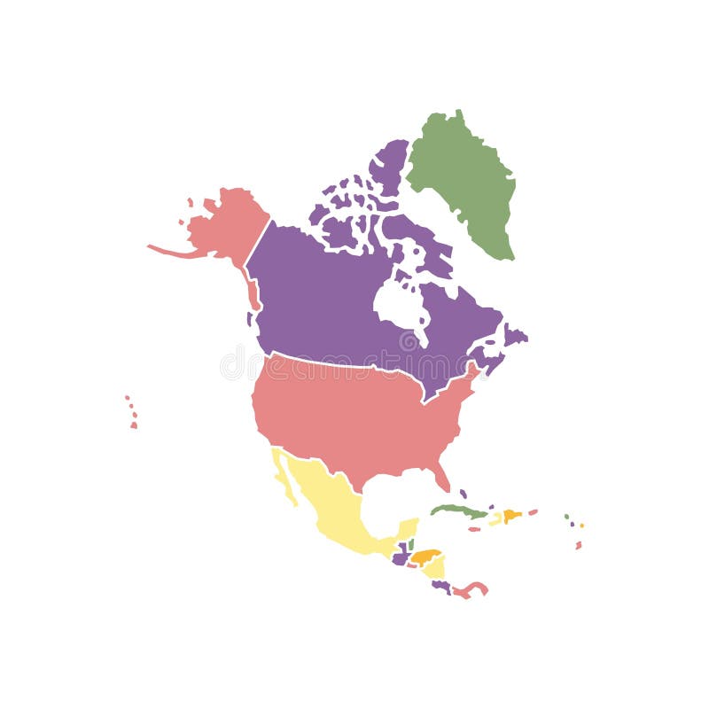
Free with trial Isolated colored map of North America on a white background. Highly detailed, with borders. Includes the USA, Canada, Mexico, Cuba, Guatemala, Haiti, the Dominican Republic, Honduras, and Nicaragua. Bermuda map illustrations Colored North America Map with Detailed Regions. Isolated colored map of North America on a white background. Highly detailed, with borders. Includes the USA, Canada, Mexico, Cuba, Guatemala, Haiti, the Dominican Republic, Honduras, and Nicaragua.
Free with trial Isla Gran Bermuda in the North Atlantic Ocean - belonging to Bermuda. Described location diagram with yellow shape of the island and sample maps of its surroundings. Bermuda map illustrations Isla Gran Bermuda. Bermuda. Location diagram. Yellow. Isla Gran Bermuda in the North Atlantic Ocean - belonging to Bermuda. Described location diagram with yellow shape of the island and sample maps of its surroundings
Free with trial Vector illustration of a map canada territories. White flat design isolated on a white background. Highly detailed vector illustration. Bermuda map vectors Map of canada with detailed territories. Vector illustration of a map canada territories. White flat design isolated on a white background. Highly detailed vector illustration
Free with trial Bright colored Bermuda shape. Multicolor geometric style island logo. Modern trendy design. Radiant vector illustration. Bermuda map vectors Bright colored Bermuda shape. Multicolor geometric style island logo
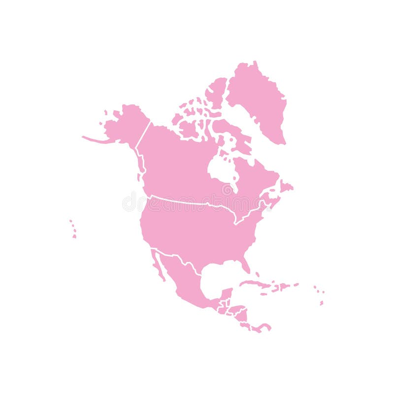
Free with trial Isolated pink map of North America on a white background. Highly detailed, with borders. Includes the USA, Canada, Mexico, Cuba, Guatemala, Haiti, the Dominican Republic, Honduras, and Nicaragua. Bermuda map illustrations Pink North America Map with Detailed Regions. Isolated pink map of North America on a white background. Highly detailed, with borders. Includes the USA, Canada, Mexico, Cuba, Guatemala, Haiti, the Dominican Republic, Honduras, and Nicaragua.
Free with trial Isolated green map of North America on a white background. Highly detailed, with borders. Includes the USA, Canada, Mexico, Cuba, Guatemala, Haiti, the Dominican Republic, Honduras, and Nicaragua. Bermuda map illustrations Green North America Map with Detailed Regions. Isolated green map of North America on a white background. Highly detailed, with borders. Includes the USA, Canada, Mexico, Cuba, Guatemala, Haiti, the Dominican Republic, Honduras, and Nicaragua.
Free with trial View of the earth from space showing the location of the country Bermuda in the center of the image. Bermuda map illustrations View of the earth from space showing the location of Bermuda. View of the earth from space showing the location of the country Bermuda in the center of the image.
Free with trial Isolated creamy map of North America on a white background. Highly detailed, with borders. Includes the USA, Canada, Mexico, Cuba, Guatemala, Haiti, the Dominican Republic, Honduras, and Nicaragua. Bermuda map illustrations Creamy North America Map with Detailed Regions. Isolated creamy map of North America on a white background. Highly detailed, with borders. Includes the USA, Canada, Mexico, Cuba, Guatemala, Haiti, the Dominican Republic, Honduras, and Nicaragua.
Free with trial Isolated orange map of North America on a white background. Highly detailed, with borders. Includes the USA, Canada, Mexico, Cuba, Guatemala, Haiti, the Dominican Republic, Honduras, and Nicaragua. Bermuda map illustrations Orange North America Map with Detailed Regions. Isolated orange map of North America on a white background. Highly detailed, with borders. Includes the USA, Canada, Mexico, Cuba, Guatemala, Haiti, the Dominican Republic, Honduras, and Nicaragua.
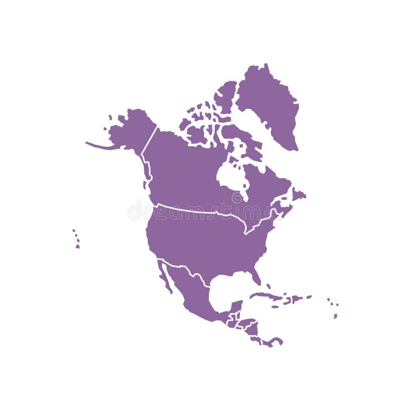
Free with trial Isolated purple map of North America on a white background. Highly detailed, with borders. Includes the USA, Canada, Mexico, Cuba, Guatemala, Haiti, the Dominican Republic, Honduras, and Nicaragua. Bermuda map illustrations Purple North America Map with Detailed Regions. Isolated purple map of North America on a white background. Highly detailed, with borders. Includes the USA, Canada, Mexico, Cuba, Guatemala, Haiti, the Dominican Republic, Honduras, and Nicaragua.
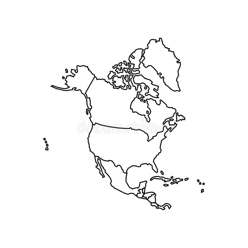
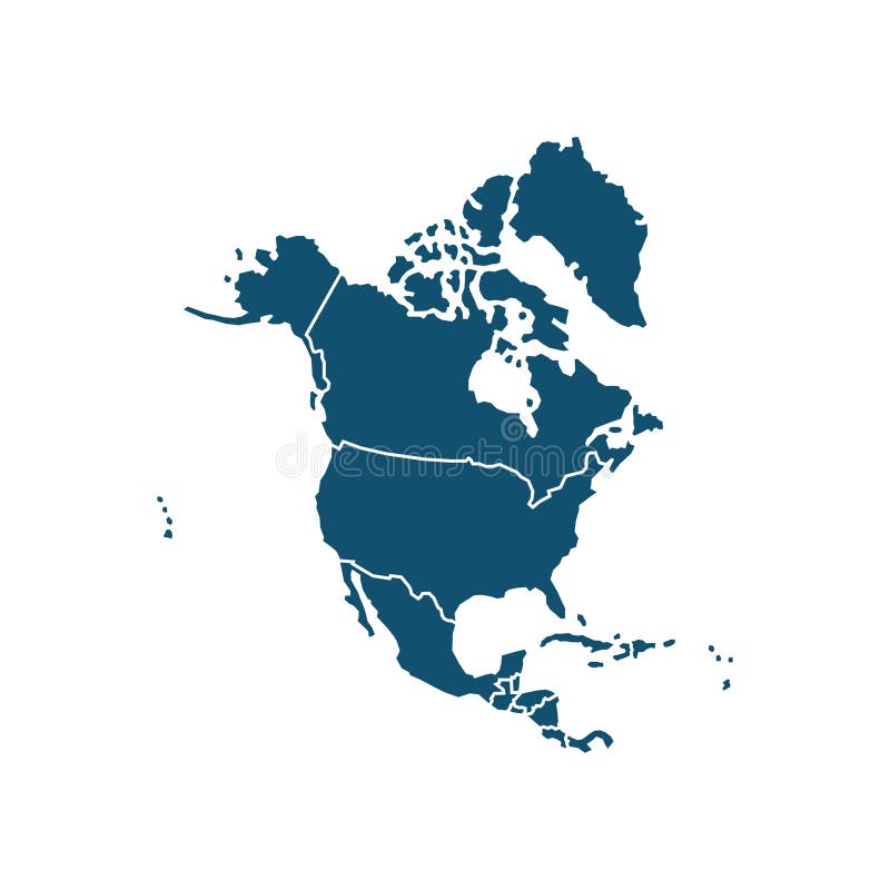
Free with trial Isolated map of North America on a white background. Highly detailed, with borders. Includes the USA, Canada, Mexico, Cuba, Guatemala, Haiti, the Dominican Republic, Honduras, and Nicaragua. Bermuda map illustrations Highly Detailed Isolated North America Map with Borders. Isolated map of North America on a white background. Highly detailed, with borders. Includes the USA, Canada, Mexico, Cuba, Guatemala, Haiti, the Dominican Republic, Honduras, and Nicaragua.
Free with trial Vector illustration of a map of canada territories. White flat design isolated on a white background. Highly detailed vector illustration. Bermuda map vectors Map of canada with territories. Vector illustration of a map of canada territories. White flat design isolated on a white background. Highly detailed vector illustration
Free with trial Close view of the earth from space showing Bermuda in the center of the image. Globe that shows one hemisphere of our planet. Light clouds cover parts of the earth. Bermuda map illustrations View of the earth globe from space showing Bermuda in the center of the image. Close view of the earth from space showing Bermuda in the center of the image. Globe that shows one hemisphere of our planet. Light clouds cover parts of the earth.
Free with trial Isolated blue map of North America on a white background. Highly detailed, with borders. Includes the USA, Canada, Mexico, Cuba, Guatemala, Haiti, the Dominican Republic, Honduras, and Nicaragua. Bermuda map illustrations Blue North America Map with Detailed Regions. Isolated blue map of North America on a white background. Highly detailed, with borders. Includes the USA, Canada, Mexico, Cuba, Guatemala, Haiti, the Dominican Republic, Honduras, and Nicaragua.
Free with trial Isolated blue map of North America on a white background. Highly detailed, with borders. Includes the USA, Canada, Mexico, Cuba, Guatemala, Haiti, the Dominican Republic, Honduras, and Nicaragua. Bermuda map illustrations Blue North America Map with Detailed Regions. Isolated blue map of North America on a white background. Highly detailed, with borders. Includes the USA, Canada, Mexico, Cuba, Guatemala, Haiti, the Dominican Republic, Honduras, and Nicaragua.
Free with trial Holding a flag Bermuda flag heart illustration patriotic background. Bermuda map illustrations Holding a flag Bermuda flag heart illustration
Free with trial Isolated map of North America on a white background. Highly detailed, with borders. Includes the USA, Canada, Mexico, Cuba, Guatemala, Haiti, the Dominican Republic, Honduras, and Nicaragua. Bermuda map illustrations Highly detailed isolated North America map with countries on white background. Isolated map of North America on a white background. Highly detailed, with borders. Includes the USA, Canada, Mexico, Cuba, Guatemala, Haiti, the Dominican Republic, Honduras, and Nicaragua.
Free with trial Bermuda Flag Pin Icon with Geometric Design. Vector illustration. Bermuda map vectors Bermuda Flag Pin Icon with Geometric Design
Free with trial Colorful map of Caribbean islands. Tropical geography, showing Cuba, Jamaica, Bahamas, lesser islands with boats. Vivid illustration for travel, tourism, vacation cartography. Bermuda map illustrations Colorful map of Caribbean islands. Tropical geography, showing Cuba, Jamaica, Bahamas, lesser islands with boats. Vivid
Free with trial Bermuda islands, official national waving flag, central america, vector illustration. Bermuda map vectors Bermuda islands, official national waving flag, america. Bermuda islands, official national waving flag, central america, vector illustration
Free with trial A nautical chart featuring the Bermuda Triangle in deep blue and white. A red marker pin is placed over the area, evoking mystery and maritime intrigue. Bermuda map illustrations Maritime Chart of the Bermuda Triangle with a Distinctive Red Marker Pin, Evoking Mystery and the Sea. A nautical chart featuring the Bermuda Triangle in deep blue and white. A red marker pin is placed over the area, evoking mystery and maritime intrigue.
Free with trial American Maps in Gray with National Flags. Gray World Map Featuring America. Bermuda map vectors American Maps in Gray with National Flags. Gray World Map Featuring America
Free with trial 3D Flag of Switzerland and Bermuda on Blue Sky with Sun Shine. Bermuda map illustrations Switzerland and Bermuda Flag Together A Concept of Relations. 3D Flag of Switzerland and Bermuda on Blue Sky with Sun Shine
Free with trial 3D Flag of Saudi Arabia and Bermuda on Blue Sky with Sun Shine. Bermuda map illustrations Saudi Arabia and Bermuda Flag Together A Concept of Relations. 3D Flag of Saudi Arabia and Bermuda on Blue Sky with Sun Shine
Free with trial 3D Flag of Mexico and Bermuda on Blue Sky with Sun Shine. Bermuda map illustrations Mexico and Bermuda Flag Together A Concept of Relations. 3D Flag of Mexico and Bermuda on Blue Sky with Sun Shine
Free with trial 3D Flag of Mexico and Bermuda on Blue Sky with Sun Shine. Bermuda map illustrations Mexico and Bermuda Flag Together A Concept of Relations. 3D Flag of Mexico and Bermuda on Blue Sky with Sun Shine
Free with trial Bermuda silk flag waving background. Bermuda map illustrations Bermuda silk flag waving
Free with trial Isla Gran Bermuda in the North Atlantic Ocean, belonging to Bermuda, isolated on a Copernicus Sentinel satellite image taken in October 12, 2022, with distance scale. Bermuda map illustrations Isla Gran Bermuda. Bermuda. Shape on white. Satellite, October 12, 2022. Isla Gran Bermuda in the North Atlantic Ocean, belonging to Bermuda, isolated on a Copernicus Sentinel satellite image taken in October 12, 2022, with distance scale
Free with trial Pin Icon with Bermuda National Flag. Location Marker Icon. Bermuda map vectors Pin Icon with Bermuda National Flag
Free with trial Colored map of canada territories, featuring states and borders. White flat design isolated on a white background. Highly detailed vector illustration. Bermuda map vectors Colored map of canada with borders with flag. Colored map of canada territories, featuring states and borders. White flat design isolated on a white background. Highly detailed vector illustration
Free with trial Bermuda Flag with Brush Stroke Effect, Grunge brush stroke. Watercolor painting flag design. Bermuda map vectors Bermuda Flag with Brush Stroke Effect, Grunge brush stroke. Watercolor painting flag
Free with trial Red map of canada divided into states and territories. White flat design isolated on a white background. Highly detailed vector illustration Europe. Bermuda map vectors Red Map of canada with States, Territories and Flag. Red map of canada divided into states and territories. White flat design isolated on a white background. Highly detailed vector illustration Europe
Free with trial Pink map of canada divided into states and territories. White flat design isolated on a white background. Highly detailed vector illustration. Bermuda map vectors Pink Map of canada with States, Territories and Flag. Pink map of canada divided into states and territories. White flat design isolated on a white background. Highly detailed vector illustration
Free with trial Vector illustration of a map of canada territories. White flat map with borders on a white background, featuring the national flag. Highly detailed vector illustration. Bermuda map vectors Vector Map of canada Territories with National Flag. Vector illustration of a map of canada territories. White flat map with borders on a white background, featuring the national flag. Highly detailed vector illustration
Free with trial Green map of canada divided into states and territories. White flat design isolated on a white background. Highly detailed vector illustration. Bermuda map vectors Green Map of canada with States, Territories and Flag. Green map of canada divided into states and territories. White flat design isolated on a white background. Highly detailed vector illustration
Free with trial Vector illustration of a map of canada territories with flag. White flat design isolated on a white background. Highly detailed vector illustration. Bermuda map vectors Map of canada with detailed territories. Vector illustration of a map of canada territories with flag. White flat design isolated on a white background. Highly detailed vector illustration
Free with trial Creamy map of canada divided into states and territories. White flat design isolated on a white background. Highly detailed vector illustration. Bermuda map vectors Creamy Map of canada with States, Territories and Flag. Creamy map of canada divided into states and territories. White flat design isolated on a white background. Highly detailed vector illustration
Free with trial Orange map of canada divided into states and territories. White flat design isolated on a white background. Highly detailed vector illustration. Bermuda map vectors Orange Map of canada with States, Territories and Flag. Orange map of canada divided into states and territories. White flat design isolated on a white background. Highly detailed vector illustration
Free with trial Purple map of canada divided into states and territories. White flat design isolated on a white background. Highly detailed vector illustration. Bermuda map vectors Purple Map of canada with States, Territories and Flag. Purple map of canada divided into states and territories. White flat design isolated on a white background. Highly detailed vector illustration
Free with trial Turquoise map of canada divided into states and territories. White flat design isolated on a white background. Highly detailed vector illustration. Bermuda map vectors Turquoise Map of canada with States, Territories and Flag. Turquoise map of canada divided into states and territories. White flat design isolated on a white background. Highly detailed vector illustration
Free with trial 3D Flag of Italy and Bermuda on Blue Sky with Sun Shine. Bermuda map illustrations Italy and Bermuda Flag Together A Concept of Relations. 3D Flag of Italy and Bermuda on Blue Sky with Sun Shine
Free with trial 3D Flag of Spain and Bermuda on Blue Sky with Sun Shine. Bermuda map illustrations Spain and Bermuda Flag Together A Concept of Relations. 3D Flag of Spain and Bermuda on Blue Sky with Sun Shine
Free with trial 3D Flag of China and Bermuda on Blue Sky with Sun Shine. Bermuda map illustrations China and Bermuda Flag Together A Concept of Realations. 3D Flag of China and Bermuda on Blue Sky with Sun Shine
Free with trial 3D Flag of Turkey and Bermuda on Blue Sky with Sun Shine. Bermuda map illustrations Turkey and Bermuda Flag Together A Concept of Relations. 3D Flag of Turkey and Bermuda on Blue Sky with Sun Shine
Free with trial 3D Flag of Brazil and Bermuda on Blue Sky with Sun Shine. Bermuda map illustrations Brazil and Bermuda Flag Together A Concept of Relations. 3D Flag of Brazil and Bermuda on Blue Sky with Sun Shine
Free with trial Isla Gran Bermuda in the North Atlantic Ocean, belonging to Bermuda, described and highlighted on a satellite image taken in October 12, 2022. Bermuda map illustrations Isla Gran Bermuda, Bermuda, highlighted and labelled. Satellite, October 12, 2022. Isla Gran Bermuda in the North Atlantic Ocean, belonging to Bermuda, described and highlighted on a satellite image taken in October 12, 2022
Free with trial Isla Gran Bermuda in the North Atlantic Ocean, belonging to Bermuda, cropped to square on a satellite image taken in February 14, 2023. Bermuda map illustrations Isla Gran Bermuda, Bermuda, cropped to square. Satellite, February 14, 2023. Isla Gran Bermuda in the North Atlantic Ocean, belonging to Bermuda, cropped to square on a satellite image taken in February 14, 2023
Free with trial 3D Waving Russia and Bermuda Flags on Blue Sky with Sun Shine. Bermuda map illustrations Russia and Bermuda Flag Together A Concept of Realations. 3D Waving Russia and Bermuda Flags on Blue Sky with Sun Shine
Free with trial 3D Flag of Indonesia and Bermuda on Blue Sky with Sun Shine. Bermuda map illustrations Indonesia and Bermuda Flag Together A Concept of Relations. 3D Flag of Indonesia and Bermuda on Blue Sky with Sun Shine
Free with trial 3D Flag of Palestine and Bermuda on Blue Sky with Sun Shine. Bermuda map illustrations Palestine and Bermuda Flag Together A Concept of Relations. 3D Flag of Palestine and Bermuda on Blue Sky with Sun Shine
Free with trial 3D Flag of Australia and Bermuda on Blue Sky with Sun Shine. Bermuda map illustrations Australia and Bermuda Flag Together A Concept of Relations. 3D Flag of Australia and Bermuda on Blue Sky with Sun Shine
Free with trial 3D Flag of South Korea and Bermuda on Blue Sky with Sun Shine. Bermuda map illustrations South Korea and Bermuda Flag Together A Concept of Relations. 3D Flag of South Korea and Bermuda on Blue Sky with Sun Shine
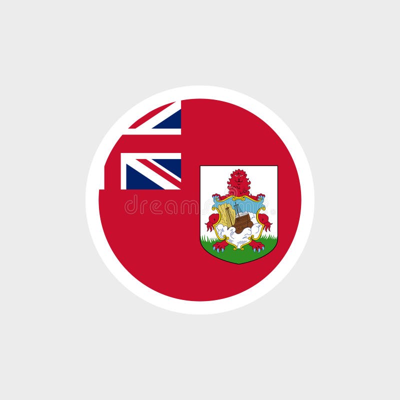
Free with trial State symbol of the overseas territory of Bermuda. Bermuda map vectors Flag of Bermuda. Bermuda red flag with coat of arms and flag of Great Britain. State symbol of the overseas territory of Bermuda.
Free with trial State symbol of the overseas territory of Bermuda. Bermuda map vectors Flag of Bermuda. Bermuda red flag with coat of arms and flag of Great Britain. State symbol of the overseas territory of Bermuda.
Free with trial Bermuda national flag featuring red ensign with Union Jack and coat of arms. Represents heritage, British ties, and island identity. Bermuda map vectors Bermuda National Flag Red Ensign with Union Jack and Bermuda Coat of Arms. Bermuda national flag featuring red ensign with Union Jack and coat of arms. Represents heritage, British ties, and island identity
Free with trial National Flags and Folded Paper Maps of America, Complete Collection of Map and Flag. Bermuda map vectors National Flags and Folded Paper Maps of America, Complete Collection of Map and Flag
Free with trial 3D Flag of Switzerland and Bermuda on Blue Sky with Sun Shine. Bermuda map illustrations Switzerland and Bermuda Flag Together A Concept of Relations. 3D Flag of Switzerland and Bermuda on Blue Sky with Sun Shine
Free with trial Pennant Flags of American Countries on a Colorful World Map. A vibrant collection of triangular pennant flags. Bermuda map vectors Pennant Flags of American Countries on a Colorful World Map. A vibrant collection of triangular pennant flags
Free with trial Isla Gran Bermuda in the North Atlantic Ocean, belonging to Bermuda, isolated on a satellite image taken in February 14, 2023, with distance scale. Bermuda map illustrations Isla Gran Bermuda. Bermuda. Shape on white. Satellite, February 14, 2023. Isla Gran Bermuda in the North Atlantic Ocean, belonging to Bermuda, isolated on a satellite image taken in February 14, 2023, with distance scale
Free with trial Isla Gran Bermuda in the North Atlantic Ocean, belonging to Bermuda, cropped to square on a satellite image taken in October 12, 2022. Bermuda map illustrations Isla Gran Bermuda, Bermuda, cropped to square. Satellite, October 12, 2022. Isla Gran Bermuda in the North Atlantic Ocean, belonging to Bermuda, cropped to square on a satellite image taken in October 12, 2022
Free with trial Isla Gran Bermuda in the North Atlantic Ocean on a satellite image taken in February 14, 2023. Bermuda map illustrations Isla Gran Bermuda. Bermuda. Satellite, February 14, 2023. Isla Gran Bermuda in the North Atlantic Ocean on a satellite image taken in February 14, 2023
Free with trial Isla Gran Bermuda in the North Atlantic Ocean on a satellite image taken in October 12, 2022. Bermuda map illustrations Isla Gran Bermuda. Bermuda. Satellite, October 12, 2022. Isla Gran Bermuda in the North Atlantic Ocean on a satellite image taken in October 12, 2022
Free with trial Coloring page with world map, sea animals, and interesting facts. Vector line art for school and geography lessons. Bermuda map vectors Educational activity worksheet about world oceans for children. Coloring page with world map, sea animals, and interesting facts. Vector line art for school and. Coloring page with world map, sea animals, and interesting facts. Vector line art for school and geography lessons.
Free with trial Nuneaton and Bedworth. Administrative area of United Kingdom on a OpenStreetMap Humanitarian style map. Bermuda map illustrations Nuneaton and Bedworth, United Kingdom. OpenStreetMap Humanitarian. Nuneaton and Bedworth. Administrative area of United Kingdom on a OpenStreetMap Humanitarian style map
Free with trial Isolated red map of North America on a white background. Highly detailed, with borders. Includes the USA, Canada, Mexico, Cuba, Guatemala, Haiti, the Dominican Republic, Honduras, and Nicaragua. Bermuda map illustrations Red North America Map with Detailed Regions. Isolated red map of North America on a white background. Highly detailed, with borders. Includes the USA, Canada, Mexico, Cuba, Guatemala, Haiti, the Dominican Republic, Honduras, and Nicaragua.
Free with trial Vintage map of North America with regions, isolated on a white background. The highly detailed map includes borders and features the USA, Canada, Mexico, Cuba, Guatemala, Haiti, the Dominican Republic, Honduras, and Nicaragua. Bermuda map vectors Vintage North America Map with Detailed Regions. Vintage map of North America with regions, isolated on a white background. The highly detailed map includes borders and features the USA, Canada, Mexico, Cuba, Guatemala, Haiti, the Dominican Republic, Honduras, and Nicaragua.
Free with trial Isolated turquoise map of North America on a white background. Highly detailed, with borders. Includes the USA, Canada, Mexico, Cuba, Guatemala, Haiti, the Dominican Republic, Honduras, and Nicaragua. Bermuda map illustrations Turquoise North America Map with Detailed Regions. Isolated turquoise map of North America on a white background. Highly detailed, with borders. Includes the USA, Canada, Mexico, Cuba, Guatemala, Haiti, the Dominican Republic, Honduras, and Nicaragua.
Free with trial North America isolated map on a white background. Highly detailed, with borders. Includes the USA, Canada, Mexico, Cuba, Guatemala, Haiti, the Dominican Republic, Honduras, and Nicaragua. Bermuda map vectors Detailed North America Map with Regions and Borders. North America isolated map on a white background. Highly detailed, with borders. Includes the USA, Canada, Mexico, Cuba, Guatemala, Haiti, the Dominican Republic, Honduras, and Nicaragua.
Free with trial Isolated map of North America on a white background. Highly detailed, with borders. Includes the USA, Canada, Mexico, Cuba, Guatemala, Haiti, the Dominican Republic, Honduras, and Nicaragua. Bermuda map vectors Highly Detailed Isolated North America Map with Borders. Isolated map of North America on a white background. Highly detailed, with borders. Includes the USA, Canada, Mexico, Cuba, Guatemala, Haiti, the Dominican Republic, Honduras, and Nicaragua.
Free with trial Nuneaton and Bedworth. Outlined administrative area of United Kingdom on a OpenStreetMap French style map. Bermuda map illustrations Nuneaton and Bedworth outlined, United Kingdom. OpenStreetMap French. Nuneaton and Bedworth. Outlined administrative area of United Kingdom on a OpenStreetMap French style map
Free with trial Nuneaton and Bedworth. Administrative area of United Kingdom highlighted and outlined on a darkened OpenStreetMap French style map. Bermuda map illustrations Nuneaton and Bedworth highlighted, United Kingdom. OpenStreetMap French. Nuneaton and Bedworth. Administrative area of United Kingdom highlighted and outlined on a darkened OpenStreetMap French style map
Free with trial Nuneaton and Bedworth. Outlined administrative area of United Kingdom on a OpenStreetMap Humanitarian style map. Bermuda map illustrations Nuneaton and Bedworth outlined, United Kingdom. OpenStreetMap Humanitarian. Nuneaton and Bedworth. Outlined administrative area of United Kingdom on a OpenStreetMap Humanitarian style map
Free with trial Isolated map of North America on a white background. Highly detailed, with borders. Includes the USA, Canada, Mexico, Cuba, Guatemala, Haiti, the Dominican Republic, Honduras, and Nicaragua. Bermuda map vectors Highly Detailed Isolated North America Map. Isolated map of North America on a white background. Highly detailed, with borders. Includes the USA, Canada, Mexico, Cuba, Guatemala, Haiti, the Dominican Republic, Honduras, and Nicaragua.
Free with trial Nuneaton and Bedworth. Administrative area of United Kingdom highlighted and outlined on a darkened OpenStreetMap Humanitarian style map. Bermuda map illustrations Nuneaton and Bedworth highlighted, United Kingdom. OpenStreetMap Humanitarian. Nuneaton and Bedworth. Administrative area of United Kingdom highlighted and outlined on a darkened OpenStreetMap Humanitarian style map
Free with trial Nuneaton and Bedworth. Administrative area of United Kingdom isolated on white on a OpenStreetMap French style map. Bermuda map illustrations Nuneaton and Bedworth, United Kingdom, isolated on white. OpenStreetMap French. Nuneaton and Bedworth. Administrative area of United Kingdom isolated on white on a OpenStreetMap French style map