Free with trial High resolution topographic map of New York with land cover, rivers and shaded relief in 1:1. 000. 000 scale. Elevation map illustrations High resolution topographic map of New York
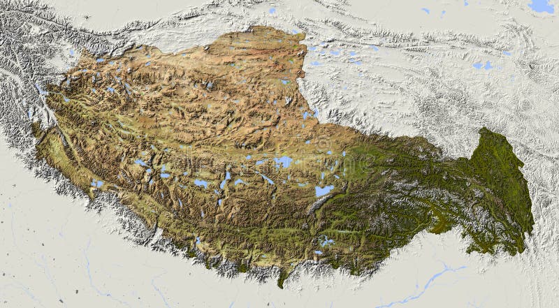
Free with trial Tibet. Shaded relief map. Surrounding territory greyed out. Colored according to elevation and dominant vegetation. Includes clip path for the state area. Elevation map illustrations Tibet, relief map. Tibet. Shaded relief map. Surrounding territory greyed out. Colored according to elevation and dominant vegetation. Includes clip path for the state area.
Free with trial Yemen. Shaded relief map. Surrounding territory greyed out. Colored according to elevation. Includes clip path for the state area. Elevation map illustrations Yemen, relief map. Yemen. Shaded relief map. Surrounding territory greyed out. Colored according to elevation. Includes clip path for the state area.
Free with trial Sweden. Shaded relief map, with major urban areas. Surrounding territory greyed out. Colored according to elevation. Includes clip path for the state area. Elevation map illustrations Sweden, relief map. Sweden. Shaded relief map, with major urban areas. Surrounding territory greyed out. Colored according to elevation. Includes clip path for the state area.
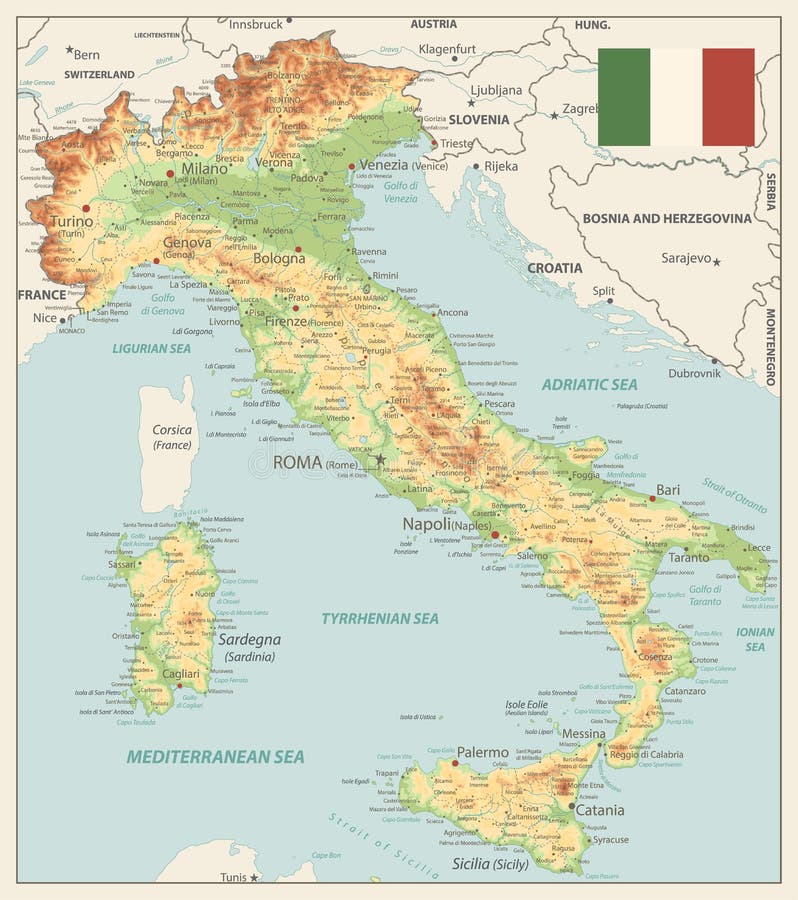
Free with trial Italy Physical Map Vinatge Colors - Image contains layers with shaded contours, land names, city names, water objects and it`s names - Highly detailed vector illustration. Elevation map vectors Italy Physical Map Vinatge Colors
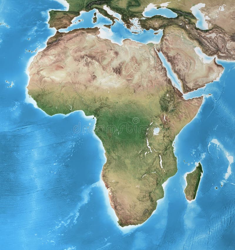
Free with trial Physical map of Africa, with high resolution details. Flattened satellite view of Planet Earth, its geography and topography. 3D illustration - Elements of this image furnished by NASA. Elevation map illustrations High resolution detailed map of Africa. Physical map of Africa, with high resolution details. Flattened satellite view of Planet Earth, its geography and topography. 3D illustration - Elements of this image furnished by NASA
Free with trial Utah. Shaded relief map, with major urban areas and rivers, surrounding territory greyed out. Colored according to elevation. Clipping path for the state area included. Projection: Standard Mercator Extents: -115. 0/-108. 5/36. 0/43. 0 Data sources: US Census Bureau, NASA. Elevation map illustrations Utah, shaded relief map. Utah. Shaded relief map, with major urban areas and rivers, surrounding territory greyed out. Colored according to elevation. Clipping path for the state area included. Projection: Standard Mercator Extents: -115.0/-108.5/36.0/43.0 Data sources: US Census Bureau, NASA
Free with trial California Physical Map - Highly Detailed Relief Map of California State vector illustration - All elements are separated in editable layers clearly labeled. Elevation map vectors California Physical Map
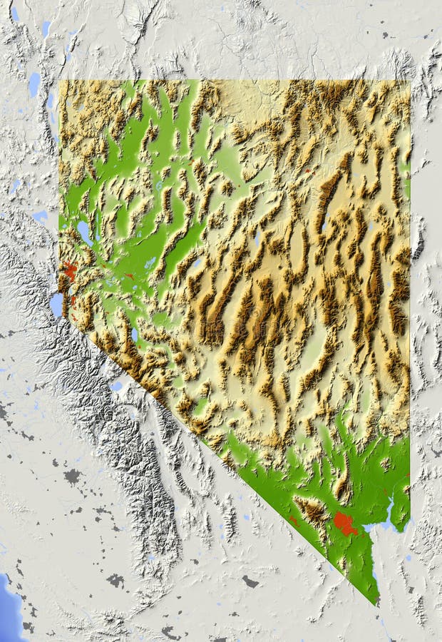
Free with trial Nevada. Shaded relief map, with major urban areas and rivers, surrounding territory greyed out. Colored according to elevation. Clipping path for the state area included. Projection: Standard Mercator Extents: -121. 0/-113. 5/34. 5/43. 0 Data sources: US Census Bureau, NASA. Elevation map illustrations Nevada, shaded relief map. Nevada. Shaded relief map, with major urban areas and rivers, surrounding territory greyed out. Colored according to elevation. Clipping path for the state area included. Projection: Standard Mercator Extents: -121. 0/-113. 5/34. 5/43. 0 Data sources: US Census Bureau, NASA
Free with trial High resolution topographic map of Hawaii with land cover, rivers and shaded relief in 1:1. 000. 000 scale. Elevation map illustrations High resolution topographic map of Hawaii
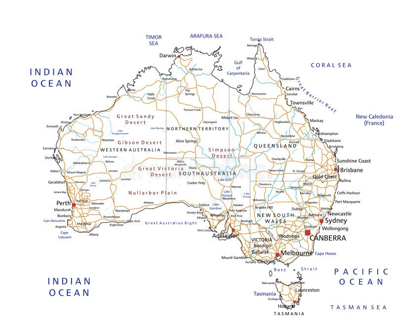
Free with trial High detailed Australia road and highway map with labeling. Vector illustration. Elevation map vectors High detailed Australia road map with labeling. High detailed Australia road and highway map with labeling. Vector illustration.
Free with trial High resolution topographic map of Connecticut with land cover, rivers and shaded relief in 1:1. 000. 000 scale. Elevation map illustrations High resolution topographic map of Connecticut
Free with trial USA detailed physical map and navigation icons with water objects and cities. Elevation map vectors USA detailed physical map and navigation icons
Free with trial Arab Emirates. Shaded relief map. Surrounding territory greyed out. Colored according to elevation. Includes clip path for the state area. Elevation map illustrations Arab Emirates, shaded relief map. Arab Emirates. Shaded relief map. Surrounding territory greyed out. Colored according to elevation. Includes clip path for the state area.
Free with trial Vietnam. Shaded relief map. Surrounding territory greyed out. Colored according to elevation. Includes clip path for the state area. Elevation map illustrations Vietnam, relief map. Vietnam. Shaded relief map. Surrounding territory greyed out. Colored according to elevation. Includes clip path for the state area.
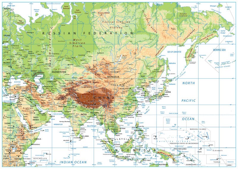
Free with trial Asia Physical Map with Rivers, Lakes and Elevations. Retro Colors. Elevation map vectors Asia Physical Map with Rivers, Lakes and Elevations
Free with trial Maryland. Shaded relief map. Surrounding territory greyed out. Shows major urban areas and rivers. Colored according to relative elevation. Clipping path for state area included. Elevation map illustrations Maryland, relief map. Maryland. Shaded relief map. Surrounding territory greyed out. Shows major urban areas and rivers. Colored according to relative elevation. Clipping path for state area included.
Free with trial USA Political Road Map and map pointers with roads, water objects and cities. Elevation map vectors USA Political Road Map and map pointers
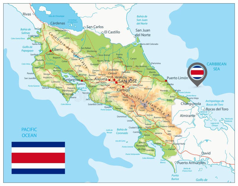
Free with trial Costa Rica Physical Map. Detailed map of Costa Rica with shaded relief map, major cities, roads and water objects. Elevation map vectors Costa Rica Physical Map
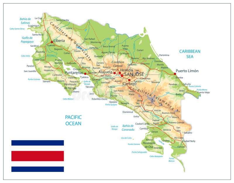
Free with trial Costa Rica Physical Map Isolated On White. Detailed map of Costa Rica with shaded relief map, major cities, roads and water objects. Elevation map vectors Costa Rica Physical Map Isolated On White
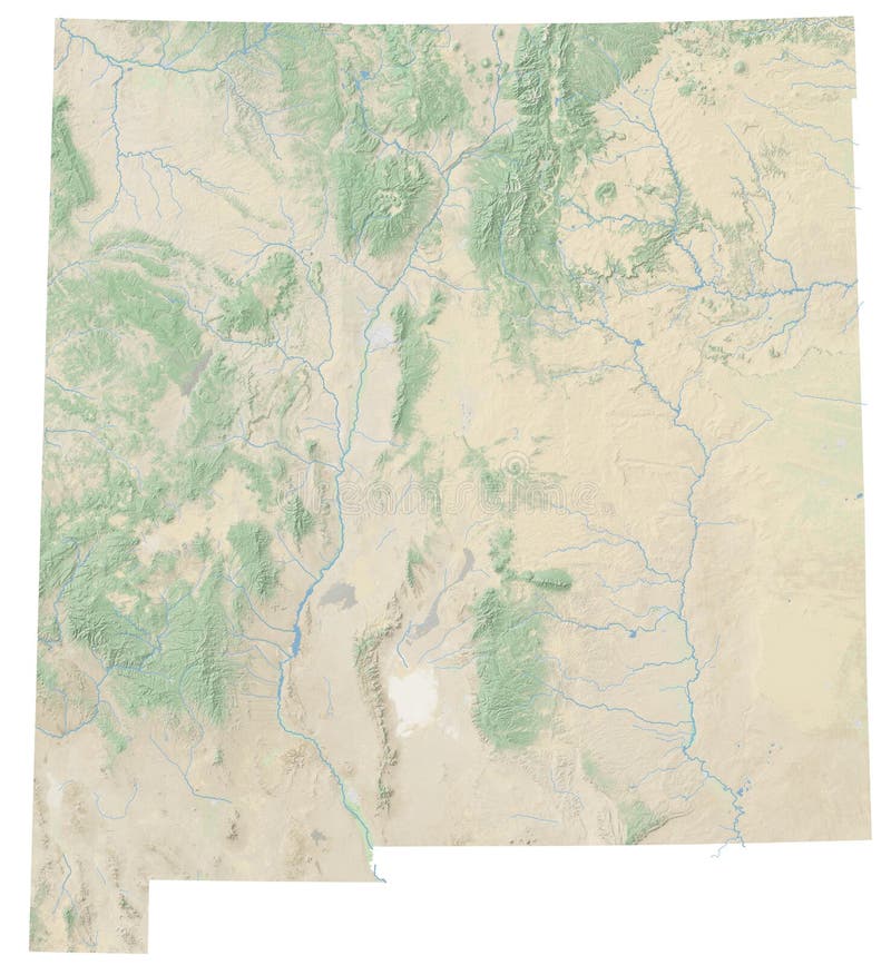
Free with trial High resolution topographic map of New Mexico with land cover, rivers and shaded relief in 1:1. 000. 000 scale. Elevation map illustrations High resolution topographic map of New Mexico
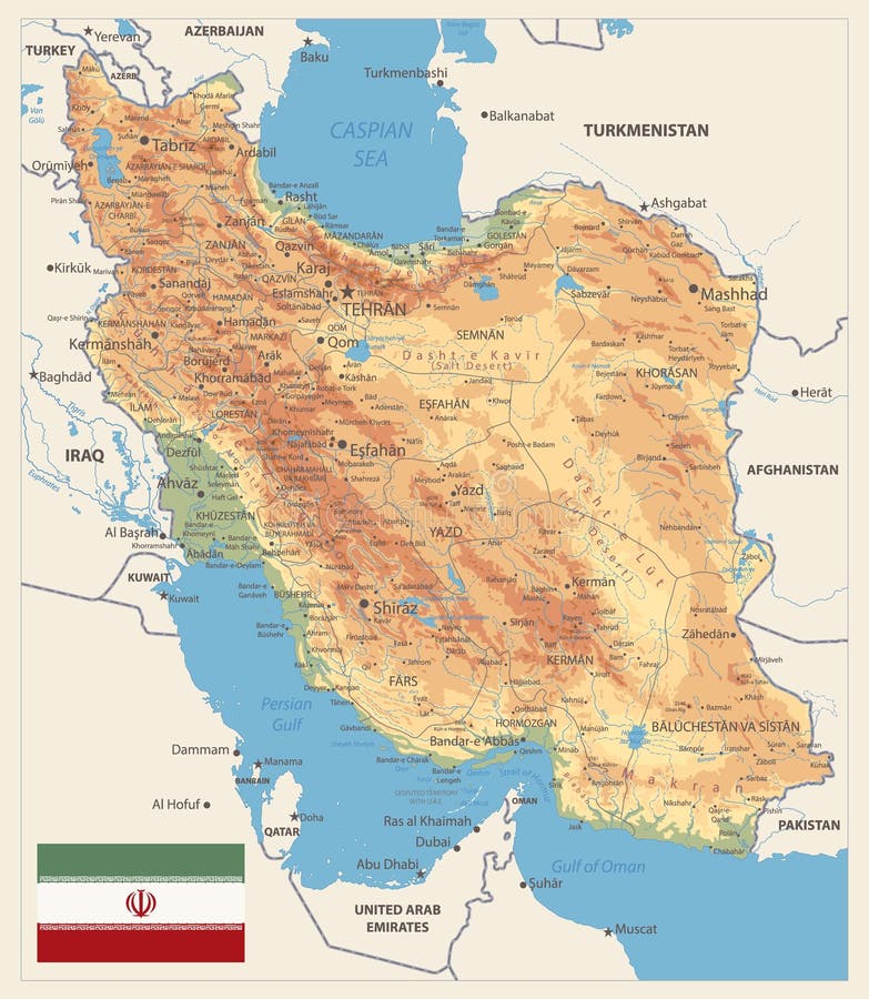
Free with trial Physical map of Iran Retro Colors. Image contains layers with shaded contours, land names, city names, water objects and it`s names. Elevation map vectors Physical map of Iran Retro Colors
Free with trial Detailed Relief map of USA. No text. Vector illustration. Elevation map vectors Detailed Relief map of USA. No text
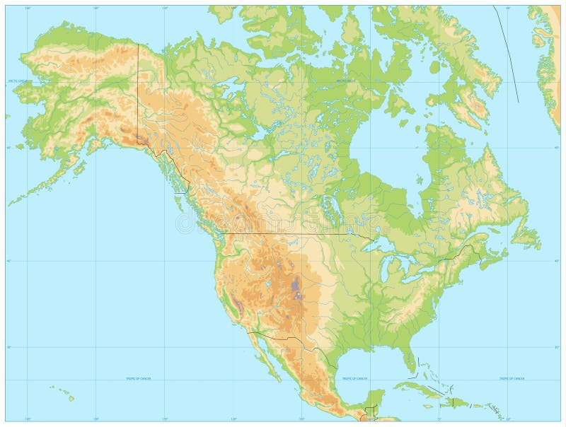
Free with trial North America Physical Map. No text. Vector illustration. Elevation map vectors North America Physical Map. No text
Free with trial Czech Republic Physical Map. No text - Detailed map of Czech Republic vector illustration - All elements are separated in editable layers clearly labeled. Elevation map vectors Czech Republic Physical Map. No text
Free with trial Asia Physical Map Isolated on White. Vector illustration. Elevation map vectors Asia Physical Map Isolated on White
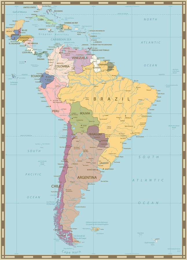
Free with trial South America Political Map with lakes and rivers. Old colors. Elevation map vectors South America Political Map. Old colors. South America Political Map with lakes and rivers. Old colors.
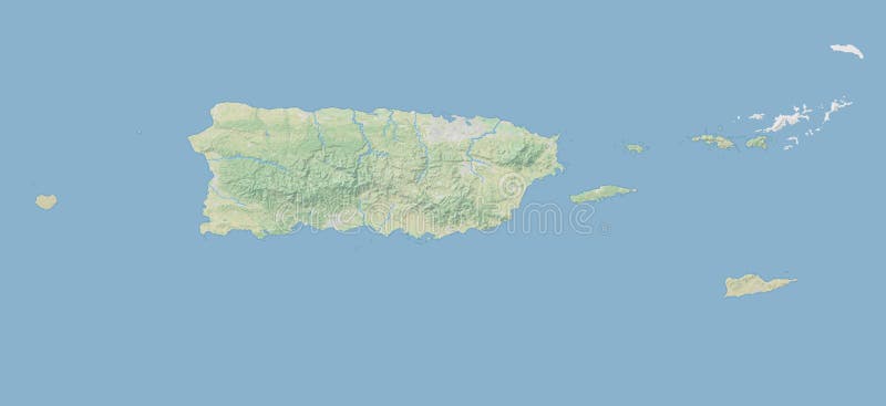
Free with trial High resolution topographic map of Puerto Rico with land cover, rivers and shaded relief in 1:1. 000. 000 scale. Elevation map illustrations High resolution topographic map of Puerto Rico
Free with trial Physical map of South Asia, with high resolution details. Flattened satellite view of Planet Earth, its geography and topography. 3D illustration - Elements of this image furnished by NASA. Elevation map illustrations High resolution detailed map of South Asia, Himalayas and India. Physical map of South Asia, with high resolution details. Flattened satellite view of Planet Earth, its geography and topography. 3D illustration - Elements of this image furnished by NASA
Free with trial South America Detailed Physical Map with global relief, lakes and rivers. Retro colors. No text. Highly detailed vector map. Elevation map vectors South America Detailed Physical Map with global relief, lakes an
Free with trial High resolution topographic map of New Hampshire with land cover, rivers and shaded relief in 1:1. 000. 000 scale. Elevation map illustrations High resolution topographic map of New Hampshire
Free with trial High detailed Russia road map and navigation icons with separated layers. Elevation map vectors High detailed Russia road map and navigation icons
Free with trial The Great Lakes system Profile map, Canada, United States. Elevation map vectors The Great Lakes system Profile map, Canada, United States.
Free with trial High detailed Australia road and highway map with labeling. Vector illustration. Elevation map vectors High detailed Australia road map with labeling. High detailed Australia road and highway map with labeling. Vector illustration.
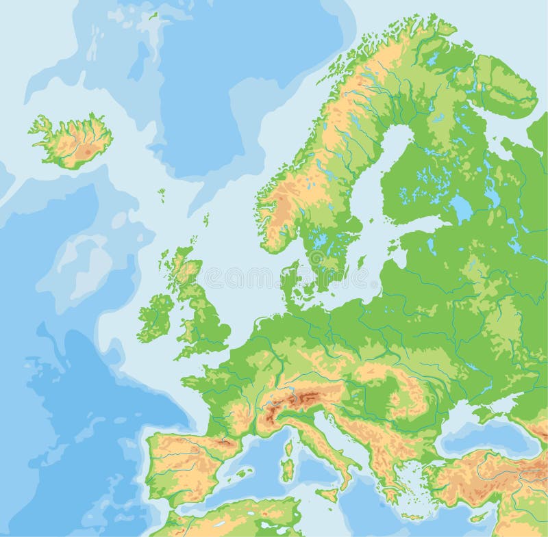
Free with trial High detailed Europe physical map with rivers and surface elements. Vector illustration. Elevation map vectors High detailed Europe physical map. High detailed Europe physical map with rivers and surface elements. Vector illustration.
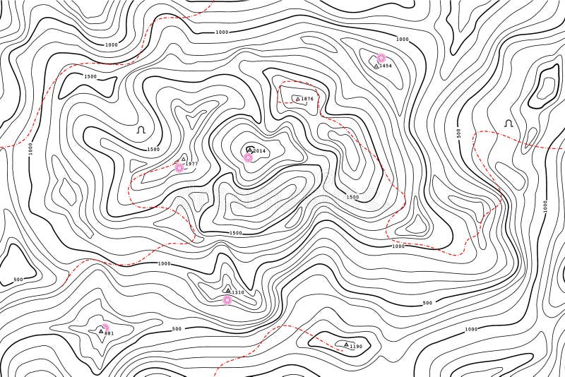
Free with trial Contour line map. Topographical relief outline, cartography texture geographic world mapping grid terrain trails, contouring graphic geography topographic abstract vector background. Elevation map vectors Contour line map. Topographical relief outline, cartography texture geographic world mapping grid terrain trails, vector. Contour line map. Topographical relief outline, cartography texture geographic world mapping grid terrain trails, contouring graphic geography topographic abstract vector background
Free with trial Stippled world relief vector map. Light edition. Elevation map vectors Stippled world relief vector map
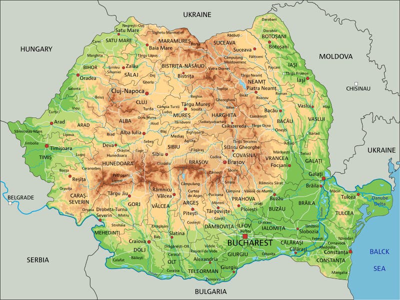
Free with trial High detailed Romania physical map with labeling. Vector illustration. Elevation map vectors High detailed Romania physical map with labeling.
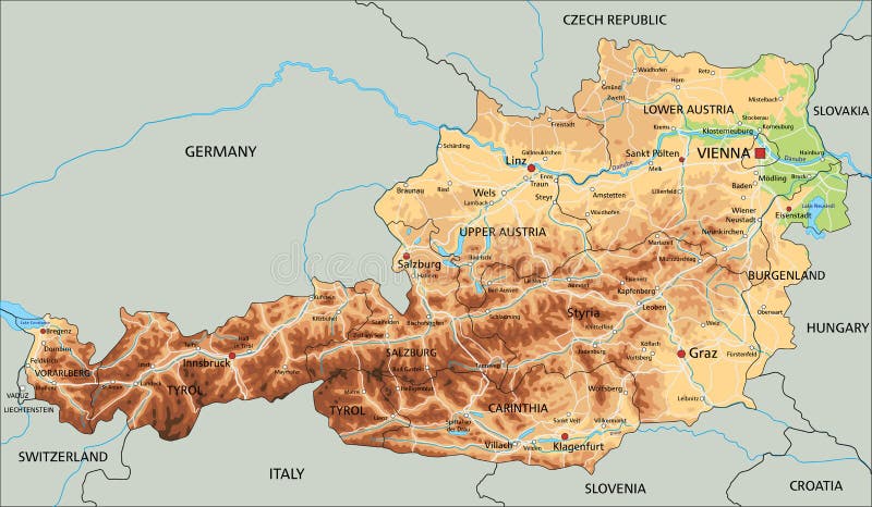
Free with trial High detailed Austria physical map with labeling. clearly labeled, separated layers, vector illustration. Elevation map vectors High detailed Austria physical map with labeling.
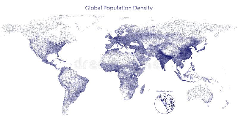
Free with trial Stippled map of global population density. Vector illustration. Elevation map vectors Stippled vector map of global population density. Stippled map of global population density. Vector illustration
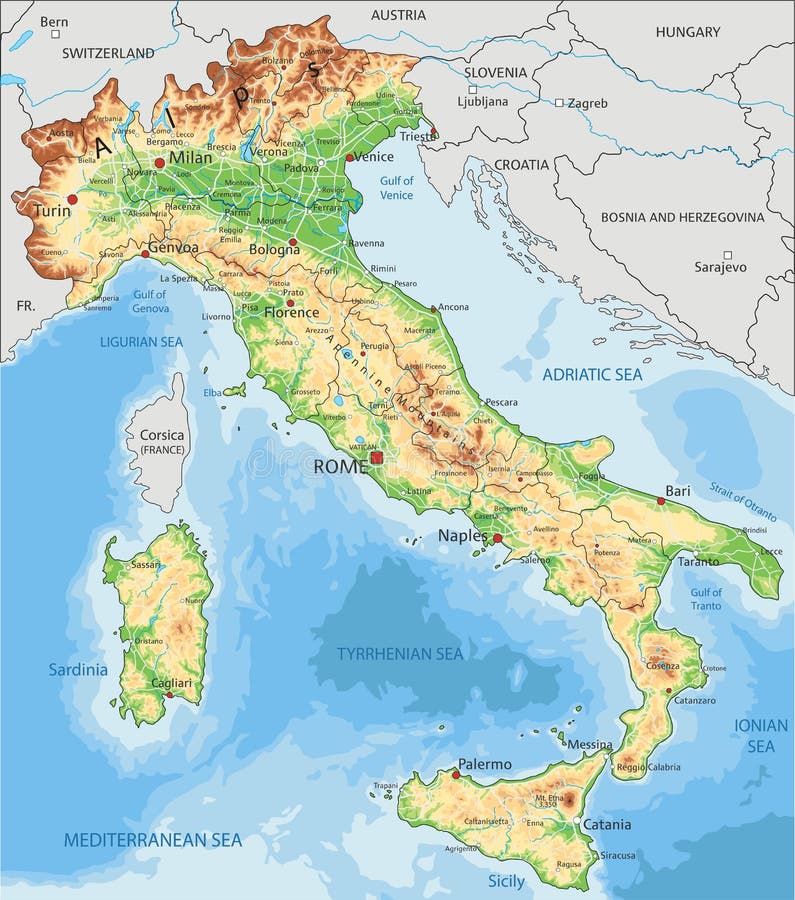
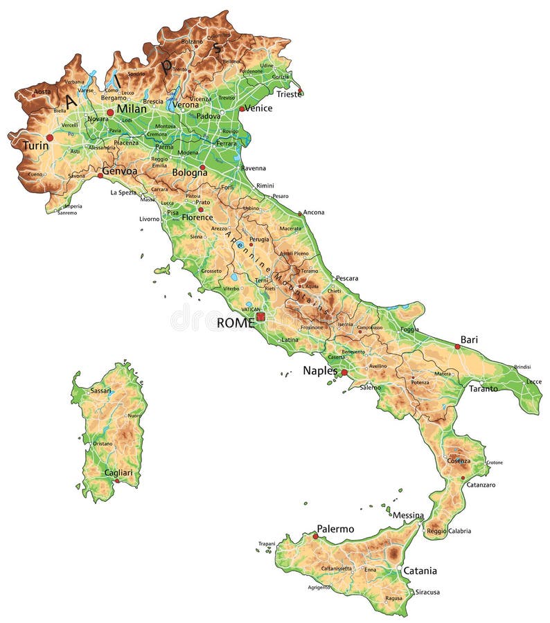
Free with trial High detailed Italy physical map with labeling. Vector illustration. Elevation map vectors High detailed Italy physical map with labeling.
Free with trial High detailed Japan physical map. Vector illustration. Elevation map vectors High detailed Japan physical map.
Free with trial High detailed Germany physical map with labeling. Vector illustration. Elevation map vectors High detailed Germany physical map with labeling.
Free with trial High detailed Australia physical map. Clearly labeled, separated layers, vector illustration. Elevation map vectors High detailed Australia physical map.
Free with trial United States of America USA Vector Map isolated on white. background. Vector illustration. Elevation map vectors United States of America USA Vector Map
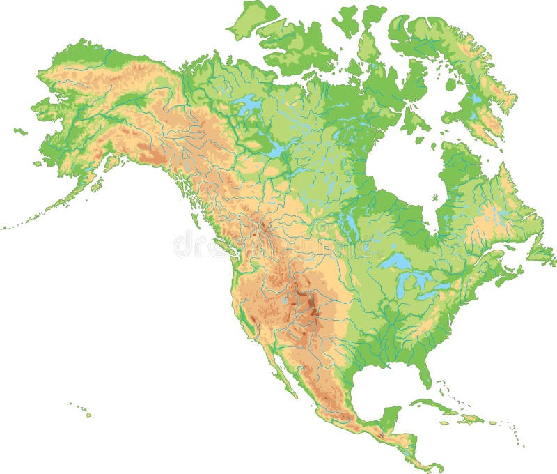
Free with trial High detailed North America physical map with labeling. Vector illustration. Elevation map vectors High detailed North America physical map. High detailed North America physical map with labeling. Vector illustration.
Free with trial High detailed South Africa physical map with labeling. Vector illustration. Elevation map vectors High detailed South Africa physical map with labeling.
Free with trial High detailed Italy physical map with labeling. Vector illustration. Elevation map vectors High detailed Italy physical map with labeling.
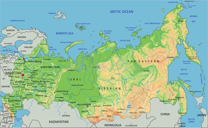
Free with trial High detailed Russia physical map with labeling. Vector illustration. Elevation map vectors High detailed Russia physical map with labeling.
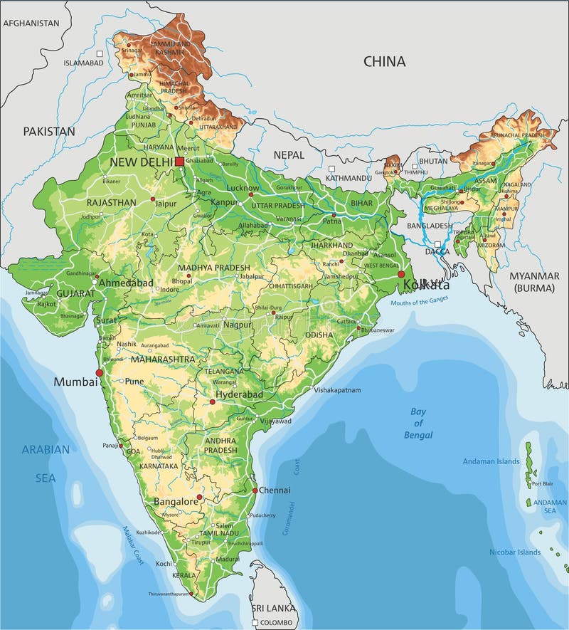
Free with trial High detailed India physical map with labeling. Vector illustration. Elevation map vectors High detailed India physical map with labeling.
Free with trial High detailed Australia physical map. Clearly labeled, separated layers, vector illustration. Elevation map vectors High detailed Australia physical map.
Free with trial Vector abstract earth relief map. Generated conceptual elevation map. Elevation map vectors Vector abstract earth relief map.
Free with trial High detailed United Kingdom physical map with labeling. Vector illustration. Elevation map vectors High detailed United Kingdom physical map with labeling.
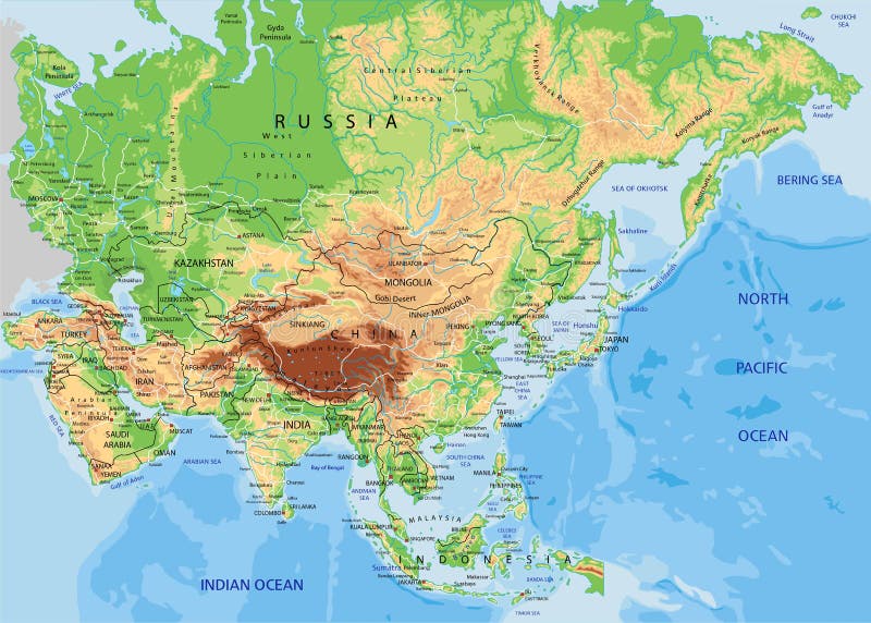
Free with trial High detailed Asia physical map with rivers and surface elements. Vector illustration. Elevation map vectors High detailed Asia physical map with labeling. High detailed Asia physical map with rivers and surface elements. Vector illustration.
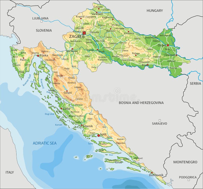
Free with trial High detailed Croatia physical map with labeling. Vector illustration. Elevation map vectors High detailed Croatia physical map with labeling.
Free with trial Vector abstract earth relief map. Generated conceptual elevation map. Elevation map vectors Vector abstract earth relief map.
Free with trial Topographic map showing terrain lines with gradient background. Elevation map vectors Topographic map natural color. Topographic map showing terrain lines with gradient background.
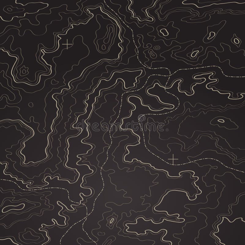
Free with trial TOPOGRAPHIC ALTITUDE LINE MAP WITH ATTRACTION POINT. SEAMLESS VECTOR PATTERN. HEIGHT HIKE MAP. SYMBOL ATTRACTION. Elevation map vectors TOPOGRAPHIC ALTITUDE LINE MAP WITH ATTRACTION POINT. SEAMLESS VECTOR PATTERN
Free with trial Camera 360 icon graphic design template vector illustration arrow round technology rotation digital angle flat video full circle panorama view rotate black plane screen angel corner review visual app area sense look drone quality production 360-degree lens around point map elevation wide picture tour application service circular arrows spin landscape photo. Elevation map vectors Camera 360 icon graphic design template vector
Free with trial Model of a mine elevation. GIS product made after processing aerial pictures taken from a drone. It shows excavation site with steep rock walls. Elevation map illustrations Digital elevation model of mine for GIS usage. Model of a mine elevation. GIS product made after processing aerial pictures taken from a drone. It shows excavation site with steep rock walls
Free with trial Physical map of Mediterranean and Central Europe, states and borders, North Africa and the Middle East. Mountains, lakes and plains. 3d render. Elevation map illustrations Physical map of Mediterranean and Central Europe, states and borders, North Africa and the Middle East
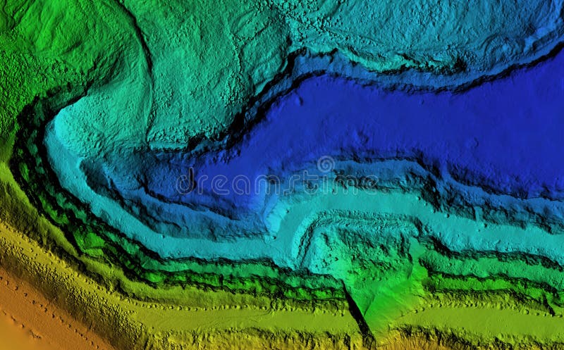
Free with trial DEM - digital elevation model. Product made after proccesing pictures taken from a drone. It shows excavation site with piles of aggregates. Elevation map illustrations Digital elevation model piles of aggregates for GIS usage. DEM - digital elevation model. Product made after proccesing pictures taken from a drone. It shows excavation site with piles of aggregates
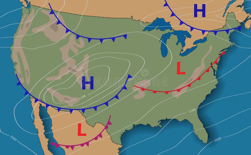
Free with trial Weather forecast. Meteorological weather map of the United State of America. Realistic synoptic map USA with aditable generic map showing isobars and weather fronts. Topography and physical map. EPS 10. Elevation map illustrations Weather forecast. Meteorological weather map of the United State of America. Realistic synoptic map USA with aditable generic map
Free with trial Poland Physical Map. Highly detailed map vector illustration. Image contains layers with shaded contours, land names, city names, water objects and it`s names, highways. Elevation map vectors Poland Physical Map
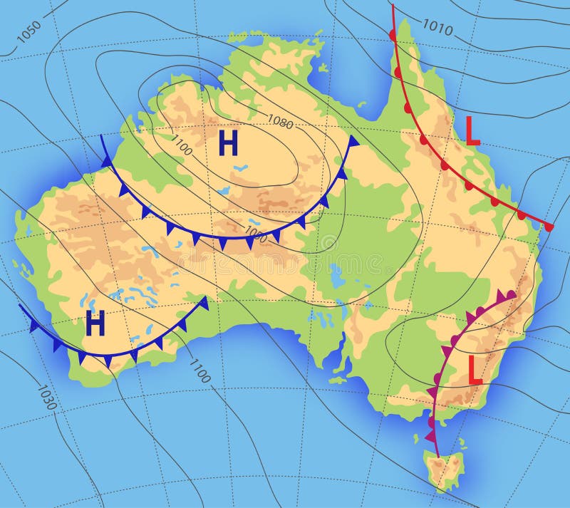
Free with trial Weather forecast. Meteorological weather map of the AUSTRALIA. Realistic synoptic map Australia with aditable generic map showing isobars and weather fronts. Topography and physical map. Vector EPS 10. Elevation map vectors Weather forecast. Meteorological weather map of the AUSTRALIA. Realistic synoptic map Australia with aditable generic
Free with trial A world map with a compass. Elevation map illustrations WOrld Map with compass. A world map with a compass
Free with trial The world map in a United Kingdom Theme. Elevation map illustrations World Map UK Theme. The world map in a United Kingdom Theme
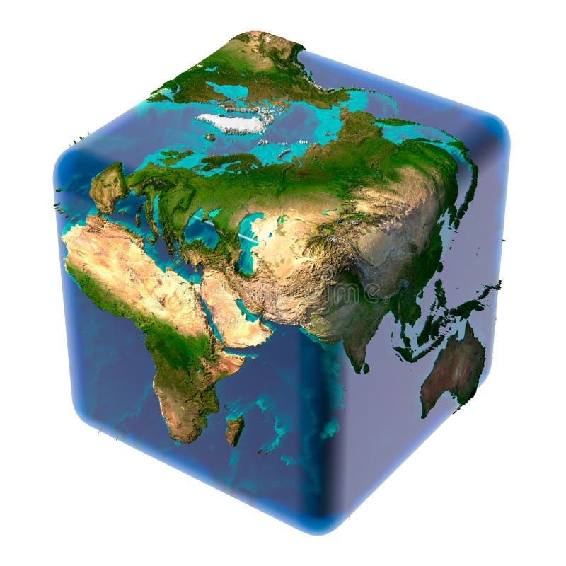
Free with trial Earth as a cube with a shadow, with a translucent water, detailed relief map of the continents and oceans. Elevation map illustrations Cubic Earth with translucent ocean. Earth as a cube with a shadow, with a translucent water, detailed relief map of the continents and oceans
Free with trial The world map presented in a Brazillian Theme. Elevation map illustrations World Map Brazil Theme. The world map presented in a Brazillian Theme
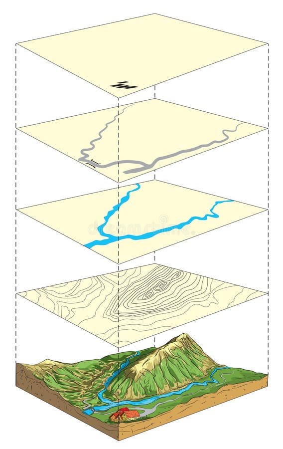
Free with trial Illustration of terrain model and its representation on topographic map in layers. Elevation map vectors Topographic relief. Illustration of terrain model and its representation on topographic map in layers
Free with trial Earth as a cube with translucent body of water and a detailed relief map of the continents and ocean floor. Elevation map illustrations Cubic Earth with translucent ocean. Earth as a cube with translucent body of water and a detailed relief map of the continents and ocean floor
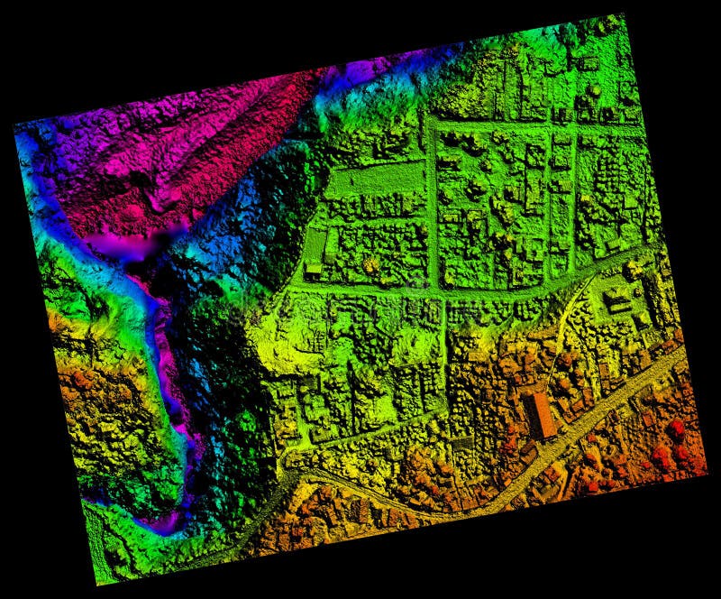
Free with trial Aerial Orthorectified, Orthorectification Digital Elevation Model Of Banos De Agua Santa San Martin Canyon Altitude Represented From Blue To Red. Elevation map illustrations Aerial Orthorectified, Orthorectification Digital Elevation Model
Free with trial Relief map of South America. Vector stippled illustration. Elevation map vectors Vector stippled relief map of South America. Relief map of South America. Vector stippled illustration
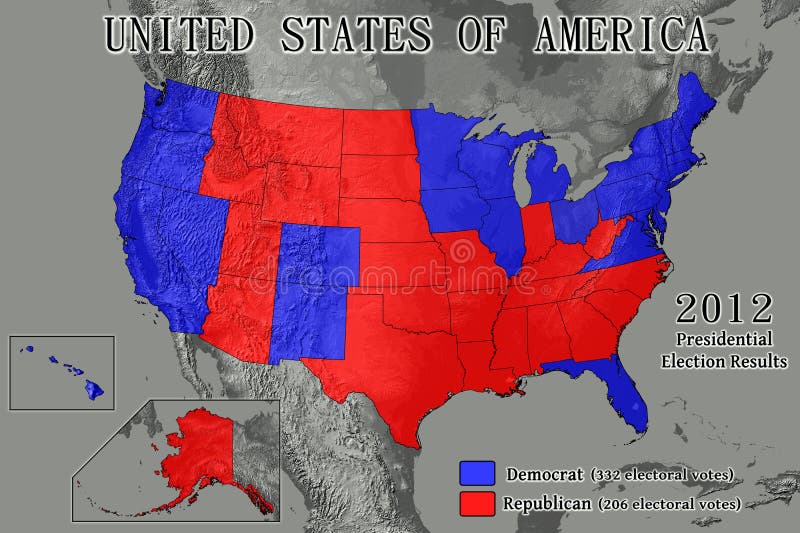
Free with trial United States of America map showing Electoral College results from the 2012 Presidential Election (Data source: USGS). Elevation map illustrations United States 2012 Election Results. United States of America map showing Electoral College results from the 2012 Presidential Election (Data source: USGS).
Free with trial Earth with translucent water in the oceans and the detailed topography of the continents. A fragment of the Asia and Oceania. Isolated on white. Elevation map illustrations Realistic Planet Earth. Earth with translucent water in the oceans and the detailed topography of the continents. A fragment of the Asia and Oceania. Isolated on white
Free with trial Detailed 3D rendering of the globe on black background. The colors of the land areas represent hight (elevation) information. Elevation map illustrations World, Australia, Antarctica. Detailed 3D rendering of the globe on black background. The colors of the land areas represent hight (elevation) information.
Free with trial Highly detailed planet Earth in the morning. Exaggerated precise relief lit morning sun. Persian Gulf. Elements of this image furnished by NASA. Elevation map illustrations Detailed Earth. Persian Gulf. Highly detailed planet Earth in the morning. Exaggerated precise relief lit morning sun. Persian Gulf. Elements of this image furnished by NASA
Free with trial The metaphor of ecology and purity of the planet Earth. Elevation map illustrations Ecology Earth. The metaphor of ecology and purity of the planet Earth
Free with trial The metaphor of ecology and purity of the planet Earth. Elevation map illustrations Ecology Earth. The metaphor of ecology and purity of the planet Earth
Free with trial Planet earth with translucent water of the oceans, atmosphere, volumetric clouds, and detailed topography in outer space. Elevation map illustrations Earth in Space. Planet earth with translucent water of the oceans, atmosphere, volumetric clouds, and detailed topography in outer space