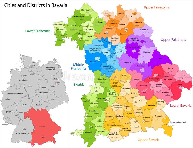
Free with trial Administrative division of Germany. Map of Bavaria with cities and districts. Federal territories vectors State of Germany - Bavaria. Administrative division of Germany. Map of Bavaria with cities and districts
Free with trial The United States of America USA, commonly known as the United States U. S. or America, is a federal republic composed of 50 states, a federal district, five major self-governing territories, and various possessions. At 3. 8 million square miles 9. 8 million km2, the United States is the world`s third- or fourth-largest country by total area. Federal territories vectors Map of The United States of America USA Divided States Maps Silhouette Illustration on White Background. The United States of America USA, commonly known as the United States U.S. or America, is a federal republic composed of 50 states, a federal district, five major self-governing territories, and various possessions. At 3.8 million square miles 9.8 million km2, the United States is the world`s third- or fourth-largest country by total area.
Free with trial Administrative division of the the Federal Democratic Republic of Ethiopia. Federal territories vectors Ethiopia map. Administrative division of the the Federal Democratic Republic of Ethiopia
Free with trial Map of United state of America Territories. High detailed vector map - United state of America Territories. map shape/contour/outline/border with state isolate on white background. Federal territories vectors Map of United state of America Territories. High detailed vector map - United state of America Territories.
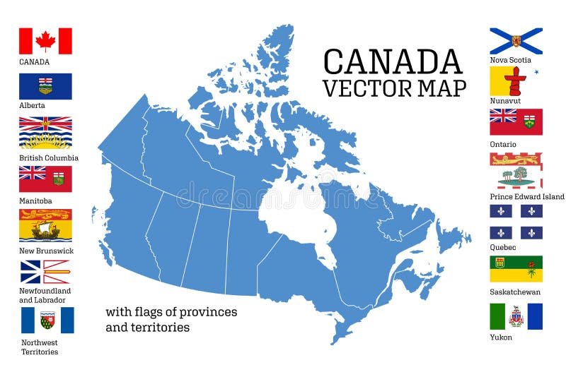
Free with trial Canada map with flags of provinces and territories. Vector illustration. Ottawa, Toronto, Vancouver. Federal territories vectors Canada map with flags of provinces and territories. Vector illustration
Free with trial Administrative division of the Federal Republic of Nigeria. Federal territories vectors Nigeria map. Administrative division of the Federal Republic of Nigeria
Free with trial Road map of the Canadian federal State with national parks. Federal territories vectors Alberta road and national park map. Road map of the Canadian federal State with national parks
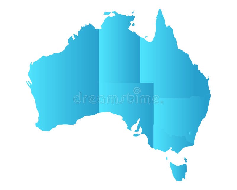
Free with trial Detailed and accurate illustration of map of Australia. Federal territories vectors Map of Australia
Free with trial Administrative division of Canada. Map of Northwest Territories with regions and main cities, vector illustration. Federal territories vectors Province of Canada - Northwest Territories. Administrative division of Canada. Map of Northwest Territories with regions and main cities, vector illustration
Free with trial Vector flags of provinces and territories of Canada. Vector illustration. Ottawa, Toronto, Vancouver. Federal territories vectors Flags of Canadians provinces and territories. Vector illustration. Vector flags of provinces and territories of Canada. Vector illustration. Ottawa, Toronto, Vancouver
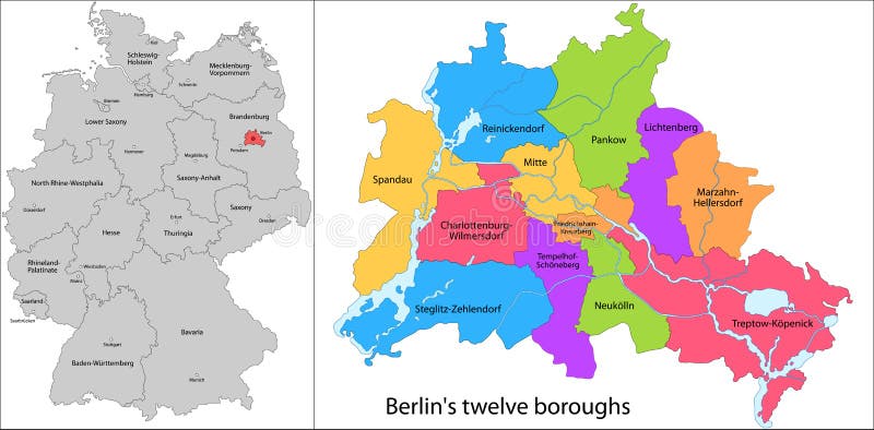
Free with trial Administrative division of Germany. Map of Berlin with twelve boroughs. Federal territories vectors Boroughs of Berlin. Administrative division of Germany. Map of Berlin with twelve boroughs.
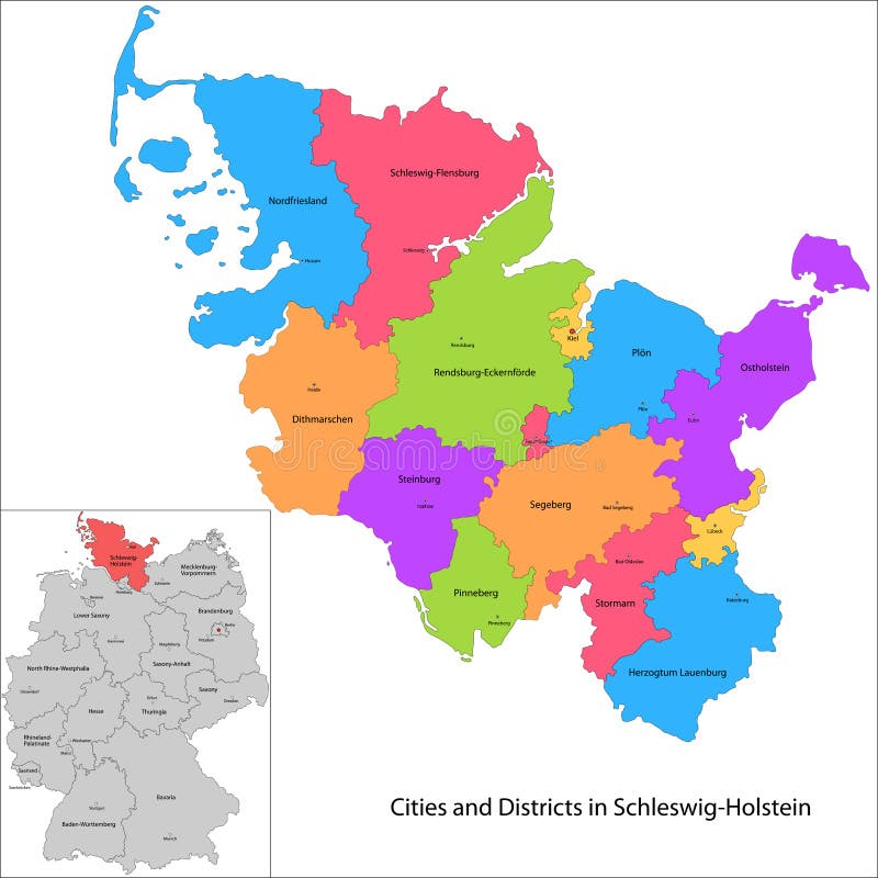
Free with trial Administrative division of Germany. Map of Schleswig-Holstein with cities and districts. Federal territories vectors State of Germany - Schleswig-Holstein. Administrative division of Germany. Map of Schleswig-Holstein with cities and districts
Free with trial Administrative division of Germany. Map of Brandenburg with cities and districts. Federal territories vectors State of Germany - Brandenburg. Administrative division of Germany. Map of Brandenburg with cities and districts
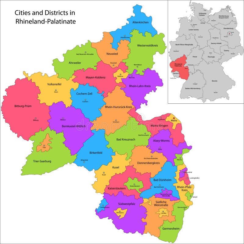
Free with trial Administrative division of Germany. Map of Rhineland-Palatinate with cities and districts. Federal territories vectors State of Germany - Rhineland-Palatinate. Administrative division of Germany. Map of Rhineland-Palatinate with cities and districts
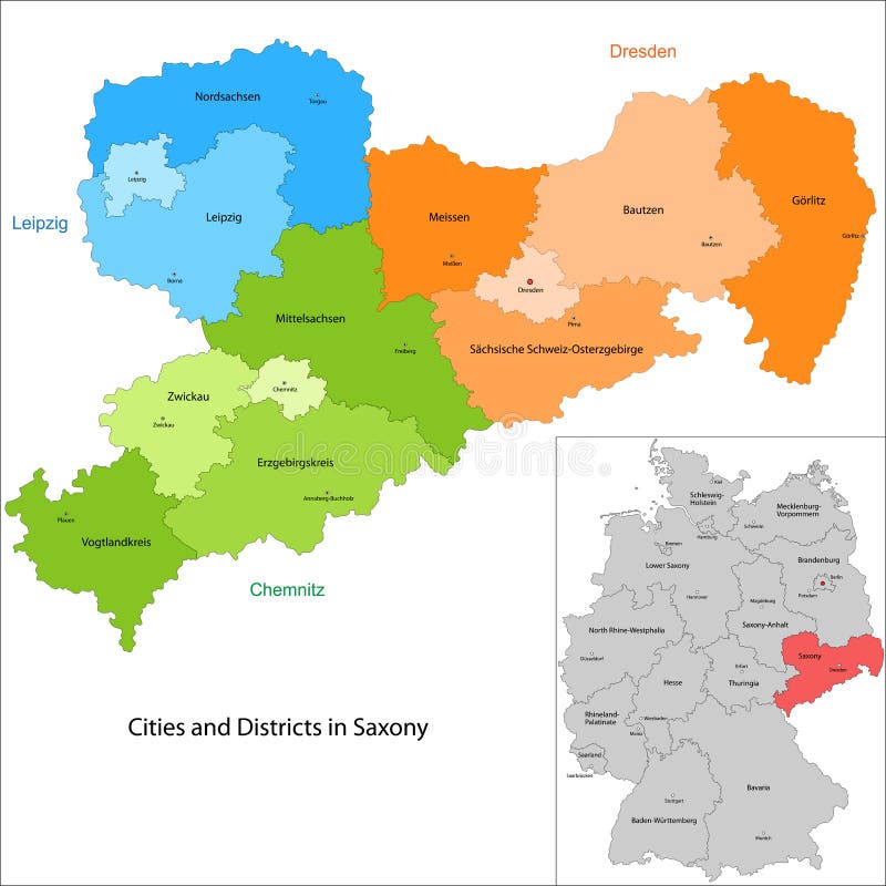
Free with trial Administrative division of Germany. Map of Saxony with cities and districts. Federal territories vectors State of Germany - Saxony. Administrative division of Germany. Map of Saxony with cities and districts
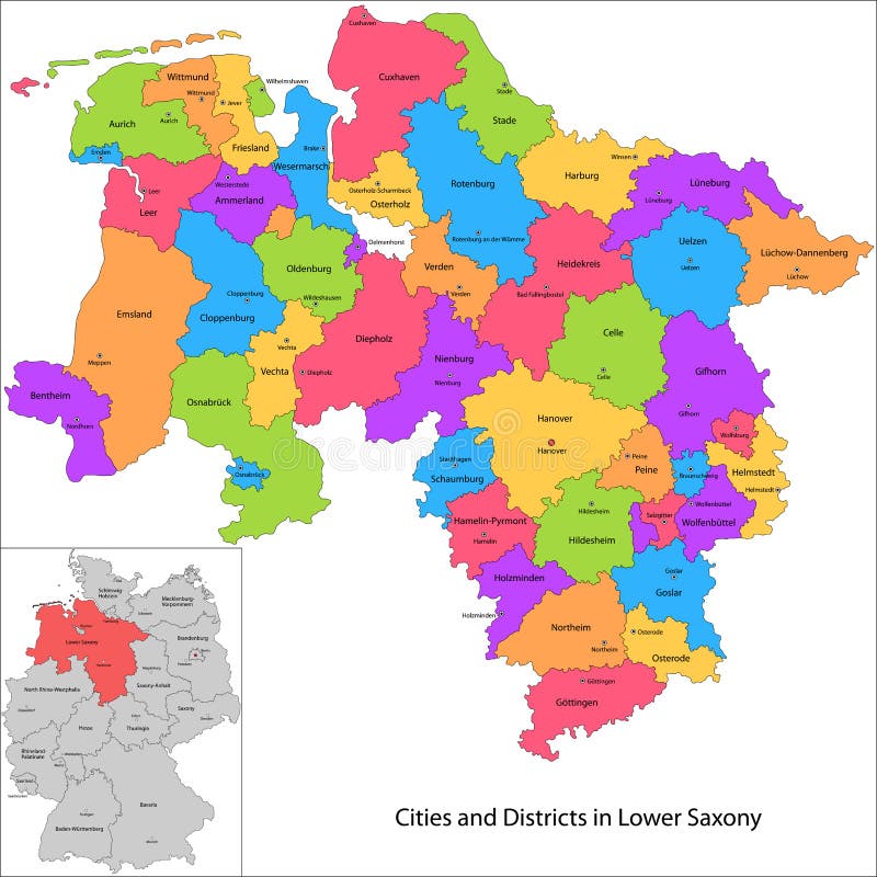
Free with trial Administrative division of Germany. Map of Lower Saxony with cities and districts. Federal territories vectors State of Germany - Lower Saxony. Administrative division of Germany. Map of Lower Saxony with cities and districts
Free with trial Administrative division of Germany. Map of Baden-Wurttemberg with cities and districts. Federal territories vectors State of Germany - Baden-Wurttemberg. Administrative division of Germany. Map of Baden-Wurttemberg with cities and districts
Free with trial Administrative division of Germany. Map of Hamburg. Federal territories vectors Free and Hanseatic City of Hamburg. Administrative division of Germany. Map of Hamburg
Free with trial Detailed and accurate illustration of map of Australia. Federal territories vectors Map of Australia
Free with trial Official vector coat of arms of Canada. Federal territories vectors Coat of arms of Canada
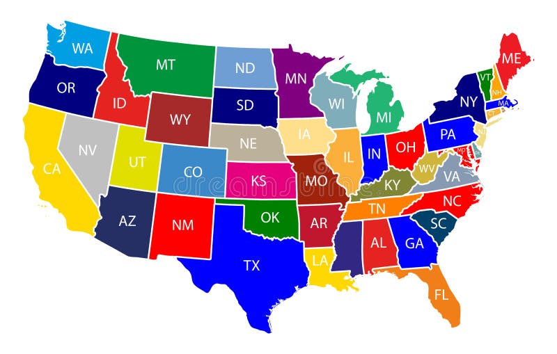
Free with trial The United States of America USA, commonly known as the United States U. S. or America, is a federal republic composed of 50 states, a federal district, five major self-governing territories, and various possessions. At 3. 8 million square miles 9. 8 million km2, the United States is the world`s third- or fourth-largest country by total area. Federal territories vectors Map of The United States of America USA with Colorful States with Name Illustration on White Background. The United States of America USA, commonly known as the United States U.S. or America, is a federal republic composed of 50 states, a federal district, five major self-governing territories, and various possessions. At 3.8 million square miles 9.8 million km2, the United States is the world`s third- or fourth-largest country by total area.
Free with trial The United States of America USA, commonly known as the United States U. S. or America, is a federal republic composed of 50 states, a federal district, five major self-governing territories, and various possessions. At 3. 8 million square miles 9. 8 million km2, the United States is the world`s third- or fourth-largest country by total area. Federal territories vectors Map of The United States of America USA Divided States Maps Outline Illustration on White Background. The United States of America USA, commonly known as the United States U.S. or America, is a federal republic composed of 50 states, a federal district, five major self-governing territories, and various possessions. At 3.8 million square miles 9.8 million km2, the United States is the world`s third- or fourth-largest country by total area.
Free with trial High-quality vector map of Malaysia, showcasing 13 states and 3 federal territories with clear administrative divisions. This scalable and fully editable map is ideal for infographics, educational materials, business presentations, and digital projects. Perfect for designers, researchers, and professionals needing a modern and accurate representation of Malaysia. Federal territories vectors Malaysia Map with 13 States and 3 Federal Territories - Labuan. High-quality vector map of Malaysia, showcasing 13 states and 3 federal territories with clear administrative divisions. This scalable and fully editable map is ideal for infographics, educational materials, business presentations, and digital projects. Perfect for designers, researchers, and professionals needing a modern and accurate representation of Malaysia.
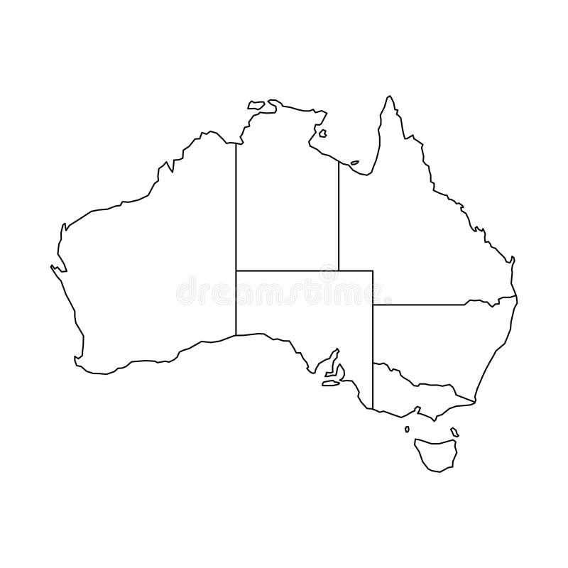
Free with trial A clean, black and white outline map of Canada, clearly delineating its national borders and all ten provinces and three territories. This minimalist vector illustration is isolated on a pure white background, offering a versatile graphic element for various design projects. Ideal for educational materials, travel guides, presentations, infographics, or any project requiring a clear, customizable representation of Canada's geography and administrative divisions. Its simple line art style ensures clarity and adaptability. Federal territories vectors Outline Map of Canada with Provinces and Territories. A clean, black and white outline map of Canada, clearly delineating its national borders and all ten. A clean, black and white outline map of Canada, clearly delineating its national borders and all ten provinces and three territories. This minimalist vector illustration is isolated on a pure white background, offering a versatile graphic element for various design projects. Ideal for educational materials, travel guides, presentations, infographics, or any project requiring a clear, customizable representation of Canada's geography and administrative divisions. Its simple line art style ensures clarity and adaptability.
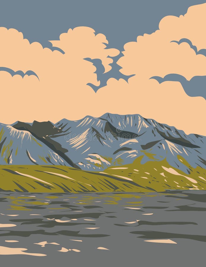
Free with trial WPA poster art of Naatsihchoh Naats ihch oh National Park Reserve encompassing parts of the South Nahanni River watershed in the Northwest Territories, Canada done in works project administration. Federal territories vectors Naatsihchoh National Park Reserve in Northwest Territories Canada WPA Poster Art. WPA poster art of Naatsihchoh Naats ihch oh National Park Reserve encompassing parts of the South Nahanni River watershed in the Northwest Territories, Canada done in works project administration.
Free with trial Vector map of Russia with regions or or federal districts and administrative divisions. Editable and clearly labeled layers. Federal territories vectors Vector map of Russia with regions or or federal districts and administrative divisions.
Free with trial Map of India with rivers and lakes. Map consists of separate maps of federal states and union territories that can be used separately only vector variant. Especially looks nice at high magnification. Not for navigational use. Federal territories vectors Map of India with rivers and lakes.
Free with trial Perak States and federal territories of Malaysia, Federation of Malaysia map vector illustration, scribble sketch Perak Darul Ridzuan map. Federal territories vectors Perak States and federal territories of Malaysia, Federation of Malaysia map vector illustration, scribble sketch Perak Darul
Free with trial Flag of Sarawak state and federal territory of Malaysia. Vector illustration. Federal territories vectors Flag of Sarawak state and federal territory of Malaysia.
Free with trial Black location map of Yukon territories inside gray map of Canada. Federal territories vectors Location map of Yukon territories
Free with trial Circle Flag banner of Sarawak state and federal territory of Malaysia vector illustration. Emblem of Sarawak. Federal territories vectors Circle Flag banner of Sarawak state and federal territory of Malaysia vector illustration.
Free with trial United States of America, gray political map. Fifty single states with their own geographic territories and borders, bound together in a union and federal government, with the capital Washington, D. C. Federal territories vectors United States of America with capital Washington, gray political map. United States of America, gray political map. Fifty single states with their own geographic territories and borders, bound together in a union and federal government, with the capital Washington, D.C.
Free with trial Malaysia political map of administrative divisions - states and federal territories. Colorful 3D vector map with dropped shadow and country name labels. Federal territories vectors Malaysia political map of administrative divisions
Free with trial Malaysia political map of administrative divisions - states and federal territories. 3D colorful vector map with name labels. Federal territories vectors Malaysia political map of administrative divisions
Free with trial A simple black and white outline map of the United States, displaying all 50 states and territories. Ideal for educational purposes or projects. Federal territories illustrations Blank Outline Map of the United States Showing All 50 States and Territories. A simple black and white outline map of the United States, displaying all 50 states and territories. Ideal for educational purposes or projects
Free with trial Vector illustration of a map of Australia divided into states and territories. White flat map with black borders on a white background. Federal territories vectors Vector Map of Australia with States. Vector illustration of a map of Australia divided into states and territories. White flat map with black borders on a white background.
Free with trial Pastel vector map of Canada with black borders and names of it`s provinces and territories. Federal territories vectors Pastel map of Canada. Pastel vector map of Canada with black borders and names of it`s provinces and territories
Free with trial White vector map of Canada with black borders and names of it`s provinces and territories. Federal territories vectors White map of Canada. White vector map of Canada with black borders and names of it`s provinces and territories
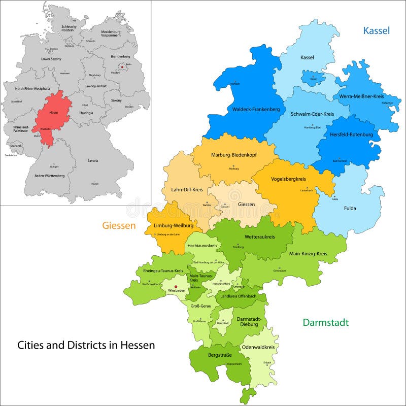
Free with trial Administrative division of Germany. Map of Hesse with cities and districts. Federal territories vectors State of Germany - Hesse. Administrative division of Germany. Map of Hesse with cities and districts
Free with trial Administrative division of Germany. Map of Saarland with cities and districts. Federal territories vectors State of Germany - Saarland. Administrative division of Germany. Map of Saarland with cities and districts
Free with trial Administrative division of Germany. Map of Free Hanseatic City of Bremen. Federal territories vectors Free Hanseatic City of Bremen
Free with trial Administrative division of Germany. Map of Mecklenburg-Vorpommern with cities and districts. Federal territories vectors State of Germany - Mecklenburg-Vorpommern. Administrative division of Germany. Map of Mecklenburg-Vorpommern with cities and districts
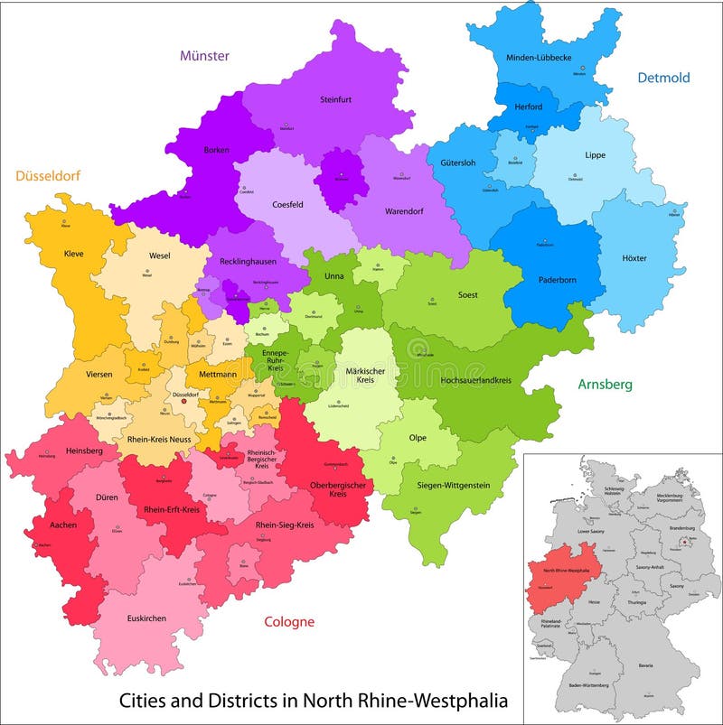
Free with trial Administrative division of Germany. Map of North Rhine-Westphalia with cities and districts. Federal territories vectors State of Germany - North Rhine-Westphalia. Administrative division of Germany. Map of North Rhine-Westphalia with cities and districts
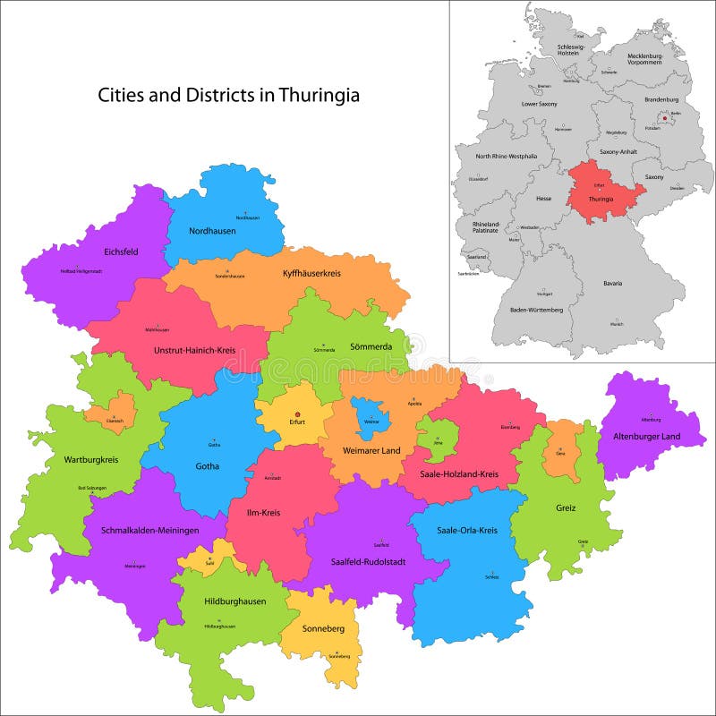
Free with trial Administrative division of Germany. Map of Thuringia with cities and districts. Federal territories vectors State of Germany - Thuringia. Administrative division of Germany. Map of Thuringia with cities and districts
Free with trial Administrative division of Germany. Map of Saxony-Anhalt with cities and districts. Federal territories vectors State of Germany - Saxony-Anhalt. Administrative division of Germany. Map of Saxony-Anhalt with cities and districts
Free with trial Yukon is the westernmost and smallest of Canada three federal territories. Federal territories vectors Map of Yukon. Yukon is the westernmost and smallest of Canada three federal territories
Free with trial Vector flat styled map of India and its capitals of states and union territories. Federal territories illustrations Republic of India map. Vector flat styled map of India and its capitals of states and union territories
Free with trial Detailed and accurate illustration of map of Australia. Federal territories vectors Map of Australia
Free with trial Detailed and accurate illustration of map of Australia. Federal territories vectors Map of Australia
Free with trial Kedah States and federal territories of Malaysia, Federation of Malaysia map vector illustration, scribble sketch Kedah Darul Aman map. Federal territories vectors Kedah map vector. Kedah States and federal territories of Malaysia, Federation of Malaysia map vector illustration, scribble sketch Kedah Darul Aman map
Free with trial Sabah States and federal territories of Malaysia, Federation of Malaysia map vector illustration, scribble sketch Sabah map. Federal territories vectors Sabah map vector. Sabah States and federal territories of Malaysia, Federation of Malaysia map vector illustration, scribble sketch Sabah map
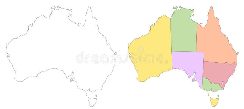
Free with trial Australia map sets, Australia administrative map, Australia outline and states map set - illustration version. Federal territories illustrations Australia map sets, Australia administrative map, Australia outline and states map set - illustration version
Free with trial Kedah States and federal territories of Malaysia, Federation of Malaysia map vector illustration, scribble sketch Kedah Darul Aman map. Federal territories vectors Kedah map vector. Kedah States and federal territories of Malaysia, Federation of Malaysia map vector illustration, scribble sketch Kedah Darul Aman map
Free with trial Detailed and accurate illustration of map of Australia. Federal territories vectors Map of Australia
Free with trial Detailed and accurate illustration of map of Australia. Federal territories vectors Map of Australia
Free with trial Johor States and federal territories of Malaysia, Federation of Malaysia map vector illustration, scribble sketch Johore map. Federal territories vectors Johor map vector. Johor States and federal territories of Malaysia, Federation of Malaysia map vector illustration, scribble sketch Johore map
Free with trial Perak States and federal territories of Malaysia, Federation of Malaysia map vector illustration, scribble sketch Perak Darul Ridzuan map. Federal territories vectors Perak map vector. Perak States and federal territories of Malaysia, Federation of Malaysia map vector illustration, scribble sketch Perak Darul Ridzuan map
Free with trial Kedah States and federal territories of Malaysia, Federation of Malaysia map vector illustration, scribble sketch Kedah Darul Aman map. Federal territories vectors Kedah map vector. Kedah States and federal territories of Malaysia, Federation of Malaysia map vector illustration, scribble sketch Kedah Darul Aman map
Free with trial Labuan States and federal territories of Malaysia, Federation of Malaysia map vector illustration, scribble sketch Federal Territory of Labuan pearl of Borneo map. Federal territories vectors Labuan map vector. Labuan States and federal territories of Malaysia, Federation of Malaysia map vector illustration, scribble sketch Federal Territory of Labuan pearl of Borneo map
Free with trial Perlis States and federal territories of Malaysia, Federation of Malaysia map vector illustration, scribble sketch Perlis Indera Kayangan map. Federal territories vectors Perlis map vector. Perlis States and federal territories of Malaysia, Federation of Malaysia map vector illustration, scribble sketch Perlis Indera Kayangan map
Free with trial Penang States and federal territories of Malaysia, Federation of Malaysia map vector illustration, scribble sketch State of Penang map. Federal territories vectors Penang map vector. Penang States and federal territories of Malaysia, Federation of Malaysia map vector illustration, scribble sketch State of Penang map
Free with trial Pahang States and federal territories of Malaysia, Federation of Malaysia map vector illustration, scribble sketch Pahang Darul Makmur map. Federal territories vectors Pahang map vector. Pahang States and federal territories of Malaysia, Federation of Malaysia map vector illustration, scribble sketch Pahang Darul Makmur map
Free with trial Malacca States and federal territories of Malaysia, Federation of Malaysia map vector illustration, scribble sketch Malacca State map. Federal territories vectors Malacca map vector. Malacca States and federal territories of Malaysia, Federation of Malaysia map vector illustration, scribble sketch Malacca State map
Free with trial Kelantan States and federal territories of Malaysia, Federation of Malaysia map vector illustration, scribble sketch Kelantan Darul Naim map. Federal territories vectors Kelantan map vector. Kelantan States and federal territories of Malaysia, Federation of Malaysia map vector illustration, scribble sketch Kelantan Darul Naim map
Free with trial Selangor States and federal territories of Malaysia, Federation of Malaysia map vector illustration, scribble sketch Selangor Darul Ehsan map. Federal territories vectors Selangor map vector. Selangor States and federal territories of Malaysia, Federation of Malaysia map vector illustration, scribble sketch Selangor Darul Ehsan map
Free with trial Terengganu States and federal territories of Malaysia, Federation of Malaysia map vector illustration, scribble sketch Terengganu Darul Iman Trengganu or Tringganu map. Federal territories vectors Terengganu map vector. Terengganu States and federal territories of Malaysia, Federation of Malaysia map vector illustration, scribble sketch Terengganu Darul Iman Trengganu or Tringganu map
Free with trial Negeri Sembilan States and federal territories of Malaysia, Federation of Malaysia map vector illustration, scribble sketch Negeri Sembilan Darul Khusus map. Federal territories vectors Negeri Sembilan map vector. Negeri Sembilan States and federal territories of Malaysia, Federation of Malaysia map vector illustration, scribble sketch Negeri Sembilan Darul Khusus map
Free with trial Detailed and accurate illustration of map of Australia. Federal territories vectors Map of Australia
Free with trial Sabah States and federal territories of Malaysia, Federation of Malaysia map vector illustration, scribble sketch Sabah map. Federal territories vectors Sabah map vector. Sabah States and federal territories of Malaysia, Federation of Malaysia map vector illustration, scribble sketch Sabah map
Free with trial Sabah States and federal territories of Malaysia, Federation of Malaysia map vector illustration, scribble sketch Sabah map. Federal territories vectors Sabah map vector. Sabah States and federal territories of Malaysia, Federation of Malaysia map vector illustration, scribble sketch Sabah map
Free with trial Colorful political map of India. Administrative divisions - states and union territories. Simple flat vector map with labels. Federal territories vectors India - political map of administrative divisions. Colorful political map of India. Administrative divisions - states and union territories. Simple flat vector map with labels.
Free with trial The United States of America USA, commonly known as the United States U. S. or America, is a federal republic composed of 50 states, a federal district, five major self-governing territories, and various possessions. At 3. 8 million square miles 9. 8 million km2, the United States is the world`s third- or fourth-largest country by total area. Federal territories vectors Map of The United States of America USA with Colorful States Illustration on White Background. The United States of America USA, commonly known as the United States U.S. or America, is a federal republic composed of 50 states, a federal district, five major self-governing territories, and various possessions. At 3.8 million square miles 9.8 million km2, the United States is the world`s third- or fourth-largest country by total area.
Free with trial The icon set includes the waving flags of Washington DC, Puerto Rico, US Virgin Islands, Guam, American Samoa, Palau, Northern Mariana Islands, Federated States of Micronesia and Marshall Islands. Federal territories vectors USA - Free Associated States and Unincorporated Territories Flag Set. The icon set includes the waving flags of Washington DC, Puerto Rico, US Virgin Islands, Guam, American Samoa, Palau, Northern Mariana Islands, Federated States of Micronesia and Marshall Islands
Free with trial Map of India with rivers and lakes, national flag of India, world map as background. Map consists of separate maps of federal states and union territories that can be used separately. Please look at my other images of cartographic series - they are all very detailed and carefully drawn by hand WITH RIVERS AND LAKES. Federal territories vectors Map of India with rivers and lakes. Map of India with rivers and lakes, national flag of India, world map as background. Map consists of separate maps of federal states and union territories that can be used separately. Please look at my other images of cartographic series - they are all very detailed and carefully drawn by hand WITH RIVERS AND LAKES.
Free with trial A computer generated illustration image of the state flag of Selangor in Peninsula Malaysia. Federal territories illustrations The state flag of Selangor in Peninsula Malaysia
Free with trial Coat of arms of Yukon is the smallest and westernmost of Canadas three federal territories. Vector illustration. Federal territories vectors Coat of arms of Yukon in Canada. Coat of arms of Yukon is the smallest and westernmost of Canadas three federal territories. Vector illustration
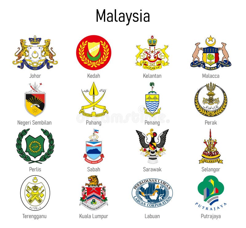
Free with trial Coat of arms of the state of Malaysia, All Malaysian regions emblem collection. Federal territories illustrations Coat of arms of the state of Malaysia, All Malaysian regions emblem
Free with trial Black location map of Quebec province inside gray map of Canada. Federal territories vectors Location map of Quebec province
Free with trial Black location map of Alberta province inside gray map of Canada. Federal territories vectors Location map of Alberta province
Free with trial Detailed and accurate illustration of map and flag of Australia. Federal territories vectors Map and flag of Australia