Free with trial An abstract close-up view of a textured surface resembling a topographic map with pink and green hues. The intricate patterns suggest rolling hills and valleys, creating a visually rich and organic design. Green topographic map illustrations Topographic map texture pink and green abstract terrain relief surface close-up detailed pattern. An abstract close-up view of a textured surface resembling a topographic map with pink and green hues. The intricate patterns suggest rolling hills and valleys, creating a visually rich and organic design
Free with trial A stylized topographic map featuring wavy lines and pastel colors, creating a visually appealing abstract background. The design combines blue, pink, yellow, and green hues with concentric circles, evoking a sense of depth and movement. Ideal for use in graphic design, presentations, or as a decorative element. Green topographic map illustrations Abstract Topographic Map Background. A stylized topographic map featuring wavy lines and pastel colors, creating a visually appealing abstract background. The design combines blue, pink, yellow, and green hues with concentric circles, evoking a sense of depth and movement. Ideal for use in graphic design, presentations, or as a decorative element.
Free with trial A seamless pattern of dark grey contour lines on a light green background, resembling a topographic map or abstract terrain. Green topographic map vectors Topographic contour lines pattern light green background. A seamless pattern of dark grey contour lines on a light green background, resembling a topographic map or abstract terrain
Free with trial A highly detailed abstract image showcasing a green textured surface, resembling a topographic map or microscopic landscape. Generative AI. Green topographic map illustrations Abstract Green Textured Surface Resembling Topographic Map or Microscopic Landscape in High Detail. A highly detailed abstract image showcasing a green textured surface, resembling a topographic map or microscopic landscape. Generative AI
Free with trial Concept Geographic Relief, Terrain Features, Topographic Map, Green Elevation, Contour Lines Illustrating Geographic Relief Terrain Features Topographic Map with Lush Green Elevation Contours. Green topographic map illustrations Illustrating Geographic Relief Terrain Features: Topographic Map with Lush Green Elevation. Concept Geographic Relief, Terrain Features, Topographic Map, Green Elevation, Contour Lines Illustrating Geographic Relief Terrain Features Topographic Map with Lush Green Elevation Contours
Free with trial Displaying neon green hexagonal data icons clustering on topographic map, showing telemetry. Hexagon, glyphs, glow, dashboard, geospatial, terrain, analytics. Green topographic map illustrations Displaying neon green hexagonal data icons clustering on topographic map, showing telemetry
Free with trial A detailed topographic map displays a river flowing through a lush, green mountainous region. Green topographic map illustrations Topographic map showing a winding river valley through green forested mountains with contour lines. A detailed topographic map displays a river flowing through a lush, green mountainous region
Free with trial This is an image of a wavy pattern in shades of green and brown. The pattern is reminiscent of a topographic map or a sound wave. Generative AI Illustration. Green topographic map illustrations This is an image of a wavy pattern in shades of green and brown. The pattern is reminiscent of a topographic map or a sound wave
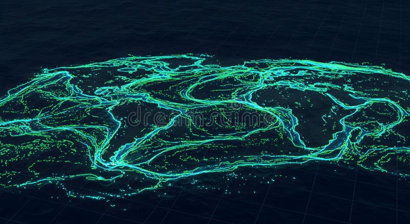
Free with trial Abstract digital topographic map. Neon green and blue visualization of terrain. Futuristic landscape design. Green topographic map illustrations Abstract Topographic Map Digital Terrain Visualization Neon Green and Blue Hues Futuristic Landscape Design. Abstract digital topographic map. Neon green and blue visualization of terrain. Futuristic landscape design
Free with trial Abstract topographic map background. Wavy lines create pattern. Oxidized copper, mint green, orange brown earth tones blend. Seamless design. Suitable for wallpaper, fabric, decor. Green topographic map illustrations Abstract topographic map background. Wavy lines create pattern. Oxidized copper, mint green, orange brown earth tones blend.
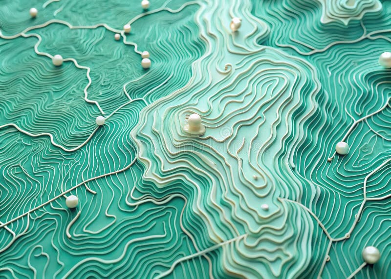
Free with trial This captivating vector illustration showcases a mesmerizing mint green topographic map background. Delicate pearl-like textures enhance the contour lines, creating a visually stunning representation of geographic relief. The seamless pattern design makes it ideal for various applications, from wallpaper and surface design to map backgrounds and digital art projects. The gentle gradient of mint. Green topographic map illustrations Seamless Mint Green Pearl Contour Trails Topographic Map Background Texture Vector Design Element for Geographic Relief. This captivating vector illustration showcases a mesmerizing mint green topographic map background. Delicate pearl-like textures enhance the contour lines, creating a visually stunning representation of geographic relief. The seamless pattern design makes it ideal for various applications, from wallpaper and surface design to map backgrounds and digital art projects. The gentle gradient of mint
Free with trial Stunning aerial view Great Britain Ireland. Topographic map illustration showing green landscapes, detailed coastlines, ocean. Explore Europa geography terrain elevations from above. Green topographic map illustrations Stunning aerial view Great Britain Ireland. Topographic map illustration showing green landscapes, detailed coastlines, ocean.
Free with trial Abstract topographic map art featuring layered green contours creating elevation, terrain depth. Modern design offers gradient flow with smooth flowing texture. Artistic representation. Green topographic map illustrations Abstract topographic map art featuring layered green contours creating elevation, terrain depth. Modern design offers gradient
Free with trial A green topographic map visualizes natural terrain in an abstract relief illustration contour lines indicate elevation and depression, showcasing geographic and cartographic details the wavy land surface provides a modern, smooth texture, perfect for backgrounds or graphic designs. Green topographic map illustrations Topographic map visualization green wavy land abstract relief illustration natural terrain contour lines showing elevation and. a green topographic map visualizes natural terrain in an abstract relief illustration contour lines indicate elevation and depression, showcasing geographic and cartographic details the wavy land surface provides a modern, smooth texture, perfect for backgrounds or graphic designs
Free with trial Close-up of a glowing topographic contour map rendered as layered neon lines on a dark background. Green and yellow contour lines form concentric elevation shapes across a textured black surface, giving a futuristic, technical mood. Green topographic map illustrations Neon Topographic Contour Line Map. Close-up of a glowing topographic contour map rendered as layered neon lines on a dark background. Green and yellow contour lines form concentric elevation shapes across a textured black surface, giving a futuristic, technical mood.
Free with trial Topographic world map highlighting continents and oceans. North America and South America are on the left, Africa and Europe in the center, with Asia and Australia on the right. Greenland and polar ice caps appear white at the top, surrounded by blue oceans. Variations in green, brown, and beige shades represent different terrains, with green indicating forests, beige for deserts, and brown for mountains. This image offers a detailed geographical view of the Earth's surface. Green topographic map illustrations Topographic world map highlighting continents and oceans
Free with trial This abstract background features topographic map-like lines in earth tones, creating a wavy and organic pattern. The design evokes a sense of nature, geography, and fluid movement, perfect for modern and minimalist projects. Green topographic map illustrations Abstract Topographic Map Background, Green Earth Tone Waves. This abstract background features topographic map-like lines in earth tones, creating a wavy and organic pattern. The design evokes a sense of nature, geography, and fluid movement, perfect for modern and minimalist projects.
Free with trial Abstract green topographic contour line background. Perfect for maps, geography, terrain, adventure, hiking, or military design projects. Green topographic map vectors Green Topographic Map Line Pattern Background. Abstract green topographic contour line background. Perfect for maps, geography, terrain, adventure, hiking, or military design projects
Free with trial Military-style topographic map with contour lines, elevation data, and coordinates. Ideal for war strategy visuals, navigation design, and tactical planning interfaces. Battlefield top view green UI. Green topographic map vectors Topographic military map background. Military-style topographic map with contour lines, elevation data, and coordinates. Ideal for war strategy visuals, navigation design, and tactical planning interfaces. Battlefield top view green UI.
Free with trial A modern abstract background featuring smooth green contour lines in a topographic map style on a white surface. Perfect for eco-friendly designs, presentations, or scientific visuals. Green topographic map vectors Green Gradient Topographic Contour Line Background. A modern abstract background featuring smooth green contour lines in a topographic map style on a white surface. Perfect for eco-friendly designs, presentations, or scientific visuals
Free with trial A seamless pattern featuring thin, light-colored contour lines on a solid sage green background, representing topographic elevation and geographical terrain. Green topographic map vectors Topographic map contour lines pattern in sage green. A seamless pattern featuring thin, light-colored contour lines on a solid sage green background, representing topographic elevation and geographical terrain
Free with trial Abstract pattern of green topographic contour lines on a creating a sense of elevation and terrain. topographic map, contour lines. Green topographic map vectors Green topographic contour lines on white background. Abstract pattern of green topographic contour lines on a creating a sense of elevation and terrain. topographic map, contour lines
Free with trial Abstract pattern of white topographic contour lines on a muted olive green background. topographic map, contour lines, elevation. Green topographic map vectors Topographic contour lines on olive green background. Abstract pattern of white topographic contour lines on a muted olive green background. topographic map. Abstract pattern of white topographic contour lines on a muted olive green background. topographic map, contour lines, elevation
Free with trial Seamless pattern of green topographic contour lines on a light yellow background. topographic map, contour lines, elevation. green. Green topographic map vectors Green topographic contour lines on yellow background. Seamless pattern of green topographic contour lines on a light yellow background. topographic map, contour lines, elevation. green
Free with trial A seamless pattern of beige contour lines representing topographic elevation on a muted green background. The lines vary in thickness and spacing, creating a sense of depth and topographical. Green topographic map vectors Green Topographic Map Contour Lines Pattern elevation. A seamless pattern of beige contour lines representing topographic elevation on a muted green background. The lines vary in thickness and spacing, creating a sense of depth and topographical
Free with trial A mesmerizing abstract 3D rendered image featuring a digital topographic map. The surface is composed of intricate, glowing contour lines in vibrant shades of electric blue, mint green, and magenta, creating a futuristic and dynamic texture. The lines undulate across a softly lit, almost white background, suggesting data visualization or a technological landscape. The overall mood is modern, clean, and innovative, with a sense of depth and intricate detail. Green topographic map illustrations Abstract glowing digital topographic map with contour lines on a bright background. A mesmerizing abstract 3D rendered image featuring a digital topographic map. The surface is composed of intricate, glowing contour lines in vibrant shades of electric blue, mint green, and magenta, creating a futuristic and dynamic texture. The lines undulate across a softly lit, almost white background, suggesting data visualization or a technological landscape. The overall mood is modern, clean, and innovative, with a sense of depth and intricate detail.
Free with trial A minimalist sage green background featuring dark green topographic contour lines. The organic, flowing shapes represent elevation, terrain, and mapping data. Green topographic map vectors Sage green topographic map contour lines pattern background. A minimalist sage green background featuring dark green topographic contour lines. The organic, flowing shapes represent elevation, terrain, and mapping data
Free with trial A minimalist background featuring black topographic contour lines on a solid olive green surface, representing geological elevation and terrain mapping patterns. Green topographic map vectors Olive green topographic map contour lines pattern background. A minimalist background featuring black topographic contour lines on a solid olive green surface, representing geological elevation and terrain mapping patterns
Free with trial Abstract image with green topographic contour lines over a vivid purple background. The lines form fluid, organic shapes, evoking the appearance of a stylized elevation map. These contours vary in thickness and are smoothly interconnected, creating a dynamic visual pattern with a sense of depth and movement. The contrast between the bright green and purple enhances the vividness of the design, making it a visually striking piece. Green topographic map vectors Purple background with green abstract topographic contour lines images. Abstract image with green topographic contour lines over a vivid purple background. The lines form fluid, organic shapes, evoking the appearance of a stylized elevation map. These contours vary in thickness and are smoothly interconnected, creating a dynamic visual pattern with a sense of depth and movement. The contrast between the bright green and purple enhances the vividness of the design, making it a visually striking piece.
Free with trial Flowing abstract design with wavy, layered patterns in warm brown, golden, and green tones. The layers overlap in a topographic style, creating a sense of depth and movement. Each layer varies in size, enhancing the three-dimensional effect, while color transitions suggest contours similar to a relief map. The smooth, curved lines are visually engaging, with gradients blending seamlessly across the composition. Green topographic map illustrations Abstract topographic map with flowing colors and curved layers. Flowing abstract design with wavy, layered patterns in warm brown, golden, and green tones. The layers overlap in a topographic style, creating a sense of depth and movement. Each layer varies in size, enhancing the three-dimensional effect, while color transitions suggest contours similar to a relief map. The smooth, curved lines are visually engaging, with gradients blending seamlessly across the composition.
Free with trial Abstract illustration of a topographic map with contour lines in varying shades of green and blue. A compass with a red needle pointing north is superimposed on the map. The image evokes themes of exploration, navigation, geography, and cartography. Suitable for backgrounds, educational materials, or travel-related content. Green topographic map illustrations Topographic Map with Compass. Abstract illustration of a topographic map with contour lines in varying shades of green and blue. A compass with a red needle pointing north is superimposed on the map. The image evokes themes of exploration, navigation, geography, and cartography. Suitable for backgrounds, educational materials, or travel-related content.
Free with trial This image depicts a detailed topographic map featuring contour lines that represent elevation changes. The map uses varying shades of green and brown to indicate different elevations, with a central area highlighted in a lighter shade. The contour lines are closely spaced in some regions, suggesting steep slopes, while they are more spread out in other areas, indicating gentler terrain. The map. Green topographic map illustrations Topographic map with contour lines. This image depicts a detailed topographic map featuring contour lines that represent elevation changes. The map uses varying shades of green and brown to indicate different elevations, with a central area highlighted in a lighter shade. The contour lines are closely spaced in some regions, suggesting steep slopes, while they are more spread out in other areas, indicating gentler terrain. The map
Free with trial A minimalist abstract background featuring organic wavy dotted lines resembling a topographic map on a textured light green surface. Green topographic map vectors Abstract Dotted Line Topographic Green Textured Background. Vector Illustration. A minimalist abstract background featuring organic wavy dotted lines resembling a topographic map on a textured light green surface
Free with trial A dark blue background featuring light green topographic contour lines that represent elevation and terrain mapping in a clean minimalist style. Green topographic map vectors Topographic map contour lines pattern in light green on dark blue background. A dark blue background featuring light green topographic contour lines that represent elevation and terrain mapping in a clean minimalist style
Free with trial Yellow contour lines form an abstract, topographic pattern on a green background. The lines create irregular shapes with varying densities, resembling elevation or depth maps. The central cluster of lines is thicker and more concentrated, giving a sense of depth and complexity to the design. The overall effect is a stylized map made without specific geographic reference. Green topographic map illustrations Yellow contour lines form an abstract, topographic pattern on a green background.
Free with trial This image displays a detailed topographic map of a mountainous region. The map features various elevations, marked by different shades of green and brown, indicating varying heights. Blue areas represent water bodies, likely lakes or rivers. The map also includes contour lines and marked trails, suggesting routes for hiking or exploration. The region depicted appears to be lush and rugged, with. Green topographic map illustrations Detailed topographic map of mountainous region. This image displays a detailed topographic map of a mountainous region. The map features various elevations, marked by different shades of green and brown, indicating varying heights. Blue areas represent water bodies, likely lakes or rivers. The map also includes contour lines and marked trails, suggesting routes for hiking or exploration. The region depicted appears to be lush and rugged, with
Free with trial A detailed topographic map exhibits an elevated perspective, revealing intricate terrain features in realistic shades of green and brown, set against a bright white background. This representation is. Green topographic map illustrations Elevated Topographic Map with Detailed Terrain Features in Realistic Shades of Green and Brown on a. A detailed topographic map exhibits an elevated perspective, revealing intricate terrain features in realistic shades of green and brown, set against a bright white background. This representation is
Free with trial This image features an abstract, multi-layered topographic map design. The layers are rendered in various shades of red, purple, green and beige, creating a visually appealing and dynamic composition. The design evokes a sense of depth and dimension, making it suitable for backgrounds, wallpapers, or design elements where a modern and artistic touch is desired. The smooth curves and organic shapes give it a fluid and contemporary feel. Green topographic map illustrations Abstract Layered Topographic Map. This image features an abstract, multi-layered topographic map design. The layers are rendered in various shades of red, purple, green and beige, creating a visually appealing and dynamic composition. The design evokes a sense of depth and dimension, making it suitable for backgrounds, wallpapers, or design elements where a modern and artistic touch is desired. The smooth curves and organic shapes give it a fluid and contemporary feel.
Free with trial The image features an orange map marker prominently placed on a topographic map. The marker is positioned to indicate a specific location, which is marked by a white circle in the center. The topographic map beneath the marker displays various elevations with contour lines in green and blue, representing different heights. Additionally, there is a depiction of a mountain with snow on the right. Green topographic map illustrations Orange map marker indicating a location on a topographic map. The image features an orange map marker prominently placed on a topographic map. The marker is positioned to indicate a specific location, which is marked by a white circle in the center. The topographic map beneath the marker displays various elevations with contour lines in green and blue, representing different heights. Additionally, there is a depiction of a mountain with snow on the right
Free with trial A visually striking 3D layered topographic map showcasing the state of Florida and its surrounding regions, including parts of the Gulf of Mexico and the Atlantic Ocean. The intricate paper cut-out style illustrates varying land elevations with shades of green and brown, while ocean depths are depicted through graduated blues. County or administrative boundaries are clearly marked. This modern and clean cartographic illustration is ideal for geographical studies, travel planning, environmental presentations, educational content, or any design project requiring a sophisticated map visualization of the Sunshine State. Green topographic map illustrations 3D Layered Topographic Map of Florida with Ocean Depths. A visually striking 3D layered topographic map showcasing the state of Florida and its surrounding regions, including parts of the Gulf of Mexico and the Atlantic Ocean. The intricate paper cut-out style illustrates varying land elevations with shades of green and brown, while ocean depths are depicted through graduated blues. County or administrative boundaries are clearly marked. This modern and clean cartographic illustration is ideal for geographical studies, travel planning, environmental presentations, educational content, or any design project requiring a sophisticated map visualization of the Sunshine State.
Free with trial An abstract, layered illustration resembling a topographic map or a stylized landscape. The image features a series of curved, overlapping shapes in varying shades of blue, green, and beige, creating a sense of depth and dimension. The design has a clean, modern aesthetic, suitable for backgrounds, graphic design projects, and conceptual visualizations. It evokes themes of nature, data visualization, and abstract art. Green topographic map illustrations Abstract Topographic Map Background. An abstract, layered illustration resembling a topographic map or a stylized landscape. The image features a series of curved, overlapping shapes in varying shades of blue, green, and beige, creating a sense of depth and dimension. The design has a clean, modern aesthetic, suitable for backgrounds, graphic design projects, and conceptual visualizations. It evokes themes of nature, data visualization, and abstract art.
Free with trial A vector design of a 3D topographic map with green terrain. Represents geography, hiking trails, and land surveying. Ideal for mapping software, outdoor apps, and geology, vector design Generative AI. Green topographic map vectors 3D Topographic Map Vector Design, vector design Generative AI. A vector design of a 3D topographic map with green terrain. Represents geography, hiking trails, and land surveying. Ideal for mapping software, outdoor apps, and geology, vector design Generative AI