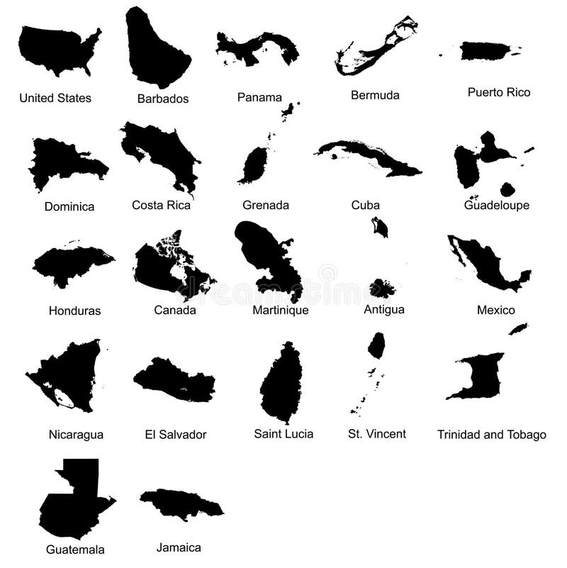
Free with trial Layered editable vector illustration silhouette country map of 22 north american countries. Guadeloupe map vectors Layered editable vector illustration silhouette country map of 22 north american countries.
Free with trial Political map of the Caribbean - Large and Lesser Antilles - with their capitals, national borders, rivers and lakes. Vector illustration with english labeling and scale. Guadeloupe map vectors Large And Lesser Antilles Political Map. Political map of the Caribbean - Large and Lesser Antilles - with their capitals, national borders, rivers and lakes. Vector illustration with english labeling and scale.
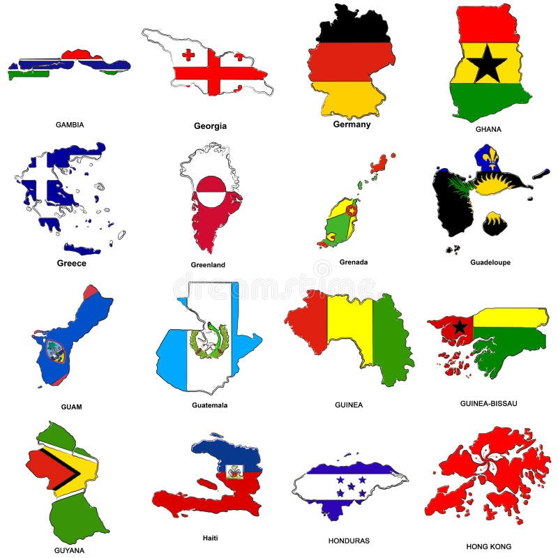
Free with trial A collection of map shaped flags of the world in the style of doodle-like sketches. Guadeloupe map illustrations World flag map sketches collection 05. A collection of map shaped flags of the world in the style of doodle-like sketches
Free with trial Political map of Lesser Antilles, Haiti and Dominican Republic with the capitals, national borders, rivers and lakes. Vector illustration with english labeling and scale. Guadeloupe map vectors Lesser Antilles, Haiti, Dominican Republic. Political map of Lesser Antilles, Haiti and Dominican Republic with the capitals, national borders, rivers and lakes. Vector illustration with english labeling and scale.
Free with trial Latin, Caribbean, North and South American country regions' vector maps. Guadeloupe map vectors Latin, Caribbean, North and South American country regions' vector maps
Free with trial American continent, complete set of flags,. Guadeloupe map vectors American continent flags. American continent, complete set of flags,
Free with trial Guadeloupe map silhouette on the white background. Vector illustration. Guadeloupe map vectors Guadeloupe map silhouette
Free with trial Lesser Antilles political map. The Caribbees with Haiti, the Dominican Republic and Puerto Rico in the Caribbean Sea. With capitals and national borders. English labeling. Illustration. Vector. Guadeloupe map vectors Lesser Antilles political map
Free with trial Lesser Antilles political map. Caribbees with Haiti, Dominican Republic and Puerto Rico in the Caribbean Sea. Gray illustration with English labeling on white background. Vector. Guadeloupe map vectors Lesser Antilles political map
Free with trial Administrative vector map of Central America and the Caribbean countries. Guadeloupe map illustrations Administrative map of Central America and the Caribbean countries
Free with trial Vector isolated flags of North America continent. Guadeloupe map vectors Vector isolated flags of North Americainclude Central America and Caribbean countries. Vector isolated flags of North America continent
Free with trial Guadeloupe Political Map with capital Basse-Terre, an overseas region of France, located in the Leeward Islands, part of the Lesser Antilles in the Caribbean. English labeling and scaling. Guadeloupe map vectors Guadeloupe Political Map
Free with trial Guadeloupe, Dominica, Martinique political map with capitals Basse-Terre, Roseau and Fort-de-France. Caribbean islands, parts of Lesser Antilles. Gray illustration over white. English labeling. Vector. Guadeloupe map vectors Guadeloupe, Dominica, Martinique political map
Free with trial Grunge stamp with map of Guadeloupe - vector illustration. Guadeloupe map vectors Stamp with map of Guadeloupe
Free with trial Guadeloupe 3d golden map isolated in white. Guadeloupe map illustrations Guadeloupe 3d Golden Map
Free with trial Guadeloupe, Dominica and Martinique political map with capitals Basse-Terre, Roseau and Fort-de-France. Islands in Caribbean Sea and parts of Lesser Antilles. Illustration. English labeling. Vector. Guadeloupe map vectors Guadeloupe, Dominica and Martinique political map
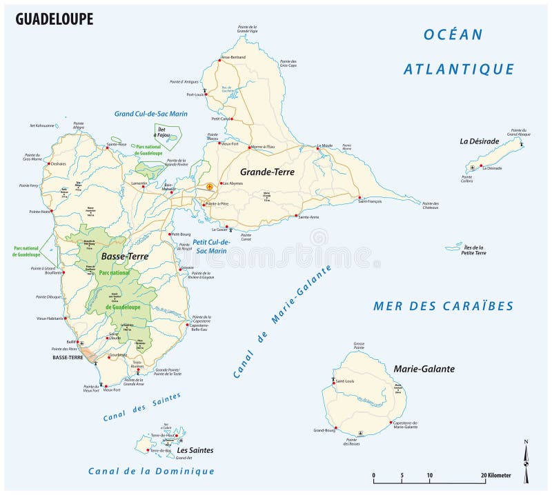
Free with trial Detailed street map of the Caribbean islands of Guadeloupe. Guadeloupe map illustrations Guadeloupe road map. Detailed street map of the Caribbean islands of Guadeloupe
Free with trial Vector road map of the french overseas territory of Guadeloupe. Guadeloupe map vectors Vector road map of the french overseas territory of Guadeloupe
Free with trial Vector collage of love smile map of Guadeloupe and red grunge seal stamp with heart. Map of Guadeloupe collage formed with smiles, male and female symbols. Guadeloupe map vectors Collage of Love Smile Map of Guadeloupe and Grunge Heart Stamp. Vector collage of love smile map of Guadeloupe and red grunge seal stamp with heart. Map of Guadeloupe collage formed with smiles, male and female symbols.
Free with trial Pixelated map of Guadeloupe composition and solid illustration. Vector map of Guadeloupe composition of circle pixels with honeycomb periodic order on a white background. Guadeloupe map vectors Dot Pattern Map of Guadeloupe. Pixelated map of Guadeloupe composition and solid illustration. Vector map of Guadeloupe composition of circle pixels with honeycomb periodic order on a white background.
Free with trial Solid and mesh vector map of Guadeloupe. Wire frame 2D polygonal mesh in vector format, geographic templates for patriotic illustrations. Illustrations are isolated on a white background. Guadeloupe map vectors Solid and Wire Frame Map of Guadeloupe. Solid and mesh vector map of Guadeloupe. Wire frame 2D polygonal mesh in vector format, geographic templates for patriotic illustrations. Illustrations are isolated on a white background.
Free with trial Map of guadeloupe. High detailed vector map - guadeloupe. map shape/contour/outline/border with state isolate on white background. Guadeloupe map vectors Map of guadeloupe. High detailed vector map - guadeloupe.
Free with trial Guadeloupe map illustration on white background cartography. Guadeloupe map illustrations Guadeloupe map illustration white background. Guadeloupe map illustration on white background cartography
Free with trial Guadeloupe map with france flag. French overseas departments map with French national fl ag illustration. Guadeloupe map vectors Guadeloupe map with france flag. French overseas departments map with French national flag illustration
Free with trial Guadeloupe administrative divisions of the French overseas departements. Guadeloupe map vectors Guadeloupe administrative map. Guadeloupe administrative divisions of the French overseas departements
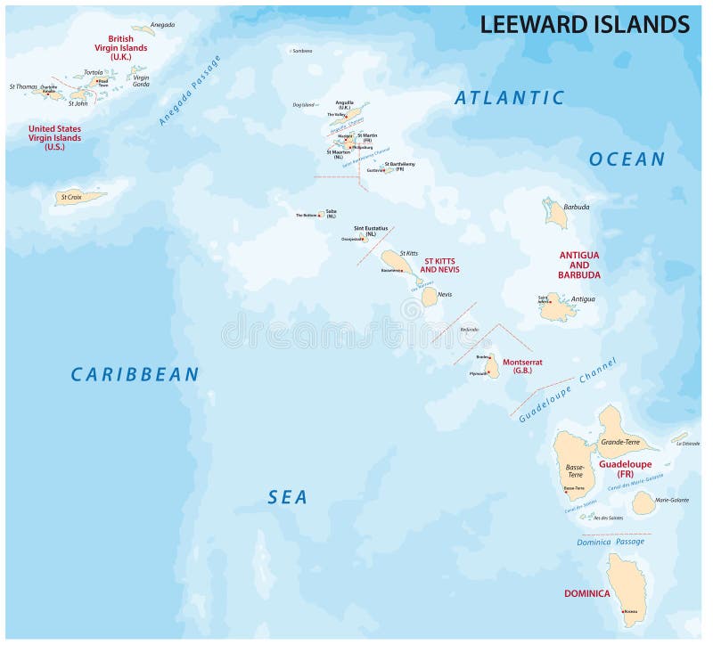
Free with trial Leeward Islands, political map. Part of the Lesser Antilles, north of Windward Islands in the Caribbean. Virgin Islands, Anguilla, St Kitts and Nevis, Antigua and Barbuda, Montserrat, and Guadeloupe. Guadeloupe map vectors Leeward Islands, political map, part of Lesser Antilles in the Caribbean. Leeward Islands, political map. Part of the Lesser Antilles, north of Windward Islands in the Caribbean. Virgin Islands, Anguilla, St Kitts and Nevis, Antigua and Barbuda, Montserrat, and Guadeloupe.
Free with trial Weather mosaic map of Guadeloupe, and scratched red round Best Chicken badge. Geographic vector mosaic map of Guadeloupe is done as subtraction from rounded square and scattered rain, cloud, sun,. Guadeloupe map vectors Scratched Best Chicken Seal and Hole Climate Mosaic Map of Guadeloupe. Weather mosaic map of Guadeloupe, and scratched red round Best Chicken badge. Geographic vector mosaic map of Guadeloupe is done as subtraction from rounded square and scattered rain, cloud, sun,
Free with trial Eastern Caribbean islands, gray political map. Puerto Rico, Virgin Islands, Leeward and Windward Islands, and part of the Leeward Antilles north the coast of Venezuela, located in the Caribbean Sea. Guadeloupe map vectors Eastern Caribbean islands, Leeward and Windward Islands, gray political map. Eastern Caribbean islands, gray political map. Puerto Rico, Virgin Islands, Leeward and Windward Islands, and part of the Leeward Antilles north the coast of Venezuela, located in the Caribbean Sea.
Free with trial Vector road map of cornwall, united kingdom. Guadeloupe map illustrations Cornwall road map. Vector road map of cornwall, united kingdom
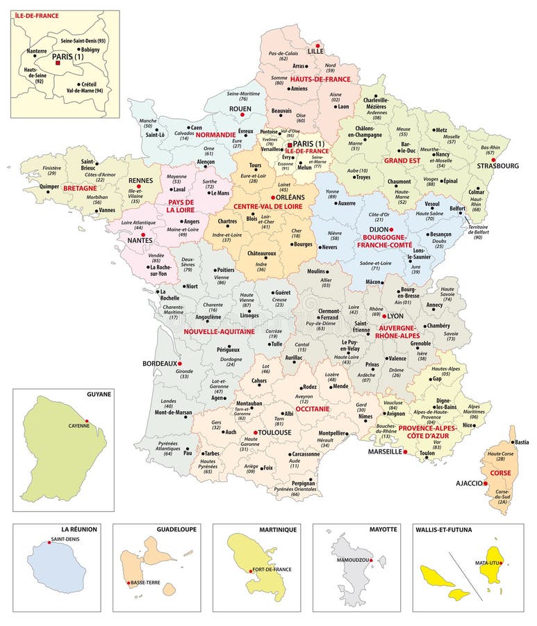
Free with trial Administrative map of the 13 regions of France and overseas territories. Guadeloupe map vectors Administrative map of the 13 regions of France and overseas territories
Free with trial Map of leeward islands, Caribbean island group. Guadeloupe map illustrations Map of leeward islands, Caribbean island group
Free with trial Interactive map of metropolitans French regions with 5 overseas regions, Administrative divisions of France. Guadeloupe map vectors Interactive map of metropolitans French regions with 5 overseas regions
Free with trial Marie-Galante map. Island silhouette icon. Isolated Marie-Galante black map outline. Vector illustration. Guadeloupe map vectors Marie-Galante map.
Free with trial Basse-Terre Island map. Island silhouette icon. Isolated Basse-Terre Island black map outline. Vector illustration. Guadeloupe map vectors Basse-Terre Island map.
Free with trial Dominica map high detailed silhouette illustration isolated on white background. Guadeloupe map illustrations Dominica map high detailed silhouette illustration. Dominica map high detailed silhouette illustration isolated on white background.
Free with trial Basse-Terre Island Map Outline. Vintage Discover the World Rubber Stamp with Island Map. Hipster Style Nautical Insignia, with Round Rope Border. Travel Vector Illustration. Guadeloupe map vectors Basse-Terre Island Map Outline. Vintage Discover. Basse-Terre Island Map Outline. Vintage Discover the World Rubber Stamp with Island Map. Hipster Style Nautical Insignia, with Round Rope Border. Travel Vector Illustration.
Free with trial Guadeloupe flat landmarks vector illustration. Guadeloupe line city with famous travel sights, skyline, design. Guadeloupe map vectors Guadeloupe flat landmarks vector illustration. Guadeloupe line city with famous travel sights, skyline, design.
Free with trial Grande-Terre map. Island silhouette icon. Isolated Grande-Terre black map outline. Vector illustration. Guadeloupe map vectors Grande-Terre map.
Free with trial Terre-de-Haut Island map. Island silhouette icon. Isolated Terre-de-Haut Island black map outline. Vector illustration. Guadeloupe map vectors Terre-de-Haut Island map.
Free with trial Vector isolated illustration of simplified administrative map of France. Borders and names of the regions. Colorful silhouettes. Guadeloupe map vectors Vector isolated illustration of simplified administrative map of France. Borders and names of the regions
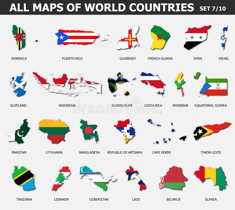
Free with trial All maps of world countries and flags. Set 7 of 10. Collection of outline shape of international country map with shadow. Flat design. Vector. Guadeloupe map vectors All maps of world countries and flags . Set 7 of 10 . Collection of outline shape of international country map with shadow . Flat
Free with trial America Pointer Flag Icons with american Map set2 - subdivided states map, vector illustration in. CS and. EPS10. Contain transparency. Guadeloupe map vectors America Pointer Flag Icons with american Map set2
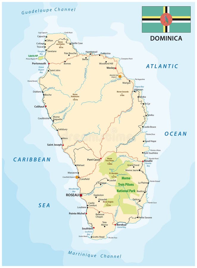
Free with trial Dominica road vector map with flag, Lesser Antilles. Guadeloupe map vectors Dominica road map with flag, Lesser Antilles
Free with trial Caribbean highlighted in red from Earth’s orbit. 3D illustration. Elements of this image furnished by NASA. Guadeloupe map illustrations Map of Caribbean. Caribbean highlighted in red from Earth’s orbit. 3D illustration. Elements of this image furnished by NASA.
Free with trial 3D render of Caribbean in red on grey political globe with transparent oceans. 3D illustration. Guadeloupe map illustrations Map of Caribbean. 3D render of Caribbean in red on grey political globe with transparent oceans. 3D illustration.
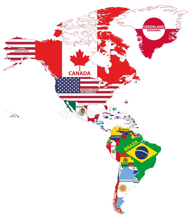
Free with trial Vector illustration of North and South America maps. Guadeloupe map vectors Vector illustration of North and South America map with country names and flags of countries. Vector illustration of North and South America maps
Free with trial Vector illustration of North and South America maps. Guadeloupe map vectors Vector illustration of North and South America map with country names and flags of countries. Vector illustration of North and South America maps
Free with trial Vector high detailed maps of Central American and Caribbean countries with administrative divisions regions borders. Guadeloupe map vectors Vector high detailed maps of Central American and Caribbean countries with administrative divisions regions borders
Free with trial Caribbean in red on planet Earth as seen from space on full sphere. 3D illustration. Elements of this image furnished by NASA. Guadeloupe map illustrations Caribbean on planet Earth. Caribbean in red on planet Earth as seen from space on full sphere. 3D illustration. Elements of this image furnished by NASA.
Free with trial Marie-Galante geometric polygonal maps, mosaic style island collection. Cute low poly style, modern design. Marie-Galante polygonal maps for infographics or presentation. Guadeloupe map vectors Marie-Galante geometric polygonal maps, mosaic. Marie-Galante geometric polygonal maps, mosaic style island collection. Cute low poly style, modern design. Marie-Galante polygonal maps for infographics or presentation.
Free with trial Caribbean in red from Earth’s orbit. 3D illustration. Elements of this image furnished by NASA. Guadeloupe map illustrations Caribbean on Earth. Caribbean in red from Earth’s orbit. 3D illustration. Elements of this image furnished by NASA.
Free with trial Caribbean on political globe with shadow and translucent oceans isolated on white background. 3D illustration. Guadeloupe map illustrations Caribbean on globe. Caribbean on political globe with shadow and translucent oceans isolated on white background. 3D illustration.
Free with trial Caribbean from space on planet Earth at night with bright city lights. Detailed plastic planet surface with real mountains. 3D illustration. Elements of this image furnished by NASA. Guadeloupe map illustrations Caribbean on Earth from space. Caribbean from space on planet Earth at night with bright city lights. Detailed plastic planet surface with real mountains. 3D illustration. Elements of this image furnished by NASA
Free with trial Vector flags and maps of North American countries set. Guadeloupe map vectors Vector flags and maps of North American countries
Free with trial Set of official national flags of the world and other territories. Alphabetical order. North America. Vector design illustration. Guadeloupe map vectors National flags of the world
Free with trial Caribbean on bright political globe with embedded flag. 3D illustration isolated on white background. Guadeloupe map illustrations Caribbean with flag on globe isolated. Caribbean on bright political globe with embedded flag. 3D illustration isolated on white background.
Free with trial Golden Guadeloupe 3d map surrounded with other countries in black with golden borders and shallow dof. Political map with borders. Guadeloupe map illustrations Golden Guadeloupe 3d map surrounded with other countries in black with golden borders and shallow dof. Political map
Free with trial Antique Map of Guadeloupe on Aged Paper, Historical Map. Guadeloupe map illustrations Antique Map of Guadeloupe on Aged Paper
Free with trial Map of Guadeloupe, Forest with Water Map, CO2 Reduction. Guadeloupe map illustrations Map of Guadeloupe, Forest with Water Map
Free with trial Antique Map of Guadeloupe on Aged Paper, Historical Map. Guadeloupe map illustrations Antique Map of Guadeloupe on Aged Paper. Historical Map
Free with trial Guadeloupe blank outline map set. Guadeloupe map vectors Guadeloupe outline map. Guadeloupe blank outline map set
Free with trial Symbol Map of the Island guadeloupe, basse-terre (Guadeloupe) showing the island with just a few black dots. Guadeloupe map vectors Abstract map of the island guadeloupe, basse-terre (Guadeloupe). Symbol Map of the Island guadeloupe, basse-terre (Guadeloupe) showing the island with just a few black dots
Free with trial Seismic activity earthquake Guadeloupe map Richter scale. Guadeloupe map illustrations Seismic activity earthquake Guadeloupe map
Free with trial Black silhouette map of Guadeloupe France. Guadeloupe map vectors Guadeloupe France silhouette map with transparent background. Black silhouette map of Guadeloupe France
Free with trial Gold Emblem of Guadeloupe, Background Map. Guadeloupe map illustrations Gold Emblem of Guadeloupe Map. Gold Emblem of Guadeloupe, Background Map
Free with trial Guadeloupe on the map of Caribbean islands in soft grunge and vintage style, like old paper with watercolor painting. Guadeloupe map illustrations Map of Caribbean islands - Guadeloupe. Guadeloupe on the map of Caribbean islands in soft grunge and vintage style, like old paper with watercolor painting
Free with trial Silver Coin with Map of Guadeloupe, Silver Coin Design. Guadeloupe map illustrations Silver Coin with Map of Guadeloupe
Free with trial Golden Coin with Map of Guadeloupe, Gold Coin Design. Guadeloupe map illustrations Golden Coin with Map of Guadeloupe
Free with trial Outline map of Guadeloupe France with transparent background. Guadeloupe map vectors Guadeloupe France outline map. Outline map of Guadeloupe France with transparent background
Free with trial Map of Guadeloupe Reforestation Green Agenda, Climate Message. Guadeloupe map illustrations Map of Guadeloupe Reforestation Green Agenda
Free with trial Seismic activity earthquake Guadeloupe map Richter scale. Guadeloupe map illustrations Seismic activity earthquake Guadeloupe map
Free with trial Blue Guadeloupe 3d map with pointer pin surrounded with other countries in white. Political map with borders. 3d render illustration. Guadeloupe map illustrations Blue Guadeloupe 3d map with pointer pin surrounded with other countries in white. Political map with borders. 3d render
Free with trial Map of guadeloupe silhouette flat and outline design on white background. Guadeloupe map vectors Map of guadeloupe silhouette flat and outline design
Free with trial Symbol Map of the Island la desirade (Guadeloupe) showing the island with just a few black dots. Guadeloupe map vectors Abstract map of the island la desirade (Guadeloupe). Symbol Map of the Island la desirade (Guadeloupe) showing the island with just a few black dots
Free with trial Symbol Map of the Island marie-galante (Guadeloupe) showing the island with just a few black dots. Guadeloupe map vectors Abstract map of the island marie-galante (Guadeloupe). Symbol Map of the Island marie-galante (Guadeloupe) showing the island with just a few black dots
Free with trial Map of guadeloupe vector illustration design. Guadeloupe map vectors Map of guadeloupe
Free with trial Map of guadeloupe vector illustration design. Guadeloupe map vectors Map of guadeloupe
Free with trial Map of guadeloupe vector illustration design. Guadeloupe map vectors Map of guadeloupe