Free with trial Vector Vintage set of Hawaiian icons and symbols. Hawaiian map vectors Vector Retro set of Hawaiian icons and symbols. Vector Vintage set of Hawaiian icons and symbols
Free with trial A stylized map of the island of Hawaii and all adjacent islands. Hawaiian map vectors Map of Hawaii. A stylized map of the island of Hawaii and all adjacent islands.
Free with trial Vector graphic design state of Hawaii in retro style. Hawaiian map vectors Vector graphic T-shirt design of Hawaii in retro style. Vector graphic design state of Hawaii in retro style
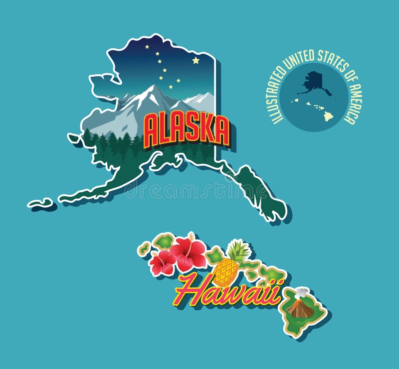
Free with trial Vector graphic of state of Alaska in retro style. Hawaiian map vectors Vector graphic T-shirt design of Alaska in retro style. Vector graphic of state of Alaska in retro style
Free with trial Alaska, Hawaii retro state facts luggage stickers. Hawaiian map vectors Alaska, Hawaii retro state facts illustrations. Alaska, Hawaii retro state facts luggage stickers
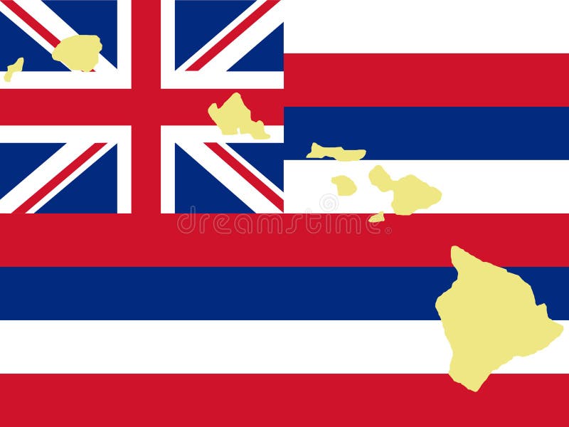
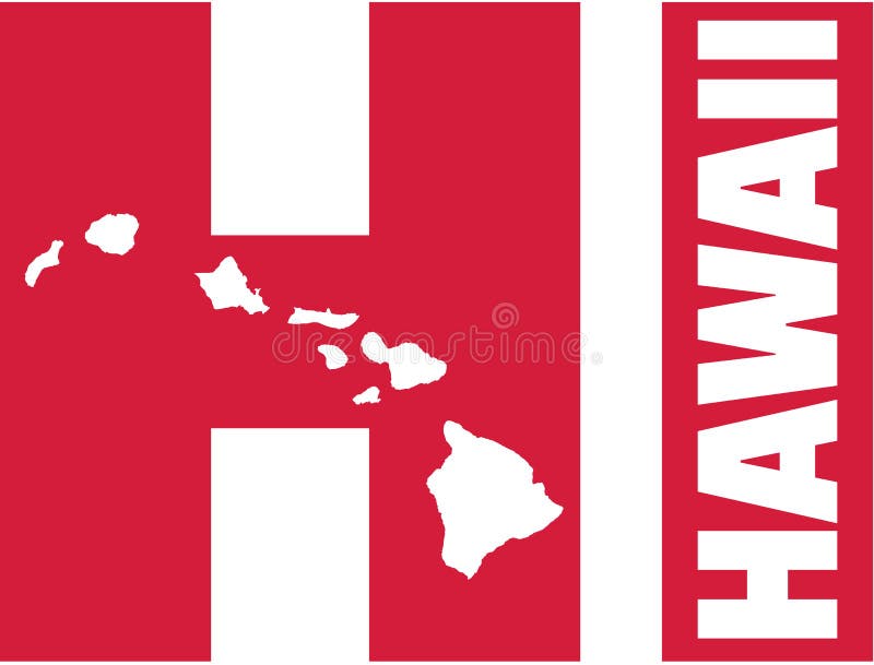
Free with trial Hawaii flag USA america vector. Hawaiian map vectors Hawaii flag vector. Hawaii flag USA america vector
Free with trial Illustrated pictorial map of Alaska and Hawaii, United States. Vector Illustration. Hawaiian map vectors Illustrated pictorial map of Alaska and Hawaii
Free with trial Vector Retro set of banners with Hawaiian symbols. Hawaiian map vectors Retro set of banners with Hawaiian symbols
Free with trial Burnt map illustration of the big island of Hawaii. Hawaiian map illustrations Old map of Hawaii on parchment. Burnt map illustration of the big island of Hawaii
Free with trial Vector Vintage set of Hawaiian icons and symbols. Hawaiian map vectors Vector Retro set of Hawaiian icons and symbols. Vector Vintage set of Hawaiian icons and symbols
Free with trial Vector Vintage set of Hawaiian icons and symbols. Hawaiian map vectors Vector Retro set of Hawaiian icons and symbols. Vector Vintage set of Hawaiian icons and symbols
Free with trial Vector file of Hawaii Islands map - state in the United States. Hawaiian map vectors Hawaii Islands map - state in the United States
Free with trial Kauai Hawaii island USA vector. Hawaiian map vectors Kauai Hawaii vector. Kauai Hawaii island USA vector
Free with trial Set of Retro Summer Vacation Labels in Vintage Style. Illustration. Hawaiian map vectors Set of Retro Summer Labels. Set of Retro Summer Vacation Labels in Vintage Style. Illustration.
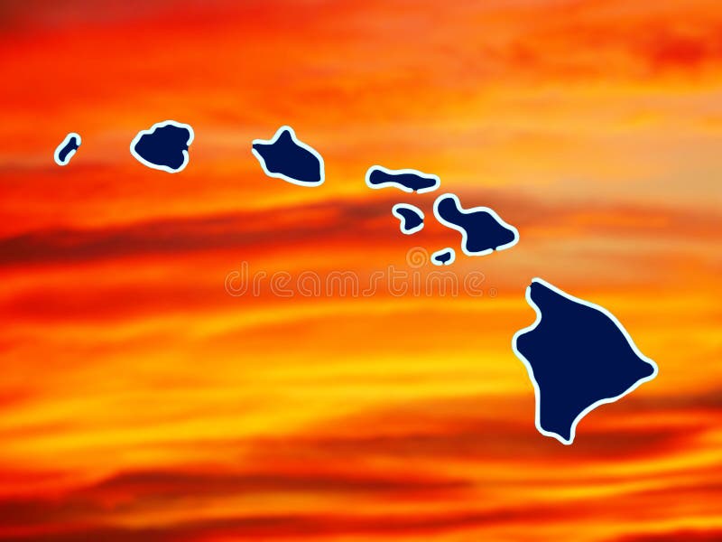
Free with trial A map of hawaiian islands with a colorful sunset in the background. Hawaiian map illustrations Map of hawaiian islands
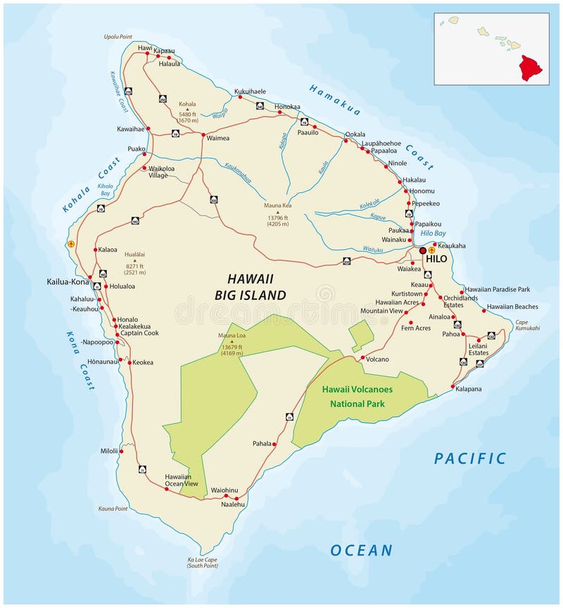
Free with trial Detailed street map of the Hawaiian islands big Iceland, Hawaii. Hawaiian map illustrations Big Island, Hawaii road map. Detailed street map of the Hawaiian islands big Iceland, Hawaii
Free with trial Hawaii illustrated map with animals, nature landmarks, symbols. USA discovery. For books, tourist leaflets, guides, travel posters. different prints. Hawaiian map vectors Hawaiian map with icons, characters and symbols. Hawaii illustrated map with animals, nature landmarks, symbols. USA discovery. For books, tourist leaflets, guides, travel posters. different prints
Free with trial Hawaii illustrated map with animals, nature landmarks, symbols. USA discovery. For books, tourist leaflets, guides, travel posters. different prints. Hawaiian map vectors Hawaiian map with icons, characters and symbols. Hawaii illustrated map with animals, nature landmarks, symbols. USA discovery. For books, tourist leaflets, guides, travel posters. different prints
Free with trial Hawaii map United States island vector. Hawaiian map vectors Hawaii map USA. Hawaii map United States island vector
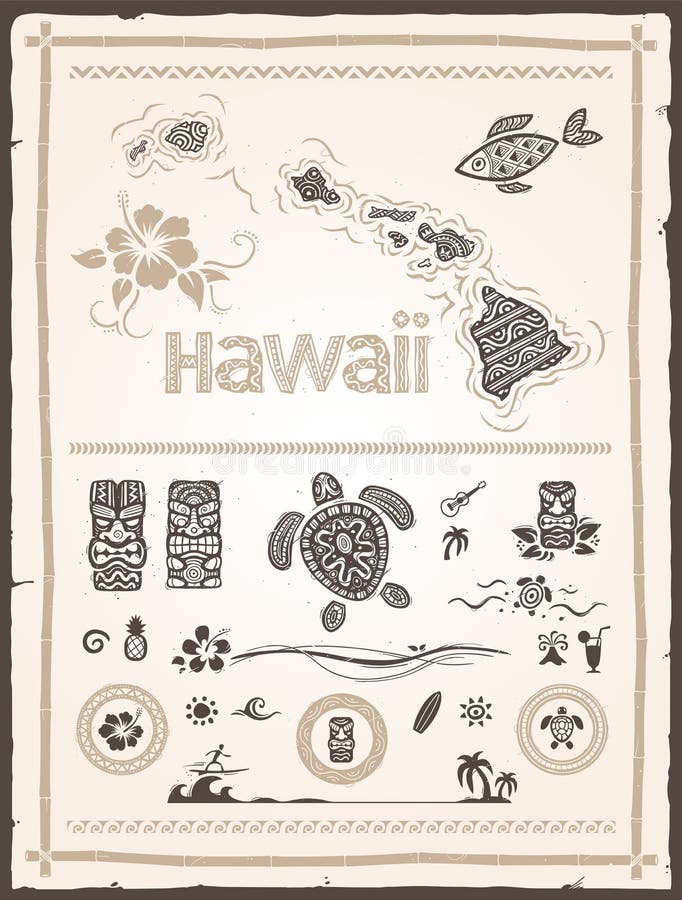
Free with trial Collection of various hawaiian and polynesian design elements. Hawaiian map vectors Hawaiian Design Elements. Collection of various hawaiian and polynesian design elements
Free with trial Detailed road map of big island hawaii island. Hawaiian map vectors Big island map. Detailed road map of big island hawaii island
Free with trial Set of international people in traditional costumes on the map world. Hawaiian map vectors Vector illustration multicultural national children on map earth. Set of international people in traditional costumes on the map world
Free with trial Black vector map of hawaii state isolated on white background. Hawaiian map vectors Black vector map of hawaii state isolated on white
Free with trial Vector Vintage set of Hawaiian icons and symbols. Vector illustration, EPS 10. Hawaiian map vectors Hawaiian, Hawaii Set. Vector Vintage set of Hawaiian icons and symbols. Vector illustration, EPS 10
Free with trial USA map with Alaska and Hawaii map, new political detailed map, separate individual states, with state names, isolated on white background 3D blank vector. Hawaiian map vectors USA map with Alaska and Hawaii map, new political detailed map, separate individual states, with state names, isolated on white
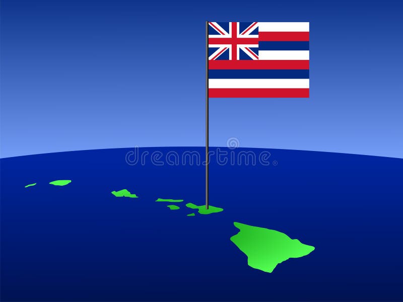
Free with trial Map of Hawaii and their flag on pole illustration. Hawaiian map vectors Map of Hawaii with flag. Map of Hawaii and their flag on pole illustration
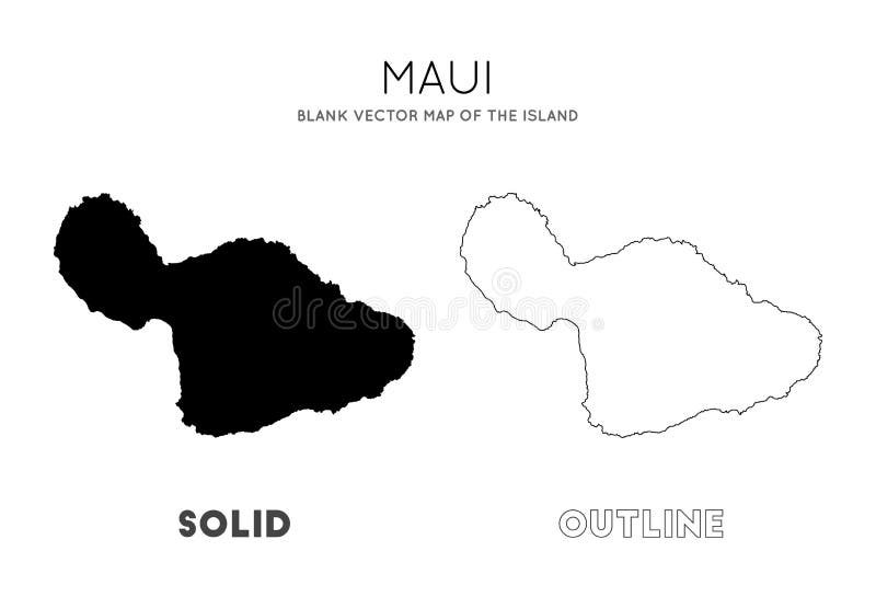
Free with trial Maui Hawaii USA island vector. Hawaiian map vectors Maui Hawaii vector. Maui Hawaii USA island vector
Free with trial Oahu Hawaii USA island vector. Hawaiian map vectors Oahu Hawaii vector. Oahu Hawaii USA island vector
Free with trial Tropical leaves gold color on black background isolated, can be used as background. Hawaiian map illustrations Tropical leaves frame in gold and black. Tropical leaves gold color on black background isolated, can be used as background
Free with trial Detailed map of the entire Hawaiian archipelago. Hawaiian map vectors Hawaiian islands map. Detailed map of the entire Hawaiian archipelago
Free with trial Hawaiian Islands, Sandwich Islands, gray political map. U. S. state of Hawaii with capital Honolulu, and unincorporated territory Midway Atoll. Archipelago in North Pacific Ocean. Illustration. Vector. Hawaiian map vectors Hawaiian Islands, Sandwich Islands, gray political map
Free with trial Road map of the Hawaiian Islands of Maui, Molokai, Lanai and Kahoolawe. Hawaiian map vectors Road map of the Hawaiian Islands of Maui, Molokai, Lanai and Kahoolawe
Free with trial 3d isometric map of Oahu is an island in Hawaiian Islands, isolaated vector illustration. Hawaiian map vectors 3d isometric map of Oahu is an island in Hawaiian Islands
Free with trial Blue Hawaiian Islands map collage of stars, and scratched rounded seal. Abstract geographic scheme in blue color tints. Vector Hawaiian Islands map is composed of blue stars. Hawaiian map vectors Blue Star Hawaiian Islands Map Composition and Textured Stamp. Blue Hawaiian Islands map collage of stars, and scratched rounded seal. Abstract geographic scheme in blue color tints. Vector Hawaiian Islands map is composed of blue stars.
Free with trial 3d isometric map of Maui is an island in Hawaiian Islands, isolaated vector illustration. Hawaiian map vectors 3d isometric map of Maui is an island in Hawaiian Islands
Free with trial 3d isometric map of Hawaii is an island in Hawaiian Islands, isolaated vector illustration. Hawaiian map vectors 3d isometric map of Hawaii is an island in Hawaiian Islands
Free with trial Color Hawaiian Islands map mosaic of stars, and scratched rounded red WELCOME stamp. Abstract geographic scheme in colorful color tinges. Vector Hawaiian Islands map is shaped of colorful stars. Hawaiian map vectors Bright Star Hawaiian Islands Map Composition and Distress Welcome Seal. Color Hawaiian Islands map mosaic of stars, and scratched rounded red WELCOME stamp. Abstract geographic scheme in colorful color tinges. Vector Hawaiian Islands map is shaped of colorful stars.
Free with trial Mosaic Hawaiian Islands map and rectangular seal stamps. Flat Hawaiian Islands map mosaic of scattered rotated rectangular items. Blue caption rubber stamps with distress textures. Hawaiian map illustrations Mosaic Hawaiian Islands Map and Distress Rectangle Watermarks. Mosaic Hawaiian Islands map and rectangular seal stamps. Flat Hawaiian Islands map mosaic of scattered rotated rectangular items. Blue caption rubber stamps with distress textures
Free with trial A map of the Hawaiian island of oahu. Hawaiian map illustrations Oahu road map. A map of the Hawaiian island of oahu
Free with trial Road map of the Hawaiian island kauai. Hawaiian map vectors Kauai road map. Road map of the Hawaiian island kauai
Free with trial Map of the main Hawaiian island Oahu. Hawaiian map illustrations Oahu road map. Map of the main Hawaiian island Oahu
Free with trial Road map of the Hawaiian island molokai. Hawaiian map vectors Molokai road map. Road map of the Hawaiian island molokai
Free with trial A map of the Hawaiian island of big Iceland. Hawaiian map illustrations Big island road map. A map of the Hawaiian island of big Iceland
Free with trial Detailed street map of the two Hawaiian islands maui and Kahoolawe. Hawaiian map illustrations Maui and Kahoolawe road map. Detailed street map of the two Hawaiian islands maui and Kahoolawe
Free with trial Maui, Hawaii, gray political map with capital Wailuku. Part of Hawaiian Islands and Hawaii, a state of the United States in North Pacific Ocean. With unpopulated island Kahoolawe. Illustration. Vector. Hawaiian map vectors Maui, Hawaii, United States, gray political map, capital Wailuku. Maui, Hawaii, gray political map with capital Wailuku. Part of Hawaiian Islands and Hawaii, a state of the United States in North Pacific Ocean. With unpopulated island Kahoolawe. Illustration. Vector
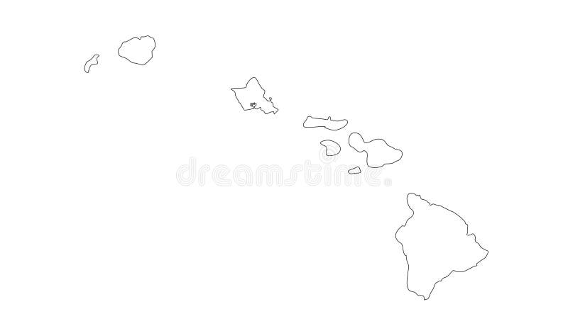
Free with trial Outline Map, of the Hawaiian Islands. Hawaiian map vectors Outline Map of the Hawaiian Islands
Free with trial Bright yellow mesh Hawaiian Islands map with glare effect. Wire frame polygonal mesh in vector EPS10 format on a dark black background. Abstract 2d mesh designed with triangular lines, spheric points,. Hawaiian map vectors Yellow Mesh Wire Frame Hawaiian Islands Map with Light Spots. Bright yellow mesh Hawaiian Islands map with glare effect. Wire frame polygonal mesh in vector EPS10 format on a dark black background. Abstract 2d mesh designed with triangular lines, spheric points,
Free with trial Kauai island United States of America, North America, US, USA, Hawaiian Islands, Hawaii map vector illustration, scribble sketch Kaua‘i or The Garden Island map,. Hawaiian map vectors Kauai island United States of America, North America, US, USA, Hawaiian Islands, Hawaii map vector illustration, scribble sketch
Free with trial Hawaii island United States of America, North America, US, USA, Hawaiian Islands map vector illustration, scribble sketch Hawai‘i or Big Island map,. Hawaiian map vectors Hawaii island United States of America, North America, US, USA, Hawaiian Islands map vector illustration, scribble sketch Hawai
Free with trial Vector Retro set of banners with Hawaiian symbols. Hawaiian map vectors Retro set of banners with Hawaiian symbols
Free with trial Vector Retro set of banners with Hawaiian symbols. Hawaiian map vectors Retro set of banners with Hawaiian symbols
Free with trial Hawaii with state abbreviations HI and map vector. Hawaiian map vectors Hawaii with state abbreviations HI and map
Free with trial Detailed road map of Oahu hawaii island. Hawaiian map illustrations Oahu road map. Detailed road map of Oahu hawaii island
Free with trial Big Island grunge vintage map illustration clip-art. Hawaiian map vectors Big Island grunge vintage map
Free with trial State of Hawaii, counties, outline map. Island state of the United States in the Pacific Ocean, subdivided into the five counties Hawaii, Honolulu, Kalawao, Kauai, and Maui, nicknamed The Aloha State. Hawaiian map vectors State of Hawaii, counties, outline map. Island state of the United States in the Pacific Ocean, subdivided into the five counties Hawaii, Honolulu, Kalawao
Free with trial USA with Alaska and Hawaii map blank blue white card paper 3D vector. Hawaiian map vectors USA with Alaska and Hawaii map blank blue white card paper 3D
Free with trial Vector Vintage set of Hawaiian icons and symbols. Vector illustration, EPS 10. Hawaiian map vectors Hawaiian, Hawaii Set. Vector Vintage set of Hawaiian icons and symbols. Vector illustration, EPS 10
Free with trial Hawaiian icons and symbols. Travel Hawaii concept design. Dancing girl, palm tree, hibiscus and plumeria flowers, guitar cocktail. Tropical paradise. Vector Illustration. Isolated on white. Hawaiian map vectors Hawaiian icons and symbols set. Hawaiian icons and symbols. Travel Hawaii concept design. Dancing girl, palm tree, hibiscus and plumeria flowers, guitar cocktail. Tropical paradise. Vector Illustration. Isolated on white.
Free with trial Hawaii State map in gray on a black background 3d. Hawaiian map vectors Hawaii State map in gray on a black background 3d
Free with trial Set of international people in traditional costumes on the map world. Hawaiian map vectors Map vector illustration multicultural national children on planet earth. Set of international people in traditional costumes on the map world
Free with trial Palm tree and Hawaii map. Hawaiian Islands on abstract hand painted watercolor blot. Blue and indigo banner, flyer. Vector template. Tropical, summer graphic design for woman t shirt. Hawaiian map vectors Watercolor Hawaiian, tropical graphic design. Palm tree and Hawaii map.Hawaiian Islands on abstract hand painted watercolor blot. Blue and indigo banner, flyer. Vector template. Tropical, summer graphic design for woman t shirt.
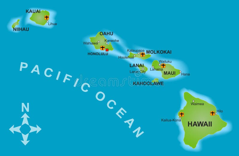
Free with trial High detailed Hawaii physical map with labeling. Vector illustration. Hawaiian map vectors High detailed Hawaii physical map with labeling.
Free with trial Vector map of the Midway Atoll in the Northern Pacific Ocean. Hawaiian map vectors Map of the Midway Atoll in the Northern Pacific Ocean
Free with trial Vector Vintage set pattern of Hawaiian icons and symbols. Vector illustration, EPS 10. Hawaiian map vectors Hawaiian, Hawaii Set pattern. Vector Vintage set pattern of Hawaiian icons and symbols. Vector illustration, EPS 10
Free with trial High detailed Hawaii physical map with labeling. Vector illustration. Hawaiian map vectors High detailed Hawaii physical map with labeling.
Free with trial Outline map of the islans of Hawaii over a white background. Hawaiian map illustrations Hawaii State Outline Map. Outline map of the islans of Hawaii over a white background
Free with trial A Hawaii Stamp Postal. Map Silhouette Seal. Passport Round Design. Vector Icon. Design Retro Travel. Hawaiian map vectors Hawaii Stamp Postal. Map Silhouette Seal. Passport Round Design. Vector Icon. Design Retro Travel.
Free with trial USA with Alaska and Hawaii map with individual states separated, infographics with icons blank. Hawaiian map vectors USA with Alaska and Hawaii map with individual states separated, infographics with icons blank
Free with trial Oahu map. Blank vector map of the Island. Borders of Oahu for your infographic. Vector illustration. Hawaiian map vectors Oahu map.
Free with trial Maui island detailed editable map with with cities and towns, geographic sites, roads, interstates and U. S. highways. Vector EPS-10 file, trending color scheme. Hawaiian map vectors Maui island detailed editable map
Free with trial A Maui Hawaii Stamp Postal. Map Silhouette Seal. Passport Round Design. Vector Icon. Design Retro Travel. Hawaiian map vectors Maui Hawaii Stamp Postal. Map Silhouette Seal. Passport Round Design. Vector Icon. Design Retro Travel.
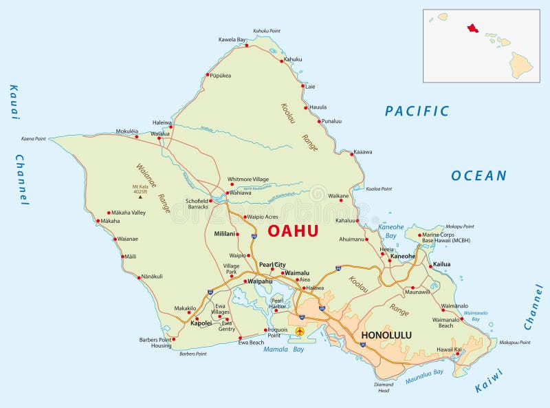
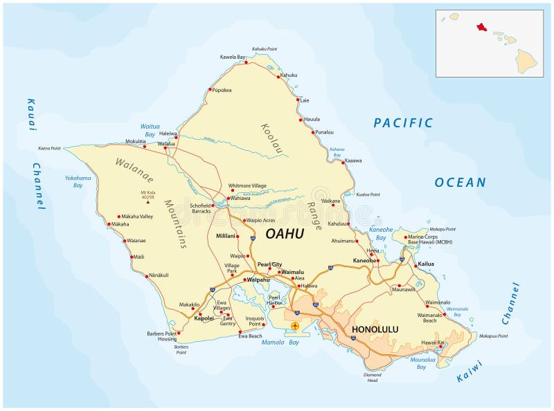
Free with trial Oahu island detailed editable map with cities and towns, geographic sites, roads, interstates and U. S. highways. Vector EPS-10 file, trending color scheme. Hawaiian map vectors Oahu island detailed editable map
Free with trial Maui map. Blank vector map of the Island. Borders of Maui for your infographic. Vector illustration. Hawaiian map vectors Maui map.
Free with trial Solid and mesh vector map of Oahu Island. Wire carcass 2D triangular mesh in vector format, geographic models for economics illustrations. Illustrations are isolated on a white background. Hawaiian map vectors Solid and Mesh Map of Oahu Island. Solid and mesh vector map of Oahu Island. Wire carcass 2D triangular mesh in vector format, geographic models for economics illustrations. Illustrations are isolated on a white background.