Free with trial Physical map of South Asia, with high resolution details. Flattened satellite view of Planet Earth, its geography and topography. 3D illustration - Elements of this image furnished by NASA. High resolution 3d elevation map asia illustrations High resolution detailed map of South Asia, Himalayas and India. Physical map of South Asia, with high resolution details. Flattened satellite view of Planet Earth, its geography and topography. 3D illustration - Elements of this image furnished by NASA
Free with trial 3D illustration of a highly detailed map of Asia. Elements of this image furnished by NASA. --ar 16:9 --v 7 Job ID: a49db520-819c-4434-844e-cd0ae1472dfd. High resolution 3d elevation map asia illustrations Central asia terrain satellite view. 3D illustration of a highly detailed map of Asia. Elements of this image furnished by NASA. --ar 16:9 --v 7 Job ID: a49db520-819c-4434-844e-cd0ae1472dfd
Free with trial Physical map of India, Nepal, Himalayas and Tibet. Detailed flat view of the Planet Earth and its landforms. 3D illustration - Elements of this image furnished by NASA. High resolution 3d elevation map asia illustrations High resolution physical map of India and Himalayas. Physical map of India, Nepal, Himalayas and Tibet. Detailed flat view of the Planet Earth and its landforms. 3D illustration - Elements of this image furnished by NASA
Free with trial Detailed 3D topographic map showcasing South Asia. Features include terrain elevation rivers and major city locations. Perfect for geography projects educational materials or travel presentations. High resolution 3d elevation map asia illustrations 3D Topographic Map of South Asia Good Resolution Stock Photo. Detailed 3D topographic map showcasing South Asia. Features include terrain elevation rivers and major city locations. Perfect for geography projects educational materials or travel presentations.
Free with trial This detailed physical relief map showcases the intricate topography of South Asia and its neighboring areas. Prominent features include the majestic, snow-capped Himalayan mountain range, the vast Indian subcontinent with its diverse plains and plateaus, and the expansive blue waters of the Arabian Sea, Bay of Bengal, and Indian Ocean. Colors depict elevation, from deep blues for oceans to greens for lowlands, browns for highlands, and white for high peaks, offering a clear visual representation of the region's geography. Ideal for educational, scientific, and travel-related content. AI-generated image. High resolution 3d elevation map asia illustrations Detailed physical relief map of South Asia and nearby regions. This detailed physical relief map showcases the intricate topography of South Asia and its. This detailed physical relief map showcases the intricate topography of South Asia and its neighboring areas. Prominent features include the majestic, snow-capped Himalayan mountain range, the vast Indian subcontinent with its diverse plains and plateaus, and the expansive blue waters of the Arabian Sea, Bay of Bengal, and Indian Ocean. Colors depict elevation, from deep blues for oceans to greens for lowlands, browns for highlands, and white for high peaks, offering a clear visual representation of the region's geography. Ideal for educational, scientific, and travel-related content. AI-generated image.
Free with trial High-resolution, 3D topographic map of South Asia, showcasing the intricate details of the region's mountains, valleys, rivers, and coastlines. The map vividly depicts the varied elevations and landforms, from the snow-capped Himalayas to the plains of the Indian subcontinent. Ideal for educational resources, geographical studies, or presentations focusing on the region's geography and geology. High resolution 3d elevation map asia illustrations Detailed Topographic Map of South Asia. High-resolution, 3D topographic map of South Asia, showcasing the intricate details of the region's mountains, valleys, rivers, and coastlines. The map vividly depicts the varied elevations and landforms, from the snow-capped Himalayas to the plains of the Indian subcontinent. Ideal for educational resources, geographical studies, or presentations focusing on the region's geography and geology.
Free with trial High-resolution topographic map showcasing the diverse landscapes of Asia and surrounding regions. The map highlights the varied elevations, mountain ranges, and bodies of water, providing a detailed view of the geographical features. Ideal for educational resources, presentations, or any project requiring a clear representation of the region's topography. The intricate detail and vibrant color palette make this map visually engaging and informative. High resolution 3d elevation map asia illustrations Detailed Topographic Map of Asia and Surrounding Regions. High-resolution topographic map showcasing the diverse landscapes of Asia and surrounding regions. The map highlights the varied elevations, mountain ranges, and bodies of water, providing a detailed view of the geographical features. Ideal for educational resources, presentations, or any project requiring a clear representation of the region's topography. The intricate detail and vibrant color palette make this map visually engaging and informative.
Free with trial High-resolution topographic map of South Asia, showcasing the varied terrain, including mountains, plains, and bodies of water. The map highlights the geographical features of the region with a 3D effect, providing a detailed view of the landforms. Ideal for educational resources, presentations, or any project requiring a clear visual representation of the area's geography. High resolution 3d elevation map asia illustrations Detailed Topographic Map of South Asia. High-resolution topographic map of South Asia, showcasing the varied terrain, including mountains, plains, and bodies of water. The map highlights the geographical features of the region with a 3D effect, providing a detailed view of the landforms. Ideal for educational resources, presentations, or any project requiring a clear visual representation of the area's geography.
Free with trial A stylized topographic map of Asia, showcasing the continent's diverse terrain and geographical features in a three-dimensional, textured relief style. The image uses warm and cool tones to emphasize the elevation changes. High resolution 3d elevation map asia illustrations Asia map textured relief view. A stylized topographic map of Asia, showcasing the continent's diverse terrain and geographical features in a three-dimensional, textured relief style. The image uses warm and cool tones to emphasize the elevation changes
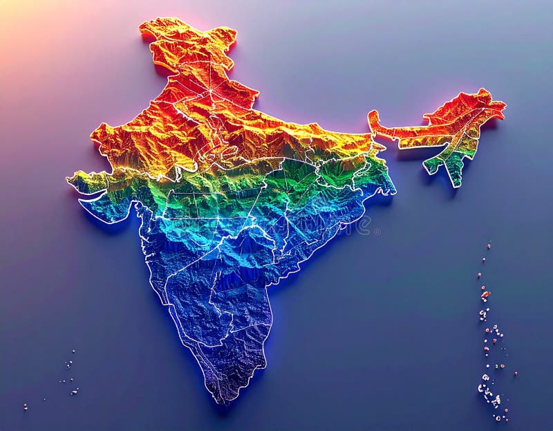
Free with trial A vibrant 3D rendered relief map of India showcases its diverse topography with rainbow colored elevation gradients highlighting mountain ranges plains and coastlines National borders are clearly defined offering a unique and visually captivating perspective This image was generated with AI. High resolution 3d elevation map asia illustrations 3D Rainbow Relief Map of India Detailed Topography Borders. A vibrant 3D rendered relief map of India showcases its diverse topography with rainbow colored elevation gradients highlighting mountain ranges plains and coastlines National borders are clearly defined offering a unique and visually captivating perspective This image was generated with AI.
Free with trial A digital elevation of vast terrain. Generated by ai. High resolution 3d elevation map asia illustrations High-Resolution 3D Map of Northeast Asia. A digital elevation of vast terrain. Generated by ai
Free with trial 3D illustration of a highly detailed map of Asia. Elements of this image furnished by NASA. --ar 16:9 --v 7 Job ID: a49db520-819c-4434-844e-cd0ae1472dfd. High resolution 3d elevation map asia illustrations East asia terrain satellite view. 3D illustration of a highly detailed map of Asia. Elements of this image furnished by NASA. --ar 16:9 --v 7 Job ID: a49db520-819c-4434-844e-cd0ae1472dfd
Free with trial A stunning 3D render of India showcasing its diverse topography from the Himalayas to the coastal plains The detailed map highlights the country s geographical features with exceptional clarity This image was generated with AI. High resolution 3d elevation map asia illustrations 3D Render of India Detailed Topographic Map. A stunning 3D render of India showcasing its diverse topography from the Himalayas to the coastal plains The detailed map highlights the country s geographical features with exceptional clarity This image was generated with AI.
Free with trial A stunning 3D rendering of South Asia, showcasing the detailed topography of India, Pakistan, and neighboring countries. Rivers, mountains, and coastlines are vividly depicted, offering a visually engaging representation of the region's geographical features. Ideal for educational purposes, travel guides, geographical studies, and presentations related to South Asian geography. High resolution 3d elevation map asia illustrations 3D Topographic Map of South Asia: India, Pakistan, and Surrounding Regions. A stunning 3D rendering of South Asia, showcasing the detailed topography of India, Pakistan, and neighboring countries. Rivers, mountains, and coastlines are vividly depicted, offering a visually engaging representation of the region's geographical features. Ideal for educational purposes, travel guides, geographical studies, and presentations related to South Asian geography.
Free with trial A stunning 3D rendered map of India, presented in a luxurious golden hue against a deep blue background. The map highlights the country's geographical features with intricate detail, showcasing its diverse terrain. The contrasting colors create a visually striking image, suitable for a variety of applications, including educational materials, presentations, and design projects related to India, geography, or global themes. High resolution 3d elevation map asia illustrations Golden India Map on Blue Background. A stunning 3D rendered map of India, presented in a luxurious golden hue against a deep blue background. The map highlights the country's geographical features with intricate detail, showcasing its diverse terrain. The contrasting colors create a visually striking image, suitable for a variety of applications, including educational materials, presentations, and design projects related to India, geography, or global themes.
Free with trial A stunning 3D rendering of India s detailed geographical features showcasing its diverse topography and relief in a visually engaging way This image was generated with AI. High resolution 3d elevation map asia illustrations 3D Render of India Map Detailed Topography Relief. A stunning 3D rendering of India s detailed geographical features showcasing its diverse topography and relief in a visually engaging way This image was generated with AI.
Free with trial A stunning 3D rendering showcases India s diverse topography from the Himalayas to the coastal plains offering a unique perspective on the country s geographical features This image was generated with AI. High resolution 3d elevation map asia illustrations 3D Render of India Map Detailed Topography and Relief. A stunning 3D rendering showcases India s diverse topography from the Himalayas to the coastal plains offering a unique perspective on the country s geographical features This image was generated with AI.
Free with trial A detailed 3D rendering of a world map showcasing the earth's topography, with oceans depicted in shades of blue and landmasses in varying shades of beige and brown, emphasizing the planet's diverse geographical features. High resolution 3d elevation map asia illustrations Textured earth globe map relief. A detailed 3D rendering of a world map showcasing the earth's topography, with oceans depicted in shades of blue and landmasses in varying shades of beige and brown, emphasizing the planet's diverse geographical features
Free with trial A stunning 3D rendering showcases India s diverse topography using a vibrant rainbow color palette highlighting its geographical features with exceptional detail This image was generated with AI. High resolution 3d elevation map asia illustrations Vibrant 3D Rainbow Relief Map of India Detailed Topography. A stunning 3D rendering showcases India s diverse topography using a vibrant rainbow color palette highlighting its geographical features with exceptional detail This image was generated with AI.
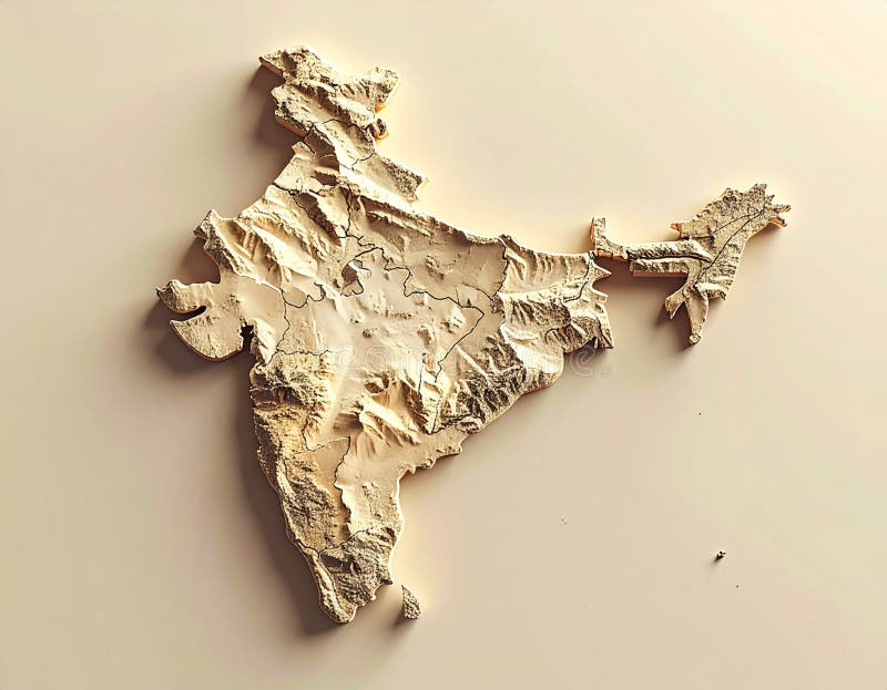
Free with trial A stunning 3D rendering of India s detailed geographical features presented as an intricately carved wooden model showcasing the country s diverse terrain with remarkable realism This image was generated with AI. High resolution 3d elevation map asia illustrations 3D Wooden Map of India Detailed Topography and Relief Model. A stunning 3D rendering of India s detailed geographical features presented as an intricately carved wooden model showcasing the country s diverse terrain with remarkable realism This image was generated with AI.
Free with trial A stunning 3D rendering of India showcases its diverse topography in a spectrum of rich colors highlighting mountain ranges plains and coastlines with exceptional detail This image was generated with AI. High resolution 3d elevation map asia illustrations Vibrant Colorful 3D Map of India Detailed Topography and Geography. A stunning 3D rendering of India showcases its diverse topography in a spectrum of rich colors highlighting mountain ranges plains and coastlines with exceptional detail This image was generated with AI.