Free with trial Massachusetts, Connecticut, Rhode Island luggage sticker labels. Island state vectors Massachusetts, Connecticut, Rhode Island retro state facts Illustrations. Massachusetts, Connecticut, Rhode Island luggage sticker labels
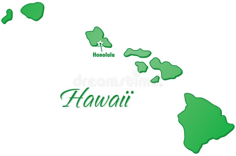
Free with trial An outlined illustration of the state of Hawaii. Island state vectors State of Hawaii Outline. An outlined illustration of the state of Hawaii.
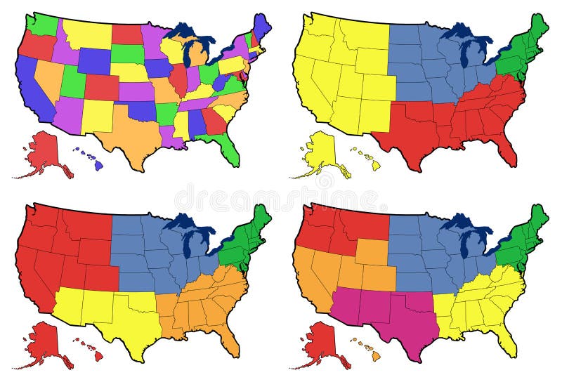
Free with trial Vector map of the United States of America with state names, and color coded in terms of temperature. Island state illustrations Vector map of the USA with state names. Vector map of the United States of America with state names, and color coded in terms of temperature.
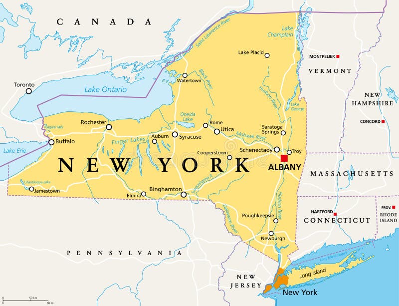
Free with trial New York State NYS, political map, with capital Albany, borders, important cities, rivers and lakes. State in the Northeastern United States of America. English labeling. Illustration. Vector. Island state vectors New York State NYS, political map. With capital Albany, borders, important cities, rivers and lakes. State in the Northeastern United States of America. New York State NYS, political map, with capital Albany, borders, important cities, rivers and lakes. State in the Northeastern United States of America. English labeling. Illustration. Vector.
Free with trial Usa state divided map colored vector blank. Island state vectors Usa state map colored vector. Usa state divided map colored vector blank
Free with trial Vector file of Ireland flag - island country in the North Atlantic. Island state vectors Ireland flag - island country in the North Atlantic
Free with trial Very detailed vector file of all fifty states. Each state is grouped individually and labeled in the layers palette. Island state vectors Fifty United States. Very detailed vector file of all fifty states. Each state is grouped individually and labeled in the layers palette.
Free with trial Map of Hawaii state designed in illustration with the counties and the county seats. Island state vectors Hawaii map. Map of Hawaii state designed in illustration with the counties and the county seats.
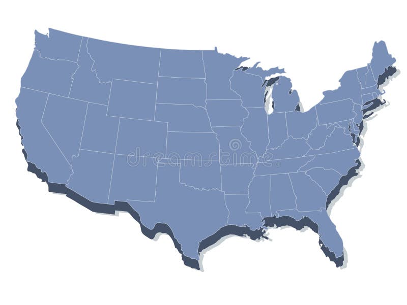
Free with trial An US State map in Blue 3D tones. Island state vectors Blue US 3D State map. An US State map in Blue 3D tones
Free with trial Vector illustration of skyline over new york city and its monuments, as empire state building, liberty statue, brooklyn bridge, chrysler building and trump building. Island state vectors New york skyline and landmarks. Vector illustration of skyline over new york city and its monuments, as empire state building, liberty statue, brooklyn bridge, chrysler building and trump building.
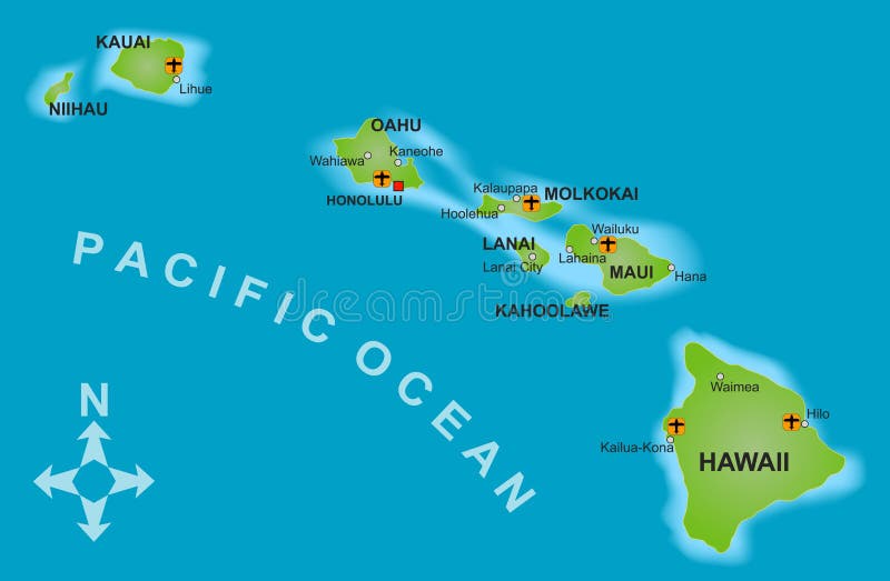
Free with trial A stylized map of the island of Hawaii and all adjacent islands. Island state vectors Map of Hawaii. A stylized map of the island of Hawaii and all adjacent islands.
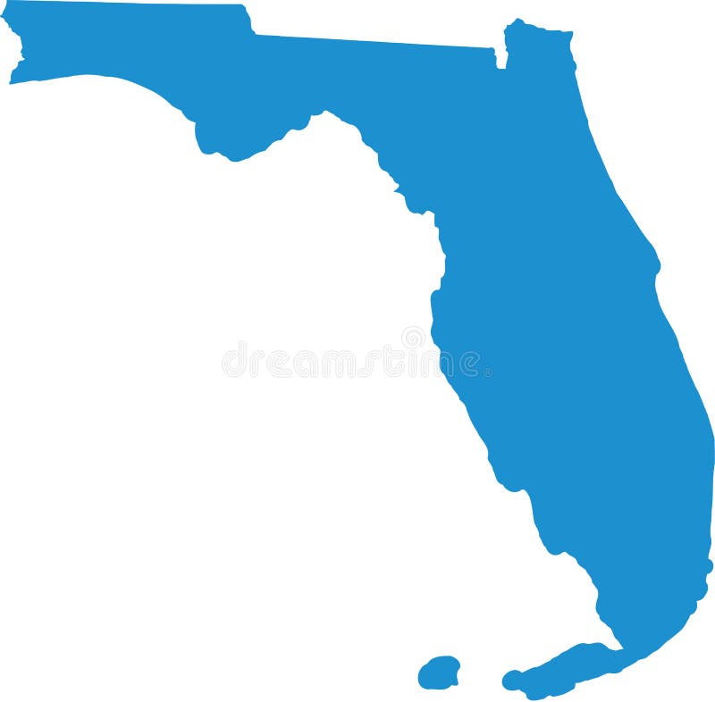
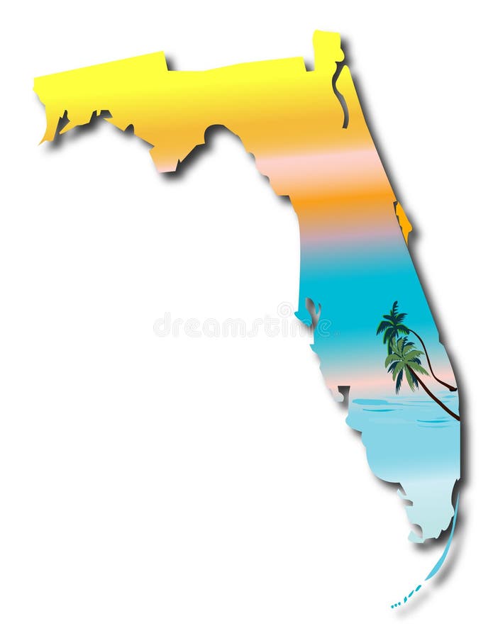
Free with trial Florida State Map with sunshine and palms background vector. Island state vectors Map of Florida. Florida State Map with sunshine and palms background vector
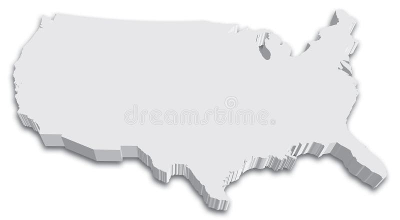
Free with trial An US State map in Black and White 3D. Island state vectors US 3D State map. An US State map in Black and White 3D
Free with trial Very detailed vector file of all fifty states in 3d. Each state is grouped individually and labeled in the layers palette. Island state vectors United States 3D Map. Very detailed vector file of all fifty states in 3d. Each state is grouped individually and labeled in the layers palette.
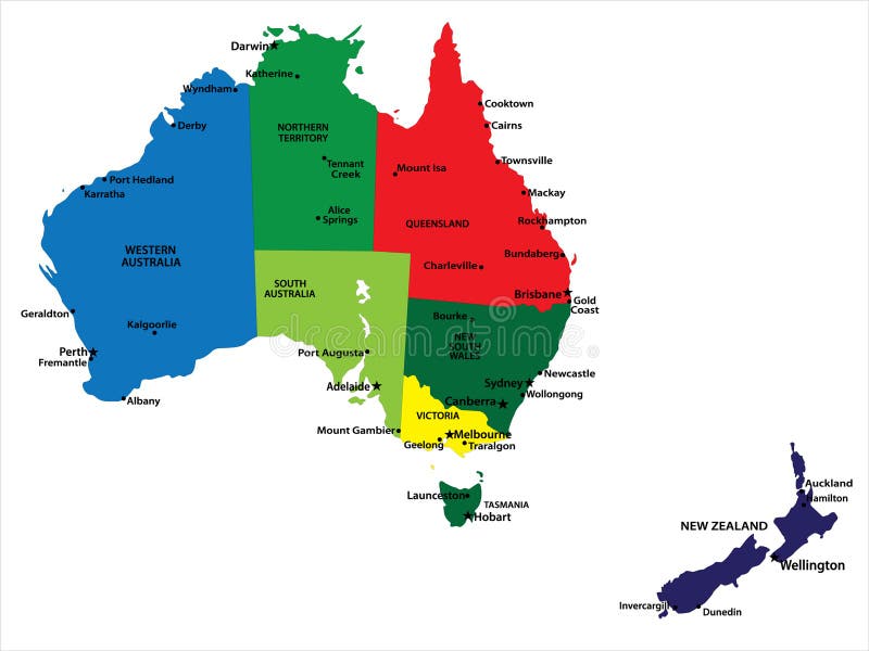
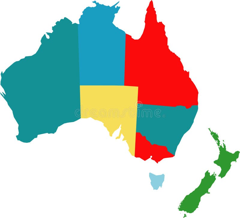
Free with trial Vector map of Australia and New Zealand with state borders and main cities. Island state vectors Australia and New Zealand
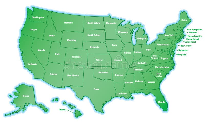
Free with trial USA 50 States with State Names and Capital cities in vivid colors. vector eps10. Island state vectors USA 50 States with State Names
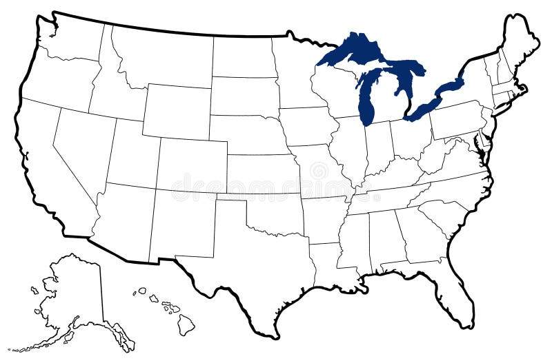
Free with trial Detailed outline map of United States showing state borders, Great Lakes, and major bays; map uses six bright colors. Island state illustrations Map of United States with state names. Detailed outline map of United States showing state borders, Great Lakes, and major bays; map uses six bright colors
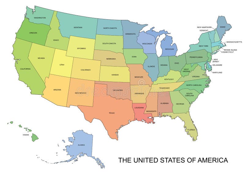
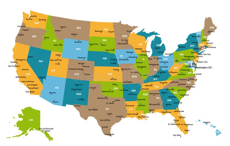
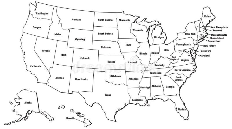
Free with trial Detailed illustration of all fifty states of United States of America with major cities and state abbreviations. All states are in separate layers and can be easily changed in Adobe Illustrator additional format. Island state vectors Map of all US states. Detailed illustration of all fifty states of United States of America with major cities and state abbreviations. All states are in separate layers and can be easily changed in Adobe Illustrator additional format.
Free with trial Vector illustration of skyline over new york city and its monuments, as empire state building, liberty statue, brooklyn bridge, chrysler building and trump building, on the background the flag of united states of america. Island state vectors New york skyline with flag usa. Vector illustration of skyline over new york city and its monuments, as empire state building, liberty statue, brooklyn bridge, chrysler building and trump building, on the background the flag of united states of america
Free with trial An illustrated map of the United States. Island state vectors United States Map. An illustrated map of the United States.
Free with trial Mexico map designed in illustration with states colored in bright colors and with the main cities. Neighbouring countries are in an additional format (. AI) in the latent layer. Island state vectors Mexico map
Free with trial Illustrated world political map in vector. Included present political borders. Island state vectors Actual world political map. Illustrated world political map in vector. Included present political borders.
Free with trial An illustrated map of the United States. Island state illustrations United States Map Silhouette. An illustrated map of the United States.
Free with trial Detailed physical maps of United States showing Great Lakes and major bays; maps show US with progressively more features: Mississippi river Basin, state borders, and both. Island state illustrations Four versions of physical map of United States. Detailed physical maps of United States showing Great Lakes and major bays; maps show US with progressively more features: Mississippi river Basin, state borders, and both
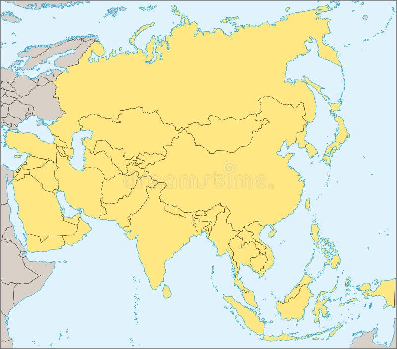
Free with trial Political map of Asia with present states borders, detailed vector map. Island state vectors Asia political map. Political map of Asia with present states borders, detailed vector map.
Free with trial Illustration of a detailed political map of Jamaica, with its main cities, mountains and rivers. Island state vectors Jamaica map. Illustration of a detailed political map of Jamaica, with its main cities, mountains and rivers.
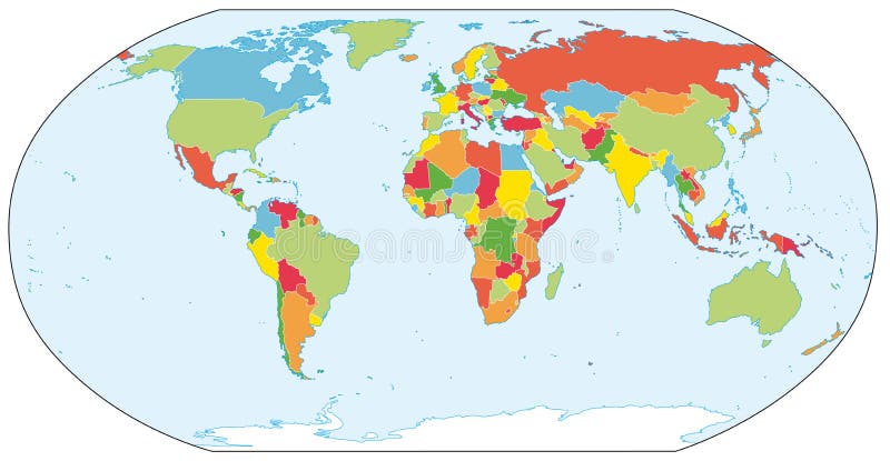
Free with trial Illustrated world map with coordinates in vector. Included present political borders. Island state vectors World map with coordinates
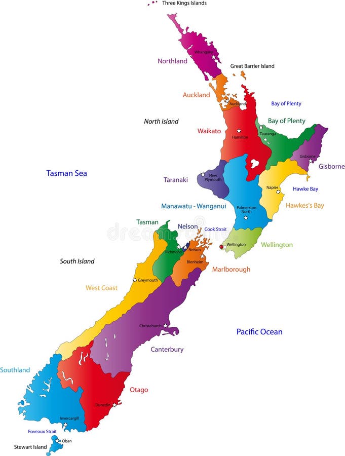
Free with trial Illustration of a detailed political map of New Zealand. Island state vectors New Zealand map. Illustration of a detailed political map of New Zealand.
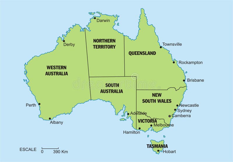
Free with trial A map of the Australian continent with the states on the continent colored in grey colors and the main cities. Island state vectors Map of Australia. A map of the Australian continent with the states on the continent colored in grey colors and the main cities.
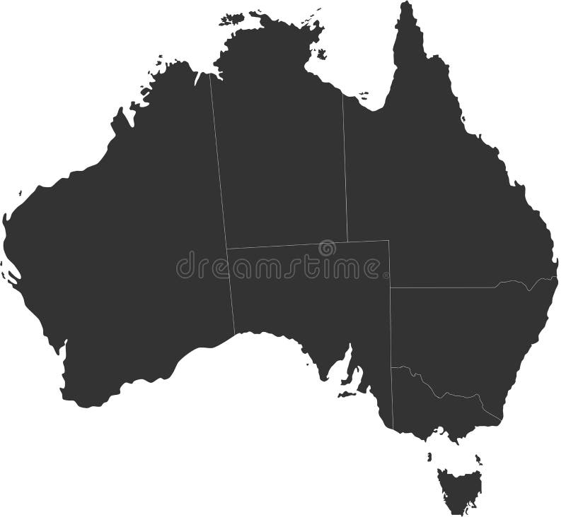
Free with trial Blind map of Australia with country borders. Names of the states and their the main cities are in an additional format (. AI) in the latent layer. Island state vectors Australia blind map. Blind map of Australia with country borders. Names of the states and their the main cities are in an additional format (. AI) in the latent layer
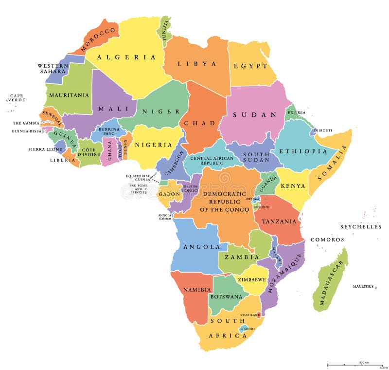
Free with trial Africa single states political map. Each country with its own color area. With national borders on white background. Continent including Madagascar and island nations. English labeling. Island state vectors Africa single states political map
Free with trial An illustrated map of the United States. Island state illustrations United States Map Outline. An illustrated map of the United States.
Free with trial Digital elaboration and silhouette of new york skyline by night with the full moon and stars in the sky, useful for any event in the big apple city as jazz gigs and shows. Island state illustrations New york skyline night with moon. Digital elaboration and silhouette of new york skyline by night with the full moon and stars in the sky, useful for any event in the big apple city as jazz gigs and shows
Free with trial Vector map of Africa with present political borders. Island state vectors Africa vector map. Vector map of Africa with present political borders.
Free with trial Detailed outline map of United States showing state borders, Great Lakes, and major bays. Island state illustrations Outline Map of United States
Free with trial New Zealand map with the regions colored in bright colors and with the main cities. Island state vectors New Zealand map
Free with trial Vector map of the united states of america in 3d view. Island state vectors Vector map of the united states of america
Free with trial Blue vector Canada and provinces map. Island state vectors Canada map. Blue vector Canada and provinces map
Free with trial Illustrations of south eastern united states. Island state vectors Luggage stickers Tennessee, South Carolina, North Carolina. Illustrations of south eastern united states
Free with trial Flat vector illustration with stylized travel map of Ireland. The landmarks and main cities like Dublin and Belfast. Text Welcome to Ireland. Island state vectors Travel map of Ireland with landmarks and cities. Flat vector illustration with stylized travel map of Ireland. The landmarks and main cities like Dublin and Belfast. Text Welcome to Ireland
Free with trial Uk map isolated on white background Vector. Island state vectors Uk map isolated. Uk map isolated on white background Vector
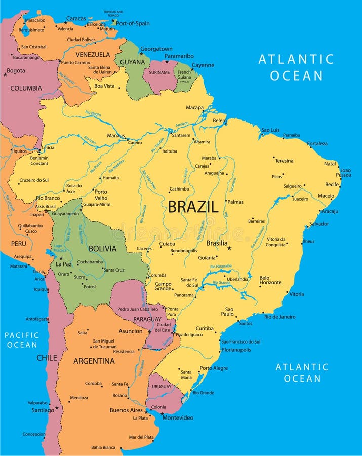
Free with trial Brazilmap designed in illustration with states colored in green colors and with the main cities. Neighbouring countries are in an additional format (. AI) in the latent layer. Island state vectors Brazil
Free with trial Complete world map including all the countries with detailed sketch, including country names & map. Island state illustrations World Map in detail. Complete world map including all the countries with detailed sketch, including country names & map.
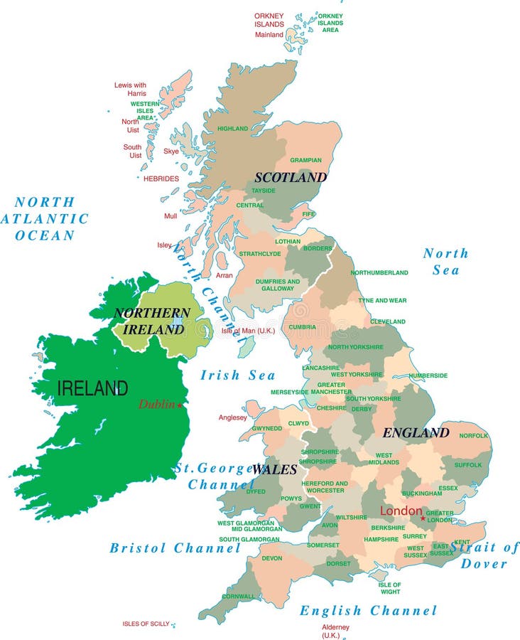
Free with trial Great Britain outline map with shadow. Detailed, Mercator projection. Island state illustrations Great Britain map with shadow. Great Britain outline map with shadow. Detailed, Mercator projection.
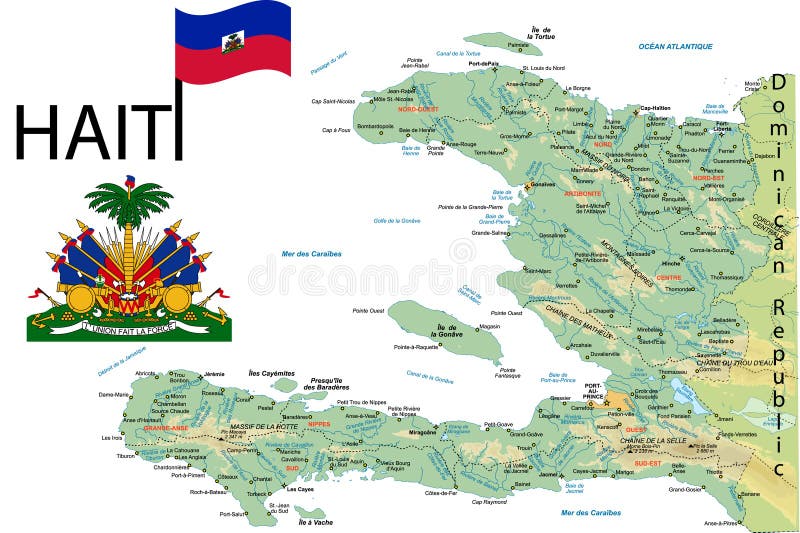
Free with trial Haiti map with major towns. Island state vectors Haiti map. Haiti map with major towns.
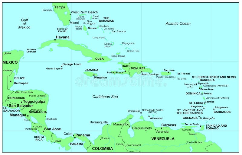
Free with trial Caribbean Sea with all islands and names. Island state vectors Caribbean Sea. Caribbean Sea with all islands and names.
Free with trial An Australia map, with the territorries separated and the main cities. Island state illustrations Australia map
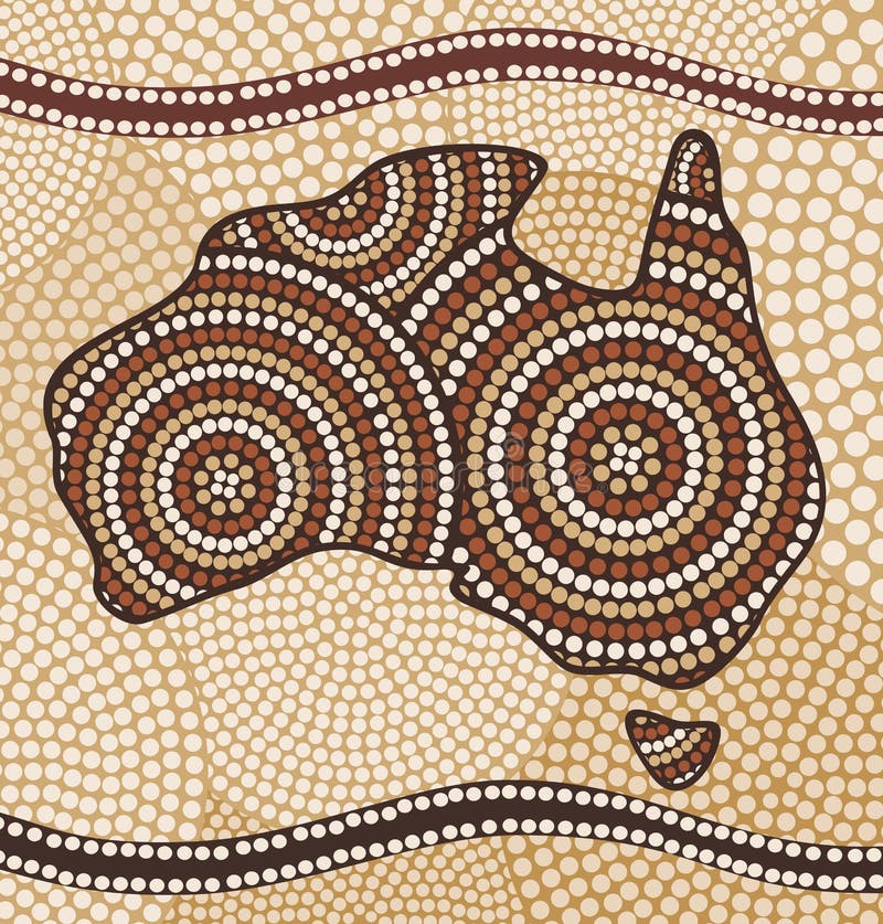
Free with trial Painting in the Aboriginal style. Island state vectors Map of Australia. Painting in the Aboriginal style
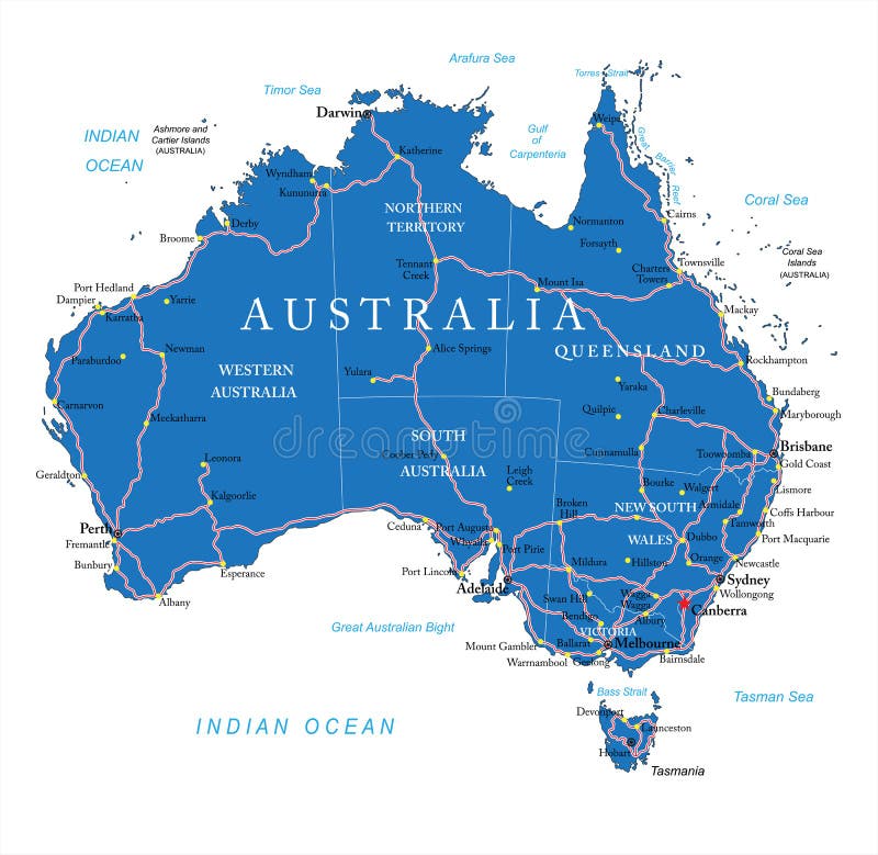
Free with trial Highly detailed vector map of Australia with administrative regions, main cities and roads. Island state vectors Australia road map. Highly detailed vector map of Australia with administrative regions, main cities and roads.
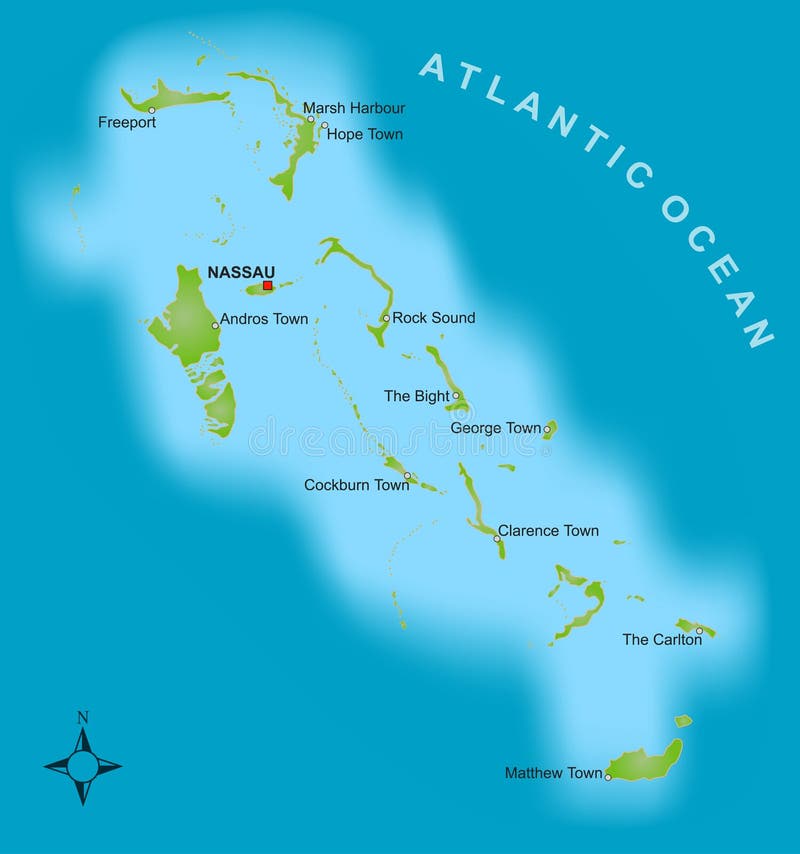
Free with trial A stylized map showing the islands of Bahamas as well as severel cities. Island state vectors Map of the Bahamas. A stylized map showing the islands of Bahamas as well as severel cities.
Free with trial Very detailed buttons of all fifty states. States are organized alphabetically let to right, top to bottom. Island state vectors Fifty states button set. Very detailed buttons of all fifty states. States are organized alphabetically let to right, top to bottom.
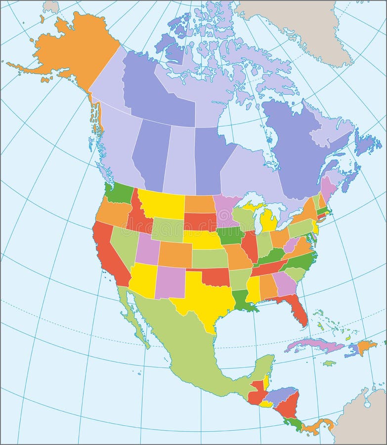
Free with trial Political map of North America with coordinates, present states borders, detailed vector map. Island state vectors North America political map. Political map of North America with coordinates, present states borders, detailed vector map.
Free with trial Australia 3D white map on gray isolated. Island state illustrations Australia 3D white map on gray
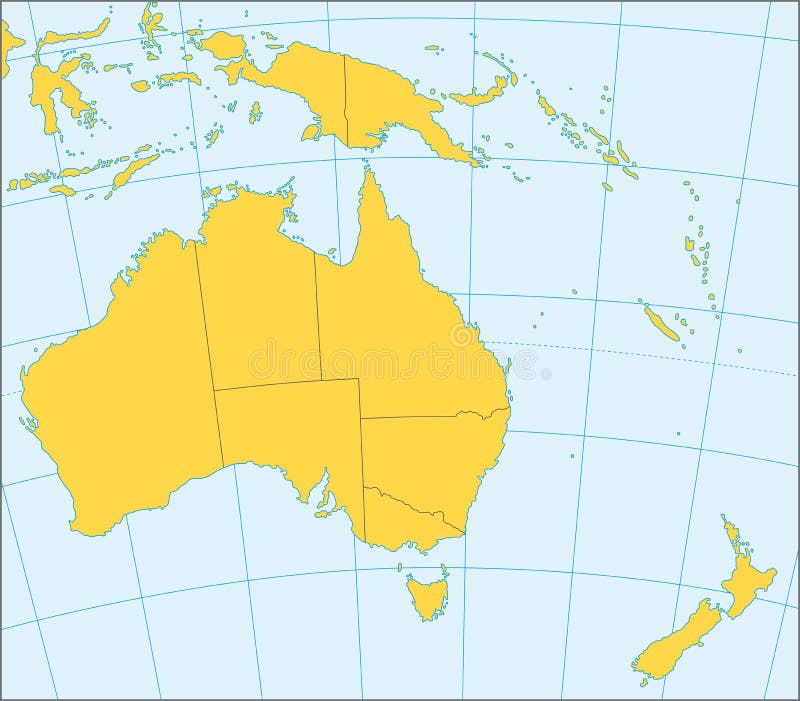
Free with trial Political map of Australia and Oceania with coordinates, present states borders, detailed vector map. Island state vectors Australia and Oceania political map. Political map of Australia and Oceania with coordinates, present states borders, detailed vector map.
Free with trial Detailed outline map of United States showing state borders, Great Lakes, and major bays; maps divide US into individual states, four regions, five regions, and six regions. Island state illustrations Four versions of regional map of United States. Detailed outline map of United States showing state borders, Great Lakes, and major bays; maps divide US into individual states, four regions, five regions, and six regions
Free with trial World map infographic template. All countries are selectable. Island state vectors World map infographic template
Free with trial High-quality Antique Map - Schagen. Island state illustrations High-quality Antique Map
Free with trial Mexico map designed in illustration with states colored in green colors and with the main cities. Neighbouring countries are in an additional format (. AI) in the latent layer. Island state vectors Vector Mexico map. Mexico map designed in illustration with states colored in green colors and with the main cities. Neighbouring countries are in an additional format (. AI) in the latent layer.
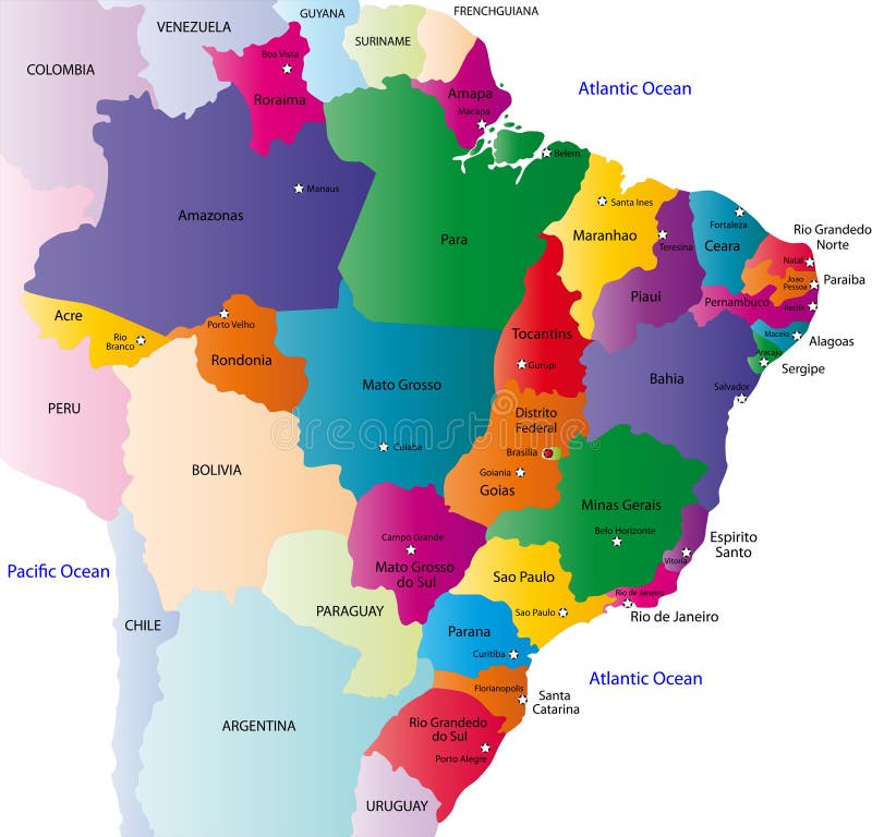
Free with trial Brazil map designed in illustration with the 26 states colored in bright colors and with the main cities. On an illustration neighbouring countries are shown too. Island state vectors Brazil map
Free with trial Vector illustration of a map and flag from Mexico. Island state vectors Mexico flag. Vector illustration of a map and flag from Mexico
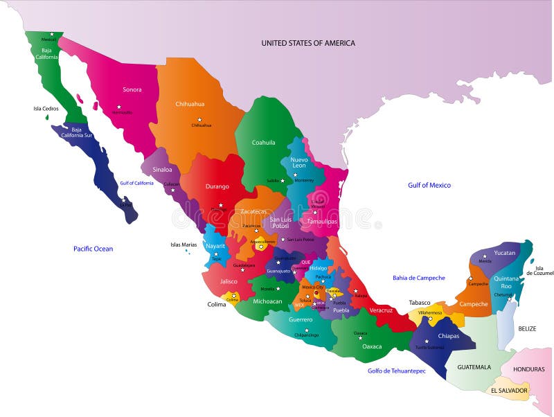
Free with trial Mexico map designed in illustration with the states colored in bright colors and with the main cities. On an illustration neighbouring countries are shown too. Island state vectors Map of Mexico. Mexico map designed in illustration with the states colored in bright colors and with the main cities. On an illustration neighbouring countries are shown too
Free with trial Vector set official national flags of the world. Country round shape flags collection with detailed emblems. Political background. Island state vectors Vector set official national flags of the world. Country round shape flags collection with detailed emblems.