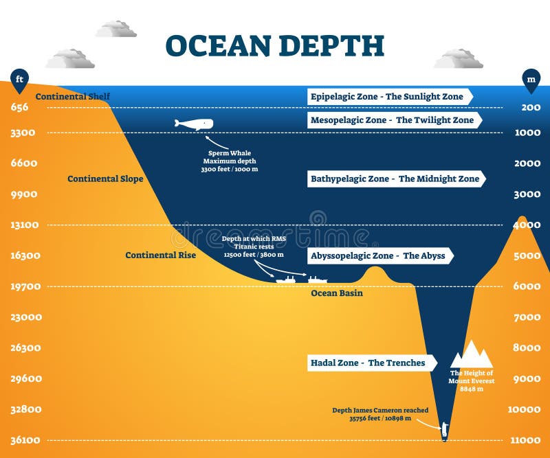
Free with trial Ocean depth zones infographic, vector illustration labeled diagram. Oceanography science educational graphic information. Depth at which sperm whales live and deepest point reached by human. Lowest point vectors Ocean depth zones infographic, vector illustration labeled diagram
Free with trial Illustration of a detailed political map of Slovakia. The black triangle indicates the highest point of Slovakia, while with the inverted triangle is represented the lowest point of the country. Lowest point vectors Slovakia map. Illustration of a detailed political map of Slovakia. The black triangle indicates the highest point of Slovakia, while with the inverted triangle is represented the lowest point of the country.
Free with trial Four Arrows Around a Circle Pointing Outwards [ file has clipping path]. Lowest point vectors 4 Arrows on a Circle. Four Arrows Around a Circle Pointing Outwards [ file has clipping path]
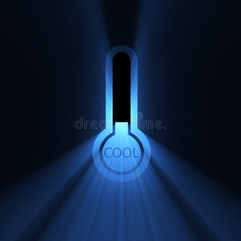
Free with trial Symbolic thermometer with powerful blue light lowering to below the icing point. Cold symbol. Extended flares for cropping. Lowest point illustrations Temperature cool chilly sign flare. Symbolic thermometer with powerful blue light lowering to below the icing point. Cold symbol. Extended flares for cropping.
Free with trial Eight Arrows Around a Circle Pointing Outwards From a Dot [jpeg file has clipping path]. Lowest point vectors 8 Arrows on a Circle. Eight Arrows Around a Circle Pointing Outwards From a Dot [jpeg file has clipping path]
Free with trial Four Arrows Pointing to a Dot Inside a Circle [ file has clipping path]. Lowest point vectors 4 Arrows in a Circle (in). Four Arrows Pointing to a Dot Inside a Circle [ file has clipping path]
Free with trial Declining Right Pointing Red Arrow Reflecting off Bottom Plane. Lowest point vectors Red Decline Arrow. Declining Right Pointing Red Arrow Reflecting off Bottom Plane
Free with trial Many two-way street or road signs with words Better and Best Price to illustrate confusion in comparison shopping and buying products for lowest cost. Lowest point illustrations Better Best Price Two Way Signs Shopping Buying Comparison. Many two-way street or road signs with words Better and Best Price to illustrate confusion in comparison shopping and buying products for lowest cost
Free with trial Curved Double Arrowhead Arrow With Reflection on Bottom Plane Pointing Up and Down. Lowest point vectors Wiggly Arrow. Curved Double Arrowhead Arrow With Reflection on Bottom Plane Pointing Up and Down
Free with trial Declining Right Pointing Arrow Reflecting off Bottom Plane (jpeg file has clipping path). Lowest point vectors Down Arrow. Declining Right Pointing Arrow Reflecting off Bottom Plane (jpeg file has clipping path)
Free with trial Affordable word on a green freeway sign to illustrate a great value or low cost sale or bargain price. Lowest point illustrations Affordable Best Value Low Price Words Freeway Sign. Affordable word on a green freeway sign to illustrate a great value or low cost sale or bargain price
Free with trial Red and yellow icon lowest prices with an exclamation point. Vector. Lowest point vectors Half Price Sticker. Vector. Red and yellow icon lowest prices with an exclamation point. Vector
Free with trial Arrow moving upward at a turning point of going down in a concept of better situation of crisis or granting a return on investment. Lowest point vectors Turning point of a situation concept. Arrow moving upward at a turning point of going down in a concept of better situation of crisis or granting a return on investment
Free with trial Winter Solstice marks the shortest day and longest night, signaling the start of winter as the sun reaches its lowest point in the sky. Lowest point vectors Winter Solstice The Shortest Day and Longest Night, Heralding the Start of Winter. Winter Solstice marks the shortest day and longest night, signaling the start of winter as the sun reaches its lowest point in the sky
Free with trial Absolute zero as lowest temperature limit for water freezing outline diagram. Labeled educational comparison scheme with Kelvin, celsius and fahrenheit scales vector illustration. Liquid state changes. Lowest point vectors Absolute zero as lowest temperature limit for water freezing outline diagram
Free with trial Drawing of manager atop peak bar of financial growth chart giving a helping hand to executive at lowest point of graph. Business metaphor for mentoring, helping hand, guidance, leadership, guidance. Lowest point illustrations Drawn Manager Pulling Executive Out Of Trough. Drawing of manager atop peak bar of financial growth chart giving a helping hand to executive at lowest point of graph. Business metaphor for mentoring, helping hand, guidance, leadership, guidance
Free with trial Path of Least Resistance Words on colored arrow signs pointing you to take the easiest route or way forward and avoiding conflict or difficulty. Lowest point illustrations Path of Least Resistance Word Arrow Signs Avoid Conflict Take Ea. Path of Least Resistance Words on colored arrow signs pointing you to take the easiest route or way forward and avoiding conflict or difficulty
Free with trial The words This Way to Savings on a golden compass to advertise a special sale or clearance event where a shopper can save big money. Lowest point illustrations This Way to Savings Compass Sale Clearance Blowout. The words This Way to Savings on a golden compass to advertise a special sale or clearance event where a shopper can save big money
Free with trial WPA poster art of Badwater Basin, an endorheic basin in Death Valley National Park Inyo County California lowest point in North America in works project or administration federal art project style. Lowest point vectors The Badwater Basin in Death Valley National Park Inyo County California United States of America WPA Poster Art. WPA poster art of Badwater Basin, an endorheic basin in Death Valley National Park Inyo County California lowest point in North America in works project or administration federal art project style
Free with trial The liquid pressure experiment shows water flowing from three tabs at different heights in a glass tank, demonstrating that pressure increases with depth. Lowest point vectors Liquid Pressure Experiment Demonstrating with a Glass Tank, Three Tabs, and Water. The liquid pressure experiment shows water flowing from three tabs at different heights in a glass tank, demonstrating that pressure increases with depth
Free with trial Vibrant view of Badwater basin, endorheic basin in Death Valley National Park, Death Valley, Inyo County California, USA. Lowest point illustrations Vibrant view of Badwater basin, endorheic basin in Death Valley National Park, Death Valley, Inyo County California, USA
Free with trial Vacuum energy bike taps into zero point energythe lowest possible energy state of a quantum mech. Lowest point illustrations Vacuum energy bike taps into zero point energythe lowest possibl
Free with trial Witness the breathtaking panorama of Death Valley's Badwater Basin, the lowest point in North America, situated dramatically below sea level. This desolate yet awe-inspiring landscape offers a unique perspective on the Earth's topography. The stark beauty of the basin, sculpted by eons of erosion, reveals a vast expanse of cracked earth, shimmering under the relentless desert sun. Imagine the. Lowest point illustrations Death Valleys Badwater Basin Lowest Point in North America a Stunning Landscape Below Sea Level. Witness the breathtaking panorama of Death Valley's Badwater Basin, the lowest point in North America, situated dramatically below sea level. This desolate yet awe-inspiring landscape offers a unique perspective on the Earth's topography. The stark beauty of the basin, sculpted by eons of erosion, reveals a vast expanse of cracked earth, shimmering under the relentless desert sun. Imagine the
Free with trial Wave Trough The lowest point of a wave, isolated on white background, photo vj. Lowest point illustrations Wave Trough The lowest point of a wave, isolated on white bacg. Wave Trough The lowest point of a wave, isolated on white background, photo vj
Free with trial Witness the breathtaking minimalism of Death Valley's Badwater Basin, the lowest point in North America. This captivating landscape photograph perfectly encapsulates the extreme heat and stark beauty of this unique desert environment. The image's palette is dominated by muted tones, ranging from the fiery hues of the sun-baked earth to the cool, almost ethereal shades of the receding shadows. Lowest point illustrations Death Valley Badwater Basin A Minimalist Masterpiece Capturing the Extreme Heat and Serenity of the Lowest Point in. Witness the breathtaking minimalism of Death Valley's Badwater Basin, the lowest point in North America. This captivating landscape photograph perfectly encapsulates the extreme heat and stark beauty of this unique desert environment. The image's palette is dominated by muted tones, ranging from the fiery hues of the sun-baked earth to the cool, almost ethereal shades of the receding shadows.
Free with trial Infographic style semi abstract concept of Stochastic Optimization. A single, luminous golden light particle navigates a complex, undulating landscape of transparent crystalline energy contours, making precise, probabilistic steps, ultimately settling at the lowest, most radiant emerald green point. Minimalist dark background. Lowest point illustrations Stochastic Optimization Precise Probabilistic Steps Radiant Emerald Green Point. Infographic style semi abstract concept of Stochastic Optimization. A single, luminous golden light particle navigates a complex, undulating landscape of transparent crystalline energy contours, making precise, probabilistic steps, ultimately settling at the lowest, most radiant emerald green point. Minimalist dark background.
Free with trial Diagram illustrating the transformation of kinetic and potential energy using a swing. The swing is depicted in three positions. At the peak positions, potential energy is at a maximum while kinetic energy is minimal. At the lowest point, kinetic energy is maximized, and potential energy is zero. Labels provide details such as "h 0, V max" for maximum kinetic energy and "h max, V 0" for maximum potential energy. Lowest point illustrations Transformations of kinetic and potential energy. Diagram illustrating the transformation of kinetic and potential energy using a swing. The swing is depicted in three positions. At the peak positions, potential energy is at a maximum while kinetic energy is minimal. At the lowest point, kinetic energy is maximized, and potential energy is zero. Labels provide details such as "h 0, V max" for maximum kinetic energy and "h max, V 0" for maximum potential energy.
Free with trial The image depicts a smooth, golden wave against a dark background. The wave has a distinct red section at its lowest point, creating a striking contrast with the surrounding gold. The overall composition is minimalistic and elegant, emphasizing the interplay of colors and shapes. Lowest point illustrations Golden wave with red center. The image depicts a smooth, golden wave against a dark background. The wave has a distinct red section at its lowest point, creating a striking contrast with the surrounding gold. The overall composition is minimalistic and elegant, emphasizing the interplay of colors and shapes
Free with trial Infographic style semi abstract concept of Stochastic Optimization. A single, luminous golden light particle navigates a complex, undulating landscape of transparent crystalline energy contours, making precise, probabilistic steps, ultimately settling at the lowest, most radiant emerald green point. Minimalist dark background. Lowest point illustrations Semi Abstract Stochastic Optimization Minimalist Dark Background Undulating Landscape. Infographic style semi abstract concept of Stochastic Optimization. A single, luminous golden light particle navigates a complex, undulating landscape of transparent crystalline energy contours, making precise, probabilistic steps, ultimately settling at the lowest, most radiant emerald green point. Minimalist dark background.
Free with trial The image depicts a smooth, golden wave against a dark background. The wave has a distinct red section at its lowest point, creating a striking contrast with the surrounding gold. The overall composition is minimalistic and elegant, emphasizing the interplay of colors and shapes. Lowest point illustrations Golden wave with red center. The image depicts a smooth, golden wave against a dark background. The wave has a distinct red section at its lowest point, creating a striking contrast with the surrounding gold. The overall composition is minimalistic and elegant, emphasizing the interplay of colors and shapes
Free with trial A digital illustration depicts a circular dreamcatcher suspended by a string against a deep black background, featuring an intricate flower of life geometric pattern at its center and multiple strands of feathers arranged in a descending size order from top to bottom, creating a delicate web-like formation that culminates with the largest feather at the lowest point, all set amidst a backdrop of. Lowest point illustrations A dreamcatcher with a flower of life design and feathers hanging against a starry night sky background. A digital illustration depicts a circular dreamcatcher suspended by a string against a deep black background, featuring an intricate flower of life geometric pattern at its center and multiple strands of feathers arranged in a descending size order from top to bottom, creating a delicate web-like formation that culminates with the largest feather at the lowest point, all set amidst a backdrop of
Free with trial A large, perfectly formed droplet of golden honey captured in a close-up studio setting. The honey exhibits a deep amber color and a highly viscous, glossy surface that reflects light intensely, giving it a luminous The droplet is rounded and substantial, with a smooth, unbroken surface, and a smaller bead of honey is beginning to form at its lowest point, indicating the continuous flow. Tiny,. Lowest point illustrations Thick golden honey forming a large, glossy droplet. a large, perfectly formed droplet of golden honey captured in a close-up studio setting. The honey exhibits a deep amber color and a highly viscous, glossy surface that reflects light intensely, giving it a luminous The droplet is rounded and substantial, with a smooth, unbroken surface, and a smaller bead of honey is beginning to form at its lowest point, indicating the continuous flow. Tiny,
Free with trial Infographic style semi abstract concept of Stochastic Optimization. A single, luminous golden light particle navigates a complex, undulating landscape of transparent crystalline energy contours, making precise, probabilistic steps, ultimately settling at the lowest, most radiant emerald green point. Minimalist dark background. Lowest point illustrations Luminous Golden Light Particle Navigates Crystalline Contours. Infographic style semi abstract concept of Stochastic Optimization. A single, luminous golden light particle navigates a complex, undulating landscape of transparent crystalline energy contours, making precise, probabilistic steps, ultimately settling at the lowest, most radiant emerald green point. Minimalist dark background.
Free with trial A detailed thermometer illustration features a vertical bar graph displaying temperature measurements in degrees Celsius, with clear axis labels including Absolute Zero and OK, showing the full range from 0 to 100 degrees Celsius where the highest temperature appears at the top and the lowest at the bottom, while additional markings indicate conversions to Fahrenheit with extremes reaching -80. Lowest point illustrations A thermometer with a vertical bar graph showing temperature range in degrees Celsius from absolute zero to boiling point. A detailed thermometer illustration features a vertical bar graph displaying temperature measurements in degrees Celsius, with clear axis labels including Absolute Zero and OK, showing the full range from 0 to 100 degrees Celsius where the highest temperature appears at the top and the lowest at the bottom, while additional markings indicate conversions to Fahrenheit with extremes reaching -80
Free with trial A classic high mountain view from a col (or saddle), the lowest point on a ridge between two peaks. The perspective looks through the col, with steep, rocky faces rising on both sides. Below, a glacier flows down a valley, its surface a river of ice. In the distance, more peaks and ridges are visible. The scene is about the passage through mountains, the connection between valleys, and the. Lowest point illustrations View from High Col Saddle with Peaks on Both Sides and Glacier Below. A classic high mountain view from a col (or saddle), the lowest point on a ridge between two peaks. The perspective looks through the col, with steep, rocky faces rising on both sides. Below, a glacier flows down a valley, its surface a river of ice. In the distance, more peaks and ridges are visible. The scene is about the passage through mountains, the connection between valleys, and the
Free with trial A minimalist circular clock face crafted from golden metal against a black background features a radial line graph at its center that visualizes time-position data of a human body, with the graph divided into distinct sections representing different temporal positions arranged in a radial pattern where the highest point sits at the top and the lowest at the bottom, highlighted by the white text. Lowest point illustrations A circular golden clock face with a black background displays a radial line graph showing time-position body data in minimalist. A minimalist circular clock face crafted from golden metal against a black background features a radial line graph at its center that visualizes time-position data of a human body, with the graph divided into distinct sections representing different temporal positions arranged in a radial pattern where the highest point sits at the top and the lowest at the bottom, highlighted by the white text
Free with trial Infographic style semi abstract concept of Stochastic Optimization. A single, luminous golden light particle navigates a complex, undulating landscape of transparent crystalline energy contours, making precise, probabilistic steps, ultimately settling at the lowest, most radiant emerald green point. Minimalist dark background. Lowest point illustrations Infographic Semi Abstract Stochastic Optimization Golden Light Particle. Infographic style semi abstract concept of Stochastic Optimization. A single, luminous golden light particle navigates a complex, undulating landscape of transparent crystalline energy contours, making precise, probabilistic steps, ultimately settling at the lowest, most radiant emerald green point. Minimalist dark background.
Free with trial A vibrant horizontal bar graph illustrates cumulative assessment scores with the x-axis labeled Cumulative Scores and the y-axis labeled Written Test, featuring six distinct bars colored in pink blue green orange yellow red purple and gray that represent different score levels arranged from highest at the top to lowest at the bottom, where the highest bar on the left signifies written test results. Lowest point illustrations Colorful horizontal bar graph showing cumulative scores from written tests and interviews with a legend explaining each data point. A vibrant horizontal bar graph illustrates cumulative assessment scores with the x-axis labeled Cumulative Scores and the y-axis labeled Written Test, featuring six distinct bars colored in pink blue green orange yellow red purple and gray that represent different score levels arranged from highest at the top to lowest at the bottom, where the highest bar on the left signifies written test results
Free with trial Discover the mesmerizing beauty of Badwater Basin, Death Valley's lowest point, through a captivating macro lens. This image unveils intricate patterns and reflections formed by the basin's unique salt flats. The interplay of light and shadow creates a captivating dance of textures, highlighting the crystalline structure of the salt. Each tiny facet of the salt reflects the surrounding landscape. Lowest point illustrations Stunning Macro Reflections of Badwater Basins Salt Flats in Death Valley National Park A CloseUp Exploration of Natures. Discover the mesmerizing beauty of Badwater Basin, Death Valley's lowest point, through a captivating macro lens. This image unveils intricate patterns and reflections formed by the basin's unique salt flats. The interplay of light and shadow creates a captivating dance of textures, highlighting the crystalline structure of the salt. Each tiny facet of the salt reflects the surrounding landscape
Free with trial Salt crust formations at Badwater Basin, Death Valley, USA, create an intricate pattern on the landscape. The surface is covered with crystallized salt, forming geometric shapes with raised edges. The salt crust is white with hints of earthy brown, reflecting sunlight under a clear blue sky. In the distance, rugged mountain ranges add to the stark contrast of the scene. Badwater Basin, at 282 feet below sea level, is the lowest point in North America, contributing to the unique salt formations. Lowest point illustrations Badwater Basin Death Valley - Masterpiece Salt Crust Landscape. Salt crust formations at Badwater Basin, Death Valley, USA, create an intricate pattern on the landscape. The surface is covered with crystallized salt, forming geometric shapes with raised edges. The salt crust is white with hints of earthy brown, reflecting sunlight under a clear blue sky. In the distance, rugged mountain ranges add to the stark contrast of the scene. Badwater Basin, at 282 feet below sea level, is the lowest point in North America, contributing to the unique salt formations.
Free with trial Salt crust formations at Badwater Basin, Death Valley, USA, create an intricate pattern on the landscape. The surface is covered with crystallized salt, forming geometric shapes with raised edges. The salt crust is white with hints of earthy brown, reflecting sunlight under a clear blue sky. In the distance, rugged mountain ranges add to the stark contrast of the scene. Badwater Basin, at 282 feet below sea level, is the lowest point in North America, contributing to the unique salt formations. Lowest point illustrations Badwater Basin Death Valley - Masterpiece Salt Crust Landscape. Salt crust formations at Badwater Basin, Death Valley, USA, create an intricate pattern on the landscape. The surface is covered with crystallized salt, forming geometric shapes with raised edges. The salt crust is white with hints of earthy brown, reflecting sunlight under a clear blue sky. In the distance, rugged mountain ranges add to the stark contrast of the scene. Badwater Basin, at 282 feet below sea level, is the lowest point in North America, contributing to the unique salt formations.
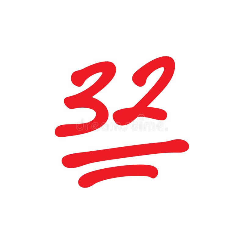
Free with trial 32 points mark, school test scores, thirty two point exam results, vector illustration. Lowest point vectors 32 points mark, school test scores, thirty two point exam results, vector illustration
Free with trial Witness the breathtaking beauty of Death Valley National Park's Badwater Basin, the lowest and hottest point in North America. This desolate yet captivating landscape showcases the park's extreme conditions. Charred, rocky terrain, sculpted by unrelenting sun and wind, meets a vast expanse of white salt flats that stretch to the horizon. The scene is framed by a brilliant, clear blue sky,. Lowest point illustrations Death Valleys Badwater Basin A Stunning Landscape of Extreme Heat and Vast Salt Flats Under a Clear Sky. Witness the breathtaking beauty of Death Valley National Park's Badwater Basin, the lowest and hottest point in North America. This desolate yet captivating landscape showcases the park's extreme conditions. Charred, rocky terrain, sculpted by unrelenting sun and wind, meets a vast expanse of white salt flats that stretch to the horizon. The scene is framed by a brilliant, clear blue sky,
Free with trial The image depicts a colorful temperature gauge displaying degrees in a range from 0 to 180. The gauge is segmented into various color-coded sections, representing different temperature ranges. The needle on the gauge points to a specific temperature, indicating the current reading. The colors transition smoothly from blue at the lowest temperature to red at the highest, passing through green,. Lowest point vectors Colorful temperature gauge displaying degrees
Free with trial The image presents a striking black line drawing of a heartbeat on a white background. The line forms a wave-like pattern, with the highest point at the center and the lowest point at the outer edge. The line is slightly thicker at the beginning and ends, creating a sense of depth and movement. The simplicity of the design, with its only two colors and a single line, makes it a powerful visual representation of the heartbeat. Lowest point illustrations A black line on a white background. The image presents a striking black line drawing of a heartbeat on a white background. The line forms a wave-like pattern, with the highest point at the center and the lowest point at the outer edge. The line is slightly thicker at the beginning and ends, creating a sense of depth and movement. The simplicity of the design, with its only two colors and a single line, makes it a powerful visual representation of the heartbeat.
Free with trial A wooden paddle displaying the number zero rests on a rich wood grain surface. Lowest point illustrations Number Zero on a Wooden Paddle The Starting Point. A wooden paddle displaying the number zero rests on a rich wood grain surface
Free with trial Rendered by AI This photograph captures the immense scale of an open-cast mine featuring deep concentric terraces and access roads curving down the sides. A large body of turquoise water has collected at the lowest point of the excavation creating a dramatic industrial landscape. Lowest point illustrations An aerial photograph shows a vast terraced open pit mine with water pooling at the lowest level. Rendered by AI This photograph captures the immense scale of an open-cast mine featuring deep concentric terraces and access roads curving down the sides. A large body of turquoise water has collected at the lowest point of the excavation creating a dramatic industrial landscape
Free with trial Experience the awe-inspiring beauty of Death Valley National Park Badwater Basin under a breathtaking sunset. This iconic desert landscape, one of the lowest points in North America, showcases the dramatic interplay of light and shadow against the arid, salt-encrusted flats. The fiery hues of the golden hour paint the sky in vibrant earth tones, while the rugged mountains and rock formations of. Lowest point illustrations Witness the Fiery Sunset over Badwater Basin in Death Valley National Park A Dramatic Landscape Panorama. Experience the awe-inspiring beauty of Death Valley National Park Badwater Basin under a breathtaking sunset. This iconic desert landscape, one of the lowest points in North America, showcases the dramatic interplay of light and shadow against the arid, salt-encrusted flats. The fiery hues of the golden hour paint the sky in vibrant earth tones, while the rugged mountains and rock formations of
Free with trial An abstract, high-tech image showcasing a vibrant red energy wave flowing across a dark, futuristic circuit board landscape. The wave intensifies into a dynamic vortex of glowing red particles at its lowest point, symbolizing deep data processing, artificial intelligence analysis, or a critical network event. Illuminated blue lines and subtle binary code in the background reinforce the cybernetic and digital themes. Ideal for concepts related to big data, machine learning, cybersecurity, and advanced technological innovation. Lowest point illustrations Digital Data Flow and AI Processing on Circuit Board. An abstract, high-tech image showcasing a vibrant red energy wave flowing across a dark, futuristic circuit board landscape. The wave intensifies into a dynamic vortex of glowing red particles at its lowest point, symbolizing deep data processing, artificial intelligence analysis, or a critical network event. Illuminated blue lines and subtle binary code in the background reinforce the cybernetic and digital themes. Ideal for concepts related to big data, machine learning, cybersecurity, and advanced technological innovation.
Free with trial This image depicts a contour map of a valley. The map shows varying elevations with contour lines indicating different heights. The highest point is at the top, and the lowest point is at the bottom, with the valley in the middle. The contour lines are closer together in some areas, indicating steeper slopes, while they are more spread out in others, indicating gentler slopes. Lowest point vectors Contour map of a valley Vector. This image depicts a contour map of a valley. The map shows varying elevations with contour lines indicating different heights. The highest point is at the top, and the lowest point is at the bottom, with the valley in the middle. The contour lines are closer together in some areas, indicating steeper slopes, while they are more spread out in others, indicating gentler slopes
Free with trial A stunning panoramic vista from Dante's View overlooking the vast expanse of Death Valley National Park, California. The image captures the immense scale of the valley floor, featuring the brilliant white salt flats of Badwater Basin, the lowest point in North America. Rugged, barren mountains frame the scene under a wide, partly cloudy sky. This iconic, arid landscape showcases the extreme and desolate beauty of the Mojave Desert, a popular destination for travel, hiking, and exploring unique geological formations. Lowest point illustrations Dante\'s View Overlooking Badwater Basin, Death Valley National Park. A stunning panoramic vista from Dante's View overlooking the vast expanse of Death Valley National Park, California. The image captures the immense scale of the valley floor, featuring the brilliant white salt flats of Badwater Basin, the lowest point in North America. Rugged, barren mountains frame the scene under a wide, partly cloudy sky. This iconic, arid landscape showcases the extreme and desolate beauty of the Mojave Desert, a popular destination for travel, hiking, and exploring unique geological formations.
Free with trial This striking image captures a huge, naturally formed salt crystal structure rising from the highly saline waters of the Dead Sea. The turquoise water contrasts sharply with the white, spiky salt formations and the arid brown landscape in the background. This geological wonder highlights the unique environment of the lowest point on Earth. Rendered by Ai. Lowest point illustrations Massive Salt Crystal Formation at the Dead Sea. This striking image captures a huge, naturally formed salt crystal structure rising from the highly saline waters of the Dead Sea. The turquoise water contrasts sharply with the white, spiky salt formations and the arid brown landscape in the background. This geological wonder highlights the unique environment of the lowest point on Earth. Rendered by Ai
Free with trial An abstract image of data streams in binary code shooting towards a blue wireframe landscape with a bright light illuminating the lowest point The scene suggests analysis of data trends insightful information processing advanced technology and futuristic perspectives. Lowest point illustrations Abstract data visualization with binary code streams illuminating wireframe landscape perfect for technology concepts. An abstract image of data streams in binary code shooting towards a blue wireframe landscape with a bright light illuminating the lowest point The scene suggests analysis of data trends insightful information processing advanced technology and futuristic perspectives
Free with trial This low-key studio photograph captures a delicate moment of equilibrium between polished metal and raw stone. A gleaming steel ball rests at the lowest point of a highly reflective, curving metallic surface. Rendered by Ai The composition features strong contrast, highlighting the sleekness of the curve against the rugged texture of the upright slate block. This abstract still life explores. Lowest point illustrations Dynamic balance of metal sphere and rough slate. This low-key studio photograph captures a delicate moment of equilibrium between polished metal and raw stone. A gleaming steel ball rests at the lowest point of a highly reflective, curving metallic surface. Rendered by Ai The composition features strong contrast, highlighting the sleekness of the curve against the rugged texture of the upright slate block. This abstract still life explores
Free with trial 5 stars golden icon five pointed vector. Lowest point vectors 5 stars golden icon five pointed
Free with trial A road in Estes Park. Rocky Mountain National Park is located in the north-central region of the U. S. state of Colorado. It features majestic mountain views, a variety of wildlife, varied climates and environments�'from wooded forests to mountain tundra�'and easy access to back-country trails and campsites. The park is located northwest of Boulder, Colorado in the Rockies, and includes the Continental Divide and the headwaters of the Colorado River. The park contains 359 miles (578 km) of trails, 150 lakes, and 450 miles (720 km) of streams. The park contains over 60 named peaks higher than 12,000 feet (3,700 m), and over one fourth of the park resides above tree line. The highest point of the park is Longs Peak, which rises to 14,259 feet (4,346 m surveys before 2002 show 14,255 feet (4,345 m) The lowest elevations in the park are montane forests and grassland. The ponderosa pine, which prefers drier areas, dominates, though at higher elevations douglas fir trees are found. Above 9,000 feet (2,700 m) the montane forests give way to the subalpine forest. Engelmann Spruce and Subalpine Fir trees are common in this zone. These forests tend to have more moisture than the montane and tend to be denser. Above tree line, at approximately 11,500 feet (3,500 m), trees disappear and the vast alpine tundra takes over. Due to harsh winds and weather, the plants in the tundra are short with very limited growing seasons. Streams have created lush riparian wetlands across the park. Lowest point illustrations The Road to the Majestic Peaks. A road in Estes Park. Rocky Mountain National Park is located in the north-central region of the U. S. state of Colorado. It features majestic mountain views, a variety of wildlife, varied climates and environments�'from wooded forests to mountain tundra�'and easy access to back-country trails and campsites. The park is located northwest of Boulder, Colorado in the Rockies, and includes the Continental Divide and the headwaters of the Colorado River. The park contains 359 miles (578 km) of trails, 150 lakes, and 450 miles (720 km) of streams. The park contains over 60 named peaks higher than 12,000 feet (3,700 m), and over one fourth of the park resides above tree line. The highest point of the park is Longs Peak, which rises to 14,259 feet (4,346 m surveys before 2002 show 14,255 feet (4,345 m) The lowest elevations in the park are montane forests and grassland. The ponderosa pine, which prefers drier areas, dominates, though at higher elevations douglas fir trees are found. Above 9,000 feet (2,700 m) the montane forests give way to the subalpine forest. Engelmann Spruce and Subalpine Fir trees are common in this zone. These forests tend to have more moisture than the montane and tend to be denser. Above tree line, at approximately 11,500 feet (3,500 m), trees disappear and the vast alpine tundra takes over. Due to harsh winds and weather, the plants in the tundra are short with very limited growing seasons. Streams have created lush riparian wetlands across the park.
Free with trial A road in Estes Park. Rocky Mountain National Park is located in the north-central region of the U. S. state of Colorado. It features majestic mountain views, a variety of wildlife, varied climates and environments�'from wooded forests to mountain tundra�'and easy access to back-country trails and campsites. The park is located northwest of Boulder, Colorado in the Rockies, and includes the Continental Divide and the headwaters of the Colorado River. The park contains 359 miles (578 km) of trails, 150 lakes, and 450 miles (720 km) of streams. The park contains over 60 named peaks higher than 12,000 feet (3,700 m), and over one fourth of the park resides above tree line. The highest point of the park is Longs Peak, which rises to 14,259 feet (4,346 m surveys before 2002 show 14,255 feet (4,345 m) The lowest elevations in the park are montane forests and grassland. The ponderosa pine, which prefers drier areas, dominates, though at higher elevations douglas fir trees are found. Above 9,000 feet (2,700 m) the montane forests give way to the subalpine forest. Engelmann Spruce and Subalpine Fir trees are common in this zone. These forests tend to have more moisture than the montane and tend to be denser. Above tree line, at approximately 11,500 feet (3,500 m), trees disappear and the vast alpine tundra takes over. Due to harsh winds and weather, the plants in the tundra are short with very limited growing seasons. Streams have created lush riparian wetlands across the park. Lowest point illustrations The Road to the Majestic Peaks. A road in Estes Park. Rocky Mountain National Park is located in the north-central region of the U. S. state of Colorado. It features majestic mountain views, a variety of wildlife, varied climates and environments�'from wooded forests to mountain tundra�'and easy access to back-country trails and campsites. The park is located northwest of Boulder, Colorado in the Rockies, and includes the Continental Divide and the headwaters of the Colorado River. The park contains 359 miles (578 km) of trails, 150 lakes, and 450 miles (720 km) of streams. The park contains over 60 named peaks higher than 12,000 feet (3,700 m), and over one fourth of the park resides above tree line. The highest point of the park is Longs Peak, which rises to 14,259 feet (4,346 m surveys before 2002 show 14,255 feet (4,345 m) The lowest elevations in the park are montane forests and grassland. The ponderosa pine, which prefers drier areas, dominates, though at higher elevations douglas fir trees are found. Above 9,000 feet (2,700 m) the montane forests give way to the subalpine forest. Engelmann Spruce and Subalpine Fir trees are common in this zone. These forests tend to have more moisture than the montane and tend to be denser. Above tree line, at approximately 11,500 feet (3,500 m), trees disappear and the vast alpine tundra takes over. Due to harsh winds and weather, the plants in the tundra are short with very limited growing seasons. Streams have created lush riparian wetlands across the park.
Free with trial This striking abstract image features a dynamic wave-like structure composed of a glossy translucent material. The form smoothly transitions from cool cyan to vibrant magenta across its length, creating a powerful visual gradient. Rendered by Ai, a lone perfectly formed liquid droplet hovers precisely above the lowest point of the twist, unifying the two colorful sections. This high-resolution. Lowest point illustrations Vibrant twisting fluid wave with a suspended droplet. This striking abstract image features a dynamic wave-like structure composed of a glossy translucent material. The form smoothly transitions from cool cyan to vibrant magenta across its length, creating a powerful visual gradient. Rendered by Ai, a lone perfectly formed liquid droplet hovers precisely above the lowest point of the twist, unifying the two colorful sections. This high-resolution
Free with trial Ai Masterpiece. This panoramic wide-angle photograph captures a large, multi-tiered open-pit mine, showcasing its distinctive concentric circular terraces. These levels, carved into the earth, are partially overgrown with lush green grass and small bushes, indicating a period of disuse and natural reclamation. At the lowest point of the excavation, two tranquil pools of water reflect the moody,. Lowest point illustrations A sweeping panoramic view of a vast terraced open pit mine under a cloudy sky. Ai Masterpiece. This panoramic wide-angle photograph captures a large, multi-tiered open-pit mine, showcasing its distinctive concentric circular terraces. These levels, carved into the earth, are partially overgrown with lush green grass and small bushes, indicating a period of disuse and natural reclamation. At the lowest point of the excavation, two tranquil pools of water reflect the moody,
Free with trial Ai Masterpiece. This panoramic wide-angle photograph captures a large, multi-tiered open-pit mine, showcasing its distinctive concentric circular terraces. These levels, carved into the earth, are partially overgrown with lush green grass and small bushes, indicating a period of disuse and natural reclamation. At the lowest point of the excavation, two tranquil pools of water reflect the moody,. Lowest point illustrations A sweeping panoramic view of a vast terraced open pit mine under a cloudy sky. Ai Masterpiece. This panoramic wide-angle photograph captures a large, multi-tiered open-pit mine, showcasing its distinctive concentric circular terraces. These levels, carved into the earth, are partially overgrown with lush green grass and small bushes, indicating a period of disuse and natural reclamation. At the lowest point of the excavation, two tranquil pools of water reflect the moody,
Free with trial The surreal Dead Sea landscape at sunrise, completely constructed from mineral mosaic tiles. The hyper-saline water glows with deep blue neon tiles, with salt crystals forming along the shore in white crystalline mosaic. People float effortlessly on the water, their bodies rendered in detailed mosaic figures. The surrounding desert mountains glow with orange and pink neon tiles in the morning. Lowest point illustrations Mosaic Dead Sea Israel Jordan Floating Salt. The surreal Dead Sea landscape at sunrise, completely constructed from mineral mosaic tiles. The hyper-saline water glows with deep blue neon tiles, with salt crystals forming along the shore in white crystalline mosaic. People float effortlessly on the water, their bodies rendered in detailed mosaic figures. The surrounding desert mountains glow with orange and pink neon tiles in the morning
Free with trial A striking visual representation of a significant economic downturn or stock market crash, featuring a bold red line graph plummeting sharply downwards, with a dramatic explosion effect at its lowest point. A subtle white line graph mirrors the initial volatility before the steep decline. The dark background with a grid pattern emphasizes the data-driven nature of the concept. This image powerfully conveys concepts of financial crisis, loss, risk, and market instability, suitable for news, business, and finance-related content. Lowest point illustrations Stock Market Crash and Economic Downturn Graph. A striking visual representation of a significant economic downturn or stock market crash, featuring a bold red. A striking visual representation of a significant economic downturn or stock market crash, featuring a bold red line graph plummeting sharply downwards, with a dramatic explosion effect at its lowest point. A subtle white line graph mirrors the initial volatility before the steep decline. The dark background with a grid pattern emphasizes the data-driven nature of the concept. This image powerfully conveys concepts of financial crisis, loss, risk, and market instability, suitable for news, business, and finance-related content.
Free with trial This image features a speedometer gauge isolated on a white background. The gauge displays speed measurements in miles per hour (MPH) ranging from 0 to 140. The gauge has distinct color zones: red for the lowest speeds, yellow for mid-range speeds, and black for the highest speeds. The needle points to the current speed, and the background is plain white, ensuring the gauge is the focal point of. Lowest point illustrations Speedometer gauge isolated on white background. This image features a speedometer gauge isolated on a white background. The gauge displays speed measurements in miles per hour (MPH) ranging from 0 to 140. The gauge has distinct color zones: red for the lowest speeds, yellow for mid-range speeds, and black for the highest speeds. The needle points to the current speed, and the background is plain white, ensuring the gauge is the focal point of
Free with trial A three-dimensional bar graph is depicted against a white background, illustrating a clear downward trend. The bars, transitioning from blue at the highest point to red at the lowest, decrease in height from left to right, visually representing a decline or loss. Lowest point illustrations 3D bar graph showing a downward trend with red and blue bars chart data. A three-dimensional bar graph is depicted against a white background, illustrating a clear downward trend. The bars, transitioning from blue at the highest point to red at the lowest, decrease in height from left to right, visually representing a decline or loss
Free with trial A conceptual image of a heavy, metallic anchor transforming into a swarm of colorful, light butterflies at its lowest point. Lowest point illustrations Rusty Anchor Transforming into Colorful Butterflies. A conceptual image of a heavy, metallic anchor transforming into a swarm of colorful, light butterflies at its lowest point
Free with trial The image depicts a serene sunset over a calm body of water. The sky is divided into three panels, each showing a different phase of the sunset. The leftmost panel shows the sun beginning to set, with a gradient of yellow and orange hues. The middle panel captures the sun at its lowest point, with a deep red and pink gradient. The rightmost panel shows the sun just below the horizon, with a. Lowest point illustrations Sunset over tranquil waters in three serene phases. The image depicts a serene sunset over a calm body of water. The sky is divided into three panels, each showing a different phase of the sunset. The leftmost panel shows the sun beginning to set, with a gradient of yellow and orange hues. The middle panel captures the sun at its lowest point, with a deep red and pink gradient. The rightmost panel shows the sun just below the horizon, with a
Free with trial This image depicts a three-dimensional surface with a gradient color scheme representing different elevations. The terrain appears to be layered, with a smooth gradient transitioning from yellow at the highest point, through orange and pink, to green and blue at the lowest. The image likely represents a topographical map or a visual representation of data in a three-dimensional space, emphasizing. Lowest point illustrations Color gradient 3d terrain surface with layered elevation. This image depicts a three-dimensional surface with a gradient color scheme representing different elevations. The terrain appears to be layered, with a smooth gradient transitioning from yellow at the highest point, through orange and pink, to green and blue at the lowest. The image likely represents a topographical map or a visual representation of data in a three-dimensional space, emphasizing

![Four Arrows Around a Circle Pointing Outwards [ file has clipping path]. Lowest point vectors](https://thumbs.dreamstime.com/b/4-arrows-circle-6692413.jpg)
![Eight Arrows Around a Circle Pointing Outwards From a Dot [jpeg file has clipping path]. Lowest point vectors](https://thumbs.dreamstime.com/b/8-arrows-circle-6692419.jpg)
![Four Arrows Pointing to a Dot Inside a Circle [ file has clipping path]. Lowest point vectors](https://thumbs.dreamstime.com/b/4-arrows-circle-6692402.jpg)