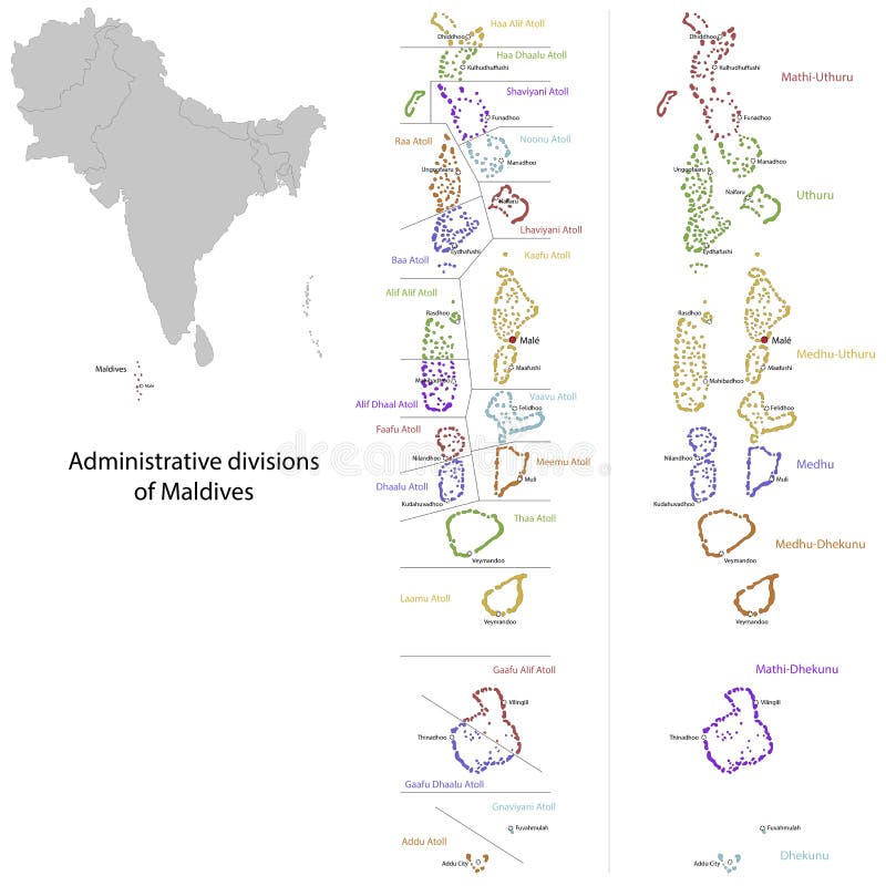
Free with trial Administrative division of the Republic of the Maldives. Maldives location map vectors Maldives map. Administrative division of the Republic of the Maldives
Free with trial Vector map of Maldives. Country map with division, cities and capital Male. Political map, world map, infographic elements. Maldives location map vectors Vector map of Maldives.
Free with trial Maldives vector map. Editable template with regions, cities, red pins and blue surface on white background. Maldives location map vectors Maldives map vector with red pin. Maldives vector map. Editable template with regions, cities, red pins and blue surface on white background
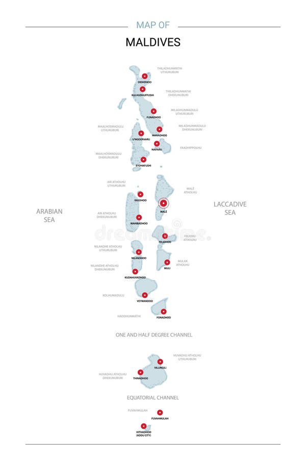
Free with trial Stylized vector Maldives map showing big cities, capital Male, administrative divisions. Maldives location map vectors Maldives map with administrative divisions. Stylized vector Maldives map showing big cities, capital Male, administrative divisions.
Free with trial Maldives map with borders, cities, capital and administrative divisions. Infographic vector map. Editable layers clearly labeled. Maldives location map vectors Maldives infographic map vector illustration. Maldives map with borders, cities, capital and administrative divisions. Infographic vector map. Editable layers clearly labeled.
Free with trial Maldives map on a world map with flag and map pointer. Vector illustration. Maldives location map illustrations Maldives map on a world map with flag and map pointer. Vector illustration
Free with trial Asia with highlighted Maldives map. Vector Illustration. Maldives location map vectors Asia with highlighted Maldives map
Free with trial Maldives islands map silhouette vector illustration Eps 10. Maldives location map vectors Maldives islands map silhouette vector
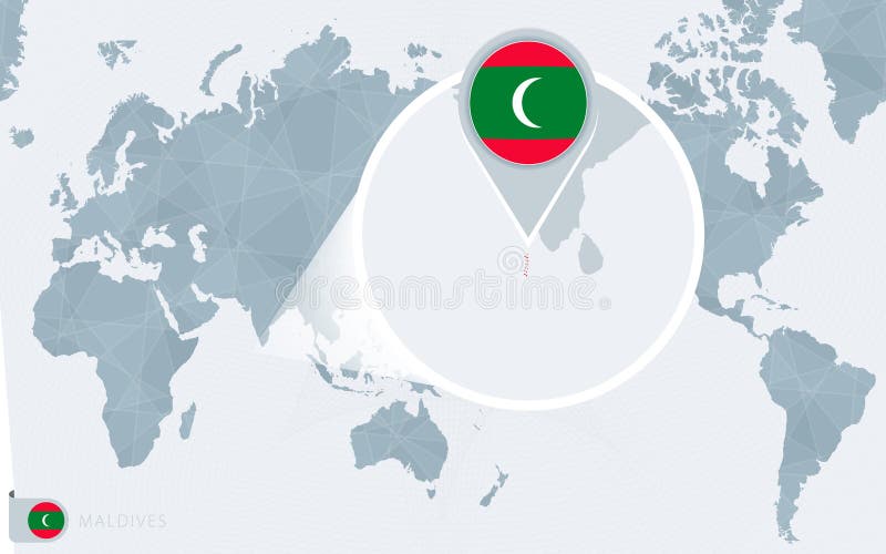
Free with trial Pacific Centered World map with magnified Maldives. Flag and map of Maldives on Asia in Center World Map. Maldives location map vectors Pacific Centered World map with magnified Maldives. Flag and map of Maldives
Free with trial Grunge rubber stamp or label with the name of Maldives, vector illustration. Maldives location map vectors Grunge rubber stamp or label with the name of Maldives
Free with trial Maldives location displayed on a clean world map with clear geographic context. Ideal for travel visuals, presentations, and informational design use. Maldives location map illustrations Maldives Map Location Pointer on Global Map. Maldives location displayed on a clean world map with clear geographic context. Ideal for travel visuals, presentations, and informational design use
Free with trial Maldives location displayed on a clean world map with clear geographic context. Ideal for travel visuals, presentations, and informational design use. Maldives location map illustrations Maldives Location Pointer on Regional Map. Maldives location displayed on a clean world map with clear geographic context. Ideal for travel visuals, presentations, and informational design use
Free with trial Maldives location displayed on a clean world map with clear geographic context. Ideal for travel visuals, presentations, and informational design use. Maldives location map illustrations Maldives Country Location on Flat World Map. Maldives location displayed on a clean world map with clear geographic context. Ideal for travel visuals, presentations, and informational design use
Free with trial Maldives location displayed on a clean world map with clear geographic context. Ideal for travel visuals, presentations, and informational design use. Maldives location map illustrations Maldives Location on Oval World Map Projection. Maldives location displayed on a clean world map with clear geographic context. Ideal for travel visuals, presentations, and informational design use
Free with trial Maldives location displayed on a clean world map with clear geographic context. Ideal for travel visuals, presentations, and informational design use. Maldives location map illustrations Maldives Location on World Map with Pin Marker. Maldives location displayed on a clean world map with clear geographic context. Ideal for travel visuals, presentations, and informational design use
Free with trial Maldives location displayed on a clean world map with clear geographic context. Ideal for travel visuals, presentations, and informational design use. Maldives location map illustrations Maldives Location Highlight on Minimal World Map. Maldives location displayed on a clean world map with clear geographic context. Ideal for travel visuals, presentations, and informational design use
Free with trial Maldives location displayed on a clean world map with clear geographic context. Ideal for travel visuals, presentations, and informational design use. Maldives location map illustrations Maldives Location Pin on World Map Travel Concept. Maldives location displayed on a clean world map with clear geographic context. Ideal for travel visuals, presentations, and informational design use
Free with trial Maldives highlighted on a detailed map, geographic location of Maldives. Vector Map. Maldives location map vectors Maldives highlighted on a detailed map, geographic location of Maldives
Free with trial Maldives Location Highlighted on Asian Map with Flag Icon. Detailed Vector Design. Maldives location map vectors Maldives Location Highlighted on Asian Map with Flag Icon
Free with trial Highlighted Maldives on Global Map with 3D Flag Location Pin of Maldives. The image symbolizes travel, geography, international identity, and global navigation. Maldives location map vectors Highlighted Maldives on Global Map with 3D Flag Location Pin of Maldives
Free with trial Maldives location displayed on a clean world map with clear geographic context. Ideal for travel visuals, presentations, and informational design use. Maldives location map illustrations Maldives Map Pin on World Map. Maldives location displayed on a clean world map with clear geographic context. Ideal for travel visuals, presentations, and informational design use
Free with trial Maldives location displayed on a clean world map with clear geographic context. Ideal for travel visuals, presentations, and informational design use. Maldives location map illustrations Maldives City Location Highlight on Globe. Maldives location displayed on a clean world map with clear geographic context. Ideal for travel visuals, presentations, and informational design use
Free with trial Maldives location displayed on a clean world map with clear geographic context. Ideal for travel visuals, presentations, and informational design use. Maldives location map illustrations Maldives Location on Globe with Pin Marker. Maldives location displayed on a clean world map with clear geographic context. Ideal for travel visuals, presentations, and informational design use
Free with trial Male capital city of Maldives,Urban Streets Roads Map with city center location pin, illustration vector element image. Maldives location map vectors Male,Maldives,Urban Streets Roads Map with location pin. Male capital city of Maldives,Urban Streets Roads Map with city center location pin, illustration vector element image
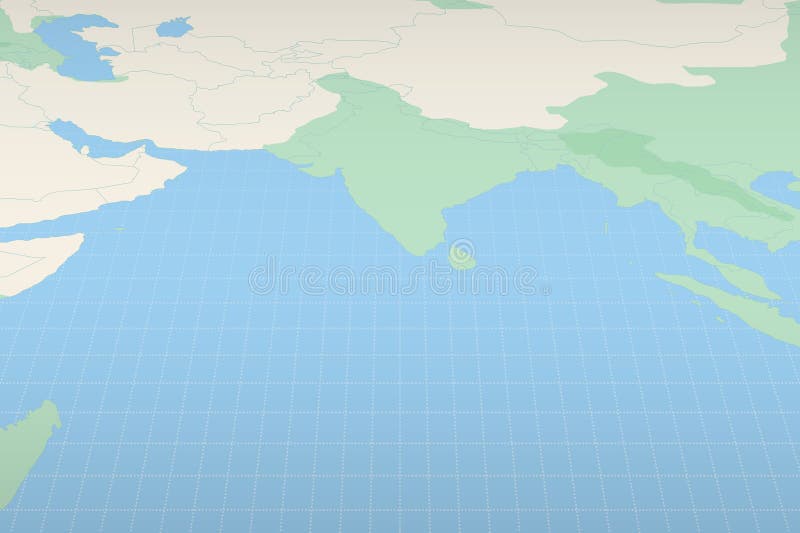
Free with trial Locator map showing the location of the country Maldives on a map of the corresponding continental area. Maldives location map vectors Locator map showing the location of Maldives. Locator map showing the location of the country Maldives on a map of the corresponding continental area.
Free with trial Discover the breathtaking beauty of the Maldives, a scattered archipelago of idyllic islands nestled in the Indian Ocean. This aerial view showcases the unique location of this tropical paradise on a world map, highlighting its secluded position amidst turquoise waters. The image reveals the intricate network of lagoons and coral reefs that surround these pristine islands. Imagine the crystal-. Maldives location map illustrations Unveiling the Maldives A Stunning Aerial Perspective of a Tropical Island Paradise Located on a World Map. Discover the breathtaking beauty of the Maldives, a scattered archipelago of idyllic islands nestled in the Indian Ocean. This aerial view showcases the unique location of this tropical paradise on a world map, highlighting its secluded position amidst turquoise waters. The image reveals the intricate network of lagoons and coral reefs that surround these pristine islands. Imagine the crystal-
Free with trial Seychelles, Maldives, Mauritius flags map pins isolated icons vector illustration. Tropical islands countries national flags location points. Official symbols stickers signs, markers badges. Maldives location map vectors Seychelles, Maldives, Mauritius flags map pins isolated icons vector illustration. Tropical islands countries national
Free with trial Immerse yourself in the breathtaking beauty of the Maldives with this panoramic map image. A clean, white background showcases a detailed world map, with prominent map pointers specifically highlighting the archipelago's location. The vibrant national flag of the Maldives is prominently displayed, adding a touch of national pride to this visually engaging resource. Perfect for travel brochures,. Maldives location map illustrations Discover the Maldives A Panoramic Map Highlights This Tropical Paradise with Its National Flag Ideal for Travel Guides. Immerse yourself in the breathtaking beauty of the Maldives with this panoramic map image. A clean, white background showcases a detailed world map, with prominent map pointers specifically highlighting the archipelago's location. The vibrant national flag of the Maldives is prominently displayed, adding a touch of national pride to this visually engaging resource. Perfect for travel brochures,
Free with trial Stylized Map of Maldives with Neighboring Areas. Map in a modern, minimalistic style with soft gradient colors. Maldives location map vectors Stylized Map of Maldives with Neighboring Areas
Free with trial Map silhouette of Maldives. Country outline graphic. Island nation shape. Isolated illustration on white background. Maldives location map illustrations Black silhouette of Maldives map with text Maldives illustration. Map silhouette of Maldives. Country outline graphic. Island nation shape. Isolated illustration on white background
Free with trial Detailed map of Addu Atoll, Maldives. Maldives location map vectors Detailed map of Addu Atoll, Maldives
Free with trial Maldives Male Map and Lettering Design on White. Maldives location map illustrations Maldives Male Map and Lettering Design
Free with trial Maldives Naifaru Map and Lettering Design on White. Maldives location map illustrations Maldives Naifaru Map and Lettering Design
Free with trial Maldives Hithadhoo Map and Lettering Design on White. Maldives location map illustrations Maldives Hithadhoo Map and Lettering Design
Free with trial Maldives Fuvahmulah Map and Lettering Design on White. Maldives location map illustrations Maldives Fuvahmulah Map and Lettering Design
Free with trial Maldives Kulhudhuffushi Map and Lettering Design on White. Maldives location map illustrations Maldives Kulhudhuffushi Map and Lettering Design
Free with trial Vintage Map Of Maldives With Atolls On Retro Paper Background. Maldives location map illustrations Vintage Map Of Maldives With Atolls On Retro Paper
Free with trial Maldives island map symbol shape, travel web flat concept icon vector illustration. Maldives location map vectors Maldives island map symbol shape, travel web flat concept icon vector illustration
Free with trial Maldives island map symbol shape, travel web flat concept icon vector illustration. Maldives location map vectors Maldives island map symbol shape, travel web flat concept icon vector illustration
Free with trial Maldives map silhouette vector shape outline tropical islands palm trees travel destination tourism geography graphic. Maldives location map vectors Stylized maldives islands map silhouette vector outline shape with tropical palm trees on coastline. Maldives map silhouette vector shape outline tropical islands palm trees travel destination tourism geography graphic
Free with trial 3D Isometric Map Highlighting Maldives in Red. Vector illustration. Maldives location map vectors 3D Isometric Map Highlighting Maldives in Red
Free with trial Maldives Map in Blue with Gold Framed Accents. Modern Vector Map of Maldives. Vector Illustration. Maldives location map vectors Maldives Map in Blue with Gold Framed Accents. Modern Vector Map of Maldives
Free with trial Maldives Map Under Magnifying Glass with National Flag Overlay. The image represents geographical focus, national identity, and exploration. Maldives location map vectors Maldives Map Under Magnifying Glass with National Flag Overlay
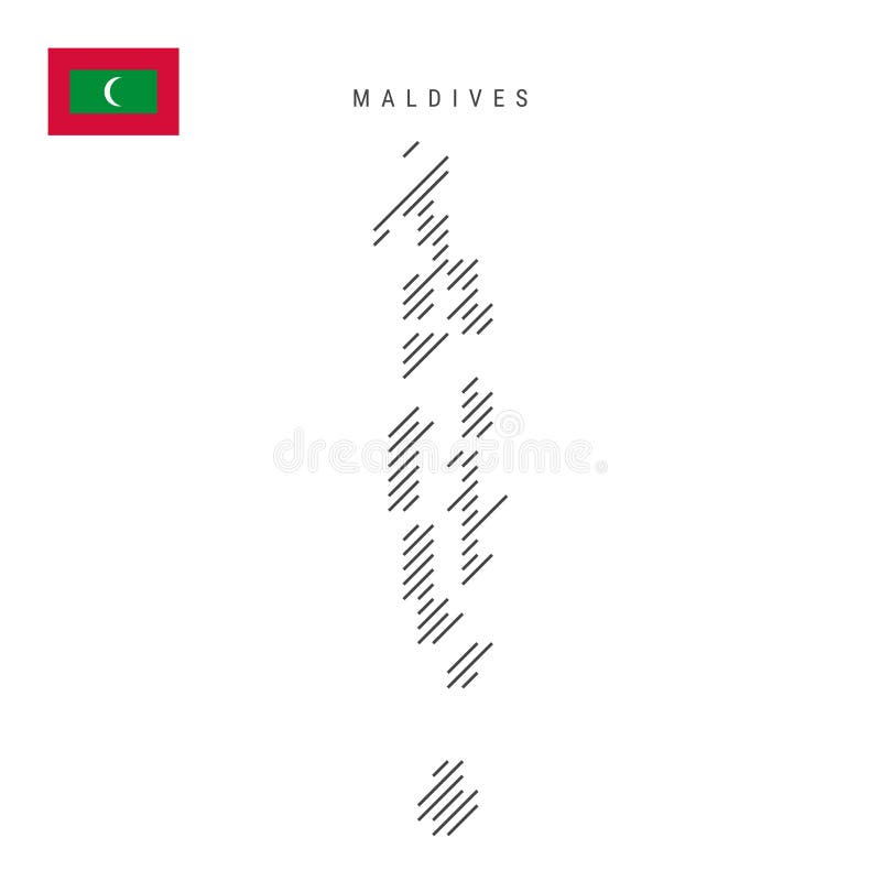
Free with trial Maldives map from pattern of black slanted parallel lines. Maldivian map with gray diagonal lines. Silhouette of a country made of oblique hatching. Vector illustration isolated on white. Maldives location map illustrations Maldives map from pattern of black slanted parallel lines. Flat vector illustration isolated on white. Maldives map from pattern of black slanted parallel lines. Maldivian map with gray diagonal lines. Silhouette of a country made of oblique hatching. Vector illustration isolated on white.
Free with trial This vibrant political map of the Maldives provides a comprehensive overview of the island nation's geography and political boundaries. The map clearly identifies the capital city, Male, along with other key urban centers, showcasing their locations relative to the archipelago's numerous islands. It also highlights the neighboring countries, including Sri Lanka and India, offering a visual. Maldives location map illustrations Detailed Political Map of the Maldives Exploring the Capital Major Cities and Surrounding Nations. This vibrant political map of the Maldives provides a comprehensive overview of the island nation's geography and political boundaries. The map clearly identifies the capital city, Male, along with other key urban centers, showcasing their locations relative to the archipelago's numerous islands. It also highlights the neighboring countries, including Sri Lanka and India, offering a visual
Free with trial Maldives Map Pin with National Flag on Open World Map. Perfect for use in travel guides, geography content, global positioning concepts, and international business themes. Maldives location map vectors Maldives Map Pin with National Flag on Open World Map
Free with trial Maldives Highlighted in Flag Colors on Geographic Map. Modern Map on a dark abstract backdrop. Maldives location map vectors Maldives Highlighted in Flag Colors on Geographic Map
Free with trial Maldives Flag Map Pointer Design with Shadow. Vector illustrator. Maldives location map vectors Maldives Flag Map Pointer Design with Shadow
Free with trial A Maldives flag map on white background with clipping path 3d illustration. Maldives location map illustrations Maldives flag map with clipping path. A Maldives flag map on white background with clipping path 3d illustration
Free with trial Maldives Map Highlighted with Flag Marker. Flag Pointer on Geographic Map. Maldives location map vectors Maldives Map Highlighted with Flag Marker
Free with trial Maldives waving flag, round circle sticker badge, heart shaped icon, map pin. Maldivian flag buttons of different shapes. Vector illustration isolated on white. Maldives location map vectors Maldives waving flag, circle badge, heart shaped, map pin. Flat vector illustration isolated. Maldives waving flag, round circle sticker badge, heart shaped icon, map pin. Maldivian flag buttons of different shapes. Vector illustration isolated on white.
Free with trial Maldives Map Markers Set. Perfect for projects related to Maldives, travel, geography, and international representation. Vector collection. Maldives location map vectors Maldives Map Markers Set. Perfect for projects related to Maldives, travel, geography, and international representation
Free with trial View of the earth from space showing the location of the country Maldives in the center of the image. Maldives location map illustrations View of the earth from space showing the location of Maldives. View of the earth from space showing the location of the country Maldives in the center of the image.
Free with trial Collection of flags and coats of arms of Maldives in flat style with map and text. Maldives location map vectors Collection of flat national flags of Maldives with map. Collection of flags and coats of arms of Maldives in flat style with map and text.
Free with trial Vintage Map Of South Asia On Retro Paper Background. Maldives location map illustrations Vintage Map Of South Asia On Retro Paper
Free with trial Vintage Map Of Sri Lanka With Provinces On Retro Paper Background. Maldives location map illustrations Vintage Map Of Sri Lanka With Provinces On Retro Paper
Free with trial Detailed 3D topographic map of Maldives, South Asia, Isolated White Background. Maldives location map illustrations Geography of Maldives in 3D isometric view. Detailed 3D topographic map of Maldives, South Asia, Isolated White Background. Detailed 3D topographic map of Maldives, South Asia, Isolated White Background.
Free with trial Detailed 3D topographic map showcasing South Asia. Features include terrain elevation rivers and major city locations. Perfect for geography projects educational materials or travel presentations. Maldives location map illustrations 3D Topographic Map of South Asia Good Resolution Stock Photo. Detailed 3D topographic map showcasing South Asia. Features include terrain elevation rivers and major city locations. Perfect for geography projects educational materials or travel presentations.
Free with trial Maldives flag ribbon icon for patriotic, cultural, or national-themed designs. Vector illustration. Maldives location map vectors Maldives flag ribbon icon for patriotic, cultural, or national designs. Vector illustration.
Free with trial Maldives Flag Pin Icon with Geometric Design. Vector illustration. Maldives location map vectors Maldives Flag Pin Icon with Geometric Design
Free with trial Maldives flag wavy ribbon abstract background. Vector illustration. Maldives location map vectors Maldives flag wavy ribbon background. Vector illustration.
Free with trial Maldives flag wavy abstract background layout. Vector illustration. Maldives location map vectors Maldives flag wavy background layout. Vector illustration.
Free with trial Flags of Maldives. Flat element design. National Flag. White isolated background. Maldives location map vectors Flags of Maldives
Free with trial A stunning satellite image showcasing the Indian subcontinent, highlighting its diverse geography. The image features detailed land formations, including the Himalayas, the vast plains of the Ganges, and the coastline. Clouds are visible, adding depth and realism. Ideal for educational materials, travel guides, documentaries, and geographical studies. Maldives location map illustrations Satellite View of the Indian Subcontinent. A stunning satellite image showcasing the Indian subcontinent, highlighting its diverse geography. The image features detailed land formations, including the Himalayas, the vast plains of the Ganges, and the coastline. Clouds are visible, adding depth and realism. Ideal for educational materials, travel guides, documentaries, and geographical studies.
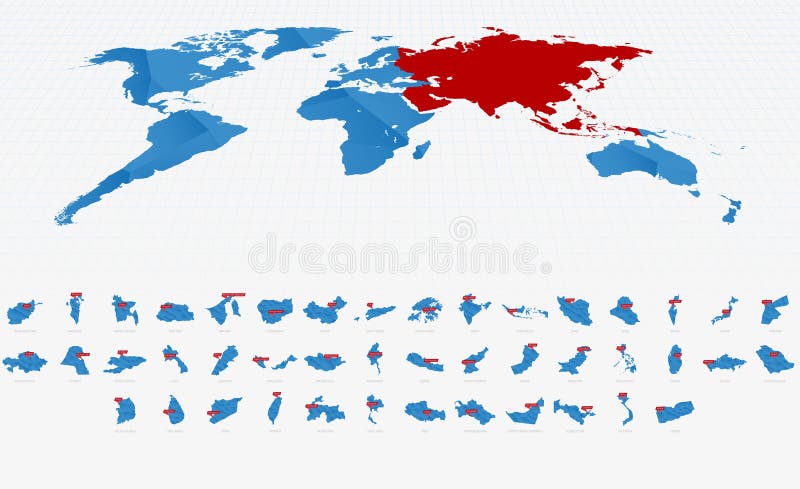
Free with trial Low Poly Blue Gradient Maps of Asia with Capital City Signs. Maps Collection. Maldives location map vectors Low Poly Blue Gradient Maps of Asia with Capital City Signs
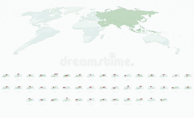
Free with trial Curved Paper Style Maps of Asia with Capital Cities. Vector Collection of Asia Maps. Maldives location map vectors Curved Paper Style Maps of Asia with Capital Cities. Vector Collection of Asia Maps
Free with trial Set of vector flags of world countries ilustrator. Maldives location map vectors Set of vector flags of world countries
Free with trial Vector set of brush strokes with flags of the world and with shadow. Maldives location map vectors Brush stroke with flags of the world. Vector set of brush strokes with flags of the world and with shadow.
Free with trial Set of round 3D buttons of national flags of different countries. Maldives location map vectors Set of round 3D buttons of national flags
Free with trial Asian Maps and Flags in Isometric Style. Isometric Maps Collection. Maldives location map vectors Asian Maps and Flags in Isometric Style. Isometric Maps Collection
Free with trial Maldives Location Map on map South Asia. 3d Maldives flag map marker location pin. High quality map of Republic of Maldives Republic. South Asia. Vector illustration EPS10. Maldives location map vectors Maldives Location Map on map South Asia. 3d Maldives flag map marker location pin. High quality map of Republic of Maldives Republ
Free with trial Maldives map in Asia zoom version, icons showing Maldives location and flags, Maldives map. Maldives location map vectors Maldives map in Asia zoom version, icons showing Maldives location and flags
Free with trial Location of Maldives on the World Map with Enlarged Map of Maldives with Flag. Geographical Vector Template for your design. Maldives location map vectors Location of Maldives on the World Map with Enlarged Map of Maldives with Flag
Free with trial Maldives map, stylish location icon with Maldives map and flag. Green pin icon. Maldives location map vectors Maldives map, stylish location icon with Maldives map and flag
Free with trial Maldives map in Asia, icons showing Maldives location and flags, Maldives map. Maldives location map vectors Maldives map in Asia, icons showing Maldives location and flags
Free with trial Location of Maldives on the world map, marked with Maldives flag pin. Cartographic vector illustration. Maldives location map vectors Location of Maldives on the world map, marked with Maldives flag pin
Free with trial Maldives is depicted on a folded paper map and pinned location marker with flag of Maldives. Folded vector map. Maldives location map vectors Maldives is depicted on a folded paper map and pinned location marker with flag of Maldives