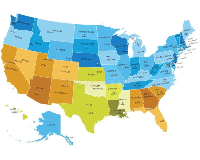
Free with trial USA states map with names of cities. Eps file contains separate layers with state and sities name, boundaries and layer with counties. Map colorado counties vectors USA map with names of states. USA states map with names of cities. Eps file contains separate layers with state and sities name, boundaries and layer with counties.
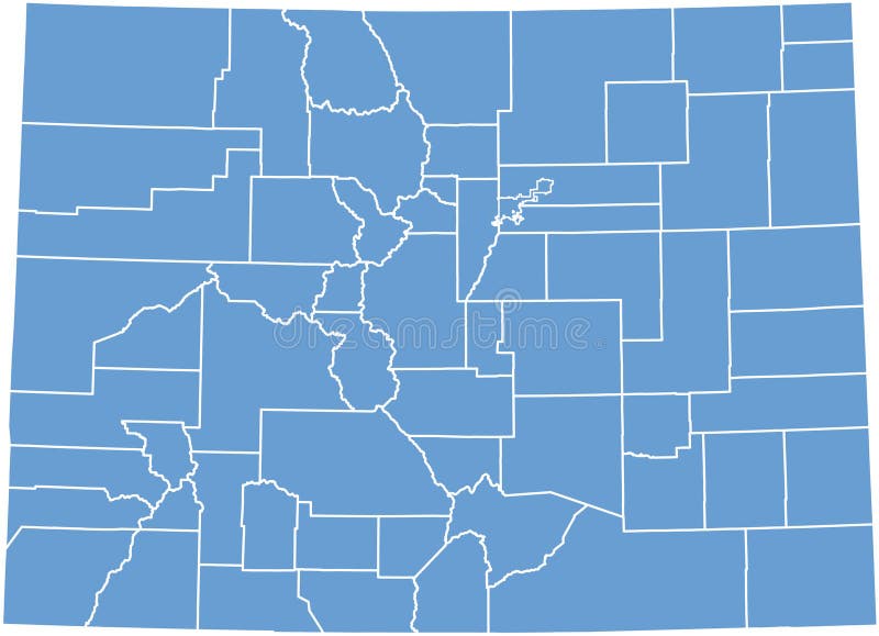
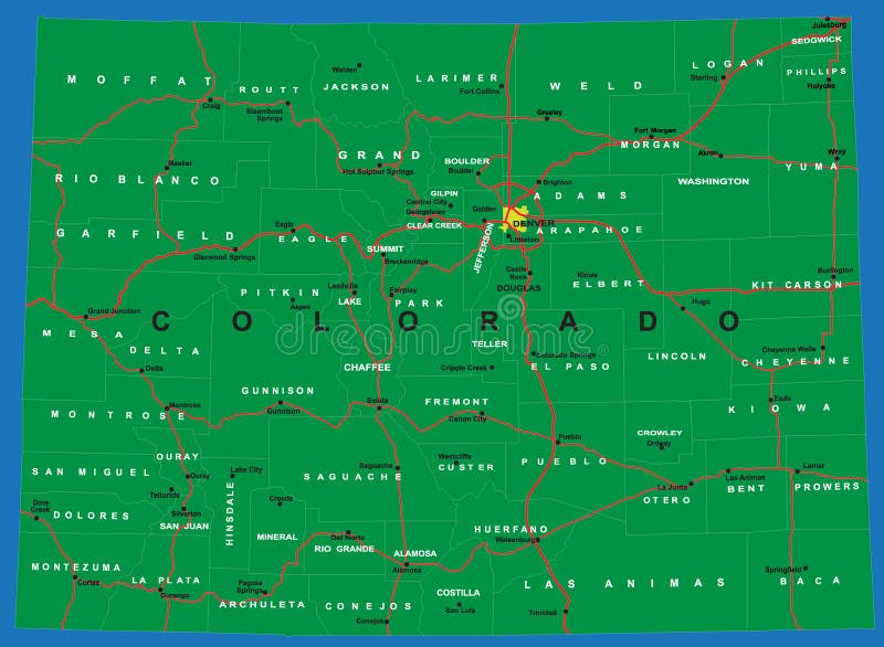
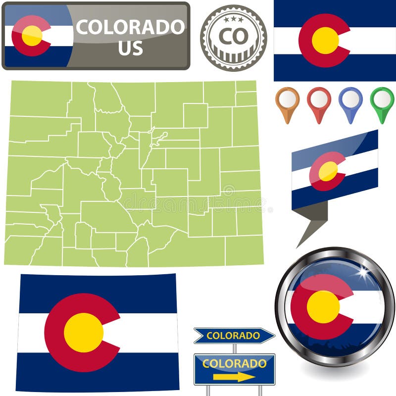
Free with trial Colorado state vector map by counties. Map colorado counties vectors Colorado State map by counties. Colorado state vector map by counties
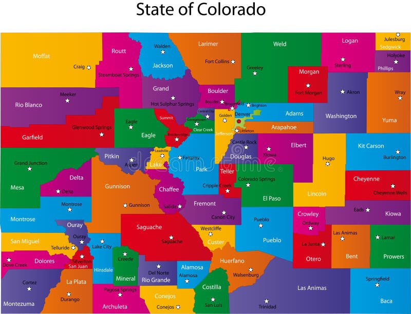
Free with trial Map of Colorado state designed in illustration with the counties and the county seats. Map colorado counties vectors Map of Colorado
Free with trial Map of Colorado state designed in illustration with the counties and the county seats. Map colorado counties vectors State of Colorado. Map of Colorado state designed in illustration with the counties and the county seats.
Free with trial Colorado County Map with 64 counties, county seats, and neighboring states/country. Each county and neighboring states/country is an individual object. Map colorado counties vectors Colorado county map
Free with trial Topographic Relief Peaks and Valleys Map of US Federal State of Colorado. Map colorado counties vectors Colorado Relief Map. Topographic Relief Peaks and Valleys Map of US Federal State of Colorado
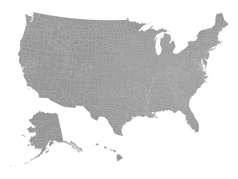
Free with trial Vector illustration of the Gray Counties Map of the United States of America. Map colorado counties vectors Gray Counties Map of the United States of America
Free with trial Colorado vector State Map with Community Assistance and Activates Icons Original pastel Illustration isolated on gray background. Map colorado counties vectors Colorado vector State Map with Community Assistance and Activate
Free with trial 3D grass map of 25 United States including: Alabama AL Alaska AK Arizona AZ Arkansas AR California CA Colorado CO Connecticut CT Delaware DE Florida FL Georgia GA Hawaii HI Idaho ID Illinois IL Indiana IN Iowa IA Kansas KS Kentucky KY Louisiana LA Maine ME Maryland MD Massachusetts MA Michigan MI Minnesota MN Mississippi MS Missouri MO. Map colorado counties illustrations US State Maps Set I. 3D grass map of 25 United States including: Alabama AL Alaska AK Arizona AZ Arkansas AR California CA Colorado CO Connecticut CT Delaware DE Florida FL Georgia GA Hawaii HI Idaho ID Illinois IL Indiana IN Iowa IA Kansas KS Kentucky KY Louisiana LA Maine ME Maryland MD Massachusetts MA Michigan MI Minnesota MN Mississippi MS Missouri MO
Free with trial Set of county maps of USA states Virginia,Washington,West Virginia,Wisconsin,Wyoming. Map colorado counties vectors Maps counties USA states. Set of county maps of USA states Virginia,Washington,West Virginia,Wisconsin,Wyoming.
Free with trial Set of county maps of USA states South Carolina,South Dakota,Tennessee,Texas,Utah,Vermont. Map colorado counties vectors Maps counties USA states. Set of county maps of USA states South Carolina,South Dakota,Tennessee,Texas,Utah,Vermont.
Free with trial Detailed and accurate illustration of map of Colorado. Map colorado counties vectors Map of Colorado
Free with trial Colorado - Kansas - Oklahoma - Missouri Map labelled black illustration. Map colorado counties illustrations Colorado - Kansas - Oklahoma - Missouri Map labelled black
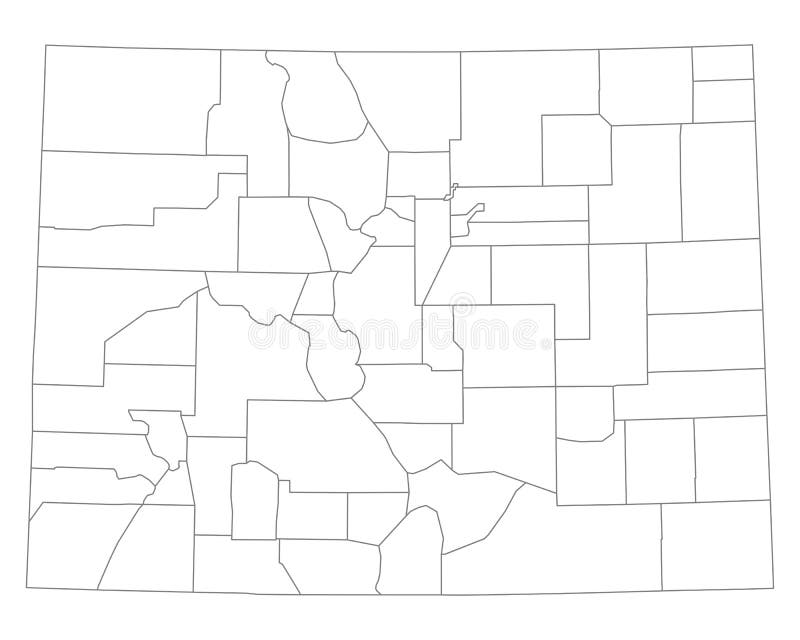
Free with trial A large and detailed map of the State of Colorado with every county. Map colorado counties vectors Colorado county map. A large and detailed map of the State of Colorado with every county.
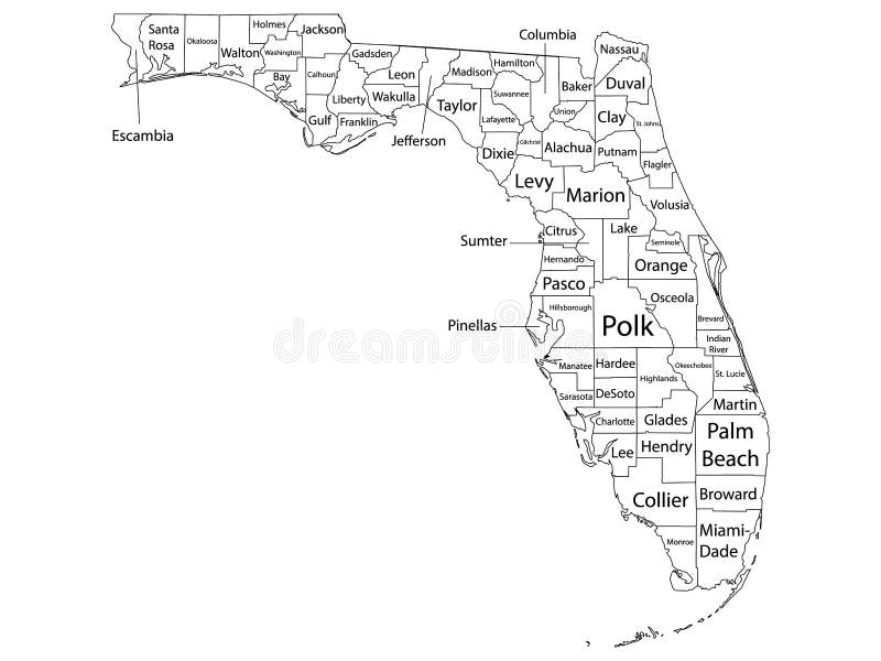
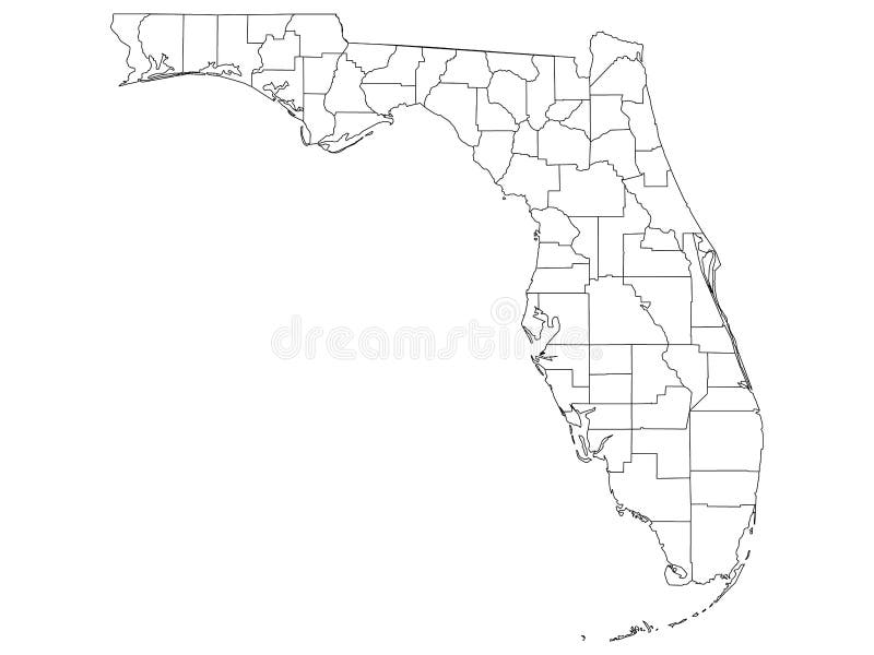
Free with trial White Outline Counties Map With Counties Names of US State of Florida. Map colorado counties vectors Counties Map of US State of Florida. White Outline Counties Map With Counties Names of US State of Florida
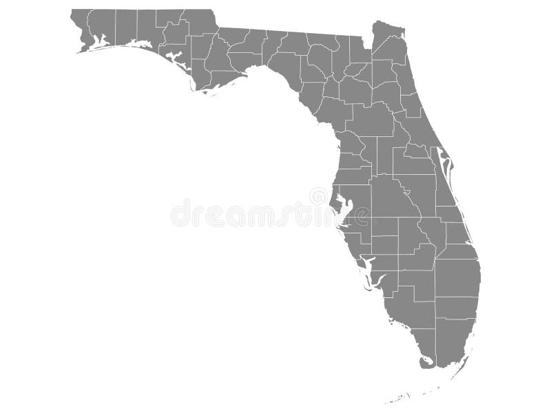
Free with trial Gray Outline Counties Map of US State of Florida. Map colorado counties vectors Counties Map of US State of Florida
Free with trial White Outline Counties Map of US State of Mississippi. Map colorado counties vectors Counties Map of US State of Mississippi
Free with trial White Outline Counties Map of US State of Florida. Map colorado counties vectors Counties Map of US State of Florida
Free with trial Gray Outline Counties Map of US State of Michigan. Map colorado counties vectors Counties Map of US State of Michigan
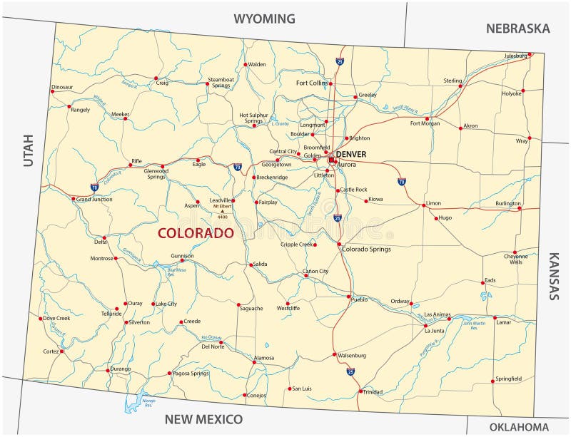
Free with trial Highly detailed vector map of Colorado,with counties,main cities and roads. Map colorado counties vectors State of Colorado political map. Highly detailed vector map of Colorado,with counties,main cities and roads.
Free with trial Street map of the US state Colorado. Map colorado counties vectors Colorado road map. Street map of the US state Colorado
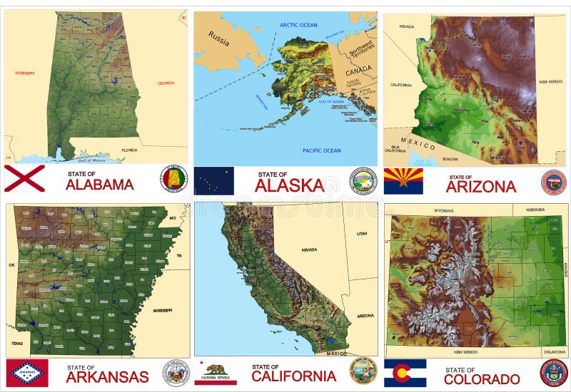
Free with trial Set of county maps of USA states Alabama,Alaska,Arizona,Arkansas,California,Colorado. Map colorado counties illustrations Maps counties USA states. Set of county maps of USA states Alabama,Alaska,Arizona,Arkansas,California,Colorado.
Free with trial Topographic Relief Peaks and Valleys Map of US Federal State of Washington. Map colorado counties vectors Washington Relief Map. Topographic Relief Peaks and Valleys Map of US Federal State of Washington
Free with trial Set of county maps of USA states Hawaii,Idaho,Illinois,Indiana,Iowa,Kansas. Map colorado counties illustrations Maps counties USA states. Set of county maps of USA states Hawaii,Idaho,Illinois,Indiana,Iowa,Kansas.
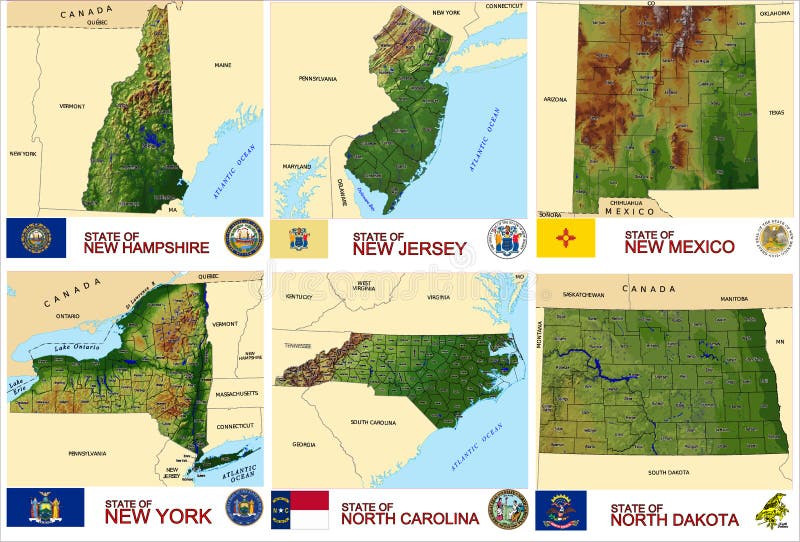
Free with trial Set of county maps of USA states New Hampshire,New Jersey, New Mexico,New York,North Carolina,North Dakota. Map colorado counties vectors Maps counties USA states. Set of county maps of USA states New Hampshire,New Jersey, New Mexico,New York,North Carolina,North Dakota.
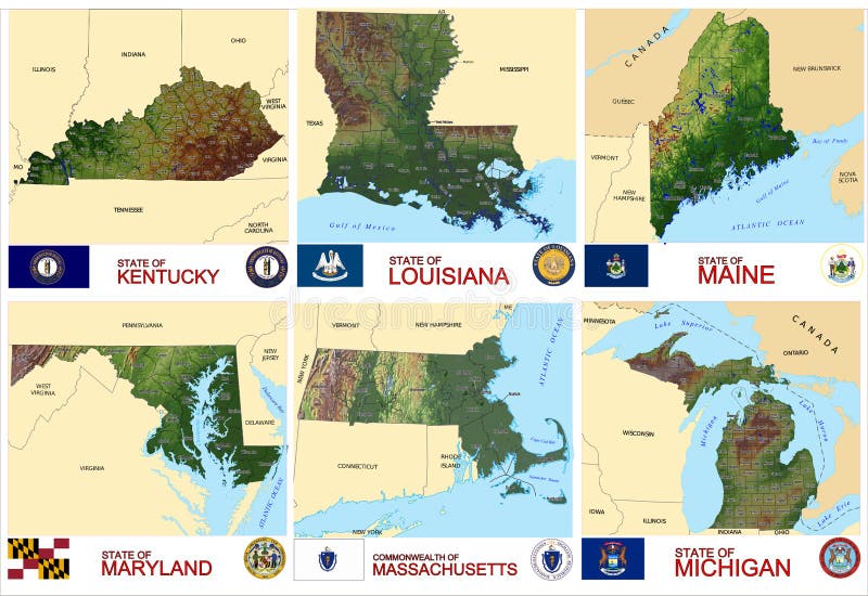
Free with trial Set of county maps of USA states Kentucky, Louisiana,Maine,Maryland,Massachusetts,Michigan,. Map colorado counties illustrations Maps counties USA states. Set of county maps of USA states Kentucky, Louisiana,Maine,Maryland,Massachusetts,Michigan,
Free with trial 38 of 50 states of the United States, divided into counties with territory nicknames, Detailed vector Colorado Map with name and date admitted to the Union, travel poster and postcard for design. Map colorado counties vectors 38 of 50 states of the United States, divided into counties with territory nicknames, Detailed vector Colorado Map with name and
Free with trial Counties map of Colorado labeled. Map colorado counties vectors County map of Colorado labeled
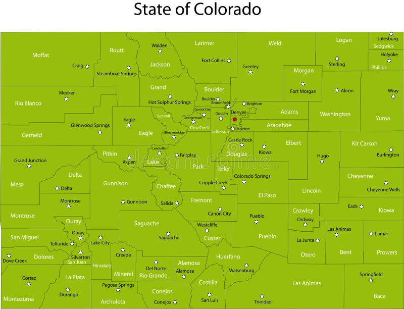
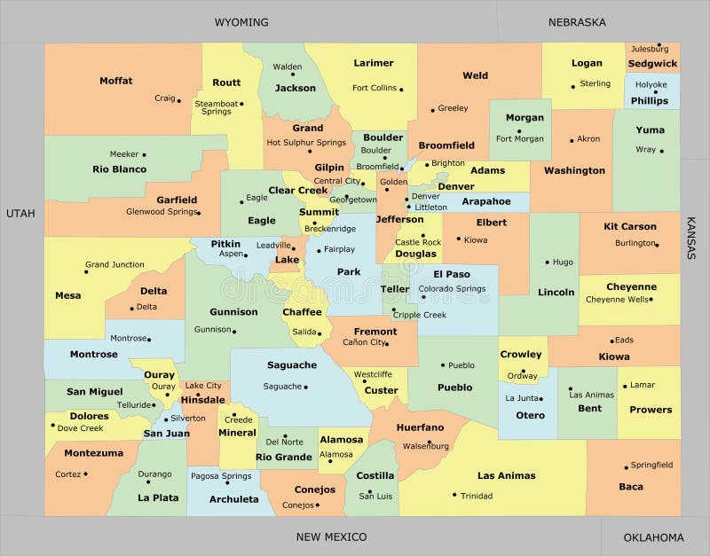
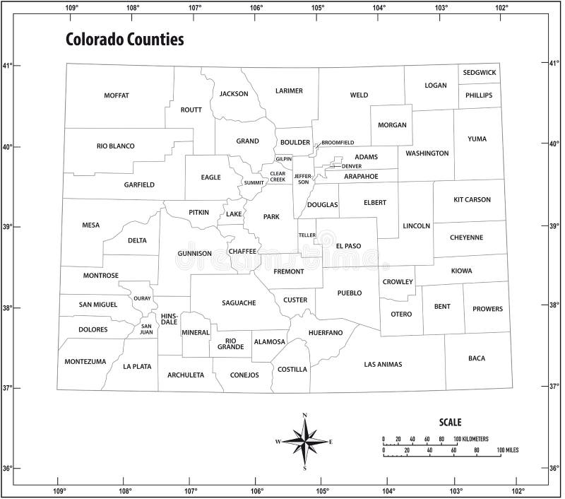
Free with trial Colorful County Map With Counties Names of the US Federal State of Colorado. Map colorado counties vectors Colorado County Map. Colorful County Map With Counties Names of the US Federal State of Colorado
Free with trial Colorado County, Texas Counties in Texas, United States of America,USA, U. S. , US map vector illustration, scribble sketch Colorado map. Map colorado counties vectors Colorado County, Texas Counties in Texas, United States of America,USA, U.S., US map vector illustration, scribble sketch
Free with trial 3d Political Map of Colorado. Map includes state flag and counties. Map colorado counties illustrations 3d Political Map of Colorado
Free with trial Map of Colorado state, US with flag and counties. Vector image. Map colorado counties vectors Map of Colorado, US. Map of Colorado state, US with flag and counties. Vector image
Free with trial Pastel vector map of the Federal State of Colorado, USA with black borders and names of its counties. Map colorado counties vectors Pastel counties map of Colorado, USA. Pastel vector map of the Federal State of Colorado, USA with black borders and names of its counties
Free with trial White vector map of the Federal State of Colorado, USA with black borders and names of its counties. Map colorado counties vectors White counties map of Colorado, USA. White vector map of the Federal State of Colorado, USA with black borders and names of its counties
Free with trial Colorado counties map and congressional districts since 2023 map. Denver and Colorado Springs cities skylines. Vector set. Map colorado counties vectors Colorado counties map and congressional districts since 2023 map. Denver and Colorado Springs cities skylines. Vector set
Free with trial Colorado state outline administrative and political vector map in black and white. Map colorado counties vectors Colorado state outline administrative and political vector map in black and white
Free with trial Colorado map. Geometric style us state outline with counties. Amazing violet vector illustration. Map colorado counties vectors Colorado map.
Free with trial Colorado red highlighted in map of the United States of America illustration. Map colorado counties illustrations Colorado red highlighted in map of the United States of America
Free with trial Modern City Map - Denver Colorado city of the USA with neighborhoods and titles illustration. Map colorado counties vectors Modern City Map - Denver Colorado city of the USA with neighborhoods and titles
Free with trial Colorado outline map state shape united states America borders. Map colorado counties vectors Colorado outline map state shape united states
Free with trial Detailed and accurate illustration of map of Colorado. Map colorado counties vectors Map of Colorado
Free with trial Detailed and accurate illustration of map of Colorado. Map colorado counties vectors Map of Colorado
Free with trial Blue Smooth Topographic Relief Peaks and Valleys Map of US Federal State of Colorado. Map colorado counties vectors Blue Colorado Relief Map. Blue Smooth Topographic Relief Peaks and Valleys Map of US Federal State of Colorado
Free with trial Colorado Springs CO city map USA labelled black illustration. Map colorado counties vectors Colorado Springs CO city map USA labelled black illustration
Free with trial Detailed and accurate illustration of map of Colorado. Map colorado counties vectors Map of Colorado
Free with trial Modern City Map - Colorado Springs CO city of the USA with neighborhoods and titles illustration. Map colorado counties vectors Modern City Map - Colorado Springs CO city of the USA with neigh
Free with trial Modern City Map - Colorado Springs CO city of the USA with neighborhoods and titles outline map illustration. Map colorado counties vectors Modern City Map - Colorado Springs CO city of the USA with neigh
Free with trial Vector illustration of the Counties Map of US State of Michigan. Map colorado counties vectors Counties Map of US State of Michigan
Free with trial Vector illustration of the Counties Map of US State of Pennsylvania. Map colorado counties vectors Counties Map of US State of Pennsylvania
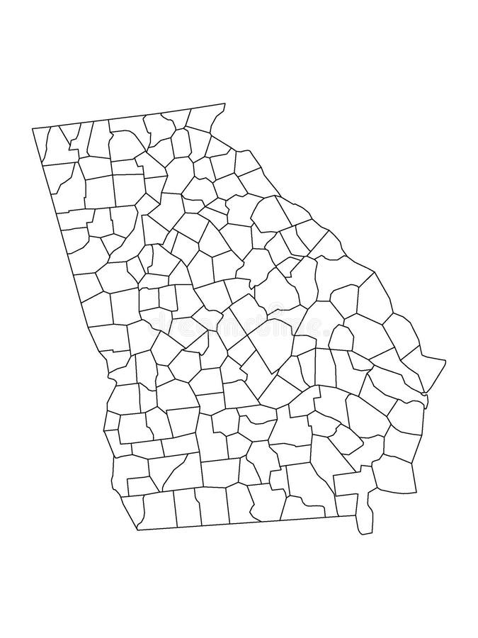
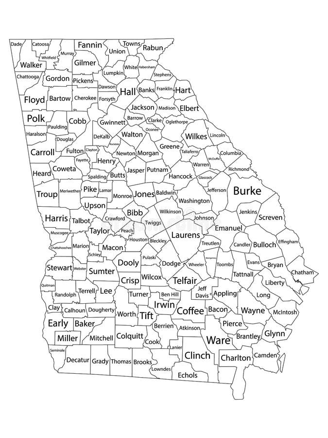
Free with trial Vector illustration of the Counties Map of US State of Georgia. Map colorado counties vectors Counties Map of US State of Georgia
Free with trial Vector illustration of the Counties Map of US State of West Virginia. Map colorado counties vectors Counties Map of US State of West Virginia
Free with trial Vector illustration of the Counties Map of US State of Montana. Map colorado counties vectors Counties Map of US State of Montana
Free with trial Vector illustration of the Counties Map of US State of Wisconsin. Map colorado counties vectors Counties Map of US State of Wisconsin
Free with trial Colorado map with American national flag illustration in artwork style. Map colorado counties vectors Colorado map with American national flag illustration
Free with trial White Outline Counties Map With Counties Names of US State of Missouri. Map colorado counties vectors Counties Map of US State of Missouri. White Outline Counties Map With Counties Names of US State of Missouri
Free with trial White Outline Counties Map With Counties Names of US State of Minnesota. Map colorado counties vectors Counties Map of US State of Minnesota. White Outline Counties Map With Counties Names of US State of Minnesota
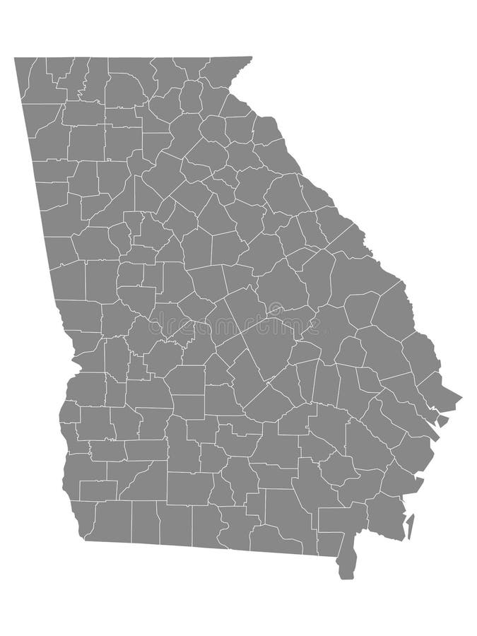
Free with trial Gray Outline Counties Map of US State of Georgia. Map colorado counties vectors Counties Map of US State of Georgia
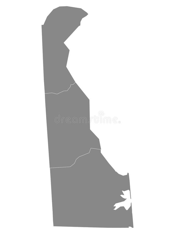
Free with trial Gray Outline Counties Map of US State of Delaware. Map colorado counties vectors Counties Map of US State of Delaware
Free with trial Gray Outline Counties Map of US State of Maryland. Map colorado counties vectors Counties Map of US State of Maryland
Free with trial White Outline Counties Map of US State of Kentucky. Map colorado counties vectors Counties Map of US State of Kentucky
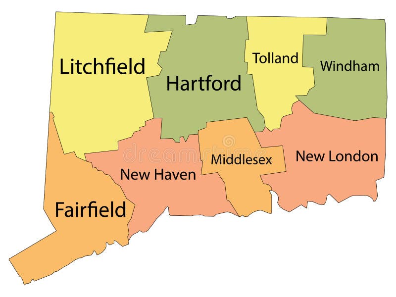
Free with trial White Outline Counties Map With Counties Names of US State of Connecticut. Map colorado counties vectors Counties Map of US State of Connecticut. White Outline Counties Map With Counties Names of US State of Connecticut
Free with trial White Outline Counties Map With Counties Names of US State of Maryland. Map colorado counties vectors Counties Map of US State of Maryland. White Outline Counties Map With Counties Names of US State of Maryland
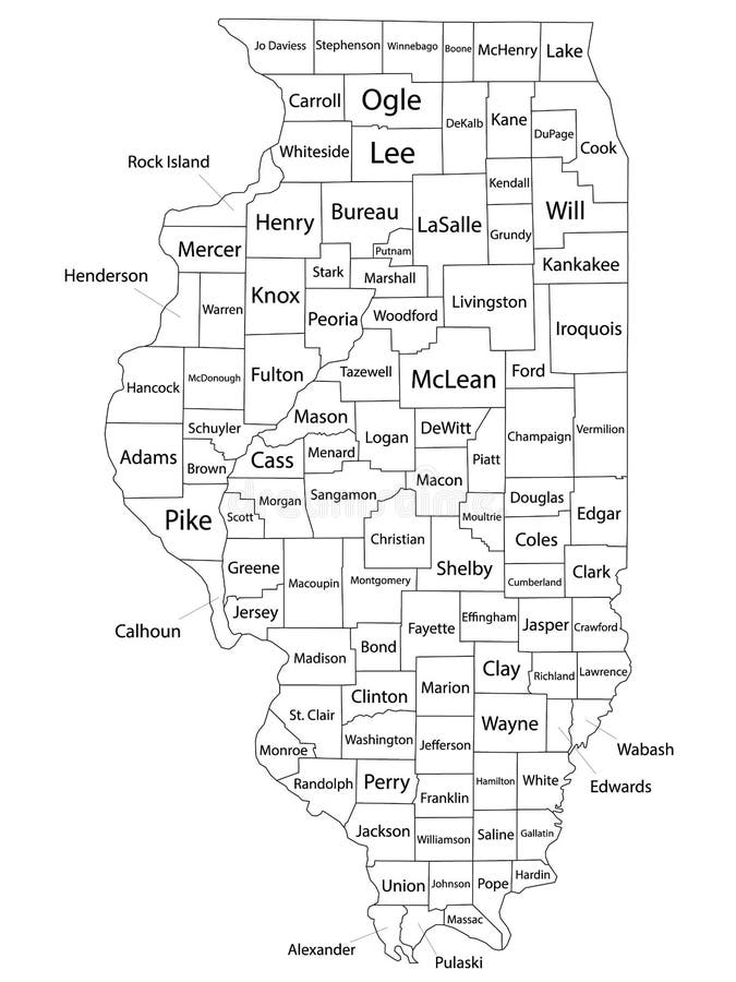
Free with trial White Outline Counties Map With Counties Names of US State of Illinois. Map colorado counties vectors Counties Map of US State of Illinois. White Outline Counties Map With Counties Names of US State of Illinois
Free with trial White Outline Counties Map of US State of Maine. Map colorado counties vectors Counties Map of US State of Maine
Free with trial White Outline Counties Map With Counties Names of US State of Maine. Map colorado counties vectors Counties Map of US State of Maine. White Outline Counties Map With Counties Names of US State of Maine
Free with trial White Outline Counties Map With Counties Names of US State of Michigan. Map colorado counties vectors Counties Map of US State of Michigan. White Outline Counties Map With Counties Names of US State of Michigan
Free with trial White Outline Counties Map With Counties Names of US State of Iowa. Map colorado counties vectors Counties Map of US State of Iowa. White Outline Counties Map With Counties Names of US State of Iowa
Free with trial White Outline Counties Map With Counties Names of US State of Georgia. Map colorado counties vectors Counties Map of US State of Georgia. White Outline Counties Map With Counties Names of US State of Georgia
Free with trial Gray Outline Counties Map of US State of Mississippi. Map colorado counties vectors Counties Map of US State of Mississippi
Free with trial White Outline Counties Map With Counties Names of US State of Indiana. Map colorado counties vectors Counties Map of US State of Indiana. White Outline Counties Map With Counties Names of US State of Indiana
Free with trial Highly detailed vector silhouettes of US state maps, Division United States into counties, political and geographic subdivisions of a states, Mountain and West South Central - Colorado, New Mexico, Texas - set 13 of 17 for design. Map colorado counties vectors Highly detailed vector silhouettes of US state maps, Division United States into counties, political and geographic subdivisions
Free with trial Colorful County Map With Counties Names of the US Federal State of Connecticut. Map colorado counties vectors Connecticut County Map. Colorful County Map With Counties Names of the US Federal State of Connecticut
Free with trial Colorful County Map With Counties Names of the US Federal State of California. Map colorado counties vectors California County Map. Colorful County Map With Counties Names of the US Federal State of California
Free with trial Colorful County Map With Counties Names of the US Federal State of South Carolina. Map colorado counties vectors South Carolina County Map. Colorful County Map With Counties Names of the US Federal State of South Carolina
Free with trial Geographical Map of United States with States with Counties with Regions with Shadows. Map colorado counties illustrations Modern White Map of United States with States with Counties With Shadow. Geographical Map of United States with States with Counties with Regions with Shadows
Free with trial 3d Political Map of California. Map includes state flag and counties. Map colorado counties illustrations 3d Political Map of California
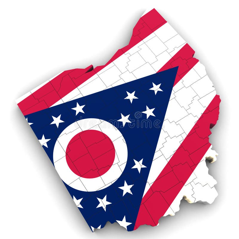
Free with trial 3d Political Map of Ohio. Map includes state flag and counties. Map colorado counties illustrations 3d Political Map of Ohio
Free with trial 3d Political Map of Alaska. Map includes state flag and counties. Map colorado counties illustrations 3d Political Map of Alaska
Free with trial Gray Map on White Background of Counties of USA Federal State of Minnesota. Map colorado counties vectors Counties of USA Federal State of Minnesota
Free with trial Set 4 of 5 Division United States into counties, political and geographic subdivisions of a states, Highly detailed vector maps with names and territory nicknames for design. Map colorado counties vectors Set 4 of 5 Division United States into counties, political and geographic subdivisions of a states, Highly detailed vector maps