Free with trial Flames. Rapid Flames Vector graphics, Different kinds of flames in different size and shape. all in vector formats. Maps elements vectors Flames. Rapid Flames Vector graphics, Different kinds of flames in different size and shape. all in vector formats
Free with trial Set of the maps, globes and elements for the news related infographic. Each country on the world map can be colored separately. Maps elements vectors Elements for the news infographic with map. Set of the maps, globes and elements for the news related infographic. Each country on the world map can be colored. Set of the maps, globes and elements for the news related infographic. Each country on the world map can be colored separately
Free with trial United states Map Infographic Template geometric concept banner. vector illustration. Maps elements vectors United states Map Infographic Template geometric concept banner. Vector illustration
Free with trial Set of modern city elements for creating your own maps of the ci. Ty. Maps elements vectors Set of modern city elements for creating your own maps of the ci. Ty
Free with trial Vector infographic illustration with charts, maps, arrows, tags and other design elements. Maps elements vectors Infographics design elements, infographic template. Vector infographic illustration with charts, maps, arrows, tags and other design elements. Vector infographic illustration with charts, maps, arrows, tags and other design elements.
Free with trial Set of modern city elements for creating your own maps of the ci. Ty. Infographics. Vector illustration. Maps elements vectors Set of modern city elements for creating your own maps of the ci. Ty. Infographics. Vector illustration
Free with trial Infographic elements. With maps, charts and icons. Maps elements vectors Infographic elements. With maps, charts and icons
Free with trial Modern city map elements for generating your own infographics, m. Aps. Vector illustration. Maps elements vectors Modern city map elements for generating your own infographics, m. Aps. Vector illustration
Free with trial Maps and navigation icon set. Set of the simple maps and navigation related icons. Maps elements vectors Maps and navigation icon set. Set of the simple maps and navigation related icons
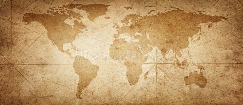
Free with trial Old map of the world on a old parchment background. Vintage style. Elements of this Image Furnished by NASA. Maps elements illustrations Old map of the world on a old parchment background. Vintage style. Elements of this Image Furnished by NASA. Old map of the world on a old parchment background
Free with trial World map. Blue world map illustration with white background. Maps elements illustrations World map. Blue world map illustration with white background
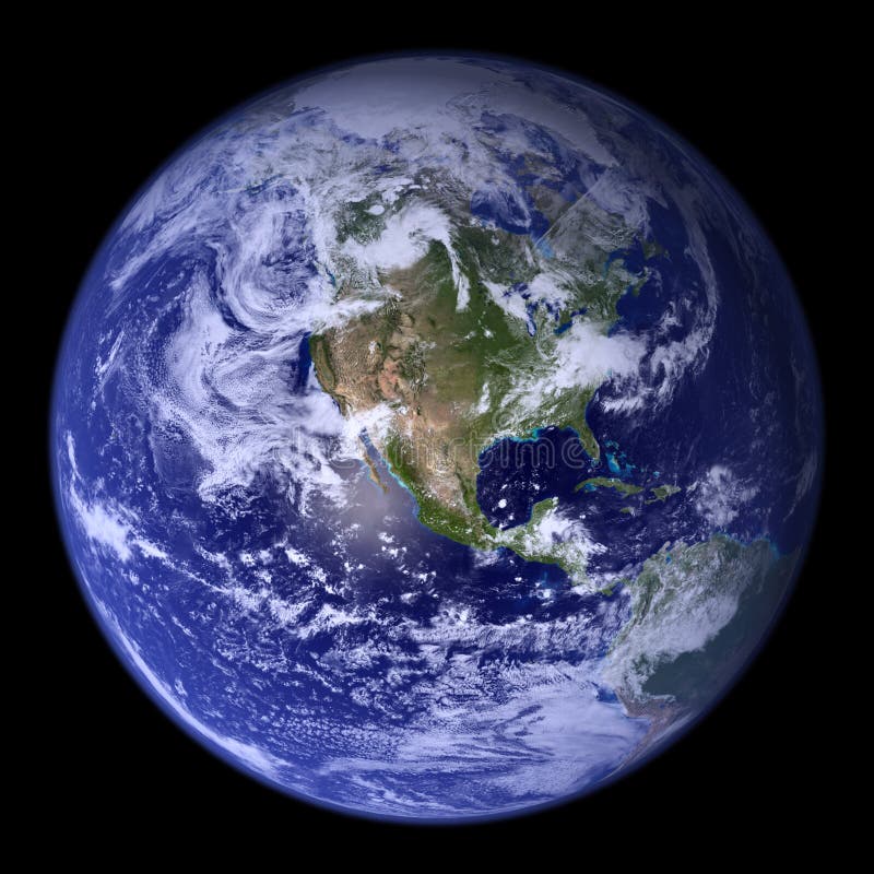
Free with trial 3d, globe and earth, world map. Maps elements illustrations World 3d globe. 3d, globe and earth, world map. 3d, globe and earth, world map.
Free with trial Choice of four banners in global theme, four variations made of same elements. Maps elements vectors Global banners set. Choice of four banners in global theme, four variations made of same elements. Choice of four banners in global theme, four variations made of same elements.
Free with trial Earth core structure illustrated with geological layers according to scale - isolated on black (Elements of this 3d image furnished by NASA - source maps from. Maps elements illustrations Earth core structure to scale - isolated. Earth core structure illustrated with geological layers according to scale - isolated on black (Elements of this. Earth core structure illustrated with geological layers according to scale - isolated on black (Elements of this 3d image furnished by NASA - source maps from
Free with trial Binary background design. Maps elements illustrations Binary Background. Design. Binary background design.
Free with trial United states Map Infographic Template jigsaw concept banner. vector illustration. Maps elements vectors United states Map Infographic Template jigsaw concept banner. Vector illustration
Free with trial United states Map Infographic Template jigsaw concept banner. vector illustration. Maps elements vectors United states Map Infographic Template jigsaw concept banner. Vector illustration
Free with trial Infographic business design elements - vector illustration. Infograph template collection. World and USA maps. Industrial factory icons. Creative graphic set. Maps elements vectors Infographic business design elements - vector illustration. Infograph template collection. World and USA maps. Industrial factory. Icons. Creative graphic set
Free with trial Set of modern city elements for creating your own maps of the ci. Ty. Infographics. Vector illustration. Maps elements vectors Set of modern city elements for creating your own maps of the ci. Ty. Infographics. Vector illustration
Free with trial Set of modern city elements for creating your own maps of the ci. Ty. Infographics. Vector illustration. Maps elements vectors Set of modern city elements for creating your own maps of the ci. Ty. Infographics. Vector illustration
Free with trial Vector layout elements. Everything you need for web design. Maps elements vectors UI & web elements pack. Vector layout elements. Everything you need for web design. Vector layout elements. Everything you need for web design.
Free with trial Infographics page with a lot of design elements like chart, globe, icons, graphics, maps, cakes, human shapes and so on. Ideal for business analisys rapresentation. Maps elements vectors Infographics page with a lot of design elements. Like chart, globe, icons, graphics, maps, cakes, human shapes and so on. Ideal for business analisys
Free with trial Dark Infographics page with a lot of design elements like chart, globe, icons, graphics, maps, cakes, human shapes and so on. Ideal for business analisys rapresentation. Maps elements vectors Infographics page with a lot of design elements. Dark Infographics page with a lot of design elements like chart, globe, icons, graphics, maps, cakes, human. Dark Infographics page with a lot of design elements like chart, globe, icons, graphics, maps, cakes, human shapes and so on. Ideal for business analisys rapresentation.
Free with trial Infographics page with a lot of design elements like chart, globe, icons, graphics, maps, cakes, human shapes and so on. Ideal for business analisys rapresentation. Maps elements vectors Infographics page with a lot of design elements. Like chart, globe, icons, graphics, maps, cakes, human shapes and so on. Ideal for business analisys
Free with trial Business infographic vector set in material design style. Business infographics elements. Infographic in flat style design. Infographics vector elements, graphics, backgrounds, world maps, icons set. Maps elements vectors Business infographic vector set in material design style. Business infographics elements. Infographic in flat style design. Infographics vector elements
Free with trial Modern city map elements for generating your own infographics, m. Aps. Vector illustration. Maps elements vectors Modern city map elements for generating your own infographics, m. Aps. Vector illustration
Free with trial World Map infographic. Infographic elements with icons and world maps. Vector. Maps elements vectors World Map infographic. Infographic elements with icons and world maps. Vector
Free with trial Tourism infographic elements. Set of the maps and pictograms for tourism and travel map creation. Each country on the world map can be colored separately. Maps elements vectors Tourism infographic elements. Set of the maps and pictograms for tourism and travel map creation. Each country on the world map can be colored separately
Free with trial Vacation, travel and holiday icon set. Collection of 9 design elements inspired by water, nature, beach, sun and globe. Perfect use for travel guides, websites, maps and travel brochures. Maps elements vectors Vacation, travel and holiday summer icons. Vacation, travel and holiday icon set. Collection of 9 design elements inspired by water, nature, beach, sun and globe. Vacation, travel and holiday icon set. Collection of 9 design elements inspired by water, nature, beach, sun and globe. Perfect use for travel guides, websites, maps and travel brochures.
Free with trial Nature, turism and mountains icon set. Collection of 9 design elements inspired by nature, environment, tourism and travel. Perfect use for travel guides, websites, maps and travel brochures. Maps elements vectors Nature, mountain and turism icons - blue and green. Nature, turism and mountains icon set. Collection of 9 design elements inspired by nature, environment. Nature, turism and mountains icon set. Collection of 9 design elements inspired by nature, environment, tourism and travel. Perfect use for travel guides, websites, maps and travel brochures.
Free with trial Multipurpose presentation slides vector template. Infographic elements for data visualization with world and USA maps. Set of universal icons. Maps elements vectors Multipurpose presentation vector template infographic. Multipurpose presentation slides vector template. Infographic elements for data visualization with world. Multipurpose presentation slides vector template. Infographic elements for data visualization with world and USA maps. Set of universal icons.
Free with trial Road with red pins. Navigating, milestone timeline 3d map maps roads vector roadway graphic illustrations location checkpoint graph. Maps elements vectors Road with red pins. Navigating, milestone timeline 3d map maps roads vector roadway graphic illustrations graph. Road with red pins. Navigating, milestone. Road with red pins. Navigating, milestone timeline 3d map maps roads vector roadway graphic illustrations location checkpoint graph
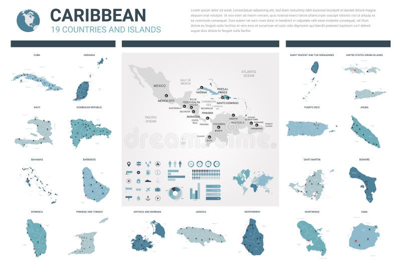
Free with trial Vector maps set. High detailed 19 maps of Caribbean countries with administrative division and cities. Political map, map of Caribbean region, world map, globe, infographic elements. Maps elements vectors Vector maps set. High detailed 19 maps of Caribbean countries with administrative division and cities. Political map, map of. Caribbean region, world map. Vector maps set. High detailed 19 maps of Caribbean countries with administrative division and cities. Political map, map of Caribbean region, world map, globe, infographic elements
Free with trial Vector maps set. High detailed 45 maps of European countries with administrative division and cities. Political map, map of Europe continent, world map, globe, infographic elements. Part 1. Maps elements vectors Vector maps set. High detailed 45 maps of European countries with administrative division and cities. Political map, map of. Europe continent, world map, globe. Vector maps set. High detailed 45 maps of European countries with administrative division and cities. Political map, map of Europe continent, world map, globe, infographic elements. Part 1
Free with trial Vector maps set. High detailed 44 maps of Asian countries with administrative division and cities. Political map, map of Asia continent, world map, globe, infographic elements. Part 2. Maps elements vectors Vector maps set. High detailed 44 maps of Asian countries with administrative division and cities. Political map, map of Asia. Continent, world map, globe. Vector maps set. High detailed 44 maps of Asian countries with administrative division and cities. Political map, map of Asia continent, world map, globe, infographic elements. Part 2
Free with trial Vector maps set. High detailed 44 maps of Asian countries with administrative division and cities. Political map, map of Asia continent, world map, globe, infographic elements. Part 1. Maps elements vectors Vector maps set. High detailed 44 maps of Asian countries with administrative division and cities. Political map, map of Asia. Continent, world map, globe. Vector maps set. High detailed 44 maps of Asian countries with administrative division and cities. Political map, map of Asia continent, world map, globe, infographic elements. Part 1
Free with trial Vector maps set. High detailed 23 maps of North American countries with administrative division and cities. Political map, map of America continent, world map, globe, infographic elements. Maps elements vectors Vector maps set. High detailed 23 maps of North American countries with administrative division and cities. Political map, map of. America continent, world map. Vector maps set. High detailed 23 maps of North American countries with administrative division and cities. Political map, map of America continent, world map, globe, infographic elements
Free with trial Vector maps set. High detailed 45 maps of European countries with administrative division and cities. Political map, map of Europe continent, world map, globe, infographic elements. Part 2. Maps elements vectors Vector maps set. High detailed 45 maps of European countries with administrative division and cities. Political map, map of. Europe continent, world map, globe. Vector maps set. High detailed 45 maps of European countries with administrative division and cities. Political map, map of Europe continent, world map, globe, infographic elements. Part 2
Free with trial Vector maps set. High detailed 15 maps of Middle East countries with administrative division and cities. Political map, map of Middle East region, world map, globe, infographic elements. Maps elements vectors Vector maps set. High detailed 15 maps of Middle East countries with administrative division and cities. Political map, map of. Middle East region, world map. Vector maps set. High detailed 15 maps of Middle East countries with administrative division and cities. Political map, map of Middle East region, world map, globe, infographic elements
Free with trial Vector maps set. High detailed 11 maps of South America countries with administrative division and cities. Political map, map of America continent, world map, globe, infographic elements. Maps elements vectors Vector maps set. High detailed 11 maps of South America countries with administrative division and cities. Political map, map of. America continent, world map. Vector maps set. High detailed 11 maps of South America countries with administrative division and cities. Political map, map of America continent, world map, globe, infographic elements
Free with trial Vector maps set. High detailed 46 maps of African countries with administrative division and cities. Political map, map of Africa continent, world map, globe, infographic elements. Part 1. Maps elements vectors Vector maps set. High detailed 46 maps of African countries with administrative division and cities. Political map, map of Africa. Continent, world map, globe. Vector maps set. High detailed 46 maps of African countries with administrative division and cities. Political map, map of Africa continent, world map, globe, infographic elements. Part 1
Free with trial Vector maps set. High detailed 46 maps of African countries with administrative division and cities. Political map, map of Africa continent, world map, globe, infographic elements. Part 2. Maps elements vectors Vector maps set. High detailed 46 maps of African countries with administrative division and cities. Political map, map of Africa. Continent, world map, globe. Vector maps set. High detailed 46 maps of African countries with administrative division and cities. Political map, map of Africa continent, world map, globe, infographic elements. Part 2
Free with trial Vector maps set. High detailed 28 maps of European Union countries member states with administrative division and cities. Political map, map of Europe , world map, globe, infographic elements. Maps elements vectors Vector maps set. High detailed 28 maps of European Union countries member states with administrative division and cities. Political map, map of Europe , world. Vector maps set. High detailed 28 maps of European Union countries member states with administrative division and cities. Political map, map of Europe , world map, globe, infographic elements
Free with trial Colorful Set of Location, Places, Travel and Destination Pin Icons, Flags and Buttons for Navigation and Maps. Vector Illustration. Maps elements vectors Colorful Set of Location, Places, Travel and Destination Pin Icons. Flags and Buttons for Navigation and Maps. Vector Illustration
Free with trial World map,five continents. Colourful five continents world map illustration with white background. Maps elements illustrations World map,five continents. Colourful five continents world map illustration with white background
Free with trial Map pins and arrows. Set of elements in navigation maps. Maps elements vectors Map pins and arrows. Set of elements in navigation maps
Free with trial Planet earth explode in space. (Elements of this 3d image furnished by NASA - texture maps from. Maps elements illustrations Planet earth explode in space. (Elements of this 3d image furnished by NASA - texture maps from
Free with trial Earth core structure illustrated with geological layers according to scale - isolated on black (Elements of this 3d image furnished by NASA - source maps from. Maps elements illustrations Earth core structure to scale - isolated. Earth core structure illustrated with geological layers according to scale - isolated on black (Elements of this 3d. Earth core structure illustrated with geological layers according to scale - isolated on black (Elements of this 3d image furnished by NASA - source maps from
Free with trial Earth core structure illustrated with geological layers according to scale - isolated on black (Elements of this 3d image furnished by NASA - source maps from. Maps elements illustrations Earth core structure to scale - isolated. Earth core structure illustrated with geological layers according to scale - isolated on black (Elements of this 3d. Earth core structure illustrated with geological layers according to scale - isolated on black (Elements of this 3d image furnished by NASA - source maps from
Free with trial The sun rising over the earth. City and street lights light up the surface creating a network of routes. NO NASA files or maps used in this image. ALL elements are sourced from my own images including textures. Maps elements illustrations Global Networking. The sun rising over the earth. City and street lights light up the surface creating a network of routes. NO NASA files or maps used in this. The sun rising over the earth. City and street lights light up the surface creating a network of routes. NO NASA files or maps used in this image. ALL elements are sourced from my own images including textures.
Free with trial Five types of flames. Five types of vector flames. Maps elements vectors Five types of flames. Five types of vector flames
Free with trial Vector illustrated set of vintage blank scrolls, banners, ribbons and various paper shapes. Maps elements vectors Vintage papers and scrolls. Vector illustrated set of vintage blank scrolls, banners, ribbons and various paper shapes. Vector illustrated set of vintage blank scrolls, banners, ribbons and various paper shapes.
Free with trial Flat design style modern icons set of various website sitemap collection for creating flowchart navigation of web site architecture and prototyping site maps structure and interactions. Isolated on light-gray background. Maps elements illustrations Website sitemaps flat icons set. Flat design style modern icons set of various website sitemap collection for creating flowchart navigation of web site. Flat design style modern icons set of various website sitemap collection for creating flowchart navigation of web site architecture and prototyping site maps structure and interactions. Isolated on light-gray background
Free with trial Binary background with world map. Maps elements illustrations Binary Background. With world map. Binary background with world map.
Free with trial World map and globe for your infographics. World maps and 3d globe elements for your infographics reports. Maps elements vectors World map and globe for your infographics. World maps and 3d globe elements for your infographics reports
Free with trial A detailed collection of countries. Maps elements vectors Detailed countries collection. A detailed collection of countries. A detailed collection of countries.
Free with trial Binary background design with world map. Maps elements illustrations Binary Background. Design with world map
Free with trial BUSINESS, TECHNOLOGY and FINANCIAL ICONS. Set of concept icons for business. Maps elements vectors BUSINESS, TECHNOLOGY and FINANCIAL ICONS. Set of concept icons for business
Free with trial Set Of Traveling People. With baggage and maps including families couples and young woman isolated vector illustration. Maps elements vectors Set Of Traveling People. With baggage and maps including families couples and young woman isolated vector illustration
Free with trial South america Map Infographic Template jigsaw concept banner. illustration. Maps elements illustrations South america Map Infographic Template jigsaw concept banner. Illustration
Free with trial Set of hand drawn whales. Include blue whale, finback, orca, killwhale, humpback, sperm whale, bowhead. Maps elements vectors Set of hand drawn whales. Include blue whale, finback, orca, killwhale, humpback, sperm whale, bowhead
Free with trial Gold oval frame in the Gothic style on a dark background. Banner. Frame. Maps elements vectors Gold oval frame in the Gothic style.Frame. Gold oval frame in the Gothic style on a dark background. Banner.Frame. Gold oval frame in the Gothic style on a dark background. Banner.Frame.
Free with trial Copper mexico. Map of mexico in vintage copper texture. Maps elements illustrations Copper mexico. Map of mexico in vintage copper texture
Free with trial Stylized map of Australia with the symbols of Australian culture and nature. Traditional symbols of Australian culture and nature in the form of maps. Maps elements vectors Stylized map of Australia with the symbols of Australian culture and nature. Traditional symbols of Australian culture and nature in the form of maps
Free with trial Virginia state road map with Interstates and U. S. Highways. All elements on 3 separate layers for easy editing. Map created May 31, 2009. Source: Public domain National Planning Network ( and United States Federal Highway Administration ( maps. Maps elements vectors Virginia Interstate Map. Virginia state road map with Interstates and U. S. Highways. All elements on 3 separate layers for easy editing. Map created May 31. Virginia state road map with Interstates and U. S. Highways. All elements on 3 separate layers for easy editing. Map created May 31, 2009. Source: Public domain National Planning Network ( and United States Federal Highway Administration ( maps.
Free with trial Set of modern city elements for creating your own maps of the ci. Ty. Infographics. Vector illustration. Maps elements vectors Set of modern city elements for creating your own maps of the ci. Ty. Infographics. Vector illustration
Free with trial Set of modern city elements for creating your own maps of the ci. Ty. Infographics. Vector illustration. Maps elements vectors Set of modern city elements for creating your own maps of the ci. Ty. Infographics. Vector illustration
Free with trial Set of auto repair service elements for creating your own infographics or maps of the car service station. Vector illustration. Maps elements vectors Set of auto repair service elements for creating your own infographics or maps of the car service station. Vector illustration
Free with trial Set of auto repair service elements for creating your own infographics or maps of the car service station. Vector illustration. Maps elements vectors Set of auto repair service elements for creating your own infographics or maps of the car service station. Vector illustration
Free with trial Set of auto repair service elements for creating your own infographics or maps of the car service station. Vector illustration. Maps elements vectors Set of auto repair service elements for creating your own infographics or maps of the car service station. Vector illustration
Free with trial Vector set of infographic elements consisting of 30 groups, including pie charts, bar charts, column charts, area charts, line charts, world maps, people icons. Maps elements vectors Big set of infographic elements. Vector set of infographic elements consisting of 30 groups, including pie charts, bar charts, column charts, area charts, line. Vector set of infographic elements consisting of 30 groups, including pie charts, bar charts, column charts, area charts, line charts, world maps, people icons
Free with trial Infographics page with a lot of design elements like chart, globe, icons, graphics, maps, cakes, human shapes and so on. Ideal for business analisys rapresentation. Maps elements vectors Infographics page with a lot of design elements. Like chart, globe, icons, graphics, maps, cakes, human shapes and so on. Ideal for business analisys
Free with trial Infographics page with a lot of design elements like chart, globe, icons, graphics, maps, cakes, human shapes and so on. Ideal for business analisys rapresentation. Maps elements vectors Infographics page with a lot of design elements. Like chart, globe, icons, graphics, maps, cakes, human shapes and so on. Ideal for business analisys
Free with trial Infographics page with a lot of design elements like chart, globe, icons, graphics, maps, cakes, human shapes and so on. Ideal for business analisys rapresentation. Maps elements vectors Infographics page with a lot of design elements. Like chart, globe, icons, graphics, maps, cakes, human shapes and so on. Ideal for business analisys
Free with trial Contryside map elements for generating your own infographics, ma. Ps. Vector illustration. Maps elements vectors Contryside map elements for generating your own infographics, ma. Ps. Vector illustration
Free with trial Contryside map elements for generating your own infographics, ma. Ps. Vector illustration. Maps elements vectors Contryside map elements for generating your own infographics, ma. Ps. Vector illustration
Free with trial Modern city map elements for generating your own infographics, m. Aps. Vector illustration. Maps elements vectors Modern city map elements for generating your own infographics, m. Aps. Vector illustration
Free with trial Industry map elements. For generating your own infographics, maps. Vector illustration. Maps elements vectors Industry map elements. For generating your own infographics, maps. Vector illustration
Free with trial Contryside map elements. For generating your own infographics, maps. Vector illustration. Maps elements vectors Contryside map elements. For generating your own infographics, maps. Vector illustration
 Sign in