Free with trial India map designed in illustration with the regions colored in bright colors and with the main cities. On an illustration neighbouring countries are shown too. Neighbouring countries vectors Map of India. India map designed in illustration with the regions colored in bright colors and with the main cities. On an illustration neighbouring countries are shown too
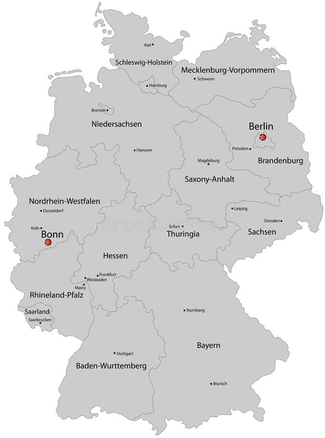
Free with trial Germany map designed in illustration with the regions colored in grey colors and with the main cities. Neighbouring countries are in an additional format (. AI) in the latent layer. Neighbouring countries vectors Map of Germany. Germany map designed in illustration with the regions colored in grey colors and with the main cities. Neighbouring countries are in an additional format (. AI) in the latent layer.
Free with trial Turkey map designed in illustration with the regions colored in bright colors and with the main cities. On an illustration neighbouring countries are shown too. Neighbouring countries vectors Map of Turkey. Turkey map designed in illustration with the regions colored in bright colors and with the main cities. On an illustration neighbouring countries are shown too
Free with trial Bulgaria map designed in illustration with provinces colored in green colors and with the main cities. Neighbouring countries are in an additional format (. AI) in the latent layer. Neighbouring countries vectors Map of Bulgaria. Bulgaria map designed in illustration with provinces colored in green colors and with the main cities. Neighbouring countries are in an additional format (.AI) in the latent layer.
Free with trial Blind map of Germany with regions borders. Names of the regions, main cities, and neighbouring countries are in an additional format (. AI) in the latent layer. Neighbouring countries vectors Blind map of Germany
Free with trial India map designed in illustration with regions colored in bright colors and with the main cities. Neighbouring countries are in an additional format (. AI) in the latent layer. Neighbouring countries vectors India map
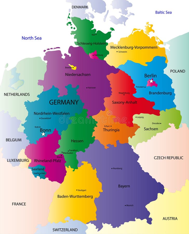
Free with trial Germany map designed in illustration with the regions colored in bright colors and with the main cities. On an illustration neighbouring countries are shown too. Neighbouring countries vectors Map of Germany. Germany map designed in illustration with the regions colored in bright colors and with the main cities. On an illustration neighbouring countries are shown too
Free with trial Switzerland map designed in illustration with the regions colored in bright colors and with the main cities. Neighbouring countries are in an additional format (. AI) in the latent layer. Neighbouring countries vectors Switzerland map
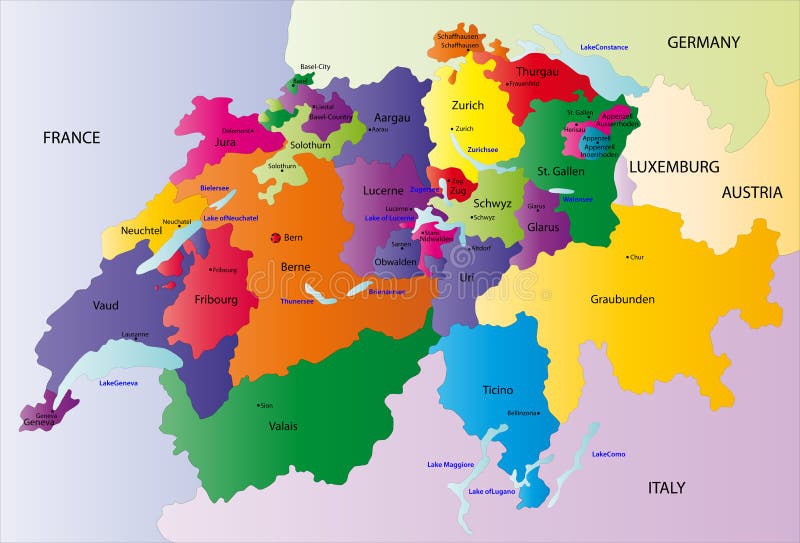
Free with trial Switzerland map designed in illustration with the regions colored in bright colors and with the main cities. On an illustration neighbouring countries are shown too. Neighbouring countries vectors Vector Switzerland map. Switzerland map designed in illustration with the regions colored in bright colors and with the main cities. On an illustration neighbouring countries are shown too
Free with trial Switzerland map designed in illustration with the regions colored in green colors and with the main cities. Neighbouring countries are in an additional format (. AI) in the latent layer. Neighbouring countries vectors Switzerland map
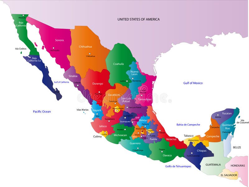
Free with trial Mexico map designed in illustration with states colored in bright colors and with the main cities. Neighbouring countries are in an additional format (. AI) in the latent layer. Neighbouring countries vectors Mexico map
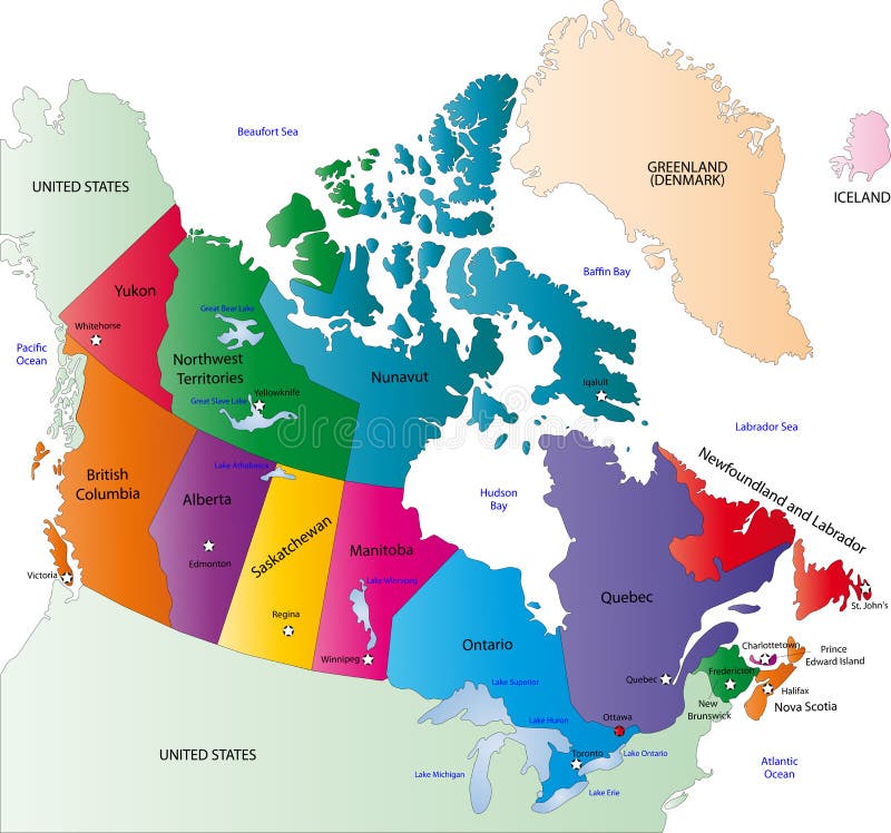
Free with trial Canada map designed in illustration with the states colored in bright colors and with the main cities. Neighbouring countries are in an additional format (. AI) in the latent layer. Neighbouring countries vectors Canada map
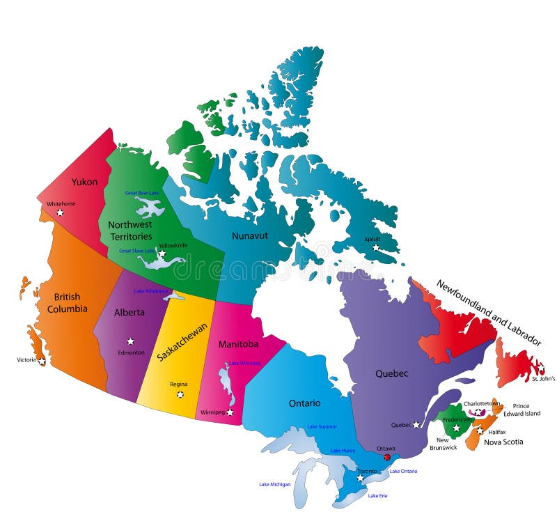
Free with trial Canada map designed in illustration with states colored in bright colors and with the main cities. On an illustration neighbouring countries are shown too. Neighbouring countries vectors Canada color map. Canada map designed in illustration with states colored in bright colors and with the main cities. On an illustration neighbouring countries are shown too
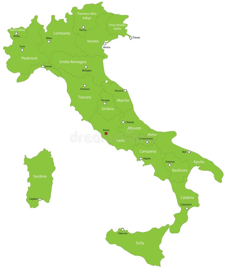
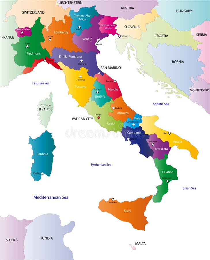
Free with trial Italy map designed in illustration with the 20 regions colored in green colors and with the main cities. Neighbouring countries are in an additional format (. AI) in the latent layer. Neighbouring countries vectors Italy
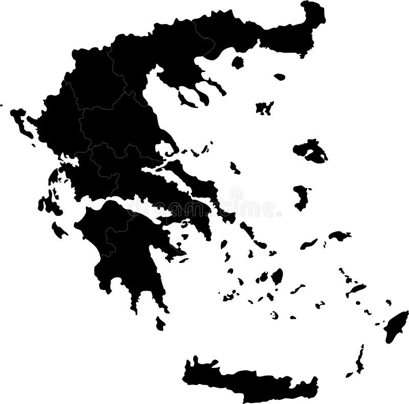
Free with trial Blind map of Greece with regions borders. Names of the regions, main cities, and neighbouring countries are in an additional format (. AI) in the latent layer. Neighbouring countries vectors Greece
Free with trial Poland map designed in illustration with the 16 provinces colored in green colors and with the main cities. Neighbouring countries are in an additional format (. AI) in the latent layer. Neighbouring countries vectors Poland
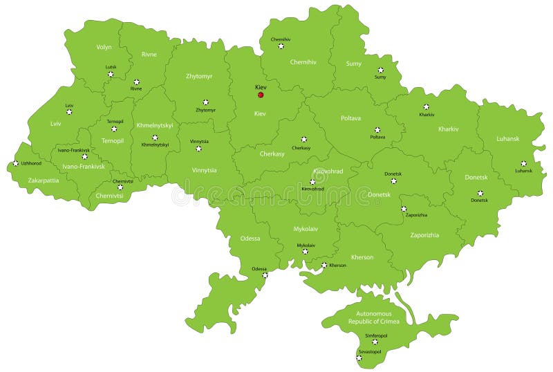
Free with trial Ukraine map designed in illustration with the oblasts colored in green colors and with the main cities. Neighbouring countries are in an additional format (. AI) in the latent layer. Neighbouring countries vectors Ukraine map
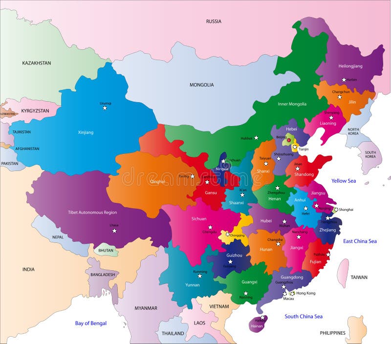
Free with trial China map designed in illustration with the regions colored in bright colors and with the main cities. On an illustration neighbouring countries are shown too. Neighbouring countries illustrations Map of China. China map designed in illustration with the regions colored in bright colors and with the main cities. On an illustration neighbouring countries. China map designed in illustration with the regions colored in bright colors and with the main cities. On an illustration neighbouring countries are shown too
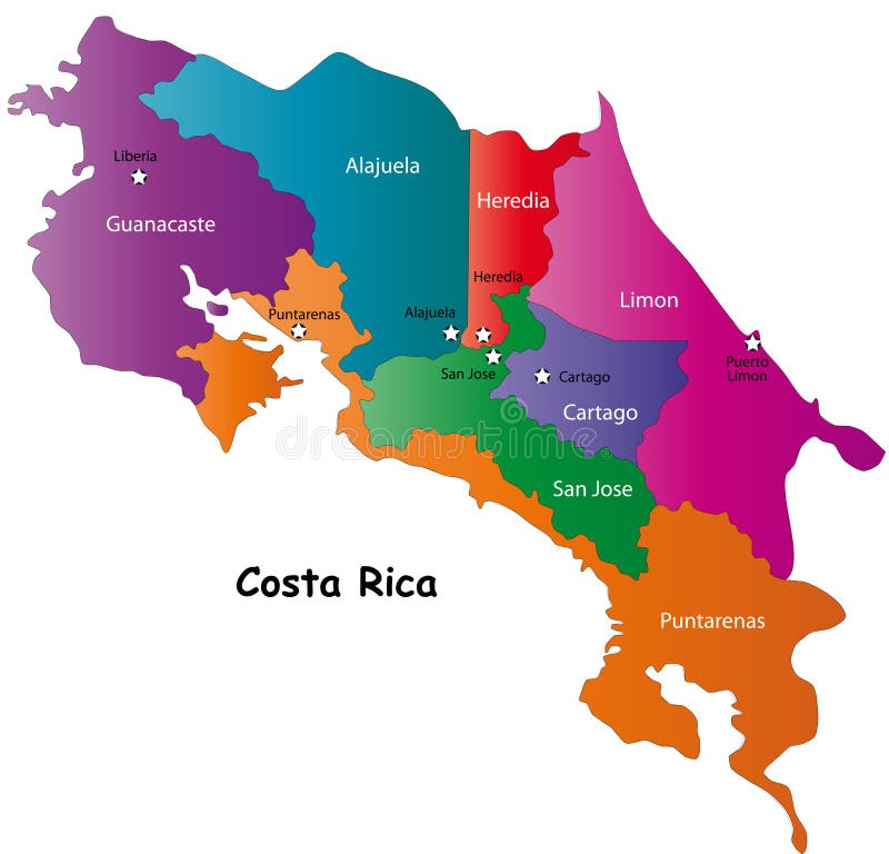
Free with trial Costa Rica map designed in illustration with 7 provinces colored in bright colors and with the main cities. Neighbouring countries are in an additional format (. AI) in the latent layer. Costa Rica map with. Neighbouring countries vectors Map of Costa Rica. Costa Rica map designed in illustration with 7 provinces colored in bright colors and with the main cities. Neighbouring countries are in an additional format (.AI) in the latent layer. Costa Rica map with
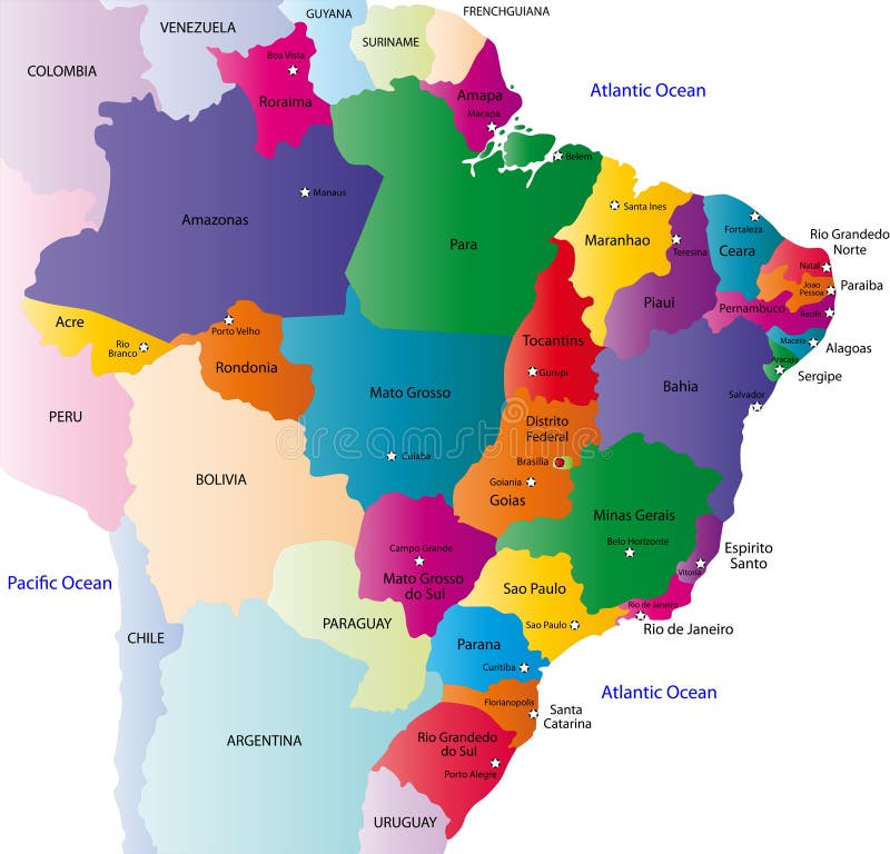
Free with trial Brazilmap designed in illustration with states colored in green colors and with the main cities. Neighbouring countries are in an additional format (. AI) in the latent layer. Neighbouring countries vectors Brazil
Free with trial Costa Rica map designed in illustration with 7 provinces colored in green colors and with the main cities. Neighbouring countries are in an additional format (. AI) in the latent layer. Neighbouring countries vectors Vector Costa Rica map. Costa Rica map designed in illustration with 7 provinces colored in green colors and with the main cities. Neighbouring countries are in an additional format (.AI) in the latent layer.
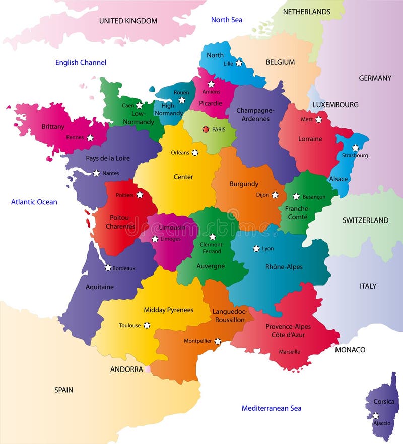
Free with trial France map designed in illustration with the regions colored in bright colors and with the main cities. Neighbouring countries are in an additional format (. AI) in the latent layer. Neighbouring countries vectors Map of France. France map designed in illustration with the regions colored in bright colors and with the main cities. Neighbouring countries are in an additional format (. AI) in the latent layer.
Free with trial Mexico map designed in illustration with states colored in green colors and with the main cities. Neighbouring countries are in an additional format (. AI) in the latent layer. Neighbouring countries vectors Vector Mexico map. Mexico map designed in illustration with states colored in green colors and with the main cities. Neighbouring countries are in an additional format (. AI) in the latent layer.
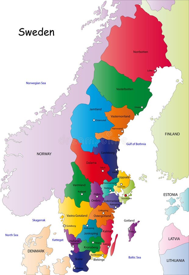
Free with trial Sweden map designed in illustration with the regions colored in bright colors and with the main cities. On an illustration neighbouring countries are shown too. Neighbouring countries vectors Sweden map
Free with trial Brazil map designed in illustration with the 26 states colored in bright colors and with the main cities. On an illustration neighbouring countries are shown too. Neighbouring countries vectors Brazil map
Free with trial Blind map of Denmark with regions borders. Names of the regions, main cities, and neighbouring countries are in an additional format (. AI) in the latent layer. Neighbouring countries vectors Denmark map. Blind map of Denmark with regions borders. Names of the regions, main cities, and neighbouring countries are in an additional format (.AI) in the latent layer.
Free with trial Mexico map designed in illustration with the states colored in bright colors and with the main cities. On an illustration neighbouring countries are shown too. Neighbouring countries vectors Map of Mexico. Mexico map designed in illustration with the states colored in bright colors and with the main cities. On an illustration neighbouring countries are shown too
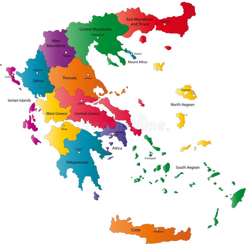
Free with trial Greece map designed in illustration with the regions colored in green colors and with the main cities. Neighbouring countries are in an additional format (. AI) in the latent layer. Neighbouring countries vectors Map of Greece. Greece map designed in illustration with the regions colored in green colors and with the main cities. Neighbouring countries are in an additional format (.AI) in the latent layer.
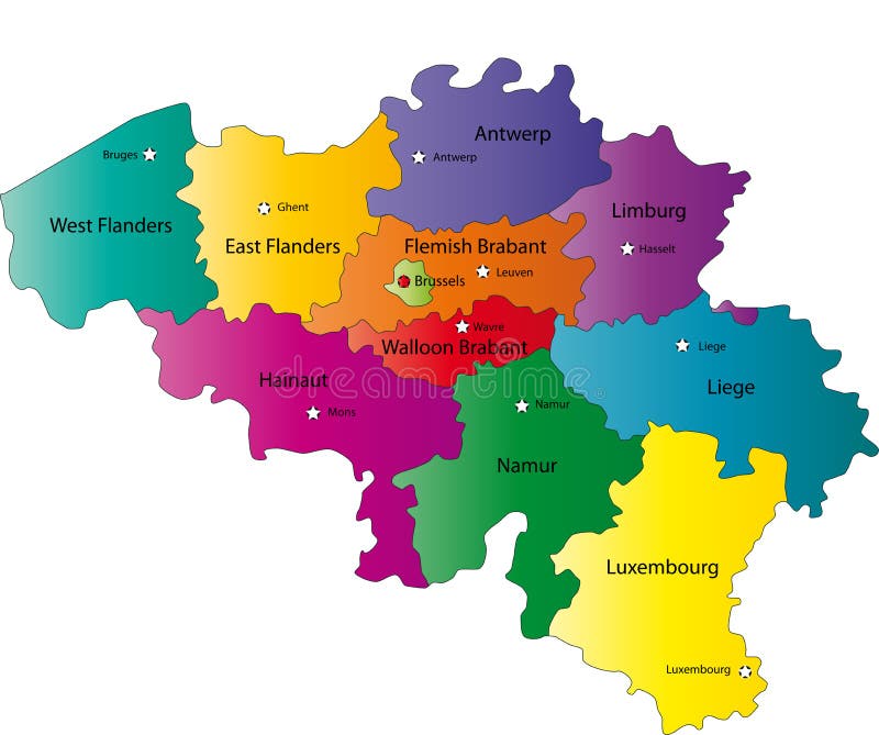
Free with trial Belgium map designed in illustration with the regions colored in bright colors and with the main cities. Neighbouring countries are in an additional format (. AI) in the latent layer. Neighbouring countries vectors Map of Belgium. Belgium map designed in illustration with the regions colored in bright colors and with the main cities. Neighbouring countries are in an additional format (. AI) in the latent layer.
Free with trial Netherlands map designed in illustration with the regions colored in bright colors and with the main cities. Neighbouring countries are in an additional format (. AI) in the latent layer. Neighbouring countries vectors Netherlands map
Free with trial Italy map designed in illustration with the regions colored in bright colors and with the main cities. On an illustration neighbouring countries are shown too. Neighbouring countries vectors Color map of Italy. Italy map designed in illustration with the regions colored in bright colors and with the main cities. On an illustration neighbouring countries are shown too
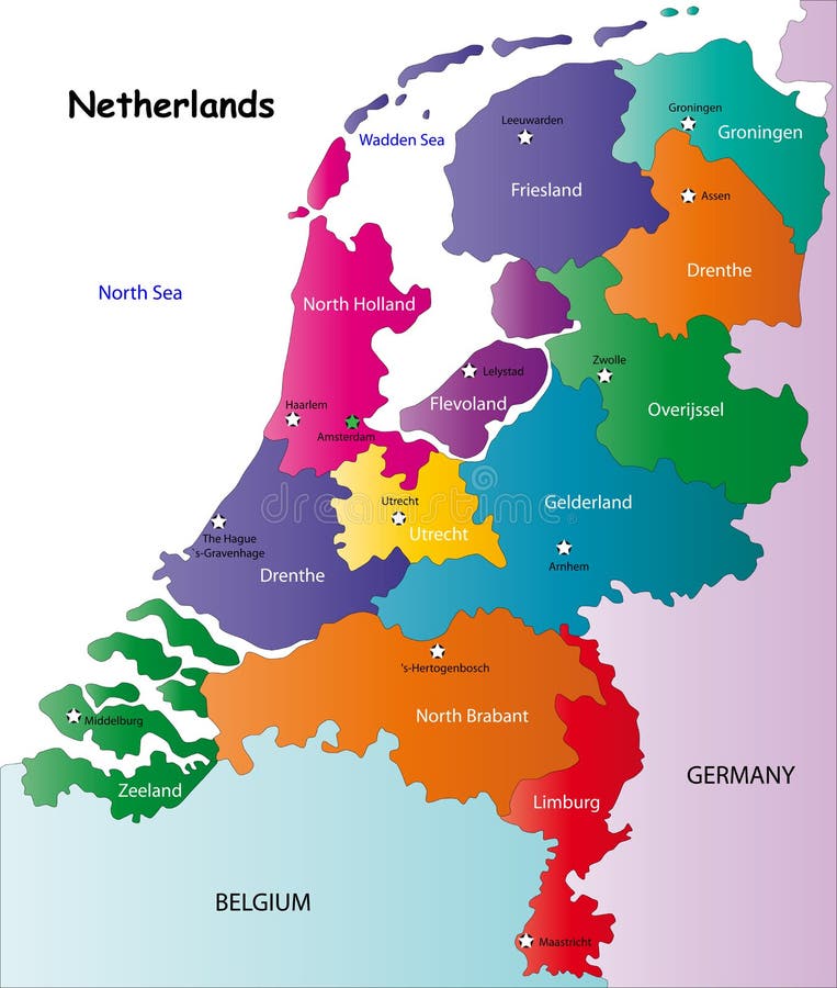
Free with trial Netherlands map designed in illustration with the regions colored in green colors and with the main cities. Neighbouring countries are in an additional format (. AI) in the latent layer. Neighbouring countries vectors Vector Netherlands map. Netherlands map designed in illustration with the regions colored in green colors and with the main cities. Neighbouring countries are in an additional format (.AI) in the latent layer.
Free with trial Belgium map designed in illustration with the regions colored in grey colors and with the main cities. Neighbouring countries are in an additional format (. AI) in the latent layer. Neighbouring countries vectors Belgium map
Free with trial Canada map designed in illustration with states colored in green colors and with the main cities. Neighbouring countries are in an additional format (. AI) in the latent layer. Neighbouring countries vectors Canada
Free with trial Spain map designed in illustration with the regions colored in bright colors and with the main cities. Neighbouring countries are in an additional format (. AI) in the latent layer. Neighbouring countries vectors Spain map
Free with trial Blind map of Spain with regions borders. Names of the regions, main cities, and neighbouring countries are in an additional format (. AI) in the latent layer. Neighbouring countries vectors Spain map. Blind map of Spain with regions borders. Names of the regions, main cities, and neighbouring countries are in an additional format (. AI) in the latent layer.
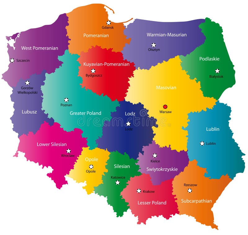
Free with trial Poland map designed in illustration with the 16 provinces colored in bright colors and with the main cities. On an illustration neighbouring countries are shown too. Neighbouring countries vectors Poland map
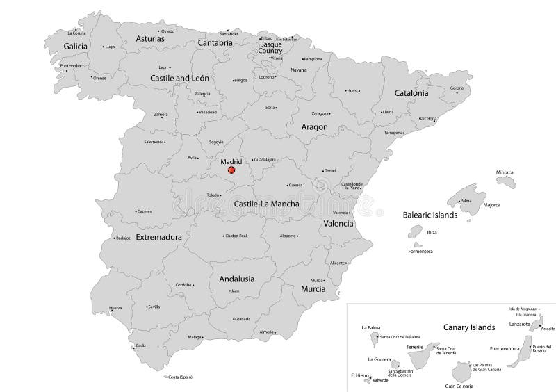
Free with trial Spain map designed in illustration with the regions colored in grey colors and with the main cities. Neighbouring countries are in an additional format (. AI) in the latent layer. Neighbouring countries vectors Map of Spain. Spain map designed in illustration with the regions colored in grey colors and with the main cities. Neighbouring countries are in an additional format (.AI) in the latent layer.
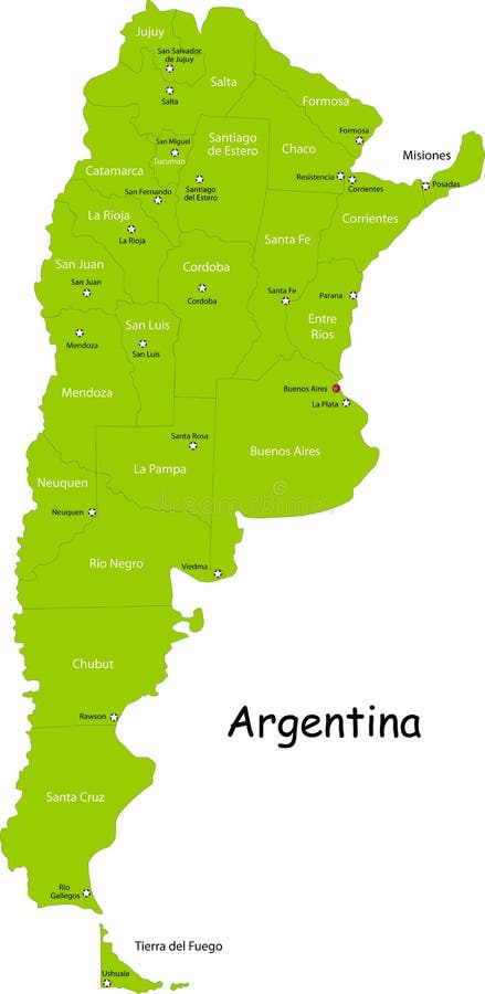
Free with trial Argentina map designed in illustration with states colored in bright colors and with the main cities. Neighbouring countries are in an additional format (. AI) in the latent layer. Neighbouring countries vectors Argentina map
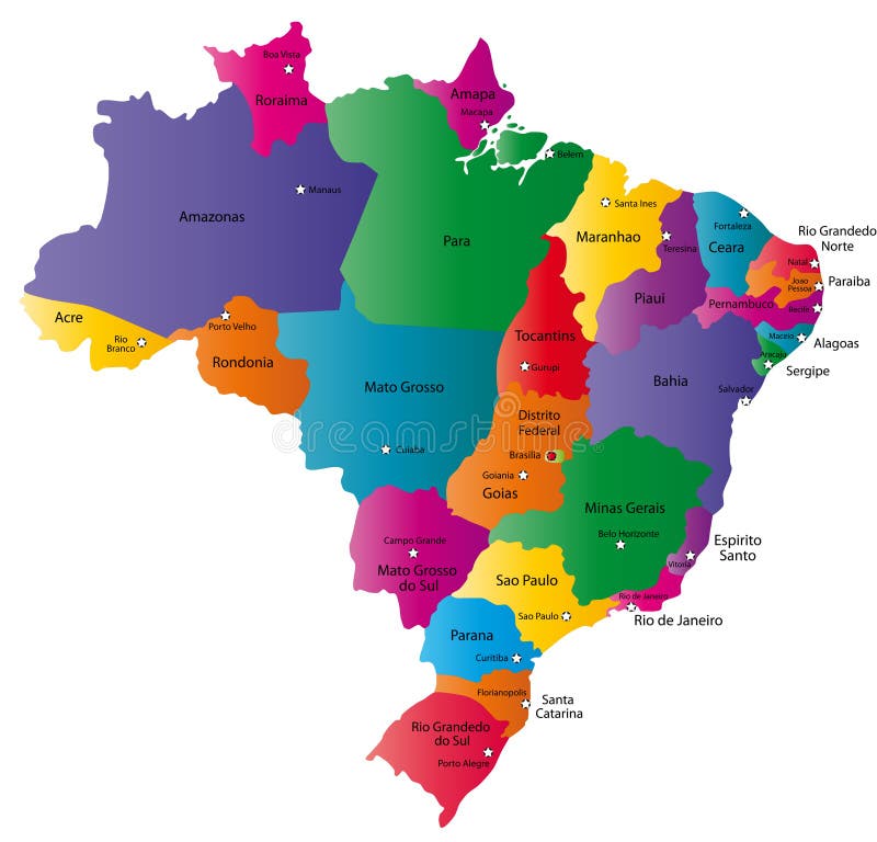
Free with trial Brazil map designed in illustration with 26 states colored in bright colors and with the main cities. Neighbouring countries are in an additional format (. AI) in the latent layer. Neighbouring countries illustrations Map of Brazil. Brazil map designed in illustration with 26 states colored in bright colors and with the main cities. Neighbouring countries are in an additional format (.AI) in the latent layer.
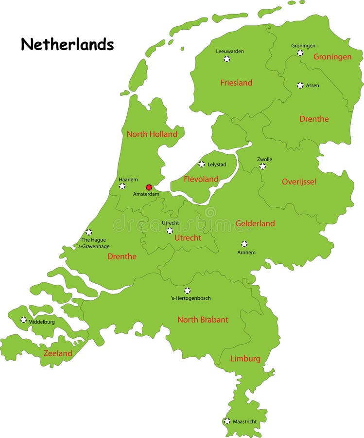
Free with trial Netherlands map designed in illustration with the regions colored in bright colors and with the main cities. On an illustration neighbouring countries are shown too. Neighbouring countries vectors Netherlands map
Free with trial Spain map designed in illustration with the regions colored in bright colors and with the main cities. On an illustration neighbouring countries are shown too. Neighbouring countries vectors Vector Spain map. Spain map designed in illustration with the regions colored in bright colors and with the main cities. On an illustration neighbouring countries are shown too
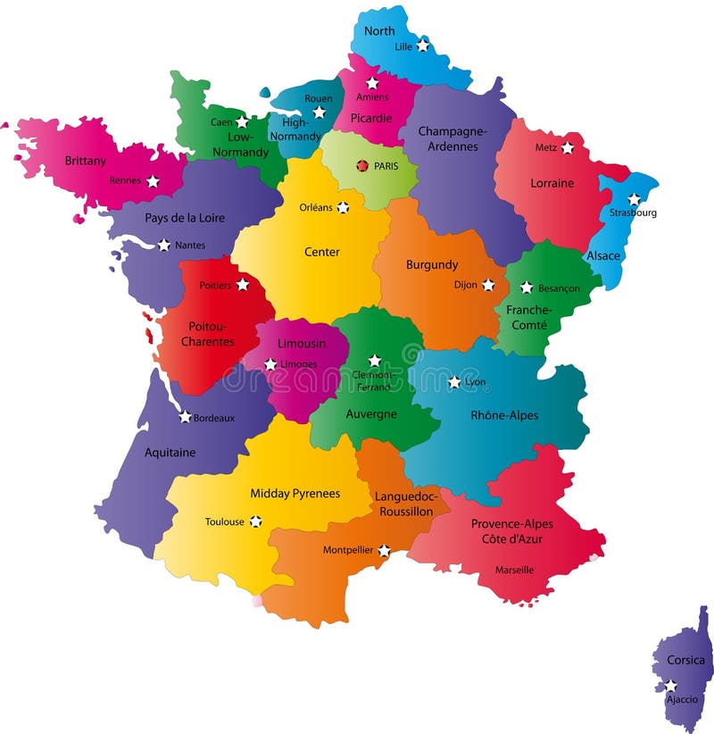
Free with trial France map designed in illustration with the regions colored in bright colors and with the main cities. On an illustration neighbouring countries are shown too. Neighbouring countries vectors Vector France map. France map designed in illustration with the regions colored in bright colors and with the main cities. On an illustration neighbouring countries are shown too.
Free with trial Greece map designed in illustration with the regions colored in bright colors and with the main cities. Neighbouring countries are in an additional format (. AI) in the latent layer. Neighbouring countries vectors Vector Greece map. Greece map designed in illustration with the regions colored in bright colors and with the main cities. Neighbouring countries are in an additional format (.AI) in the latent layer.
Free with trial Denmark map designed in illustration with the regions colored in green colors and with the main cities. Neighbouring countries are in an additional format (. AI) in the latent layer. Neighbouring countries vectors Denmark map
Free with trial Poland map designed in illustration with the 16 provinces colored in bright colors and with the main cities. Neighbouring countries are in an additional format (. AI) in the latent layer. Neighbouring countries vectors Color Poland map. Poland map designed in illustration with the 16 provinces colored in bright colors and with the main cities. Neighbouring countries are in an additional format (.AI) in the latent layer.
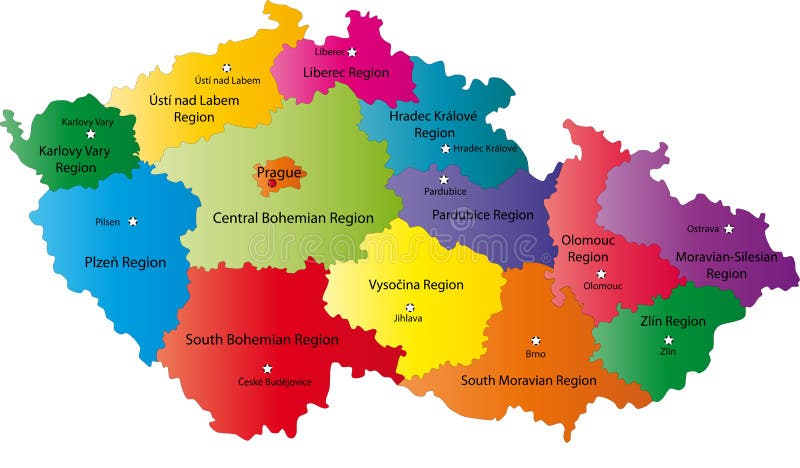
Free with trial Czech Republic map designed in illustration with the regions colored in bright colors and with the main cities. Neighbouring countries are in an additional format (. AI) in the latent layer. Neighbouring countries vectors Czech Republic map
Free with trial Blind map of Netherlands with regions borders. Names of the regions, main cities, and neighbouring countries are in an additional format (. AI) in the latent layer. Neighbouring countries vectors Map of Netherlands
Free with trial Slovakia map designed in illustration with the regions colored in bright colors and with the main cities. Neighbouring countries are in an additional format (. AI) in the latent layer. Neighbouring countries vectors Map of Slovakia. Slovakia map designed in illustration with the regions colored in bright colors and with the main cities. Neighbouring countries are in an additional format (. AI) in the latent layer.
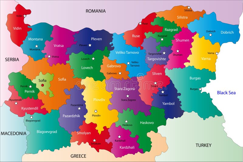
Free with trial Bulgaria map designed in illustration with the provinces colored in bright colors and with the main cities. On an illustration neighbouring countries are shown too. Neighbouring countries vectors Bulgaria map
Free with trial India map designed in illustration with regions colored in green colors and with the main cities. Neighbouring countries are in an additional format (. AI) in the latent layer. Neighbouring countries vectors India
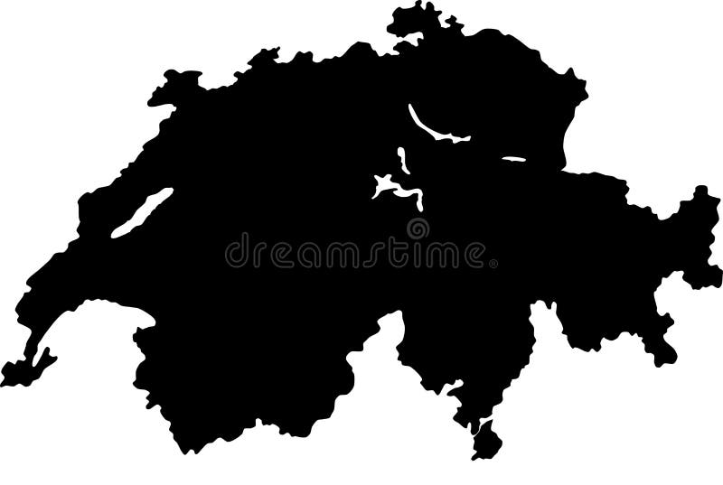
Free with trial Blind map of Switzerland with regions borders. Names of the regions, main cities, and neighbouring countries are in an additional format (. AI) in the latent layer. Neighbouring countries vectors Vector map of Switzerland. Blind map of Switzerland with regions borders. Names of the regions, main cities, and neighbouring countries are in an additional format (.AI) in the latent layer.
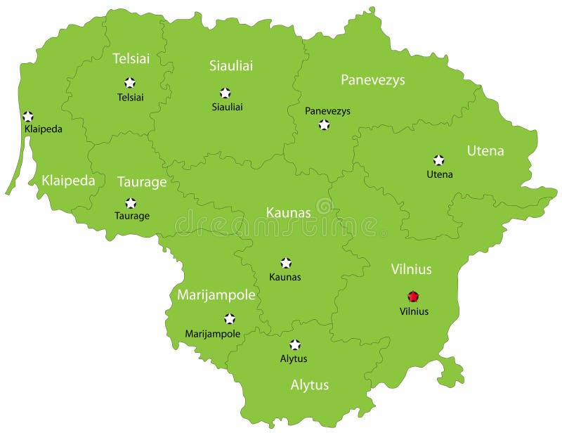
Free with trial Lithuania map designed in illustration with the 10 counties colored in green colors and with the main cities. Neighbouring countries are in an additional format (. AI) in the latent layer. Neighbouring countries vectors Vector Lithuania map. Lithuania map designed in illustration with the 10 counties colored in green colors and with the main cities. Neighbouring countries are in an additional format (.AI) in the latent layer.
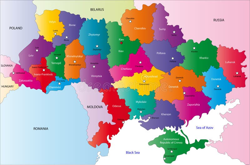
Free with trial Ukraine map designed in illustration with the region colored in bright colors and with the main cities. On an illustration neighbouring countries are shown too. Neighbouring countries vectors Map of Ukraine. Ukraine map designed in illustration with the region colored in bright colors and with the main cities. On an illustration neighbouring countries are shown too
Free with trial Costa Rica map designed in illustration with the states colored in bright colors and with the main cities. On an illustration neighbouring countries are shown too. Neighbouring countries vectors Costa Rica map
Free with trial Iceland map designed in illustration with provinces colored in bright colors and with the main cities. Neighbouring countries are in an additional format (. AI) in the latent layer. Neighbouring countries vectors Map of Iceland. Iceland map designed in illustration with provinces colored in bright colors and with the main cities. Neighbouring countries are in an additional format (.AI) in the latent layer.
Free with trial Iceland map designed in illustration with provinces colored in green colors and with the main cities. Neighbouring countries are in an additional format (. AI) in the latent layer. Neighbouring countries vectors Map of Iceland. Iceland map designed in illustration with provinces colored in green colors and with the main cities. Neighbouring countries are in an additional format (.AI) in the latent layer.
Free with trial Argentina map designed in illustration with states colored in green colors and with the main cities. Neighbouring countries are in an additional format (. AI) in the latent layer. Neighbouring countries vectors Map of Argentina. Argentina map designed in illustration with states colored in green colors and with the main cities. Neighbouring countries are in an additional format (.AI) in the latent layer.
Free with trial Sweden map designed in illustration with the regions colored in green colors and with the main cities. Neighbouring countries are in an additional format (. AI) in the latent layer. Neighbouring countries illustrations Vector Sweden map. Sweden map designed in illustration with the regions colored in green colors and with the main cities. Neighbouring countries are in an additional format (.AI) in the latent layer.
Free with trial Hungary map designed in illustration with the regions colored in green colors and with the main cities. Neighbouring countries are in an additional format (. AI) in the latent layer. Neighbouring countries vectors Hungary map
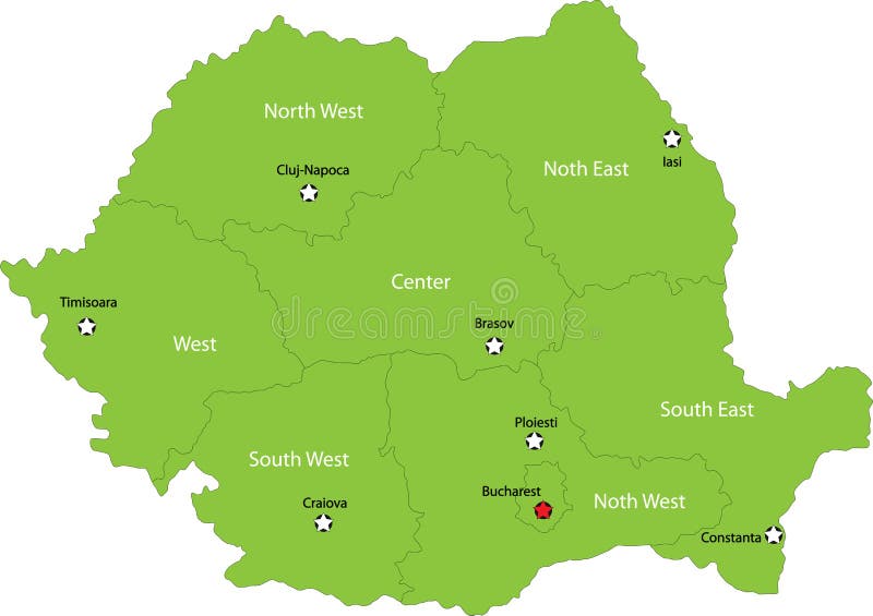
Free with trial Romania map designed in illustration with the regions colored in bright colors and with the main cities. Neighbouring countries are in an additional format (. AI) in the latent layer. Neighbouring countries vectors Romania map
Free with trial Romania map designed in illustration with the regions colored in bright colors and with the main cities. Neighbouring countries are in an additional format (. AI) in the latent layer. Neighbouring countries vectors Map of Romania. Romania map designed in illustration with the regions colored in bright colors and with the main cities. Neighbouring countries are in an additional format (.AI) in the latent layer.
Free with trial Austria map designed in illustration with the regions colored in bright colors and with the main cities. Neighbouring countries are in an additional format (. AI) in the latent layer. Neighbouring countries vectors Vector map of Austria. Austria map designed in illustration with the regions colored in bright colors and with the main cities. Neighbouring countries are in an additional format (.AI) in the latent layer.
Free with trial Belgium map designed in illustration with the 21 counties colored in bright colors and with the main cities. Neighbouring countries are in an additional format (. AI) in the latent layer. Neighbouring countries vectors Sweden. Belgium map designed in illustration with the 21 counties colored in bright colors and with the main cities. Neighbouring countries are in an additional format (.AI) in the latent layer.
Free with trial Austria map of Slovakia with regions borders. Names of the regions, main cities, and neighbouring countries are in an additional format (. AI) in the latent layer. Neighbouring countries vectors Austria map
Free with trial Romania map designed in illustration with the regions colored in green colors and with the main cities. Neighbouring countries are in an additional format (. AI) in the latent layer. Neighbouring countries vectors Romania map
Free with trial Estonia map designed in illustration with states colored in green colors and with the main cities. Neighbouring countries are in an additional format (. AI) in the latent layer. Neighbouring countries vectors Vector Estonia map. Estonia map designed in illustration with states colored in green colors and with the main cities. Neighbouring countries are in an additional format (.AI) in the latent layer.
Free with trial Czech Republic map designed in illustration with the regions colored in grey colors and with the main cities. Neighbouring countries are in an additional format (. AI) in the latent layer. Neighbouring countries vectors Map of Czech Republic. Czech Republic map designed in illustration with the regions colored in grey colors and with the main cities. Neighbouring countries are in an additional format (.AI) in the latent layer.
Free with trial Blind map of Sweden with regions borders. Names of the regions, main cities, and neighbouring countries are in an additional format (. AI) in the latent layer. Neighbouring countries vectors Map of Sweden
Free with trial France map designed in illustration with the regions colored in grey colors and with the main cities. Neighbouring countries are in an additional format (. AI) in the latent layer. Neighbouring countries vectors Map of France. France map designed in illustration with the regions colored in grey colors and with the main cities. Neighbouring countries are in an additional format (.AI) in the latent layer.
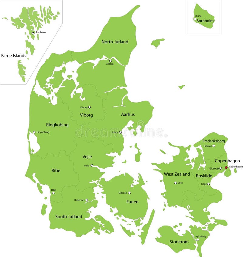
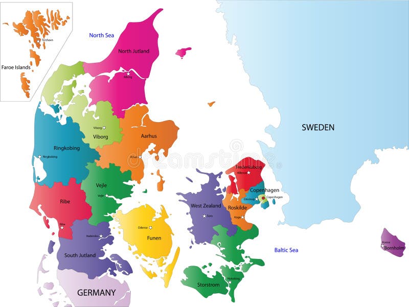
Free with trial Denmark map designed in illustration with the regions colored in bright colors and with the main cities. On an illustration neighbouring countries are shown too. Neighbouring countries vectors Map of Denmark. Denmark map designed in illustration with the regions colored in bright colors and with the main cities. On an illustration neighbouring countries are shown too
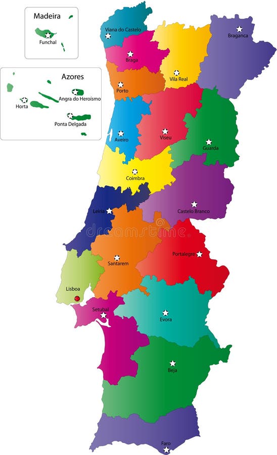
Free with trial Portugal map designed in illustration with the regions colored in bright colors and with the main cities. Neighbouring countries are in an additional format (. AI) in the latent layer. Neighbouring countries vectors Map of Portugal. Portugal map designed in illustration with the regions colored in bright colors and with the main cities. Neighbouring countries are in an additional format (.AI) in the latent layer.
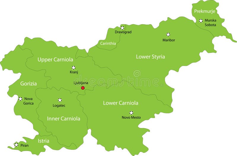
Free with trial Slovenia map designed in illustration with the regions colored in green colors and with the main cities. Neighbouring countries are in an additional format (. AI) in the latent layer. Neighbouring countries vectors Map of Slovenia. Slovenia map designed in illustration with the regions colored in green colors and with the main cities. Neighbouring countries are in an additional format (.AI) in the latent layer.
Free with trial Portugal map designed in illustration with the regions colored in bright colors and with the main cities. Neighbouring countries are in an additional format (. AI) in the latent layer. Neighbouring countries vectors Vector map Portugal. Portugal map designed in illustration with the regions colored in bright colors and with the main cities. Neighbouring countries are in an additional format (.AI) in the latent layer.
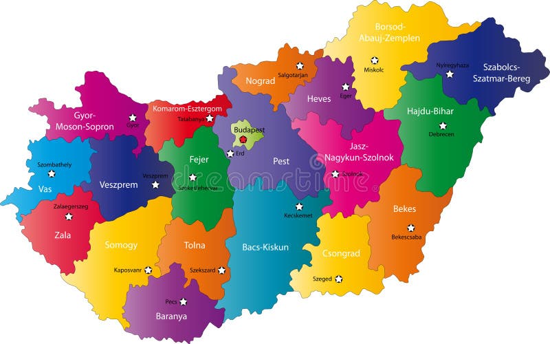
Free with trial Hungary map designed in illustration with the regions colored in bright colors and with the main cities. On an illustration neighbouring countries are shown too. Neighbouring countries vectors Hungary map
Free with trial Hungary map designed in illustration with the regions colored in bright colors and with the main cities. Neighbouring countries are in an additional format (. AI) in the latent layer. Neighbouring countries vectors Map of Hungary. Hungary map designed in illustration with the regions colored in bright colors and with the main cities. Neighbouring countries are in an additional format (. AI) in the latent layer.
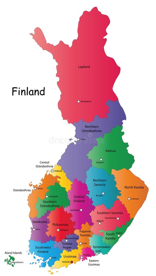
Free with trial Finland map designed in illustration with the 20 regions colored in bright colors and with the main cities. Neighbouring countries are in an additional format (. AI) in the latent layer. Neighbouring countries vectors Map of Finland. Finland map designed in illustration with the 20 regions colored in bright colors and with the main cities. Neighbouring countries are in an additional format (.AI) in the latent layer.
Free with trial Blind map of Slovakia with 20 regions borders. Names of the regions, main cities, and neighbouring countries are in an additional format (. AI) in the latent layer. Neighbouring countries vectors Black Italy map. Blind map of Slovakia with 20 regions borders. Names of the regions, main cities, and neighbouring countries are in an additional format (.AI) in the latent layer.
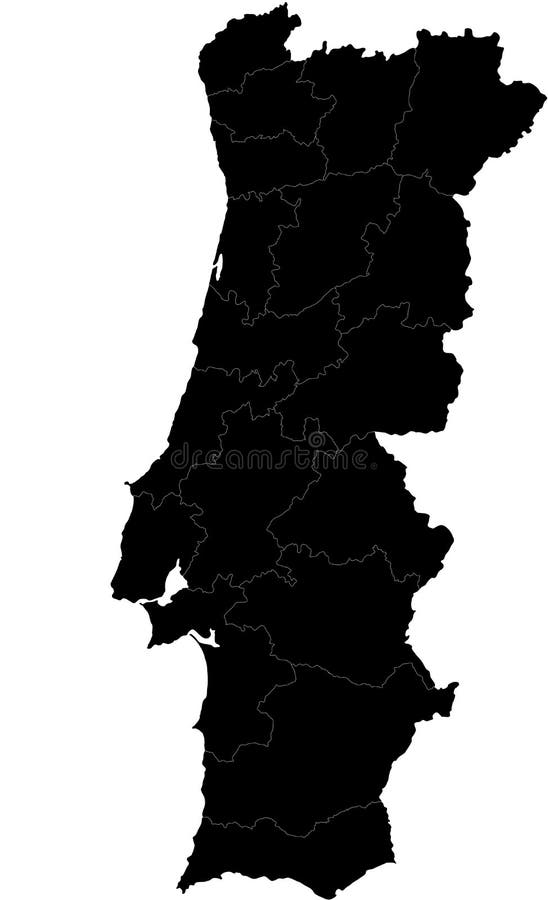
Free with trial Blind map of Portugal with regions borders. Names of the regions, main cities, and neighbouring countries are in an additional format (. AI) in the latent layer. Neighbouring countries vectors Vector map of Portugal. Blind map of Portugal with regions borders. Names of the regions, main cities, and neighbouring countries are in an additional format (. AI) in the latent layer.
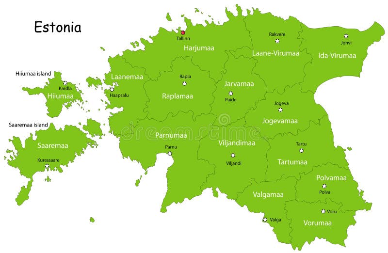
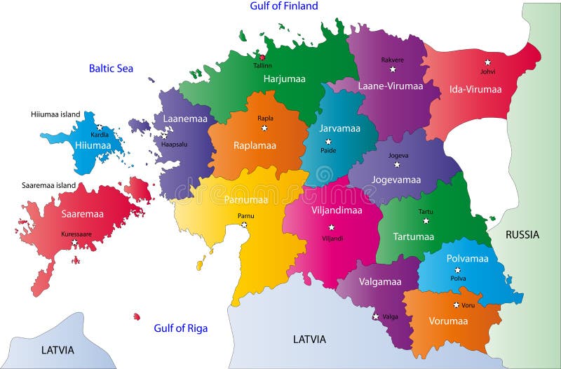
Free with trial Estonia map designed in illustration with the regions colored in bright colors and with the main cities. On an illustration neighbouring countries are shown too. Neighbouring countries vectors Estonia map