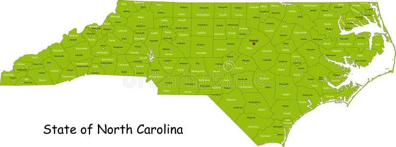
Free with trial Illustrated design of the map of North Carolina (USA), including counties and county seats. Isolated against a white background. North carolina city map vectors State of North Carolina. Illustrated design of the map of North Carolina (USA), including counties and county seats. Isolated against a white background.
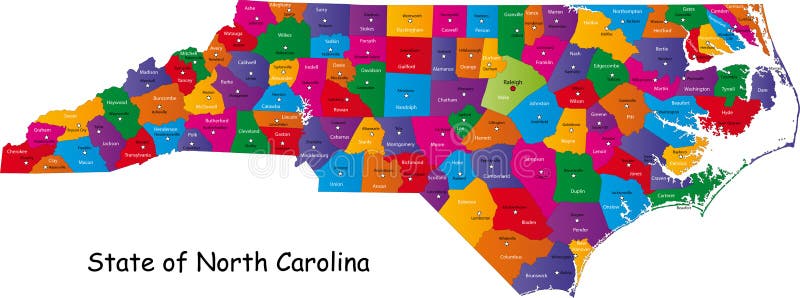
Free with trial Colorful illustrated design of the map of North Carolina (USA), including counties and county seats. Isolated against a white background. North carolina city map vectors North Carolina map. Colorful illustrated design of the map of North Carolina (USA), including counties and county seats. Isolated against a white background.
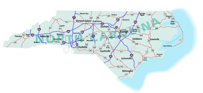
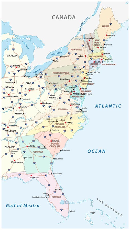
Free with trial North Carolina state road map with Interstates, U. S. Highways and state roads. All elements on separate layers (Fill, Roads, Cities, Outline) for easy editing. Map created December 3, 2009. ZIP File contains EPS-8 Adobe Illustrator file, Illustrator CS3 file, and large JPG file, 6806x3120. Source: Public domain National Planning Network ( and United States. North carolina city map vectors North Carolina State Interstate Map. North Carolina state road map with Interstates, U.S. Highways and state roads. All elements on separate layers (Fill, Roads, Cities, Outline) for easy editing. Map created December 3, 2009. ZIP File contains EPS-8 Adobe Illustrator file, Illustrator CS3 file, and large JPG file, 6806x3120. Source: Public domain National Planning Network ( and United States
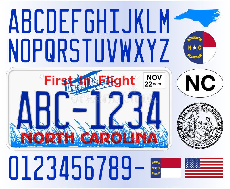
Free with trial North Carolina car license plate pattern, letters, numbers and symbols, vector illustration, USA. North carolina city map vectors North Carolina car license plate pattern, USA. North Carolina car license plate pattern, letters, numbers and symbols, vector illustration, USA
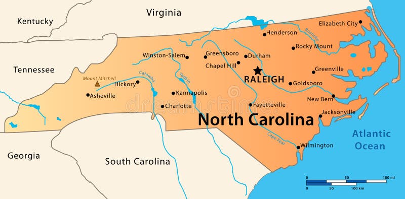
Free with trial Illustration of the map of the Great State of North Carolina, USA. Featuring its main cities, rivers, lakes and the highest peak of the state. North carolina city map vectors North Carolina Map. Illustration of the map of the Great State of North Carolina, USA. Featuring its main cities, rivers, lakes and the highest peak of the state.
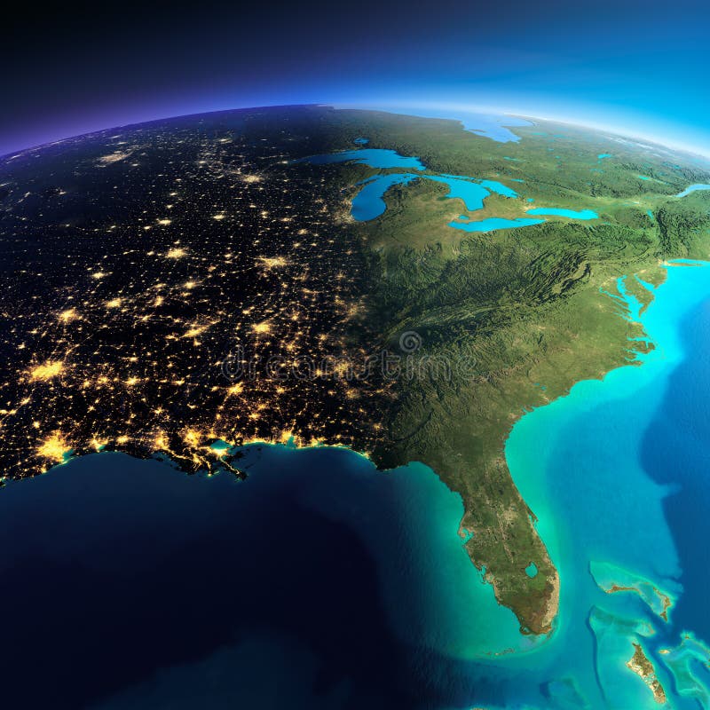
Free with trial Night planet Earth with precise detailed relief and city lights illuminated by moonlight. North America. USA. Gulf of Mexico and Florida. Elements of this image furnished by NASA. North carolina city map illustrations Detailed Earth. North America. USA. Gulf of Mexico and Florida o. Night planet Earth with precise detailed relief and city lights illuminated by moonlight. North America. USA. Gulf of Mexico and Florida. Elements of this image furnished by NASA
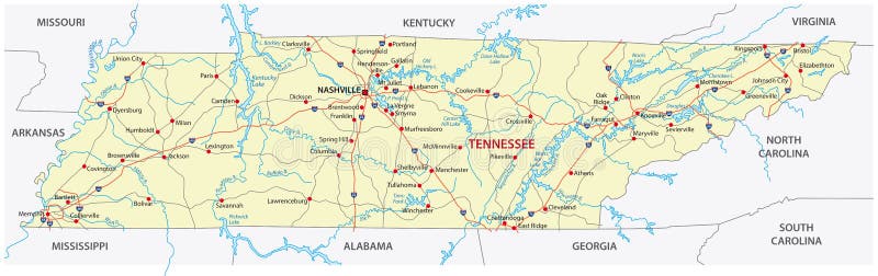
Free with trial The tennessee road vector map. North carolina city map vectors The tennessee road map. The tennessee road vector map
Free with trial Set of county maps of USA states South Carolina,South Dakota,Tennessee,Texas,Utah,Vermont. North carolina city map vectors Maps counties USA states. Set of county maps of USA states South Carolina,South Dakota,Tennessee,Texas,Utah,Vermont.
Free with trial Set of county maps of USA states Virginia,Washington,West Virginia,Wisconsin,Wyoming. North carolina city map vectors Maps counties USA states. Set of county maps of USA states Virginia,Washington,West Virginia,Wisconsin,Wyoming.
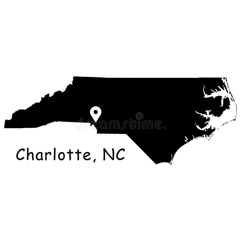
Free with trial Charlotte on North Carolina State Map. Detailed NC State Map with Location Pin on Charlotte City. Black silhouette vector map isolated on white background. Vector File. North carolina city map vectors Charlotte on North Carolina State Map. Detailed NC State Map with Location Pin on Charlotte City. Black silhouette vector map isol
Free with trial Stamp set with the name and map of North Carolina, United States, vector illustration. North carolina city map vectors Stamp set with the name and map of North Carolina
Free with trial North Carolina state contour with Capital City against blurred USA flag. North carolina city map illustrations North Carolina state contour
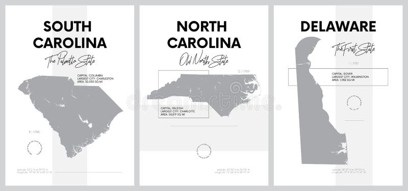
Free with trial Vector posters with highly detailed silhouettes of maps of the states of America, Division South Atlantic - South Carolina, North Carolina, Delaware - set 9 of 17 travel postcard. North carolina city map vectors Vector posters with highly detailed silhouettes of maps of the states of America, Division South Atlantic - South Carolina, North
Free with trial Tennessee - North Carolina - Alabama - Georgia - South Carolina labelled black illustration. North carolina city map illustrations Tennessee - North Carolina - Alabama - Georgia - South Carolina
Free with trial Vector map of the East Coast, United States. North carolina city map vectors Vector map of the East Coast, United States
Free with trial Southeast Region, the South of the United States, political map. Geographic and cultural region, also referred to as the Southern United States, American South, Southland, Dixieland, or simply Dixie. North carolina city map vectors Southeast Region, the South of the United States, political map
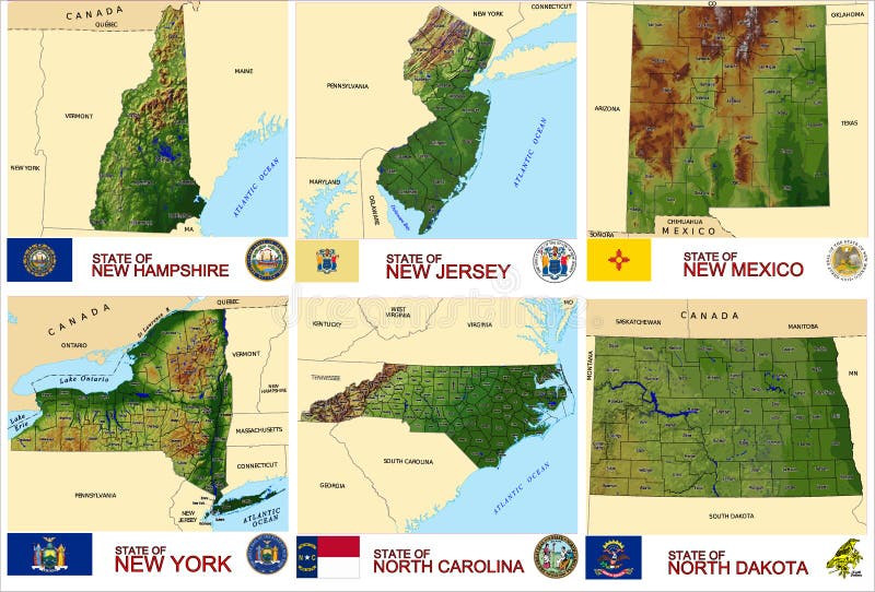
Free with trial Set of county maps of USA states New Hampshire,New Jersey, New Mexico,New York,North Carolina,North Dakota. North carolina city map vectors Maps counties USA states. Set of county maps of USA states New Hampshire,New Jersey, New Mexico,New York,North Carolina,North Dakota.
Free with trial All state capitols of the United States. Detailed vector isolated icons of all capitol buildings. Map of the United States with all state capitals on it. All flags of the U. S. states. Vector set. North carolina city map vectors All state capitols of the United States. Detailed vector isolated icons of all capitol buildings. Map of the United States
Free with trial Vector illustration of the Black Map of USA State of Florida. North carolina city map vectors Black Map of USA State of Florida
Free with trial Vector Illustration of the Seal of USA City of Boston, Massachusetts. North carolina city map vectors Seal of USA City of Boston, Massachusetts
Free with trial Planet Earth with detailed exaggerated relief at night lit by the lights of cities. North America. USA. Gulf of Mexico and Florida. 3D rendering. Elements of this image furnished by NASA. North carolina city map illustrations Detailed Earth at night. North America. USA. Gulf of Mexico and Florida. Planet Earth with detailed exaggerated relief at night lit by the lights of cities. North America. USA. Gulf of Mexico and Florida. 3D rendering. Elements of this image furnished by NASA
Free with trial Highly detailed planet Earth. Night with glowing city lights gives way to day. The boundary of the night & day. North America. USA. Gulf of Mexico and Florida. Elements of this image furnished by NASA. North carolina city map illustrations Detailed Earth. Gulf of California, Mexico and the western U.S. Highly detailed planet Earth. Night with glowing city lights gives way to day. The boundary of the night & day. North America. USA. Gulf of Mexico and Florida. Elements of this image furnished by NASA
Free with trial USA 50 States Colorful Map and State Names vector. North carolina city map vectors USA 50 States vivid colors. USA 50 States Colorful Map and State Names vector
Free with trial Highly detailed Earth, illuminated by moonlight. The glow of cities sheds light on the detailed exaggerated terrain. Night Earth. Gulf of Mexico and Florida. Elements of this image furnished by NASA. North carolina city map illustrations Night Earth. Gulf of Mexico and Florida
Free with trial Set of county maps of USA states Hawaii,Idaho,Illinois,Indiana,Iowa,Kansas. North carolina city map illustrations Maps counties USA states. Set of county maps of USA states Hawaii,Idaho,Illinois,Indiana,Iowa,Kansas.
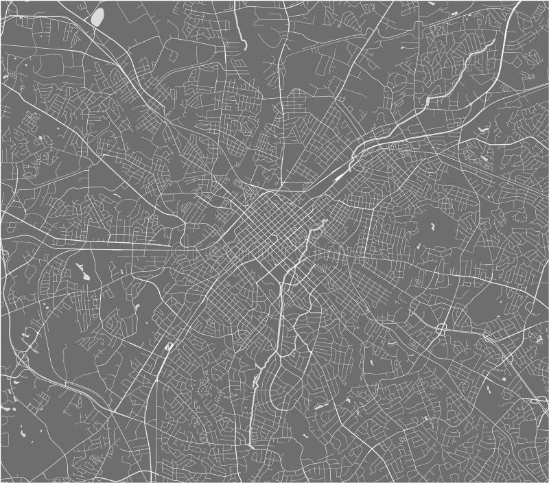
Free with trial Satellite map of Charlotte, North Carolina, city streets. Street map, city center. Usa. North carolina city map vectors Satellite map of Charlotte, North Carolina, city streets. Usa. Satellite map of Charlotte, North Carolina, city streets. Street map, city center. Usa
Free with trial Raleigh North Carolina city map USA labelled black illustration. North carolina city map vectors Raleigh North Carolina city map USA labelled black illustration
Free with trial Greensboro North Carolina city watercolor map in front of a white background illustration. North carolina city map illustrations Greensboro North Carolina city watercolor map in front of a whit
Free with trial Modern City Map - Charlotte North Carolina city of the USA illustration. North carolina city map vectors Modern City Map - Charlotte North Carolina city of the USA
Free with trial Modern City Map - Charlotte North Carolina city of the USA with boroughs and titles outline map illustration. North carolina city map vectors Modern City Map - Charlotte North Carolina city of the USA with
Free with trial Modern City Map - Raleigh North Carolina city of the USA with neighborhoods and titles illustration. North carolina city map vectors Modern City Map - Raleigh North Carolina city of the USA with ne
Free with trial Raleigh North Carolina city map grey illustration silhouette shape. North carolina city map vectors Raleigh North Carolina city map grey illustration silhouette shape
Free with trial Step back in time with this captivating panoramic view of Webster, North Carolina. This vintage city map offers a detailed street plan, showcasing the historical layout of the town. Notice the meticulous representation of buildings, roads, and landmarks, providing a unique glimpse into the past. Perfect for anyone interested in the history and development of Webster. Explore the intricacies of. North carolina city map illustrations Discover the Charming Streets of Webster North Carolina A Retro City Map Panoramic View for History Buffs and. Step back in time with this captivating panoramic view of Webster, North Carolina. This vintage city map offers a detailed street plan, showcasing the historical layout of the town. Notice the meticulous representation of buildings, roads, and landmarks, providing a unique glimpse into the past. Perfect for anyone interested in the history and development of Webster. Explore the intricacies of
Free with trial Vector map of the city of Charlotte, in the USA of North Carolina. North carolina city map illustrations Map of the city of Charlotte, in the USA of North Carolina
Free with trial Vector map of the city of Charlotte, in the USA of North Carolina. North carolina city map illustrations Map of the city of Charlotte, in the USA of North Carolina
Free with trial Vector map of the city of Charlotte, in the USA of North Carolina. North carolina city map illustrations Map of the city of Charlotte, in the USA of North Carolina
Free with trial Vector map of the city of Charlotte, in the USA of North Carolina. North carolina city map illustrations Map of the city of Charlotte, in the USA of North Carolina
Free with trial Vector map of the city of Charlotte, in the USA of North Carolina. North carolina city map illustrations Map of the city of Charlotte, in the USA of North Carolina
Free with trial Detailed map of North Carolina state,in vector format,with county borders,roads and major cities. North carolina city map vectors North Carolina state political map. Detailed map of North Carolina state,in vector format,with county borders,roads and major cities
Free with trial Charlotte North Carolina Stamps. City Stamp Vector Art. Postal Passport Travel. Design Set Pattern. North carolina city map vectors Charlotte North Carolina Stamps. City Stamp Vector Art. Postal Passport Travel. Design Set Pattern
Free with trial High detailed North Carolina road map with labeling. North carolina city map vectors Detailed North Carolina road map with labeling.
Free with trial Symbol Map of Greenville (North Carolina, United States) showing the village or settlement with a pattern of just a few black horizontal lines. North carolina city map vectors Symbol Map of Greenville (North Carolina, United States)
Free with trial Vintage wall art map of Carolina Beach, located in New Hanover, North Carolina, United States. Aerial plan with forests, roads, cities, lakes and rivers. North carolina city map illustrations Retro US map of Carolina Beach, North Carolina. Vintage street map. Vintage wall art map of Carolina Beach, located in New Hanover, North Carolina, United States. Aerial plan with forests, roads, cities, lakes and rivers.
Free with trial Vintage wall art map of Durham, located in Durham, North Carolina, United States. Aerial plan with forests, roads, cities, lakes and rivers. North carolina city map illustrations Retro US map of Durham, North Carolina. Vintage street map. Vintage wall art map of Durham, located in Durham, North Carolina, United States. Aerial plan with forests, roads, cities, lakes and rivers.
Free with trial Vintage wall art map of Greenville, located in Pitt, North Carolina, United States. Aerial plan with forests, roads, cities, lakes and rivers. North carolina city map illustrations Retro US map of Greenville, North Carolina. Vintage street map. Vintage wall art map of Greenville, located in Pitt, North Carolina, United States. Aerial plan with forests, roads, cities, lakes and rivers.
Free with trial Vintage wall art map of Roanoke Rapids, located in Halifax, North Carolina, United States. Aerial plan with forests, roads, cities, lakes and rivers. North carolina city map illustrations Retro US map of Roanoke Rapids, North Carolina. Vintage street map. Vintage wall art map of Roanoke Rapids, located in Halifax, North Carolina, United States. Aerial plan with forests, roads, cities, lakes and rivers.
Free with trial Vintage wall art map of Charlotte, located in Mecklenburg, North Carolina, United States. Aerial plan with forests, roads, cities, lakes and rivers. North carolina city map illustrations Retro US map of Charlotte, North Carolina. Vintage street map. Vintage wall art map of Charlotte, located in Mecklenburg, North Carolina, United States. Aerial plan with forests, roads, cities, lakes and rivers.
Free with trial Stylish outline map of north carolina state on a old vintage grunge background. Generative Ai. North carolina city map illustrations Outline map of north carolina state on a old vintage grunge background
Free with trial North Carolina - Highly detailed editable political map with labeling. North carolina city map vectors North Carolina - detailed editable political map with labeling.
Free with trial T-shirt map badge of Raleigh, North Carolina. Tee shirt print typography label badge emblem. Vector illustration. North carolina city map vectors T-shirt map badge of Raleigh, North Carolina
Free with trial T-shirt map badge of Charlotte, North Carolina. Tee shirt print typography label badge emblem. Vector illustration. North carolina city map vectors T-shirt map badge of Charlotte, North Carolina
Free with trial Charlotte North Carolina Map with neighborhoods and modern round shapes illustration. North carolina city map vectors Charlotte North Carolina Map with neighborhoods and modern round
Free with trial T-shirt map badge of Durham, North Carolina. Tee shirt print typography label badge emblem. Vector illustration. North carolina city map vectors T-shirt map badge of Durham, North Carolina
Free with trial Fayetteville North Carolina Map with wards and modern round shapes illustration. North carolina city map vectors Fayetteville North Carolina Map with wards and modern round shapes
Free with trial Highly detailed gray map of North Carolina with county lines, US state. Editable administrative map of North Carolina with territory borders and counties names labeled realistic vector illustration. North carolina city map vectors Highly detailed gray map of North Carolina with county lines, US state
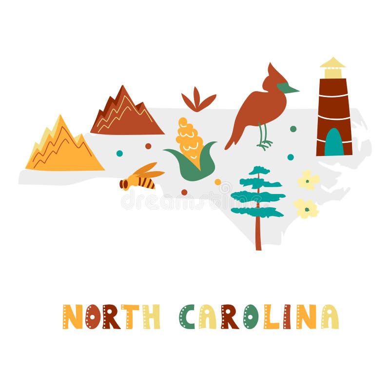
Free with trial USA map collection. State symbols and nature on gray state silhouette - North Carolina. Cartoon simple style for print. North carolina city map vectors USA map collection. State symbols on gray state silhouette - North Carolina. USA map collection. State symbols and nature on gray state silhouette - North Carolina. Cartoon simple style for print
Free with trial Greensboro, North Carolina, United States, high resolution map with city boundaries, and editable paths. The city map was drawn with white areas and lines for main roads, side roads and watercourses on a black background. North carolina city map illustrations Greensboro, North Carolina, United States, Black and White high resolution map. Greensboro, North Carolina, United States, high resolution map with city boundaries, and editable paths. The city map was drawn with white areas and lines for main roads, side roads and watercourses on a black background
Free with trial A Raleigh North Carolina Travel Stamp Icon Skyline City Design badge. North carolina city map vectors Raleigh North Carolina Travel Stamp Icon Skyline City Design badge.
Free with trial Vintage wall art map of Raleigh, located in Wake, North Carolina, United States. Aerial plan with forests, roads, cities, lakes and rivers. North carolina city map illustrations Retro US map of Raleigh, North Carolina. Vintage street map. Vintage wall art map of Raleigh, located in Wake, North Carolina, United States. Aerial plan with forests, roads, cities, lakes and rivers.
Free with trial Vintage wall art map of Boone, located in Watauga, North Carolina, United States. Aerial plan with forests, roads, cities, lakes and rivers. North carolina city map illustrations Retro US map of Boone, North Carolina. Vintage street map. Vintage wall art map of Boone, located in Watauga, North Carolina, United States. Aerial plan with forests, roads, cities, lakes and rivers.
Free with trial Map of Durham,North Carolina with all major and minor roads,railways and waterways. Colorful line art on black background. North carolina city map vectors Colorful Map of Durham, North Carolina with all major and minor roads. Map of Durham,North Carolina with all major and minor roads,railways and waterways. Colorful line art on black background
Free with trial Vintage wall art map of Edenton, located in Chowan, North Carolina, United States. Aerial plan with forests, roads, cities, lakes and rivers. North carolina city map illustrations Retro US map of Edenton, North Carolina. Vintage street map. Vintage wall art map of Edenton, located in Chowan, North Carolina, United States. Aerial plan with forests, roads, cities, lakes and rivers.
Free with trial Vintage wall art map of Hillsborough, located in Orange, North Carolina, United States. Aerial plan with forests, roads, cities, lakes and rivers. North carolina city map illustrations Retro US map of Hillsborough, North Carolina. Vintage street map. Vintage wall art map of Hillsborough, located in Orange, North Carolina, United States. Aerial plan with forests, roads, cities, lakes and rivers.
Free with trial 3d Map of North Carolina state with color. United State of America, US, United State. North carolina city map illustrations 3d Map of North Carolina state with color. United State of America, US, United State
Free with trial Vintage wall art map of Harkers Island, located in Carteret, North Carolina, United States. Aerial plan with forests, roads, cities, lakes and rivers. North carolina city map illustrations Retro US map of Harkers Island, North Carolina. Vintage street map. Vintage wall art map of Harkers Island, located in Carteret, North Carolina, United States. Aerial plan with forests, roads, cities, lakes and rivers.
Free with trial Durham, North Carolina, United States, high resolution map with city boundaries, and editable paths. The city map was drawn with white areas and lines for main roads, side roads and watercourses on a black background. North carolina city map illustrations Durham, North Carolina, United States, Black and White high resolution map. Durham, North Carolina, United States, high resolution map with city boundaries, and editable paths. The city map was drawn with white areas and lines for main roads, side roads and watercourses on a black background
Free with trial 3d Map of North Carolina state with color. United State of America, US, United State. North carolina city map illustrations 3d Map of North Carolina state with color. United State of America, US, United State
Free with trial 3d Map of North Carolina state with color. United State of America, US, United State. North carolina city map illustrations 3d Map of North Carolina state with color. United State of America, US, United State
Free with trial Mecklenburg County, North Carolina State U. S. county, United States of America, USA, U. , US map vector illustration, scribble sketch Mecklenburg map,. North carolina city map vectors Mecklenburg County, North Carolina State U.S. county, United States of America, USA, U.S., US map vector illustration, scribble
Free with trial Lincoln County, North Carolina State U. S. county, United States of America, USA, U. , US map vector illustration, scribble sketch Lincoln map,. North carolina city map vectors Lincoln County, North Carolina State U.S. county, United States of America, USA, U.S., US map vector illustration, scribble
Free with trial Catawba and Alamance County, North Carolina State U. S. county, United States of America, USA, U. , US map vector illustration, scribble sketch map,. North carolina city map vectors Catawba and Alamance County, North Carolina State U.S. county, United States of America, USA, U.S., US map vector illustration
Free with trial Lenoir County, North Carolina State U. S. county, United States of America, USA, U. , US map vector illustration, scribble sketch Lenoir map,. North carolina city map vectors Lenoir County, North Carolina State U.S. county, United States of America, USA, U.S., US map vector illustration, scribble
Free with trial Moore County, North Carolina State U. S. county, United States of America, USA, U. , US map vector illustration, scribble sketch Moore map,. North carolina city map vectors Moore County, North Carolina State U.S. county, United States of America, USA, U.S., US map vector illustration, scribble sketch
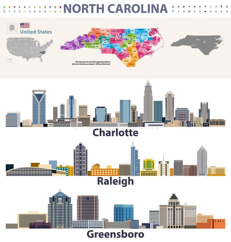
Free with trial Vector congressional districts map and major cities skylines of North Carolina. North carolina city map vectors Vector congressional districts map and major cities skylines of North Carolina
Free with trial North Carolina state detailed editable map with cities and towns, geographic sites, roads, railways, interstates and U. S. highways. Vector EPS-10 file, trending color scheme. North carolina city map vectors North Carolina state detailed editable map
Free with trial Pastel vector administrative map of the Federal State of North Carolina, USA with black borders and name tags of its counties. North carolina city map vectors Pastel counties map of North Carolina, USA. Pastel vector administrative map of the Federal State of North Carolina, USA with black borders and name tags of its counties
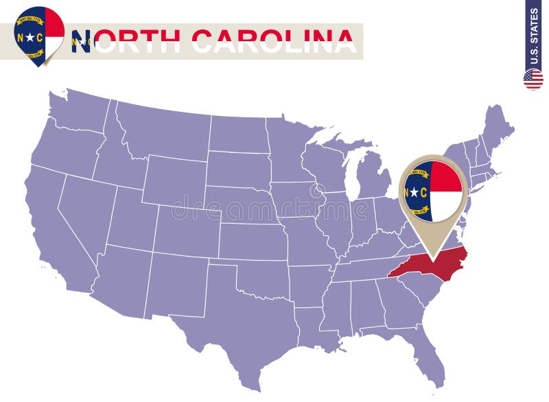
Free with trial North Carolina State on USA Map. North Carolina flag and map. US States. North carolina city map vectors North Carolina State on USA Map. North Carolina flag and map
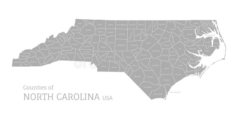
Free with trial White vector administrative map of the Federal State of North Carolina, USA with black borders and name tags of its counties. North carolina city map vectors White counties map of North Carolina, USA. White vector administrative map of the Federal State of North Carolina, USA with black borders and name tags of its counties
Free with trial North Carolina city line icon. Element of USA states illustration icons. Signs, symbols can be used for web, logo, mobile app, UI, UX on white background. North carolina city map illustrations North Carolina city line icon. Element of USA states illustration icons. Signs, symbols can be used for web, logo, mobile app, UI
Free with trial North Carolina state map on vintage usa map, crack paper background. North carolina city map illustrations Vintage North Carolina state map. North Carolina state map on vintage usa map, crack paper background