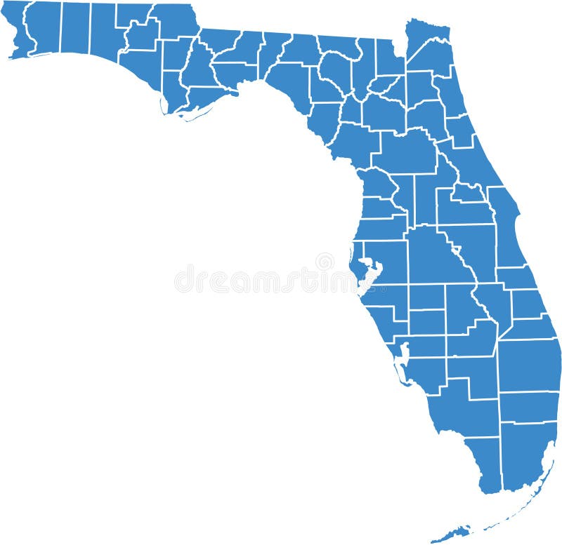
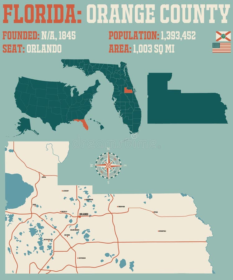
Free with trial County by county florida, vector option, to monitor state activity in different areas, can be used in flash and web. Orange county map vectors Florida by counties. County by county florida, vector option, to monitor state activity in different areas, can be used in flash and web
Free with trial Colorful map of the state of Louisiana with counties and county seats. Orange county map vectors Map of Louisiana. Colorful map of the state of Louisiana with counties and county seats.
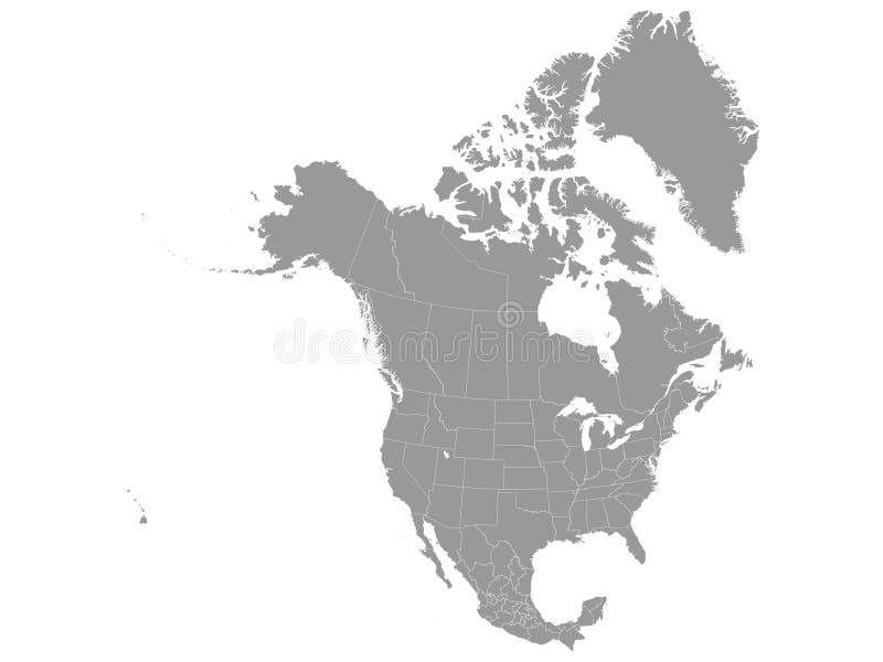
Free with trial Detailed flat vector illustration of Gray map of North America with state borders. Orange county map vectors Gray map of North America
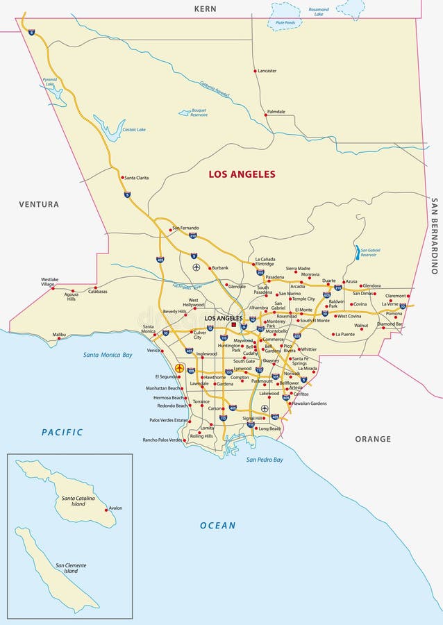
Free with trial Los angeles county road map. Orange county map vectors Los angeles county map. Los angeles county road map
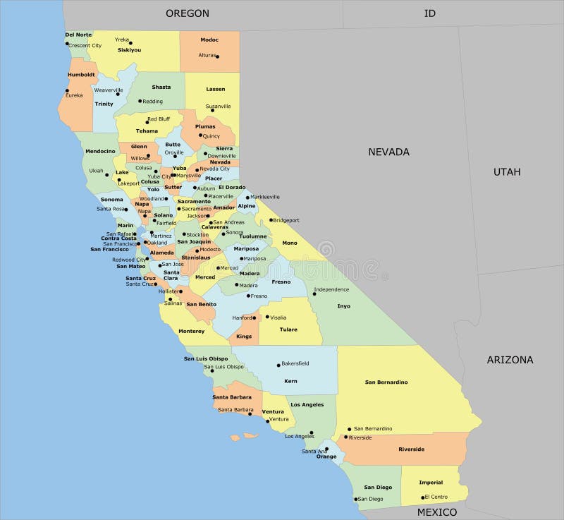
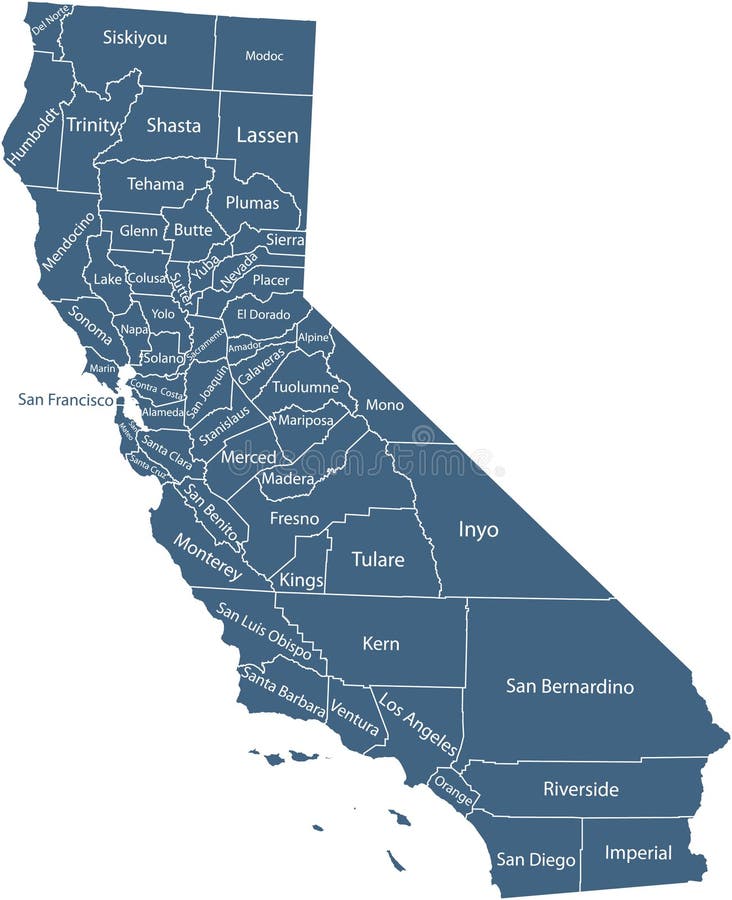
Free with trial US State California County Map with 58 counties, county seats, and neighboring states and country. Each county and neighboring states country is an individual object. Orange county map vectors California county map with 58 counties
Free with trial Map or ireland depicting county boundaries. Northern Ireland shown in orange, the Irish Republic shown in green. Orange county map illustrations Ireland map & counties. Map or ireland depicting county boundaries. Northern Ireland shown in orange, the Irish Republic shown in green.
Free with trial A California map and counties. Orange county map vectors California map. A California map and counties.
Free with trial Detailed map of Nigeria. Each file is constructed using multiple layers including country borders, county names, main roads and a highly detailed state silhouette. Each file is fully customizable with the ability to change the color of individual counties to suit your needs. Orange county map vectors Nigeria map. Detailed map of Nigeria. Each file is constructed using multiple layers including country borders, county names, main roads and a highly detailed state silhouette. Each file is fully customizable with the ability to change the color of individual counties to suit your needs.
Free with trial Vector street map of greater Los Angeles area, California, United States. Orange county map vectors Vector street map of greater Los Angeles area, California, United States
Free with trial California map shape illustration icon. Vector California map satate. Orange county map vectors California map shape illustration icon. Vector California map satate
Free with trial Large and detailed map of Orange city and county in California. Orange county map vectors Orange county map in California. Large and detailed map of Orange city and county in California.
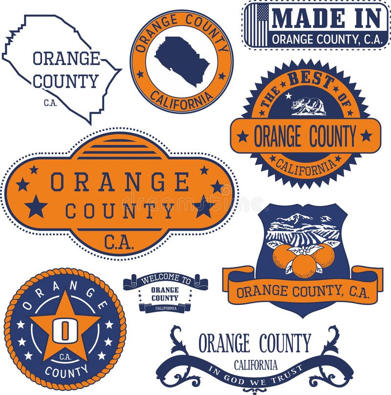
Free with trial Orange county, California. Set of generic stamps and signs including Orange county map and seal elements. Orange county map vectors Orange county, CA. Set of stamps and signs. Orange county, California. Set of generic stamps and signs including Orange county map and seal elements.
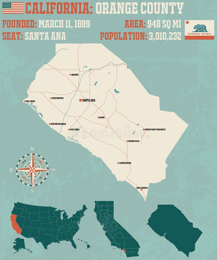
Free with trial Large and detailed map of California - Orange county. Orange county map vectors California - Orange county
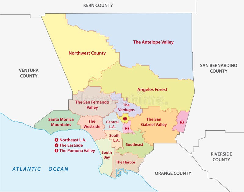
Free with trial Los angeles county regions map, california. Orange county map vectors Los angeles county regions map
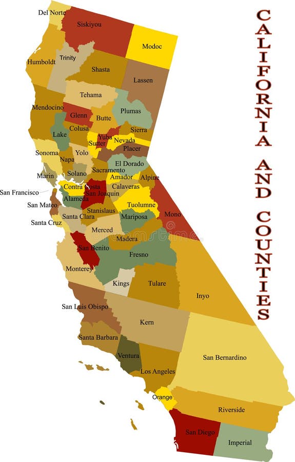
Free with trial Map of California state with the counties and the county seats and flag. Orange county map vectors California administrative map with flag. Map of California state with the counties and the county seats and flag
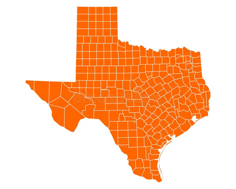
Free with trial Detailed and accurate illustration of map of Texas. Orange county map vectors Map of Texas
Free with trial Detailed flat vector illustration of Blue map of North America with country borders. Orange county map vectors Blue map of North America
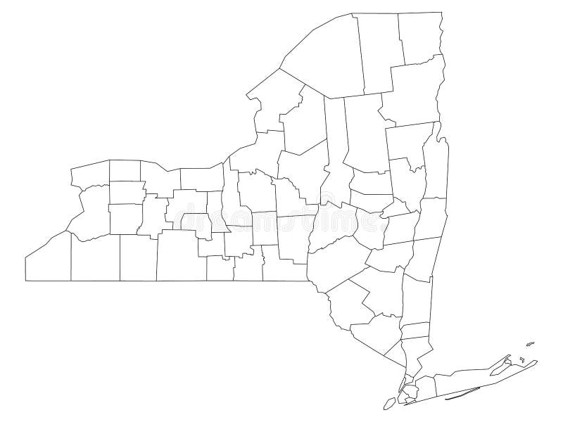
Free with trial White Outline Counties Map of US State of New York. Orange county map vectors Counties Map of US State of New York
Free with trial Vector of California state of the United States with counties map. Orange county map vectors Map of state California, USA. Vector of California state of the United States with counties map
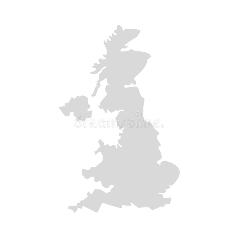
Free with trial UK infographics map and icons. Orange county map vectors UK infographic with icons. UK infographics map and icons
Free with trial Australia infographic map and icons. Orange county map vectors Australia infographic with icons. Australia infographic map and icons
Free with trial Large and detailed map of Orange county in California, USA. Orange county map vectors Map of Orange County in California
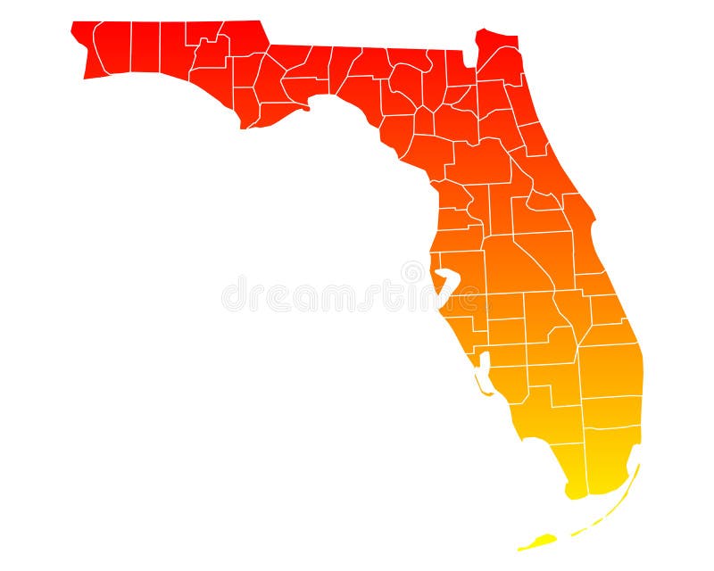
Free with trial Large and detailed map of Orange county in Florida, USA. Orange county map vectors Map of Orange County in Florida
Free with trial Set Of Orange County California Map, orange county map. Orange county map vectors Set Of Orange County California Map
Free with trial Orange County, California blank outline map set. Orange county map vectors Orange County, California outline map set
Free with trial Orange County, New York State U. S. county, United States of America, USA, U. , US map vector illustration, scribble sketch Orange map,. Orange county map vectors Orange County, New York State U.S. county, United States of America, USA, U.S., US map vector illustration, scribble sketch
Free with trial Set of generic stamps and signs of Orange county, New York state. Orange county map vectors Generic stamps and signs of Orange county, NY. Set of generic stamps and signs of Orange county, New York state
Free with trial Los angeles county regions map, california. Orange county map vectors Los angeles county regions map
Free with trial Counties map of California state of United Sates of America with county names in blue backgrounds. Orange county map vectors California county map with names. Counties map of California state of United Sates of America with county names in blue backgrounds
Free with trial Detailed flat vector illustration of Orange map of USA and Canada with country borders. Orange county map vectors Orange map of USA and Canada
Free with trial Orange map of US federal state of Georgia Peach State. Orange county map vectors Orange map of Georgia Peach State. Orange map of US federal state of Georgia Peach State
Free with trial Orange map of US federal state of Tennessee Volunteer State. Orange county map vectors Orange map of Tennessee Volunteer State. Orange map of US federal state of Tennessee Volunteer State
Free with trial Orange map of US federal state of California Golden State. Orange county map vectors Orange map of California Golden State. Orange map of US federal state of California Golden State
Free with trial Orange map of US federal state of Michigan Great Lake State. Orange county map vectors Orange map of Michigan Great Lake State. Orange map of US federal state of Michigan Great Lake State
Free with trial Orange map of US federal state of Pennsylvania Keystone State. Orange county map vectors Orange map of Pennsylvania Keystone State. Orange map of US federal state of Pennsylvania Keystone State
Free with trial Orange map of US federal state of Minnesota Land of Ten Thousand Lakes. Orange county map vectors Orange map of Minnesota Land of Ten Thousand Lakes. Orange map of US federal state of Minnesota Land of Ten Thousand Lakes
Free with trial United Kingdom county vector region map. UK east region ireland simple vector map. Orange county map vectors United Kingdom county vector region map. UK east region ireland simple vector map
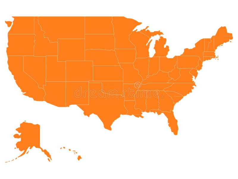
Free with trial Vector Illustration of Orange USA Map With State Borders. Orange county map vectors Orange USA Map With State Borders
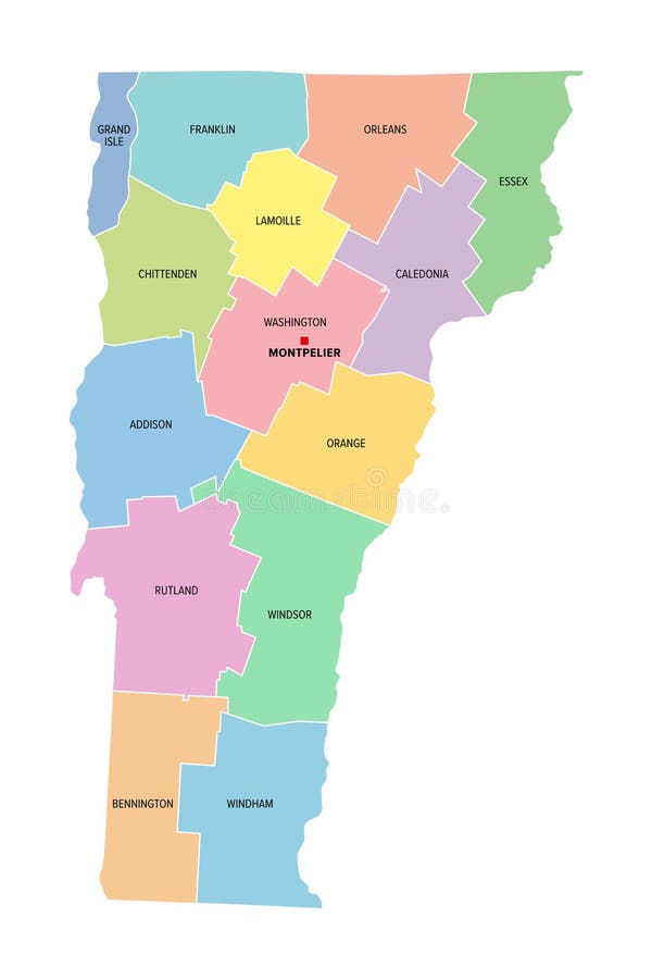
Free with trial Vermont, U. S. state, subdivided into 14 counties, multi colored political map with capital Montpelier, borders and county names. State in the New England region of United States. Green Mountain State. Orange county map vectors Vermont, U.S. state, subdivided into 14 counties, multi colored map. Vermont, U.S. state, subdivided into 14 counties, multi colored political map with capital. Vermont, U.S. state, subdivided into 14 counties, multi colored political map with capital Montpelier, borders and county names. State in the New England region of United States. Green Mountain State.
Free with trial Simple border map of Florida - sothern state on USA. Some beach umbrellas and towels, fish, flowers, tropical leaves. Land with textured background and orange lettering. Orange county map vectors Simple border map on Florida - sothern state on USA. Land with textured background and orange letteringSimple border map. Simple border map of Florida - sothern state on USA. Some beach umbrellas and towels, fish, flowers, tropical leaves. Land with textured background and orange lettering
Free with trial On a white background map of Ireland with the border between northern Ireland and the Republic. The two primary colors are orange and green. Orange county map vectors Map of the Irish state on a white background. General information division of territory. Vector illustration. On a white background map of Ireland with the border between northern Ireland and the Republic. The two primary colors are orange and green.
Free with trial Detailed vector map of Kenya with country borders, county names, main roads and a highly detailed state silhouette. Orange county map vectors Kenya map. Detailed vector map of Kenya with country borders, county names, main roads and a highly detailed state silhouette.
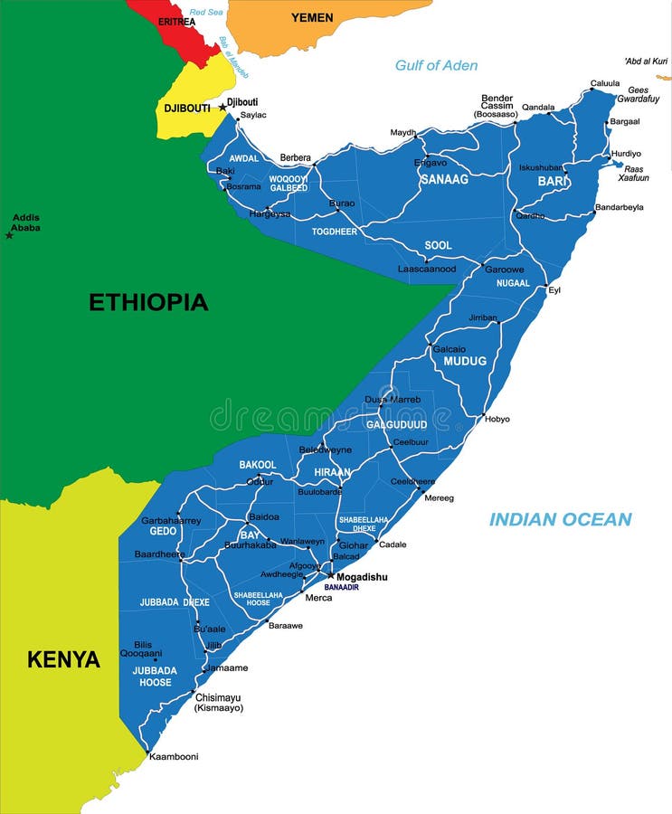
Free with trial Detailed map of Somalia. Each file is constructed using multiple layers including country borders,county names, main roads and a highly detailed state silhouette. Orange county map vectors Somalia map. Detailed map of Somalia. Each file is constructed using multiple layers including country borders,county names, main roads and a highly detailed state silhouette.
Free with trial Detailed map of New York state,in. vector format,with county borders and major. cities. Orange county map vectors New York state political map. Detailed map of New York state,in .vector format,with county borders and major .cities
Free with trial Orange city, California. Set of generic stamps and signs. Orange county map vectors Orange city, CA. Stamps and signs. Orange city, California. Set of generic stamps and signs.
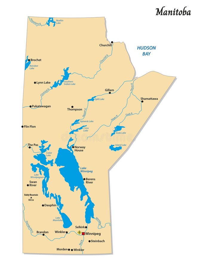
Free with trial Simple vector map of Manitoba, Canada. Orange county map vectors Simple vector map of Manitoba, Canada
Free with trial Croatia map, new political detailed map, separate individual regions, with state names, isolated on white background 3D vector. Orange county map vectors Croatia map, new political detailed map, separate individual regions, with state names, isolated on white background 3D
Free with trial Vector map of the Croatian peninsula Istria, Croatia. Orange county map vectors Vector map of the Croatian peninsula Istria, Croatia
Free with trial Nevada map silhouette isolated on white background. United state of America country. Orange county map illustrations Nevada map silhouette. Nevada map silhouette isolated on white background. United state of America country.
Free with trial Vector map of Northern Cape Province, South Africa. Orange county map vectors Vector map of Northern Cape Province, South Africa
Free with trial Detailed and accurate illustration of map of Florida. Orange county map vectors Map of Florida
Free with trial Outline of California map- vector illustration. Orange county map vectors Outline of California map
Free with trial Detailed and accurate illustration of map of California. Orange county map vectors Map of California
Free with trial Detailed and accurate illustration of map of North Carolina. Orange county map vectors Map of North Carolina
Free with trial Detailed and accurate illustration of map of Alaska. Orange county map vectors Map of Alaska
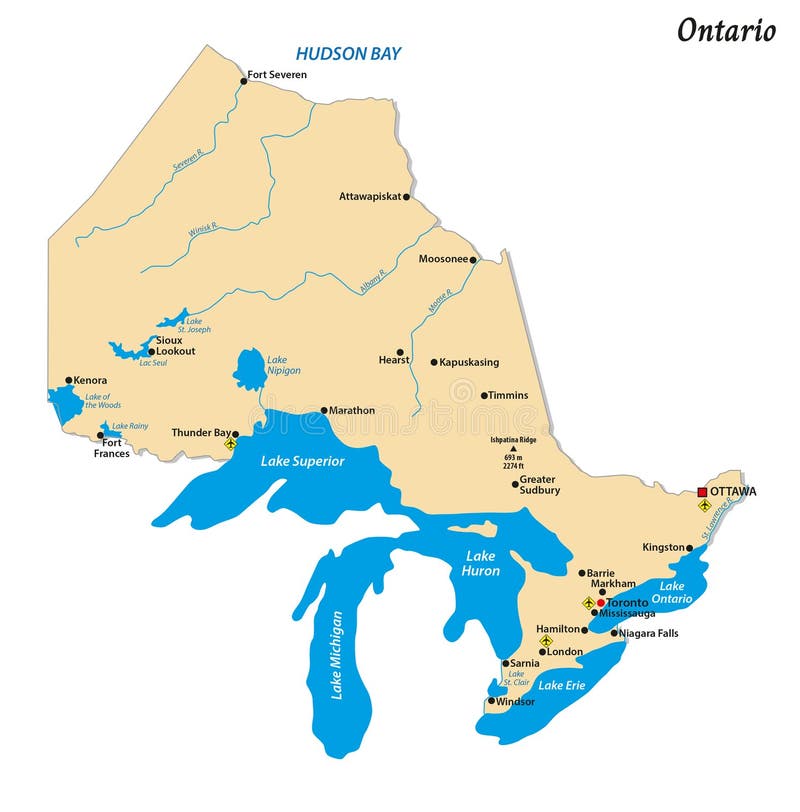
Free with trial Simple vector map of Ontario, Canada. Orange county map vectors Simple vector map of Ontario, Canada
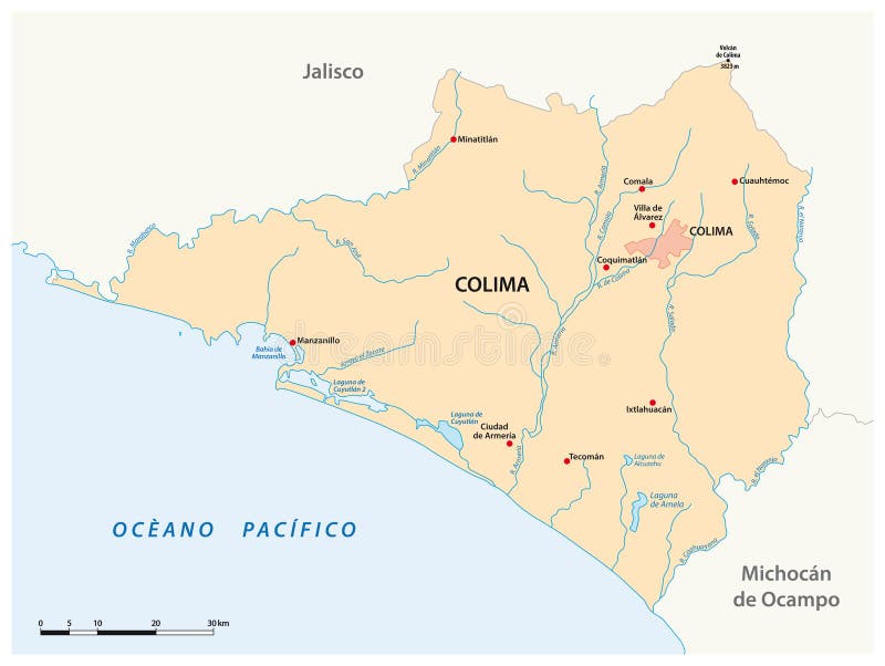
Free with trial Vector map of the Mexican state of Colima. Orange county map vectors Vector map of the Mexican state of Colima
Free with trial Detailed and accurate illustration of map of New Hampshire. Orange county map vectors Map of New Hampshire
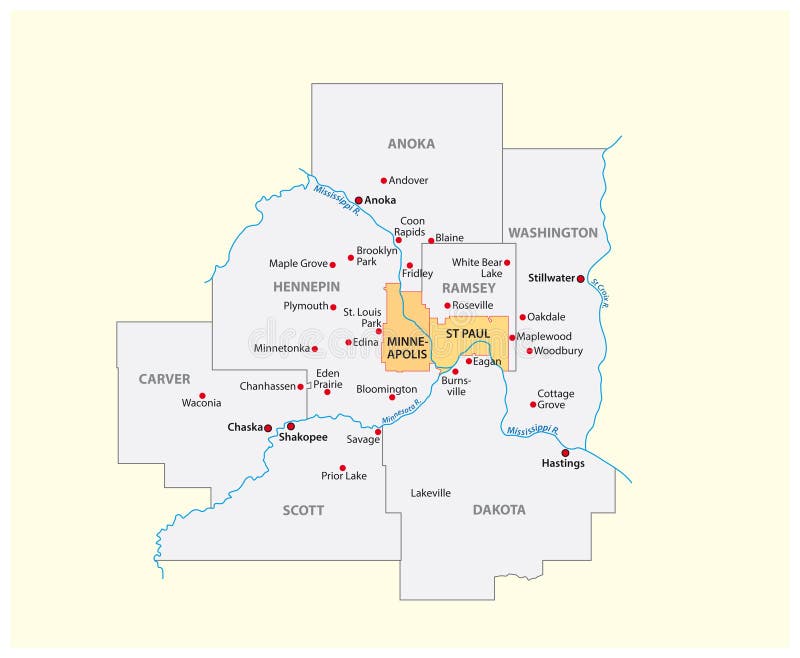
Free with trial Vector map of the Minneapolis-Saint Paul metropolitan area, Minnesota, United States. Orange county map vectors Vector map of the Minneapolis-Saint Paul metropolitan area, Minnesota, United States
Free with trial Gray Outline Counties Map of US State of New Jersey. Orange county map vectors Counties Map of US State of New Jersey
Free with trial Detailed and accurate illustration of map of Michigan. Orange county map vectors Map of Michigan
Free with trial Vector South Carolina Map silhouette. Isolated Illustration. Black on White background. Orange county map illustrations Vector South Carolina Map silhouette
Free with trial Colorful political map of South Africe, RSA. Administrative divisions - provinces. Simple flat vector map with labels. Orange county map vectors South Africa - map of provinces. Colorful political map of South Africe, RSA. Administrative divisions - provinces. Simple flat vector map with labels.
Free with trial White Outline Counties Map With Counties Names of US State of New York. Orange county map vectors Counties Map of US State of New York. White Outline Counties Map With Counties Names of US State of New York
Free with trial Detailed and accurate illustration of map of Florida. Orange county map vectors Map of Florida
Free with trial Colorful Colorado political map with clearly labeled, separated layers. Vector illustration. Orange county map vectors Colorful Colorado political map with clearly labeled, separated layers.
Free with trial Detailed and accurate illustration of map of Kansas. Orange county map vectors Map of Kansas
Free with trial Detailed and accurate illustration of map of Colorado. Orange county map vectors Map of Colorado
Free with trial Vector graphic illustration of a map of california state outline with the word home written in the outline. Orange county map vectors California state map outline with the word home. Vector graphic illustration of a map of california state outline with the word home written in the outline
Free with trial Detailed and accurate illustration of map of South Carolina. Orange county map vectors Map of South Carolina
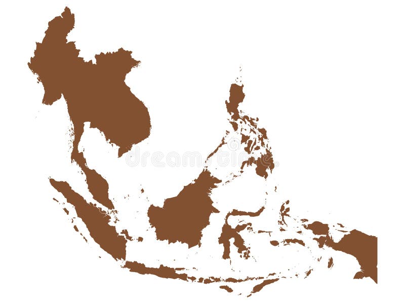
Free with trial Detailed flat vector illustration of Brown map of Southeast Asia. Orange county map vectors Brown map of Southeast Asia
Free with trial Detailed flat vector illustration of Green Map of Southeast Asia. Orange county map vectors Green Map of Southeast Asia
Free with trial Detailed flat vector illustration of Green map of USA and Canada with state borders. Orange county map vectors Green map of USA and Canada
Free with trial California map with set of different pins- vector illustration. Orange county map vectors California map with set of different pins
Free with trial Detailed flat vector illustration of Brown Map of South America. Orange county map vectors Brown Map of South America
Free with trial Detailed and accurate illustration of map of Maryland. Orange county map vectors Map of Maryland
Free with trial Romania World map. World geography. illustration. Orange county map illustrations Romania World map. World geography. illustration.
Free with trial Detailed and accurate illustration of map of Kentucky. Orange county map vectors Map of Kentucky