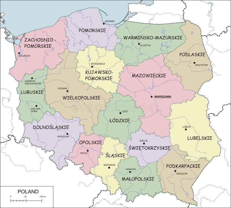
Free with trial Poland Political Map with capital Warsaw, national borders, most important cities, rivers and lakes. English labeling and scaling. Illustration. Poland map rivers vectors Poland Political Map
Free with trial Baltic States Political Map. Estonia, Latvia and Lithuania with capitals Tallinn, Riga and Vilnius. With national borders, important cities, rivers and lakes. English labeling and scaling. Poland map rivers vectors Baltic States Political Map
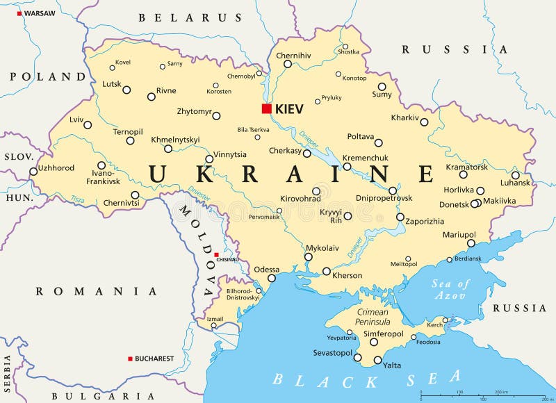
Free with trial Ukraine political map with capital Kiev, national borders, important cities, rivers and lakes. English labeling and scaling. Illustration. Poland map rivers vectors Ukraine Political Map
Free with trial World Map, physical map of Europe and North Africa. Poland map rivers illustrations Map of Europe and North Africa
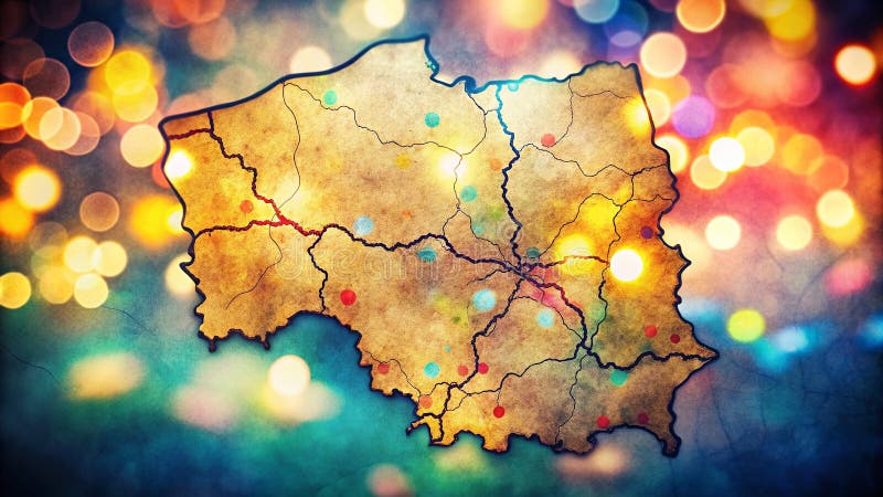
Free with trial Contour map of Poland with voivodeships, rivers and lakes. Poland map rivers vectors Poland - contour map, vector illustration. Contour map of Poland with voivodeships, rivers and lakes
Free with trial Poland Map and Colored Icons - Detailed map of Poland vector illustration. Poland map rivers vectors Poland Map and Colored Icons
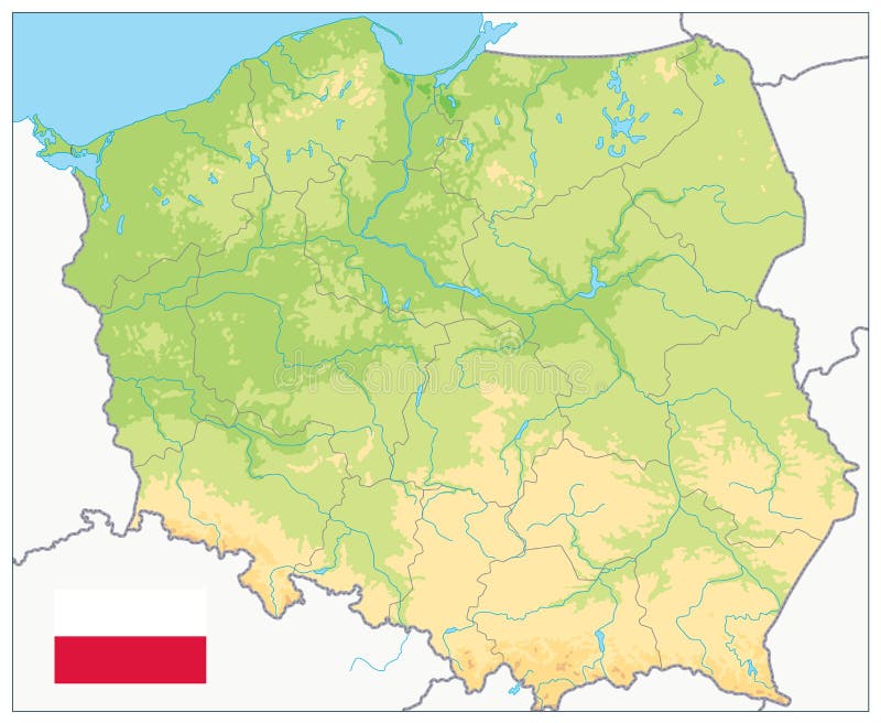
Free with trial Poland Physical Map. Highly detailed map vector illustration. Image contains layers with shaded contours, land names, city names, water objects and it`s names, highways. Poland map rivers vectors Poland Physical Map
Free with trial Krakow map with roads and rivers, city municipality administrative borders, art design with grey and blue on white background. Poland map rivers vectors Map of Krakow city within administrative borders with roads and rivers on white background. Krakow map with roads and rivers, city municipality administrative borders, art design with grey and blue on white background
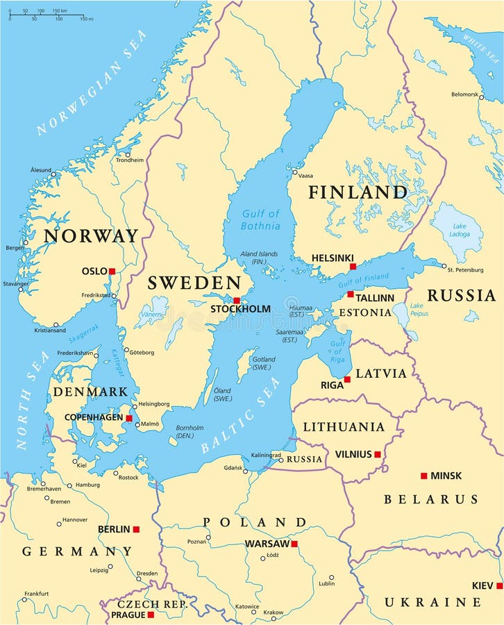
Free with trial Baltic Sea Area Political Map with capitals, national borders, important cities, rivers and lakes. English labeling and scaling. Illustration. Poland map rivers vectors Baltic Sea Area Political Map
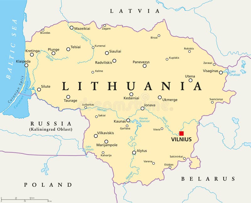
Free with trial Lithuania political map with capital Vilnius, national borders, important cities, rivers and lakes. English labeling and scaling. Illustration. Poland map rivers vectors Lithuania Political Map
Free with trial Planisphere map globe Europe, Middle East Asia and Africa. Poland map rivers illustrations Political map globe of Europe, Middle East Asia and Africa. Planisphere map globe Europe, Middle East Asia and Africa
Free with trial Poland Political Map and Flat Map Icons - Detailed map of Poland vector illustration. Poland map rivers vectors Poland Political Map and Flat Map Icons
Free with trial Poland Political Map - Detailed map of Poland vector illustration. Poland map rivers vectors Poland Political Map
Free with trial Poland Physical Map Isolated On White. Highly detailed map vector illustration. Image contains layers with shaded contours, land names, city names, water objects and it`s names, highways. Poland map rivers vectors Poland Physical Map Isolated On White
Free with trial Poland Political Map Isolated on white - Detailed map of Poland vector illustration. Poland map rivers vectors Poland Political Map Isolated on white
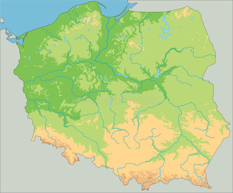
Free with trial Poland Physical Map. No text. Highly detailed map vector illustration. Image contains layers with shaded contours, water objects. Poland map rivers vectors Poland Physical Map. No text
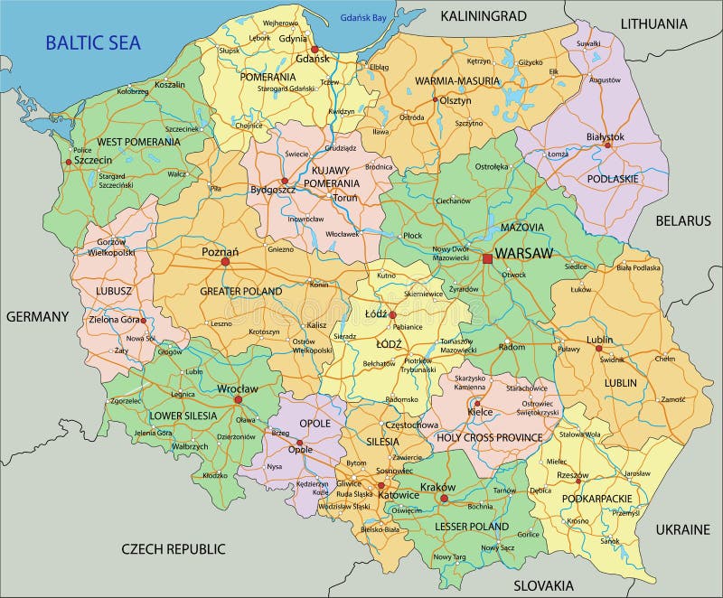
Free with trial Poland Detail Administrative Map and roads - Detailed map of Poland vector illustration. Poland map rivers vectors Poland Detail Administrative Map and roads
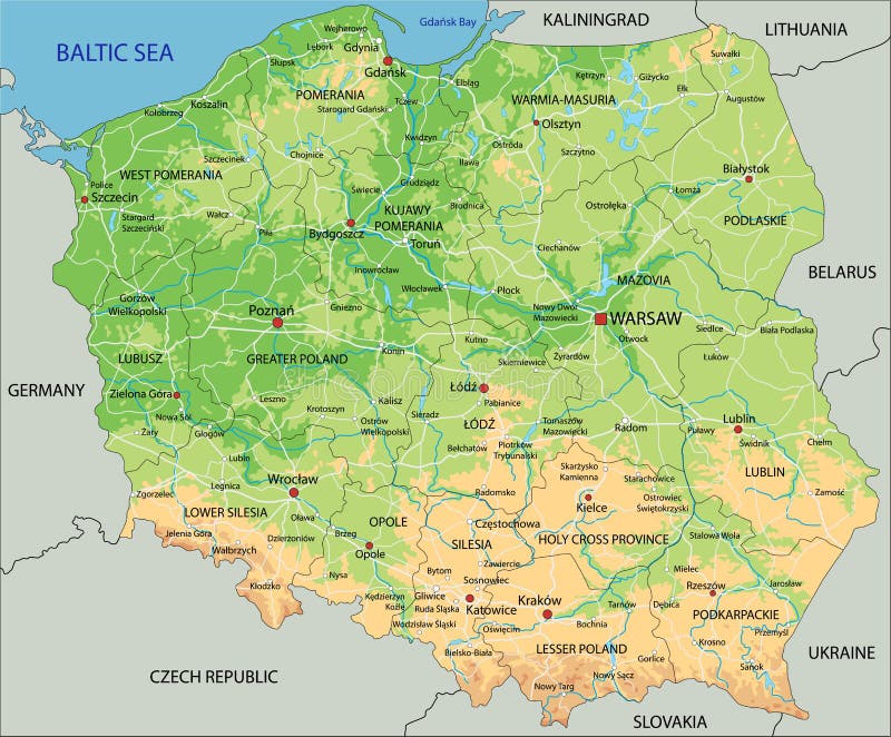
Free with trial High detailed Poland physical map with labeling. Vector illustration. Poland map rivers vectors High detailed Poland physical map with labeling.
Free with trial Poland - Highly detailed editable political map with labeling. Vector illustration. Poland map rivers vectors Poland - Highly detailed editable political map with labeling.
Free with trial Colorful Poland political map with clearly labeled, separated layers. Vector illustration. Poland map rivers vectors Colorful Poland political map with clearly labeled, separated layers.
Free with trial High detailed Poland physical map. Vector illustration. Poland map rivers vectors High detailed Poland physical map.
Free with trial High detailed Poland physical map with labeling. Vector illustration. Poland map rivers vectors High detailed Poland physical map with labeling.
Free with trial High detailed Poland physical map with labeling. Vector illustration. Poland map rivers vectors High detailed Poland physical map with labeling.
Free with trial Poland Physical Map Retro Colors - Detailed map of Poland vector illustration - All elements are separated in editable layers clearly labeled. Poland map rivers vectors Poland Physical Map Retro Colors
Free with trial Poland Physical Map Retro Colors. No text - Detailed map of Poland vector illustration - All elements are separated in editable layers clearly labeled. Poland map rivers vectors Poland Physical Map Retro Colors. No text
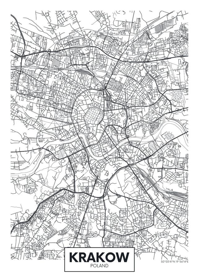
Free with trial City map Krakow, travel vector poster design roads, trails and rivers. Poland map rivers vectors City map Krakow, travel vector poster design
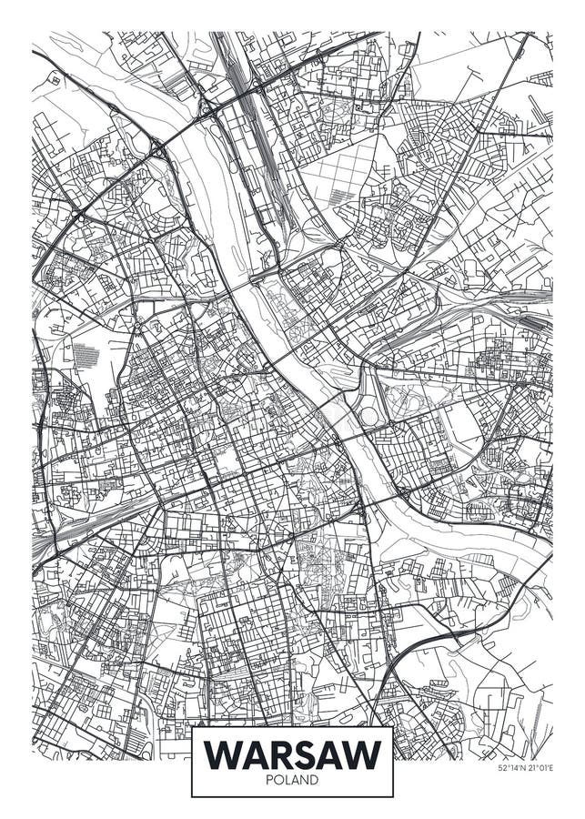
Free with trial City map Warsaw, travel vector poster design roads, trails and rivers. Poland map rivers vectors City map Warsaw, travel vector poster design
Free with trial Czech Republic Political Map with capital Prague, national borders, important cities, rivers and lakes. English labeling and scaling. Illustration. Poland map rivers vectors Czech Republic Political Map
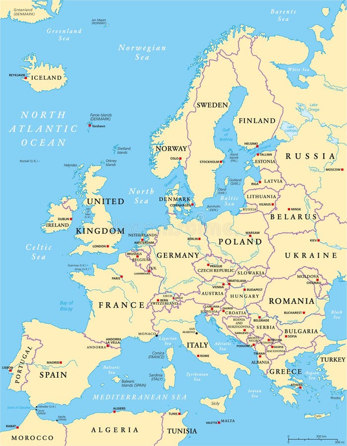
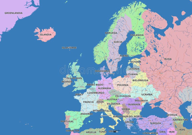
Free with trial Europe Political Map and the surrounding region. With countries, capitals, national borders, big rivers and lakes. English labeling and scaling. Illustration. Poland map rivers vectors Europe Political Map
Free with trial Belarus Political Map with capital Minsk, national borders, important cities, rivers and lakes. English labeling and scaling. Illustration. Poland map rivers vectors Belarus Political Map
Free with trial High detail color vector atlas with capitals, cities, towns names, seas, rivers and lakes | High resolution map of Europe in Mercator projection. Poland map rivers vectors Europe political map. High detail color vector atlas with capitals, cities, towns names, seas, rivers and lakes | High resolution map of Europe in Mercator projection
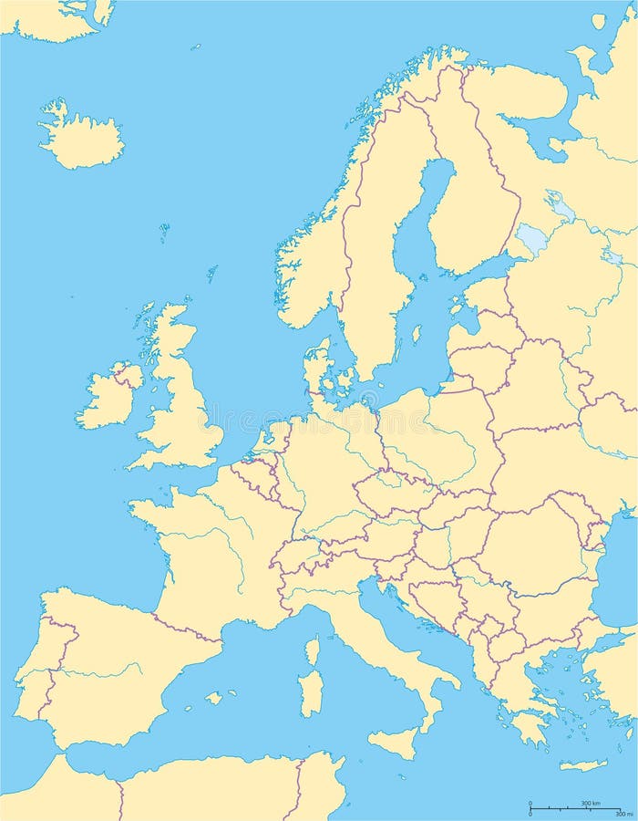
Free with trial Europe Political Map and the surrounding region. Countries with national borders, big rivers and lakes. English scaling. Illustration. Poland map rivers vectors Europe Political Map And Surrounding Region. Europe Political Map and the surrounding region. Countries with national borders, big rivers and lakes. English scaling. Illustration.
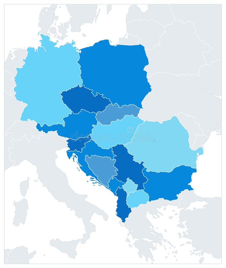
Free with trial Central Europe Map In Colors Of Blue. No text. Vector illustration. Poland map rivers vectors Central Europe Map In Colors Of Blue. No text
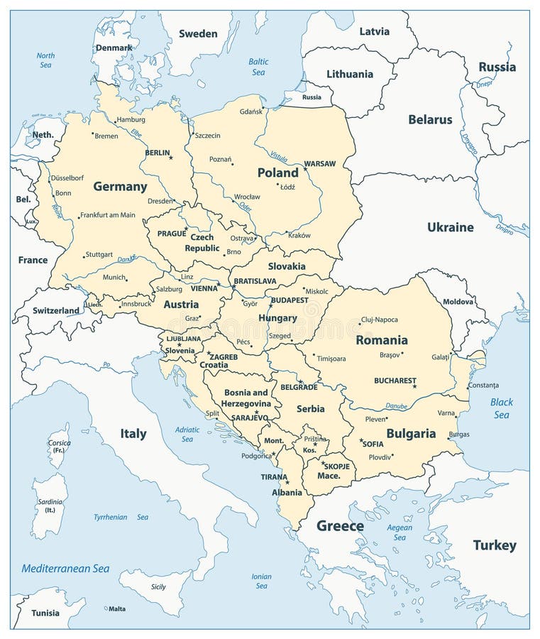
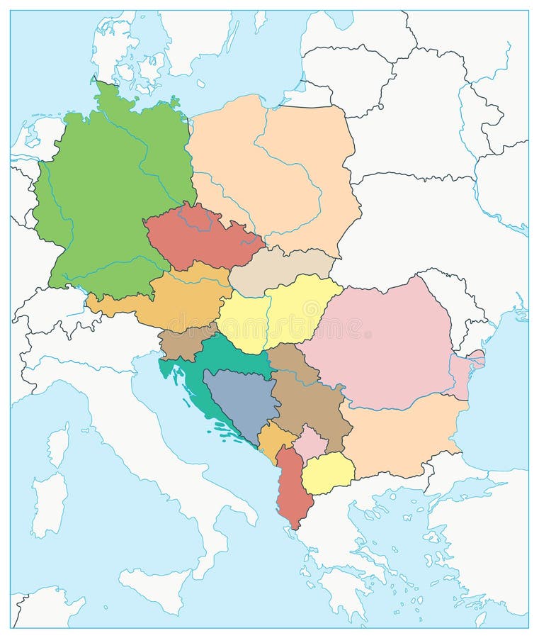
Free with trial Central Europe Map. Vector illustration. Poland map rivers vectors Central Europe Map
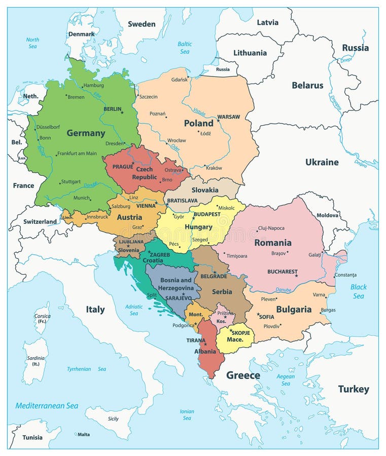
Free with trial Central Europe Political Map. Vector illustration. Poland map rivers vectors Central Europe Political Map
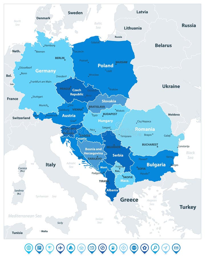
Free with trial Central Europe Map In Colors Of Blue and Map Pointers. Vector illustration. Poland map rivers vectors Central Europe Map In Colors Of Blue and Map Pointers
Free with trial Central Europe Map Aqua Blue Colors. Vector illustration. Poland map rivers vectors Central Europe Map Aqua Blue Colors
Free with trial Central Europe Political Map. No text. Vector illustration. Poland map rivers vectors Central Europe Political Map. No text
Free with trial Map of the railroad tracks in the three Baltic states. Poland map rivers vectors Map of the railroad tracks in the three Baltic states
Free with trial Planisphere map globe Europe, Middle East and north Africa. Poland map rivers illustrations Political map globe of Europe, Middle East and north Africa. Planisphere map globe Europe, Middle East and north Africa
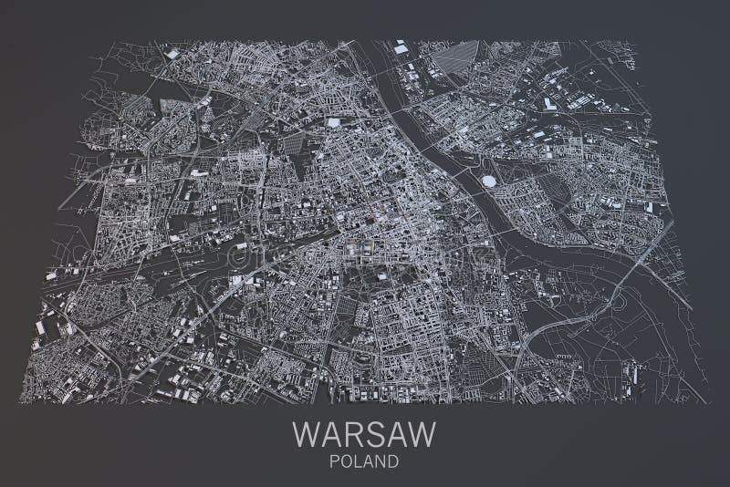
Free with trial Satellite view of Warsaw on black background. Poland map rivers illustrations Warsaw map, satellite view, Poland. Satellite view of Warsaw on black background
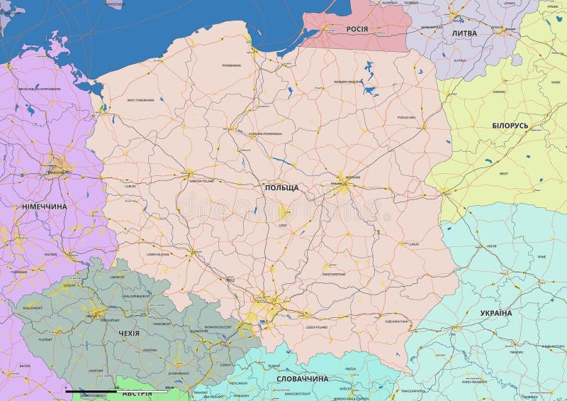
Free with trial Detailed editable vector map of Poland on Ukrainian language. The map highlights state boundaries, major cities, highways, rivers, and geographic features. Poland map rivers vectors Detailed editable vector map of Poland on Ukrainian language
Free with trial Detailed editable vector map of Poland on Polish language. The map highlights state boundaries, major cities, highways, rivers, and geographic features. Poland map rivers vectors Detailed editable vector map of Poland on Polish language
Free with trial Detailed editable vector map of Poland on German language. The map highlights state boundaries, major cities, highways, rivers, and geographic features. Poland map rivers vectors Detailed editable vector map of Poland on German language
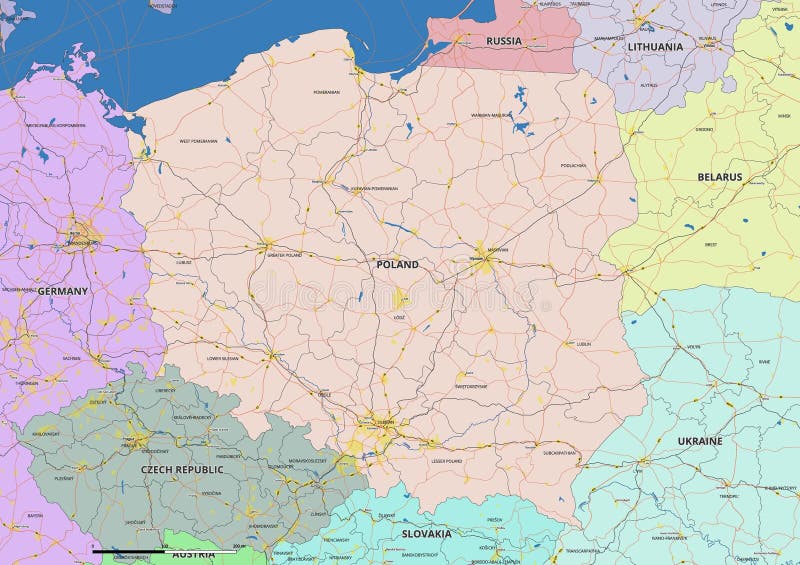
Free with trial Detailed editable vector map of Poland on English language. The map highlights state boundaries, major cities, highways, rivers, and geographic features. Poland map rivers vectors Detailed editable vector map of Poland on English language
Free with trial Vintage wall art map of Poland, located in Herkimer, New York, United States. Aerial plan with forests, roads, cities, lakes and rivers. Poland map rivers illustrations Retro US map of Poland, New York. Vintage street map. Vintage wall art map of Poland, located in Herkimer, New York, United States. Aerial plan with forests, roads, cities, lakes and rivers.
Free with trial Map of Europe with a detailed network of train routes connecting major cities. Countries like France, Germany, Poland, and Italy are visible, with key cities such as Paris, Berlin, Warsaw, and Rome marked. Color-coded lines represent different train routes, facilitating easy travel across the continent. Icons denote train stations and other transportation hubs. Geographic features like rivers and coastlines are subtly integrated into the background, offering an informative overview of transportation infrastructure. Poland map rivers illustrations Map of Europe with a detailed network of train routes connecting major cities.
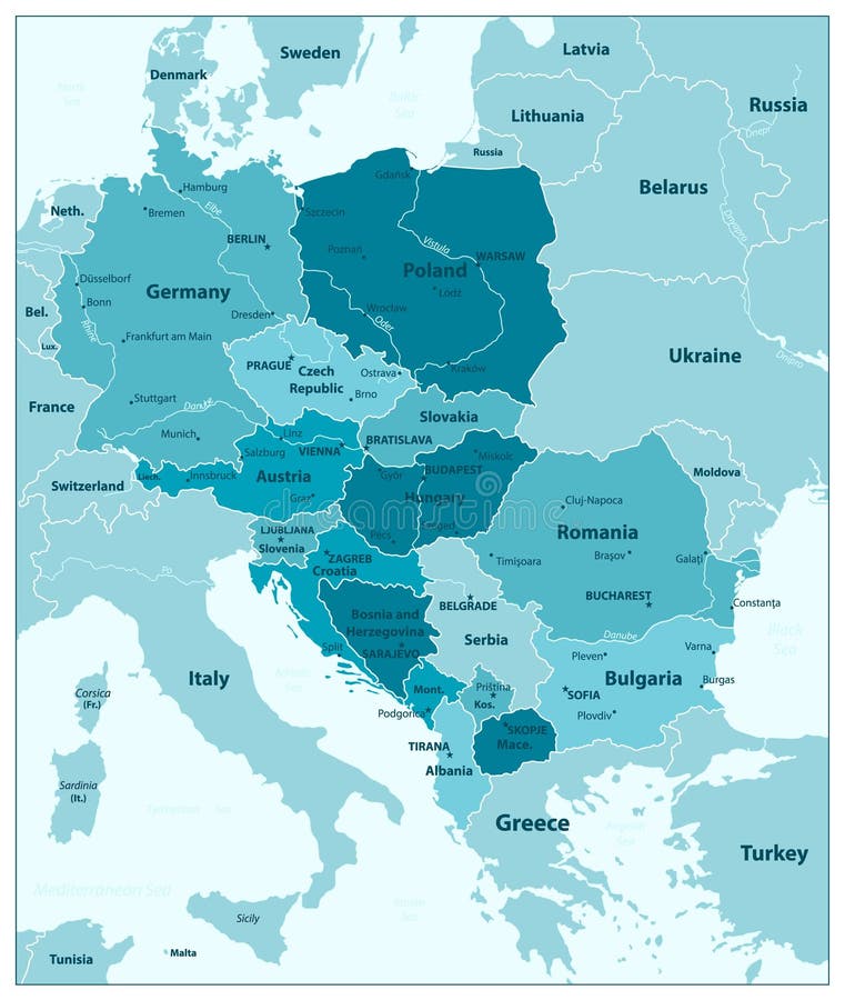
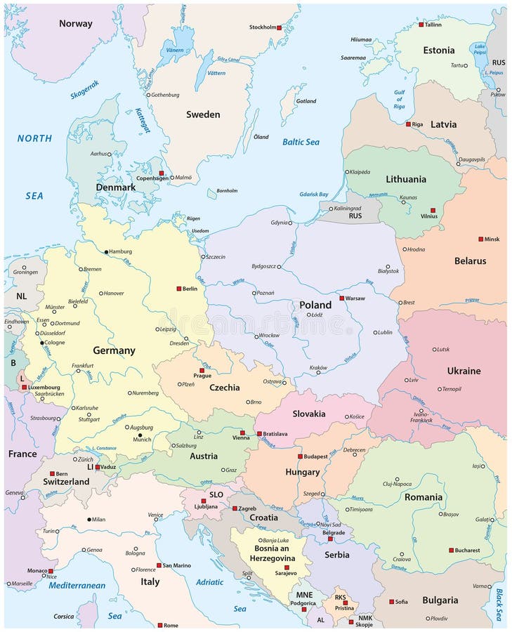
Free with trial Map of Central Europe with the most important cities and rivers. Poland map rivers vectors Map of Central Europe with the most important cities and rivers
Free with trial Discover a captivating representation of Poland, rendered in a vibrant, artistic doodle style. This freehand sketch map is not just a geographical representation it's a visual journey through the Polish landscape, brought to life with the delicate touch of bokeh effects. Soft focus adds a dreamy quality, drawing the eye to the intricate details of the doodle. Imagine the rolling hills,. Poland map rivers illustrations A Whimsical Exploration of Poland Artistic Doodle Map with Bokeh Effects a Soft Focus Background for a Captivating. Discover a captivating representation of Poland, rendered in a vibrant, artistic doodle style. This freehand sketch map is not just a geographical representation it's a visual journey through the Polish landscape, brought to life with the delicate touch of bokeh effects. Soft focus adds a dreamy quality, drawing the eye to the intricate details of the doodle. Imagine the rolling hills,
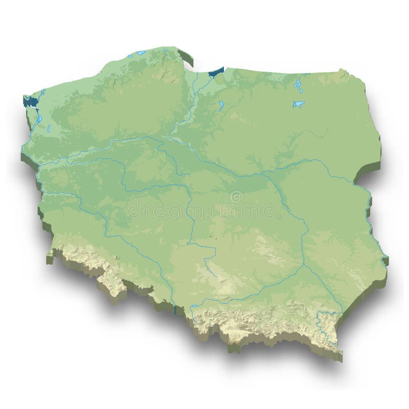
Free with trial 3d isometric relief map of Poland with shadow. Poland map rivers vectors 3d isometric relief map of Poland
Free with trial Vintage wall art map of Poland, located in Owen, Indiana, United States. Aerial plan with forests, roads, cities, lakes and rivers. Poland map rivers illustrations Retro US map of Poland, Indiana. Vintage street map. Vintage wall art map of Poland, located in Owen, Indiana, United States. Aerial plan with forests, roads, cities, lakes and rivers.
Free with trial Red CMYK national map of POLAND inside detailed beige blank political map of European continent with rivers and lakes on blue background using Mercator projection. Poland map rivers vectors Location map of the REPUBLIC OF POLAND, EUROPE. Red CMYK national map of POLAND inside detailed beige blank political map of European continent with rivers and lakes on blue background using Mercator projection
Free with trial Orange CMYK national map of POLAND inside detailed beige blank political map of European continent with rivers and lakes on blue background using Mercator projection. Poland map rivers vectors Location map of the REPUBLIC OF POLAND, EUROPE. Orange CMYK national map of POLAND inside detailed beige blank political map of European continent with rivers and lakes on blue background using Mercator projection
Free with trial Experience the captivating beauty of Poland at night with this stunning map illustration. Subtle aqua and blue hues gently illuminate the country rivers, borders, and geographical features, showcasing the intricate tapestry of Poland landscape. The illuminated borders stand out against a backdrop of a starry night sky, creating an ethereal and artistic representation of the country. This vector. Poland map rivers illustrations A Starry Night Over Poland An AquaHued Illuminated Map of the Polish Landscape Perfect for Travel Inspiration or. Experience the captivating beauty of Poland at night with this stunning map illustration. Subtle aqua and blue hues gently illuminate the country rivers, borders, and geographical features, showcasing the intricate tapestry of Poland landscape. The illuminated borders stand out against a backdrop of a starry night sky, creating an ethereal and artistic representation of the country. This vector
Free with trial A detailed illustration of an antique map depicting Polonia circa 319-323 CE. The map showcases the geographical landscape, including rivers like Vistula Fluv. and Oder Fluv. , and settlements of various tribes like Gothi and Vandali. The image evokes a sense of history and exploration, suitable for educational materials, historical documentaries, or design projects requiring a vintage cartographic element. Poland map rivers illustrations Historical Map of Polonia (319-323 CE). A detailed illustration of an antique map depicting Polonia circa 319-323 CE. The map showcases the geographical. A detailed illustration of an antique map depicting Polonia circa 319-323 CE. The map showcases the geographical landscape, including rivers like Vistula Fluv. and Oder Fluv., and settlements of various tribes like Gothi and Vandali. The image evokes a sense of history and exploration, suitable for educational materials, historical documentaries, or design projects requiring a vintage cartographic element.
Free with trial Topographic map of Europe shows landforms rivers and mountains. Overhead view displays country borders and natural water bodies. Realistic globe perspective reveals diverse, terrain and. Poland map rivers illustrations Topographic map of Europe shows landforms rivers and mountains. Overhead view displays country borders and natural water bodies.
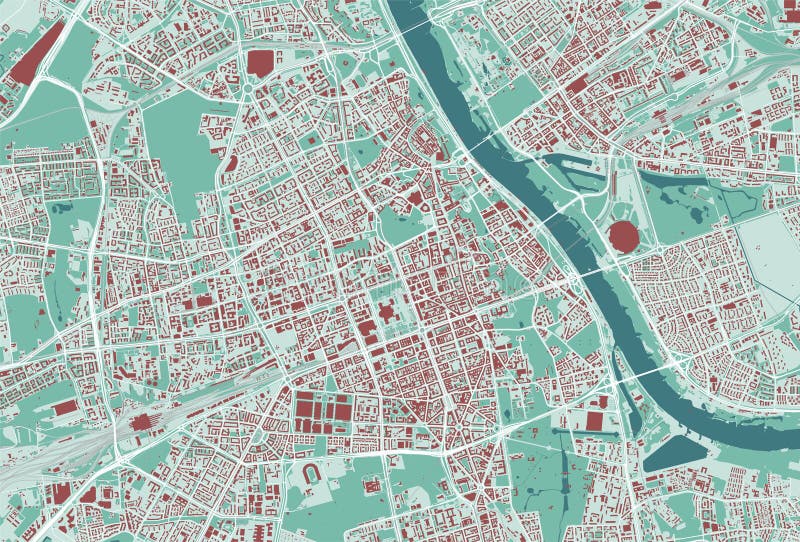
Free with trial Warsaw map, green streetmap poster of Poland city. Poland map rivers vectors Warsaw map, green poster. Warsaw map, green streetmap poster of Poland city
Free with trial Poland outlined on a Pale colored elevation map with lakes and rivers. Poland map rivers illustrations Poland outlined. Pale. Poland outlined on a Pale colored elevation map with lakes and rivers
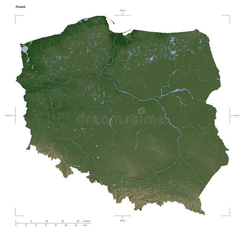
Free with trial Shape of a Pale colored elevation map with lakes and rivers of the Poland, with distance scale and map border coordinates, isolated on white. Poland map rivers illustrations Poland shape on white. Pale. Shape of a Pale colored elevation map with lakes and rivers of the Poland, with distance scale and map border coordinates, isolated on white
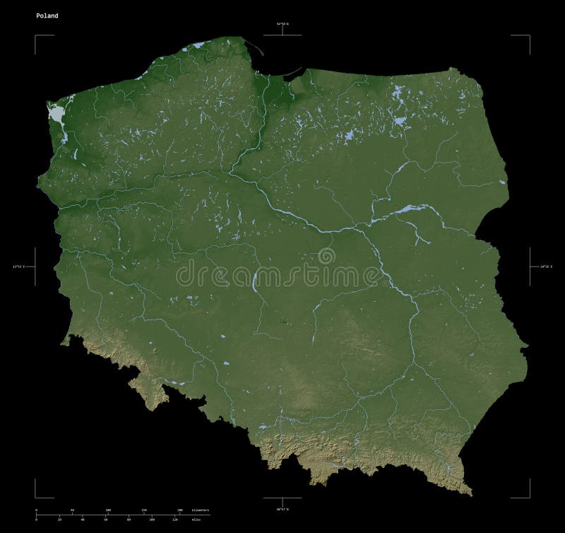
Free with trial Shape of a Pale colored elevation map with lakes and rivers of the Poland, with distance scale and map border coordinates, isolated on black. Poland map rivers illustrations Poland shape on black. Pale. Shape of a Pale colored elevation map with lakes and rivers of the Poland, with distance scale and map border coordinates, isolated on black
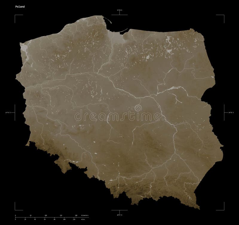
Free with trial Shape of a elevation map colored in sepia tones with lakes and rivers of the Poland, with distance scale and map border coordinates, isolated on black. Poland map rivers illustrations Poland shape on black. Sepia. Shape of a elevation map colored in sepia tones with lakes and rivers of the Poland, with distance scale and map border coordinates, isolated on black
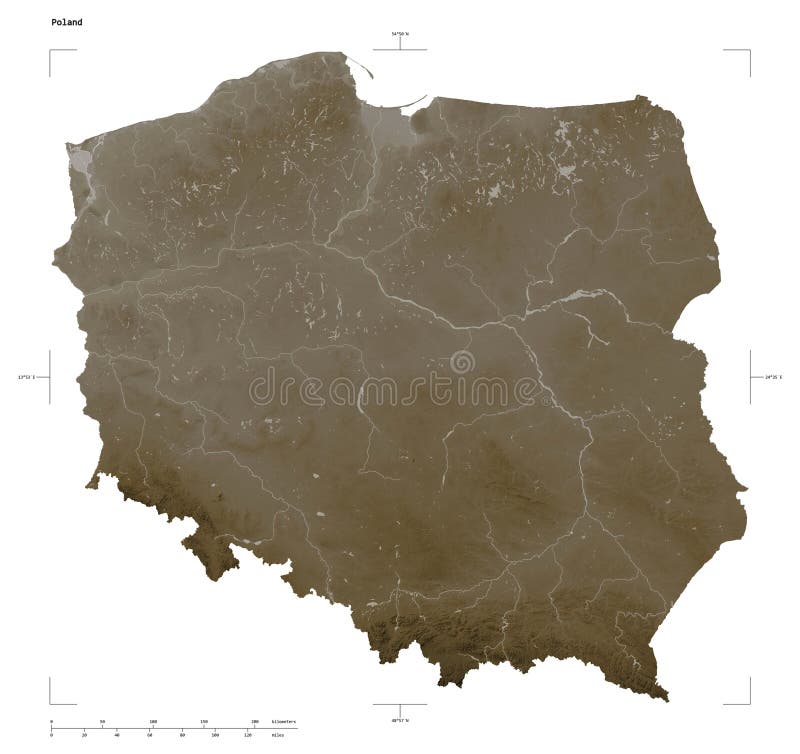
Free with trial Shape of a elevation map colored in sepia tones with lakes and rivers of the Poland, with distance scale and map border coordinates, isolated on white. Poland map rivers illustrations Poland shape on white. Sepia. Shape of a elevation map colored in sepia tones with lakes and rivers of the Poland, with distance scale and map border coordinates, isolated on white
Free with trial Shape of a Bilevel elevation map with lakes and rivers of the Poland, with distance scale and map border coordinates, isolated on black. Poland map rivers illustrations Poland shape on black. Bilevel. Shape of a Bilevel elevation map with lakes and rivers of the Poland, with distance scale and map border coordinates, isolated on black
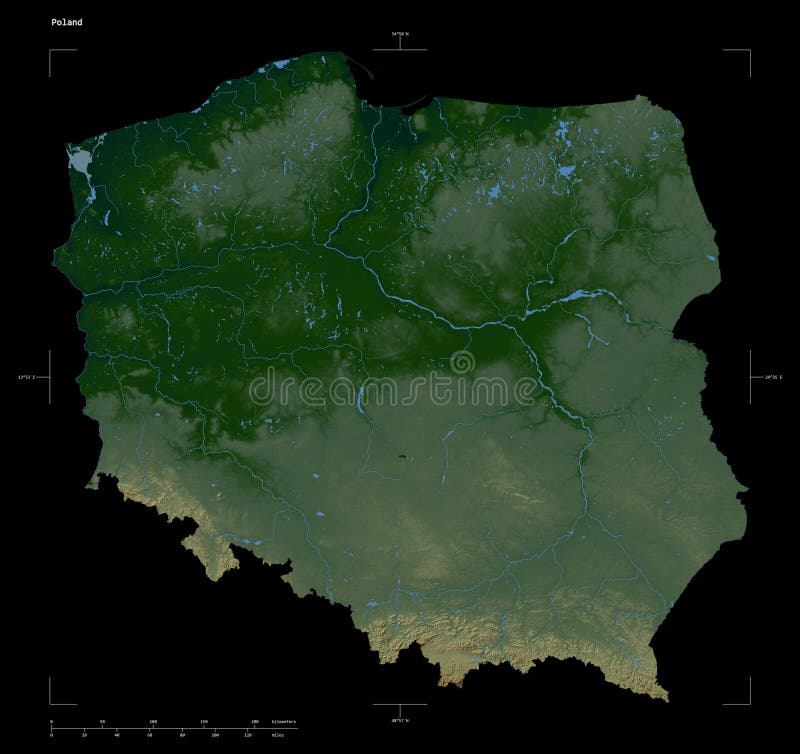
Free with trial Shape of a Colored elevation map with lakes and rivers of the Poland, with distance scale and map border coordinates, isolated on black. Poland map rivers illustrations Poland shape on black. Physical. Shape of a Colored elevation map with lakes and rivers of the Poland, with distance scale and map border coordinates, isolated on black
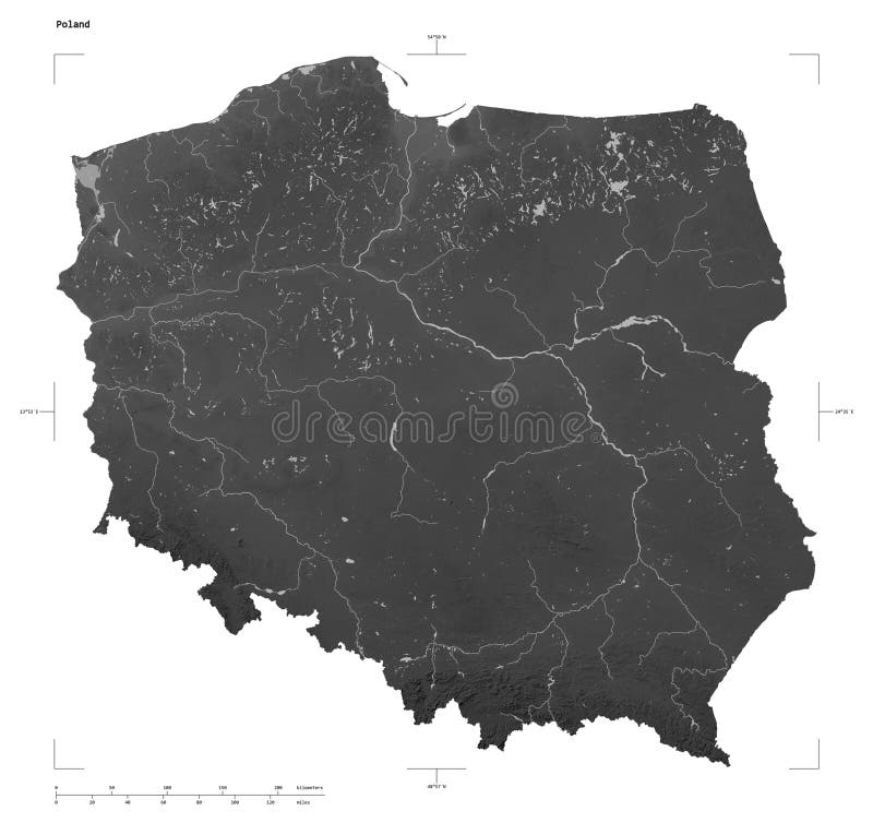
Free with trial Shape of a Grayscale elevation map with lakes and rivers of the Poland, with distance scale and map border coordinates, isolated on white. Poland map rivers illustrations Poland shape on white. Grayscale. Shape of a Grayscale elevation map with lakes and rivers of the Poland, with distance scale and map border coordinates, isolated on white
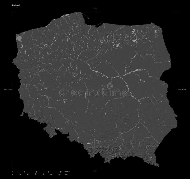
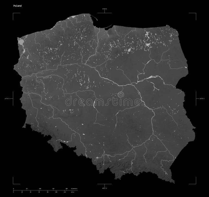
Free with trial Shape of a Grayscale elevation map with lakes and rivers of the Poland, with distance scale and map border coordinates, isolated on black. Poland map rivers illustrations Poland shape on black. Grayscale. Shape of a Grayscale elevation map with lakes and rivers of the Poland, with distance scale and map border coordinates, isolated on black
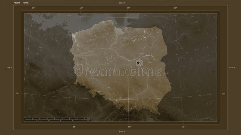
Free with trial Poland highlighted on a Pale colored elevation map with lakes and rivers map with the country's capital point, cartographic grid, distance scale and map border coordinates. Poland map rivers illustrations Poland highlighted - composition. Pale. Poland highlighted on a Pale colored elevation map with lakes and rivers map with the country's capital point, cartographic grid, distance scale and map border coordinates
Free with trial Poland highlighted on a Pale colored elevation map with lakes and rivers. Poland map rivers illustrations Poland highlighted. Pale. Poland highlighted on a Pale colored elevation map with lakes and rivers
Free with trial Poland highlighted on a elevation map colored in sepia tones with lakes and rivers map with the country's capital point, cartographic grid, distance scale and map border coordinates. Poland map rivers illustrations Poland highlighted - composition. Sepia. Poland highlighted on a elevation map colored in sepia tones with lakes and rivers map with the country's capital point, cartographic grid, distance scale and map border coordinates
Free with trial Poland highlighted on a elevation map colored in sepia tones with lakes and rivers. Poland map rivers illustrations Poland highlighted. Sepia. Poland highlighted on a elevation map colored in sepia tones with lakes and rivers
Free with trial Poland highlighted on a Bilevel elevation map with lakes and rivers map with the country's capital point, cartographic grid, distance scale and map border coordinates. Poland map rivers illustrations Poland highlighted - composition. Bilevel. Poland highlighted on a Bilevel elevation map with lakes and rivers map with the country's capital point, cartographic grid, distance scale and map border coordinates
Free with trial Poland highlighted on a Colored elevation map with lakes and rivers map with the country's capital point, cartographic grid, distance scale and map border coordinates. Poland map rivers illustrations Poland highlighted - composition. Physical. Poland highlighted on a Colored elevation map with lakes and rivers map with the country's capital point, cartographic grid, distance scale and map border coordinates
Free with trial Poland highlighted on a Grayscale elevation map with lakes and rivers map with the country's capital point, cartographic grid, distance scale and map border coordinates. Poland map rivers illustrations Poland highlighted - composition. Grayscale. Poland highlighted on a Grayscale elevation map with lakes and rivers map with the country's capital point, cartographic grid, distance scale and map border coordinates
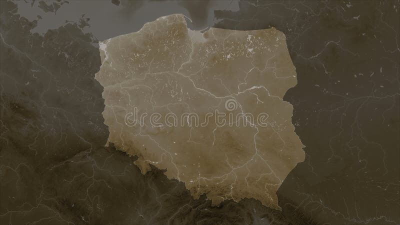
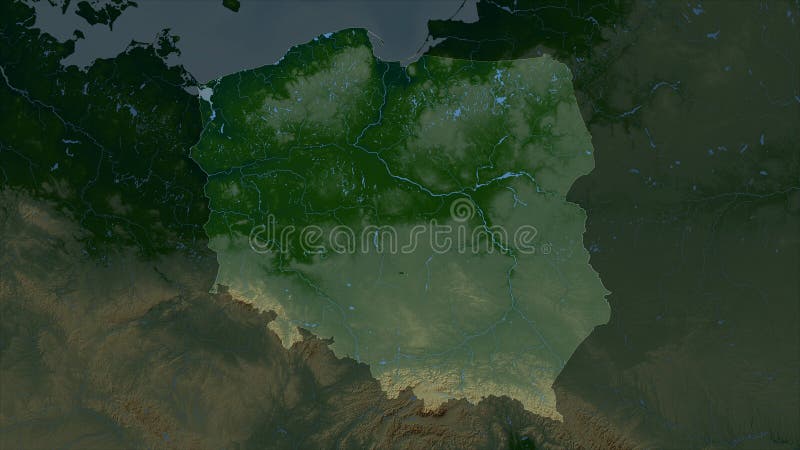
Free with trial Poland highlighted on a Colored elevation map with lakes and rivers. Poland map rivers illustrations Poland highlighted. Physical. Poland highlighted on a Colored elevation map with lakes and rivers
Free with trial Detailed editable vector map of European Union, EU on Arab language. The map highlights countries boundaries, major cities, highways, rivers, and geographic features. Poland map rivers vectors Detailed editable vector map of Europa on Arab language. Detailed editable vector map of European Union, EU on Arab language. The map highlights countries boundaries, major cities, highways, rivers, and geographic features.
Free with trial Detailed editable vector map of European Union, EU on Hindi language. The map highlights countries boundaries, major cities, highways, rivers, and geographic features. Poland map rivers vectors Detailed editable vector map of Europa on Hindi language. Detailed editable vector map of European Union, EU on Hindi language. The map highlights countries boundaries, major cities, highways, rivers, and geographic features.
Free with trial Detailed editable vector map of European Union, EU on Polish language. The map highlights countries boundaries, major cities, highways, rivers, and geographic features. Poland map rivers vectors Detailed editable vector map of Europa on Polish language. Detailed editable vector map of European Union, EU on Polish language. The map highlights countries boundaries, major cities, highways, rivers, and geographic features.
Free with trial Detailed editable vector map of European Union, EU on French language. The map highlights countries boundaries, major cities, highways, rivers, and geographic features. Poland map rivers vectors Detailed editable vector map of Europa on French language. Detailed editable vector map of European Union, EU on French language. The map highlights countries boundaries, major cities, highways, rivers, and geographic features.
Free with trial Detailed editable vector map of European Union, EU on Spanish language. The map highlights countries boundaries, major cities, highways, rivers, and geographic features. Poland map rivers vectors Detailed editable vector map of Europa on Spanish language. Detailed editable vector map of European Union, EU on Spanish language. The map highlights countries boundaries, major cities, highways, rivers, and geographic features.