Free with trial 3D laser scanning is a cutting-edge surveying technology that captures detailed measurements of buildings and infrastructure in real time, creating precise digital models for construction planning, design optimization, and accurate site documentation. Realtime mapping illustrations Outdoor laser scanning process of a modern building. 3D laser scanning is a cutting-edge surveying technology that captures detailed measurements of buildings and infrastructure in real time, creating precise digital models for construction planning, design optimization, and accurate site documentation.
Free with trial 3D laser scanning is a cutting-edge surveying technology that captures detailed measurements of buildings and infrastructure in real time, creating precise digital models for construction planning, design optimization, and accurate site documentation. Realtime mapping illustrations Outdoor laser scanning process of a modern building. 3D laser scanning is a cutting-edge surveying technology that captures detailed measurements of buildings and infrastructure in real time, creating precise digital models for construction planning, design optimization, and accurate site documentation.
Free with trial 3D laser scanning is a cutting-edge surveying technology that captures detailed measurements of buildings and infrastructure in real time, creating precise digital models for construction planning, design optimization, and accurate site documentation. Realtime mapping illustrations Outdoor laser scanning process of a modern building. 3D laser scanning is a cutting-edge surveying technology that captures detailed measurements of buildings and infrastructure in real time, creating precise digital models for construction planning, design optimization, and accurate site documentation.
Free with trial 3D laser scanning is a cutting-edge surveying technology that captures detailed measurements of buildings and infrastructure in real time, creating precise digital models for construction planning, design optimization, and accurate site documentation. Realtime mapping illustrations Outdoor laser scanning process of a modern building. 3D laser scanning is a cutting-edge surveying technology that captures detailed measurements of buildings and infrastructure in real time, creating precise digital models for construction planning, design optimization, and accurate site documentation.
Free with trial 3D laser scanning is a cutting-edge surveying technology that captures detailed measurements of buildings and infrastructure in real time, creating precise digital models for construction planning, design optimization, and accurate site documentation. Realtime mapping illustrations Outdoor laser scanning process of a modern building. 3D laser scanning is a cutting-edge surveying technology that captures detailed measurements of buildings and infrastructure in real time, creating precise digital models for construction planning, design optimization, and accurate site documentation.
Free with trial 3D laser scanning is a cutting-edge surveying technology that captures detailed measurements of buildings and infrastructure in real time, creating precise digital models for construction planning, design optimization, and accurate site documentation. Realtime mapping illustrations Outdoor laser scanning process of a modern building. 3D laser scanning is a cutting-edge surveying technology that captures detailed measurements of buildings and infrastructure in real time, creating precise digital models for construction planning, design optimization, and accurate site documentation.
Free with trial 3D laser scanning is a cutting-edge surveying technology that captures detailed measurements of buildings and infrastructure in real time, creating precise digital models for construction planning, design optimization, and accurate site documentation. Realtime mapping illustrations Outdoor laser scanning process of a modern building. 3D laser scanning is a cutting-edge surveying technology that captures detailed measurements of buildings and infrastructure in real time, creating precise digital models for construction planning, design optimization, and accurate site documentation.
Free with trial 3D laser scanning is a cutting-edge surveying technology that captures detailed measurements of buildings and infrastructure in real time, creating precise digital models for construction planning, design optimization, and accurate site documentation. Realtime mapping illustrations Outdoor laser scanning process of a modern building. 3D laser scanning is a cutting-edge surveying technology that captures detailed measurements of buildings and infrastructure in real time, creating precise digital models for construction planning, design optimization, and accurate site documentation.
Free with trial 3D laser scanning is a cutting-edge surveying technology that captures detailed measurements of buildings and infrastructure in real time, creating precise digital models for construction planning, design optimization, and accurate site documentation. Realtime mapping illustrations Outdoor laser scanning process of a modern building. 3D laser scanning is a cutting-edge surveying technology that captures detailed measurements of buildings and infrastructure in real time, creating precise digital models for construction planning, design optimization, and accurate site documentation.
Free with trial 3D laser scanning is a cutting-edge surveying technology that captures detailed measurements of buildings and infrastructure in real time, creating precise digital models for construction planning, design optimization, and accurate site documentation. Realtime mapping illustrations Outdoor laser scanning process of a modern building. 3D laser scanning is a cutting-edge surveying technology that captures detailed measurements of buildings and infrastructure in real time, creating precise digital models for construction planning, design optimization, and accurate site documentation.
Free with trial 3D laser scanning is a cutting-edge surveying technology that captures detailed measurements of buildings and infrastructure in real time, creating precise digital models for construction planning, design optimization, and accurate site documentation. Realtime mapping illustrations Outdoor laser scanning process of a modern building. 3D laser scanning is a cutting-edge surveying technology that captures detailed measurements of buildings and infrastructure in real time, creating precise digital models for construction planning, design optimization, and accurate site documentation.
Free with trial 3D laser scanning is a cutting-edge surveying technology that captures detailed measurements of buildings and infrastructure in real time, creating precise digital models for construction planning, design optimization, and accurate site documentation. Realtime mapping illustrations Outdoor laser scanning process of a modern building. 3D laser scanning is a cutting-edge surveying technology that captures detailed measurements of buildings and infrastructure in real time, creating precise digital models for construction planning, design optimization, and accurate site documentation.
Free with trial 3D laser scanning is a cutting-edge surveying technology that captures detailed measurements of buildings and infrastructure in real time, creating precise digital models for construction planning, design optimization, and accurate site documentation. Realtime mapping illustrations Outdoor laser scanning process of a modern building. 3D laser scanning is a cutting-edge surveying technology that captures detailed measurements of buildings and infrastructure in real time, creating precise digital models for construction planning, design optimization, and accurate site documentation.
Free with trial 3D laser scanning is a cutting-edge surveying technology that captures detailed measurements of buildings and infrastructure in real time, creating precise digital models for construction planning, design optimization, and accurate site documentation. Realtime mapping illustrations Outdoor laser scanning process of a modern building. 3D laser scanning is a cutting-edge surveying technology that captures detailed measurements of buildings and infrastructure in real time, creating precise digital models for construction planning, design optimization, and accurate site documentation.
Free with trial The image depicts a large-scale augmented reality setup in a dimly lit room where multiple projectors display interactive 3D models of a city on the walls and floor. A person stands in the center, surrounded by holographic projections of buildings, streets, and urban infrastructure. The setup includes sensors, cameras, and projection equipment to create an immersive environment for urban planning. Realtime mapping illustrations Augmented reality visualization showing a city model with interactive elements. The image depicts a large-scale augmented reality setup in a dimly lit room where multiple projectors display interactive 3D models of a city on the walls and floor. A person stands in the center, surrounded by holographic projections of buildings, streets, and urban infrastructure. The setup includes sensors, cameras, and projection equipment to create an immersive environment for urban planning
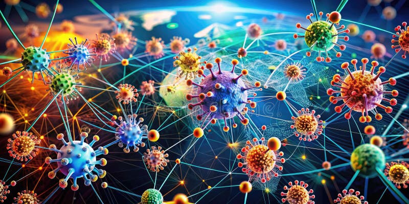
Free with trial Uncover the intricate dynamics of epidemic outbreaks with our interactive disease modeling simulations. Explore how infectious diseases spread through populations using mathematical models and network analysis. Visualize the complex interplay of factors like contact rates, incubation periods, and interventions on epidemic spread. This resource allows users to explore diverse scenarios, adjust. Realtime mapping illustrations Visualizing Epidemic Spread Explore Infectious Disease Transmission Population Dynamics Through Interactive Disease. Uncover the intricate dynamics of epidemic outbreaks with our interactive disease modeling simulations. Explore how infectious diseases spread through populations using mathematical models and network analysis. Visualize the complex interplay of factors like contact rates, incubation periods, and interventions on epidemic spread. This resource allows users to explore diverse scenarios, adjust
Free with trial The image depicts a cheerful, cartoon-like digital assistant or robot holding a smartphone displaying a GPS navigation map. The map highlights a route with a red location pin, suggesting real-time navigation or location services. Above the assistant’s head, there are thought bubbles containing icons representing connectivity, syncing, and a question mark, indicating concepts like network. Realtime mapping illustrations Digital Assistant Using GPS Navigation on Smartphone for Location-Based Services. The image depicts a cheerful, cartoon-like digital assistant or robot holding a smartphone displaying a GPS navigation map. The map highlights a route with a red location pin, suggesting real-time navigation or location services. Above the assistant’s head, there are thought bubbles containing icons representing connectivity, syncing, and a question mark, indicating concepts like network
Free with trial Close-up of a modern smartphone securely attached to a car dashboard, showing a GPS navigation app with a clear map route. Ideal for travel, technology, driving safety, and mobile app marketing content. Realtime mapping illustrations Smartphone mounted on car dashboard displaying GPS navigation app during daytime drive. Close-up of a modern smartphone securely attached to a car dashboard, showing a GPS navigation app with a clear map route. Ideal for travel, technology, driving safety, and mobile app marketing content
Free with trial A GIS-enabled 3D globe map highlighting international shipping routes. Generative AI. Realtime mapping illustrations A GIS-enabled 3D globe map highlighting international shipping routes.
Free with trial Perspective shot of black mobile device featuring golden map lines and navigation markers. Creative visualization of pathfinding and location services. Vibrant technology concept for modern travel. Generative AI. Realtime mapping illustrations Isometric view of smartphone showing orange map pins with glowing trail and city network. Perspective shot of black mobile device featuring golden map lines and navigation markers. Creative visualization of pathfinding and location services. Vibrant technology concept for modern travel. Generative AI
Free with trial A highly detailed, 4k highly detailed image depicting data visualization abstract. The scene features a swirling vortex of data points mapping out intricate relationships in a a soft gradient void. The visual style is organic flowing lines, illuminated by neon accents on data points. Colors transition smoothly, representing different data metrics. Perfect for technology blogs, corporate. Realtime mapping illustrations Background Data Visualization Abstract Organic Flowing Lines A Swirling Vortex Of Data Points. A highly detailed, 4k highly detailed image depicting data visualization abstract. The scene features a swirling vortex of data points mapping out intricate relationships in a a soft gradient void. The visual style is organic flowing lines, illuminated by neon accents on data points. Colors transition smoothly, representing different data metrics. Perfect for technology blogs, corporate
Free with trial A highly detailed, masterpiece image depicting data visualization abstract. The scene features a flowing river of information mapping out intricate relationships in a a futuristic control room. The visual style is minimalist data design, illuminated by neon accents on data points. The visualization is fluid and responsive, reacting to unseen data streams. Perfect for technology blogs, corporate. Realtime mapping illustrations A Flowing River Of Information Data Visualization Abstract Minimalist Data Design Digital Art. A highly detailed, masterpiece image depicting data visualization abstract. The scene features a flowing river of information mapping out intricate relationships in a a futuristic control room. The visual style is minimalist data design, illuminated by neon accents on data points. The visualization is fluid and responsive, reacting to unseen data streams. Perfect for technology blogs, corporate
Free with trial This image features a robust, multi-screen portable device, possibly for industrial or scientific use. Each of the three screens displays distinct data visualizations, including geographical maps with thermal overlays and analytical graphs, indicating real-time monitoring or complex data analysis in a high-tech application. Realtime mapping vectors A rugged portable device displays three separate screens with complex data visualizations. This image features a robust, multi-screen portable device, possibly for industrial or scientific use. Each of the three screens displays distinct data visualizations, including geographical maps with thermal overlays and analytical graphs, indicating real-time monitoring or complex data analysis in a high-tech application.
Free with trial 2D illustration of four executives in a futuristic meeting room, seated around a table with a glowing holographic globe display. The individuals, dressed in formal business attire, are engaged and taking notes. The globe shows digital outlines of continents, suggesting a focus on global strategy or data analysis. The room's cool blue lighting adds a high-tech atmosphere. Realtime mapping illustrations A captivating 2D illustration featuring a group of forward-thinking executives in a high-tech. 2D illustration of four executives in a futuristic meeting room, seated around a table with a glowing holographic globe display. The individuals, dressed in formal business attire, are engaged and taking notes. The globe shows digital outlines of continents, suggesting a focus on global strategy or data analysis. The room's cool blue lighting adds a high-tech atmosphere.
Free with trial Chrono-Transit A Future of Personalized Mobility. Realtime mapping illustrations Chrono-Transit A Future of Personalized Mobility
Free with trial Inside modern ocean research vessel bridge. Global positioning system navigation on multiple screens with real-time data. Advanced tech for maritime navigation. Scientific discovery in. Realtime mapping illustrations Inside modern ocean research vessel bridge. Global positioning system navigation on multiple screens with real-time data.
Free with trial Concept Cloud Migration, Data Integration, OnPremises Transfer, Cloud Sync, Data Flow Synced Skies OnPrem to Cloud Data Flow. Realtime mapping illustrations Synced Skies: On-Prem to Cloud Data Flow. Concept Cloud Migration, Data Integration, On-Premises. Concept Cloud Migration, Data Integration, OnPremises Transfer, Cloud Sync, Data Flow Synced Skies OnPrem to Cloud Data Flow
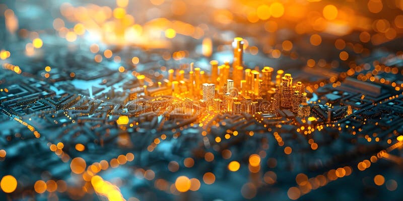
Free with trial Macro view of luminous energy lines representing urban infrastructure, smart city connectivity, high speed traffic flow, digital transformation, futuristic transportation networks, data highway. Generative AI. Realtime mapping illustrations Night city concept with glowing orange light paths and blue electronic circuit board patterns. Macro view of luminous energy lines representing urban infrastructure, smart city connectivity, high speed traffic flow, digital transformation, futuristic transportation networks, data highway. Generative AI
Free with trial Startup team uses drone delivery simulation software in a modern innovation hub. Realtime mapping illustrations Startup team utilizing drone delivery simulation software inside modern innovation hub workspace. Startup team uses drone delivery simulation software in a modern innovation hub
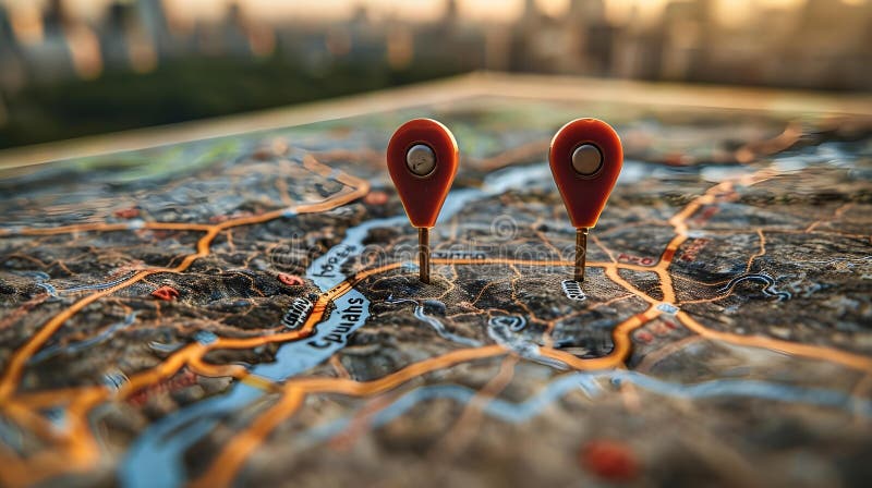
Free with trial Concept Route Planning, Dual Pins, Sunset Map, Optimization, Navigation Optimized Route Planning with Dual Pins on a Sunset Map. Realtime mapping illustrations Optimized Route Planning with Dual Pins on a Sunset Map. Concept Route Planning, Dual Pins, Sunset. Concept Route Planning, Dual Pins, Sunset Map, Optimization, Navigation Optimized Route Planning with Dual Pins on a Sunset Map
Free with trial Modern smartphone screen showing a detailed, colorful three-dimensional city map with various building icons and multiple prominent red location markers, illustrating urban navigation and digital city planning. Generative AI. Realtime mapping illustrations Smartphone displaying a vibrant 3d city map with multiple building icons and red location pins. Modern smartphone screen showing a detailed, colorful three-dimensional city map with various building icons and multiple prominent red location markers, illustrating urban navigation and digital city planning. Generative AI
Free with trial High-angle view of a smartphone on a city model, showing a digital map with two prominent orange location pins. the urban model includes detailed buildings, streets, and green areas, all connected by glowing orange lines. Generative AI. Realtime mapping illustrations Smartphone on a detailed city model displaying a digital map with two large orange location pins. High-angle view of a smartphone on a city model, showing a digital map with two prominent orange location pins. the urban model includes detailed buildings, streets, and green areas, all connected by glowing orange lines. Generative AI
Free with trial An underwater 3D GIS map visualizing oceanic data networks and location pins. Generative AI. Realtime mapping illustrations An underwater 3D GIS map visualizing oceanic data networks and location pins.
Free with trial A highly detailed, 4k highly detailed image depicting futuristic digital grid. The scene features an intricate glowing grid pattern mapping out virtual territories in a a clean, minimalist tech background. The visual style is sci-fi geometric design, illuminated by bright white grid illumination. The perspective emphasizes depth and scale, creating an immersive feeling. Perfect for technology. Realtime mapping illustrations Sci-Fi Geometric Design Digital Art 4K Highly Detailed Background Bright White Grid Illumination. A highly detailed, 4k highly detailed image depicting futuristic digital grid. The scene features an intricate glowing grid pattern mapping out virtual territories in a a clean, minimalist tech background. The visual style is sci-fi geometric design, illuminated by bright white grid illumination. The perspective emphasizes depth and scale, creating an immersive feeling. Perfect for technology
Free with trial A highly detailed, sharp details image depicting data visualization abstract. The scene features a glowing fractal data structure mapping out intricate relationships in a a clean white abstract background. The visual style is minimalist data design, illuminated by bright analytical highlights. The image conveys clarity, insight, and the beauty of organized data. Perfect for technology blogs,. Realtime mapping illustrations Background Minimalist Data Design Data Visualization Abstract A Glowing Fractal Data Structure Digital Art. A highly detailed, sharp details image depicting data visualization abstract. The scene features a glowing fractal data structure mapping out intricate relationships in a a clean white abstract background. The visual style is minimalist data design, illuminated by bright analytical highlights. The image conveys clarity, insight, and the beauty of organized data. Perfect for technology blogs,
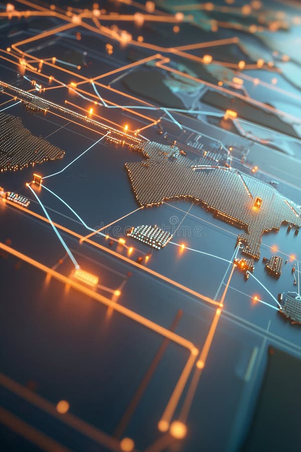
Free with trial A global 3D map with dynamic data visualization of international GIS networks. Generative AI. Realtime mapping illustrations A global 3D map with dynamic data visualization of international GIS networks.
Free with trial A conceptual illustration of an autonomous vehicle with advanced self-driving car technology. It features LiDAR sensors emitting light beams for real-time perception of surroundings, representing the future of smart mobility, safe urban driving, and autom. Realtime mapping vectors Conceptual illustration of an autonomous vehicle using advanced sensors for self-driving capability. A conceptual illustration of an autonomous vehicle with advanced self-driving car technology. It features LiDAR sensors emitting light beams for real-time perception of surroundings, representing the future of smart mobility, safe urban driving, and autom
Free with trial Smartphone showcasing a digital map with two prominent orange location pins. the map features green parks and detailed streets, set against a blurred 3d model of a city with buildings and trees. Generative AI. Realtime mapping illustrations Smartphone displaying a vibrant digital map with two orange location pins on a detailed 3d city model. Smartphone showcasing a digital map with two prominent orange location pins. the map features green parks and detailed streets, set against a blurred 3d model of a city with buildings and trees. Generative AI
Free with trial Imagine a world where urban exploration is enhanced by cutting-edge smartphone technology. This mockup showcases a futuristic device meticulously designed for detailed visualization of complex urban environments. The intricate details, from towering skyscrapers to hidden alleys, are rendered with stunning clarity and realism, all displayed on a sleek, responsive screen. This innovative. Realtime mapping illustrations Capturing the Urban Landscape A Futuristic Smartphone Visualization of Advanced Exploration Technology. Imagine a world where urban exploration is enhanced by cutting-edge smartphone technology. This mockup showcases a futuristic device meticulously designed for detailed visualization of complex urban environments. The intricate details, from towering skyscrapers to hidden alleys, are rendered with stunning clarity and realism, all displayed on a sleek, responsive screen. This innovative
Free with trial This captivating wall features an array of multiple screens, each displaying intricate maps related to investment technology and fintech innovations. It showcases how visual data can enhance decision-making in the financial sector as technology evolves. Realtime mapping illustrations Explore the Future of Fintech with an Innovative Wall of Interactive Screens Displaying Investment Maps. This captivating wall features an array of multiple screens, each displaying intricate maps related to investment technology and fintech innovations. It showcases how visual data can enhance decision-making in the financial sector as technology evolves
Free with trial Mobile phone showing navigation application. Digital map with highlighted routes and several destination markers, indicating travel or location tracking technology. Modern device on dark background. Generative AI. Realtime mapping illustrations Smartphone displaying a digital map with multiple orange location pins and glowing lines on a dark table. Mobile phone showing navigation application. Digital map with highlighted routes and several destination markers, indicating travel or location tracking technology. Modern device on dark background. Generative AI
Free with trial A person in a suit is seated at a wooden desk, interacting with a futuristic holographic interface that displays various data visualizations. Realtime mapping illustrations Navigating the Digital Universe Generated by AI. A person in a suit is seated at a wooden desk, interacting with a futuristic holographic interface that displays various data visualizations.
Free with trial Mining operations center highlights trend anticipation and forecasting dashboards for efficiency. Realtime mapping illustrations AI-Infused Digital Mining Operations Center Highlighting Trend Anticipation and Resource Forecast Dashboards. Mining operations center highlights trend anticipation and forecasting dashboards for efficiency
Free with trial A highly detailed, high quality image depicting data visualization abstract. The scene features a glowing fractal data structure mapping out intricate relationships in a a soft gradient void. The visual style is abstract digital art, illuminated by neon accents on data points. The abstract nature allows for versatile use across various data topics. Perfect for technology blogs, corporate. Realtime mapping illustrations A Glowing Fractal Data Structure Background Concept Illustration A Soft Gradient Void Data Visualization Abstract. A highly detailed, high quality image depicting data visualization abstract. The scene features a glowing fractal data structure mapping out intricate relationships in a a soft gradient void. The visual style is abstract digital art, illuminated by neon accents on data points. The abstract nature allows for versatile use across various data topics. Perfect for technology blogs, corporate
Free with trial A highly detailed, crisp focus image depicting futuristic digital grid. The scene features an intricate glowing grid pattern mapping out virtual territories in a a clean, minimalist tech background. The visual style is clean minimalist grid, illuminated by neon blue and green lines. The design is both functional and aesthetically pleasing, representing future infrastructure. Perfect for technology. Realtime mapping illustrations Clean Minimalist Grid Neon Blue And Green Lines Background An Intricate Glowing Grid Pattern Crisp Focus A Clean, Minimalist Tech. A highly detailed, crisp focus image depicting futuristic digital grid. The scene features an intricate glowing grid pattern mapping out virtual territories in a a clean, minimalist tech background. The visual style is clean minimalist grid, illuminated by neon blue and green lines. The design is both functional and aesthetically pleasing, representing future infrastructure. Perfect for technology
Free with trial A dynamic 3D map visualizing trade routes with glowing GIS data overlays. Generative AI. Realtime mapping illustrations A dynamic 3D map visualizing trade routes with glowing GIS data overlays.
Free with trial A 3D visualization of disaster response routes with connected GIS points. Generative AI. Realtime mapping illustrations A 3D visualization of disaster response routes with connected GIS points.
Free with trial A 3D visualization of disaster response routes with connected GIS points. Generative AI. Realtime mapping illustrations A 3D visualization of disaster response routes with connected GIS points.
Free with trial A dynamic 3D map visualizing trade routes with glowing GIS data overlays. Generative AI. Realtime mapping illustrations A dynamic 3D map visualizing trade routes with glowing GIS data overlays.
Free with trial A highly detailed, photorealistic image depicting futuristic digital grid. The scene features a dynamic energy field mapping out virtual territories in a a dark, infinite cyber space. The visual style is dynamic light trails, illuminated by volumetric light rays. The grid lines are sharp and precise, indicating advanced engineering. Perfect for technology blogs, corporate presentations, and. Realtime mapping illustrations A Dark, Infinite Cyber Space Background Volumetric Light Rays Concept Illustration Digital Art Photorealistic. A highly detailed, photorealistic image depicting futuristic digital grid. The scene features a dynamic energy field mapping out virtual territories in a a dark, infinite cyber space. The visual style is dynamic light trails, illuminated by volumetric light rays. The grid lines are sharp and precise, indicating advanced engineering. Perfect for technology blogs, corporate presentations, and
Free with trial Concept Technology, Connectivity, Global, Map, Minimalist Global Connectivity Network Map with a Minimalist Twist. Realtime mapping illustrations Global Connectivity Network Map with a Minimalist Twist. Concept Technology, Connectivity, Global. Concept Technology, Connectivity, Global, Map, Minimalist Global Connectivity Network Map with a Minimalist Twist
Free with trial Cutting-edge drone technology facilitating the rapid delivery of medical supplies in underserved regions, significantly improving healthcare logistics and emergency response. Generated AI. Realtime mapping illustrations AI-driven drone networks transform medical supply delivery in remote areas, enhancing healthcare access and response times during. Cutting-edge drone technology facilitating the rapid delivery of medical supplies in underserved regions, significantly improving healthcare logistics and emergency response. Generated AI
Free with trial This cutting-edge underwater robot, resembling a sleek, futuristic turtle, navigates the ocean's depths with precision and grace. Designed for scientific exploration and environmental monitoring, the autonomous vehicle boasts advanced sensors and imaging capabilities. Its streamlined design allows for efficient movement through complex underwater terrains, capturing stunning visuals and. Realtime mapping illustrations Autonomous Underwater Turtle Robot Exploring the Depths for Scientific Discovery and Environmental Monitoring. This cutting-edge underwater robot, resembling a sleek, futuristic turtle, navigates the ocean's depths with precision and grace. Designed for scientific exploration and environmental monitoring, the autonomous vehicle boasts advanced sensors and imaging capabilities. Its streamlined design allows for efficient movement through complex underwater terrains, capturing stunning visuals and
Free with trial Concept Traffic Patterns, Urban Map, Data Visualization, City Congestion, Transportation Trends Visual representation of urban traffic data on a city map. Realtime mapping illustrations Visual representation of urban traffic data on a city map. Concept Traffic Patterns, Urban Map. Concept Traffic Patterns, Urban Map, Data Visualization, City Congestion, Transportation Trends Visual representation of urban traffic data on a city map
Free with trial Explore a state-of-the-art fleet of drones conducting environmental monitoring and conservation efforts, outfitted with cutting-edge sensors and artificial intelligence technology for real-time data analysis, exquisite background. Realtime mapping illustrations Cutting-Edge Eco-Tech, Advanced Drone Fleet for Environmental Monitoring. Explore a state-of-the-art fleet of drones conducting environmental monitoring and conservation efforts, outfitted with cutting-edge sensors and artificial intelligence technology for real-time data analysis, exquisite background
Free with trial AI advisor visualizes forest carbon offsets and ESG scoring for investor board decisions. Realtime mapping illustrations AI advisor visualizes forest carbon offset impact and ESG scoring for sustainability-driven investor board meetings. AI advisor visualizes forest carbon offsets and ESG scoring for investor board decisions
Free with trial Autonomous drones operate in a sunrise logistics hub with animated global trade charts. Realtime mapping illustrations Low-Angle Perspective of High-Tech Logistics Hub with Autonomous Drones and Animated Global Trade Charts at Sunrise. Autonomous drones operate in a sunrise logistics hub with animated global trade charts
Free with trial Streamline your network management with a cutting-edge monitoring system designed for seamless IT team collaboration. This intuitive platform provides real-time visibility into network performance, identifying potential issues before they impact users. Visualize complex network data with interactive dashboards, enabling quick problem resolution and proactive maintenance. The system facilitates. Realtime mapping illustrations Effortlessly Monitor and Visualize Your Network Infrastructure A Collaborative Network Monitoring System for Enhanced. Streamline your network management with a cutting-edge monitoring system designed for seamless IT team collaboration. This intuitive platform provides real-time visibility into network performance, identifying potential issues before they impact users. Visualize complex network data with interactive dashboards, enabling quick problem resolution and proactive maintenance. The system facilitates
Free with trial A 3D isometric map with real-time updates of GIS location data. Generative AI. Realtime mapping illustrations A 3D isometric map with real-time updates of GIS location data.
Free with trial A global GIS visualization on a 3D sphere highlighting data interconnectivity. Generative AI. Realtime mapping illustrations A global GIS visualization on a 3D sphere highlighting data interconnectivity.
Free with trial A 3D isometric map with real-time updates of GIS location data. Generative AI. Realtime mapping illustrations A 3D isometric map with real-time updates of GIS location data.
Free with trial A sleek 3D industrial map showing networked supply chains with GIS overlays. Generative AI. Realtime mapping illustrations A sleek 3D industrial map showing networked supply chains with GIS overlays.
Free with trial A futuristic 3D map showing global energy distribution and network pathways. Generative AI. Realtime mapping illustrations A futuristic 3D map showing global energy distribution and network pathways.
Free with trial A global GIS visualization on a 3D sphere highlighting data interconnectivity. Generative AI. Realtime mapping illustrations A global GIS visualization on a 3D sphere highlighting data interconnectivity.
Free with trial A futuristic 3D map showing global energy distribution and network pathways. Generative AI. Realtime mapping illustrations A futuristic 3D map showing global energy distribution and network pathways.
Free with trial A 3D isometric map with real-time updates of GIS location data. Generative AI. Realtime mapping illustrations A 3D isometric map with real-time updates of GIS location data.
Free with trial A sleek 3D industrial map showing networked supply chains with GIS overlays. Generative AI. Realtime mapping illustrations A sleek 3D industrial map showing networked supply chains with GIS overlays.
Free with trial Concept Data Visualization, Information Flow, AI Technology, Charts, Graphs AIgenerated data visualization showing information flow. Realtime mapping illustrations AIgenerated data visualization showing information flow. Concept Data Visualization, Information. Concept Data Visualization, Information Flow, AI Technology, Charts, Graphs AIgenerated data visualization showing information flow
Free with trial Mobile device showing a navigation map with two distinct orange location markers and bright glowing paths connecting various points. Device sits on a dark, subtly reflective table, highlighting connectivity. Generative AI. Realtime mapping illustrations Smartphone displaying a digital map with two orange location pins and connected routes on a dark, reflective surface. Mobile device showing a navigation map with two distinct orange location markers and bright glowing paths connecting various points. Device sits on a dark, subtly reflective table, highlighting connectivity. Generative AI
Free with trial This captivating aerial shot showcases a delivery sign prominently displayed at a residential address. The drone's vantage point offers a comprehensive, detailed view, capturing the sign's placement and surrounding environment. This meticulously-crafted image provides a crucial perspective for accurate delivery address verification. The clear visibility of the address number and any. Realtime mapping illustrations Drone Photography Captures Delivery Sign at a Residential Home A Detailed Aerial Perspective for Precise Address. This captivating aerial shot showcases a delivery sign prominently displayed at a residential address. The drone's vantage point offers a comprehensive, detailed view, capturing the sign's placement and surrounding environment. This meticulously-crafted image provides a crucial perspective for accurate delivery address verification. The clear visibility of the address number and any
Free with trial A vibrant 3D national map with railway networks and spatial GIS data overlays. Generative AI. Realtime mapping illustrations A vibrant 3D national map with railway networks and spatial GIS data overlays.
Free with trial A vibrant 3D national map with railway networks and spatial GIS data overlays. Generative AI. Realtime mapping illustrations A vibrant 3D national map with railway networks and spatial GIS data overlays.
Free with trial This image features a world map in a dotted texture with a large yellow location pin highlighting Asia. The background is solid, creating a clean, modern feel of connectivity. Realtime mapping illustrations Interactive Global Map with Bright Yellow Pin Indicating Real-Time Order Status and Location. This image features a world map in a dotted texture with a large yellow location pin highlighting Asia. The background is solid, creating a clean, modern feel of connectivity
Free with trial A futuristic 3D global connectivity map with glowing GIS pathways. Generative AI. Realtime mapping illustrations A futuristic 3D global connectivity map with glowing GIS pathways.
Free with trial A futuristic 3D global connectivity map with glowing GIS pathways. Generative AI. Realtime mapping illustrations A futuristic 3D global connectivity map with glowing GIS pathways.
Free with trial A futuristic 3D global connectivity map with glowing GIS pathways. Generative AI. Realtime mapping illustrations A futuristic 3D global connectivity map with glowing GIS pathways.
Free with trial Concept AI, Data Visualization, Flow Analysis, Technology, Information Systems Visualizing Data Flow Generated by AI. Realtime mapping illustrations Visualizing Data Flow Generated by AI. Concept AI, Data Visualization, Flow Analysis, Technology. Concept AI, Data Visualization, Flow Analysis, Technology, Information Systems Visualizing Data Flow Generated by AI