Free with trial Coahuila United Mexican States, Mexico, federal republic map vector illustration, scribble sketch Free and Sovereign State of Coahuila de Zaragoza map. Saltillo outline map vectors Coahuila map vector. Coahuila United Mexican States, Mexico, federal republic map vector illustration, scribble sketch Free and Sovereign State of Coahuila de Zaragoza map
Free with trial Coahuila United Mexican States, Mexico, federal republic map vector illustration, scribble sketch Free and Sovereign State of Coahuila de Zaragoza map. Saltillo outline map vectors Coahuila map vector. Coahuila United Mexican States, Mexico, federal republic map vector illustration, scribble sketch Free and Sovereign State of Coahuila de Zaragoza map
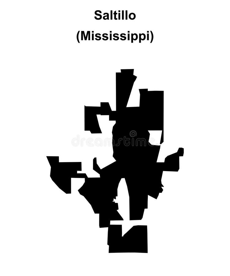
Free with trial Saltillo (Mississippi) blank outline map. Saltillo outline map vectors Saltillo outline map. Saltillo (Mississippi) blank outline map
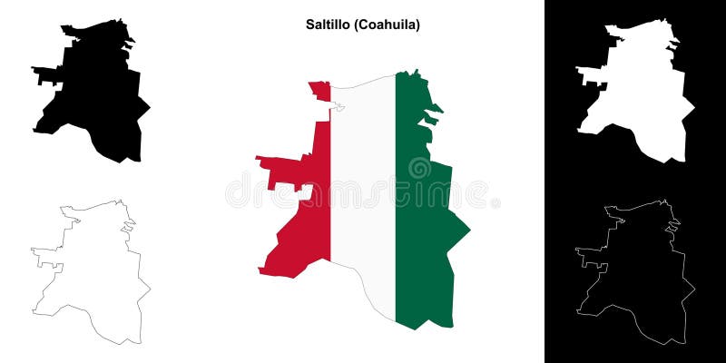
Free with trial Saltillo municipality (Coahuila) outline map set. Saltillo outline map vectors Saltillo outline map. Saltillo municipality (Coahuila) outline map set
Free with trial Vintage wall art map of Saltillo, located in Hardin, Tennessee, United States. Aerial plan with forests, roads, cities, lakes and rivers. Saltillo outline map illustrations Retro US map of Saltillo, Tennessee. Vintage street map. Vintage wall art map of Saltillo, located in Hardin, Tennessee, United States. Aerial plan with forests, roads, cities, lakes and rivers.
Free with trial Vintage wall art map of Saltillo, located in Lee, Mississippi, United States. Aerial plan with forests, roads, cities, lakes and rivers. Saltillo outline map illustrations Retro US map of Saltillo, Mississippi. Vintage street map. Vintage wall art map of Saltillo, located in Lee, Mississippi, United States. Aerial plan with forests, roads, cities, lakes and rivers.
Free with trial Vintage wall art map of Saltillo, located in Huntingdon, Pennsylvania, United States. Aerial plan with forests, roads, cities, lakes and rivers. Saltillo outline map illustrations Retro US map of Saltillo, Pennsylvania. Vintage street map. Vintage wall art map of Saltillo, located in Huntingdon, Pennsylvania, United States. Aerial plan with forests, roads, cities, lakes and rivers.
Free with trial Outline map of mexico, solid map of mexico, dotted map of mexico. vector illustration of map of mexico for your design needs. country geography concept. Saltillo outline map vectors Map of mexico silhouette with four different styles of maps isolated on transparent background. Outline map of mexico, solid map of mexico, dotted map of mexico. Outline map of mexico, solid map of mexico, dotted map of mexico. vector illustration of map of mexico for your design needs. country geography concept
Free with trial Coahuila of Mexico map shape, travel web concept icon vector illustration. Saltillo outline map vectors Coahuila of Mexico map shape, travel web concept icon vector illustration
Free with trial Coahuila of Mexico map shape, travel web concept icon vector illustration. Saltillo outline map vectors Coahuila of Mexico map shape, travel web concept icon vector illustration
Free with trial Coahuila state blank vector outline map set. Saltillo outline map vectors Coahuila blank outline map set. Coahuila state blank vector outline map set
Free with trial Detailed map of mexican state Coahuila. Colored. Vectored. Map with capital city of Saltillo. Outline map. Saltillo outline map vectors Coahuila state location on map of Mexico. Detailed map of mexican state Coahuila. Colored. Vectored. Map with capital city of Saltillo. Outline map
Free with trial Saltillo City United Mexican States, Mexico, Coahuila State map vector illustration, scribble sketch City of Saltillo map,. Saltillo outline map vectors Saltillo City United Mexican States, Mexico, Coahuila State map vector illustration, scribble sketch City of Saltillo map
Free with trial Saltillo City United Mexican States, Mexico, Coahuila State map vector illustration, scribble sketch City of Saltillo map,. Saltillo outline map vectors Saltillo City United Mexican States, Mexico, Coahuila State map vector illustration, scribble sketch City of Saltillo map
Free with trial Saltillo City United Mexican States, Mexico, Coahuila State map vector illustration, scribble sketch City of Saltillo map,. Saltillo outline map vectors Saltillo City United Mexican States, Mexico, Coahuila State map vector illustration, scribble sketch City of Saltillo map
Free with trial Saltillo municipality Free and Sovereign State of Coahuila de Zaragoza, Mexico, United Mexican States map vector illustration, scribble sketch Saltillo map,. Saltillo outline map vectors Saltillo municipality Free and Sovereign State of Coahuila de Zaragoza, Mexico, United Mexican States map vector illustration
Free with trial Saltillo municipality Free and Sovereign State of Coahuila de Zaragoza, Mexico, United Mexican States map vector illustration, scribble sketch Saltillo map,. Saltillo outline map vectors Saltillo municipality Free and Sovereign State of Coahuila de Zaragoza, Mexico, United Mexican States map vector illustration
Free with trial Saltillo municipality Free and Sovereign State of Coahuila de Zaragoza, Mexico, United Mexican States map vector illustration, scribble sketch Saltillo map,. Saltillo outline map vectors Saltillo municipality Free and Sovereign State of Coahuila de Zaragoza, Mexico, United Mexican States map vector illustration
Free with trial Detailed map of mexican state San Luis Potos�. Colored. Vectored. Map with capital city of San Luis Potos�. Outline map. Saltillo outline map vectors . Detailed map of mexican state San Luis Potos�. Colored. Vectored. Map with capital city of San Luis Potos�. Outline map
Free with trial Detailed map of mexican state Sonora. Colored. Vectored. Map with capital city of Hermosillo. Outline map. Saltillo outline map vectors Sonora state location on map of Mexico. Detailed map of mexican state Sonora . Colored. Vectored. Map with capital city of Hermosillo. Outline map
Free with trial Detailed map of mexican state Tabasco. Colored. Vectored. Map with capital city of Villahermosa. Outline map. Saltillo outline map vectors Tabasco state location on map of Mexico. Detailed map of mexican state Tabasco. Colored. Vectored. Map with capital city of Villahermosa. Outline map
Free with trial Detailed map of mexican state Sinaloa. Colored. Vectored. Map with capital city of Culiac�n. Outline map. Saltillo outline map vectors Sinaloa state location on map of Mexico. Detailed map of mexican state Sinaloa. Colored. Vectored. Map with capital city of Culiac�n. Outline map
Free with trial Detailed map of mexican state Coahuila. Colored. Vectored. Map with capital city of Pachuca. Outline map. Saltillo outline map vectors Hidalgo state location on map of Mexico. Detailed map of mexican state Coahuila. Colored. Vectored. Map with capital city of Pachuca. Outline map
Free with trial Detailed map of mexican state Quer�taro. Colored. Vectored. Map with capital city of Quer�taro. Outline map. Saltillo outline map vectors . Detailed map of mexican state Quer�taro. Colored. Vectored. Map with capital city of Quer�taro. Outline map
Free with trial Coahuila United Mexican States, Mexico, federal republic map vector illustration, scribble sketch Free and Sovereign State of Coahuila de Zaragoza map. Saltillo outline map vectors Coahuila map vector. Coahuila United Mexican States, Mexico, federal republic map vector illustration, scribble sketch Free and Sovereign State of Coahuila de Zaragoza map
Free with trial State Coahuila of Mexico map on transparent background. Blank map of Coahuila with regions in gray for your web site design, logo, app, UI. Mexico. EPS10. Saltillo outline map vectors State Coahuila of Mexico map on transparent background. Blank map of Coahuila with regions in gray for your web site design, log. State Coahuila of Mexico map on transparent background. Blank map of Coahuila with regions in gray for your web site design, logo, app, UI. Mexico. EPS10
Free with trial Location of Coahuila on map Mexico. 3d location sign of Coahuila. Quality map with provinces of Mexico for your design. EPS10. Saltillo outline map vectors Location of Coahuila on map Mexico. 3d location sign of Coahuila. Quality map with provinces of Mexico for your design.
Free with trial Coahuila, state of Mexico. Grayscaled map with lakes and rivers. Shape presented against its country area with informative overlays. 3D rendering. Saltillo outline map illustrations Coahuila, Mexico - composition. Grayscale. Coahuila, state of Mexico. Grayscaled map with lakes and rivers. Shape presented against its country area with informative overlays. 3D rendering
Free with trial Coahuila, state of Mexico. Grayscaled map with lakes and rivers. Shape outlined against its country area. 3D rendering. Saltillo outline map illustrations Coahuila, Mexico - outlined. Grayscale. Coahuila, state of Mexico. Grayscaled map with lakes and rivers. Shape outlined against its country area. 3D rendering
Free with trial Coahuila, state of Mexico. Elevation map colored in wiki style with lakes and rivers. Corner auxiliary location maps. Saltillo outline map illustrations Coahuila, Mexico. Wiki. Capital. Coahuila, state of Mexico. Elevation map colored in wiki style with lakes and rivers. Corner auxiliary location maps
Free with trial Coahuila, state of Mexico. Elevation map colored in sepia tones with lakes and rivers. Corner auxiliary location maps. Saltillo outline map illustrations Coahuila, Mexico. Sepia. Capital. Coahuila, state of Mexico. Elevation map colored in sepia tones with lakes and rivers. Corner auxiliary location maps
Free with trial Coahuila, state of Mexico. Elevation map colored in wiki style with lakes and rivers. Saltillo outline map illustrations Coahuila, Mexico. Wiki. No legend. Coahuila, state of Mexico. Elevation map colored in wiki style with lakes and rivers
Free with trial Coahuila, state of Mexico. Elevation map colored in sepia tones with lakes and rivers. Saltillo outline map illustrations Coahuila, Mexico. Sepia. No legend. Coahuila, state of Mexico. Elevation map colored in sepia tones with lakes and rivers
Free with trial Coahuila, state of Mexico. Colored elevation map with lakes and rivers. Corner auxiliary location maps. Saltillo outline map illustrations Coahuila, Mexico. Physical. Capital. Coahuila, state of Mexico. Colored elevation map with lakes and rivers. Corner auxiliary location maps
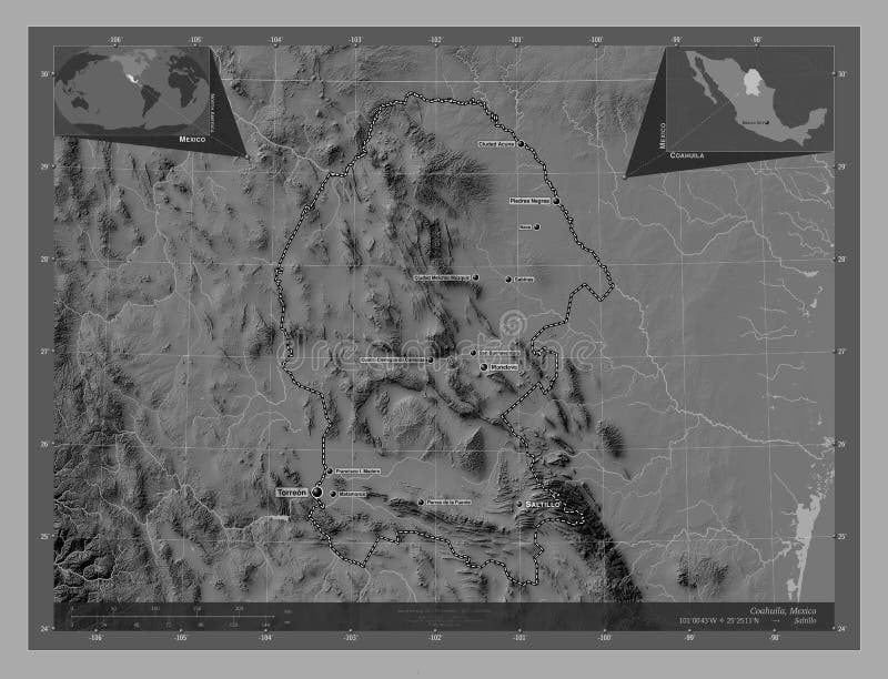
Free with trial Coahuila, state of Mexico. Grayscale elevation map with lakes and rivers. Corner auxiliary location maps. Saltillo outline map illustrations Coahuila, Mexico. Grayscale. Capital. Coahuila, state of Mexico. Grayscale elevation map with lakes and rivers. Corner auxiliary location maps
Free with trial Coahuila, state of Mexico. Bilevel elevation map with lakes and rivers. Saltillo outline map illustrations Coahuila, Mexico. Bilevel. No legend. Coahuila, state of Mexico. Bilevel elevation map with lakes and rivers
Free with trial Coahuila, state of Mexico. Elevation map colored in wiki style with lakes and rivers. Locations of major cities of the region. Corner auxiliary location maps. Saltillo outline map illustrations Coahuila, Mexico. Wiki. Major cities. Coahuila, state of Mexico. Elevation map colored in wiki style with lakes and rivers. Locations of major cities of the region. Corner auxiliary location maps
Free with trial Coahuila, state of Mexico. Colored elevation map with lakes and rivers. Saltillo outline map illustrations Coahuila, Mexico. Physical. No legend. Coahuila, state of Mexico. Colored elevation map with lakes and rivers
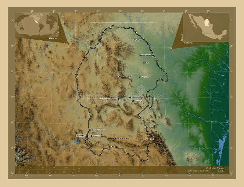
Free with trial Coahuila, state of Mexico. Elevation map colored in sepia tones with lakes and rivers. Locations of major cities of the region. Corner auxiliary location maps. Saltillo outline map illustrations Coahuila, Mexico. Sepia. Major cities. Coahuila, state of Mexico. Elevation map colored in sepia tones with lakes and rivers. Locations of major cities of the region. Corner auxiliary location maps
Free with trial Coahuila, state of Mexico. Grayscale elevation map with lakes and rivers. Saltillo outline map illustrations Coahuila, Mexico. Grayscale. No legend. Coahuila, state of Mexico. Grayscale elevation map with lakes and rivers
Free with trial Coahuila, state of Mexico. Bilevel elevation map with lakes and rivers. Locations of major cities of the region. Corner auxiliary location maps. Saltillo outline map illustrations Coahuila, Mexico. Bilevel. Major cities. Coahuila, state of Mexico. Bilevel elevation map with lakes and rivers. Locations of major cities of the region. Corner auxiliary location maps
Free with trial Coahuila, state of Mexico. Colored elevation map with lakes and rivers. Locations of major cities of the region. Corner auxiliary location maps. Saltillo outline map illustrations Coahuila, Mexico. Physical. Major cities. Coahuila, state of Mexico. Colored elevation map with lakes and rivers. Locations of major cities of the region. Corner auxiliary location maps
Free with trial Coahuila, state of Mexico. Grayscale elevation map with lakes and rivers. Locations of major cities of the region. Corner auxiliary location maps. Saltillo outline map illustrations Coahuila, Mexico. Grayscale. Major cities. Coahuila, state of Mexico. Grayscale elevation map with lakes and rivers. Locations of major cities of the region. Corner auxiliary location maps
Free with trial Coahuila, state of Mexico. Low resolution satellite map. Corner auxiliary location maps. Saltillo outline map illustrations Coahuila, Mexico. Low-res satellite. Capital. Coahuila, state of Mexico. Low resolution satellite map. Corner auxiliary location maps
Free with trial Coahuila, state of Mexico. High resolution satellite map. Corner auxiliary location maps. Saltillo outline map illustrations Coahuila, Mexico. High-res satellite. Capital. Coahuila, state of Mexico. High resolution satellite map. Corner auxiliary location maps
Free with trial Coahuila, state of Mexico. Low resolution satellite map. Saltillo outline map illustrations Coahuila, Mexico. Low-res satellite. No legend. Coahuila, state of Mexico. Low resolution satellite map
Free with trial Coahuila, state of Mexico. Bilevel elevation map with lakes and rivers. Corner auxiliary location maps. Saltillo outline map illustrations Coahuila, Mexico. Bilevel. Capital. Coahuila, state of Mexico. Bilevel elevation map with lakes and rivers. Corner auxiliary location maps
Free with trial Coahuila, state of Mexico. High resolution satellite map. Saltillo outline map illustrations Coahuila, Mexico. High-res satellite. No legend. Coahuila, state of Mexico. High resolution satellite map
Free with trial Coahuila, state of Mexico. Elevation map colored in wiki style with lakes and rivers. Locations and names of major cities of the region. Corner auxiliary location maps. Saltillo outline map illustrations Coahuila, Mexico. Wiki. Labelled points of cities. Coahuila, state of Mexico. Elevation map colored in wiki style with lakes and rivers. Locations and names of major cities of the region. Corner auxiliary location maps
Free with trial Coahuila, state of Mexico. Low resolution satellite map. Locations of major cities of the region. Corner auxiliary location maps. Saltillo outline map illustrations Coahuila, Mexico. Low-res satellite. Major cities. Coahuila, state of Mexico. Low resolution satellite map. Locations of major cities of the region. Corner auxiliary location maps
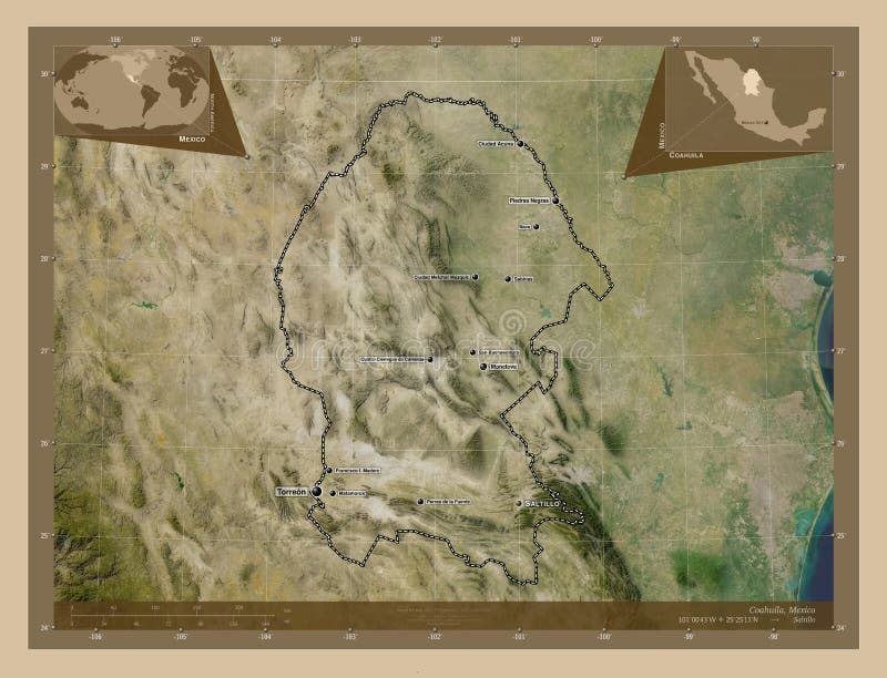
Free with trial Coahuila, state of Mexico. Elevation map colored in sepia tones with lakes and rivers. Locations and names of major cities of the region. Corner auxiliary location maps. Saltillo outline map illustrations Coahuila, Mexico. Sepia. Labelled points of cities. Coahuila, state of Mexico. Elevation map colored in sepia tones with lakes and rivers. Locations and names of major cities of the region. Corner auxiliary location maps
Free with trial Coahuila, state of Mexico. High resolution satellite map. Locations of major cities of the region. Corner auxiliary location maps. Saltillo outline map illustrations Coahuila, Mexico. High-res satellite. Major cities. Coahuila, state of Mexico. High resolution satellite map. Locations of major cities of the region. Corner auxiliary location maps
Free with trial Adjuntas, municipality of Puerto Rico. Low resolution satellite map. Saltillo outline map illustrations Adjuntas, Puerto Rico. Low-res satellite. No legend. Adjuntas, municipality of Puerto Rico. Low resolution satellite map
Free with trial Coahuila, state of Mexico. Bilevel elevation map with lakes and rivers. Locations and names of major cities of the region. Corner auxiliary location maps. Saltillo outline map illustrations Coahuila, Mexico. Bilevel. Labelled points of cities. Coahuila, state of Mexico. Bilevel elevation map with lakes and rivers. Locations and names of major cities of the region. Corner auxiliary location maps
Free with trial Adjuntas, municipality of Puerto Rico. High resolution satellite map. Saltillo outline map illustrations Adjuntas, Puerto Rico. High-res satellite. No legend. Adjuntas, municipality of Puerto Rico. High resolution satellite map
Free with trial Coahuila, state of Mexico. Colored elevation map with lakes and rivers. Locations and names of major cities of the region. Corner auxiliary location maps. Saltillo outline map illustrations Coahuila, Mexico. Physical. Labelled points of cities. Coahuila, state of Mexico. Colored elevation map with lakes and rivers. Locations and names of major cities of the region. Corner auxiliary location maps
Free with trial Coahuila, state of Mexico. Grayscale elevation map with lakes and rivers. Locations and names of major cities of the region. Corner auxiliary location maps. Saltillo outline map illustrations Coahuila, Mexico. Grayscale. Labelled points of cities. Coahuila, state of Mexico. Grayscale elevation map with lakes and rivers. Locations and names of major cities of the region. Corner auxiliary location maps
Free with trial Adjuntas, municipality of Puerto Rico. Low resolution satellite map. Locations of major cities of the region. Corner auxiliary location maps. Saltillo outline map illustrations Adjuntas, Puerto Rico. Low-res satellite. Major cities. Adjuntas, municipality of Puerto Rico. Low resolution satellite map. Locations of major cities of the region. Corner auxiliary location maps
Free with trial Adjuntas, municipality of Puerto Rico. High resolution satellite map. Locations of major cities of the region. Corner auxiliary location maps. Saltillo outline map vectors Adjuntas, Puerto Rico. High-res satellite. Major cities. Adjuntas, municipality of Puerto Rico. High resolution satellite map. Locations of major cities of the region. Corner auxiliary location maps
Free with trial Coahuila, state of Mexico. Low resolution satellite map. Locations and names of major cities of the region. Corner auxiliary location maps. Saltillo outline map illustrations Coahuila, Mexico. Low-res satellite. Labelled points of cities. Coahuila, state of Mexico. Low resolution satellite map. Locations and names of major cities of the region. Corner auxiliary location maps
Free with trial Coahuila, state of Mexico. High resolution satellite map. Locations and names of major cities of the region. Corner auxiliary location maps. Saltillo outline map illustrations Coahuila, Mexico. High-res satellite. Labelled points of cities. Coahuila, state of Mexico. High resolution satellite map. Locations and names of major cities of the region. Corner auxiliary location maps
Free with trial Adjuntas, municipality of Puerto Rico. High resolution satellite map. Locations and names of major cities of the region. Corner auxiliary location maps. Saltillo outline map illustrations Adjuntas, Puerto Rico. High-res satellite. Labelled points of ci. Adjuntas, municipality of Puerto Rico. High resolution satellite map. Locations and names of major cities of the region. Corner auxiliary location maps
Free with trial Adjuntas, municipality of Puerto Rico. Low resolution satellite map. Locations and names of major cities of the region. Corner auxiliary location maps. Saltillo outline map illustrations Adjuntas, Puerto Rico. Low-res satellite. Labelled points of cit. Adjuntas, municipality of Puerto Rico. Low resolution satellite map. Locations and names of major cities of the region. Corner auxiliary location maps
Free with trial Coahuila, state of Mexico. Colored shader data with lakes and rivers. Shape presented against its country area with informative overlays. 3D rendering. Saltillo outline map illustrations Coahuila, Mexico - composition. Physical. Coahuila, state of Mexico. Colored shader data with lakes and rivers. Shape presented against its country area with informative overlays. 3D rendering
Free with trial Coahuila, state of Mexico. Colored relief with lakes and rivers. Shape presented against its country area with informative overlays. 3D rendering. Saltillo outline map illustrations Coahuila, Mexico - composition. Relief. Coahuila, state of Mexico. Colored relief with lakes and rivers. Shape presented against its country area with informative overlays. 3D rendering
Free with trial Coahuila, state of Mexico. Colored shader data with lakes and rivers. Shape outlined against its country area. 3D rendering. Saltillo outline map illustrations Coahuila, Mexico - outlined. Physical. Coahuila, state of Mexico. Colored shader data with lakes and rivers. Shape outlined against its country area. 3D rendering
Free with trial Coahuila, state of Mexico. Satellite imagery. Shape outlined against its country area. 3D rendering. Saltillo outline map illustrations Coahuila, Mexico - outlined. Satellite. Coahuila, state of Mexico. Satellite imagery. Shape outlined against its country area. 3D rendering
Free with trial Coahuila, state of Mexico. Sentinel-2 satellite imagery. Shape isolated on black. Description, location of the capital. Contains modified Copernicus Sentinel data. Saltillo outline map illustrations Coahuila, Mexico - black solid. Sentinel-2 satellite. Coahuila, state of Mexico. Sentinel-2 satellite imagery. Shape isolated on black. Description, location of the capital. Contains modified Copernicus Sentinel data
Free with trial Coahuila, state of Mexico. Satellite imagery. Shape presented against its country area with informative overlays. 3D rendering. Saltillo outline map illustrations Coahuila, Mexico - composition. Satellite. Coahuila, state of Mexico. Satellite imagery. Shape presented against its country area with informative overlays. 3D rendering
Free with trial Coahuila, state of Mexico. Solid color shape. Corner auxiliary location maps. Saltillo outline map illustrations Coahuila, Mexico. Solid. Capital. Coahuila, state of Mexico. Solid color shape. Corner auxiliary location maps
Free with trial Coahuila, state of Mexico. Solid color shape. Saltillo outline map illustrations Coahuila, Mexico. Solid. No legend. Coahuila, state of Mexico. Solid color shape
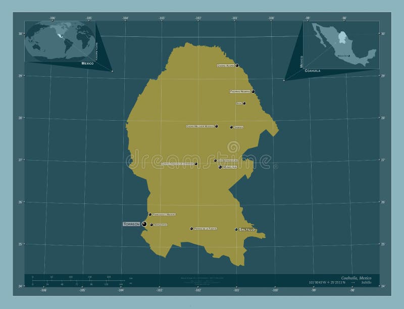
Free with trial Coahuila, state of Mexico. Solid color shape. Locations of major cities of the region. Corner auxiliary location maps. Saltillo outline map illustrations Coahuila, Mexico. Solid. Major cities. Coahuila, state of Mexico. Solid color shape. Locations of major cities of the region. Corner auxiliary location maps
Free with trial Coahuila, state of Mexico. Patterned solids with lakes and rivers. Shape presented against its country area with informative overlays. 3D rendering. Saltillo outline map illustrations Coahuila, Mexico - composition. Pattern. Coahuila, state of Mexico. Patterned solids with lakes and rivers. Shape presented against its country area with informative overlays. 3D rendering
Free with trial Adjuntas, municipality of Puerto Rico. Solid color shape. Saltillo outline map illustrations Adjuntas, Puerto Rico. Solid. No legend. Adjuntas, municipality of Puerto Rico. Solid color shape
Free with trial Adjuntas, municipality of Puerto Rico. Solid color shape. Locations of major cities of the region. Corner auxiliary location maps. Saltillo outline map illustrations Adjuntas, Puerto Rico. Solid. Major cities. Adjuntas, municipality of Puerto Rico. Solid color shape. Locations of major cities of the region. Corner auxiliary location maps
Free with trial Coahuila, state of Mexico. Diagram showing the location of the region on larger-scale maps. Composition of vector frames and PNG shapes on a solid background. Saltillo outline map illustrations Coahuila, Mexico. Described location diagram. Coahuila, state of Mexico. Diagram showing the location of the region on larger-scale maps. Composition of vector frames and PNG shapes on a solid background
Free with trial Coahuila, state of Mexico. Colored relief with lakes and rivers. Shape outlined against its country area. 3D rendering. Saltillo outline map illustrations Coahuila, Mexico - outlined. Relief. Coahuila, state of Mexico. Colored relief with lakes and rivers. Shape outlined against its country area. 3D rendering
Free with trial Coahuila, state of Mexico. Solid color shape. Locations and names of major cities of the region. Corner auxiliary location maps. Saltillo outline map illustrations Coahuila, Mexico. Solid. Labelled points of cities. Coahuila, state of Mexico. Solid color shape. Locations and names of major cities of the region. Corner auxiliary location maps
Free with trial Coahuila, state of Mexico. Sentinel-2 satellite imagery. Shape isolated on solid background with informative overlays. Contains modified Copernicus Sentinel data. Saltillo outline map illustrations Coahuila, Mexico - composition. Sentinel-2 satellite. Coahuila, state of Mexico. Sentinel-2 satellite imagery. Shape isolated on solid background with informative overlays. Contains modified Copernicus Sentinel data
Free with trial Adjuntas, municipality of Puerto Rico. Solid color shape. Locations and names of major cities of the region. Corner auxiliary location maps. Saltillo outline map illustrations Adjuntas, Puerto Rico. Solid. Labelled points of cities. Adjuntas, municipality of Puerto Rico. Solid color shape. Locations and names of major cities of the region. Corner auxiliary location maps