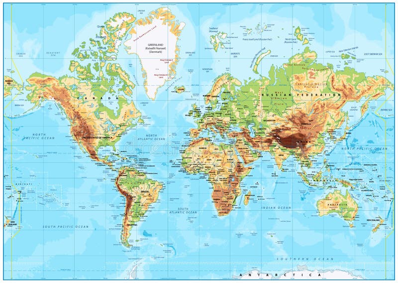
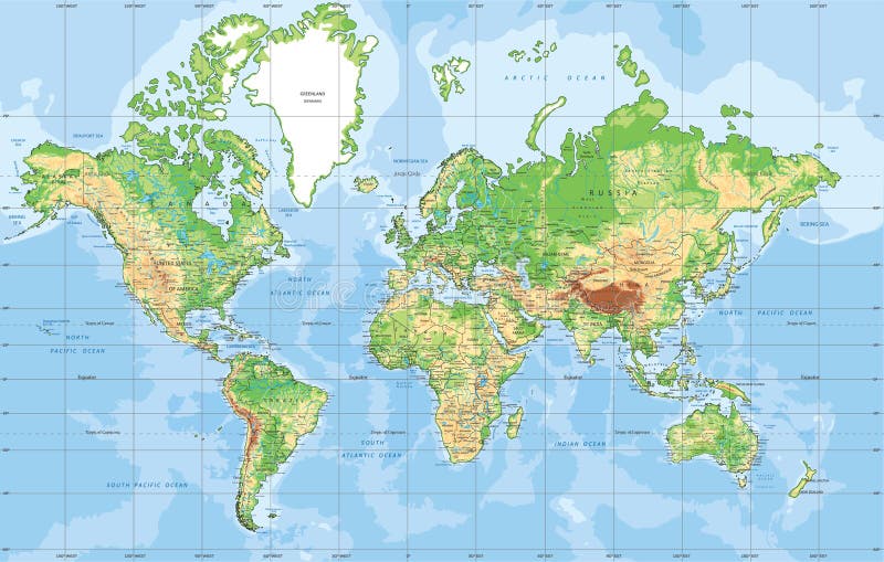
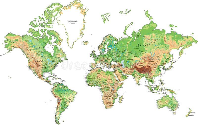
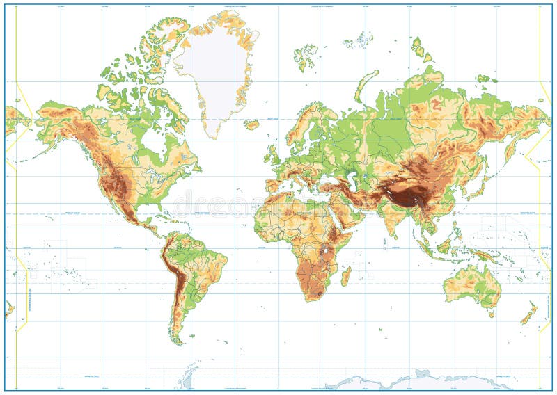
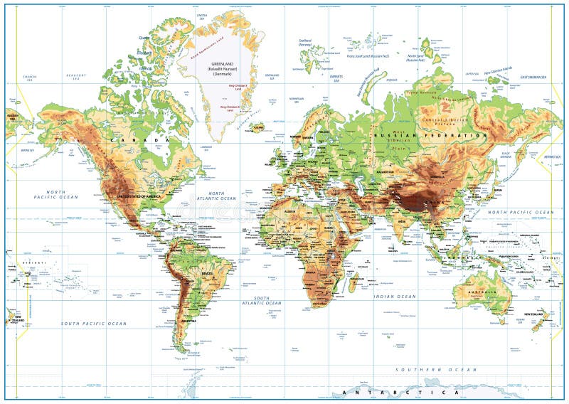
Free with trial Detailed Physical World Map with labeling. Vector illustration. Terrain china map vectors Detailed Physical World Map
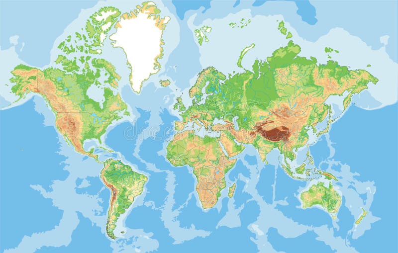
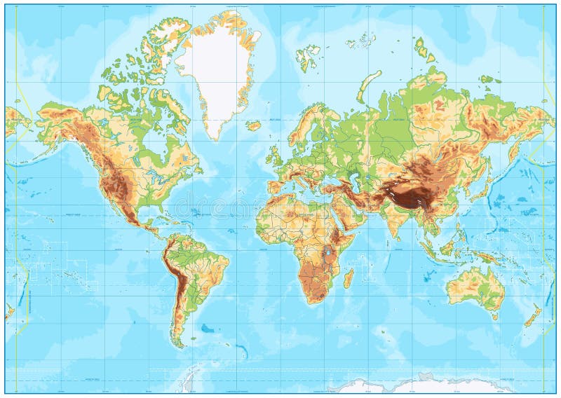
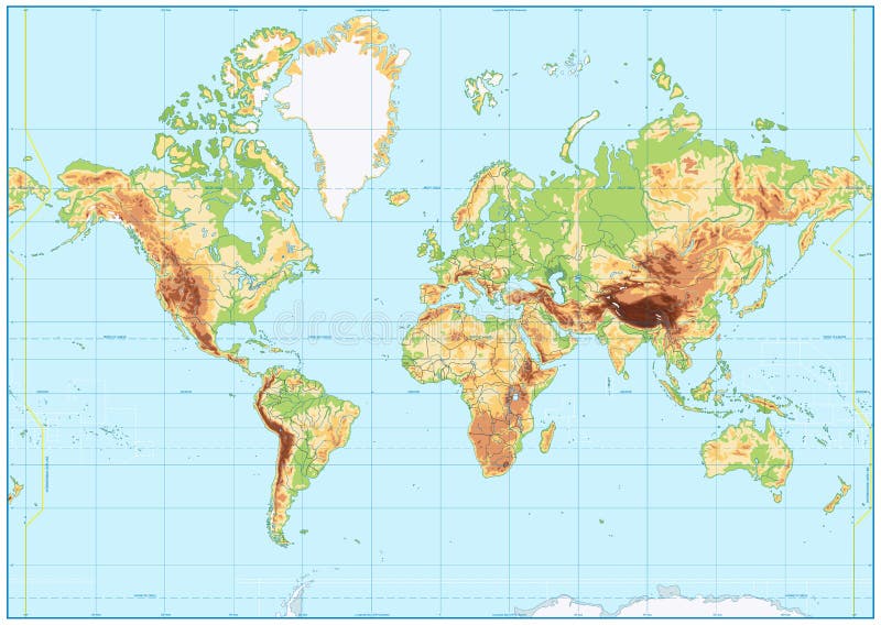
Free with trial Highly detailed physical map of the World. Vector illustration. Terrain china map vectors Highly detailed physical map of the World.
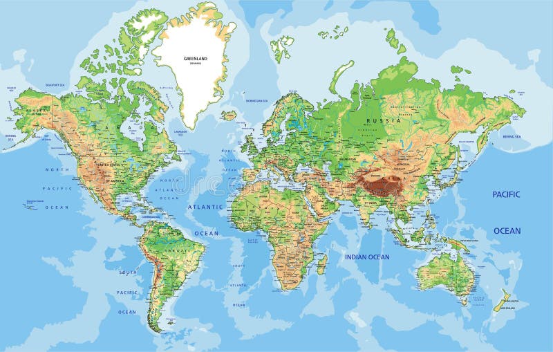
Free with trial Physical World map in Mercator projection with clearly labeled, separated layers. Vector illustration. Terrain china map vectors Highly detailed physical World map with labeling. Vector illustration. Physical World map in Mercator projection with clearly labeled, separated layers. Vector illustration.
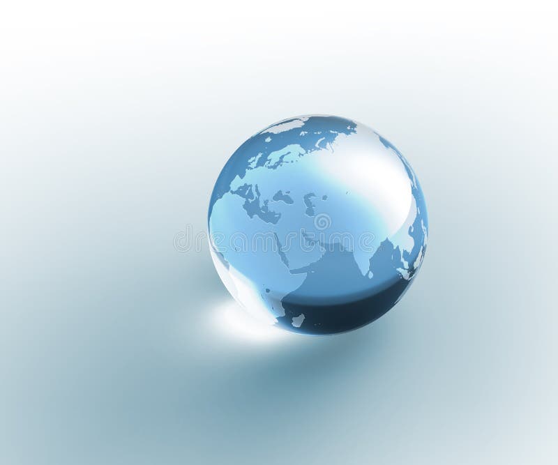
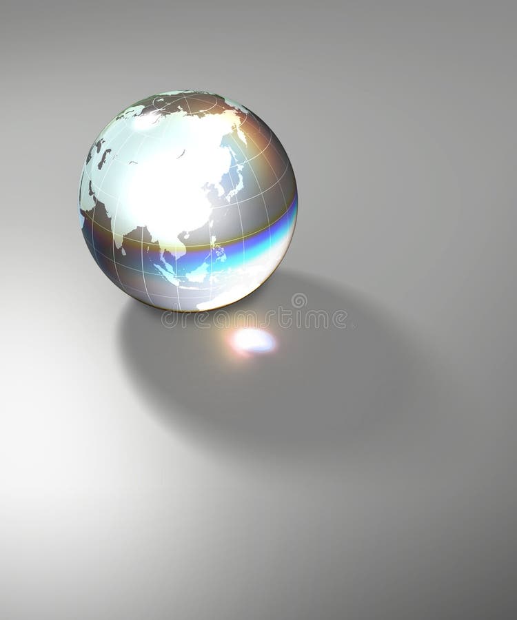
Free with trial Isolated blue (aquamarine) colored crystal glass globe with sandblasted world map. Photorealistic 3D rendering. Please look for the same series for another countries. Terrain china map illustrations Solid glass globe Earth transparent. Isolated blue (aquamarine) colored crystal glass globe with sandblasted world map. Photorealistic 3D rendering. Please look for the same series for another countries.
Free with trial Six blue (aquamarine) colored globe Earth illustrations with different views and countries. Terrain china map illustrations Planet Globe Earth map isolated. Six blue (aquamarine) colored globe Earth illustrations with different views and countries.
Free with trial World physical map. Robinson projection, centered on Africa, colored according to elevation, with contour lines, rivers and ocean depths. Isolated on white with clipping path. Fully editable vector version with 22 layers available. Terrain china map vectors Globe centered on Africa. World physical map. Robinson projection, centered on Africa, colored according to elevation, with contour lines, rivers and ocean depths. Isolated on white with clipping path. Fully editable vector version with 22 layers available.
Free with trial Isolated blue (aquamarine) colored crystal glass globe with sandblasted world map. Photorealistic 3D rendering. Please look for the same series for another countries. Terrain china map illustrations Solid glass globe Earth transparent. Isolated blue (aquamarine) colored crystal glass globe with sandblasted world map. Photorealistic 3D rendering. Please look for the same series for another countries.
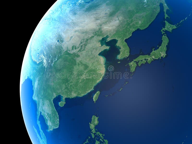
Free with trial East Asia as seen from space. Terrain china map illustrations Planet Earth. East Asia as seen from space
Free with trial Planet earth with translucent water of the oceans, atmosphere, volumetric clouds, and detailed topography in outer space. Terrain china map illustrations Earth in Space. Planet earth with translucent water of the oceans, atmosphere, volumetric clouds, and detailed topography in outer space
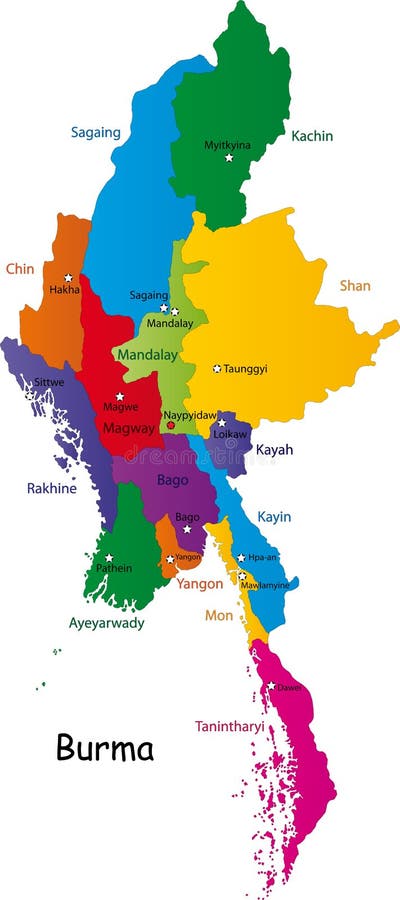
Free with trial Burma map designed in illustration with the provinces and the main cities. (Map is hight resolution). Terrain china map vectors Burma map
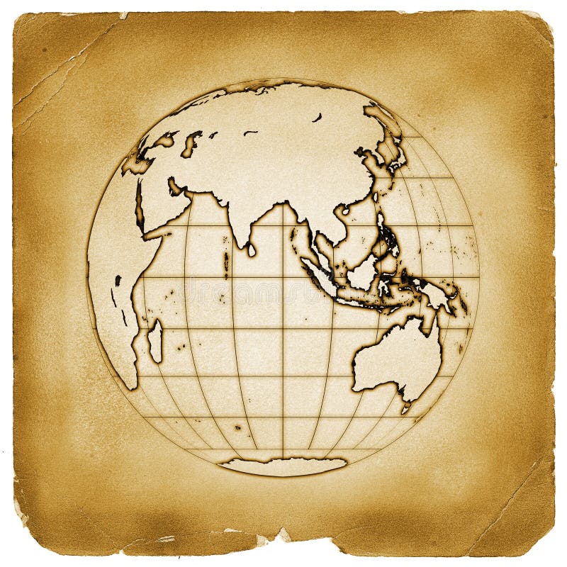
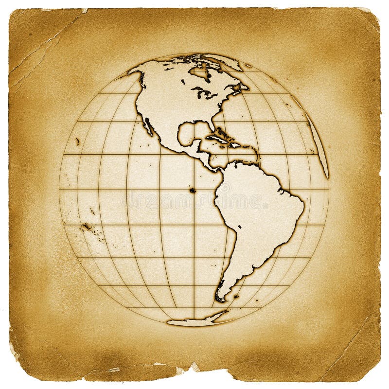
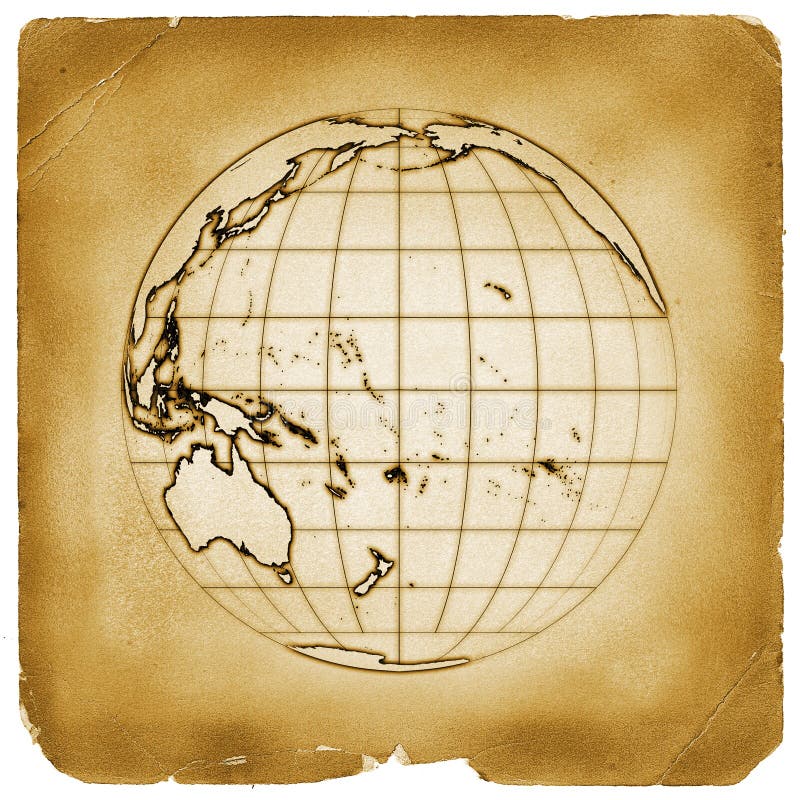
Free with trial Illustration of globe Earth map with present terrain contours and accurate geographic coordinates on weathered papyrus. Other countries available. Terrain china map illustrations Planet globe earth old vintage paper. Illustration of globe Earth map with present terrain contours and accurate geographic coordinates on weathered papyrus. Other countries available.
Free with trial Illustration of globe Earth map with present terrain contours and accurate geographic coordinates on weathered papyrus. Other countries available. Terrain china map illustrations Planet globe earth old vintage paper. Illustration of globe Earth map with present terrain contours and accurate geographic coordinates on weathered papyrus. Other countries available.
Free with trial Detailed Physical World Map Retro Colors. No bathymetry. Vector illustration. Terrain china map vectors Detailed Physical World Map Retro Colors. No bathymetry
Free with trial Highly detailed Earth, illuminated by moonlight. The glow of cities sheds light on the detailed exaggerated terrain. Night Earth. Eastern China and Taiwan. Elements of this image furnished by NASA. Terrain china map illustrations Night Earth. Eastern China and Taiwan
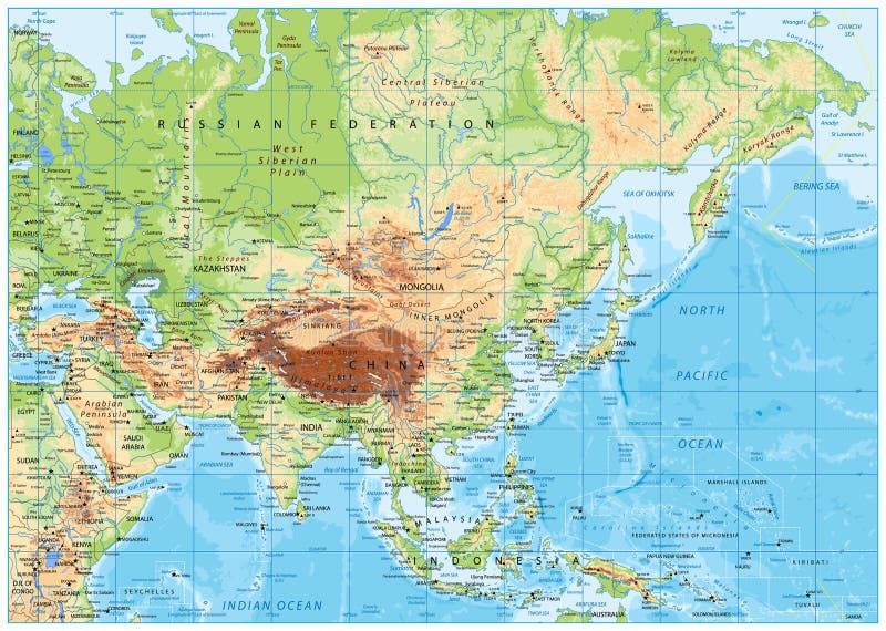
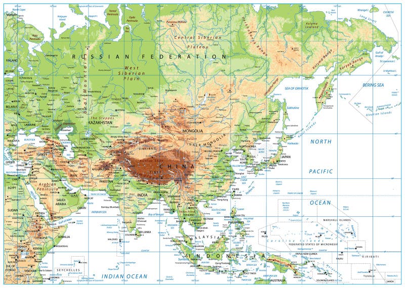
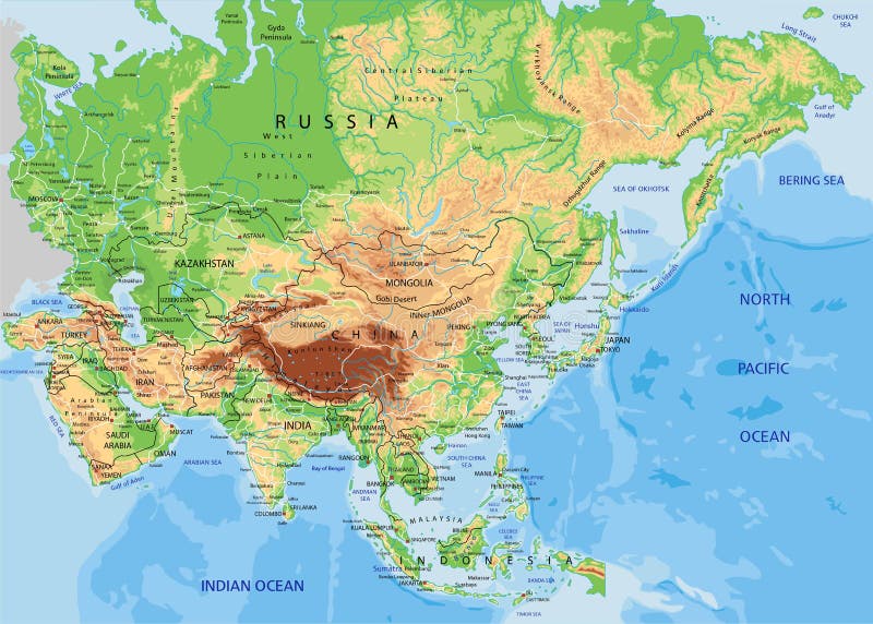
Free with trial Asia physical map with rivers, lakes and elevations. Terrain china map vectors Asia physical map
Free with trial Blank Physical World Map and bathymetry. Vector illustration. Terrain china map vectors Blank Physical World Map and bathymetry
Free with trial Highly detailed planet Earth in the morning. Exaggerated precise relief lit morning sun. Eastern China and Taiwan. Elements of this image furnished by NASA. Terrain china map illustrations Detailed Earth. Eastern China and Taiwan. Highly detailed planet Earth in the morning. Exaggerated precise relief lit morning sun. Eastern China and Taiwan. Elements of this image furnished by NASA
Free with trial Physical World map in Mercator projection with clearly labeled, separated layers. Vector illustration. Terrain china map vectors Physical World map in Mercator projection. Physical World map in Mercator projection with clearly labeled, separated layers. Vector illustration.
Free with trial Detailed Physical World Map Isolated on Retro White Color. Vector illustration. Terrain china map vectors Detailed Physical World Map Isolated on Retro White Color
Free with trial Highly detailed physical map of the World. Vector illustration. Terrain china map vectors Highly detailed physical map of the World.
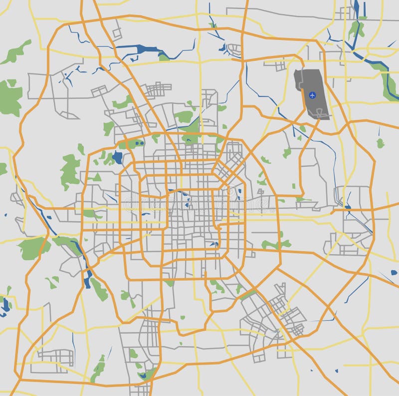
Free with trial This is an illustration of Beijing City map. Terrain china map vectors Highly Detailed Beijing City Road Network Map. This is an illustration of Beijing City map.
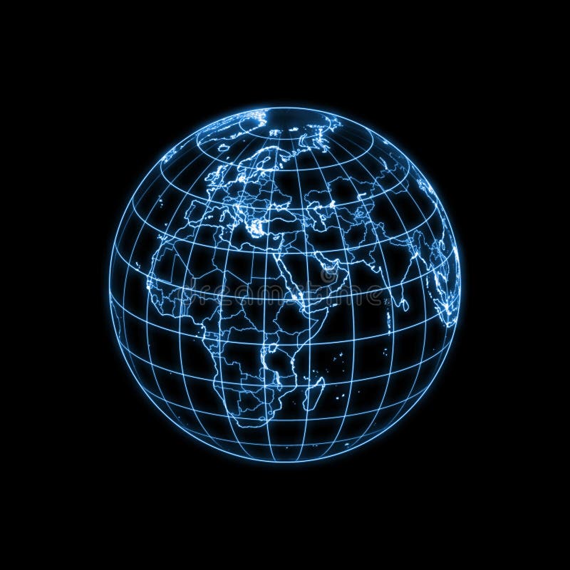
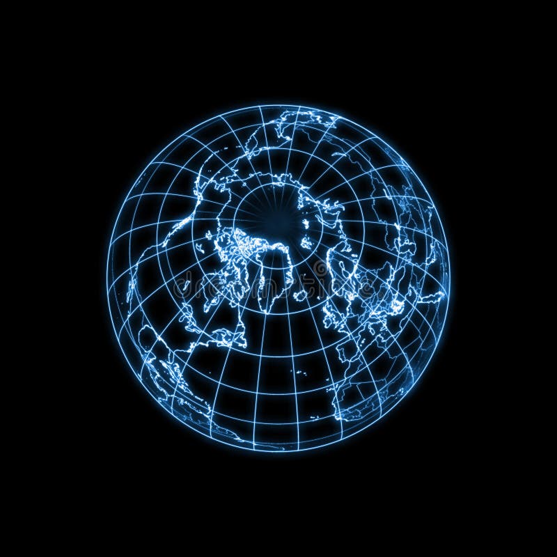
Free with trial Accurate illustration of the world with lighting contour of countries, political boundaries (dimmer) and geographic coordinates. Other countries are available. Terrain china map illustrations Globe Earth glowing light map outline. Accurate illustration of the world with lighting contour of countries, political boundaries (dimmer) and geographic coordinates. Other countries are available.
Free with trial Accurate illustration of the world with lighting contour of countries, political boundaries (dimmer) and geographic coordinates. Other countries are available. Terrain china map illustrations Globe Earth glowing light map outline. Accurate illustration of the world with lighting contour of countries, political boundaries (dimmer) and geographic coordinates. Other countries are available.
Free with trial Accurate illustration of the world with lighting contour of countries, political boundaries (dimmer) and geographic coordinates. Other countries are available. Terrain china map illustrations Globe Earth glowing light map outline. Accurate illustration of the world with lighting contour of countries, political boundaries (dimmer) and geographic coordinates. Other countries are available.
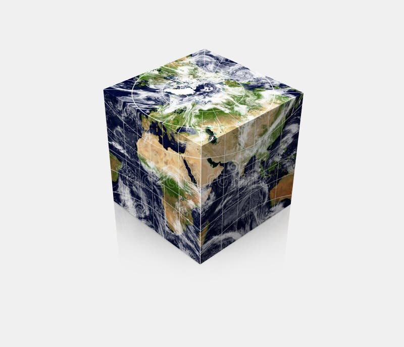
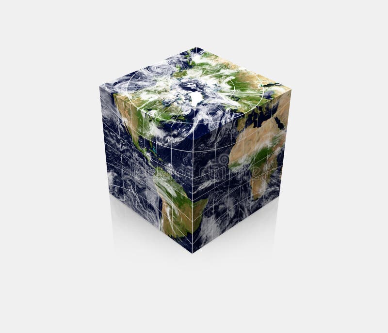
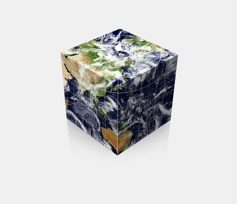
Free with trial Rendering of the cubic globe Earth with realistic map and related geographic coordinates. Featuring north pole (top) and countries around 45E (at the front vertical edge). Terrain china map illustrations Cubic Planet globe Earth cube. Rendering of the cubic globe Earth with realistic map and related geographic coordinates. Featuring north pole (top) and countries around 45E (at the front vertical edge)
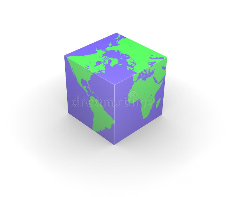
Free with trial Rendering of the world map with a continuous 3D texture mapping onto a cube. Please look for the same series for another countries. Terrain china map illustrations Cubic globe Earth cube square. Rendering of the world map with a continuous 3D texture mapping onto a cube. Please look for the same series for another countries.
Free with trial Rendering of the world map with a continuous 3D texture mapping onto a cube. Please look for the same series for another countries. Terrain china map illustrations Cubic globe Earth cube square. Rendering of the world map with a continuous 3D texture mapping onto a cube. Please look for the same series for another countries.
Free with trial Rendering of the cubic globe Earth with realistic map and related geographic coordinates. Featuring north pole (top) and countries around 45W (at the front vertical edge). Terrain china map illustrations Cubic Planet globe Earth cube. Rendering of the cubic globe Earth with realistic map and related geographic coordinates. Featuring north pole (top) and countries around 45W (at the front vertical edge)
Free with trial Six green colored isolated globe Earth illustrations with different views and countries. Terrain china map illustrations Planet Globe Earth map isolated. Six green colored isolated globe Earth illustrations with different views and countries.
Free with trial Illustration of four isolated planet Earth with accurate geographical coordinates viewing at different angles. Terrain china map illustrations Globe Earth 3D planet realistic map. Illustration of four isolated planet Earth with accurate geographical coordinates viewing at different angles.
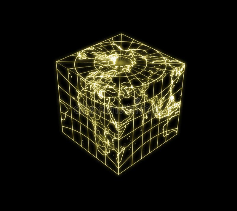
Free with trial An illustration of cubic globe Earth with glowing contour of countries, political boundaries and geographic coordinates. Please look for the same series for another countries. Featuring north pole (top) and countries around 45E (at the front vertical edge). Terrain china map illustrations Globe Earth cubic light map outline. An illustration of cubic globe Earth with glowing contour of countries, political boundaries and geographic coordinates. Please look for the same series for another countries. Featuring north pole (top) and countries around 45E (at the front vertical edge)
Free with trial Highly detailed Earth, illuminated by moonlight. The glow of cities sheds light on the detailed exaggerated terrain and translucent water of the oceans. Elements of this image furnished by NASA. Terrain china map illustrations Night Earth. A piece of Asia - Japan, Korea, China. Highly detailed Earth, illuminated by moonlight. The glow of cities sheds light on the detailed exaggerated terrain and translucent water of the oceans. Elements of this image furnished by NASA
Free with trial Earth with matte gold and sandblasted textures. Accurate coordinates (latitude and longitude) and coastline. Terrain china map illustrations Planet Globe Earth 3D isolated. Earth with matte gold and sandblasted textures. Accurate coordinates (latitude and longitude) and coastline.
Free with trial Gold world global sphere with accurate coordinate grid wire framework. PNG transparent background. Terrain china map vectors Golden Earth planet 3D Globe isolated. Gold world global sphere with accurate coordinate grid wire framework. PNG transparent background.
Free with trial A Colourful 3d Rendered 'Globe Australia / Japan' Illustration. Terrain china map illustrations Globe Australia / Japan
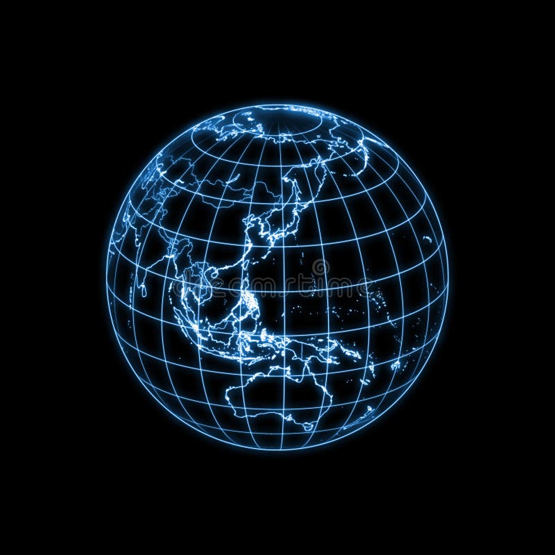
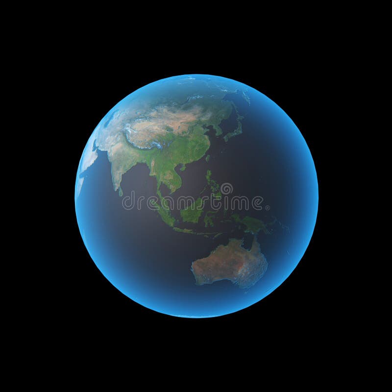
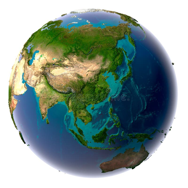
Free with trial Globe asia and australia. Terrain china map illustrations Earth asia. Globe asia and australia
Free with trial Middle East, India and parts of central Asia as seen from space with clou. Terrain china map illustrations Planet Earth. Middle East, India and parts of central Asia as seen from space with clou
Free with trial Middle East, India and parts of central Asia as seen. Terrain china map illustrations Planet Earth. Middle East, India and parts of central Asia as seen
Free with trial Gold globe - metal earth with realistic topography - asia, 3d render. Terrain china map illustrations Gold Globe - Asia. Gold globe - metal earth with realistic topography - asia, 3d render
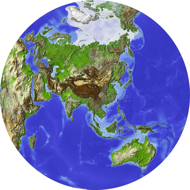
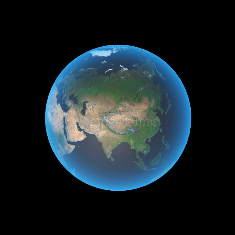
Free with trial Globe, centered on Asia. Shaded relief colored according to terrain height. Shows polar and pack ice, large urban areas. Isolated on white. Terrain china map illustrations Globe, shaded relief. Globe, centered on Asia. Shaded relief colored according to terrain height. Shows polar and pack ice, large urban areas. Isolated on white.
Free with trial Earth with matte gold and sandblasted textures. Accurate coordinates (latitude and longitude) and coastline. Terrain china map illustrations Planet Globe Earth 3D isolated. Earth with matte gold and sandblasted textures. Accurate coordinates (latitude and longitude) and coastline.
Free with trial 3D abstract globe isolated on white. Terrain china map illustrations Abstract green globe, Asia. 3D abstract globe isolated on white
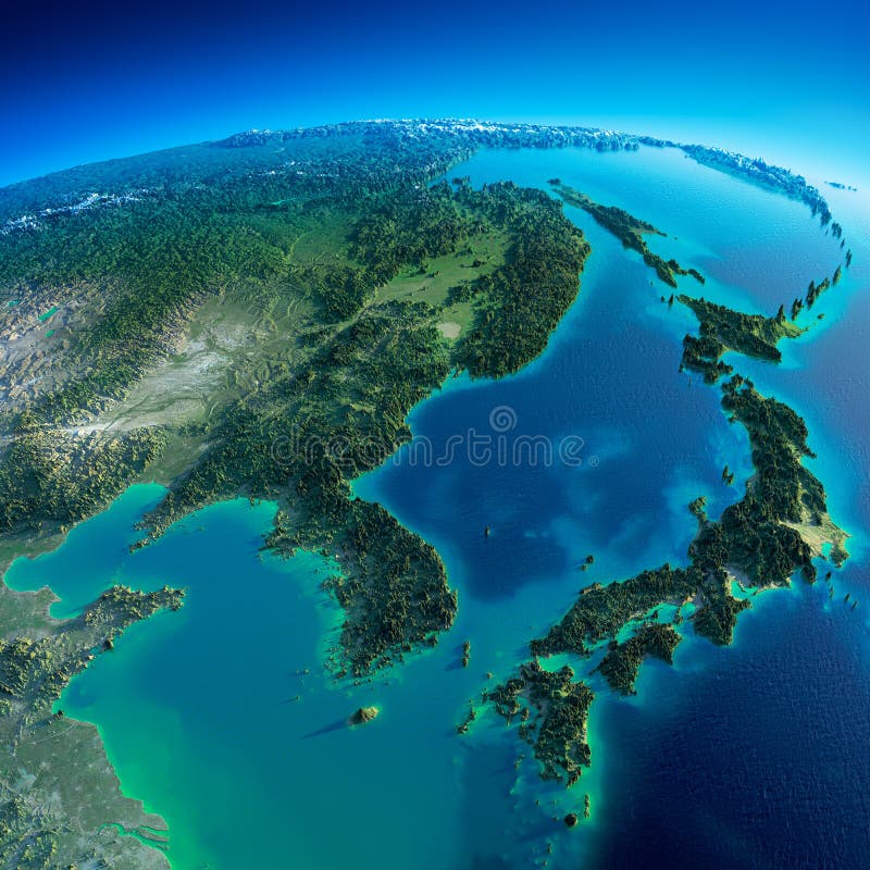
Free with trial Highly detailed planet Earth in the morning. Exaggerated precise relief lit morning sun. Detailed Earth. Korea and Japan. Elements of this image furnished by NASA. Terrain china map illustrations Detailed Earth. Korea and Japan
Free with trial Earth with translucent water in the oceans and the detailed topography of the continents. Terrain china map illustrations Realistic Planet Earth with natural. Earth with translucent water in the oceans and the detailed topography of the continents
Free with trial Highly detailed Earth, illuminated by moonlight. The glow of cities sheds light on the detailed exaggerated terrain and translucent water of the oceans. Elements of this image furnished by NASA. Terrain china map illustrations Night Earth. A piece of Asia - Indochina peninsula. Highly detailed Earth, illuminated by moonlight. The glow of cities sheds light on the detailed exaggerated terrain and translucent water of the oceans. Elements of this image furnished by NASA
Free with trial East Asia as seen from space with cloud. Terrain china map illustrations Planet Earth. East Asia as seen from space with cloud
Free with trial Earth with translucent water in the oceans and the detailed topography of the continents. Terrain china map illustrations Realistic Planet Earth with natural. Earth with translucent water in the oceans and the detailed topography of the continents
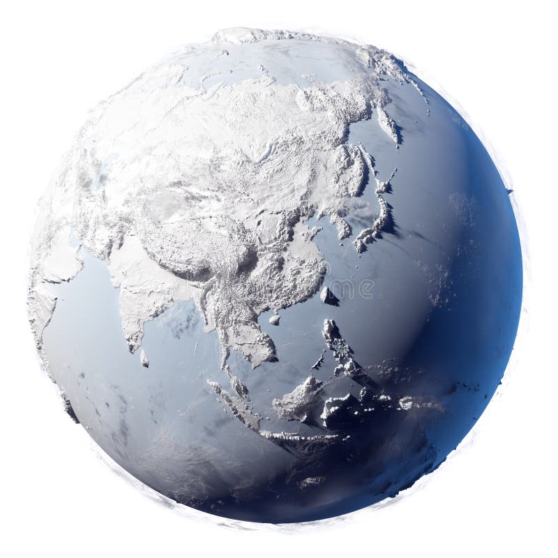
Free with trial Winter planet Earth - covered in snow and ice planet with a real detailed terrain, soft shadows and volumetric clouds on a white background. Terrain china map illustrations Snow Planet Earth. Winter planet Earth - covered in snow and ice planet with a real detailed terrain, soft shadows and volumetric clouds on a white background
Free with trial China Road Map and Map Markers. High detailed China Relief map with labeling. Terrain china map vectors China Road Map and Map Markers
Free with trial Realistic 3D Map of China with clouds and sunflare. Terrain china map illustrations Realistic 3D Map of China
Free with trial Yuanyang County, Yunnan Province China Ailaoshan the southern section of the Hani Hani Terrace is the local people for thousands of years by the sweat of the mountain opened up dozens of hectares of irrigation terraces, known as the wonders of the world, this map is one of the largest and most spectacular momentum The terraced fields. Terrain china map illustrations China Yunnan Hani Terrace View. Yuanyang County, Yunnan Province China Ailaoshan the southern section of the Hani Hani Terrace is the local people for thousands of years by the sweat of the mountain opened up dozens of hectares of irrigation terraces, known as the wonders of the world, this map is one of the largest and most spectacular momentum The terraced fields.
Free with trial Illustration of globe Earth map with present terrain contours and accurate geographic coordinates on weathered papyrus. Other countries available. Terrain china map illustrations Planet globe earth old vintage paper. Illustration of globe Earth map with present terrain contours and accurate geographic coordinates on weathered papyrus. Other countries available.
Free with trial Illustration of globe Earth map with present terrain contours and accurate geographic coordinates on weathered papyrus. Other countries available. Terrain china map illustrations Planet globe earth old vintage paper. Illustration of globe Earth map with present terrain contours and accurate geographic coordinates on weathered papyrus. Other countries available.
Free with trial Burma map designed in illustration with the provinces and the main cities. (Map is hight resolution). Terrain china map vectors Map of Burma. Burma map designed in illustration with the provinces and the main cities. (Map is hight resolution)
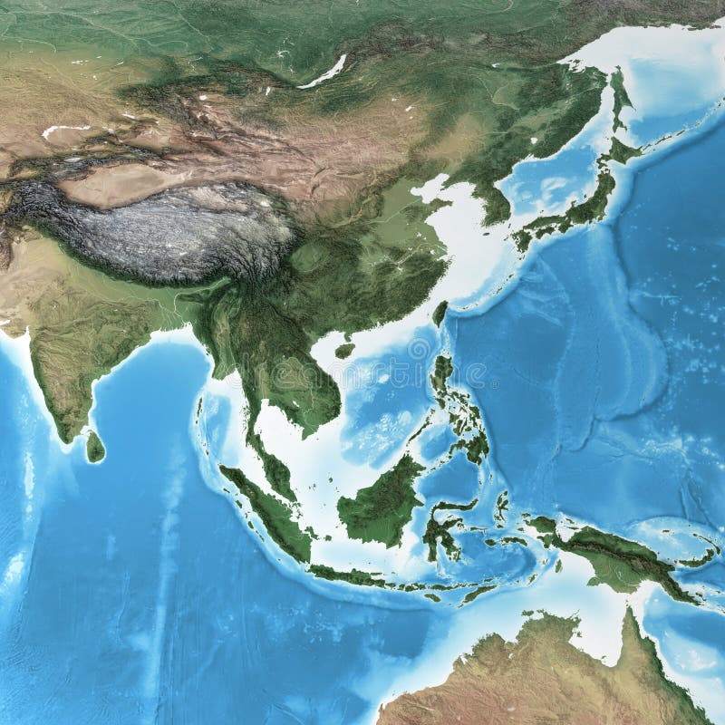
Free with trial Physical map of South East Asia, with high resolution details. Flattened satellite view of Planet Earth, its geography and topography. 3D illustration - Elements of this image furnished by NASA. Terrain china map illustrations High resolution detailed map of South East Asia. Physical map of South East Asia, with high resolution details. Flattened satellite view of Planet Earth, its. Physical map of South East Asia, with high resolution details. Flattened satellite view of Planet Earth, its geography and topography. 3D illustration - Elements of this image furnished by NASA
Free with trial Detailed Physical World Map with labeling. No bathymetry. Vector illustration. Terrain china map vectors Detailed Physical World Map with labeling. No bathymetry
Free with trial Blank Physical World Map isolated on white. Vector illustration. Terrain china map vectors Blank Physical World Map isolated on white
Free with trial Detailed Physical World Map with no labeling. Vector illustration. Terrain china map vectors Detailed Physical World Map with no labeling
Free with trial Physical World Map isolated on white with labeling. Vector illustration. Terrain china map vectors Physical World Map isolated on white with labeling
Free with trial Highly detailed planet Earth in the morning. Exaggerated precise relief lit morning sun. Eastern China and Taiwan. 3D rendering. Elements of this image furnished by NASA. Terrain china map illustrations Detailed Earth. Eastern China and Taiwan. Highly detailed planet Earth in the morning. Exaggerated precise relief lit morning sun. Eastern China and Taiwan. 3D rendering. Elements of this image furnished by NASA
Free with trial Asia Physical Map with Rivers, Lakes and Elevations. Retro Colors. Terrain china map vectors Asia Physical Map with Rivers, Lakes and Elevations
Free with trial Asia Physical Map Isolated on White. Vector illustration. Terrain china map vectors Asia Physical Map Isolated on White
Free with trial Physical map of South Asia, with high resolution details. Flattened satellite view of Planet Earth, its geography and topography. 3D illustration - Elements of this image furnished by NASA. Terrain china map illustrations High resolution detailed map of South Asia, Himalayas and India. Physical map of South Asia, with high resolution details. Flattened satellite view of Planet Earth, its geography and topography. 3D illustration - Elements of this image furnished by NASA
Free with trial High detailed Asia physical map with rivers and surface elements. Vector illustration. Terrain china map vectors High detailed Asia physical map with labeling. High detailed Asia physical map with rivers and surface elements. Vector illustration.
Free with trial Big size physical world map illustration. World map, isolated on white background. Extra large size physical world map illustration. Primary source, elements of this image furnished by NASA. Terrain china map illustrations Big size physical world map illustration. World map, isolated on white background. Primary source, elements of this image furnish. Big size physical world map illustration. World map, isolated on white background. Extra large size physical world map illustration. Primary source, elements of this image furnished by NASA.
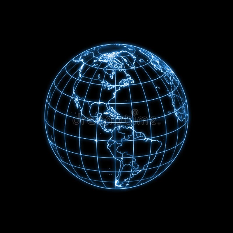
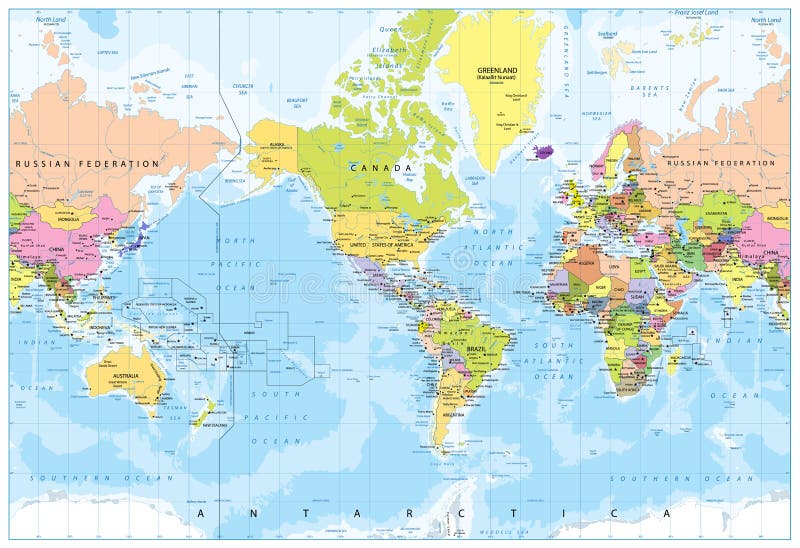
Free with trial Color world map with Central America, vector illustration. Terrain china map vectors Detailed vector illustration world political map centered by America. Color world map with Central America, vector illustration
Free with trial World Map - America in center - Bathymetry. Highly detailed illustration of World Map. Terrain china map vectors World Map - America in center - Bathymetry
Free with trial America Centered Political World Map. Highly detailed illustration of World Map. Terrain china map vectors America Centered Political World Map
Free with trial Accurate illustration of the world with lighting contour of countries, political boundaries (dimmer) and geographic coordinates. Other countries are available. Terrain china map illustrations Globe Earth glowing light map outline. Accurate illustration of the world with lighting contour of countries, political boundaries (dimmer) and geographic coordinates. Other countries are available.
Free with trial Rendering of the cubic globe Earth with realistic map and related geographic coordinates. Featuring north pole (top) and countries around 135E (at the front vertical edge). Terrain china map illustrations Cubic Planet globe Earth cube. Rendering of the cubic globe Earth with realistic map and related geographic coordinates. Featuring north pole (top) and countries around 135E (at the front vertical edge)
Free with trial An illustration of cubic globe Earth with glowing contour of countries, political boundaries and geographic coordinates. Please look for the same series for another countries. Featuring north pole (top) and countries around 135E (at the front vertical edge). Terrain china map illustrations Globe Earth cubic light map outline. An illustration of cubic globe Earth with glowing contour of countries, political boundaries and geographic coordinates. Please look for the same series for another countries. Featuring north pole (top) and countries around 135E (at the front vertical edge)
Free with trial Isolated crystal sphere with global country map and geographic coordinates (latitude and longitude). Terrain china map illustrations Globe Earth transparent glass planet. Isolated crystal sphere with global country map and geographic coordinates (latitude and longitude).
Free with trial Accurate illustration of the world with lighting contour of countries, political boundaries (dimmer) and geographic coordinates. Other countries are available. Terrain china map illustrations Globe Earth glowing light map outline. Accurate illustration of the world with lighting contour of countries, political boundaries (dimmer) and geographic coordinates. Other countries are available.
Free with trial Earth with matte gold and sandblasted textures. Accurate coordinates (latitude and longitude) and coastline. Terrain china map illustrations Planet Globe Earth 3D isolated. Earth with matte gold and sandblasted textures. Accurate coordinates (latitude and longitude) and coastline.
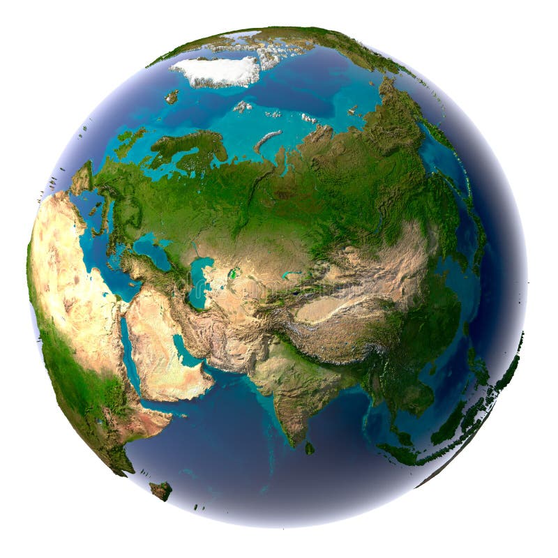
Free with trial Earth with translucent water in the oceans and the detailed topography of the continents. A fragment of the Asia and Oceania. Isolated on white. Terrain china map illustrations Realistic Planet Earth. Earth with translucent water in the oceans and the detailed topography of the continents. A fragment of the Asia and Oceania. Isolated on white
Free with trial 3D earth(terrain) Southeast Asia 3D Photorealistic Earth. Terrain china map illustrations 3D earth(terrain)Southeast Asia. 3D earth(terrain) Southeast Asia 3D Photorealistic Earth
Free with trial Isolated silver planet Earth. Glossy golden land. Metal atlas. PNG with transparent background. Terrain china map vectors Brushed steel 3D globe gold earth crust. Isolated silver planet Earth. Glossy golden land. Metal atlas. PNG with transparent background.
Free with trial High resolution 3D render of Planet Earth. Terrain china map illustrations Earth model. High resolution 3D render of Planet Earth.
Free with trial Isolated globe with blue ocean and gold land crust. Metallic world atlas. Terrain china map illustrations 3D Earth golden blue planet. Isolated globe with blue ocean and gold land crust. Metallic world atlas.