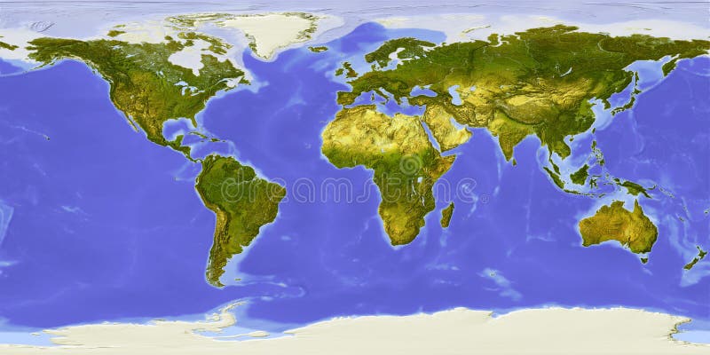
Free with trial World map centered on Africa. Shaded relief colored according to dominant vegetation. Shows polar and pack ice, large urban areas. Topographic globe map illustrations World map, shaded relief, centered on Africa. World map centered on Africa. Shaded relief colored according to dominant vegetation. Shows polar and pack ice, large urban areas.
Free with trial Physical relief - raised map of the World. Topographic elevation map of Earth. Nice for education or travel industries. Topographic globe map illustrations World map both hemispheres on one sheet. Physical relief - raised map of the World. Topographic elevation map of Earth. Nice for education or travel industries.
Free with trial Political Physical Topographic Colored World Map Vector illustration. Topographic globe map illustrations Political Colored World Map Vector. Political Physical Topographic Colored World Map Vector illustration
Free with trial Vintage world map. Ancient world antiquity paper map with continents ocean sea old sailing vector globe background. Topographic globe map vectors Vintage world map. Ancient world antiquity paper map with continents ocean sea old sailing vector globe background
Free with trial Political Physical Topographic Colored World Map Vector illustration. Topographic globe map illustrations Vintage Political Topographic Colored World Map Vector. Political Physical Topographic Colored World Map Vector illustration
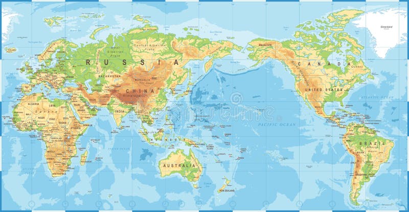
Free with trial Political Physical Topographic Colored World Map Pacific Centered- vector. Topographic globe map illustrations Political Physical Topographic Colored World Map Pacific Centered
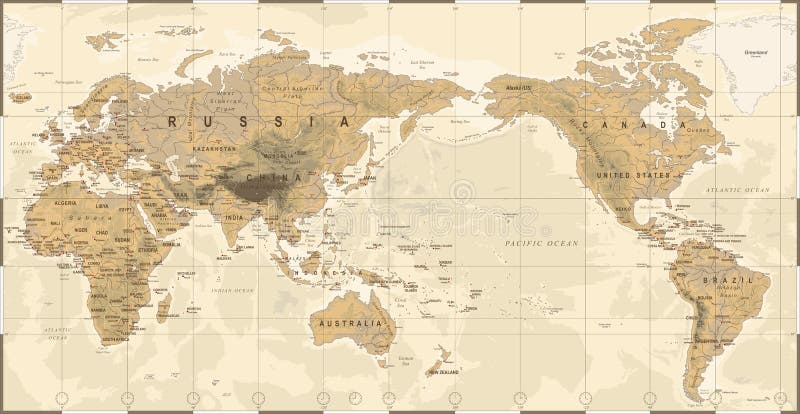
Free with trial Vintage Political Physical Topographic World Map Pacific Centered- vector. Topographic globe map illustrations Vintage Political Physical Topographic World Map Pacific Centered
Free with trial Globe in Robinson projection, centered on Africa. Shaded relief colored according to dominant vegetation. Shows polar and pack ice, large urban areas. Isolated on white, with clipping path. Topographic globe map illustrations Globe, shaded relief, centered on Africa. Globe in Robinson projection, centered on Africa. Shaded relief colored according to dominant vegetation. Shows polar and pack ice, large urban areas. Isolated on white, with clipping path.
Free with trial Globe collection. 8 views of the earth with country boundaries. Topographic globe map vectors Globe Collection
Free with trial Globe, centered on Africa. Shaded relief colored according to dominant vegetation. Shows polar and pack ice, large urban areas. Isolated on white, with clipping path. Topographic globe map illustrations Globe, shaded relief. Globe, centered on Africa. Shaded relief colored according to dominant vegetation. Shows polar and pack ice, large urban areas. Isolated on white, with clipping path.
Free with trial Vector map of the United States of America. Topographic globe map vectors Vector map of the United States of America
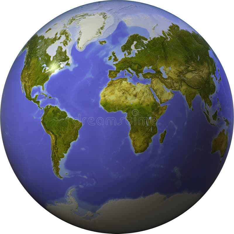
Free with trial Globe in Robinson projection, centered on America. Shaded relief colored according to dominant vegetation. Shows polar and pack ice, large urban areas. Isolated on white, with clipping path. Topographic globe map illustrations Globe, shaded relief, centered on America. Globe in Robinson projection, centered on America. Shaded relief colored according to dominant vegetation. Shows polar and pack ice, large urban areas. Isolated on white, with clipping path.
Free with trial Globe. Stylized 3D vector map, centered on Asia. Topographic globe map vectors Globe. Stylized 3D vector map. Globe. Stylized 3D vector map, centered on Asia.
Free with trial Globe. Stylized 3D vector map, centered on Africa. Topographic globe map vectors Globe. Stylized 3D vector map. Globe. Stylized 3D vector map, centered on Africa.
Free with trial Vintage Detailed Contour Topographic Map Of Wild West Abstract Vector Background. Topographic globe map vectors Vintage Detailed Contour Topographic Map Vector. Vintage Detailed Contour Topographic Map Of Wild West Abstract Vector Background
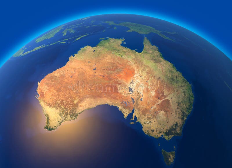
Free with trial Physical map of the world, satellite view of Australia. Oceania. Globe. Hemisphere. Reliefs and oceans. 3d rendering. Elements of this image are furnished by NASA. Topographic globe map illustrations Physical map of the world, satellite view of Australia. Oceania. Globe. Hemisphere. Reliefs and oceans.
Free with trial Vintage world map. Retro countries boundaries on topographic or marine map. Old navigation physical map with continents and oceans vector illustration. Topographic globe map vectors Vintage world map. Retro countries boundaries on topographic or marine map. Old continents navigation maps vector. Vintage world map. Retro countries boundaries on topographic or marine map. Old navigation physical map with continents and oceans vector illustration
Free with trial Political Physical Topographic Colored World Map Vector illustration. Topographic globe map illustrations Vintage Political Topographic Colored World Map Vector. Political Physical Topographic Colored World Map Vector illustration
Free with trial Political Physical Topographic Colored World Map Pacific Centered- vector. Topographic globe map illustrations Political Physical Topographic Colored World Map Pacific Centered
Free with trial Globe, centered on Europe. Shaded relief colored according to terrain height. Shows polar and pack ice, large urban areas. Isolated on white. Topographic globe map illustrations Globe, shaded relief. Globe, centered on Europe. Shaded relief colored according to terrain height. Shows polar and pack ice, large urban areas. Isolated on white.
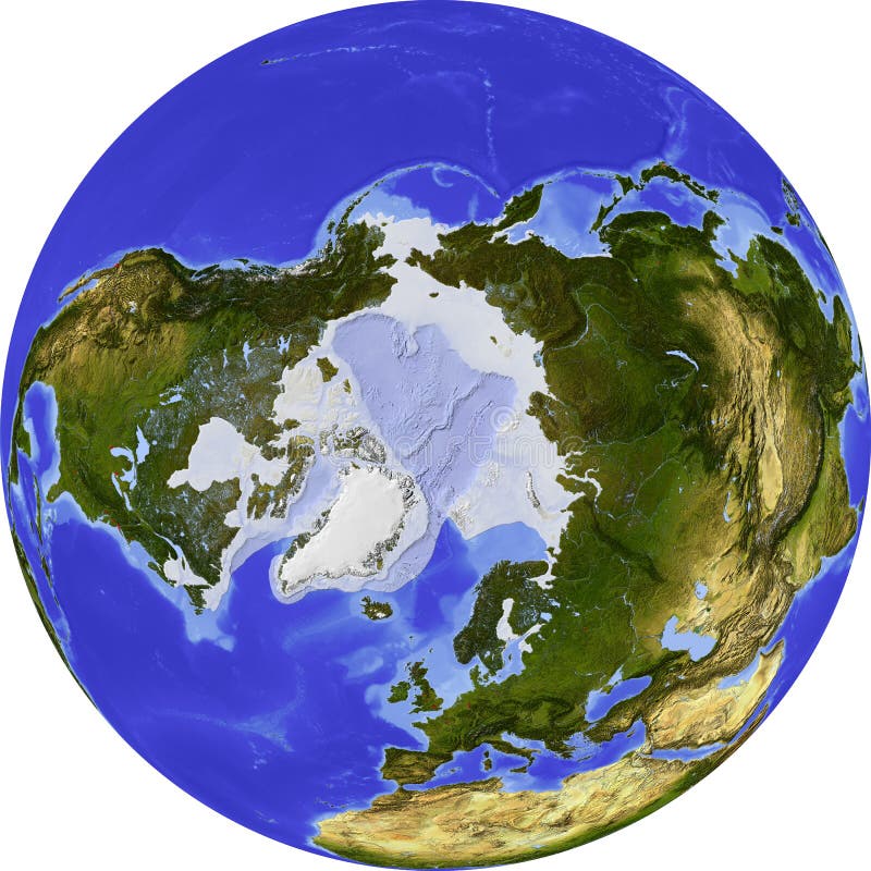
Free with trial Globe, centered on the North Pole. Shaded relief colored according to dominant vegetation. Shows polar and pack ice, large urban areas. Isolated on white, with clipping path. Topographic globe map illustrations Globe, shaded relief. Globe, centered on the North Pole. Shaded relief colored according to dominant vegetation. Shows polar and pack ice, large urban areas. Isolated on white, with clipping path.
Free with trial Globe, centered on Asia. Shaded relief colored according to terrain height. Shows polar and pack ice, large urban areas. Isolated on white. Topographic globe map illustrations Globe, shaded relief. Globe, centered on Asia. Shaded relief colored according to terrain height. Shows polar and pack ice, large urban areas. Isolated on white.
Free with trial Globe, centered on the South Pole. Shaded relief colored according to dominant vegetation. Shows polar and pack ice. Isolated on white, with clipping path. Topographic globe map illustrations Globe, shaded relief. Globe, centered on the South Pole. Shaded relief colored according to dominant vegetation. Shows polar and pack ice. Isolated on white, with clipping path.
Free with trial Globe, centered on North America. Shaded relief colored according to terrain height. Shows polar and pack ice, large urban areas. Isolated on white. Topographic globe map illustrations Globe, shaded relief. Globe, centered on North America. Shaded relief colored according to terrain height. Shows polar and pack ice, large urban areas. Isolated on white.
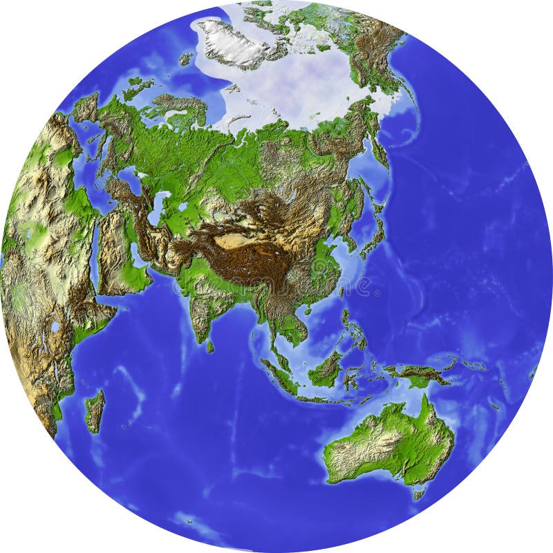
Free with trial Globe in Robinson projection, centered on Asia. Shaded relief colored according to dominant vegetation. Shows polar and pack ice, large urban areas. Isolated on white, with clipping path. Topographic globe map illustrations Globe, shaded relief, centered on Asia. Globe in Robinson projection, centered on Asia. Shaded relief colored according to dominant vegetation. Shows polar and pack ice, large urban areas. Isolated on white, with clipping path.
Free with trial Globe, centered on Australia. Shaded relief colored according to dominant vegetation. Shows polar and pack ice. Isolated on white, with clipping path. Topographic globe map illustrations Globe, shaded relief, centered on Africa. Globe, centered on Australia. Shaded relief colored according to dominant vegetation. Shows polar and pack ice. Isolated on white, with clipping path.
Free with trial World map centered on Japan. Shaded relief colored according to dominant vegetation. Shows polar and pack ice. Isolated on white, with clipping path. Topographic globe map illustrations World map, shaded relief, centered on Japan. World map centered on Japan. Shaded relief colored according to dominant vegetation. Shows polar and pack ice. Isolated on white, with clipping path.
Free with trial Globe showing the whole world on one side of a sphere. Shaded relief colored according to vegetation. Isolated on white, with clipping path. Topographic globe map illustrations Globe, shaded relief, on one side of a sphere. Globe showing the whole world on one side of a sphere. Shaded relief colored according to vegetation. Isolated on white, with clipping path.
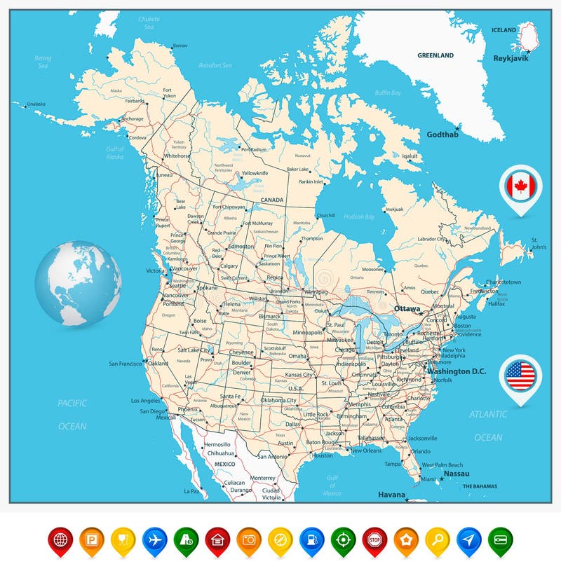
Free with trial USA and Canada large detailed political map with map pointers, states, provinces and capital cities in USA and Canada. Topographic globe map vectors USA and Canada large detailed political map with map pointers
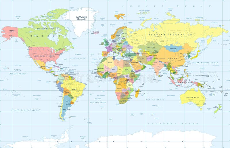
Free with trial Political Physical Topographic Colored World Map Vector illustration. Topographic globe map illustrations Political Colored World Map Vector. Political Physical Topographic Colored World Map Vector illustration
Free with trial Political Physical Topographic Colored World Map Vector illustration. Topographic globe map illustrations Political Colored World Map Vector. Political Physical Topographic Colored World Map Vector illustration
Free with trial Political Physical Topographic Colored World Map Vector illustration. Topographic globe map illustrations Political Colored World Map Vector. Political Physical Topographic Colored World Map Vector illustration
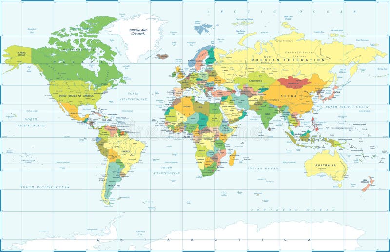
Free with trial Political Physical Topographic Colored World Map Vector illustration. Topographic globe map illustrations Political Colored Vintage World Map Vector. Political Physical Topographic Colored World Map Vector illustration
Free with trial USA map and flag - highly detailed vector illustration. Image contains land contours, country and land names, city names, water objects, flag, navigation icons, roads, railways. Topographic globe map vectors United States (USA) - infographic map - illustration. USA map and flag - highly detailed vector illustration. Image contains land contours, country and land names, city names, water objects, flag, navigation icons, roads, railways.
Free with trial Planet earth. High detailed satellite view of the Earth and its landforms, isolated on white background. Elements of this image furnished by NASA - 3D illustration. Topographic globe map illustrations Planet Earth high definition. Planet earth. High detailed satellite view of the Earth and its landforms, isolated on white background. Elements of this image furnished by NASA - 3D illustration.
Free with trial Planet earth. High detailed satellite view of the Earth and its landforms, isolated on white background. 3D illustration, elements of this image furnished by NASA. Topographic globe map illustrations Planet Earth in high resolution. Planet earth. High detailed satellite view of the Earth and its landforms, isolated on white background. 3D illustration, elements of this image furnished by NASA.
Free with trial Western and eastern hemispheres of planet Earth. Raised - relief globe. Physical topographic map of Earth. Topographic globe map illustrations World map - globe hemispheres. Western and eastern hemispheres of planet Earth. Raised - relief globe. Physical topographic map of Earth.
Free with trial Globe. Stylized 3D vector map, centered on America. Topographic globe map vectors Globe. Stylized 3D vector map. Globe. Stylized 3D vector map, centered on America.
Free with trial Globe with a political map on vintage background. 3d. Topographic globe map illustrations Globe with a political map on vintage background.
Free with trial Vintage Detailed Contour Topographic Map Of Wild West Abstract Vector Background. Topographic globe map vectors Vintage Detailed Contour Topographic Map Vector. Vintage Detailed Contour Topographic Map Of Wild West Abstract Vector Background
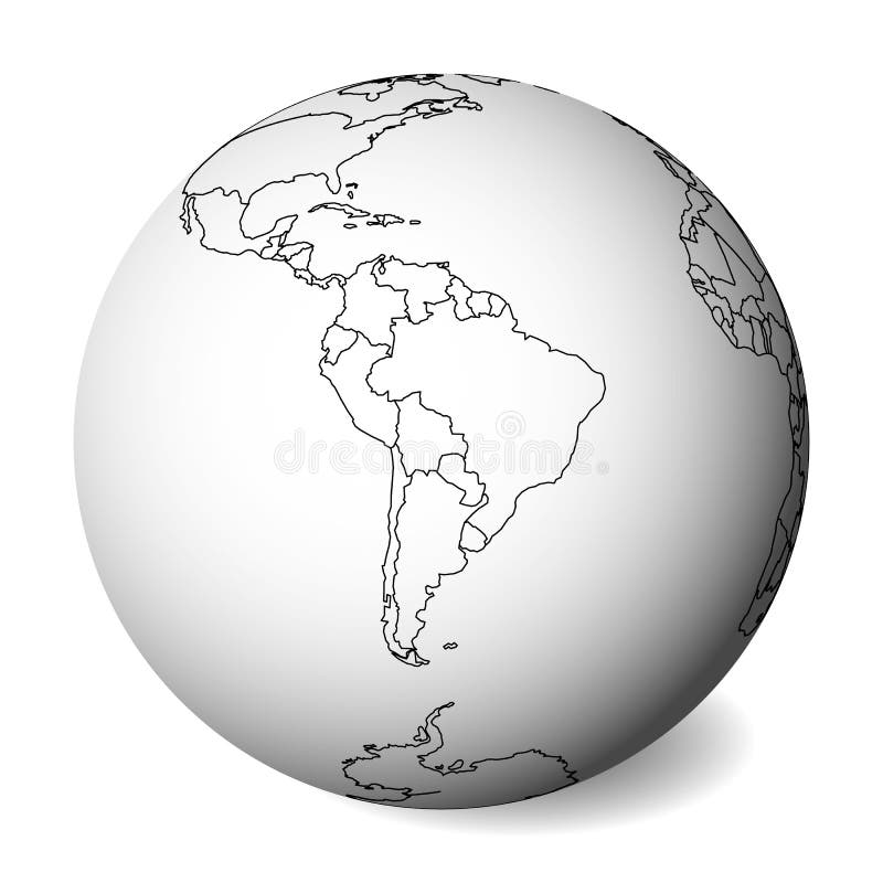
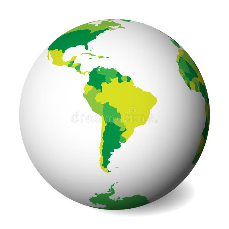
Free with trial Blank political map of South America. 3D Earth globe with black outline map. Vector illustration. Topographic globe map vectors Blank political map of South America. 3D Earth globe with black outline map. Vector illustration
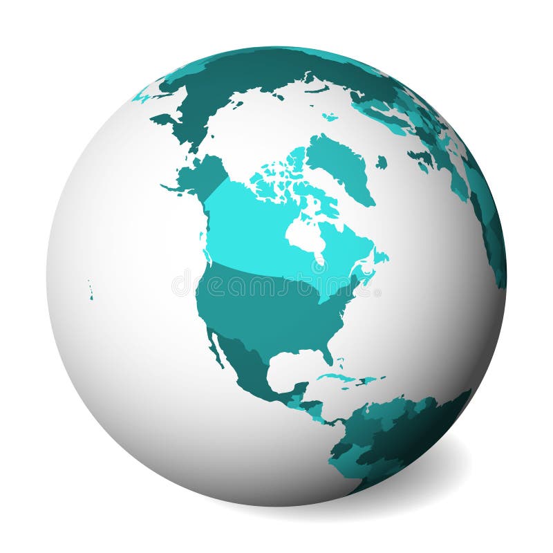
Free with trial Blank political map of North America. 3D Earth globe with turquoise blue map. Vector illustration. Topographic globe map vectors Blank political map of North America. 3D Earth globe with turquoise blue map. Vector illustration
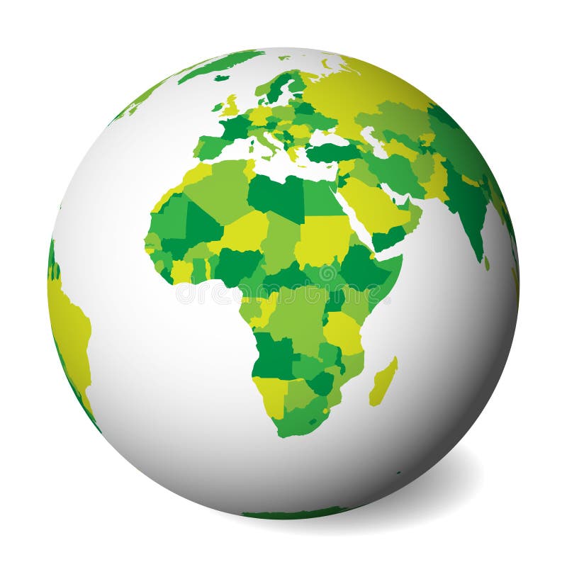
Free with trial Blank political map of Africa. 3D Earth globe with green map. Vector illustration. Topographic globe map vectors Blank political map of Africa. 3D Earth globe with green map. Vector illustration
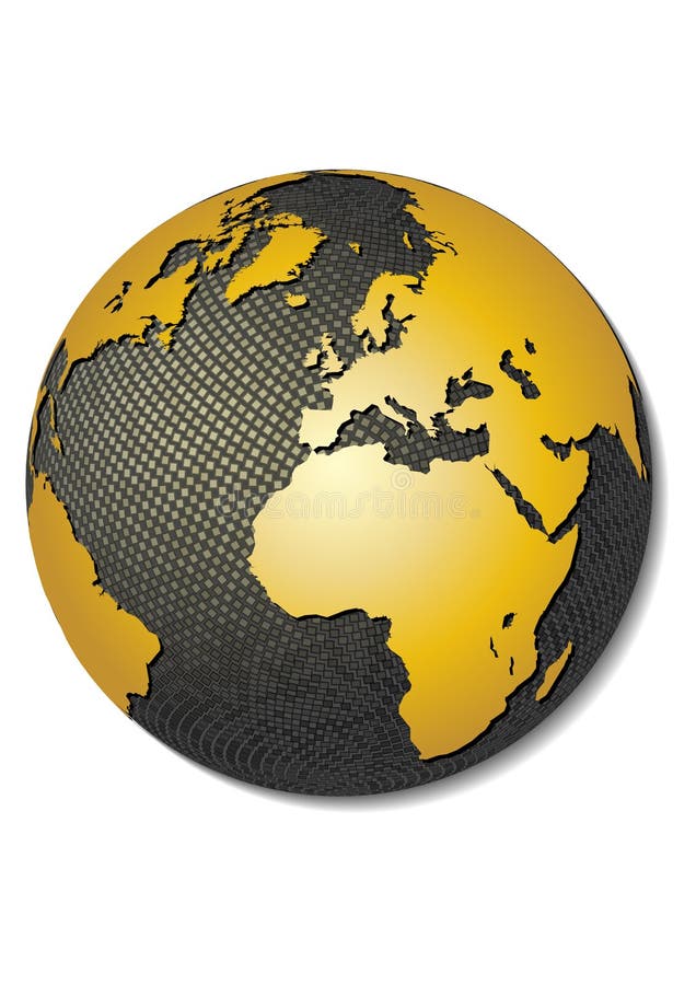
Free with trial Golden world globe with a reflection, isolated on a black background. Topographic globe map illustrations Golden world globe
Free with trial Globe, centered on North America. Shaded relief colored according to dominant vegetation. Shows polar and pack ice, large urban areas. Isolated on white, with clipping path. Topographic globe map illustrations Globe, shaded relief. Globe, centered on North America. Shaded relief colored according to dominant vegetation. Shows polar and pack ice, large urban areas. Isolated on white, with clipping path.
Free with trial Caucasus Physical Map. Detailed map of the Caucasus. Topographic globe map vectors Caucasus Physical Map
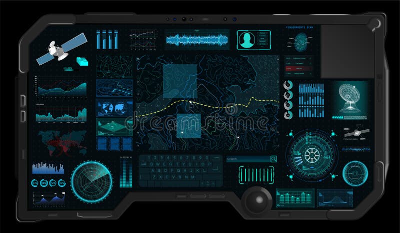
Free with trial Command Center Screen in HUD style. Topographic Map, Contour. Futuristic Interface Elements and Earth Landscape Scanning. Concept of a Conditional Geography Scheme in HUD Style. Vector Elements Set. Topographic globe map vectors Command Center Screen in HUD style
Free with trial World map. Satellite view. Continents and oceans. Topographic globe map illustrations World map. Continents and oceans. World map. Satellite view. Continents and oceans
Free with trial High detailed Russia road map and navigation icons with separated layers. Topographic globe map vectors High detailed Russia road map and navigation icons
Free with trial Vector illustration of the map of Serbia made with the captions and landmarks. Topographic globe map vectors Map of Serbia
Free with trial Illustrated map of Russia with all main cities including Moscow and tourist attractions. Trans-siberian railway on map. Topographic globe map vectors Illustrated Map of Russia
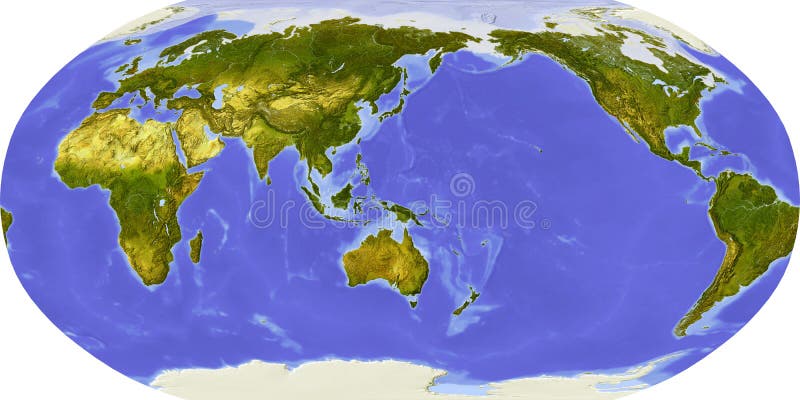
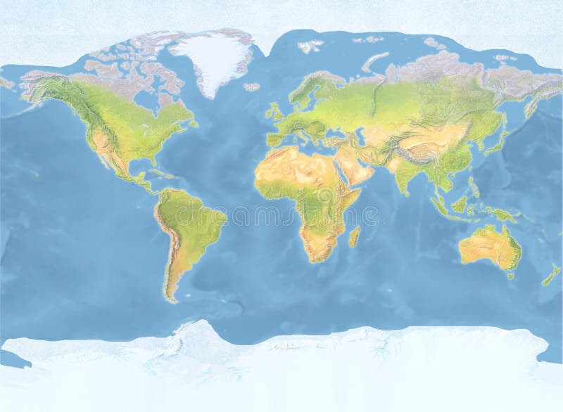
Free with trial Big size physical world map illustration. World map, isolated on white background. Extra large size physical world map illustration. Primary source, elements of this image furnished by NASA. Topographic globe map illustrations Big size physical world map illustration. World map, isolated on white background. Primary source, elements of this image furnish. Big size physical world map illustration. World map, isolated on white background. Extra large size physical world map illustration. Primary source, elements of this image furnished by NASA.
Free with trial USA map and flag - highly detailed vector illustration. Image contains land contours, country and land names, city names, water object names, flag. Topographic globe map vectors United States (USA) - map and flag - illustration. USA map and flag - highly detailed vector illustration. Image contains land contours, country and land names, city names, water object names, flag.
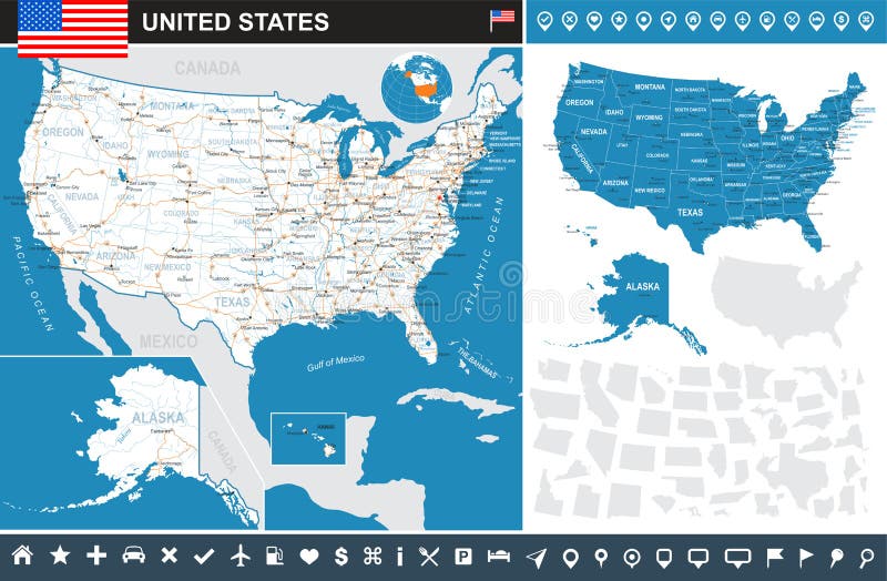
Free with trial USA map and flag - highly detailed vector illustration. Image contains next layers. There are land contours, country and land names, city names, water object names, flag, navigation icons. Topographic globe map vectors United States (USA) - map, flag and navigation icons - illustration. USA map and flag - highly detailed vector illustration. Image contains next layers. There are land contours, country and land names, city names, water object names, flag, navigation icons.
Free with trial Extended area of Israel. Topographic relief map. 3D rendering. Topographic globe map illustrations Israel neighbourhood. Relief. Extended area of Israel. Topographic relief map. 3D rendering
Free with trial Metal Earth Planet isolated on white and clipping path The Earth texture of this image furnished by NASA. Topographic globe map illustrations Metal Earth Planet
Free with trial Planet earth. High detailed satellite view of the Earth and its landforms, focused on the American continent. 3D illustration, elements of this image furnished by NASA. Topographic globe map illustrations Planet Earth in high resolution. Planet earth. High detailed satellite view of the Earth and its landforms, focused on the American continent. 3D illustration, elements of this image furnished by NASA.
Free with trial Greece on the Earth planet. Topographic globe map illustrations Greece on the Earth planet
Free with trial Topographic map centered on Laos neighborhood area. Topographic globe map illustrations Globe centered on Laos neighborhood. Topographic map. Topographic map centered on Laos neighborhood area
Free with trial Natural colored topographic world map with hand drawn shaded relief and ocean floor structure. Topographic globe map illustrations Natural colored topographic world map with hand drawn shaded relief
Free with trial Globe with political map on grey background. 3d. Topographic globe map illustrations Globe with political map on grey background.
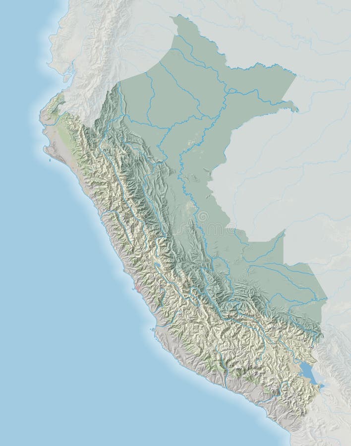
Free with trial Topographic map of Peru with shaded relief. Topographic globe map illustrations Topographic map of Peru
Free with trial 3D Cartography concep background. Rendering. Map line of topography. Abstract topographic map concep. Map mockup infographics. World map Template. Topographic globe map illustrations 3D Cartography concep background. Rendering. Map line of topography. Topographic map. Map mockup infographics. 3D Cartography concep background. Rendering. Map line of topography.Abstract topographic map concep. Map mockup infographics. World map Template
Free with trial Topographic map of Panama with shaded relief. Topographic globe map illustrations Topographic map of Panama
Free with trial Topographic map of Argentina with shaded relief. Topographic globe map illustrations Topographic map of Argentina
Free with trial Geography school set with Earth globe, topography map, ship wheel, compass, hourglass, windrose and book icons. Science for kids. Cartoon style vector illustration. Topographic globe map illustrations Geography school set with Earth globe, topography map, ship wheel, compass, hourglass, windrose and book icons.
Free with trial Vintage Detailed Contour Topographic Map Of Wild West Abstract Vector Background. Topographic globe map vectors Vintage Detailed Contour Topographic Map Vector. Vintage Detailed Contour Topographic Map Of Wild West Abstract Vector Background
Free with trial Map of the earth globe showing the location of the city Burleson in the United States (Texas). The city is marked with a red dot. No labels at all. Topographic globe map illustrations Map showing the location of the city Burleson in the United States (Texas) on the earth globe. Map of the earth globe showing the location of the city Burleson. Map of the earth globe showing the location of the city Burleson in the United States (Texas). The city is marked with a red dot. No labels at all.
Free with trial Globe similar worldmap icon. Big size physical world map illustration. World map, isolated on white background. Plain color on solid background. Topographic globe map illustrations Globe similar worldmap icon. Big size physical world map illustration. World map, isolated on white background. Plain color on
Free with trial 3D Cartography concep background. Rendering. Map line of topography. Abstract topographic map concep. Map mockup infographics. World map Template. Topographic globe map illustrations 3D Cartography concep background. Rendering. Map line of topography. Topographic map. Map mockup infographics. 3D Cartography concep background. Rendering. Map line of topography.Abstract topographic map concep. Map mockup infographics. World map Template
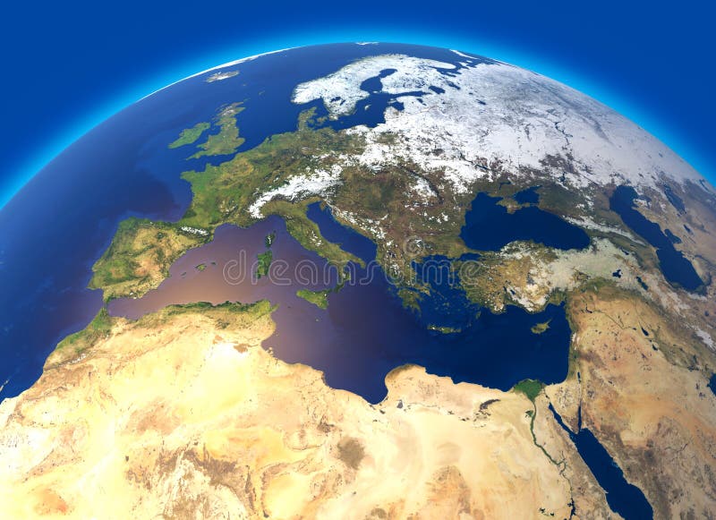
Free with trial Physical map of the world, Europe and North Africa. Globe. Hemisphere. Reliefs and oceans. 3d rendering. Element of this image are furnished by NASA. Topographic globe map illustrations Physical map of the world, Europe and North Africa. Globe. Hemisphere. Reliefs and oceans
Free with trial 3D Cartography concep background. Rendering. Map line of topography. Abstract topographic map concep. Map mockup infographics. World map Template. Topographic globe map illustrations 3D Cartography concep background. Rendering. Map line of topography. Topographic map. Map mockup infographics. 3D Cartography concep background. Rendering. Map line of topography.Abstract topographic map concep. Map mockup infographics. World map Template
Free with trial Retro topographic map, great design for any purposes. Abstract pattern in the form of topological map of heights. Topological landscape on white background. Topographic globe map vectors Retro topographic map, great design for any purposes.
Free with trial Satellite view of Italy, detail of Europe topographic map. Retouched photo Earth from space. Creative picture of frozen terrain, blue cold surface. Elements of this image furnished by NASA. Topographic globe map illustrations Satellite view of Italy, detail of Europe topographic map. Retouched photo Earth from space. Creative picture of frozen terrain
Free with trial Blank political map of Australia. 3D Earth globe with black outline map. Vector illustration. Topographic globe map vectors Blank political map of Australia. 3D Earth globe with black outline map. Vector illustration
Free with trial Blank political map of Asia. 3D Earth globe with green map. Vector illustration. Topographic globe map vectors Blank political map of Asia. 3D Earth globe with green map. Vector illustration
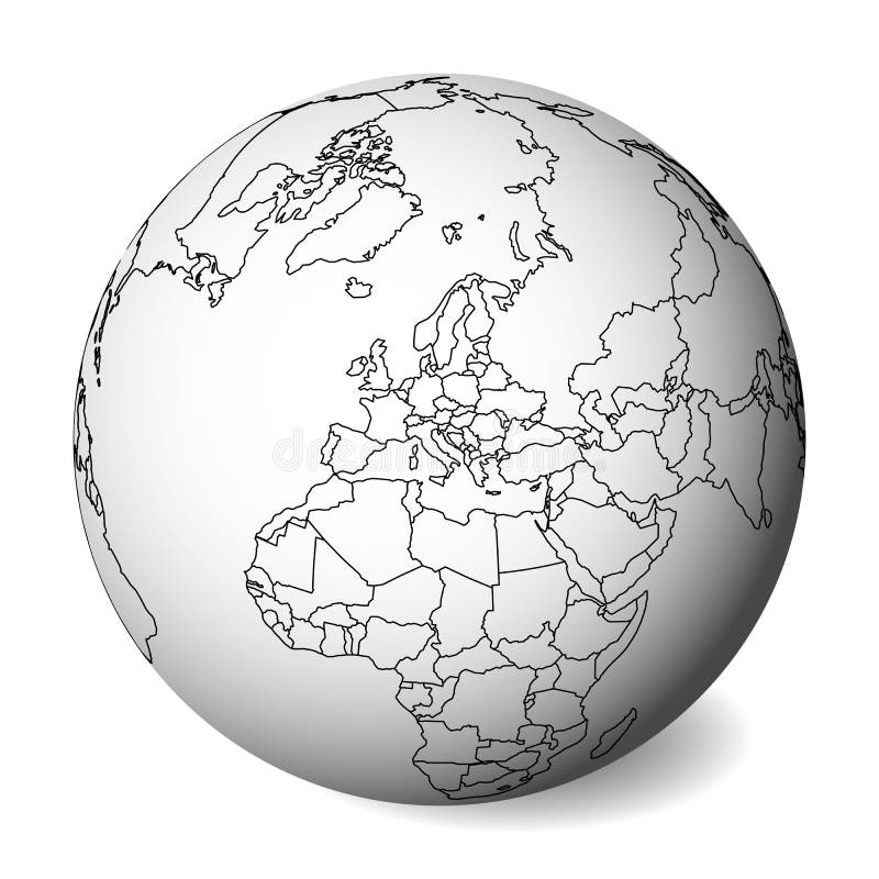
Free with trial Blank political map of Europe. 3D Earth globe with green map. Vector illustration. Topographic globe map vectors Blank political map of Europe. 3D Earth globe with green map. Vector illustration
Free with trial Blank political map of South America. 3D Earth globe with green map. Vector illustration. Topographic globe map vectors Blank political map of South America. 3D Earth globe with green map. Vector illustration
Free with trial Blank political map of Europe. 3D Earth globe with black outline map. Vector illustration. Topographic globe map vectors Blank political map of Europe. 3D Earth globe with black outline map. Vector illustration