Free with trial Wajir county outline map set. Wajir map vectors Wajir outline map. Wajir county outline map set
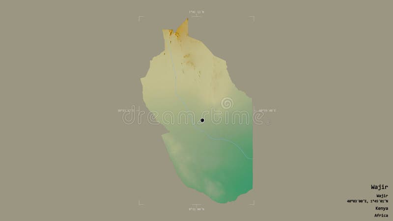
Free with trial Wajir, county of Kenya. Colored relief with lakes and rivers. Shape presented against its country area with informative overlays. 3D rendering. Wajir map illustrations Wajir, Kenya - composition. Relief. Wajir, county of Kenya. Colored relief with lakes and rivers. Shape presented against its country area with informative overlays. 3D rendering
Free with trial Shape of Wajir, county of Kenya, with its capital isolated on white background. Satellite imagery. 3D rendering. Wajir map illustrations Wajir, county of Kenya, on white. Satellite. Shape of Wajir, county of Kenya, with its capital isolated on white background. Satellite imagery. 3D rendering
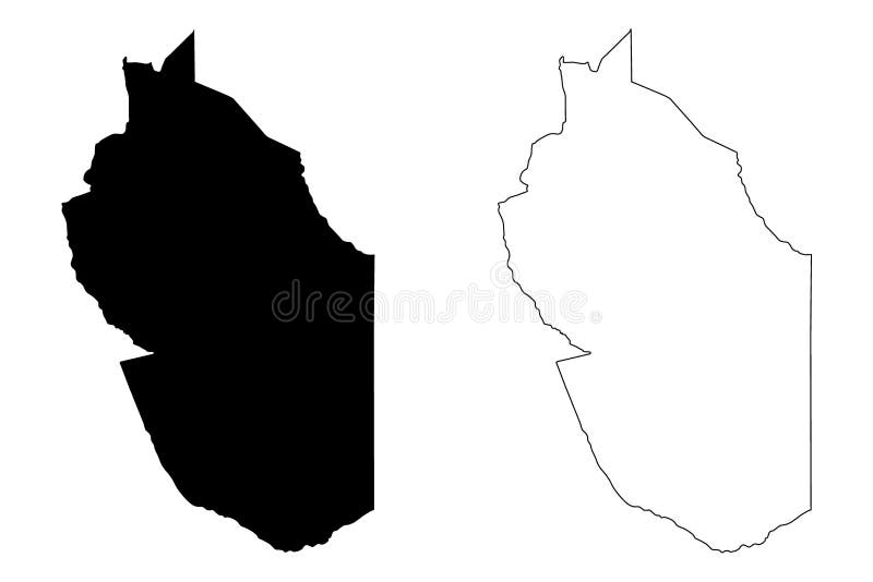
Free with trial Wajir outline map. Wajir county blank outline map set. Wajir map vectors Wajir outline map. Wajir county blank outline map set
Free with trial Wajir county blank outline map. Wajir map vectors Wajir outline map. Wajir county blank outline map
Free with trial Wajir County Republic of Kenya, North Eastern Province map vector illustration, scribble sketch Wajir map,. Wajir map vectors Wajir County Republic of Kenya, North Eastern Province map vector illustration, scribble sketch Wajir map
Free with trial Wajir County Republic of Kenya, North Eastern Province map vector illustration, scribble sketch Wajir map,. Wajir map vectors Wajir County Republic of Kenya, North Eastern Province map vector illustration, scribble sketch Wajir map
Free with trial Wajir County Republic of Kenya, North Eastern Province map vector illustration, scribble sketch Wajir map,. Wajir map vectors Wajir County Republic of Kenya, North Eastern Province map vector illustration, scribble sketch Wajir map
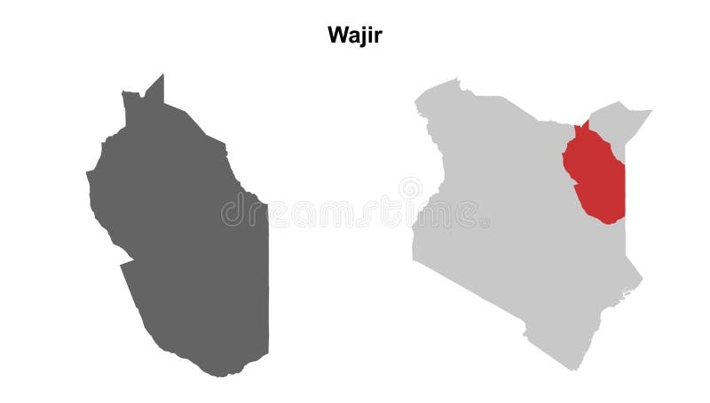
Free with trial Location Wajir County on map Kenya. 3d Wajir County location sign. Flag of Kenya. Quality map with Counties of Kenya for your web site design, logo, app, UI. EPS10. Wajir map vectors Location Wajir County on map Kenya. 3d Wajir County location sign. Flag of Kenya.
Free with trial Area of Wajir, county of Kenya, isolated on a solid background in a georeferenced bounding box. Labels. Topographic relief map. 3D rendering. Wajir map illustrations Wajir - Kenya. Bounding box. Relief. Area of Wajir, county of Kenya, isolated on a solid background in a georeferenced bounding box. Labels. Topographic relief map. 3D rendering
Free with trial Area of Wajir, county of Kenya, isolated on a solid background in a georeferenced bounding box. Labels. Bilevel elevation map. 3D rendering. Wajir map illustrations Wajir - Kenya. Bounding box. Bilevel. Area of Wajir, county of Kenya, isolated on a solid background in a georeferenced bounding box. Labels. Bilevel elevation map. 3D rendering
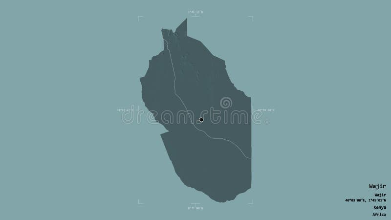
Free with trial Shape of Wajir, county of Kenya, with its capital isolated on solid background. Distance scale, region preview and labels. Topographic relief map. 3D rendering. Wajir map illustrations Wajir, county of Kenya, zoomed. Relief. Shape of Wajir, county of Kenya, with its capital isolated on solid background. Distance scale, region preview and labels. Topographic relief map. 3D rendering
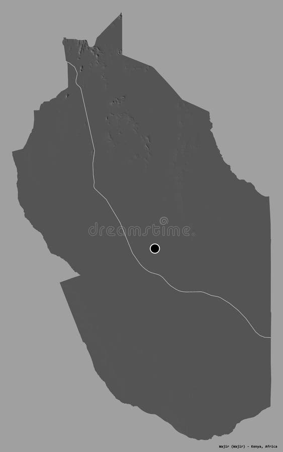
Free with trial Shape of Wajir, county of Kenya, with its capital isolated on solid background. Distance scale, region preview and labels. Bilevel elevation map. 3D rendering. Wajir map illustrations Wajir, county of Kenya, zoomed. Bilevel. Shape of Wajir, county of Kenya, with its capital isolated on solid background. Distance scale, region preview and labels. Bilevel elevation map. 3D rendering
Free with trial Shape of Wajir, county of Kenya, and its capital. Distance scale, previews and labels. Topographic relief map. 3D rendering. Wajir map illustrations Wajir, county of Kenya,. Previews. Relief. Shape of Wajir, county of Kenya, and its capital. Distance scale, previews and labels. Topographic relief map. 3D rendering
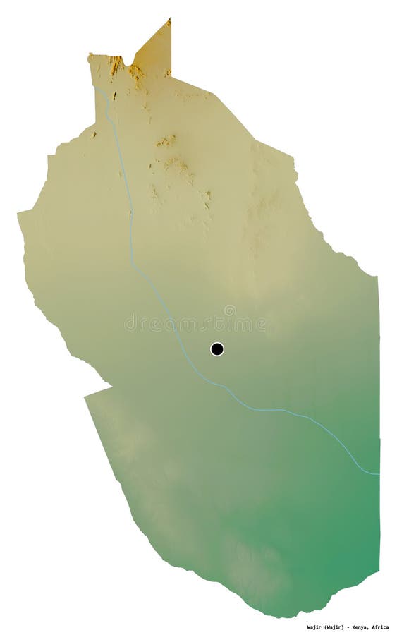
Free with trial Shape of Wajir, county of Kenya, with its capital isolated on a solid color background. Topographic relief map. 3D rendering. Wajir map illustrations Wajir, county of Kenya, on solid. Relief. Shape of Wajir, county of Kenya, with its capital isolated on a solid color background. Topographic relief map. 3D rendering
Free with trial Shape of Wajir, county of Kenya, and its capital. Distance scale, previews and labels. Bilevel elevation map. 3D rendering. Wajir map illustrations Wajir, county of Kenya,. Previews. Bilevel. Shape of Wajir, county of Kenya, and its capital. Distance scale, previews and labels. Bilevel elevation map. 3D rendering
Free with trial Shape of Wajir, county of Kenya, with its capital isolated on a solid color background. Bilevel elevation map. 3D rendering. Wajir map illustrations Wajir, county of Kenya, on solid. Bilevel. Shape of Wajir, county of Kenya, with its capital isolated on a solid color background. Bilevel elevation map. 3D rendering
Free with trial Shape of Wajir, county of Kenya, with its capital isolated on white background. Bilevel elevation map. 3D rendering. Wajir map illustrations Wajir, county of Kenya, on white. Bilevel. Shape of Wajir, county of Kenya, with its capital isolated on white background. Bilevel elevation map. 3D rendering
Free with trial Desaturated shape of Kenya with its capital, main regional division and the separated Wajir area. Labels. Topographic relief map. 3D rendering. Wajir map illustrations Location of Wajir, county of Kenya,. Relief. Desaturated shape of Kenya with its capital, main regional division and the separated Wajir area. Labels. Topographic relief map. 3D rendering
Free with trial Shape of Wajir, county of Kenya, with its capital isolated on white background. Topographic relief map. 3D rendering. Wajir map illustrations Wajir, county of Kenya, on white. Relief. Shape of Wajir, county of Kenya, with its capital isolated on white background. Topographic relief map. 3D rendering
Free with trial Desaturated shape of Kenya with its capital, main regional division and the separated Wajir area. Labels. Colored elevation map. 3D rendering. Wajir map illustrations Location of Wajir, county of Kenya,. Administrative. Desaturated shape of Kenya with its capital, main regional division and the separated Wajir area. Labels. Colored elevation map. 3D rendering
Free with trial Shape of Wajir, county of Kenya, and its capital. Distance scale, previews and labels. Colored elevation map. 3D rendering. Wajir map illustrations Wajir, county of Kenya,. Previews. Administrative. Shape of Wajir, county of Kenya, and its capital. Distance scale, previews and labels. Colored elevation map. 3D rendering
Free with trial Desaturated shape of Kenya with its capital, main regional division and the separated Wajir area. Labels. Bilevel elevation map. 3D rendering. Wajir map illustrations Location of Wajir, county of Kenya,. Bilevel. Desaturated shape of Kenya with its capital, main regional division and the separated Wajir area. Labels. Bilevel elevation map. 3D rendering
Free with trial Area of Wajir, county of Kenya, isolated on a solid background in a georeferenced bounding box. Labels. Colored elevation map. 3D rendering. Wajir map illustrations Wajir - Kenya. Bounding box. Administrative. Area of Wajir, county of Kenya, isolated on a solid background in a georeferenced bounding box. Labels. Colored elevation map. 3D rendering
Free with trial Shape of Wajir, county of Kenya, with its capital isolated on a solid color background. Colored elevation map. 3D rendering. Wajir map illustrations Wajir, county of Kenya, on solid. Administrative. Shape of Wajir, county of Kenya, with its capital isolated on a solid color background. Colored elevation map. 3D rendering
Free with trial Shape of Wajir, county of Kenya, with its capital isolated on solid background. Distance scale, region preview and labels. Colored elevation map. 3D rendering. Wajir map illustrations Wajir, county of Kenya, zoomed. Administrative. Shape of Wajir, county of Kenya, with its capital isolated on solid background. Distance scale, region preview and labels. Colored elevation map. 3D rendering
Free with trial Shape of Wajir, county of Kenya, with its capital isolated on white background. Colored elevation map. 3D rendering. Wajir map illustrations Wajir, county of Kenya, on white. Administrative. Shape of Wajir, county of Kenya, with its capital isolated on white background. Colored elevation map. 3D rendering
Free with trial Zoom in on Wajir (county of Kenya) outlined. Oblique perspective. Bilevel elevation map with surface waters. 3D rendering. Wajir map illustrations Wajir, Kenya - outlined. Bilevel. Zoom in on Wajir (county of Kenya) outlined. Oblique perspective. Bilevel elevation map with surface waters. 3D rendering
Free with trial Zoom in on Wajir (county of Kenya) extruded. Oblique perspective. Bilevel elevation map with surface waters. 3D rendering. Wajir map illustrations Wajir, Kenya - extruded with capital. Bilevel. Zoom in on Wajir (county of Kenya) extruded. Oblique perspective. Bilevel elevation map with surface waters. 3D rendering
Free with trial Wajir, county of Kenya. Elevation map colored in wiki style with lakes and rivers. Corner auxiliary location maps. Wajir map illustrations Wajir, Kenya. Wiki. Capital. Wajir, county of Kenya. Elevation map colored in wiki style with lakes and rivers. Corner auxiliary location maps
Free with trial Wajir, county of Kenya. Elevation map colored in sepia tones with lakes and rivers. Corner auxiliary location maps. Wajir map illustrations Wajir, Kenya. Sepia. Capital. Wajir, county of Kenya. Elevation map colored in sepia tones with lakes and rivers. Corner auxiliary location maps
Free with trial Wajir, county of Kenya. Elevation map colored in wiki style with lakes and rivers. Wajir map illustrations Wajir, Kenya. Wiki. No legend. Wajir, county of Kenya. Elevation map colored in wiki style with lakes and rivers
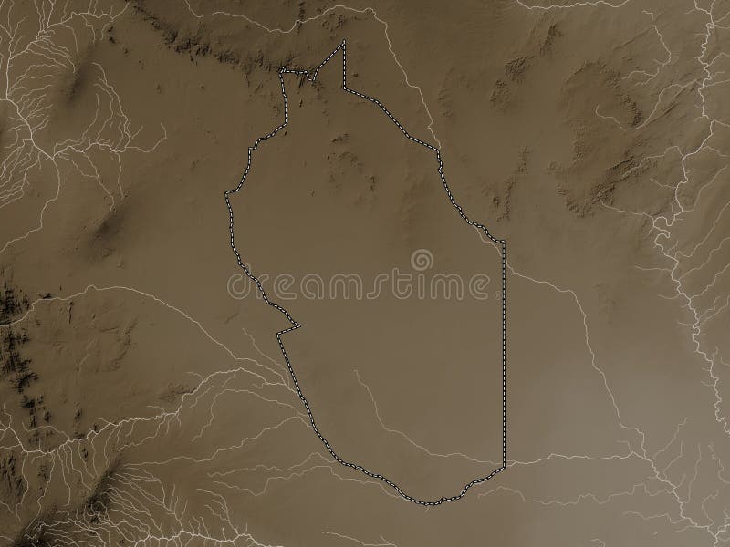
Free with trial Wajir, county of Kenya. Elevation map colored in sepia tones with lakes and rivers. Wajir map illustrations Wajir, Kenya. Sepia. No legend. Wajir, county of Kenya. Elevation map colored in sepia tones with lakes and rivers
Free with trial Wajir, county of Kenya. Colored elevation map with lakes and rivers. Corner auxiliary location maps. Wajir map illustrations Wajir, Kenya. Physical. Capital. Wajir, county of Kenya. Colored elevation map with lakes and rivers. Corner auxiliary location maps
Free with trial Wajir, county of Kenya. Elevation map colored in wiki style with lakes and rivers. Locations of major cities of the region. Corner auxiliary location maps. Wajir map illustrations Wajir, Kenya. Wiki. Major cities. Wajir, county of Kenya. Elevation map colored in wiki style with lakes and rivers. Locations of major cities of the region. Corner auxiliary location maps
Free with trial Wajir, county of Kenya. Grayscaled map with lakes and rivers. Shape outlined against its country area. 3D rendering. Wajir map illustrations Wajir, Kenya - outlined. Grayscale. Wajir, county of Kenya. Grayscaled map with lakes and rivers. Shape outlined against its country area. 3D rendering
Free with trial Wajir, county of Kenya. Colored elevation map with lakes and rivers. Wajir map illustrations Wajir, Kenya. Physical. No legend. Wajir, county of Kenya. Colored elevation map with lakes and rivers
Free with trial Wajir, county of Kenya. Grayscaled map with lakes and rivers. Shape presented against its country area with informative overlays. 3D rendering. Wajir map illustrations Wajir, Kenya - composition. Grayscale. Wajir, county of Kenya. Grayscaled map with lakes and rivers. Shape presented against its country area with informative overlays. 3D rendering
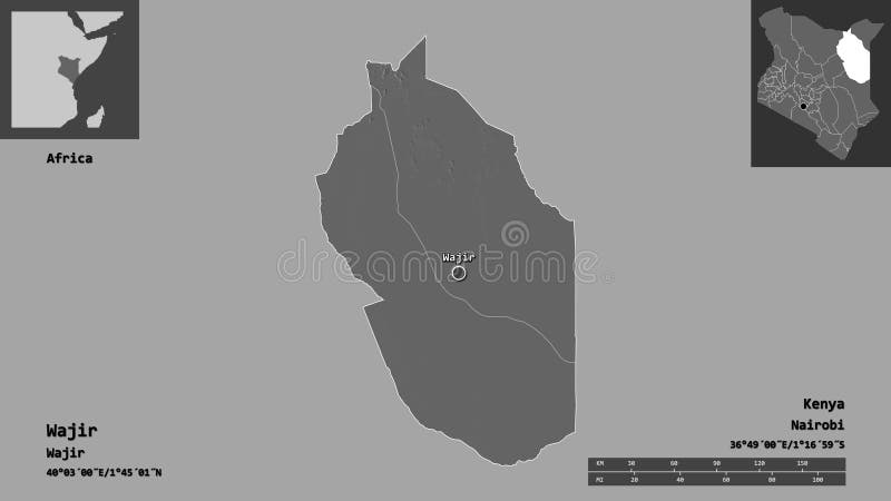
Free with trial Wajir, county of Kenya. Colored elevation map with lakes and rivers. Locations of major cities of the region. Corner auxiliary location maps. Wajir map illustrations Wajir, Kenya. Physical. Major cities. Wajir, county of Kenya. Colored elevation map with lakes and rivers. Locations of major cities of the region. Corner auxiliary location maps
Free with trial Zoom in on Wajir (county of Kenya) outlined. Oblique perspective. Colored and bumped map of the administrative division with surface waters. 3D rendering. Wajir map illustrations Wajir, Kenya - outlined. Administrative. Zoom in on Wajir (county of Kenya) outlined. Oblique perspective. Colored and bumped map of the administrative division with surface waters. 3D rendering
Free with trial Wajir, county of Kenya. Low resolution satellite map. Corner auxiliary location maps. Wajir map illustrations Wajir, Kenya. Low-res satellite. Capital. Wajir, county of Kenya. Low resolution satellite map. Corner auxiliary location maps
Free with trial Wajir, county of Kenya. Low resolution satellite map. Wajir map illustrations Wajir, Kenya. Low-res satellite. No legend. Wajir, county of Kenya. Low resolution satellite map
Free with trial Zoom in on Wajir (county of Kenya) extruded. Oblique perspective. Topographic relief map with surface waters. 3D rendering. Wajir map illustrations Wajir, Kenya - extruded with capital. Relief. Zoom in on Wajir (county of Kenya) extruded. Oblique perspective. Topographic relief map with surface waters. 3D rendering
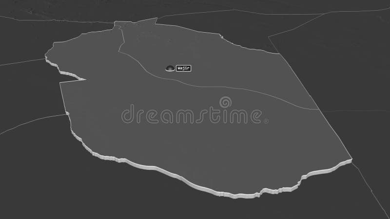
Free with trial Zoom in on Wajir (county of Kenya) outlined. Oblique perspective. Topographic relief map with surface waters. 3D rendering. Wajir map illustrations Wajir, Kenya - outlined. Relief. Zoom in on Wajir (county of Kenya) outlined. Oblique perspective. Topographic relief map with surface waters. 3D rendering
Free with trial Wajir, county of Kenya. Elevation map colored in wiki style with lakes and rivers. Locations and names of major cities of the region. Corner auxiliary location maps. Wajir map illustrations Wajir, Kenya. Wiki. Labelled points of cities. Wajir, county of Kenya. Elevation map colored in wiki style with lakes and rivers. Locations and names of major cities of the region. Corner auxiliary location maps
Free with trial Wajir, county of Kenya. Low resolution satellite map. Locations of major cities of the region. Corner auxiliary location maps. Wajir map illustrations Wajir, Kenya. Low-res satellite. Major cities. Wajir, county of Kenya. Low resolution satellite map. Locations of major cities of the region. Corner auxiliary location maps
Free with trial Wajir, county of Kenya. Elevation map colored in sepia tones with lakes and rivers. Locations and names of major cities of the region. Corner auxiliary location maps. Wajir map illustrations Wajir, Kenya. Sepia. Labelled points of cities. Wajir, county of Kenya. Elevation map colored in sepia tones with lakes and rivers. Locations and names of major cities of the region. Corner auxiliary location maps
Free with trial Wajir, county of Kenya. Colored elevation map with lakes and rivers. Locations and names of major cities of the region. Corner auxiliary location maps. Wajir map illustrations Wajir, Kenya. Physical. Labelled points of cities. Wajir, county of Kenya. Colored elevation map with lakes and rivers. Locations and names of major cities of the region. Corner auxiliary location maps
Free with trial Zoom in on Wajir (county of Kenya) extruded. Oblique perspective. Colored and bumped map of the administrative division with surface waters. 3D rendering. Wajir map illustrations Wajir, Kenya - extruded with capital. Administrative. Zoom in on Wajir (county of Kenya) extruded. Oblique perspective. Colored and bumped map of the administrative division with surface waters. 3D rendering
Free with trial Wajir, county of Kenya. Low resolution satellite map. Locations and names of major cities of the region. Corner auxiliary location maps. Wajir map illustrations Wajir, Kenya. Low-res satellite. Labelled points of cities. Wajir, county of Kenya. Low resolution satellite map. Locations and names of major cities of the region. Corner auxiliary location maps
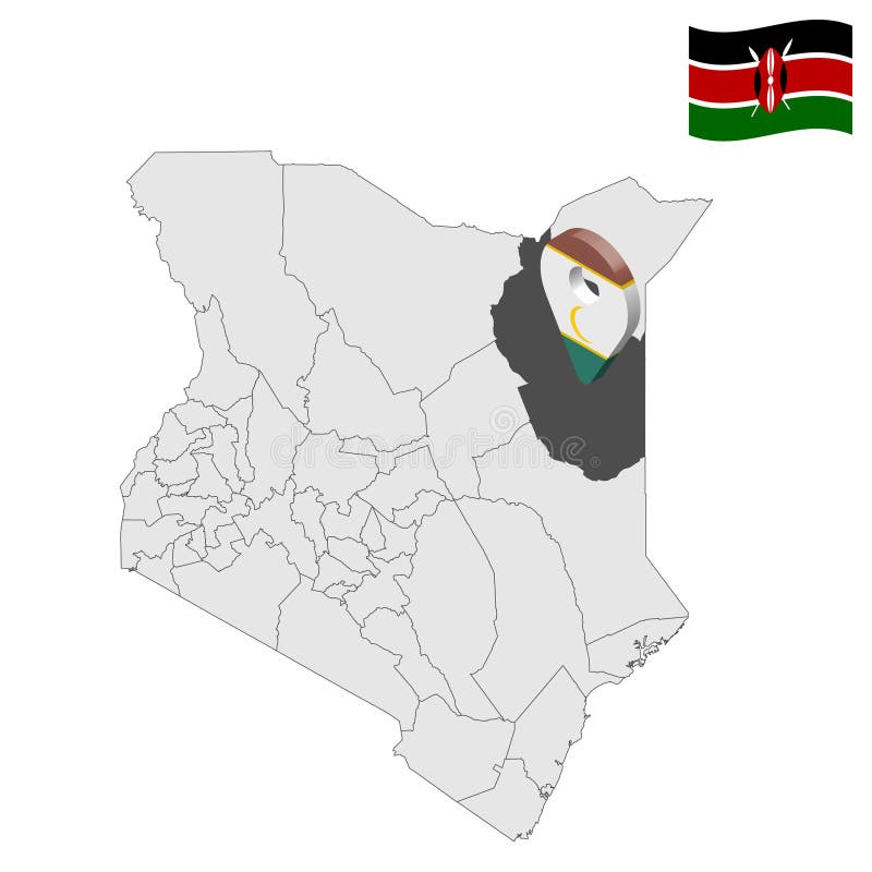
Free with trial Black highlighted location map of the Kenyan Wajir county inside gray map of the Republic of Kenya. Wajir map vectors Location map of the Wajir county of Kenya. Black highlighted location map of the Kenyan Wajir county inside gray map of the Republic of Kenya
Free with trial Area of Wajir, county of Kenya, isolated on a solid background in a georeferenced bounding box. Labels. Composition of patterned textures. 3D rendering. Wajir map illustrations Wajir - Kenya. Bounding box. Pattern. Area of Wajir, county of Kenya, isolated on a solid background in a georeferenced bounding box. Labels. Composition of patterned textures. 3D rendering
Free with trial Area of Wajir, county of Kenya, isolated on a solid background in a georeferenced bounding box. Labels. Satellite imagery. 3D rendering. Wajir map illustrations Wajir - Kenya. Bounding box. Satellite. Area of Wajir, county of Kenya, isolated on a solid background in a georeferenced bounding box. Labels. Satellite imagery. 3D rendering
Free with trial Shape of Wajir, county of Kenya, with its capital isolated on white background. Composition of patterned textures. 3D rendering. Wajir map illustrations Wajir, county of Kenya, on white. Pattern. Shape of Wajir, county of Kenya, with its capital isolated on white background. Composition of patterned textures. 3D rendering
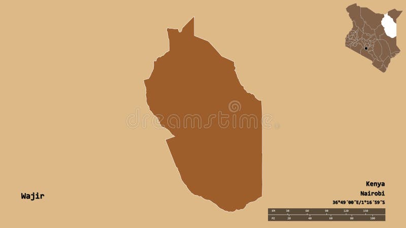
Free with trial Shape of Wajir, county of Kenya, with its capital isolated on solid background. Distance scale, region preview and labels. Satellite imagery. 3D rendering. Wajir map illustrations Wajir, county of Kenya, zoomed. Satellite. Shape of Wajir, county of Kenya, with its capital isolated on solid background. Distance scale, region preview and labels. Satellite imagery. 3D rendering
Free with trial Shape of Wajir, county of Kenya, with its capital isolated on a solid color background. Composition of patterned textures. 3D rendering. Wajir map illustrations Wajir, county of Kenya, on solid. Pattern. Shape of Wajir, county of Kenya, with its capital isolated on a solid color background. Composition of patterned textures. 3D rendering
Free with trial Desaturated shape of Kenya with its capital, main regional division and the separated Wajir area. Labels. Satellite imagery. 3D rendering. Wajir map illustrations Location of Wajir, county of Kenya,. Satellite. Desaturated shape of Kenya with its capital, main regional division and the separated Wajir area. Labels. Satellite imagery. 3D rendering
Free with trial Shape of Wajir, county of Kenya, and its capital. Distance scale, previews and labels. Satellite imagery. 3D rendering. Wajir map illustrations Wajir, county of Kenya,. Previews. Satellite. Shape of Wajir, county of Kenya, and its capital. Distance scale, previews and labels. Satellite imagery. 3D rendering
Free with trial Shape of Wajir, county of Kenya, with its capital isolated on a solid color background. Satellite imagery. 3D rendering. Wajir map illustrations Wajir, county of Kenya, on solid. Satellite. Shape of Wajir, county of Kenya, with its capital isolated on a solid color background. Satellite imagery. 3D rendering
Free with trial Desaturated shape of Kenya with its capital, main regional division and the separated Wajir area. Labels. Composition of patterned textures. 3D rendering. Wajir map illustrations Location of Wajir, county of Kenya,. Pattern. Desaturated shape of Kenya with its capital, main regional division and the separated Wajir area. Labels. Composition of patterned textures. 3D rendering
Free with trial Wajir, county of Kenya. Colored relief with lakes and rivers. Shape outlined against its country area. 3D rendering. Wajir map illustrations Wajir, Kenya - outlined. Relief. Wajir, county of Kenya. Colored relief with lakes and rivers. Shape outlined against its country area. 3D rendering
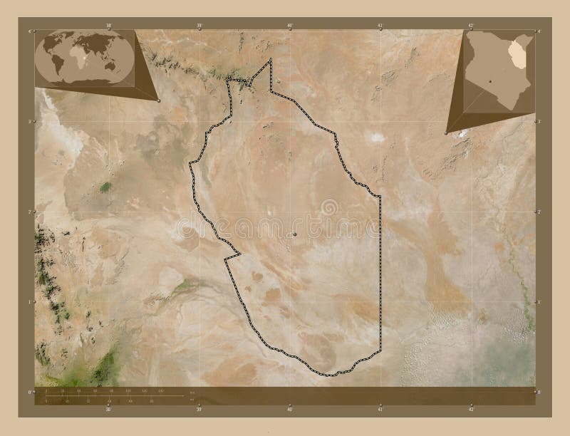
Free with trial Wajir, county of Kenya. Satellite imagery. Shape presented against its country area with informative overlays. 3D rendering. Wajir map illustrations Wajir, Kenya - composition. Satellite. Wajir, county of Kenya. Satellite imagery. Shape presented against its country area with informative overlays. 3D rendering
Free with trial Shape of Wajir, county of Kenya, with its capital isolated on solid background. Distance scale, region preview and labels. Composition of patterned textures. 3D rendering. Wajir map illustrations Wajir, county of Kenya, zoomed. Pattern. Shape of Wajir, county of Kenya, with its capital isolated on solid background. Distance scale, region preview and labels. Composition of patterned textures. 3D rendering
Free with trial Shape of Wajir, county of Kenya, and its capital. Distance scale, previews and labels. Composition of patterned textures. 3D rendering. Wajir map illustrations Wajir, county of Kenya,. Previews. Pattern. Shape of Wajir, county of Kenya, and its capital. Distance scale, previews and labels. Composition of patterned textures. 3D rendering
Free with trial Wajir, county of Kenya. Patterned solids with lakes and rivers. Shape presented against its country area with informative overlays. 3D rendering. Wajir map illustrations Wajir, Kenya - composition. Pattern. Wajir, county of Kenya. Patterned solids with lakes and rivers. Shape presented against its country area with informative overlays. 3D rendering
Free with trial Zoom in on Wajir (county of Kenya) extruded. Oblique perspective. Satellite imagery. 3D rendering. Wajir map illustrations Wajir, Kenya - extruded with capital. Satellite. Zoom in on Wajir (county of Kenya) extruded. Oblique perspective. Satellite imagery. 3D rendering
Free with trial Zoom in on Wajir (county of Kenya) outlined. Oblique perspective. Satellite imagery. 3D rendering. Wajir map illustrations Wajir, Kenya - outlined. Satellite. Zoom in on Wajir (county of Kenya) outlined. Oblique perspective. Satellite imagery. 3D rendering
Free with trial Wajir, county of Kenya. Colored shader data with lakes and rivers. Shape outlined against its country area. 3D rendering. Wajir map illustrations Wajir, Kenya - outlined. Physical. Wajir, county of Kenya. Colored shader data with lakes and rivers. Shape outlined against its country area. 3D rendering
Free with trial Wajir, county of Kenya. Solid color shape. Corner auxiliary location maps. Wajir map illustrations Wajir, Kenya. Solid. Capital. Wajir, county of Kenya. Solid color shape. Corner auxiliary location maps
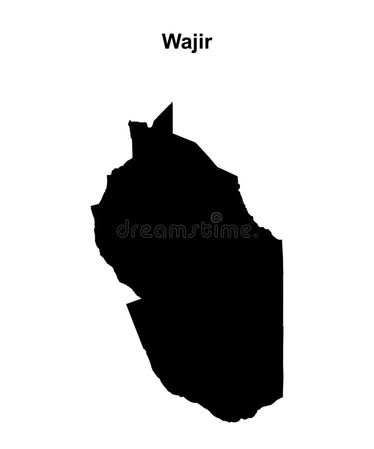
Free with trial Wajir, county of Kenya. Solid color shape. Wajir map illustrations Wajir, Kenya. Solid. No legend. Wajir, county of Kenya. Solid color shape
Free with trial Wajir, county of Kenya. Solid color shape. Locations of major cities of the region. Corner auxiliary location maps. Wajir map illustrations Wajir, Kenya. Solid. Major cities. Wajir, county of Kenya. Solid color shape. Locations of major cities of the region. Corner auxiliary location maps
Free with trial Wajir, county of Kenya. Colored shader data with lakes and rivers. Shape presented against its country area with informative overlays. 3D rendering. Wajir map illustrations Wajir, Kenya - composition. Physical. Wajir, county of Kenya. Colored shader data with lakes and rivers. Shape presented against its country area with informative overlays. 3D rendering
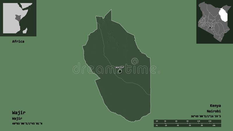
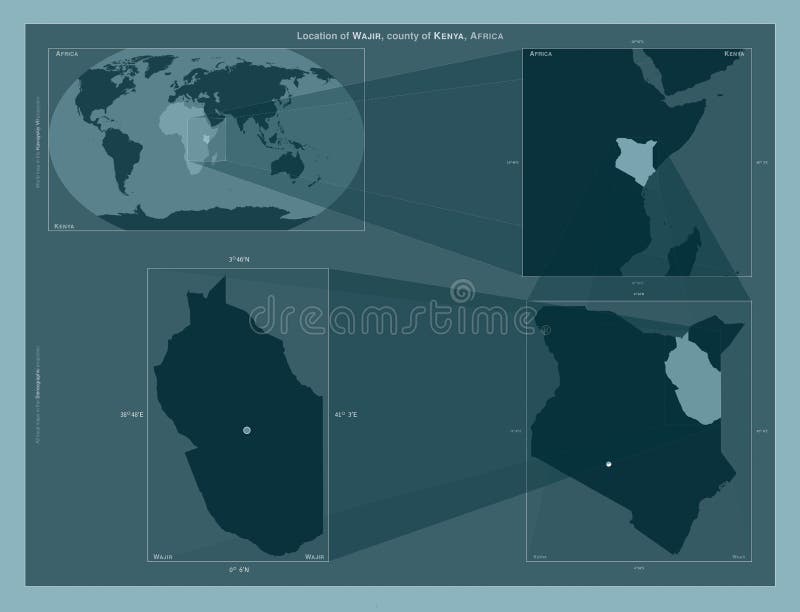
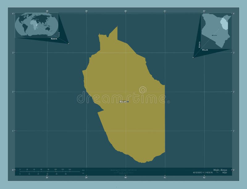
Free with trial Wajir, county of Kenya. Diagram showing the location of the region on larger-scale maps. Composition of vector frames and PNG shapes on a solid background. Wajir map illustrations Wajir, Kenya. Described location diagram. Wajir, county of Kenya. Diagram showing the location of the region on larger-scale maps. Composition of vector frames and PNG shapes on a solid background
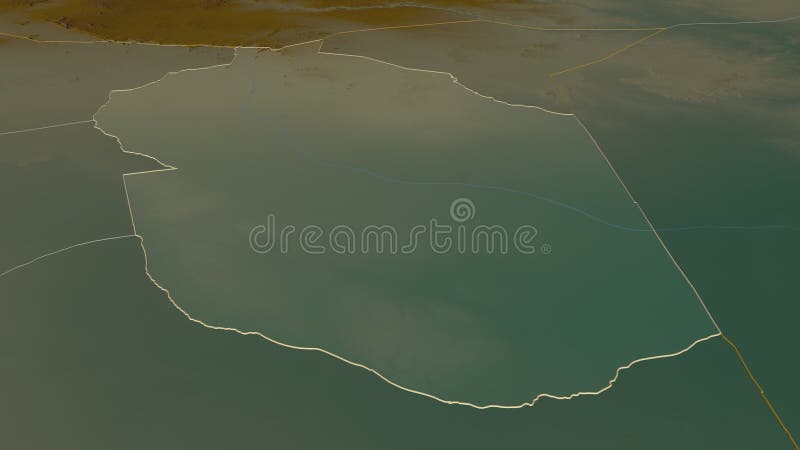
Free with trial Wajir, county of Kenya. Satellite imagery. Shape outlined against its country area. 3D rendering. Wajir map illustrations Wajir, Kenya - outlined. Satellite. Wajir, county of Kenya. Satellite imagery. Shape outlined against its country area. 3D rendering
Free with trial Wajir, county of Kenya. Solid color shape. Locations and names of major cities of the region. Corner auxiliary location maps. Wajir map illustrations Wajir, Kenya. Solid. Labelled points of cities. Wajir, county of Kenya. Solid color shape. Locations and names of major cities of the region. Corner auxiliary location maps
Free with trial Country Political Geographical Map of Kenya with Provinces with Shadows. Wajir map illustrations Modern Colorful Map of Kenya with Provinces With Shadow. Country Political Geographical Map of Kenya with Provinces with Shadows