Free with trial Honduras map with departments main cities and flag. Yoro map vectors Honduras map - cdr format. Honduras map with departments main cities and flag
Free with trial Yoro, department of Honduras. Colored shader data with lakes and rivers. Shape outlined against its country area. 3D rendering. Yoro map illustrations Yoro, Honduras - outlined. Physical. Yoro, department of Honduras. Colored shader data with lakes and rivers. Shape outlined against its country area. 3D rendering
Free with trial Shape of Yoro, department of Honduras, and its capital. Distance scale, previews and labels. Composition of patterned textures. 3D rendering. Yoro map illustrations Yoro, department of Honduras,. Previews. Pattern. Shape of Yoro, department of Honduras, and its capital. Distance scale, previews and labels. Composition of patterned textures. 3D rendering
Free with trial Yoro department outline map set. Yoro map vectors Yoro outline map. Yoro department outline map set
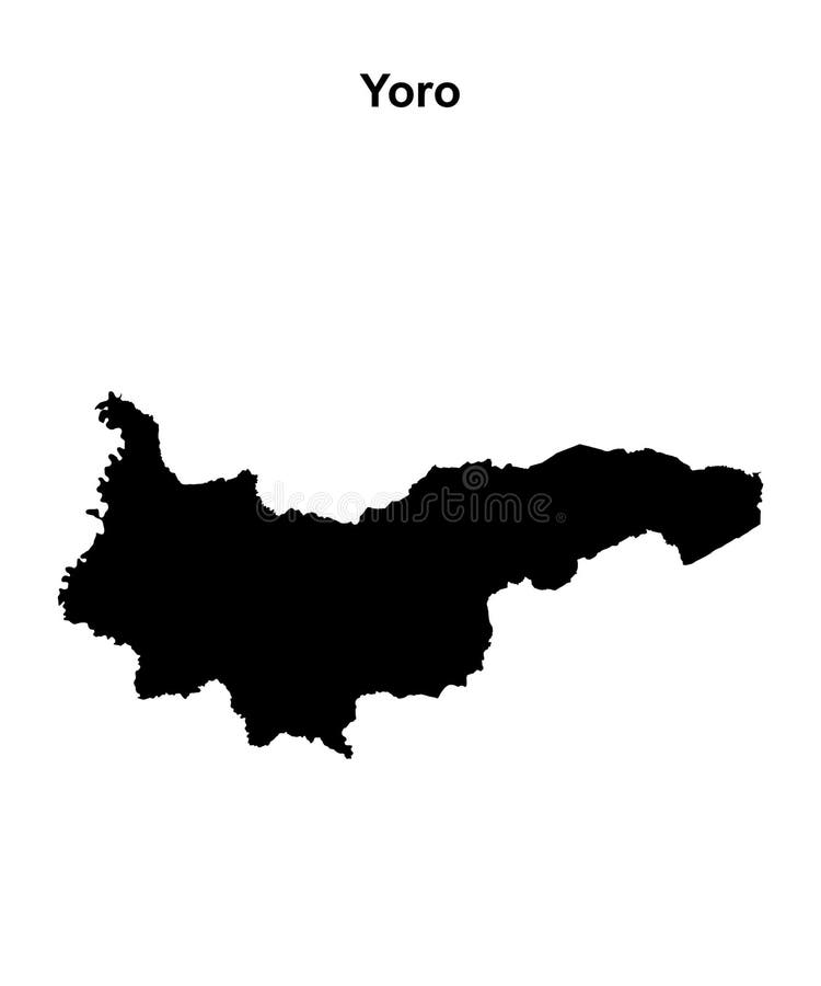
Free with trial Black silhouette map of Yoro Honduras. Yoro map vectors Yoro Honduras silhouette map with transparent background. Black silhouette map of Yoro Honduras
Free with trial Outline map of Yoro Honduras with transparent background. Yoro map vectors Yoro Honduras outline map. Outline map of Yoro Honduras with transparent background
Free with trial Yoro department blank outline map. Yoro map vectors Yoro outline map. Yoro department blank outline map
Free with trial Yoro department blank outline map set. Yoro map vectors Yoro outline map. Yoro department blank outline map set
Free with trial Olanchito city (Republic of Honduras, Yoro Department) map vector illustration, scribble sketch Olanchito map. Yoro map vectors Olanchito city (Republic of Honduras, Yoro Department) map vector illustration
Free with trial El Progreso city (Republic of Honduras, Yoro Department) map vector illustration, scribble sketch El Progreso map,. Yoro map vectors El Progreso city (Republic of Honduras, Yoro Department) map vector illustration, scribble sketch El Progreso map
Free with trial Honduras region silhouettes set and blank map of the country isolated on white background. Vector illustration design. National region silhouettes set Series. Yoro map vectors Honduras region silhouettes set and blank map of the country isolated on white background. Vector illustration design. National region silhouettes set Series
Free with trial Vector regional map of Honduras with departments and administrative divisions, and neighbouring countries and territories. Editable and clearly labeled layers. Yoro map vectors Vector regional map of Honduras with departments and administrative divisions, and neighbouring countries and territories.
Free with trial Vector regional map of Honduras with departments or territories and administrative divisions. Editable and clearly labeled layers. Yoro map vectors Vector regional map of Honduras with departments or territories and administrative divisions.
Free with trial Vector illustrated regional blank map of Honduras with departments and administrative divisions, and neighbouring countries and territories. Editable and clearly labeled layers. Yoro map vectors Vector illustrated regional blank map of Honduras with departments and administrative divisions, and neighbouring countries. Vector illustrated regional blank map of Honduras with departments and administrative divisions, and neighbouring countries and territories. Editable and clearly labeled layers
Free with trial Vector regional blank map of Honduras with departments and administrative divisions, and neighbouring countries and territories. Editable and clearly labeled layers. Yoro map vectors Vector regional blank map of Honduras with departments and administrative divisions, and neighbouring countries and territories.
Free with trial Vector regional blank map of Honduras with departments or territories and administrative divisions. Editable and clearly labeled layers. Yoro map vectors Vector regional blank map of Honduras with departments or territories and administrative divisions.
Free with trial Vector regional blank map of Honduras with departments or territories and administrative divisions. Editable and clearly labeled layers. Yoro map vectors Vector regional blank map of Honduras with departments or territories and administrative divisions.
Free with trial Vector illustrated regional map of Honduras with departments and administrative divisions, and neighbouring countries and territories. Editable and clearly labeled layers. Yoro map vectors Vector illustrated regional map of Honduras with departments and administrative divisions, and neighbouring countries. Vector illustrated regional map of Honduras with departments and administrative divisions, and neighbouring countries and territories. Editable and clearly labeled layers
Free with trial Vector regional map of Honduras with departments or territories and administrative divisions. Editable and clearly labeled layers. Yoro map vectors Vector regional map of Honduras with departments or territories and administrative divisions.
Free with trial Yoro department watercolor map of Honduras illustration. Yoro map illustrations Yoro department watercolor map of Honduras
Free with trial 3d isometric map of Yoro is a province of Honduras isolated with shadow. Yoro map vectors 3d isometric map of Yoro is a province of Honduras
Free with trial Yoro Department Republic of Honduras, Departments of Honduras map vector illustration, scribble sketch Yoro map,. Yoro map vectors Yoro Department Republic of Honduras, Departments of Honduras map vector illustration, scribble sketch Yoro map
Free with trial Yoro Department Republic of Honduras, Departments of Honduras map vector illustration, scribble sketch Yoro map,. Yoro map vectors Yoro Department Republic of Honduras, Departments of Honduras map vector illustration, scribble sketch Yoro map
Free with trial Yoro Department Republic of Honduras, Departments of Honduras map vector illustration, scribble sketch Yoro map,. Yoro map vectors Yoro Department Republic of Honduras, Departments of Honduras map vector illustration, scribble sketch Yoro map
Free with trial Zoom in on Yoro (department of Honduras) outlined. Oblique perspective. Bilevel elevation map with surface waters. 3D rendering. Yoro map illustrations Yoro, Honduras - outlined. Bilevel. Zoom in on Yoro (department of Honduras) outlined. Oblique perspective. Bilevel elevation map with surface waters. 3D rendering
Free with trial Area of Yoro, department of Honduras, isolated on a solid background in a georeferenced bounding box. Labels. Topographic relief map. 3D rendering. Yoro map illustrations Yoro - Honduras. Bounding box. Relief. Area of Yoro, department of Honduras, isolated on a solid background in a georeferenced bounding box. Labels. Topographic relief map. 3D rendering
Free with trial Area of Yoro, department of Honduras, isolated on a solid background in a georeferenced bounding box. Labels. Bilevel elevation map. 3D rendering. Yoro map illustrations Yoro - Honduras. Bounding box. Bilevel. Area of Yoro, department of Honduras, isolated on a solid background in a georeferenced bounding box. Labels. Bilevel elevation map. 3D rendering
Free with trial Shape of Yoro, department of Honduras, with its capital isolated on solid background. Distance scale, region preview and labels. Topographic relief map. 3D rendering. Yoro map illustrations Yoro, department of Honduras, zoomed. Relief. Shape of Yoro, department of Honduras, with its capital isolated on solid background. Distance scale, region preview and labels. Topographic relief map. 3D rendering
Free with trial Shape of Yoro, department of Honduras, with its capital isolated on solid background. Distance scale, region preview and labels. Bilevel elevation map. 3D rendering. Yoro map illustrations Yoro, department of Honduras, zoomed. Bilevel. Shape of Yoro, department of Honduras, with its capital isolated on solid background. Distance scale, region preview and labels. Bilevel elevation map. 3D rendering
Free with trial Shape of Yoro, department of Honduras, and its capital. Distance scale, previews and labels. Topographic relief map. 3D rendering. Yoro map illustrations Yoro, department of Honduras,. Previews. Relief. Shape of Yoro, department of Honduras, and its capital. Distance scale, previews and labels. Topographic relief map. 3D rendering
Free with trial Shape of Yoro, department of Honduras, with its capital isolated on a solid color background. Topographic relief map. 3D rendering. Yoro map illustrations Yoro, department of Honduras, on solid. Relief. Shape of Yoro, department of Honduras, with its capital isolated on a solid color background. Topographic relief map. 3D rendering
Free with trial Shape of Yoro, department of Honduras, with its capital isolated on white background. Topographic relief map. 3D rendering. Yoro map illustrations Yoro, department of Honduras, on white. Relief. Shape of Yoro, department of Honduras, with its capital isolated on white background. Topographic relief map. 3D rendering
Free with trial Desaturated shape of Honduras with its capital, main regional division and the separated Yoro area. Labels. Bilevel elevation map. 3D rendering. Yoro map illustrations Location of Yoro, department of Honduras,. Bilevel. Desaturated shape of Honduras with its capital, main regional division and the separated Yoro area. Labels. Bilevel elevation map. 3D rendering
Free with trial Shape of Yoro, department of Honduras, with its capital isolated on white background. Bilevel elevation map. 3D rendering. Yoro map illustrations Yoro, department of Honduras, on white. Bilevel. Shape of Yoro, department of Honduras, with its capital isolated on white background. Bilevel elevation map. 3D rendering
Free with trial Shape of Yoro, department of Honduras, with its capital isolated on a solid color background. Bilevel elevation map. 3D rendering. Yoro map illustrations Yoro, department of Honduras, on solid. Bilevel. Shape of Yoro, department of Honduras, with its capital isolated on a solid color background. Bilevel elevation map. 3D rendering
Free with trial Area of Yoro, department of Honduras, isolated on a solid background in a georeferenced bounding box. Labels. Colored elevation map. 3D rendering. Yoro map illustrations Yoro - Honduras. Bounding box. Administrative. Area of Yoro, department of Honduras, isolated on a solid background in a georeferenced bounding box. Labels. Colored elevation map. 3D rendering
Free with trial Shape of Yoro, department of Honduras, with its capital isolated on solid background. Distance scale, region preview and labels. Colored elevation map. 3D rendering. Yoro map illustrations Yoro, department of Honduras, zoomed. Administrative. Shape of Yoro, department of Honduras, with its capital isolated on solid background. Distance scale, region preview and labels. Colored elevation map. 3D rendering
Free with trial Desaturated shape of Honduras with its capital, main regional division and the separated Yoro area. Labels. Topographic relief map. 3D rendering. Yoro map illustrations Location of Yoro, department of Honduras,. Relief. Desaturated shape of Honduras with its capital, main regional division and the separated Yoro area. Labels. Topographic relief map. 3D rendering
Free with trial Shape of Yoro, department of Honduras, and its capital. Distance scale, previews and labels. Colored elevation map. 3D rendering. Yoro map illustrations Yoro, department of Honduras,. Previews. Administrative. Shape of Yoro, department of Honduras, and its capital. Distance scale, previews and labels. Colored elevation map. 3D rendering
Free with trial Shape of Yoro, department of Honduras, and its capital. Distance scale, previews and labels. Bilevel elevation map. 3D rendering. Yoro map illustrations Yoro, department of Honduras,. Previews. Bilevel. Shape of Yoro, department of Honduras, and its capital. Distance scale, previews and labels. Bilevel elevation map. 3D rendering
Free with trial Desaturated shape of Honduras with its capital, main regional division and the separated Yoro area. Labels. Colored elevation map. 3D rendering. Yoro map illustrations Location of Yoro, department of Honduras,. Administrative. Desaturated shape of Honduras with its capital, main regional division and the separated Yoro area. Labels. Colored elevation map. 3D rendering
Free with trial Shape of Yoro, department of Honduras, with its capital isolated on white background. Colored elevation map. 3D rendering. Yoro map illustrations Yoro, department of Honduras, on white. Administrative. Shape of Yoro, department of Honduras, with its capital isolated on white background. Colored elevation map. 3D rendering
Free with trial Yoro, department of Honduras. Grayscaled map with lakes and rivers. Shape outlined against its country area. 3D rendering. Yoro map illustrations Yoro, Honduras - outlined. Grayscale. Yoro, department of Honduras. Grayscaled map with lakes and rivers. Shape outlined against its country area. 3D rendering
Free with trial Shape of Yoro, department of Honduras, with its capital isolated on a solid color background. Colored elevation map. 3D rendering. Yoro map illustrations Yoro, department of Honduras, on solid. Administrative. Shape of Yoro, department of Honduras, with its capital isolated on a solid color background. Colored elevation map. 3D rendering
Free with trial Yoro, department of Honduras. Grayscaled map with lakes and rivers. Shape presented against its country area with informative overlays. 3D rendering. Yoro map illustrations Yoro, Honduras - composition. Grayscale. Yoro, department of Honduras. Grayscaled map with lakes and rivers. Shape presented against its country area with informative overlays. 3D rendering
Free with trial Zoom in on Yoro (department of Honduras) extruded. Oblique perspective. Topographic relief map with surface waters. 3D rendering. Yoro map illustrations Yoro, Honduras - extruded with capital. Relief. Zoom in on Yoro (department of Honduras) extruded. Oblique perspective. Topographic relief map with surface waters. 3D rendering
Free with trial Zoom in on Yoro (department of Honduras) outlined. Oblique perspective. Colored and bumped map of the administrative division with surface waters. 3D rendering. Yoro map illustrations Yoro, Honduras - outlined. Administrative. Zoom in on Yoro (department of Honduras) outlined. Oblique perspective. Colored and bumped map of the administrative division with surface waters. 3D rendering
Free with trial Zoom in on Yoro (department of Honduras) outlined. Oblique perspective. Topographic relief map with surface waters. 3D rendering. Yoro map illustrations Yoro, Honduras - outlined. Relief. Zoom in on Yoro (department of Honduras) outlined. Oblique perspective. Topographic relief map with surface waters. 3D rendering
Free with trial Zoom in on Yoro (department of Honduras) extruded. Oblique perspective. Bilevel elevation map with surface waters. 3D rendering. Yoro map illustrations Yoro, Honduras - extruded with capital. Bilevel. Zoom in on Yoro (department of Honduras) extruded. Oblique perspective. Bilevel elevation map with surface waters. 3D rendering
Free with trial Zoom in on Yoro (department of Honduras) extruded. Oblique perspective. Colored and bumped map of the administrative division with surface waters. 3D rendering. Yoro map illustrations Yoro, Honduras - extruded with capital. Administrative. Zoom in on Yoro (department of Honduras) extruded. Oblique perspective. Colored and bumped map of the administrative division with surface waters. 3D rendering
Free with trial Yoro - department of Honduras zoomed and highlighted with capital. Colored and bumped map of the administrative division. 3D rendering. Yoro map illustrations Yoro, Honduras - highlighted with capital. Administrative. Yoro - department of Honduras zoomed and highlighted with capital. Colored and bumped map of the administrative division. 3D rendering
Free with trial Yoro - department of Honduras zoomed and highlighted. Colored and bumped map of the administrative division. 3D rendering. Yoro map illustrations Yoro, Honduras - highlighted. Administrative. Yoro - department of Honduras zoomed and highlighted. Colored and bumped map of the administrative division. 3D rendering
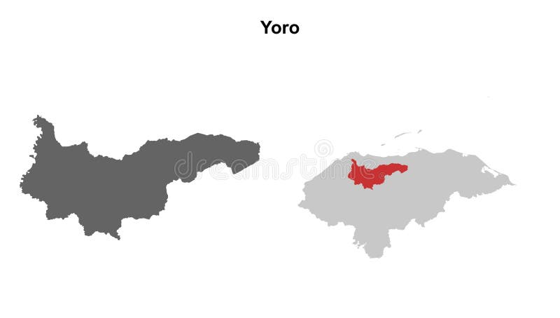
Free with trial Black location map of the Honduran Yoro department inside gray map of Honduras. Yoro map vectors Location map of Yoro department. Black location map of the Honduran Yoro department inside gray map of Honduras
Free with trial Area of Yoro, department of Honduras, isolated on a solid background in a georeferenced bounding box. Labels. Composition of patterned textures. 3D rendering. Yoro map illustrations Yoro - Honduras. Bounding box. Pattern. Area of Yoro, department of Honduras, isolated on a solid background in a georeferenced bounding box. Labels. Composition of patterned textures. 3D rendering
Free with trial Yoro, department of Honduras. Colored shader data with lakes and rivers. Shape presented against its country area with informative overlays. 3D rendering. Yoro map illustrations Yoro, Honduras - composition. Physical. Yoro, department of Honduras. Colored shader data with lakes and rivers. Shape presented against its country area with informative overlays. 3D rendering
Free with trial Area of Yoro, department of Honduras, isolated on a solid background in a georeferenced bounding box. Labels. Satellite imagery. 3D rendering. Yoro map illustrations Yoro - Honduras. Bounding box. Satellite. Area of Yoro, department of Honduras, isolated on a solid background in a georeferenced bounding box. Labels. Satellite imagery. 3D rendering
Free with trial Shape of Yoro, department of Honduras, with its capital isolated on solid background. Distance scale, region preview and labels. Composition of patterned textures. 3D rendering. Yoro map illustrations Yoro, department of Honduras, zoomed. Pattern. Shape of Yoro, department of Honduras, with its capital isolated on solid background. Distance scale, region preview and labels. Composition of patterned textures. 3D rendering
Free with trial Desaturated shape of Honduras with its capital, main regional division and the separated Yoro area. Labels. Composition of patterned textures. 3D rendering. Yoro map illustrations Location of Yoro, department of Honduras,. Pattern. Desaturated shape of Honduras with its capital, main regional division and the separated Yoro area. Labels. Composition of patterned textures. 3D rendering
Free with trial Shape of Yoro, department of Honduras, with its capital isolated on solid background. Distance scale, region preview and labels. Satellite imagery. 3D rendering. Yoro map illustrations Yoro, department of Honduras, zoomed. Satellite. Shape of Yoro, department of Honduras, with its capital isolated on solid background. Distance scale, region preview and labels. Satellite imagery. 3D rendering
Free with trial Shape of Yoro, department of Honduras, with its capital isolated on white background. Composition of patterned textures. 3D rendering. Yoro map illustrations Yoro, department of Honduras, on white. Pattern. Shape of Yoro, department of Honduras, with its capital isolated on white background. Composition of patterned textures. 3D rendering
Free with trial Zoom in on Yoro (department of Honduras) outlined. Oblique perspective. Satellite imagery. 3D rendering. Yoro map illustrations Yoro, Honduras - outlined. Satellite. Zoom in on Yoro (department of Honduras) outlined. Oblique perspective. Satellite imagery. 3D rendering
Free with trial Yoro, department of Honduras. Satellite imagery. Shape outlined against its country area. 3D rendering. Yoro map illustrations Yoro, Honduras - outlined. Satellite. Yoro, department of Honduras. Satellite imagery. Shape outlined against its country area. 3D rendering
Free with trial Desaturated shape of Honduras with its capital, main regional division and the separated Yoro area. Labels. Satellite imagery. 3D rendering. Yoro map illustrations Location of Yoro, department of Honduras,. Satellite. Desaturated shape of Honduras with its capital, main regional division and the separated Yoro area. Labels. Satellite imagery. 3D rendering
Free with trial Shape of Yoro, department of Honduras, with its capital isolated on white background. Satellite imagery. 3D rendering. Yoro map illustrations Yoro, department of Honduras, on white. Satellite. Shape of Yoro, department of Honduras, with its capital isolated on white background. Satellite imagery. 3D rendering
Free with trial Shape of Yoro, department of Honduras, with its capital isolated on a solid color background. Satellite imagery. 3D rendering. Yoro map illustrations Yoro, department of Honduras, on solid. Satellite. Shape of Yoro, department of Honduras, with its capital isolated on a solid color background. Satellite imagery. 3D rendering
Free with trial Yoro - department of Honduras zoomed and highlighted with capital. Main physical landscape features. 3D rendering. Yoro map illustrations Yoro, Honduras - highlighted with capital. Physical. Yoro - department of Honduras zoomed and highlighted with capital. Main physical landscape features. 3D rendering
Free with trial Yoro, department of Honduras. Satellite imagery. Shape presented against its country area with informative overlays. 3D rendering. Yoro map illustrations Yoro, Honduras - composition. Satellite. Yoro, department of Honduras. Satellite imagery. Shape presented against its country area with informative overlays. 3D rendering
Free with trial Map of Mongolia administrative regions departments with icons. Map location pin, arrow, looking glass, signboard, man, bicycle, car, airplane, house. Royalty free outline Mongolian vector map. Yoro map vectors Map of Mongolia administrative regions departments, icons. Map location pin, arrow, man, bicycle, car, airplane. Map of Mongolia administrative regions departments with icons. Map location pin, arrow, looking glass, signboard, man, bicycle, car, airplane, house. Royalty free outline Mongolian vector map
Free with trial Shape of Yoro, department of Honduras, and its capital. Distance scale, previews and labels. Satellite imagery. 3D rendering. Yoro map illustrations Yoro, department of Honduras,. Previews. Satellite. Shape of Yoro, department of Honduras, and its capital. Distance scale, previews and labels. Satellite imagery. 3D rendering
Free with trial Honduras higt detailed map with subdivisions. Administrative map of Honduras with districts and cities name, colored by states and administrative districts. Vector illustration. Yoro map vectors Honduras higt detailed map with subdivisions. Administrative map of Honduras with districts and cities name, colored by states and
Free with trial Yoro, department of Honduras. Patterned solids with lakes and rivers. Shape presented against its country area with informative overlays. 3D rendering. Yoro map illustrations Yoro, Honduras - composition. Pattern. Yoro, department of Honduras. Patterned solids with lakes and rivers. Shape presented against its country area with informative overlays. 3D rendering
Free with trial Shape of Yoro, department of Honduras, with its capital isolated on a solid color background. Composition of patterned textures. 3D rendering. Yoro map illustrations Yoro, department of Honduras, on solid. Pattern. Shape of Yoro, department of Honduras, with its capital isolated on a solid color background. Composition of patterned textures. 3D rendering
Free with trial Yoro, department of Honduras. Colored relief with lakes and rivers. Shape presented against its country area with informative overlays. 3D rendering. Yoro map illustrations Yoro, Honduras - composition. Relief. Yoro, department of Honduras. Colored relief with lakes and rivers. Shape presented against its country area with informative overlays. 3D rendering
Free with trial Zoom in on Yoro (department of Honduras) extruded. Oblique perspective. Satellite imagery. 3D rendering. Yoro map illustrations Yoro, Honduras - extruded with capital. Satellite. Zoom in on Yoro (department of Honduras) extruded. Oblique perspective. Satellite imagery. 3D rendering
Free with trial 3D Buildings Rendering Yoro Honduras HD satellite image nice zoom in view. Yoro map illustrations 3D Buildings Rendering Yoro Honduras HD satellite image
Free with trial Yoro, department of Honduras. Colored relief with lakes and rivers. Shape outlined against its country area. 3D rendering. Yoro map illustrations Yoro, Honduras - outlined. Relief. Yoro, department of Honduras. Colored relief with lakes and rivers. Shape outlined against its country area. 3D rendering
Free with trial Yoro, department of Honduras. Sentinel-2 satellite imagery. Shape isolated on solid background with informative overlays. Contains modified Copernicus Sentinel data. Yoro map illustrations Yoro, Honduras - composition. Sentinel-2 satellite. Yoro, department of Honduras. Sentinel-2 satellite imagery. Shape isolated on solid background with informative overlays. Contains modified Copernicus Sentinel data
Free with trial Yoro - department of Honduras zoomed and highlighted. Main physical landscape features. 3D rendering. Yoro map illustrations Yoro, Honduras - highlighted. Physical. Yoro - department of Honduras zoomed and highlighted. Main physical landscape features. 3D rendering
Free with trial Map of Honduras administrative regions departments with icons. Map location pin, arrow, looking glass, signboard, man, bicycle, car, airplane, house. Royalty free outline Hondurans vector map. Yoro map vectors Map of Honduras administrative regions departments, icons. Map location pin, arrow, man, bicycle, car, airplane. Map of Honduras administrative regions departments with icons. Map location pin, arrow, looking glass, signboard, man, bicycle, car, airplane, house. Royalty free outline Hondurans vector map
Free with trial Yoro - department of Honduras zoomed and highlighted. Satellite imagery. 3D rendering. Yoro map illustrations Yoro, Honduras - highlighted. Satellite. Yoro - department of Honduras zoomed and highlighted. Satellite imagery. 3D rendering