
Royalty-Free Stock Photo

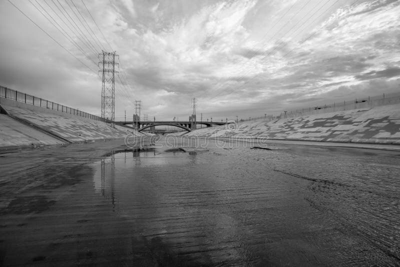
Los Angeles River flood control channel airplane view. An aerial view of the L. A. River that was channelized by the Army Corps of Engineers. Interstate 710 runs along the river, which empties into the Pacific Ocean in Long Beach, California.
Exclusively on Dreamstime
- ?
$62.50USD
$150.00USD
$250.00USD
Size MAX
4928x3280px •
16.4" x 10.9" • @300dpi •
18MB • jpg
Author credit line
Image keywords
Related searches
-
Channel Flood
-
Discharge Channel
-
Outer Underground
-
Underground Discharge Channel
-
Metropolitan Area
-
California Floods
-
San Francisco
-
Southern California
-
Sacramento River
-
Salt Marshes
-
View Corps
-
Abiquiu Lake
-
Northern New Mexico
-
New Mexico
-
Panoramic View
-
Los Angeles Flood
-
Water
-
Urban
-
Angeles Contemporary Art Museum
-
Natural Disasters
-
California Corps
-
Marine Corps
-
US Marines
-
Air Station
-
Camp Pendleton
-
Army Ocean
-
Sunny Days
More similar stock images


More stock photos from Stevehymon's portfolio


