Free with trial Durpin or Zang Palri Frodong Monastery located in Kalimpong India. Durpin stock images, royalty-free photos and pictures Durpin Monastery. Durpin or Zang Palri Frodong Monastery located in Kalimpong India.
Free with trial Zang Dhok Palri Monastery, Buddhist monastery situated atop Durpin Dara Hill in the beautiful hill town of Kalimpong, West Bengal. Popularly called as Durpin Monastery, a popular tourist destination in West Bengal, India. Durpin stock images, royalty-free photos and pictures A view of the colorful Zang Dhok Palri Monastery in Kalimpong. Zang Dhok Palri Monastery, Buddhist monastery situated atop Durpin Dara Hill in the beautiful hill town of Kalimpong, West Bengal. Popularly called as Durpin Monastery, a popular tourist destination in West Bengal, India
Free with trial An aerial view of the Teesta river, carves out ravines and gorges. View from Durpin dara- Kalimpong. Durpin stock images, royalty-free photos and pictures An aerial view of the Teesta river, ravines and gorges. An aerial view of the Teesta river, carves out ravines and gorges. View from Durpin dara- Kalimpong.
Free with trial Zang Dhok Palri Monastery, Buddhist monastery situated atop Durpin Dara Hill in the beautiful hill town of Kalimpong, West Bengal. Popularly called as Durpin Monastery, a popular tourist destination in West Bengal, India. Durpin stock images, royalty-free photos and pictures A view of the colorful Zang Dhok Palri Monastery in Kalimpong. Zang Dhok Palri Monastery, Buddhist monastery situated atop Durpin Dara Hill in the beautiful hill. Zang Dhok Palri Monastery, Buddhist monastery situated atop Durpin Dara Hill in the beautiful hill town of Kalimpong, West Bengal. Popularly called as Durpin Monastery, a popular tourist destination in West Bengal, India
Free with trial The Panoramic view of the Himalayan river Teesta, gorge, and river trail from Durpin dara- Kalimpong. Durpin stock images, royalty-free photos and pictures Panoramic view river Teesta, view from Durpin dara- Kalimpong. The Panoramic view of the Himalayan river Teesta, gorge, and river trail from Durpin dara- Kalimpong.
Free with trial The Panoramic view of the Himalayan river Teesta, gorge, and river trail from Durpin dara- Kalimpong. Durpin stock images, royalty-free photos and pictures Panoramic view river Teesta, view from Durpin dara- Kalimpong. The Panoramic view of the Himalayan river Teesta, gorge, and river trail from Durpin dara- Kalimpong.
Free with trial The mystique view of himalayan river Teesta, gorge and river trail from Durpin dara- Kalimpong. Durpin stock images, royalty-free photos and pictures Beautiful river Teesta, view from Durpin dara- Kalimpong. The mystique view of himalayan river Teesta, gorge and river trail from Durpin dara- Kalimpong.
Free with trial Durpin Monastery where108 volumes the kangyur is kept, also known as the Zang Dhok palri monastery ,it was established in 1970 by Dudjum Rinpoche and was consecrated by His Holiness. Indian army has a halipad near to this monastery. Guru Dali Lama twice visited this place. Durpin stock images, royalty-free photos and pictures Durpin Monastery where108 volumes the kangyur is kept, also known as the Zang Dhok palri monastery . Durpin Monastery where108 volumes the kangyur is kept, also known as the Zang Dhok palri monastery ,it was established in 1970 by Dudjum Rinpoche and was consecrated by His Holiness. Indian army has a halipad near to this monastery.Guru Dali Lama twice visited this place.
Free with trial A nicely build monastery named Durpin monastery with its colorful and scenic architecture. It is also known as Haridasan mk. It is in Kalimpong, West Bengal, India. Durpin stock images, royalty-free photos and pictures Durpin Monastery a buddhist temple situated in kalimpong. A nicely build monastery named Durpin monastery with its colorful and scenic architecture. It is also known as Haridasan mk. It is in Kalimpong, West Bengal, India
Free with trial The majestic grandeur view of Mount Kanchenjunga from Durpin dara- Kalimpong. Durpin stock images, royalty-free photos and pictures The majestic grandeur view of Mount Kanchenjunga
Free with trial The majestic grandeur view of Mount Kanchenjunga from Durpin dara- Kalimpong. Durpin stock images, royalty-free photos and pictures The majestic grandeur view of Mount Kanchenjunga
Free with trial The mystique view of himalayan mountain, view from Durpin dara- Kalimpong. Durpin stock images, royalty-free photos and pictures The mystique view of himalayan mountain, Durpin dara- Kalimpong. The mystique view of himalayan mountain, view from Durpin dara- Kalimpong.
Free with trial Zang Dhok Palri Monastery, Buddhist monastery situated atop Durpin Dara Hill in the beautiful hill town of Kalimpong, West Bengal. Popularly called as Durpin Monastery, a popular tourist destination in West Bengal, India. Durpin stock images, royalty-free photos and pictures A view of the colorful Zang Dhok Palri Monastery in Kalimpong. Zang Dhok Palri Monastery, Buddhist monastery situated atop Durpin Dara Hill in the beautiful hill town of Kalimpong, West Bengal. Popularly called as Durpin Monastery, a popular tourist destination in West Bengal, India
Free with trial If you are planning a quest to discover the lesser-known parts of the Himalayas, Darjeelig is one of the places that will take your breath away with their natural charm. Each view will remember you the picture you have seen in calendar. Teesta River is a 315 km long river that rises in the eastern Himalayas, flows through the Indian states of Sikkim and West Bengal through Bangladesh and enters the Bay of Bengal. It drains an area of 12,540 km². It forms the border between Sikkim and West Bengal. Delo Hill is one of the two hills that the town of Kalimpong stands between. Kalimpong is situated on a ridge connecting the two hills, Durpin and Delo. The hill is 1,704 metres 5,590 feet above msl and is the highest point of Kalimpong town. The hill is located north east of the town. Three water reservoirs, two of which serve as the primary drinking water source to the town are present atop this hill. The town of Kalimpong, the surrounding villages of Relli valley, Teesta River and its valleys all can be viewed from this point. Durpin stock images, royalty-free photos and pictures Cottages in Silk Road India. If you are planning a quest to discover the lesser-known parts of the Himalayas, Darjeelig is one of the places that will take your breath away with their natural charm. Each view will remember you the picture you have seen in calendar. Teesta River is a 315 km long river that rises in the eastern Himalayas, flows through the Indian states of Sikkim and West Bengal through Bangladesh and enters the Bay of Bengal. It drains an area of 12,540 km². It forms the border between Sikkim and West Bengal. Delo Hill is one of the two hills that the town of Kalimpong stands between. Kalimpong is situated on a ridge connecting the two hills, Durpin and Delo. The hill is 1,704 metres 5,590 feet above msl and is the highest point of Kalimpong town. The hill is located north east of the town. Three water reservoirs, two of which serve as the primary drinking water source to the town are present atop this hill. The town of Kalimpong, the surrounding villages of Relli valley, Teesta River and its valleys all can be viewed from this point.
Free with trial If you are planning a quest to discover the lesser-known parts of the Himalayas, Darjeelig is one of the places that will take your breath away with their natural charm. Each view will remember you the picture you have seen in calendar. Teesta River is a 315 km long river that rises in the eastern Himalayas, flows through the Indian states of Sikkim and West Bengal through Bangladesh and enters the Bay of Bengal. It drains an area of 12,540 km². It forms the border between Sikkim and West Bengal. Delo Hill is one of the two hills that the town of Kalimpong stands between. Kalimpong is situated on a ridge connecting the two hills, Durpin and Delo. The hill is 1,704 metres 5,590 feet above msl and is the highest point of Kalimpong town. The hill is located north east of the town. Three water reservoirs, two of which serve as the primary drinking water source to the town are present atop this hill. The town of Kalimpong, the surrounding villages of Relli valley, Teesta River and its valleys all can be viewed from this point. Durpin stock images, royalty-free photos and pictures Beautiful Himalaya.. View from Dello Hill Top. If you are planning a quest to discover the lesser-known parts of the Himalayas, Darjeelig is one of the places that will take your breath away with their natural charm. Each view will remember you the picture you have seen in calendar. Teesta River is a 315 km long river that rises in the eastern Himalayas, flows through the Indian states of Sikkim and West Bengal through Bangladesh and enters the Bay of Bengal. It drains an area of 12,540 km². It forms the border between Sikkim and West Bengal. Delo Hill is one of the two hills that the town of Kalimpong stands between. Kalimpong is situated on a ridge connecting the two hills, Durpin and Delo. The hill is 1,704 metres 5,590 feet above msl and is the highest point of Kalimpong town. The hill is located north east of the town. Three water reservoirs, two of which serve as the primary drinking water source to the town are present atop this hill. The town of Kalimpong, the surrounding villages of Relli valley, Teesta River and its valleys all can be viewed from this point.
Free with trial If you are planning a quest to discover the lesser-known parts of the Himalayas, Darjeelig is one of the places that will take your breath away with their natural charm. Each view will remember you the picture you have seen in calendar. Teesta River is a 315 km long river that rises in the eastern Himalayas, flows through the Indian states of Sikkim and West Bengal through Bangladesh and enters the Bay of Bengal. It drains an area of 12,540 km². It forms the border between Sikkim and West Bengal. Delo Hill is one of the two hills that the town of Kalimpong stands between. Kalimpong is situated on a ridge connecting the two hills, Durpin and Delo. The hill is 1,704 metres 5,590 feet above msl and is the highest point of Kalimpong town. The hill is located north east of the town. Three water reservoirs, two of which serve as the primary drinking water source to the town are present atop this hill. The town of Kalimpong, the surrounding villages of Relli valley, Teesta River and its valleys all can be viewed from this point. Durpin stock images, royalty-free photos and pictures Beautiful Himalaya.. View from Dello Hill Top. If you are planning a quest to discover the lesser-known parts of the Himalayas, Darjeelig is one of the places that will take your breath away with their natural charm. Each view will remember you the picture you have seen in calendar. Teesta River is a 315 km long river that rises in the eastern Himalayas, flows through the Indian states of Sikkim and West Bengal through Bangladesh and enters the Bay of Bengal. It drains an area of 12,540 km². It forms the border between Sikkim and West Bengal. Delo Hill is one of the two hills that the town of Kalimpong stands between. Kalimpong is situated on a ridge connecting the two hills, Durpin and Delo. The hill is 1,704 metres 5,590 feet above msl and is the highest point of Kalimpong town. The hill is located north east of the town. Three water reservoirs, two of which serve as the primary drinking water source to the town are present atop this hill. The town of Kalimpong, the surrounding villages of Relli valley, Teesta River and its valleys all can be viewed from this point.
Free with trial If you are planning a quest to discover the lesser-known parts of the Himalayas, Darjeelig is one of the places that will take your breath away with their natural charm. Each view will remember you the picture you have seen in calendar. Teesta River is a 315 km long river that rises in the eastern Himalayas, flows through the Indian states of Sikkim and West Bengal through Bangladesh and enters the Bay of Bengal. It drains an area of 12,540 km². It forms the border between Sikkim and West Bengal. Delo Hill is one of the two hills that the town of Kalimpong stands between. Kalimpong is situated on a ridge connecting the two hills, Durpin and Delo. The hill is 1,704 metres 5,590 feet above msl and is the highest point of Kalimpong town. The hill is located north east of the town. Three water reservoirs, two of which serve as the primary drinking water source to the town are present atop this hill. The town of Kalimpong, the surrounding villages of Relli valley, Teesta River and its valleys all can be viewed from this point. Durpin stock images, royalty-free photos and pictures View from Dello Hill Top. If you are planning a quest to discover the lesser-known parts of the Himalayas, Darjeelig is one of the places that will take your breath away with their natural charm. Each view will remember you the picture you have seen in calendar. Teesta River is a 315 km long river that rises in the eastern Himalayas, flows through the Indian states of Sikkim and West Bengal through Bangladesh and enters the Bay of Bengal. It drains an area of 12,540 km². It forms the border between Sikkim and West Bengal. Delo Hill is one of the two hills that the town of Kalimpong stands between. Kalimpong is situated on a ridge connecting the two hills, Durpin and Delo. The hill is 1,704 metres 5,590 feet above msl and is the highest point of Kalimpong town. The hill is located north east of the town. Three water reservoirs, two of which serve as the primary drinking water source to the town are present atop this hill. The town of Kalimpong, the surrounding villages of Relli valley, Teesta River and its valleys all can be viewed from this point.
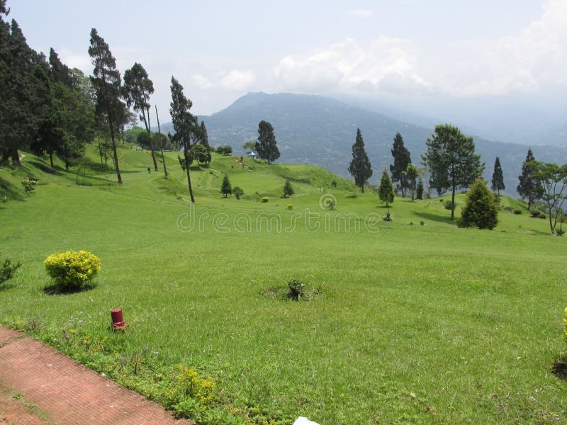
Free with trial Located among the hilly terrains of Durpin Dara, lies the 18 hole Army golf course maintained by the Indian Army stationed at Kalimpong in West Bengal. ... Army Golf Course lies on the way to the famous Durpin Monastery also known as Zang Dog Palri Monastery. Durpin stock images, royalty-free photos and pictures The Kalimpong, WB, Golf course. Located among the hilly terrains of Durpin Dara, lies the 18 hole Army golf course maintained by the Indian Army stationed at Kalimpong in West Bengal. ... Army Golf Course lies on the way to the famous Durpin Monastery also known as Zang Dog Palri Monastery.
Free with trial If you are planning a quest to discover the lesser-known parts of the Himalayas, Darjeelig is one of the places that will take your breath away with their natural charm. Each view will remember you the picture you have seen in calendar. Teesta River is a 315 km long river that rises in the eastern Himalayas, flows through the Indian states of Sikkim and West Bengal through Bangladesh and enters the Bay of Bengal. It drains an area of 12,540 km². It forms the border between Sikkim and West Bengal. Delo Hill is one of the two hills that the town of Kalimpong stands between. Kalimpong is situated on a ridge connecting the two hills, Durpin and Delo. The hill is 1,704 metres 5,590 feet above msl and is the highest point of Kalimpong town. The hill is located north east of the town. Three water reservoirs, two of which serve as the primary drinking water source to the town are present atop this hill. The town of Kalimpong, the surrounding villages of Relli valley, Teesta River and its valleys all can be viewed from this point. Durpin stock images, royalty-free photos and pictures Beautiful Himalaya.. View from Dello Hill Top. If you are planning a quest to discover the lesser-known parts of the Himalayas, Darjeelig is one of the places that will take your breath away with their natural charm. Each view will remember you the picture you have seen in calendar. Teesta River is a 315 km long river that rises in the eastern Himalayas, flows through the Indian states of Sikkim and West Bengal through Bangladesh and enters the Bay of Bengal. It drains an area of 12,540 km². It forms the border between Sikkim and West Bengal. Delo Hill is one of the two hills that the town of Kalimpong stands between. Kalimpong is situated on a ridge connecting the two hills, Durpin and Delo. The hill is 1,704 metres 5,590 feet above msl and is the highest point of Kalimpong town. The hill is located north east of the town. Three water reservoirs, two of which serve as the primary drinking water source to the town are present atop this hill. The town of Kalimpong, the surrounding villages of Relli valley, Teesta River and its valleys all can be viewed from this point.
Free with trial If you are planning a quest to discover the lesser-known parts of the Himalayas, Darjeelig is one of the places that will take your breath away with their natural charm. Each view will remember you the picture you have seen in calendar. Teesta River is a 315 km long river that rises in the eastern Himalayas, flows through the Indian states of Sikkim and West Bengal through Bangladesh and enters the Bay of Bengal. It drains an area of 12,540 km². It forms the border between Sikkim and West Bengal. Delo Hill is one of the two hills that the town of Kalimpong stands between. Kalimpong is situated on a ridge connecting the two hills, Durpin and Delo. The hill is 1,704 metres 5,590 feet above msl and is the highest point of Kalimpong town. The hill is located north east of the town. Three water reservoirs, two of which serve as the primary drinking water source to the town are present atop this hill. The town of Kalimpong, the surrounding villages of Relli valley, Teesta River and its valleys all can be viewed from this point. Durpin stock images, royalty-free photos and pictures Beautiful Himalaya.. View from Dello Hill Top. If you are planning a quest to discover the lesser-known parts of the Himalayas, Darjeelig is one of the places that will take your breath away with their natural charm. Each view will remember you the picture you have seen in calendar. Teesta River is a 315 km long river that rises in the eastern Himalayas, flows through the Indian states of Sikkim and West Bengal through Bangladesh and enters the Bay of Bengal. It drains an area of 12,540 km². It forms the border between Sikkim and West Bengal. Delo Hill is one of the two hills that the town of Kalimpong stands between. Kalimpong is situated on a ridge connecting the two hills, Durpin and Delo. The hill is 1,704 metres 5,590 feet above msl and is the highest point of Kalimpong town. The hill is located north east of the town. Three water reservoirs, two of which serve as the primary drinking water source to the town are present atop this hill. The town of Kalimpong, the surrounding villages of Relli valley, Teesta River and its valleys all can be viewed from this point.
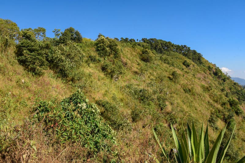
Free with trial Deforestation and landslide on hill slope, in the Himalayan Mountains, view from Durpin dara- Kalimpong. Durpin stock images, royalty-free photos and pictures Deforestation and landslide on hill slope, in the Himalayan mountain