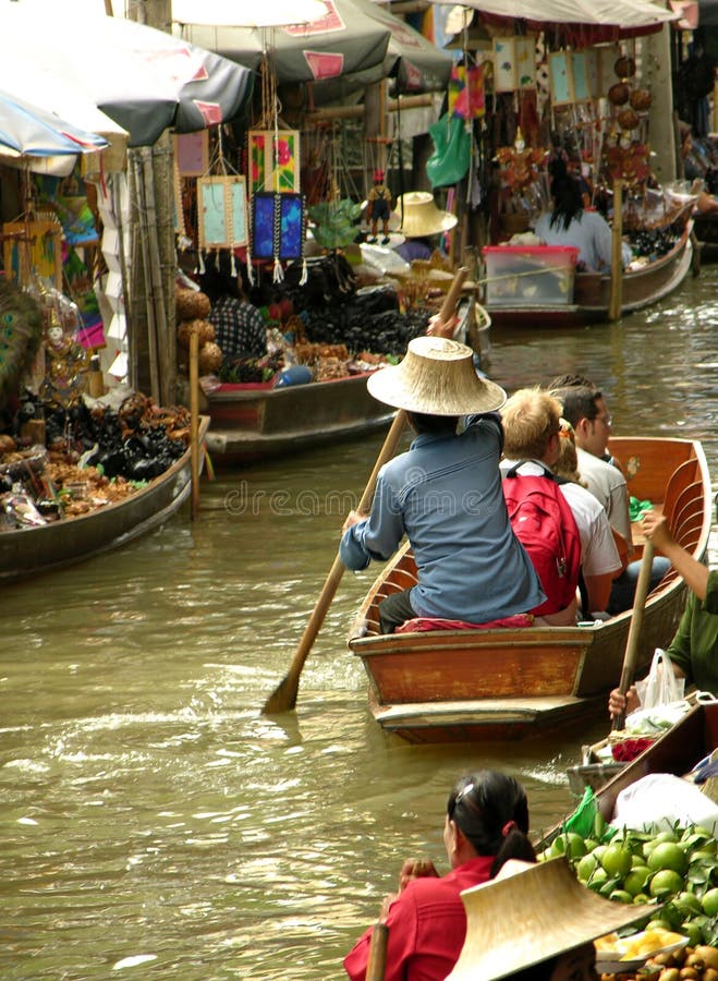
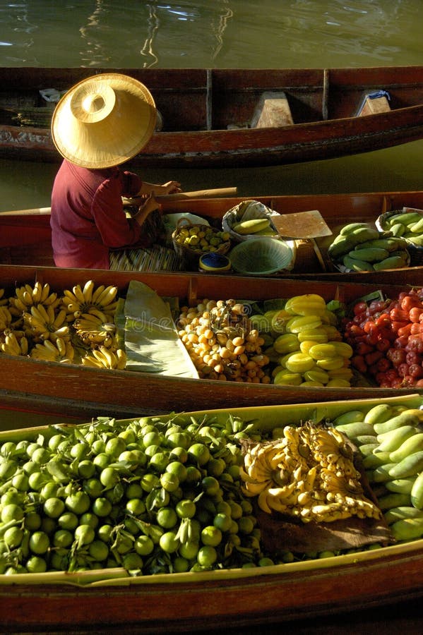
Free with trial The Damnoen Saduak Floating Market is located at Damnoen Saduak District, Ratchaburi Province, about 85 kms from Bangkok, Thailand. According to history around 1866 King Rama IV ordered that a 32 kms long canal be dug at Damnoen Saduak. This canal would connect the Mae Klong River with the Tacheen River. King ferry stock images, royalty-free photos and pictures Floating Market
Free with trial Orange tropical frog wearing a crown on a white background. King ferry stock images, royalty-free photos and pictures Orange Frog. Orange tropical frog wearing a crown on a white background
Free with trial The Damnoen Saduak Floating Market is located at Damnoen Saduak District, Ratchaburi Province, about 85 kms from Bangkok, Thailand. According to history around 1866 King Rama IV ordered that a 32 kms long canal be dug at Damnoen Saduak. This canal would connect the Mae Klong River with the Tacheen River. King ferry stock images, royalty-free photos and pictures Old Floating Market. The Damnoen Saduak Floating Market is located at Damnoen Saduak District, Ratchaburi Province, about 85 kms from Bangkok, Thailand. According to history around 1866 King Rama IV ordered that a 32 kms long canal be dug at Damnoen Saduak. This canal would connect the Mae Klong River with the Tacheen River.
Free with trial Orange frog facing with a crown the camera on a white background. King ferry stock images, royalty-free photos and pictures Orange Frog on White. Orange frog facing with a crown the camera on a white background
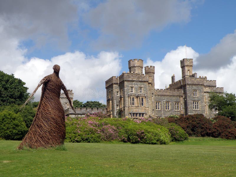
Free with trial Stornoway Castle Grounds has various mountain bike routes and trails along. surrounded by trees, wildlife and oversized carvings of the Lewis Chess Men. King ferry stock images, royalty-free photos and pictures The King, Stornoway, Isle of Lewis. Stornoway Castle Grounds has various mountain bike routes and trails along . surrounded by trees, wildlife and oversized carvings of the Lewis Chess Men.
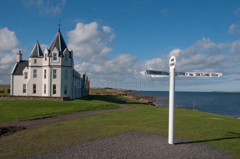
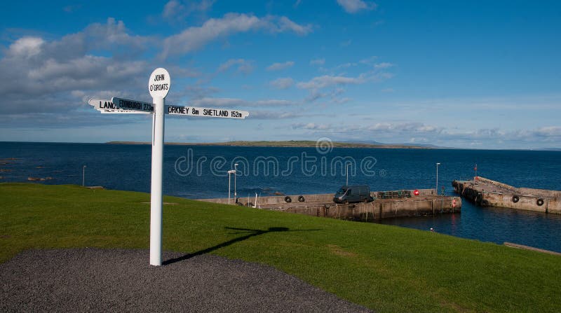
Free with trial John O' Groats Hotel and new Signpost, John O' Groats Hotel, Caithness, Scotland, UK. John O'Groats is well worth a visit. Simply, the peace and quietness here, coupled with the sounds of the Ocean, means this place is one of those spots where you can feel the world around you and just take it all in. Local legend has that the "o' Groats" refers to John's charge of one groat for use of his ferry, but it actually derives from the Dutch de groot, meaning "the large". People from John o' Groats are known as "Groaters". The settlement takes its name from Jan de Groot, a Dutchman who once plied a ferry from the Scottish mainland to Orkney, which had recently been acquired from Norway by King James IV. The name John o' Groats has a particular resonance because it is often used as a starting or ending point for cycles, walks and charitable events to and from Land's End (at the extreme south-western tip of the Cornish peninsula in England). The phrase Land's End to John o' Groats is frequently heard both as a literal journey (being the longest possible in Great Britain) and as a metaphor for great or all-encompassing. King ferry stock images, royalty-free photos and pictures John O' Groats Hotel and new Signpost, John O' Groats Hotel, Caithness, Scotland, UK. John O' Groats Hotel and new Signpost, John O' Groats Hotel, Caithness, Scotland, UK. John O'Groats is well worth a visit. Simply, the peace and quietness here, coupled with the sounds of the Ocean, means this place is one of those spots where you can feel the world around you and just take it all in. Local legend has that the "o' Groats" refers to John's charge of one groat for use of his ferry, but it actually derives from the Dutch de groot, meaning "the large". People from John o' Groats are known as "Groaters". The settlement takes its name from Jan de Groot, a Dutchman who once plied a ferry from the Scottish mainland to Orkney, which had recently been acquired from Norway by King James IV. Local legend has that the "o' Groats" refers to John's charge of one groat for use of his ferry, but it actually derives from the Dutch de groot, meaning "the large". People from John o' Groats are known as "Groaters". The name John o' Groats has a particular resonance because it is often used as a starting or ending point for cycles, walks and charitable events to and from Land's End (at the extreme south-western tip of the Cornish peninsula in England). The phrase Land's End to John o' Groats is frequently heard both as a literal journey (being the longest possible in Great Britain) and as a metaphor for great or all-encompassing
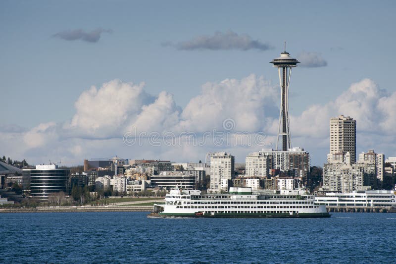
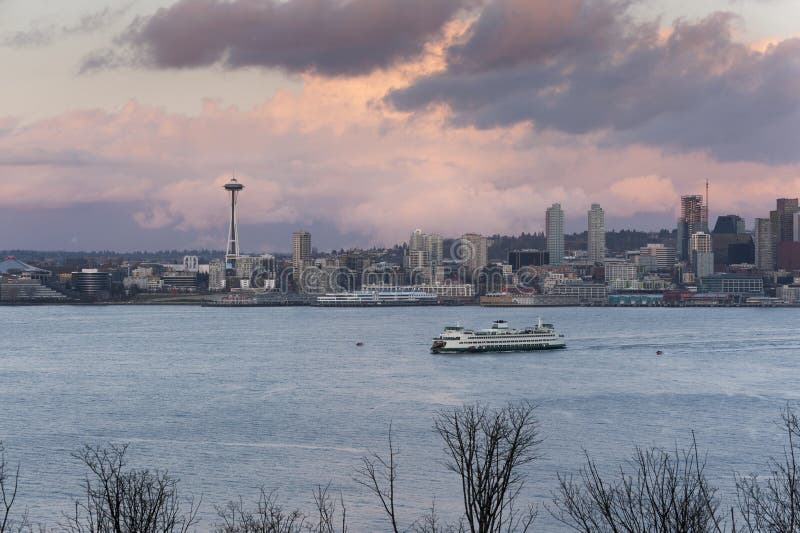
Free with trial A ferryboat passes by the Seattle waterfront on the way to Bainbridge Island on a lovely spring day. The historic Space Needle can be seen in the background. King ferry stock images, royalty-free photos and pictures Seattle Waterfront
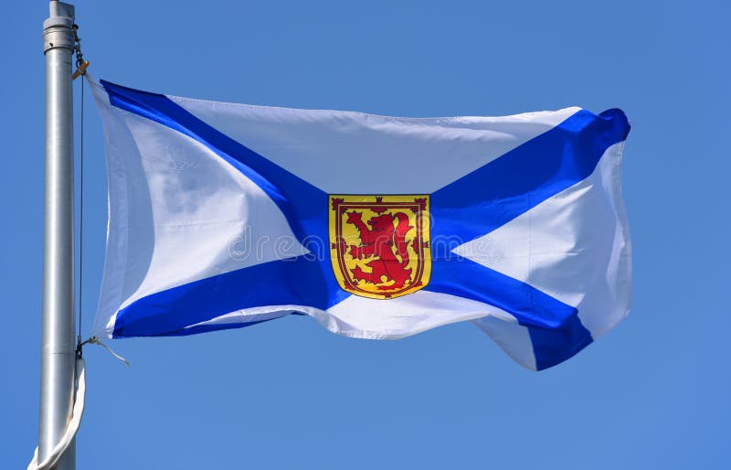
Free with trial Flag of Nova Scotia province on blue sky. Photo taken in Grand Pre in Nova Scotia, Canada. King ferry stock images, royalty-free photos and pictures Flag of Nova Scotia province of Canada. Flag of Nova Scotia province on blue sky. Photo taken in Grand Pre in Nova Scotia, Canada.
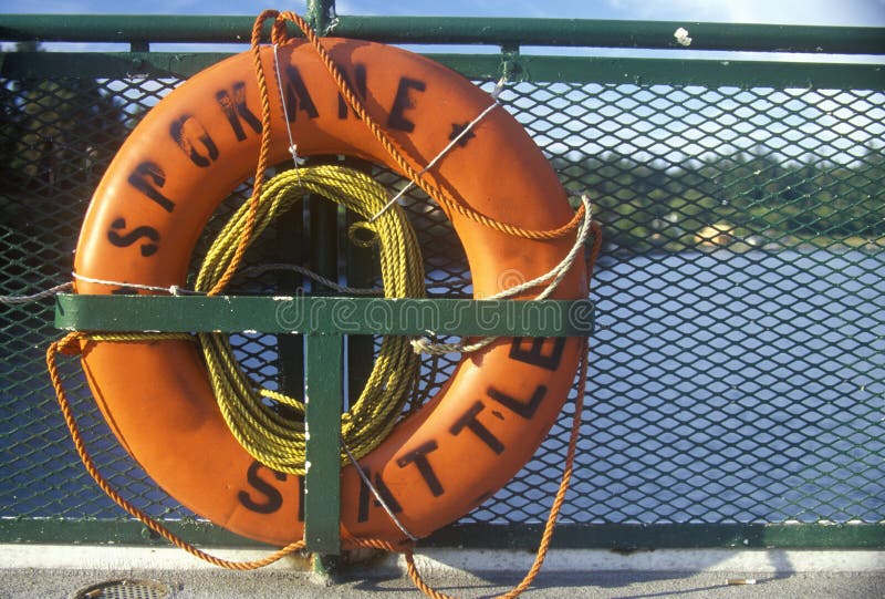
Free with trial Life preserver on board ferry to Bainbridge Island, WA. King ferry stock images, royalty-free photos and pictures Life preserver on board ferry to Bainbridge Island, WA
Free with trial Life preserver on board ferry to Bainbridge Island, WA. King ferry stock images, royalty-free photos and pictures Life preserver on board ferry to Bainbridge Island, WA
Free with trial Life preserver on board ferry to Bainbridge Island, WA. King ferry stock images, royalty-free photos and pictures Life preserver on board ferry to Bainbridge Island, WA
Free with trial Indoor stall with assorted mushrooms for sale at Ferry Plaza Farmer`s Market in San Francisco. King ferry stock images, royalty-free photos and pictures Assorted mushrooms for sale at Ferry Plaza Farmer`s Market in San Francisco
Free with trial King John`s Castle on Carlingford Lough County Louth Ireland. King ferry stock images, royalty-free photos and pictures King John`s Castle on Carlingford Lough County Louth Ireland
Free with trial Statue of King of Fame riding Pegasus on the Place de la Concorde with ferris wheel at background, Paris, France. King ferry stock images, royalty-free photos and pictures Statue of King of Fame riding Pegasus on the Place de la Concorde with ferris wheel, Paris, France
Free with trial Statue of King of Fame riding Pegasus on the Place de la Concorde with ferris wheel at background, Paris, France. King ferry stock images, royalty-free photos and pictures Statue of King of Fame riding Pegasus on the Place de la Concorde with ferris wheel, Paris, France
Free with trial Woman passenger on the Port Townsend Ferry in Washington State stands with her arms up and back to the camera as the boat sails across Puget Sound. King ferry stock images, royalty-free photos and pictures Woman passenger on the Port Townsend Ferry in Washington State stands with her arms up and back to the camera as the boat sails
Free with trial Statue of King of Fame riding Pegasus on the Place de la Concorde with ferris wheel at background, Paris, France. King ferry stock images, royalty-free photos and pictures Statue of King of Fame riding Pegasus on the Place de la Concorde with ferris wheel, Paris, France
Free with trial Statue of King of Fame riding Pegasus on the Place de la Concorde with ferris wheel at background in Paris, France. King ferry stock images, royalty-free photos and pictures Statue of King of Fame riding Pegasus on the Place de la Concorde with ferris wheel at background, Paris, France
Free with trial Statue of King of Fame riding Pegasus on the Place de la Concorde with ferris wheel at background in Paris, France. King ferry stock images, royalty-free photos and pictures Statue of King of Fame riding Pegasus on the Place de la Concorde with ferris wheel at background, Paris, France
Free with trial Statue of King of Fame riding Pegasus on the Place de la Concorde with ferris wheel and Eiffel tower at background, Paris, France. King ferry stock images, royalty-free photos and pictures Statue of King of Fame riding Pegasus on the Place de la Concorde with ferris wheel and Eiffel tower at background, Paris, France
Free with trial Aerial photo of Carlingford Ferry and Lough County Louth on the Irish Sea Ireland 06-06-22. King ferry stock images, royalty-free photos and pictures Aerial photo of Carlingford Ferry Lough County Louth on the Irish Sea Ireland
Free with trial Aerial photo of Carlingford Ferry and Lough County Louth on the Irish Sea Ireland 06-06-22. King ferry stock images, royalty-free photos and pictures Aerial photo of Carlingford Ferry Lough County Louth on the Irish Sea Ireland
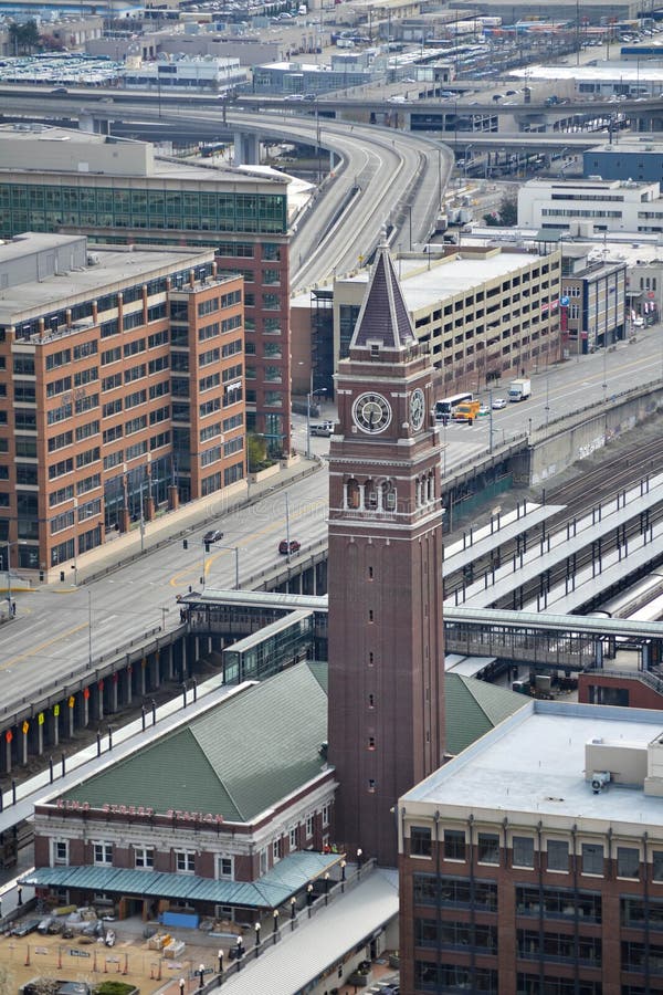
Free with trial View of King Street Station clock in Seattle from the Smith Tower observation deck. March 2013. King ferry stock images, royalty-free photos and pictures King Street Station - View from Smith Tower observation deck, Seattle, Washington. View of King Street Station clock in Seattle from the Smith Tower observation deck. March 2013.
Free with trial Seattle - October 30, 2023 Washington State ferry MV Kittitas at Fauntleroy dock with passengers and vehicles. King ferry stock images, royalty-free photos and pictures Washington State ferry MV Kittitas at Fauntleroy dock with passengers and vehicles. Seattle - October 30, 2023 Washington State ferry MV Kittitas at Fauntleroy. Seattle - October 30, 2023 Washington State ferry MV Kittitas at Fauntleroy dock with passengers and vehicles
Free with trial Toronto, Canada, Aug 5, 2022. Streetcars busy on skyscraper filled King Street. Impressive architecture of downtown Toronto, ON, Canada. King ferry stock images, royalty-free photos and pictures Toronto, Canada, Aug 5, 2022. Streetcars busy on skyscraper filled King Street
Free with trial Passenger ferry crosing the Chao Praya River in Bangkok. Sirirat Hospital in the background. The yellow flags are the flags of the King, who has stayed in the hospital for to years as of October 2011. King ferry stock images, royalty-free photos and pictures Passenger ferry in Bangkok. Passenger ferry crosing the Chao Praya River in Bangkok. Sirirat Hospital in the background. The yellow flags are the flags of the King, who has stayed in the hospital for to years as of October 2011.
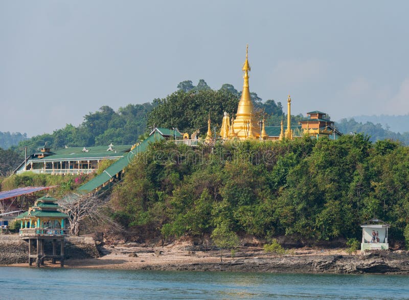
Free with trial Pagoda near the ferry pier in Kyunsu on Kadan Kyun, previously King Island, the biggest island of the Myeik Archipelago, formerly the Mergui Archipelago, in the Tanintharyi Region of Myanmar. King ferry stock images, royalty-free photos and pictures Pagoda on Kadan Kyun, Myanmar. Pagoda near the ferry pier in Kyunsu on Kadan Kyun, previously King Island, the biggest island of the Myeik Archipelago, formerly the Mergui Archipelago, in the Tanintharyi Region of Myanmar.
Free with trial Ferry, tug boat and port cranes in Elliot Bay, Seattle. King ferry stock images, royalty-free photos and pictures Elliot Bay
Free with trial John 'O Groats New Signpost and Harbour, Caithness, Scotland, UK. John o'Groats NE of the village of Canisbay, Caithness, in the far north of Scotland. John o' Groats lies on Great Britain's northeastern tip, and is popular with tourists as one end of the longest distance between two inhabited British points on the mainland, with Land's End in Cornwall lying 876 miles (1,410 km) to the southwest. It is not the most northerly point on the island of Britain (nearby Dunnet Head is farther north). John o' Groats is 690 miles (1,110 km) from London, 280 miles (450 km) from Edinburgh, 6 miles (10 km) from the Orkney Isles and 2,200 miles (3,500 km) from the North Pole. It is 4. 25 miles (6. 8 km) from the uninhabited Island of Stroma. The settlement takes its name from Jan de Groot, a Dutchman who once plied a ferry from the Scottish mainland to Orkney, which had recently been acquired from Norway by King James IV. Local legend has that the "o' Groats" refers to John's charge of one groat for use of his ferry, but it actually derives from the Dutch de groot, meaning "the large". People from John o' Groats are known as "Groaters". The name John o' Groats has a particular resonance because it is often used as a starting or ending point for cycles, walks and charitable events to and from Land's End (at the extreme south-western. King ferry stock images, royalty-free photos and pictures John 'o Groats New Signpost and Harbour, Caithness, Scotland, UK. John 'O Groats New Signpost and Harbour, Caithness, Scotland, UK. John o'Groats NE of the village of Canisbay, Caithness, in the far north of Scotland. John o' Groats lies on Great Britain's northeastern tip, and is popular with tourists as one end of the longest distance between two inhabited British points on the mainland, with Land's End in Cornwall lying 876 miles (1,410 km) to the southwest. It is not the most northerly point on the island of Britain (nearby Dunnet Head is farther north). John o' Groats is 690 miles (1,110 km) from London, 280 miles (450 km) from Edinburgh, 6 miles (10 km) from the Orkney Isles and 2,200 miles (3,500 km) from the North Pole. It is 4.25 miles (6.8 km) from the uninhabited Island of Stroma. The settlement takes its name from Jan de Groot, a Dutchman who once plied a ferry from the Scottish mainland to Orkney, which had recently been acquired from Norway by King James IV. Local legend has that the "o' Groats" refers to John's charge of one groat for use of his ferry, but it actually derives from the Dutch de groot, meaning "the large". People from John o' Groats are known as "Groaters". The name John o' Groats has a particular resonance because it is often used as a starting or ending point for cycles, walks and charitable events to and from Land's End (at the extreme south-western
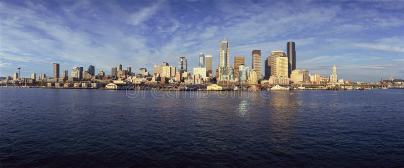
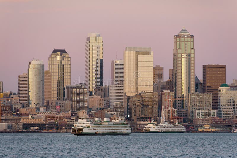
Free with trial Seattle, WA skyline from Bainbridge Island Ferry. King ferry stock images, royalty-free photos and pictures Seattle, WA skyline from Bainbridge Island Ferry
Free with trial Seattle skyline viewed through portholes of abandoned ferry boat hull covered with graffiti. Container ships in Puget Sound head to Seattle port. King ferry stock images, royalty-free photos and pictures Seattle skyline viewed through Portholes
Free with trial Going to Ko Lanta, Thailand. South Thailand. King ferry stock images, royalty-free photos and pictures Ferry boat. Going to Ko Lanta, Thailand. South Thailand.
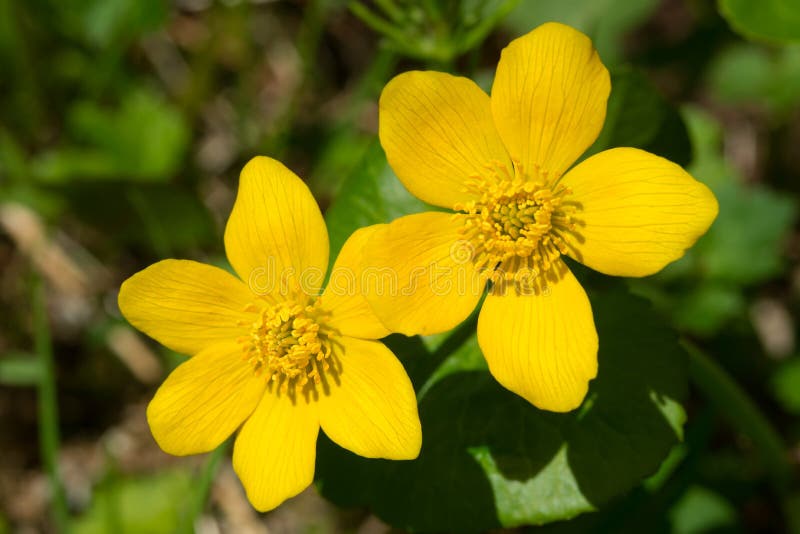
Free with trial Close up of two Marsh Marigold flowers. Also known as Kingcup. Wetland Interpretive Centre, Upper Ferry, Codroy Valley, Newfoundand and Labrador, Canada. King ferry stock images, royalty-free photos and pictures Marsh Marigold - Caltha palustris. Close up of two Marsh Marigold flowers. Also known as Kingcup. Wetland Interpretive Centre, Upper Ferry, Codroy Valley, Newfoundand and Labrador, Canada.
Free with trial Sculpture of a Lewis chess-piece from the 12th century. King ferry stock images, royalty-free photos and pictures Chess man,the King, Isle of Lewis. Sculpture of a Lewis chess-piece from the 12th century
Free with trial The Gateway of India is an arch monument built during the 20th century in Bombay, India. The monument was erected to commemorate the landing of King George V and Queen Mary at Apollo Bunder on their visit to India in 1911. King ferry stock images, royalty-free photos and pictures Promonade of Gateway of India, Mumbai. The Gateway of India is an arch monument built during the 20th century in Bombay, India. The monument was erected to commemorate the landing of King George V and Queen Mary at Apollo Bunder on their visit to India in 1911
Free with trial During a beautiful Seattle, Washington sunset ferry boats run between Bainbridge Island and downtown Seattle. Modern skyscrapers line the waterfront. King ferry stock images, royalty-free photos and pictures Seattle Skyline at Sunset. During a beautiful Seattle, Washington sunset ferry boats run between Bainbridge Island and downtown Seattle. Modern skyscrapers line the waterfront.
Free with trial During a beautiful Seattle, Washington sunset ferry boats run between Bainbridge Island and downtown Seattle. Modern skyscrapers line the waterfront. King ferry stock images, royalty-free photos and pictures Seattle Skyline at Sunset. During a beautiful Seattle, Washington sunset ferry boats run between Bainbridge Island and downtown Seattle. Modern skyscrapers line the waterfront.
Free with trial Tourists at the Gateway of India Mumbai. The Gateway of India is an arch-monument built in the early twentieth century in the city of Mumbai, in the Indian state of Maharashtra. It was erected to commemorate the landing in December 1911 at Apollo Bunder, Mumbai then Bombay, of King-Emperor George V and Queen-Empress Mary, the first British monarch to visit India. At the time of the royal visit, the gateway was not yet built, and a cardboard structure greeted the monarch. The foundation stone was laid in March 1913 for a monument built in the Indo-Saracenic style, incorporating elements of 16th-century Gujarati architecture. The final design of the monument by architect George Wittet was sanctioned only in 1914, and construction was completed in 1924. The structure is a triumphal arch made of basalt, which is 26 metres high. After its construction the gateway was used as a symbolic ceremonial entrance to British India for important colonial personnel. King ferry stock images, royalty-free photos and pictures Panorama - Tourists at Gateway of India and Taj Mahal Hotel Mumbai. Tourists at the Gateway of India Mumbai. The Gateway of India is an arch-monument built in the early twentieth century in the city of Mumbai, in the Indian state of Maharashtra. It was erected to commemorate the landing in December 1911 at Apollo Bunder, Mumbai then Bombay, of King-Emperor George V and Queen-Empress Mary, the first British monarch to visit India. At the time of the royal visit, the gateway was not yet built, and a cardboard structure greeted the monarch. The foundation stone was laid in March 1913 for a monument built in the Indo-Saracenic style, incorporating elements of 16th-century Gujarati architecture. The final design of the monument by architect George Wittet was sanctioned only in 1914, and construction was completed in 1924. The structure is a triumphal arch made of basalt, which is 26 metres high. After its construction the gateway was used as a symbolic ceremonial entrance to British India for important colonial personnel.
Free with trial Ferry service to Umanannda Temple at Brahmaputra river. Guwahati, Assam. King ferry stock images, royalty-free photos and pictures Ferry service to Umanannda Temple at Brahmaputra river
Free with trial A fisherman holding up a `Jack` Chinook or King Salmon, caught on the Skeena River, British Columbia, Canada. King ferry stock images, royalty-free photos and pictures A fisherman holding up a `Jack` Chinook or King Salmon, Skeena River, Canada. A fisherman holding up a `Jack` Chinook or King Salmon, caught on the Skeena River, British Columbia, Canada
Free with trial Canada national flag on blue sky. Photo taken on the ferry across Bay of Fundy from Saint John, NB to Digby, NS in Atlantic Canada. King ferry stock images, royalty-free photos and pictures Canada national flag
Free with trial EIDSFOSS, NORWAY - JULY 18, 2018: M/S Henrik Ibsen ”The king of the Telemark Canal” ferry boat waiting in the lock chamber while the chamber is filled up with water at Eidsfoss lock on the Telemark Canal that connects Skien to Dalen. King ferry stock images, royalty-free photos and pictures Eidsfoss lock filling with water Telemark Canal Telemark Norway. EIDSFOSS, NORWAY - JULY 18, 2018: M/S Henrik Ibsen ”The king of the Telemark Canal” ferry boat waiting in the lock chamber while the chamber is filled up with water at Eidsfoss lock on the Telemark Canal that connects Skien to Dalen
Free with trial Sweden from denmark with orange cooking filter. King ferry stock images, royalty-free photos and pictures Sweden
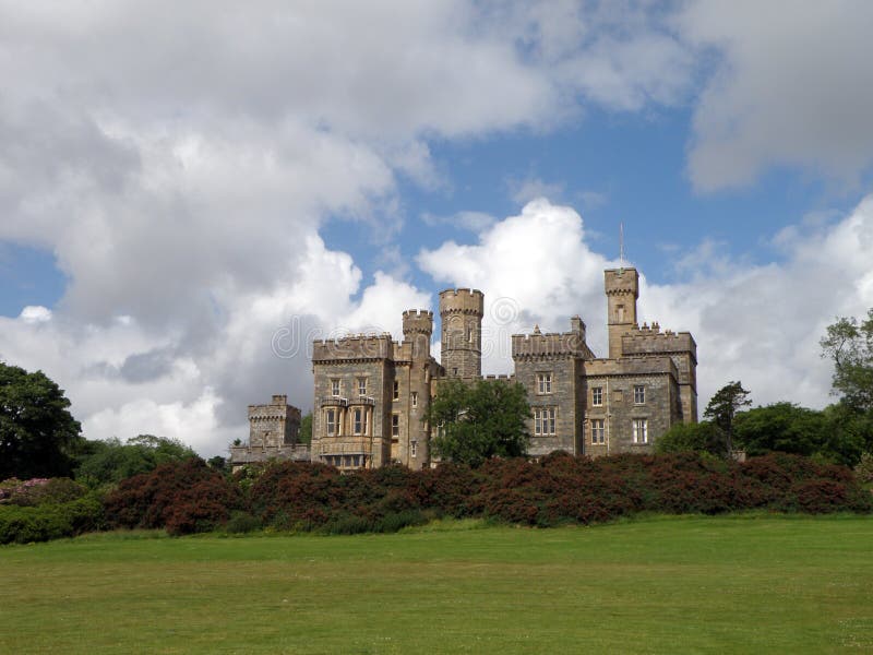
Free with trial Stornoway Castle Grounds has various mountain bike routes and trails along... surrounded by trees, wildlife and oversized carvings of the Lewis Chess Men. King ferry stock images, royalty-free photos and pictures Garden, Lews Castle, Stornoway, Isle of Lewis. Stornoway Castle Grounds has various mountain bike routes and trails along ... surrounded by trees, wildlife and oversized carvings of the Lewis Chess Men.
Free with trial Stornoway Castle Grounds has various mountain bike routes and trails along... surrounded by trees, wildlife and oversized carvings of the Lewis Chess Men. King ferry stock images, royalty-free photos and pictures Lews Castle, Stornoway, Isle of Lewis. Stornoway Castle Grounds has various mountain bike routes and trails along ... surrounded by trees, wildlife and oversized carvings of the Lewis Chess Men.
Free with trial Close up of Seattle Financial district with Columbia tower and WaMu tower. King ferry stock images, royalty-free photos and pictures Close up of Seattle Financial district
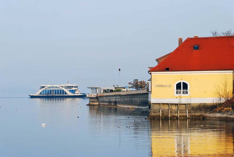
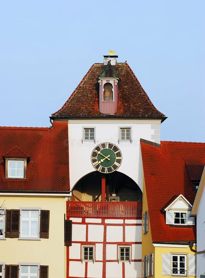
Free with trial Views of Meersburg, a very old medieval town located at the Lake Constance, Baden-Wuerttemberg, Germany. King ferry stock images, royalty-free photos and pictures Meersburg View. Views of Meersburg, a very old medieval town located at the Lake Constance, Baden-Wuerttemberg, Germany.
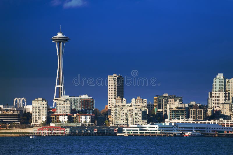
Free with trial Seattle downtown waterfront view with space needle tower and embarkment, Washington, USA. King ferry stock images, royalty-free photos and pictures Seattle downtown waterfront view with space needle
Free with trial The view across Elliott Bay of the Seattle skyline during a glorious sunset with modern office buildings, ferry terminal, and the Alaska Way viaduct. King ferry stock images, royalty-free photos and pictures Seattle Skyline
Free with trial Views of Meersburg, a very old medieval town located at the Lake Constance, Baden-Wuerttemberg, Germany. King ferry stock images, royalty-free photos and pictures Meersburg View. Views of Meersburg, a very old medieval town located at the Lake Constance, Baden-Wuerttemberg, Germany.
Free with trial The view across Elliott Bay of the Seattle skyline during a glorious sunset with modern office buildings, ferry terminal, and the Alaska Way viaduct. King ferry stock images, royalty-free photos and pictures Seattle Skyline
Free with trial KERMANSHAH, IRAN:. Taq-e Bostan is a site with large rock relief from the era of Sassanid Empire of Persia. King ferry stock images, royalty-free photos and pictures Boat on the lake of mountains with ancient Arches of Taq-e Bostan. KERMANSHAH, IRAN: . Taq-e Bostan is a site with large rock relief from the era of Sassanid Empire of Persia
Free with trial Tourists at the Gateway of India Mumbai. King ferry stock images, royalty-free photos and pictures Tourists at Gateway of India Mumbai
Free with trial A summertime view of the Seattle skyline looking from west Seattle across Elliott Bay. Cruise ships, ferryboats, tugboats, and freighters are a common sight in this maritime city. King ferry stock images, royalty-free photos and pictures Seattle Skyline
Free with trial Views of Meersburg, a very old medieval town located at the Lake Constance, Baden-Wuerttemberg, Germany. King ferry stock images, royalty-free photos and pictures Meersburg View. Views of Meersburg, a very old medieval town located at the Lake Constance, Baden-Wuerttemberg, Germany.
Free with trial A ferryboat crosses Elliott Bay in front of the Seattle skyline and the historic Space Needle which is a leftover from the 1962 World's Fair during a lovely sunset. King ferry stock images, royalty-free photos and pictures Seattle Skyline
Free with trial Royal Naval Dockyard in Bermuda. King ferry stock images, royalty-free photos and pictures Royal Naval Dockyard, Bermuda
Free with trial A lovely spring day along the Seattle, Washington waterfront. This view across Elliott Bay pictures puffy clouds and ferryboats with modern office buildings in the background. King ferry stock images, royalty-free photos and pictures Seattle Skyline. A lovely spring day along the Seattle, Washington waterfront. This view across Elliott Bay pictures puffy clouds and ferryboats with modern office buildings in the background.
Free with trial A summertime view of the Seattle skyline looking from west Seattle across Elliott Bay. Cruise ships, ferryboats, tugboats, and freighters are a common sight in this maritime city. King ferry stock images, royalty-free photos and pictures Seattle Skyline
Free with trial A summertime view of the Seattle skyline looking from west Seattle across Elliott Bay. Cruise ships, ferryboats, tugboats, and freighters are a common sight in this maritime city. King ferry stock images, royalty-free photos and pictures Seattle Skyline
Free with trial In Ko Lanta, Thailand. South Thailand. King ferry stock images, royalty-free photos and pictures Tsunami sign. In Ko Lanta, Thailand. South Thailand.
Free with trial A Seattle water taxi departing Alki Beach for a trip across Elliott Bay to downtown Seattle. Washington State, USA. King ferry stock images, royalty-free photos and pictures Seattle Water Taxi, Alki Beach. A Seattle water taxi departing Alki Beach for a trip across Elliott Bay to downtown Seattle. Washington State, USA.
Free with trial Ferry to enter the West Gate. "Harmony" to describe the Xishan is the most accurate. Xishan by the 12 islands, more than 70 small bridges will be linked to these islands together, the river density and number of stone are the most ancient town. For example, Tongji Bridge and Yanji Bridge at right angles adjacent to the bridge, no matter which side of the bridge, you can see a bridge in another bridge, it is a "Bridge Bridge," said. "Bridge Bridge" Wuzhen is the most beautiful ancient bridge landscape, called a bridge King. King ferry stock images, royalty-free photos and pictures Zhejiang Jiaxing Wuzhen Xigu water. Ferry to enter the West Gate. "Harmony" to describe the Xishan is the most accurate. Xishan by the 12 islands, more than 70 small bridges will be linked to these islands together, the river density and number of stone are the most ancient town. For example, Tongji Bridge and Yanji Bridge at right angles adjacent to the bridge, no matter which side of the bridge, you can see a bridge in another bridge, it is a "Bridge Bridge," said. "Bridge Bridge" Wuzhen is the most beautiful ancient bridge landscape, called a bridge King.
Free with trial Ferry to enter the West Gate. "Harmony" to describe the Xishan is the most accurate. Xishan by the 12 islands, more than 70 small bridges will be linked to these islands together, the river density and number of stone are the most ancient town. For example, Tongji Bridge and Yanji Bridge at right angles adjacent to the bridge, no matter which side of the bridge, you can see a bridge in another bridge, it is a "Bridge Bridge," said. "Bridge Bridge" Wuzhen is the most beautiful ancient bridge landscape, called a bridge King. King ferry stock images, royalty-free photos and pictures Zhejiang Jiaxing Wuzhen Xigu water. Ferry to enter the West Gate. "Harmony" to describe the Xishan is the most accurate. Xishan by the 12 islands, more than 70 small bridges will be linked to these islands together, the river density and number of stone are the most ancient town. For example, Tongji Bridge and Yanji Bridge at right angles adjacent to the bridge, no matter which side of the bridge, you can see a bridge in another bridge, it is a "Bridge Bridge," said. "Bridge Bridge" Wuzhen is the most beautiful ancient bridge landscape, called a bridge King.
Free with trial The Beautiful Point Robinson Lighthouse with Mount Rainier in the Backdrop during Sunset. King ferry stock images, royalty-free photos and pictures The Beautiful Point Robinson Lighthouse with Mount Rainier in the Backdrop during Sunset
Free with trial Ferry to enter the West Gate. "Harmony" to describe the Xishan is the most accurate. Xishan by the 12 islands, more than 70 small bridges will be linked to these islands together, the river density and the number of stone are the most ancient town. For example, Tongji Bridge and Yanji Bridge at right angles adjacent to the bridge, no matter which side of the bridge, you can see a bridge in another bridge, it is a "Bridge Bridge," said. "Bridge Bridge" Wuzhen is the most beautiful ancient bridge landscape, called a bridge King. King ferry stock images, royalty-free photos and pictures Zhejiang Jiaxing Wuzhen Xishan. Ferry to enter the West Gate. "Harmony" to describe the Xishan is the most accurate. Xishan by the 12 islands, more than 70 small bridges will be linked to these islands together, the river density and the number of stone are the most ancient town. For example, Tongji Bridge and Yanji Bridge at right angles adjacent to the bridge, no matter which side of the bridge, you can see a bridge in another bridge, it is a "Bridge Bridge," said. "Bridge Bridge" Wuzhen is the most beautiful ancient bridge landscape, called a bridge King.
Free with trial The Gateway of India and boats in the background Taj Mahal Hotel, Mumbai, India. It was built during the 20th century and erected to commemorate the landing of King George V and Queen Mary. King ferry stock images, royalty-free photos and pictures The Gateway of India and boats in the background Taj Mahal Hotel, Mumbai, India.
Free with trial Tourists at the Gateway of India Mumbai. King ferry stock images, royalty-free photos and pictures Tourists at Gateway of India Mumbai
Free with trial View from the sea of the Gateway of India and Taj Mahal Hotel in Mumbai. King ferry stock images, royalty-free photos and pictures Gateway of India Mumbai. View from the sea of the Gateway of India and Taj Mahal Hotel in Mumbai
Free with trial Ferry to enter the West Gate. "Harmony" to describe the Xishan is the most accurate. Xishan by the 12 islands, more than 70 small bridges will be linked to these islands together, the river density and the number of stone are the most ancient town. For example, Tongji Bridge and Yanji Bridge at right angles adjacent to the bridge, no matter which side of the bridge, you can see a bridge in another bridge, it is a "Bridge Bridge," said. "Bridge Bridge" Wuzhen is the most beautiful ancient bridge landscape, called a bridge King. King ferry stock images, royalty-free photos and pictures Zhejiang Jiaxing Wuzhen Xishan. Ferry to enter the West Gate. "Harmony" to describe the Xishan is the most accurate. Xishan by the 12 islands, more than 70 small bridges will be linked to these islands together, the river density and the number of stone are the most ancient town. For example, Tongji Bridge and Yanji Bridge at right angles adjacent to the bridge, no matter which side of the bridge, you can see a bridge in another bridge, it is a "Bridge Bridge," said. "Bridge Bridge" Wuzhen is the most beautiful ancient bridge landscape, called a bridge King.
Free with trial The Gateway of India and boats in the background Taj Mahal Hotel, Mumbai, India. It was built during the 20th century and erected to commemorate the landing of King George V and Queen Mary. King ferry stock images, royalty-free photos and pictures The Gateway of India and boats in the background Taj Mahal Hotel, Mumbai, India.
Free with trial The Gateway of India and boats in the background Taj Mahal Hotel, Mumbai, India. It was built during the 20th century and erected to commemorate the landing of King George V and Queen Mary. King ferry stock images, royalty-free photos and pictures The Gateway of India and boats in the background Taj Mahal Hotel, Mumbai, India.
Free with trial Restormel castle near bodmin from the air drone Cornwall England uk. King ferry stock images, royalty-free photos and pictures Restormel castle near bodmin from the air drone
Free with trial Rock-cut temple tombs of the ancient city Kaunos in Dalyan, Mugla, Turkey. Beautiful Dalyan river view with ferry boats and carved tombs at background. King ferry stock images, royalty-free photos and pictures Rock-cut temple tombs of the ancient city Kaunos in Dalyan, Mugla, Turkey.
Free with trial Devonport and Mount Eden Volcano, Auckland / New Zealand: The Victorian Style Seaside Village of Devonport, with the skyline of Auckland’s landmarks and CBD in the background. King ferry stock images, royalty-free photos and pictures Devonport and Mount Eden Volcano, Auckland / New Zealand
Free with trial Restormel castle near bodmin from the air drone Cornwall England uk. King ferry stock images, royalty-free photos and pictures Restormel castle near bodmin from the air drone
Free with trial Devonport and Mount Eden Volcano, Auckland / New Zealand: The Victorian Style Seaside Village of Devonport, with the skyline of Auckland’s landmarks and CBD in the background. King ferry stock images, royalty-free photos and pictures Devonport and Mount Eden Volcano, Auckland / New Zealand
Free with trial Devonport and Mount Eden Volcano, Auckland / New Zealand: The Victorian Style Seaside Village of Devonport, with the skyline of Auckland’s landmarks and CBD in the background. King ferry stock images, royalty-free photos and pictures Devonport and Mount Eden Volcano, Auckland / New Zealand
Free with trial Devonport and Mount Eden Volcano, Auckland / New Zealand: The Victorian Style Seaside Village of Devonport, with the skyline of Auckland’s landmarks and CBD in the background. King ferry stock images, royalty-free photos and pictures Devonport and Mount Eden Volcano, Auckland / New Zealand
Free with trial Devonport and Mount Eden Volcano, Auckland / New Zealand: The Victorian Style Seaside Village of Devonport, with the skyline of Auckland’s landmarks and CBD in the background. King ferry stock images, royalty-free photos and pictures Devonport and Mount Eden Volcano, Auckland / New Zealand