Free with trial Lava flowing across the East Rift Zone on the Big Island of Hawaii. Rift zone stock images, royalty-free photos and pictures Flowing Lava II. Lava flowing across the East Rift Zone on the Big Island of Hawaii.
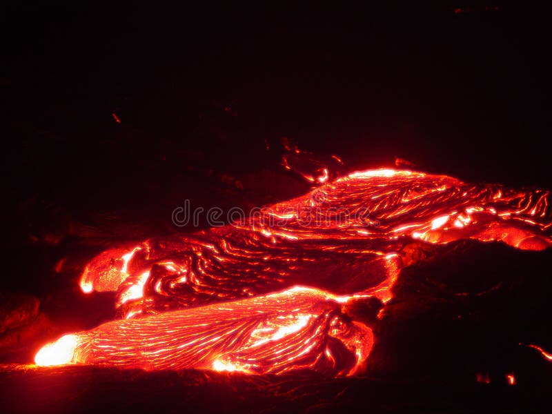
Free with trial Lava flowing across the East Rift Zone on the Big Island of Hawaii. Rift zone stock images, royalty-free photos and pictures Flowing Lava I. Lava flowing across the East Rift Zone on the Big Island of Hawaii.
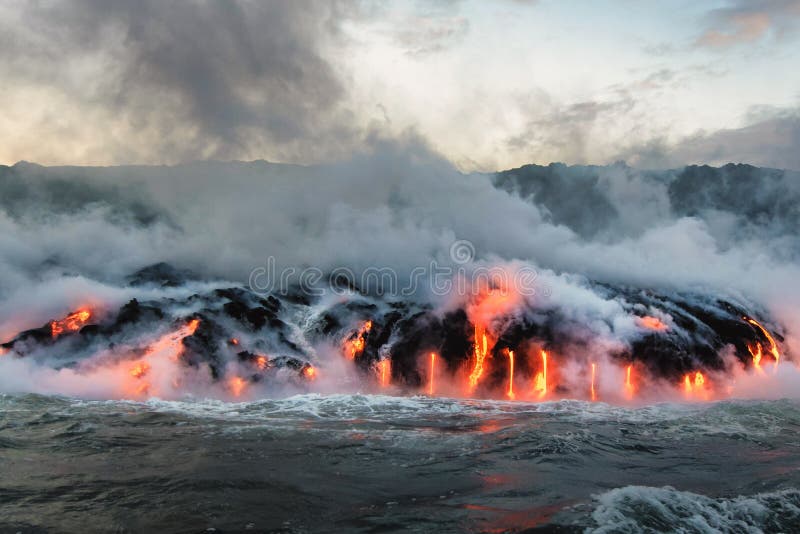
Free with trial Molten lava flowing into the Pacific Ocean on Big Island of Hawaii, creating new earth. Rift zone stock images, royalty-free photos and pictures Molten lava flowing into the Pacific Ocean
Free with trial Hotspot volcanic chain:Spatter cones and cinder cone rising above a landscape of black volcanic basalt rock from eruptions along the Great Volcanic Rift Zone, a line of cones and lava vents. Some plants survive in this environment. Spring 2014, Craters of the Moon National Monument and Preserve, Idaho, USA. Rift zone stock images, royalty-free photos and pictures Hiking path along a chain of volcanic cinder and spatter cones. Hotspot volcanic chain:Spatter cones and cinder cone rising above a landscape of black volcanic basalt rock from eruptions along the Great Volcanic Rift Zone, a line of cones and lava vents. Some plants survive in this environment. Spring 2014, Craters of the Moon National Monument and Preserve, Idaho, USA
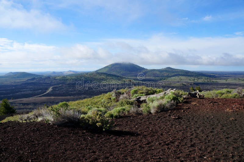
Free with trial Westward view from the Inferno Cone. A cinder cone rising above a landscape of black volcanic basalt rock and volcano domes from eruptions along the Great Volcanic Rift Zone within the last 12000 years. First species of plants and trees reconquered this harsh environment. Spring 2014, Craters of the Moon National Monument and Preserve, Idaho, USA. Rift zone stock images, royalty-free photos and pictures View over a black volcanic lava landscape from the Inferno Cone. Westward view from the Inferno Cone. A cinder cone rising above a landscape of black volcanic basalt rock and volcano domes from eruptions along the Great Volcanic Rift Zone within the last 12000 years. First species of plants and trees reconquered this harsh environment. Spring 2014, Craters of the Moon National Monument and Preserve, Idaho, USA
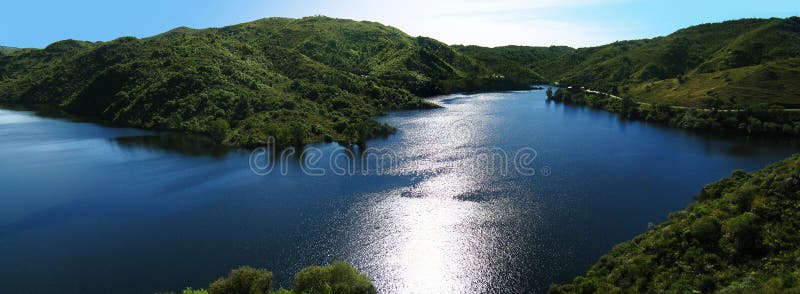
Free with trial Los Molinos Lake in Cordoba, Argentina. Rift zone stock images, royalty-free photos and pictures Lake and Mountains. Los Molinos Lake in Cordoba, Argentina.
Free with trial Molten lava flowing into the Pacific Ocean on Big Island of Hawaii, creating new earth. Rift zone stock images, royalty-free photos and pictures Molten lava flowing into the Pacific Ocean
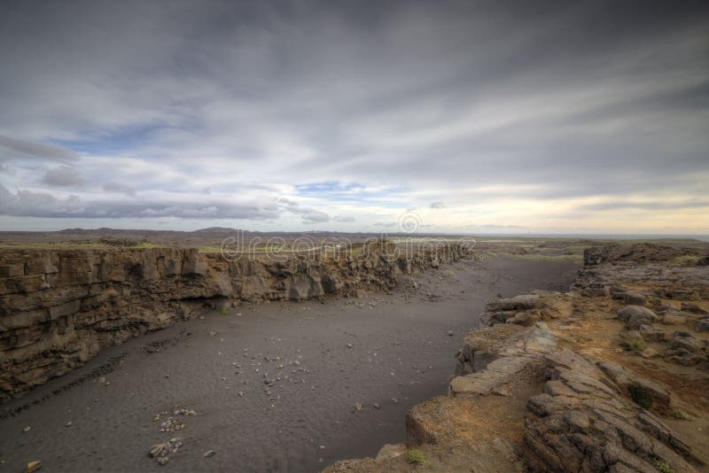
Free with trial The picture shows a rift valley in Iceland, which is caused by continental drift. Rift zone stock images, royalty-free photos and pictures Rift Valley
Free with trial Rift zone near Mývatn Lake in northeast Iceland. Left in the background is seen the volcano Hverfjall. Rift zone stock images, royalty-free photos and pictures Rift zone near Mývatn Lake in northeast Iceland
Free with trial Fault zone (Thingvellir National Park, Iceland). Basalt lava. Iceland National Park canyon continental divide plate rock rift during day , view of landscape with rocky mountain. Rift zone stock images, royalty-free photos and pictures Iceland National Park canyon continental divide plate rock rift during day , view of landscape with rocky mountain.
Free with trial Landscape Panorama of late evening light on the barren lava fields left by volcanic eruptions along the active tectonic rift area on the Reykjanes Peninsula outside the Blue Lagoon near Grindavik, Reykjanes Peninsula, Western Iceland. Rift zone stock images, royalty-free photos and pictures Moss Covered Lava Field and Volcano in Dramatic Evening Light on Reykjanes Peninsula, Western Iceland. Landscape Panorama of late evening light on the barren lava fields left by volcanic eruptions along the active tectonic rift area on the Reykjanes Peninsula outside the Blue Lagoon near Grindavik, Reykjanes Peninsula, Western Iceland.
Free with trial Today ostriches are only found natively in the wild in Africa, where they occur in a range of open arid and semi-arid habitats such as savannas and the Sahel, both north and south of the equatorial forest zone. The Somali ostrich occurs in the Horn of Africa, having evolved isolated from the common ostrich by the geographic barrier of the East African Rift. In some areas, the common ostrich`s Masai subspecies occurs alongside the Somali ostrich, but they are kept from interbreeding by behavioral and ecological differences. The Arabian ostriches in Asia Minor and Arabia were hunted to extinction by the middle of the 20th century, and in Israel attempts to introduce North African ostriches to fill their ecological role have failed. Escaped common ostriches in Australia have established feral populations. Rift zone stock images, royalty-free photos and pictures Close up of an Ostrich. Today ostriches are only found natively in the wild in Africa, where they occur in a range of open arid and semi-arid habitats such as savannas and the Sahel, both north and south of the equatorial forest zone. The Somali ostrich occurs in the Horn of Africa, having evolved isolated from the common ostrich by the geographic barrier of the East African Rift. In some areas, the common ostrich`s Masai subspecies occurs alongside the Somali ostrich, but they are kept from interbreeding by behavioral and ecological differences. The Arabian ostriches in Asia Minor and Arabia were hunted to extinction by the middle of the 20th century, and in Israel attempts to introduce North African ostriches to fill their ecological role have failed. Escaped common ostriches in Australia have established feral populations.
Free with trial Lake Baikal is in a rift valley, created by the Baikal Rift Zone, where the Earth's crust is slowly pulling apart. Rift zone stock images, royalty-free photos and pictures Lake Baikal is a rift lake located in southern Siberia, Russia. The largest freshwater lake by volume in the world. A. Lake Baikal is in a rift valley, created by the Baikal Rift Zone, where the Earth's crust is slowly pulling apart.
Free with trial The Caldera and erosional valleys of Haleakalā, or East Maui Volcano. Rift zone stock images, royalty-free photos and pictures Haleakala Volcano, Maui. The Caldera and erosional valleys of Haleakalā, or East Maui Volcano
Free with trial Wall texture. Old destroyed wall. Rift zone stock images, royalty-free photos and pictures Wall
Free with trial The summit and crater of Haleakalā (house of the sun), or East Maui Volcano. Rift zone stock images, royalty-free photos and pictures Haleakala Volcano, Maui. The summit and crater of Haleakalā (house of the sun), or East Maui Volcano
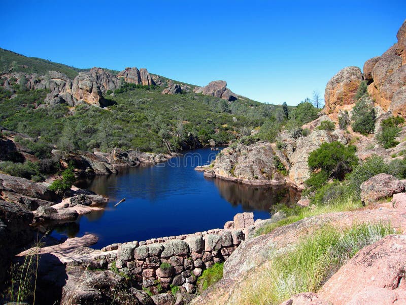
Free with trial A small dam is creating a reservoir on the Bear Gulch Creek in an otherwise arid and rocky volcanic landscape of Pinnacles National Park in Central California, USA. Rift zone stock images, royalty-free photos and pictures Bear Creek Reservoir in Pinnacles National Park, California, USA. A small dam is creating a reservoir on the Bear Gulch Creek in an otherwise arid and rocky volcanic landscape of Pinnacles National Park in Central California, USA.
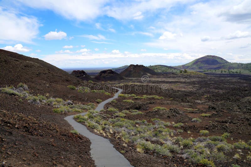
Free with trial A short paved trail leads hikers to the top of the Snow Cone at Craters of the Moon National Monument and Preserve in south-central Idaho. The foreground includes lava flow waste and sagebrush slowly working its way through portions of the hard basaltic rock. Rift zone stock images, royalty-free photos and pictures Snow Cone at Craters of the Moon National Monument and Preserve
Free with trial Molten lava flowing into the Pacific Ocean on Big Island of Hawaii, creating new earth. Rift zone stock images, royalty-free photos and pictures Molten lava flowing into the Pacific Ocean
Free with trial The upper entrance to Bear Gulch Cave is covered by large blocks of fallen volcanic rocks, just below the outflow of the Bear Gulch Creek in Pinnacles National Park, central California, USA. Rift zone stock images, royalty-free photos and pictures Pinnacles National Park, Entrance to Bear Gulch Cave in California, USA. The upper entrance to Bear Gulch Cave is covered by large blocks of fallen volcanic rocks, just below the outflow of the Bear Gulch Creek in Pinnacles National Park, central California, USA.
Free with trial The small dam is creating a reservoir on the Bear Gulch Creek in the arid volcanic landscape of Pinnacles National Park in Central California, USA. Rift zone stock images, royalty-free photos and pictures Pinnacles National Park, Bear Creek Reservoir in Volcanic Landscape of Central California, USA. The small dam is creating a reservoir on the Bear Gulch Creek in the arid volcanic landscape of Pinnacles National Park in Central California, USA.
Free with trial Boiling mud and steam from fumaroles dominate the Krafla geothermal area at Krafla Volcano, Myvatn Lake, Northern Iceland. Rift zone stock images, royalty-free photos and pictures Steam Rising at Thermal Field on the Flank of Krafla Volcano, Myvatn Lake, Northern Iceland. Boiling mud and steam from fumaroles dominate the Krafla geothermal area at Krafla Volcano, Myvatn Lake, Northern Iceland.
Free with trial Bright Neon Texture Abstract Background. Rift zone stock images, royalty-free photos and pictures Bright Neon Texture Abstract Background
Free with trial Strasbourg, France - Dec 27, 2017: Man playing inside free game zone with VR set and Precise Aiming for PlayStationVR Aim Controller - city reflection in shwocase window. Rift zone stock images, royalty-free photos and pictures Man VR headset Precise Aiming for PlayStationVR Aim Controller. Strasbourg, France - Dec 27, 2017: Man playing inside free game zone with VR set and Precise Aiming for PlayStationVR Aim Controller - city reflection in shwocase window
Free with trial The detailed seabed of the Mid-Atlantic Ridge is characterized by an underwater rift zone where tectonic plates are splitting. Rift zone stock images, royalty-free photos and pictures The detailed seabed of the Mid-Atlantic Ridge is characterized by an underwater rift zone where tectonic plates are
Free with trial A detailed seabed and an underwater rift zone are found at the Mid-Atlantic Ridge, where tectonic plates are splitting. Rift zone stock images, royalty-free photos and pictures A detailed seabed and an underwater rift zone are found at the Mid-Atlantic Ridge, where tectonic plates are splitting
Free with trial Tectonic plates are splitting at the Mid-Atlantic Ridge, which features a detailed seabed and an underwater rift zone. Rift zone stock images, royalty-free photos and pictures Tectonic plates are splitting at the Mid-Atlantic Ridge, which features a detailed seabed and an underwater rift zone
Free with trial The Mid-Atlantic Ridge has a detailed seabed and is home to an underwater rift zone where tectonic plates are splitting. Rift zone stock images, royalty-free photos and pictures The Mid-Atlantic Ridge has a detailed seabed and is home to an underwater rift zone where tectonic plates are splitting
Free with trial Large lava flows and cinder cones make up the barren landscape along a portion of the Great Volcanic Rift Zone at Craters of the Moon National Monument and Preserve in south-central Idaho. Rift zone stock images, royalty-free photos and pictures Lava Flow and Spatter Cone at Craters of the Moon National Monument and Preserve. Large lava flows and cinder cones make up the barren landscape along a portion of the Great Volcanic Rift Zone at Craters of the Moon National Monument and Preserve in south-central Idaho.
Free with trial Massive lava flows and spatter cones create a desolate landscape along a portion of the Great Volcanic Rift Zone at Craters of the Moon National Monument and Preserve in south-central Idaho. Rift zone stock images, royalty-free photos and pictures Lava Flows and Cinder Cones at Craters of the Moon National Monument and Preserve. Massive lava flows and spatter cones create a desolate landscape along a portion of the Great Volcanic Rift Zone at Craters of the Moon National Monument and Preserve in south-central Idaho.
Free with trial Rocky lava flows and relatively small volcanoes or cinder cones combine to produce an eerie landscape along a portion of the Great Volcanic Rift Zone at Craters of the Moon National Monument and Preserve in south-central Idaho. Rift zone stock images, royalty-free photos and pictures Spatter Cones and Lava Flows at Craters of the Moon National Monument and Preserve. Rocky lava flows and relatively small volcanoes or cinder cones combine to produce an eerie landscape along a portion of the Great Volcanic Rift Zone at Craters of the Moon National Monument and Preserve in south-central Idaho.
Free with trial Expansive lava flows create an otherworldly landscape along a desolate portion of the Great Volcanic Rift Zone at Craters of the Moon National Monument and Preserve in south-central Idaho. Rift zone stock images, royalty-free photos and pictures Lava Flows at Craters of the Moon National Monument and Preserve. Expansive lava flows create an otherworldly landscape along a desolate portion of the Great Volcanic Rift Zone at Craters of the Moon National Monument and Preserve in south-central Idaho.
Free with trial Aerial View of Lake Bujuku and Bujuku Valley in the Afro Alpine ecological zone in the Rwenzori Mountains, Uganda. Rift zone stock images, royalty-free photos and pictures Aerial View of Lake Bujuku and Bujuku Valley in the Afro Alpine ecological zone in the Rwenzori Mountains, Uganda
Free with trial The Church of Santa Ana (Spanish: Iglesia de Santa Ana) is the main church in Garachico. It is located next to the Plaza de la Libertad. Originally constructed around 1520, it was rebuilt after the volcanic eruption of 1706. The facade combines elements from Plateresque and Renaissance architecture. The interior is divided into three parts, with a series of arches and columns. There are a number of different altars, some of which are Baroque, as well as sculptures and paintings. The church houses an image of Christ of Mercy from Mexico, made using the marrow of corn, and a baptismal font made of marble in the 17th century. It also houses a museum of sacred art. Garachico is a municipality and town on the northern coast of Tenerife, about 52 km West of the capital Santa Cruz de Tenerife, 50 km from Tenerife North Airport and 67 km from Tenerife South Airport. The town itself nestles below a 500m cliff. The city of Garachico with its port was founded by a Jewish Genoan banker Cristobal de Ponte after the conquest of Tenerife in 1496. The May 5, 1706 eruption originating from the northwest rift zone was a major event in the town's history. Prior to then, Garachico was an important port exporting Malmsey wine and other local produce. However, a several-week-long eruption poured lava into the old bay and effectively destroyed the town's livelihood. The town itself was partially destroyed, contrary to the 'Tourist trade' myth, which will tell you that the town was completely destroyed, except for the church where the townfolk took refuge. Rift zone stock images, royalty-free photos and pictures The beautiful Church of Santa Ana in Garachico, Tenerife, Canary islands, Spain, Europe. The Church of Santa Ana (Spanish: Iglesia de Santa Ana) is the main church in Garachico. It is located next to the Plaza de la Libertad. Originally constructed around 1520, it was rebuilt after the volcanic eruption of 1706. The facade combines elements from Plateresque and Renaissance architecture. The interior is divided into three parts, with a series of arches and columns. There are a number of different altars, some of which are Baroque, as well as sculptures and paintings. The church houses an image of Christ of Mercy from Mexico, made using the marrow of corn, and a baptismal font made of marble in the 17th century. It also houses a museum of sacred art.Garachico is a municipality and town on the northern coast of Tenerife, about 52 km West of the capital Santa Cruz de Tenerife, 50 km from Tenerife North Airport and 67 km from Tenerife South Airport. The town itself nestles below a 500m cliff. The city of Garachico with its port was founded by a Jewish Genoan banker Cristobal de Ponte after the conquest of Tenerife in 1496. The May 5, 1706 eruption originating from the northwest rift zone was a major event in the town's history. Prior to then, Garachico was an important port exporting Malmsey wine and other local produce. However, a several-week-long eruption poured lava into the old bay and effectively destroyed the town's livelihood. The town itself was partially destroyed, contrary to the 'Tourist trade' myth, which will tell you that the town was completely destroyed, except for the church where the townfolk took refuge.
Free with trial The Church of Santa Ana (Spanish: Iglesia de Santa Ana) is the main church in Garachico. It is located next to the Plaza de la Libertad. Originally constructed around 1520, it was rebuilt after the volcanic eruption of 1706. The facade combines elements from Plateresque and Renaissance architecture. The interior is divided into three parts, with a series of arches and columns. There are a number of different altars, some of which are Baroque, as well as sculptures and paintings. The church houses an image of Christ of Mercy from Mexico, made using the marrow of corn, and a baptismal font made of marble in the 17th century. It also houses a museum of sacred art. Garachico is a municipality and town on the northern coast of Tenerife, about 52 km West of the capital Santa Cruz de Tenerife, 50 km from Tenerife North Airport and 67 km from Tenerife South Airport. The town itself nestles below a 500m cliff. The city of Garachico with its port was founded by a Jewish Genoan banker Cristobal de Ponte after the conquest of Tenerife in 1496. The May 5, 1706 eruption originating from the northwest rift zone was a major event in the town's history. Prior to then, Garachico was an important port exporting Malmsey wine and other local produce. However, a several-week-long eruption poured lava into the old bay and effectively destroyed the town's livelihood. The town itself was partially destroyed, contrary to the 'Tourist trade' myth, which will tell you that the town was completely destroyed, except for the church where the townfolk took refuge. Rift zone stock images, royalty-free photos and pictures The beautiful Church of Santa Ana in Garachico, Tenerife, Canary islands, Spain, Europe. The Church of Santa Ana (Spanish: Iglesia de Santa Ana) is the main church in Garachico. It is located next to the Plaza de la Libertad. Originally constructed around 1520, it was rebuilt after the volcanic eruption of 1706. The facade combines elements from Plateresque and Renaissance architecture. The interior is divided into three parts, with a series of arches and columns. There are a number of different altars, some of which are Baroque, as well as sculptures and paintings. The church houses an image of Christ of Mercy from Mexico, made using the marrow of corn, and a baptismal font made of marble in the 17th century. It also houses a museum of sacred art.Garachico is a municipality and town on the northern coast of Tenerife, about 52 km West of the capital Santa Cruz de Tenerife, 50 km from Tenerife North Airport and 67 km from Tenerife South Airport. The town itself nestles below a 500m cliff. The city of Garachico with its port was founded by a Jewish Genoan banker Cristobal de Ponte after the conquest of Tenerife in 1496. The May 5, 1706 eruption originating from the northwest rift zone was a major event in the town's history. Prior to then, Garachico was an important port exporting Malmsey wine and other local produce. However, a several-week-long eruption poured lava into the old bay and effectively destroyed the town's livelihood. The town itself was partially destroyed, contrary to the 'Tourist trade' myth, which will tell you that the town was completely destroyed, except for the church where the townfolk took refuge.
Free with trial The Church of Santa Ana (Spanish: Iglesia de Santa Ana) is the main church in Garachico. It is located next to the Plaza de la Libertad. Originally constructed around 1520, it was rebuilt after the volcanic eruption of 1706. The facade combines elements from Plateresque and Renaissance architecture. The interior is divided into three parts, with a series of arches and columns. There are a number of different altars, some of which are Baroque, as well as sculptures and paintings. The church houses an image of Christ of Mercy from Mexico, made using the marrow of corn, and a baptismal font made of marble in the 17th century. It also houses a museum of sacred art. Garachico is a municipality and town on the northern coast of Tenerife, about 52 km West of the capital Santa Cruz de Tenerife, 50 km from Tenerife North Airport and 67 km from Tenerife South Airport. The town itself nestles below a 500m cliff. The city of Garachico with its port was founded by a Jewish Genoan banker Cristobal de Ponte after the conquest of Tenerife in 1496. The May 5, 1706 eruption originating from the northwest rift zone was a major event in the town's history. Prior to then, Garachico was an important port exporting Malmsey wine and other local produce. However, a several-week-long eruption poured lava into the old bay and effectively destroyed the town's livelihood. The town itself was partially destroyed, contrary to the 'Tourist trade' myth, which will tell you that the town was completely destroyed, except for the church where the townfolk took refuge. Rift zone stock images, royalty-free photos and pictures The beautiful Church of Santa Ana in Garachico, Tenerife, Canary islands, Spain, Europe. The Church of Santa Ana (Spanish: Iglesia de Santa Ana) is the main church in Garachico. It is located next to the Plaza de la Libertad. Originally constructed around 1520, it was rebuilt after the volcanic eruption of 1706. The facade combines elements from Plateresque and Renaissance architecture. The interior is divided into three parts, with a series of arches and columns. There are a number of different altars, some of which are Baroque, as well as sculptures and paintings. The church houses an image of Christ of Mercy from Mexico, made using the marrow of corn, and a baptismal font made of marble in the 17th century. It also houses a museum of sacred art.Garachico is a municipality and town on the northern coast of Tenerife, about 52 km West of the capital Santa Cruz de Tenerife, 50 km from Tenerife North Airport and 67 km from Tenerife South Airport. The town itself nestles below a 500m cliff. The city of Garachico with its port was founded by a Jewish Genoan banker Cristobal de Ponte after the conquest of Tenerife in 1496. The May 5, 1706 eruption originating from the northwest rift zone was a major event in the town's history. Prior to then, Garachico was an important port exporting Malmsey wine and other local produce. However, a several-week-long eruption poured lava into the old bay and effectively destroyed the town's livelihood. The town itself was partially destroyed, contrary to the 'Tourist trade' myth, which will tell you that the town was completely destroyed, except for the church where the townfolk took refuge.
Free with trial Garachico is a municipality and town on the northern coast of Tenerife, about 52 km West of the capital Santa Cruz de Tenerife, 50 km from Tenerife North Airport and 67 km from Tenerife South Airport. The town itself nestles below a 500m cliff. The city of Garachico with its port was founded by a Jewish Genoan banker Crist�bal de Ponte after the conquest of Tenerife in 1496. The May 5, 1706 eruption originating from the northwest rift zone was a major event in the town's history. Prior to then, Garachico was an important port exporting Malmsey wine and other local produce. However, a several-week-long eruption poured lava into the old bay and effectively destroyed the town's livelihood. The town itself was partially destroyed, contrary to the 'Tourist trade' myth, which will tell you that the town was completely destroyed, except for the church where the townfolk took refuge. Rift zone stock images, royalty-free photos and pictures Scenic view of the colorful and beautiful resort Garachico, Tenerife, Canary islands, Spain, Europe. Garachico is a municipality and town on the northern coast of Tenerife, about 52 km West of the capital Santa Cruz de Tenerife, 50 km from Tenerife North Airport and 67 km from Tenerife South Airport. The town itself nestles below a 500m cliff. The city of Garachico with its port was founded by a Jewish Genoan banker Crist�bal de Ponte after the conquest of Tenerife in 1496. The May 5, 1706 eruption originating from the northwest rift zone was a major event in the town's history. Prior to then, Garachico was an important port exporting Malmsey wine and other local produce. However, a several-week-long eruption poured lava into the old bay and effectively destroyed the town's livelihood. The town itself was partially destroyed, contrary to the 'Tourist trade' myth, which will tell you that the town was completely destroyed, except for the church where the townfolk took refuge.
Free with trial Garachico is a municipality and town on the northern coast of Tenerife, about 52 km West of the capital Santa Cruz de Tenerife, 50 km from Tenerife North Airport and 67 km from Tenerife South Airport. The town itself nestles below a 500m cliff. The city of Garachico with its port was founded by a Jewish Genoan banker Crist�bal de Ponte after the conquest of Tenerife in 1496. The May 5, 1706 eruption originating from the northwest rift zone was a major event in the town's history. Prior to then, Garachico was an important port exporting Malmsey wine and other local produce. However, a several-week-long eruption poured lava into the old bay and effectively destroyed the town's livelihood. The town itself was partially destroyed, contrary to the 'Tourist trade' myth, which will tell you that the town was completely destroyed, except for the church where the townfolk took refuge. Rift zone stock images, royalty-free photos and pictures Scenic view of the colorful and beautiful resort Garachico, Tenerife, Canary islands, Spain, Europe. Garachico is a municipality and town on the northern coast of Tenerife, about 52 km West of the capital Santa Cruz de Tenerife, 50 km from Tenerife North Airport and 67 km from Tenerife South Airport. The town itself nestles below a 500m cliff. The city of Garachico with its port was founded by a Jewish Genoan banker Crist�bal de Ponte after the conquest of Tenerife in 1496. The May 5, 1706 eruption originating from the northwest rift zone was a major event in the town's history. Prior to then, Garachico was an important port exporting Malmsey wine and other local produce. However, a several-week-long eruption poured lava into the old bay and effectively destroyed the town's livelihood. The town itself was partially destroyed, contrary to the 'Tourist trade' myth, which will tell you that the town was completely destroyed, except for the church where the townfolk took refuge.
Free with trial Lava land on Kilauea volcano on the Big Island of Hawaii. Rift zone stock images, royalty-free photos and pictures Mauna Ulu is a volcanic cone in the eastern rift zone of the K?lauea volcano on the island of Hawaii, Big Island , USA. Lava land on Kilauea volcano on the Big Island of Hawaii
Free with trial The geothermal zone of Rotorua. The Waimangu Volcanic Rift Valley. Inferno Crater Lake is a large hot spring. The North Island, New Zealand. The concept of exotic, ecological and photo tourism. Rift zone stock images, royalty-free photos and pictures The geothermal zone of Rotorua
Free with trial Garachico is a municipality and town on the northern coast of Tenerife, about 52 km West of the capital Santa Cruz de Tenerife, 50 km from Tenerife North Airport and 67 km from Tenerife South Airport. The town itself nestles below a 500m cliff. The city of Garachico with its port was founded by a Jewish Genoan banker Crist�bal de Ponte after the conquest of Tenerife in 1496. The May 5, 1706 eruption originating from the northwest rift zone was a major event in the town's history. Prior to then, Garachico was an important port exporting Malmsey wine and other local produce. However, a several-week-long eruption poured lava into the old bay and effectively destroyed the town's livelihood. The town itself was partially destroyed, contrary to the 'Tourist trade' myth, which will tell you that the town was completely destroyed, except for the church where the townfolk took refuge. Rift zone stock images, royalty-free photos and pictures Scenic view of the colorful and beautiful resort Garachico, Tenerife, Canary islands, Spain, Europe. Garachico is a municipality and town on the northern coast of Tenerife, about 52 km West of the capital Santa Cruz de Tenerife, 50 km from Tenerife North Airport and 67 km from Tenerife South Airport. The town itself nestles below a 500m cliff. The city of Garachico with its port was founded by a Jewish Genoan banker Crist�bal de Ponte after the conquest of Tenerife in 1496. The May 5, 1706 eruption originating from the northwest rift zone was a major event in the town's history. Prior to then, Garachico was an important port exporting Malmsey wine and other local produce. However, a several-week-long eruption poured lava into the old bay and effectively destroyed the town's livelihood. The town itself was partially destroyed, contrary to the 'Tourist trade' myth, which will tell you that the town was completely destroyed, except for the church where the townfolk took refuge.
Free with trial Garachico is a municipality and town on the northern coast of Tenerife, about 52 km West of the capital Santa Cruz de Tenerife, 50 km from Tenerife North Airport and 67 km from Tenerife South Airport. The town itself nestles below a 500m cliff. The city of Garachico with its port was founded by a Jewish Genoan banker Crist�bal de Ponte after the conquest of Tenerife in 1496. The May 5, 1706 eruption originating from the northwest rift zone was a major event in the town's history. Prior to then, Garachico was an important port exporting Malmsey wine and other local produce. However, a several-week-long eruption poured lava into the old bay and effectively destroyed the town's livelihood. The town itself was partially destroyed, contrary to the 'Tourist trade' myth, which will tell you that the town was completely destroyed, except for the church where the townfolk took refuge. Rift zone stock images, royalty-free photos and pictures Scenic view of the colorful and beautiful resort Garachico, Tenerife, Canary islands, Spain, Europe. Garachico is a municipality and town on the northern coast of Tenerife, about 52 km West of the capital Santa Cruz de Tenerife, 50 km from Tenerife North Airport and 67 km from Tenerife South Airport. The town itself nestles below a 500m cliff. The city of Garachico with its port was founded by a Jewish Genoan banker Crist�bal de Ponte after the conquest of Tenerife in 1496. The May 5, 1706 eruption originating from the northwest rift zone was a major event in the town's history. Prior to then, Garachico was an important port exporting Malmsey wine and other local produce. However, a several-week-long eruption poured lava into the old bay and effectively destroyed the town's livelihood. The town itself was partially destroyed, contrary to the 'Tourist trade' myth, which will tell you that the town was completely destroyed, except for the church where the townfolk took refuge.
Free with trial Garachico is a municipality and town on the northern coast of Tenerife, about 52 km West of the capital Santa Cruz de Tenerife, 50 km from Tenerife North Airport and 67 km from Tenerife South Airport. The town itself nestles below a 500m cliff. The city of Garachico with its port was founded by a Jewish Genoan banker Crist�bal de Ponte after the conquest of Tenerife in 1496. The May 5, 1706 eruption originating from the northwest rift zone was a major event in the town's history. Prior to then, Garachico was an important port exporting Malmsey wine and other local produce. However, a several-week-long eruption poured lava into the old bay and effectively destroyed the town's livelihood. The town itself was partially destroyed, contrary to the 'Tourist trade' myth, which will tell you that the town was completely destroyed, except for the church where the townfolk took refuge. Rift zone stock images, royalty-free photos and pictures Scenic view of the colorful and beautiful resort Garachico, Tenerife, Canary islands, Spain, Europe. Garachico is a municipality and town on the northern coast of Tenerife, about 52 km West of the capital Santa Cruz de Tenerife, 50 km from Tenerife North Airport and 67 km from Tenerife South Airport. The town itself nestles below a 500m cliff. The city of Garachico with its port was founded by a Jewish Genoan banker Crist�bal de Ponte after the conquest of Tenerife in 1496. The May 5, 1706 eruption originating from the northwest rift zone was a major event in the town's history. Prior to then, Garachico was an important port exporting Malmsey wine and other local produce. However, a several-week-long eruption poured lava into the old bay and effectively destroyed the town's livelihood. The town itself was partially destroyed, contrary to the 'Tourist trade' myth, which will tell you that the town was completely destroyed, except for the church where the townfolk took refuge.
Free with trial Garachico is a municipality and town on the northern coast of Tenerife, about 52 km West of the capital Santa Cruz de Tenerife, 50 km from Tenerife North Airport and 67 km from Tenerife South Airport. The town itself nestles below a 500m cliff. The May 5, 1706 eruption originating from the northwest rift zone was a major event in the town's history. Prior to then, Garachico was an important port exporting Malmsey wine and other local produce. However, a several-week-long eruption poured lava into the old bay and effectively destroyed the town's livelihood. The town itself was partially destroyed. Rift zone stock images, royalty-free photos and pictures Scenic view of the colorful and beautiful resort Garachico, Tenerife, Canary islands, Spain, Europe. Garachico is a municipality and town on the northern coast of Tenerife, about 52 km West of the capital Santa Cruz de Tenerife, 50 km from Tenerife North Airport and 67 km from Tenerife South Airport. The town itself nestles below a 500m cliff. The May 5, 1706 eruption originating from the northwest rift zone was a major event in the town's history. Prior to then, Garachico was an important port exporting Malmsey wine and other local produce. However, a several-week-long eruption poured lava into the old bay and effectively destroyed the town's livelihood. The town itself was partially destroyed.
Free with trial Garachico is a municipality and town on the northern coast of Tenerife, about 52 km West of the capital Santa Cruz de Tenerife, 50 km from Tenerife North Airport and 67 km from Tenerife South Airport. The town itself nestles below a 500m cliff. The city of Garachico with its port was founded by a Jewish Genoan banker Crist�bal de Ponte after the conquest of Tenerife in 1496. The May 5, 1706 eruption originating from the northwest rift zone was a major event in the town's history. Prior to then, Garachico was an important port exporting Malmsey wine and other local produce. However, a several-week-long eruption poured lava into the old bay and effectively destroyed the town's livelihood. The town itself was partially destroyed, contrary to the 'Tourist trade' myth, which will tell you that the town was completely destroyed, except for the church where the townfolk took refuge. Rift zone stock images, royalty-free photos and pictures Scenic view of the colorful and beautiful resort Garachico, Tenerife, Canary islands, Spain, Europe. Garachico is a municipality and town on the northern coast of Tenerife, about 52 km West of the capital Santa Cruz de Tenerife, 50 km from Tenerife North Airport and 67 km from Tenerife South Airport. The town itself nestles below a 500m cliff. The city of Garachico with its port was founded by a Jewish Genoan banker Crist�bal de Ponte after the conquest of Tenerife in 1496. The May 5, 1706 eruption originating from the northwest rift zone was a major event in the town's history. Prior to then, Garachico was an important port exporting Malmsey wine and other local produce. However, a several-week-long eruption poured lava into the old bay and effectively destroyed the town's livelihood. The town itself was partially destroyed, contrary to the 'Tourist trade' myth, which will tell you that the town was completely destroyed, except for the church where the townfolk took refuge.
Free with trial Garachico is a municipality and town on the northern coast of Tenerife, about 52 km West of the capital Santa Cruz de Tenerife, 50 km from Tenerife North Airport and 67 km from Tenerife South Airport. The town itself nestles below a 500m cliff. The city of Garachico with its port was founded by a Jewish Genoan banker Crist�bal de Ponte after the conquest of Tenerife in 1496. The May 5, 1706 eruption originating from the northwest rift zone was a major event in the town's history. Prior to then, Garachico was an important port exporting Malmsey wine and other local produce. However, a several-week-long eruption poured lava into the old bay and effectively destroyed the town's livelihood. The town itself was partially destroyed, contrary to the 'Tourist trade' myth, which will tell you that the town was completely destroyed, except for the church where the townfolk took refuge. Rift zone stock images, royalty-free photos and pictures Scenic view of the colorful and beautiful resort Garachico, Tenerife, Canary islands, Spain, Europe. Garachico is a municipality and town on the northern coast of Tenerife, about 52 km West of the capital Santa Cruz de Tenerife, 50 km from Tenerife North Airport and 67 km from Tenerife South Airport. The town itself nestles below a 500m cliff. The city of Garachico with its port was founded by a Jewish Genoan banker Crist�bal de Ponte after the conquest of Tenerife in 1496. The May 5, 1706 eruption originating from the northwest rift zone was a major event in the town's history. Prior to then, Garachico was an important port exporting Malmsey wine and other local produce. However, a several-week-long eruption poured lava into the old bay and effectively destroyed the town's livelihood. The town itself was partially destroyed, contrary to the 'Tourist trade' myth, which will tell you that the town was completely destroyed, except for the church where the townfolk took refuge.
Free with trial Garachico is a municipality and town on the northern coast of Tenerife, about 52 km West of the capital Santa Cruz de Tenerife, 50 km from Tenerife North Airport and 67 km from Tenerife South Airport. The town itself nestles below a 500m cliff. The city of Garachico with its port was founded by a Jewish Genoan banker Crist�bal de Ponte after the conquest of Tenerife in 1496. The May 5, 1706 eruption originating from the northwest rift zone was a major event in the town's history. Prior to then, Garachico was an important port exporting Malmsey wine and other local produce. However, a several-week-long eruption poured lava into the old bay and effectively destroyed the town's livelihood. The town itself was partially destroyed, contrary to the 'Tourist trade' myth, which will tell you that the town was completely destroyed, except for the church where the townfolk took refuge. Rift zone stock images, royalty-free photos and pictures Scenic view of the colorful and beautiful resort Garachico, Tenerife, Canary islands, Spain, Europe. Garachico is a municipality and town on the northern coast of Tenerife, about 52 km West of the capital Santa Cruz de Tenerife, 50 km from Tenerife North Airport and 67 km from Tenerife South Airport. The town itself nestles below a 500m cliff. The city of Garachico with its port was founded by a Jewish Genoan banker Crist�bal de Ponte after the conquest of Tenerife in 1496. The May 5, 1706 eruption originating from the northwest rift zone was a major event in the town's history. Prior to then, Garachico was an important port exporting Malmsey wine and other local produce. However, a several-week-long eruption poured lava into the old bay and effectively destroyed the town's livelihood. The town itself was partially destroyed, contrary to the 'Tourist trade' myth, which will tell you that the town was completely destroyed, except for the church where the townfolk took refuge.
Free with trial The Church of Santa Ana (Spanish: Iglesia de Santa Ana) is the main church in Garachico. It is located next to the Plaza de la Libertad. Originally constructed around 1520, it was rebuilt after the volcanic eruption of 1706. The facade combines elements from Plateresque and Renaissance architecture. The interior is divided into three parts, with a series of arches and columns. There are a number of different altars, some of which are Baroque, as well as sculptures and paintings. The church houses an image of Christ of Mercy from Mexico, made using the marrow of corn, and a baptismal font made of marble in the 17th century. It also houses a museum of sacred art. Garachico is a municipality and town on the northern coast of Tenerife, about 52 km West of the capital Santa Cruz de Tenerife, 50 km from Tenerife North Airport and 67 km from Tenerife South Airport. The town itself nestles below a 500m cliff. The city of Garachico with its port was founded by a Jewish Genoan banker Cristobal de Ponte after the conquest of Tenerife in 1496. The May 5, 1706 eruption originating from the northwest rift zone was a major event in the town's history. Prior to then, Garachico was an important port exporting Malmsey wine and other local produce. However, a several-week-long eruption poured lava into the old bay and effectively destroyed the town's livelihood. The town itself was partially destroyed, contrary to the 'Tourist trade' myth, which will tell you that the town was completely destroyed, except for the church where the townfolk took refuge. Rift zone stock images, royalty-free photos and pictures GARACHICO, TENERIFE ISLAND, AUGUST 29, 2025: The beautiful Church of Santa Ana in Garachico. Spain, Europe. The Church of Santa Ana (Spanish: Iglesia de Santa Ana) is the main church in Garachico. It is located next to the Plaza de la Libertad. Originally constructed around 1520, it was rebuilt after the volcanic eruption of 1706. The facade combines elements from Plateresque and Renaissance architecture. The interior is divided into three parts, with a series of arches and columns. There are a number of different altars, some of which are Baroque, as well as sculptures and paintings. The church houses an image of Christ of Mercy from Mexico, made using the marrow of corn, and a baptismal font made of marble in the 17th century. It also houses a museum of sacred art.Garachico is a municipality and town on the northern coast of Tenerife, about 52 km West of the capital Santa Cruz de Tenerife, 50 km from Tenerife North Airport and 67 km from Tenerife South Airport. The town itself nestles below a 500m cliff. The city of Garachico with its port was founded by a Jewish Genoan banker Cristobal de Ponte after the conquest of Tenerife in 1496. The May 5, 1706 eruption originating from the northwest rift zone was a major event in the town's history. Prior to then, Garachico was an important port exporting Malmsey wine and other local produce. However, a several-week-long eruption poured lava into the old bay and effectively destroyed the town's livelihood. The town itself was partially destroyed, contrary to the 'Tourist trade' myth, which will tell you that the town was completely destroyed, except for the church where the townfolk took refuge.
Free with trial Landscape Panorama of late evening light on the barren lava fields left by volcanic eruptions along the active tectonic rift area on the Reykjanes Peninsula outside the Blue Lagoon with the town of Grindavik in the background, Reykjanes Peninsula, Western Iceland. Rift zone stock images, royalty-free photos and pictures Grindavik Town and Barren Volcanic Landscape on the Reykjanes Peninsula, Western Iceland. Landscape Panorama of late evening light on the barren lava fields left by volcanic eruptions along the active tectonic rift area on the Reykjanes Peninsula outside the Blue Lagoon with the town of Grindavik in the background, Reykjanes Peninsula, Western Iceland.
Free with trial Landscape Panorama of late evening light on the barren lava fields left by volcanic eruptions along the active tectonic rift area on the Reykjanes Peninsula outside the Blue Lagoon near Grindavik, Reykjanes Peninsula, Western Iceland. Rift zone stock images, royalty-free photos and pictures Reykjanes Peninsula with Volcano and Lava Fields in Evening Light, Western Iceland. Landscape Panorama of late evening light on the barren lava fields left by volcanic eruptions along the active tectonic rift area on the Reykjanes Peninsula outside the Blue Lagoon near Grindavik, Reykjanes Peninsula, Western Iceland.
Free with trial Flamingo's are foraging in the shallow riparian zone of Lake Natron in northern Tanzania. In the front barren sandbanks. The flamingo's contrasting against a green zone of vegetation. There are waves on the lake. In the orange-gray horizon some mountains are standing out on the other side of the lake. Rift zone stock images, royalty-free photos and pictures Foraging Flamingo\'s at the rim of Lake Natron Tanzania. Flamingo's are foraging in the shallow riparian zone of Lake Natron in northern Tanzania. In the front barren sandbanks. The flamingo's contrasting against a green zone of vegetation. There are waves on the lake. In the orange-gray horizon some mountains are standing out on the other side of the lake.
Free with trial Aerial top down view of a dark volcanic plain in Iceland split by a narrow rift. Bright yellow orange moss lines the fissure under cool muted light, revealing raw texture. Rift zone stock images, royalty-free photos and pictures Aerial view of Icelandic lava field rift with bright moss edges. Aerial top down view of a dark volcanic plain in Iceland split by a narrow rift. Bright yellow orange moss lines the fissure under cool muted light, revealing raw texture.
Free with trial Lava flow waste covers the landscape along a part of the Great Volcanic Rift Zone, as sagebrush slowly works it way through portions of the hard basaltic rock, just outside of Craters of the Moon National Monument and Preserve in south-central Idaho. Rift zone stock images, royalty-free photos and pictures Big Cinder Butte and Lava Waste. Lava flow waste covers the landscape along a part of the Great Volcanic Rift Zone, as sagebrush slowly works it way through portions of the hard basaltic rock, just outside of Craters of the Moon National Monument and Preserve in south-central Idaho.
Free with trial Inferno Crater Lake is a large hot spring. The Waimangu Volcanic Rift Valley. The North Island, New Zealand. The geothermal zone of Rotorua. The concept of exotic, ecological and photo tourism. Rift zone stock images, royalty-free photos and pictures Inferno Crater Lake
Free with trial Conflict resolution and negotiation with two opposing figures. Rift zone stock images, royalty-free photos and pictures Conflict resolution and negotiation with two opposing figures
Free with trial A volcano erupts in the ocean, with lava spewing out of it. The scene is both beautiful and terrifying, as the fiery lava clashes with the calm water. Scene is one of awe and wonder. Rift zone stock images, royalty-free photos and pictures A volcano erupts in the ocean, with lava spewing out of it
Free with trial Arctic plain with snow. A long fracture in snow. Winter season. Cold landscape. Natural ice terrain with flora and fauna possibilities. Rift zone stock images, royalty-free photos and pictures Arctic plain with snow. A long fracture in snow. Winter season. Cold landscape. Natural ice terrain with flora and fauna
Free with trial Grunge texture Abstract Background with Rust. Rift zone stock images, royalty-free photos and pictures Grunge Rust Texture Abstract Background. Grunge texture Abstract Background with Rust
Free with trial Panoramic picture of a large pseudo crater at Lake Myvatn in Skutustadir, northern iceland on an overcast day. Rift zone stock images, royalty-free photos and pictures Panoramic picture of a large pseudo crater at Lake Myvatn in Skutustadir, iceland on an overcast day
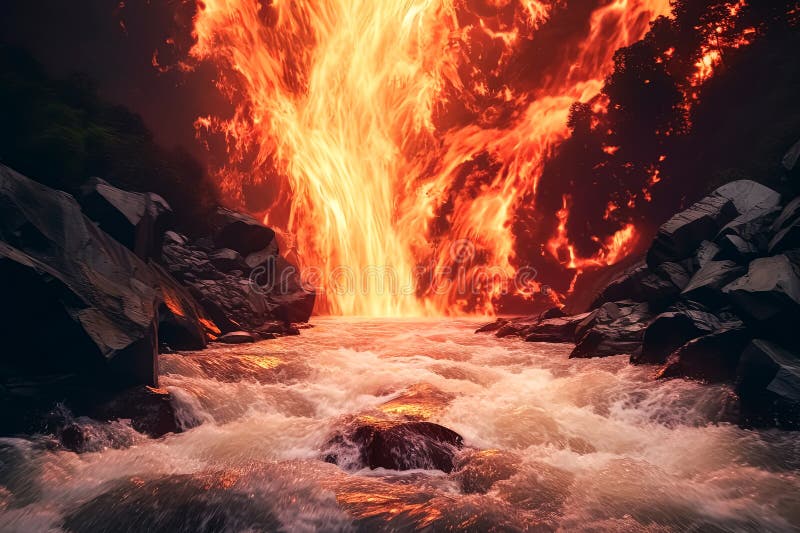
Free with trial A large wave of fire is crashing on the shore. The fire is orange and the water is dark. Rift zone stock images, royalty-free photos and pictures A large wave of
Free with trial Lava from Hawaii's Big Island streaming into the Pacific Ocean. Rift zone stock images, royalty-free photos and pictures Lava from Hawaii's Big Island streaming into the Pacific Ocean
Free with trial Earth exposed � the Afar Depression reveals the raw beauty of a continent splitting apart. Rift zone stock images, royalty-free photos and pictures . Earth exposed � the Afar Depression reveals the raw beauty of a continent splitting apart
Free with trial Grunge texture Abstract Background with Rust. Rift zone stock images, royalty-free photos and pictures Grunge Rust Texture Abstract Background. Grunge texture Abstract Background with Rust
Free with trial Cerulean Blue Texture Abstract Background. Rift zone stock images, royalty-free photos and pictures Cerulean Blue Texture Abstract Background
Free with trial Molten lava cascading into the Pacific Ocean on Hawaii's Big Island. Rift zone stock images, royalty-free photos and pictures Molten lava cascading into the Pacific Ocean on Hawaii's Big Island
Free with trial Abstract art depicting total darkness. Rift zone stock images, royalty-free photos and pictures Abstract Background Depicting Total Darkness. Abstract art depicting total darkness
Free with trial The Pacific Ocean on Hawaii's Big Island receiving flows of molten lava. Rift zone stock images, royalty-free photos and pictures The Pacific Ocean on Hawaii's Big Island receiving flows of molten lava
Free with trial The Big Island of Hawaii's Pacific Ocean witnessing molten lava pouring into its waters. Rift zone stock images, royalty-free photos and pictures The Big Island of Hawaii's Pacific Ocean witnessing molten lava pouring into its waters
Free with trial Dirt road leading to Hverfell tephra cone in the distance through a fragile volcanic landscape in Iceland. Rift zone stock images, royalty-free photos and pictures Dirt road leading to Hverfell tephra cone in the distance through a fragile volcanic landscape
Free with trial Lava from a volcano flows over a waterfall and solidifies, creating stunning lava formations amidst the cascading water. Rift zone stock images, royalty-free photos and pictures Lava from a volcano flows over a waterfall and solidifies
Free with trial Panoramic picture of a large pseudo crater in Skutustadir, iceland on an overcast day at Lake Myvatn. Rift zone stock images, royalty-free photos and pictures Panoramic picture of a large pseudo crater in Skutustadir, iceland on an overcast day
Free with trial Aerial view from an airplane window showcasing Iceland's volcanic landscape and recent lava flow near Grindavik and Blue lagoon on the Reykjanes Peninsula. Rift zone stock images, royalty-free photos and pictures Aerial view from an airplane window over Iceland\'s volcanic landscape and recent lava flow near Grindavik and Blue lagoon. Aerial view from an airplane window showcasing Iceland's volcanic landscape and recent lava flow near Grindavik and Blue lagoon on the Reykjanes Peninsula
Free with trial Cracked dry earth surface, top view of damaged land with deep crevices and fissures. Broken ground texture rough concrete surface with cracks and fractures. Damaged wall or floor with broken pattern. Rift zone stock images, royalty-free photos and pictures Cracked dry earth surface, top view of damaged land with deep crevices and fissures. Broken ground texture, rough concrete surface. Cracked dry earth surface, top view of damaged land with deep crevices and fissures. Broken ground texture rough concrete surface with cracks and fractures. Damaged wall or floor with broken pattern
Free with trial The North Island, New Zealand. The geothermal zone of Rotorua. Inferno Crater Lake is a large hot spring. The Waimangu Volcanic Rift Valley. The concept of exotic, ecological and photo tourism. Rift zone stock images, royalty-free photos and pictures The Volcanic Rift Valley. The North Island, New Zealand. The geothermal zone of Rotorua. Inferno Crater Lake is a large hot spring. The Waimangu Volcanic Rift Valley. The concept of exotic, ecological and photo tourism
Free with trial The Krafla geothermal power plant Krafla geothermal power plant taps into a geologic rift zone. It is located in Iceland, close to the Krafla Volcano and the lake Mývatn. Rift zone stock images, royalty-free photos and pictures Geothermal Plant – Icelandic Power Station. The Krafla geothermal power plant Krafla geothermal power plant taps into a geologic rift zone. It is located in Iceland, close to the Krafla Volcano and the lake Mývatn.
Free with trial The Waimangu Volcanic Rift Valley. The geothermal zone of Rotorua. Inferno Crater Lake is a large hot spring. The North Island, New Zealand. The concept of exotic, ecological and photo tourism. Rift zone stock images, royalty-free photos and pictures The Waimangu Volcanic Rift Valley
Free with trial Looking across the Rift Valley at Mountains and Lakes in Thingvellir National Park in Iceland. Rift zone stock images, royalty-free photos and pictures Looking across the Rift Valley at Mountains and Lakes
Free with trial The North Island, New Zealand. The geothermal zone of Rotorua. The Waimangu Volcanic Rift Valley. Inferno Crater Lake is a large hot spring. The concept of exotic, ecological and photo tourism. Rift zone stock images, royalty-free photos and pictures Inferno Crater Lake
Free with trial Fault zone (Thingvellir National Park, Iceland). Basalt lava. Iceland National Park canyon continental divide plate rock rift during day , view of landscape with rocky mountain. Rift zone stock images, royalty-free photos and pictures Iceland National Park canyon continental divide plate rock rift during day , view of landscape with rocky mountain.
Free with trial This is an abandoned place through which the road passes and when dawn comes, mist appears over the field of thickets. Rift zone stock images, royalty-free photos and pictures Delicious hamburger on a wSunrise in the rift zone, with morning foghite background. This is an abandoned place through which the road passes and when dawn comes, mist appears over the field of thickets.