Free with trial Small boat of tourists in the entrance to the underground river in sabang palawan in the philippines on of the longest cave systems in the world. River systems stock images, royalty-free photos and pictures Underground river sabang palawan philippines. Small boat of tourists in the entrance to the underground river in sabang palawan in the philippines on of the longest cave systems in the world
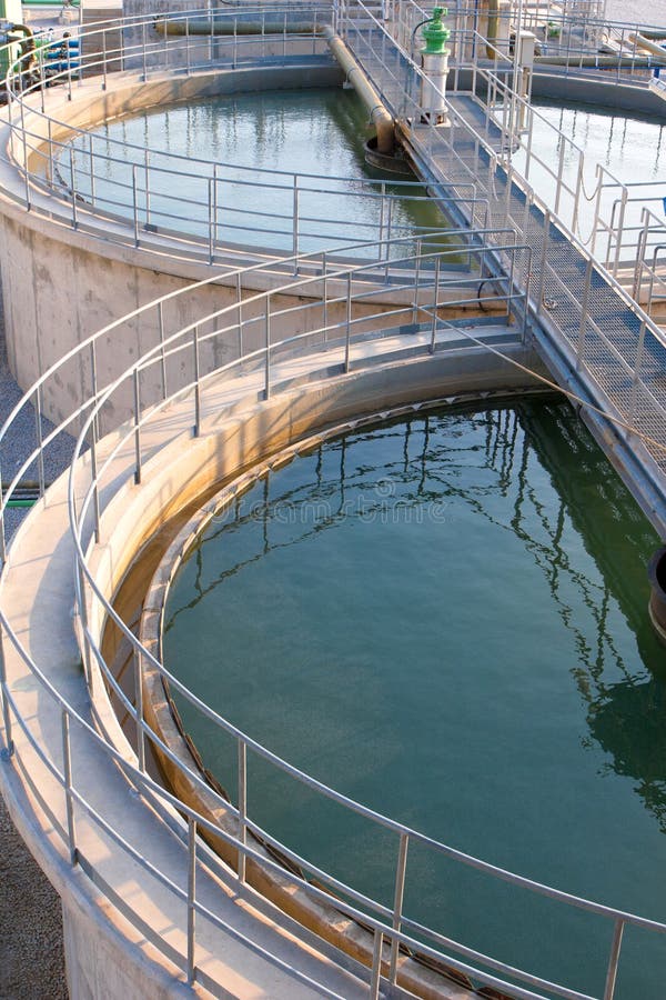
Free with trial Water in the tanks waiting for draining to the river after treatment. River systems stock images, royalty-free photos and pictures Waste water treatment systems tanks. Water in the tanks waiting for draining to the river after treatment
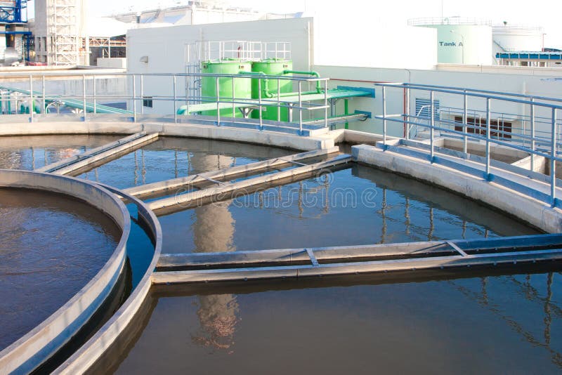
Free with trial Water in wastewater treatment tanks before draining clean water to the river. River systems stock images, royalty-free photos and pictures Wastewater treatment systems. Water in wastewater treatment tanks before draining clean water to the river
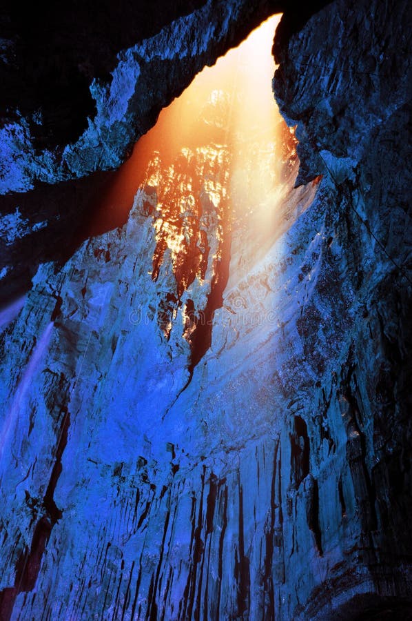
Free with trial Waterfall inside Gaping Gill cave in Ingleborough, Yorkshire Dales National Park (England). This is the largest cavern in Britain, known as the Main Chamber- comparable to St. Paul Cathedral in London. The Gaping Gill system is also one of Britain’s longest and most complex cave systems, representing one of the unmistakable landmarks on the southern slopes of Ingleborough - a 105 metres (344 ft) deep pothole with the stream Fell Beck flowing into it. Opened to the public few times a year, this cave represents without doubt an undiscovered beauty of the nature. River systems stock images, royalty-free photos and pictures Cave - Gaping Gill, Yorkshire, UK. Waterfall inside Gaping Gill cave in Ingleborough, Yorkshire Dales National Park (England). This is the largest cavern in Britain, known as the Main Chamber- comparable to St. Paul Cathedral in London. The Gaping Gill system is also one of Britain’s longest and most complex cave systems, representing one of the unmistakable landmarks on the southern slopes of Ingleborough - a 105 metres (344 ft) deep pothole with the stream Fell Beck flowing into it. Opened to the public few times a year, this cave represents without doubt an undiscovered beauty of the nature.
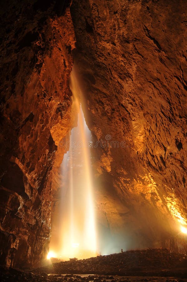
Free with trial Light from above inside Gaping Gill cave in Ingleborough, Yorkshire Dales National Park (England). This is the largest cavern in Britain, known as the Main Chamber - comparable to St. Paul Cathedral in London. The Gaping Gill system is also one of Britain’s longest and most complex cave systems, representing one of the unmistakable landmarks on the southern slopes of Ingleborough - a 105 metres (344 ft) deep pothole with the stream Fell Beck flowing into it. Opened to the public few times a year, this cave represents without doubt an undiscovered beauty of the nature. River systems stock images, royalty-free photos and pictures Light from above - Gaping Gill Cave. Light from above inside Gaping Gill cave in Ingleborough, Yorkshire Dales National Park (England). This is the largest cavern in Britain, known as the Main Chamber - comparable to St. Paul Cathedral in London. The Gaping Gill system is also one of Britain’s longest and most complex cave systems, representing one of the unmistakable landmarks on the southern slopes of Ingleborough - a 105 metres (344 ft) deep pothole with the stream Fell Beck flowing into it. Opened to the public few times a year, this cave represents without doubt an undiscovered beauty of the nature.
Free with trial The Amazon river dolphin, is a freshwater river dolphin endemic to the Orinoco, Amazon and Araguaia/Tocantins River systems of Brazil, Peru, Bolivia, Ecuador, Colombia and Venezuela. River systems stock images, royalty-free photos and pictures Amazon dolphin. The Amazon river dolphin, is a freshwater river dolphin endemic to the Orinoco, Amazon and Araguaia/Tocantins River systems of Brazil, Peru, Bolivia, Ecuador, Colombia and Venezuela.
Free with trial Geographic information systems concept, woman scientist working with futuristic interface in GIS software on a transparent screen. River systems stock images, royalty-free photos and pictures Geographic information systems concept, woman scientist working with futuristic GIS interface on a transparent screen. Geographic information systems concept, woman scientist working with futuristic interface in GIS software on a transparent screen.
Free with trial The Wicklow Mountains forms the largest continuous upland area in Ireland. They occupy the whole centre of County Wicklow and stretch outside its borders into Counties Carlow, Wexford and Dublin. Where the mountains extend into County Dublin, they are known locally as the Dublin Mountains. The highest peak is Lugnaquilla at 925 metres. Several major river systems have their source in the mountains, such as the Liffey, Dargle, Slaney and Avoca rivers. Powerscourt Waterfall is the tallest in Ireland at 121 metres. A number of these rivers have been harnessed to create reservoirs for drinking water for Dublin and its surroundings. The Wicklow Mountains experience a temperate oceanic climate with mild, damp summers and cool, wet winters. The dominant habitat of the uplands consists of blanket bog, heath and upland grassland. The uplands support a number of threatened bird species, including merlin and peregrine falcon. The valleys are a mixture of coniferous and deciduous woodland. River systems stock images, royalty-free photos and pictures Wiclow Mountains. The Wicklow Mountains forms the largest continuous upland area in Ireland. They occupy the whole centre of County Wicklow and stretch outside its borders into Counties Carlow, Wexford and Dublin. Where the mountains extend into County Dublin, they are known locally as the Dublin Mountains.The highest peak is Lugnaquilla at 925 metres. Several major river systems have their source in the mountains, such as the Liffey, Dargle, Slaney and Avoca rivers. Powerscourt Waterfall is the tallest in Ireland at 121 metres. A number of these rivers have been harnessed to create reservoirs for drinking water for Dublin and its surroundings. The Wicklow Mountains experience a temperate oceanic climate with mild, damp summers and cool, wet winters. The dominant habitat of the uplands consists of blanket bog, heath and upland grassland. The uplands support a number of threatened bird species, including merlin and peregrine falcon. The valleys are a mixture of coniferous and deciduous woodland.
Free with trial The Amazon river dolphin, is a freshwater river dolphin endemic to the Orinoco, Amazon and Araguaia/Tocantins River systems of Brazil, Peru, Bolivia, Ecuador, Colombia and Venezuela. River systems stock images, royalty-free photos and pictures Amazon dolphin. The Amazon river dolphin, is a freshwater river dolphin endemic to the Orinoco, Amazon and Araguaia/Tocantins River systems of Brazil, Peru, Bolivia, Ecuador, Colombia and Venezuela.
Free with trial Geographic information systems concept, woman scientist working with futuristic interface in GIS software on a transparent screen. River systems stock images, royalty-free photos and pictures Geographic information systems concept, woman scientist working with futuristic GIS interface on a transparent screen. Geographic information systems concept, woman scientist working with futuristic interface in GIS software on a transparent screen.
Free with trial Sunny rainbow side of the valley is about to be overrun by dark skies and a dramatic storm. River systems stock images, royalty-free photos and pictures Rainbows, Storms, Good and Evil. Sunny rainbow side of the valley is about to be overrun by dark skies and a dramatic storm.
Free with trial Agricultural civilization refers to a cultural set formed by farmers in long-term agricultural production, which is adapted to the needs of agricultural production and life, and is also a collection of national systems, etiquette and custom systems, culture and education. River systems stock images, royalty-free photos and pictures Chinese agricultural civilization. Agricultural civilization refers to a cultural set formed by farmers in long-term agricultural production, which is adapted to the needs of agricultural production and life, and is also a collection of national systems, etiquette and custom systems, culture and education.
Free with trial An old-style relief map shows mountainous regions and river systems, possibly in western United States, with places like Colorado and Reno, Nevada The map uses contour lines and shading to represent. River systems stock images, royalty-free photos and pictures An old-style relief map shows mountainous regions and river systems, possibly in western United States, with places like
Free with trial Clarke Quay is a historical riverside quay located on the Singapore River. After a conservation project was completed in the 1980's to 1990's, the area was transformed into a bustling commercial center with dozens of restaurants, pubs, and nightclubs. The umbrella-like structures on the right are sophisticated shading and cooling systems to moderate micro-climate and can reduce the ambient temperature by 4 degrees celcius. River systems stock images, royalty-free photos and pictures Singapore River and Clarke Quay. Clarke Quay is a historical riverside quay located on the Singapore River. After a conservation project was completed in the 1980's to 1990's, the area was transformed into a bustling commercial center with dozens of restaurants, pubs, and nightclubs. The umbrella-like structures on the right are sophisticated shading and cooling systems to moderate micro-climate and can reduce the ambient temperature by 4 degrees celcius.
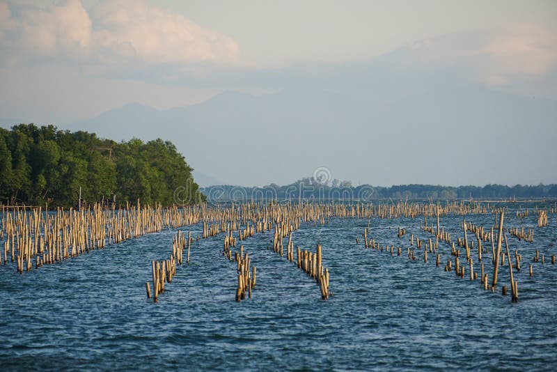
Free with trial Aerial root systems of mangroves growing in in tidal mudflats, Kinabatangan river flood plain, Sabah, Borneo, Malaysia. River systems stock images, royalty-free photos and pictures Aerial root systems of mangroves growing in in tidal mudflats
Free with trial Trash skimmer boat cleaning the water surface of the Moscow river from garbage in Moscow, Russia. River cleaning boat collects garbage on water surface of river. Floating debris removal systems. River systems stock images, royalty-free photos and pictures Trash skimmer boat cleaning water surface of river. Trash skimmer boat cleaning the water surface of the Moscow river from garbage in Moscow, Russia. River cleaning boat collects garbage on water surface of river. Floating debris removal systems
Free with trial Water discharge into the river from urban drainage systems, Moscow, Russia. River systems stock images, royalty-free photos and pictures Water discharge into the river from urban drainage systems
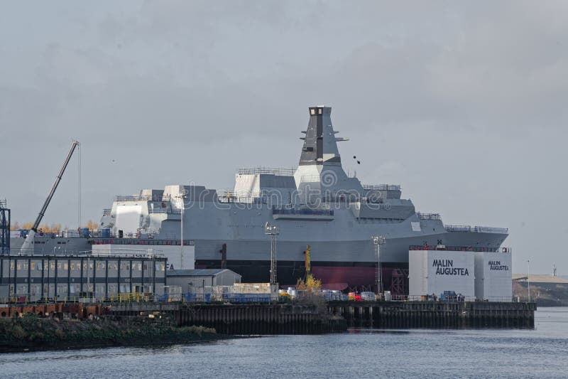
Free with trial Warship frigate construction in progress at BAE Systems on the River Clyde UK. River systems stock images, royalty-free photos and pictures Warship frigate construction in progress at BAE Systems on the River Clyde
Free with trial Norfolk, Virginia - September 24, 2019 : BAE Systems dry dock in the Elizabeth River in Norfolk, Virginia. River systems stock images, royalty-free photos and pictures BAE systems dry dock
Free with trial Glasgow, Scotland, UK, November 27th 2022, Warship frigate construction in progress at BAE Systems on the River Clyde. River systems stock images, royalty-free photos and pictures Glasgow, Scotland, UK, November 27th 2022, Warship frigate construction in progress at BAE Systems on the River Clyde
Free with trial Victoria's (Australia) one of the iconic river systems, the Barwon begins in the Otway Ranges and flows through the heart of Geelong city on its more than 155-kilometre journey to meet the sea at Barwon Heads. River systems stock images, royalty-free photos and pictures Blue sky reflecting in the waters of Barwon river in Geelong, Australia. Victoria's (Australia) one of the iconic river systems, the Barwon begins in the Otway Ranges and flows through the heart of Geelong city on its more than 155-kilometre journey to meet the sea at Barwon Heads
Free with trial Over-looking the towns of Kiona and Benton City, are the Horse Heaven Hills, one of the last of the wild ridge-line systems in our area, where Penstemon and many other native wild flowers bloom in a spring wildflower bouquet. The ridgeline provides grand views of tiny towns of Kiona and Benton City and the Yakima River Valley. Located just 15 minutes from the cities of Richland, Pasco and Kennewick, these ridge-lines provide recreational opportunities for including photographers, hikers, mountain bikers, trail runners, para-gliders, equestrians, and more, as well as threatened and endangered wildlife habitat and forage for pollinators of all kinds. The Horse Heaven Hills are now threatened in their own right from despoliation by threat of development by out of state wind tower developers who would destroy fragile plant communities and plant and animal habitats for short term gain. More information available at http: save-our-ridges. org. River systems stock images, royalty-free photos and pictures Horse Heaven Hills Purple Penstemon. Over-looking the towns of Kiona and Benton City, are the Horse Heaven Hills, one of the last of the wild ridge-line systems in our area, where Penstemon and many other native wild flowers bloom in a spring wildflower bouquet. The ridgeline provides grand views of tiny towns of Kiona and Benton City and the Yakima River Valley. Located just 15 minutes from the cities of Richland, Pasco and Kennewick, these ridge-lines provide recreational opportunities for including photographers, hikers, mountain bikers, trail runners, para-gliders, equestrians, and more, as well as threatened and endangered wildlife habitat and forage for pollinators of all kinds. The Horse Heaven Hills are now threatened in their own right from despoliation by threat of development by out of state wind tower developers who would destroy fragile plant communities and plant and animal habitats for short term gain. More information available at http: save-our-ridges.org.
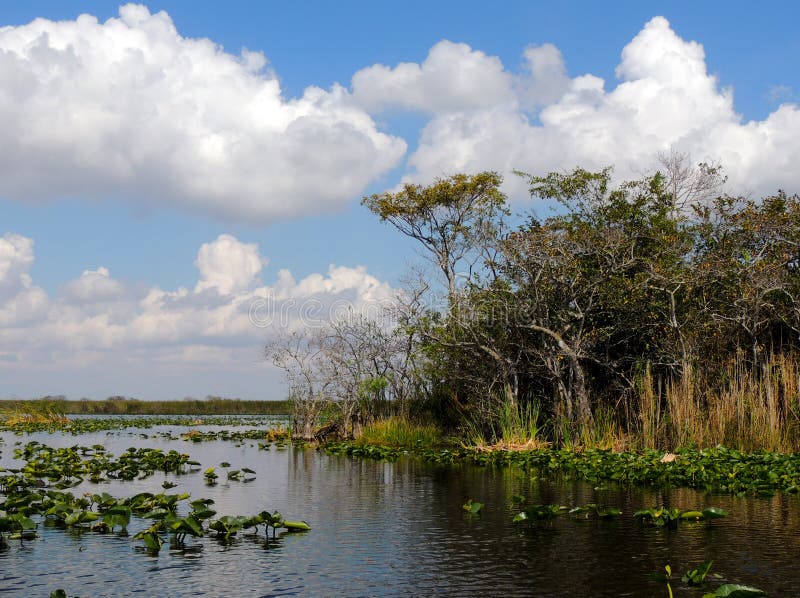
Free with trial A view of the Everglades from the canals. A beautiful day to be in nature. The Everglades is one of the most endangered water systems in the world and it is in the process of being restored to the natural state. Tree Islands are created during times of drought when the alligators dig for water. the mud and dirt that piles up eventually becomes an island in the middle of the river of grass. River systems stock images, royalty-free photos and pictures Everglades Tree Island. A view of the Everglades from the canals. A beautiful day to be in nature. The Everglades is one of the most endangered water systems in the world and it is in the process of being restored to the natural state. Tree Islands are created during times of drought when the alligators dig for water. the mud and dirt that piles up eventually becomes an island in the middle of the river of grass.
Free with trial Victoria's (Australia) one of the iconic river systems, the Barwon begins in the Otway Ranges and flows through the heart of Geelong city on its more than 155-kilometre journey to meet the sea at Barwon Heads. River systems stock images, royalty-free photos and pictures Blue sky reflecting in the waters of Barwon river in Geelong, Australia. Victoria's (Australia) one of the iconic river systems, the Barwon begins in the Otway Ranges and flows through the heart of Geelong city on its more than 155-kilometre journey to meet the sea at Barwon Heads
Free with trial Victoria's (Australia) one of the iconic river systems, the Barwon begins in the Otway Ranges and flows through the heart of Geelong city on its more than 155-kilometre journey to meet the sea at Barwon Heads. River systems stock images, royalty-free photos and pictures Blue sky reflecting in the waters of Barwon river in Geelong, Australia. Victoria's (Australia) one of the iconic river systems, the Barwon begins in the Otway Ranges and flows through the heart of Geelong city on its more than 155-kilometre journey to meet the sea at Barwon Heads
Free with trial Men are checking computer systems and work site blueprints. River systems stock images, royalty-free photos and pictures Men are checking computer systems work site blueprints
Free with trial A soldier stands on a rocky ledge, observing digital holograms projected over a river. Advanced technology enhances situational awareness in a natural landscape. River systems stock images, royalty-free photos and pictures Military personnel using advanced holographic technology near a river in a forested area. A soldier stands on a rocky ledge, observing digital holograms projected over a river. Advanced technology enhances situational awareness in a natural landscape.
Free with trial Satellite technology provides insights into the geographic features of a vast, rugged terrain illuminated by sunlight. This analysis focuses on landforms and water routes. River systems stock images, royalty-free photos and pictures Satellite imagery captures detailed geospatial analysis of rugged terrain and river systems in a remote landscape. Satellite technology provides insights into the geographic features of a vast, rugged terrain illuminated by sunlight. This analysis focuses on landforms and water routes.
Free with trial Wastewater systems in large cities. River systems stock images, royalty-free photos and pictures Drain water into the river. Wastewater systems in large cities
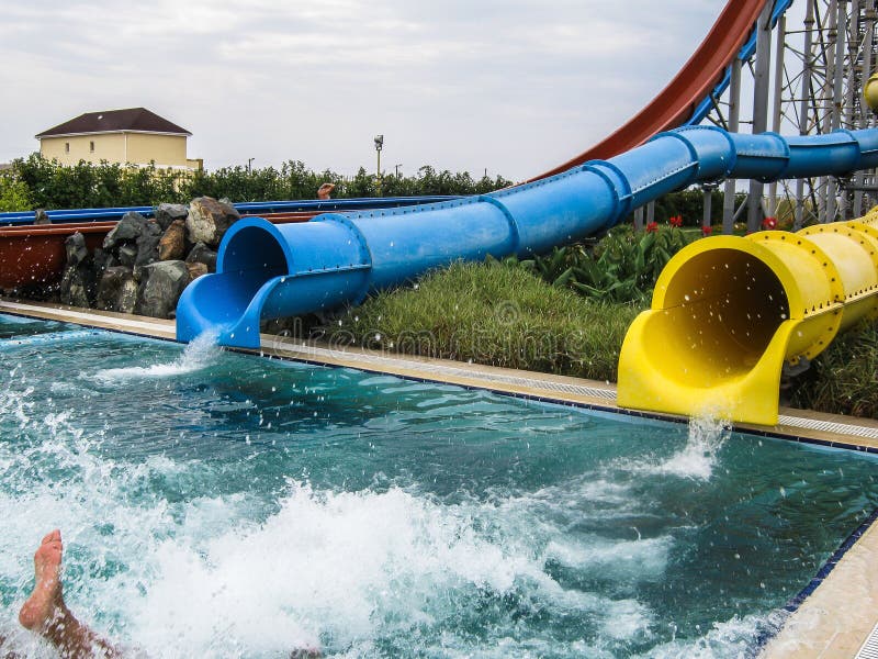
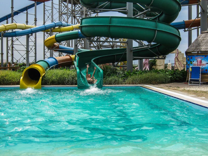
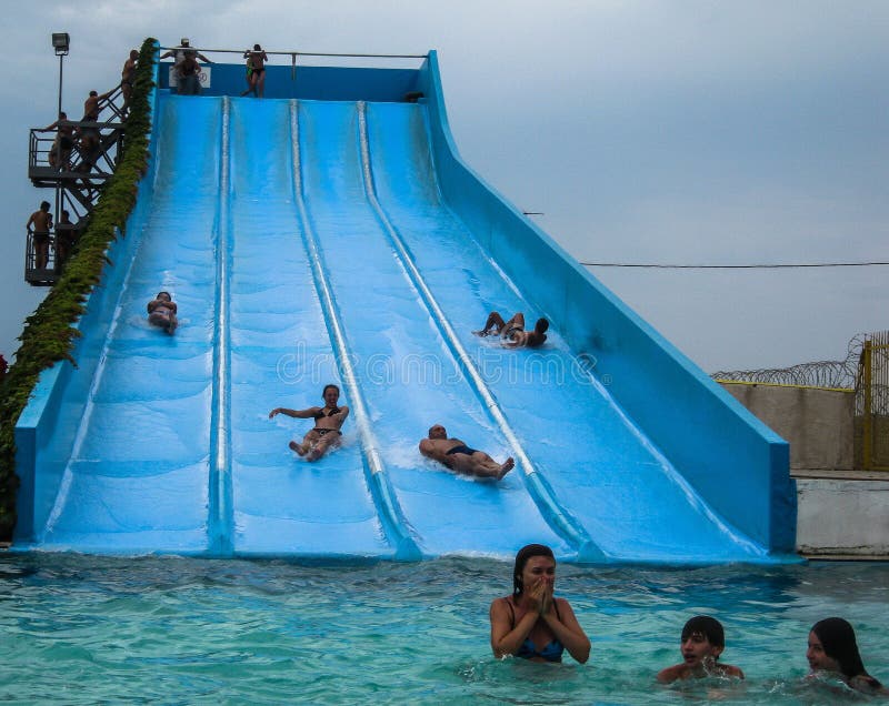
Free with trial Water Park in the Russian city of Anapa, Krasnodar region. Water Park and entertainment complex that has infrastructure facilities for water games and water rides such as water slides, sprinkle, swimming pools with a tower, fountains, lazy river and other water activities. More modern parks can be equipped with means for injecting artificial waves in the pool and classes are a special kind of surfing. Most water parks are outdoors, usually in a resort area, but there are a lot of closed systems. River systems stock images, royalty-free photos and pictures Water Park in the Russian city of Anapa, Krasnodar region.
Free with trial Water Park in the Russian city of Anapa, Krasnodar region. Water Park and entertainment complex that has infrastructure facilities for water games and water rides such as water slides, sprinkle, swimming pools with a tower, fountains, lazy river and other water activities. More modern parks can be equipped with means for injecting artificial waves in the pool and classes are a special kind of surfing. Most water parks are outdoors, usually in a resort area, but there are a lot of closed systems. River systems stock images, royalty-free photos and pictures Water Park in the Russian city of Anapa, Krasnodar region.
Free with trial Mangrove forest, fishing net, river, lake. River systems stock images, royalty-free photos and pictures Mangrove forest, fishing net, river
Free with trial Water Park in the Russian city of Anapa, Krasnodar region. Water Park and entertainment complex that has infrastructure facilities for water games and water rides such as water slides, sprinkle, swimming pools with a tower, fountains, lazy river and other water activities. More modern parks can be equipped with means for injecting artificial waves in the pool and classes are a special kind of surfing. Most water parks are outdoors, usually in a resort area, but there are a lot of closed systems. River systems stock images, royalty-free photos and pictures Water Park in the Russian city of Anapa, Krasnodar region.
Free with trial Aerial View of Bangkok and the Bhumibol Bridge inter-city expressway Across the Chao Phraya River and ring road systems on the outer edge of Bangkok Metropolitan. River systems stock images, royalty-free photos and pictures Bhumibol bridge across Cho Phraya river. Aerial View of Bangkok and the Bhumibol Bridge inter-city expressway Across the Chao Phraya River and ring road systems on the outer edge of Bangkok Metropolitan
Free with trial Old brickwork sewer tunnel with light from the turn. Underground river or old rainwater collector of the 19th century. River systems stock images, royalty-free photos and pictures Old brickwork sewer tunnel with light from the turn. Underground river or old rainwater collector of the 19th century
Free with trial This image showcases a sustainable farm surrounded by a river, featuring advanced water management systems, greenhouses, and crop fields. The landscape highlights eco-friendly practices and efficient resource use. River systems stock images, royalty-free photos and pictures Aerial view of a sustainable farm with water management systems, AI. This image showcases a sustainable farm surrounded by a river, featuring advanced water management systems, greenhouses, and crop fields. The landscape highlights eco-friendly practices and efficient resource use
Free with trial Sandy Level, VA – January 8th:Roanoke River view of the Smith Mountain Hydroelectric Dam located, in Bedford and Pittsylvania Counties, Virginia, USA on January 8th, 2019. River systems stock images, royalty-free photos and pictures Roanoke River View of the Smith Mountain Hydroelectric Dam - 2. Sandy Level, VA – January 8th:Roanoke River view of the Smith Mountain Hydroelectric Dam located, in Bedford and Pittsylvania Counties, Virginia, USA on January 8th, 2019.
Free with trial Rani ki vav is an intricately constructed stepwell situated in the town of Patan in Gujarat, India. It is located on the banks of Saraswati River. Rani ki vav was built as a memorial to an 11th-century AD king Bhimdev I. It was added to the list of UNESCO's World Heritage Sites on 22 June 2014. Stepwells are a distinctive form of subterranean water resource and storage systems on the Indian subcontinent, and have been constructed since the third millennium BC. Rani ki vav was built in the complex Maru-Gurjara architectural style with an inverted temple and seven levels of stairs and holds more than 500 principal sculptures. River systems stock images, royalty-free photos and pictures World heritage site rani ki vav India. Rani ki vav is an intricately constructed stepwell situated in the town of Patan in Gujarat, India. It is located on the banks of Saraswati River. Rani ki vav was built as a memorial to an 11th-century AD king Bhimdev I . It was added to the list of UNESCO's World Heritage Sites on 22 June 2014. Stepwells are a distinctive form of subterranean water resource and storage systems on the Indian subcontinent, and have been constructed since the third millennium BC. Rani ki vav was built in the complex Maru-Gurjara architectural style with an inverted temple and seven levels of stairs and holds more than 500 principal sculptures.
Free with trial Rani ki vav is an intricately constructed stepwell situated in the town of Patan in Gujarat, India. It is located on the banks of Saraswati River. Rani ki vav was built as a memorial to an 11th-century AD king Bhimdev I. It was added to the list of UNESCO's World Heritage Sites on 22 June 2014. Stepwells are a distinctive form of subterranean water resource and storage systems on the Indian subcontinent, and have been constructed since the third millennium BC. Rani ki vav was built in the complex Maru-Gurjara architectural style with an inverted temple and seven levels of stairs and holds more than 500 principal sculptures. River systems stock images, royalty-free photos and pictures World Heritage site of Rani ki vav India. Rani ki vav is an intricately constructed stepwell situated in the town of Patan in Gujarat, India. It is located on the banks of Saraswati River. Rani ki vav was built as a memorial to an 11th-century AD king Bhimdev I . It was added to the list of UNESCO's World Heritage Sites on 22 June 2014. Stepwells are a distinctive form of subterranean water resource and storage systems on the Indian subcontinent, and have been constructed since the third millennium BC. Rani ki vav was built in the complex Maru-Gurjara architectural style with an inverted temple and seven levels of stairs and holds more than 500 principal sculptures.
Free with trial Rani ki vav is an intricately constructed stepwell situated in the town of Patan in Gujarat, India. It is located on the banks of Saraswati River. Rani ki vav was built as a memorial to an 11th-century AD king Bhimdev I. It was added to the list of UNESCO's World Heritage Sites on 22 June 2014. Stepwells are a distinctive form of subterranean water resource and storage systems on the Indian subcontinent, and have been constructed since the third millennium BC. Rani ki vav was built in the complex Maru-Gurjara architectural style with an inverted temple and seven levels of stairs and holds more than 500 principal sculptures. River systems stock images, royalty-free photos and pictures World heritage site rani ki vav India. Rani ki vav is an intricately constructed stepwell situated in the town of Patan in Gujarat, India. It is located on the banks of Saraswati River. Rani ki vav was built as a memorial to an 11th-century AD king Bhimdev I . It was added to the list of UNESCO's World Heritage Sites on 22 June 2014. Stepwells are a distinctive form of subterranean water resource and storage systems on the Indian subcontinent, and have been constructed since the third millennium BC. Rani ki vav was built in the complex Maru-Gurjara architectural style with an inverted temple and seven levels of stairs and holds more than 500 principal sculptures.
Free with trial Norfolk, USA - June 9, 2019: Image of several US Navy ships docked at BAE Systems Pier in Norfolk for maintenance. River systems stock images, royalty-free photos and pictures BAE Systems ship repair. Norfolk, USA - June 9, 2019: Image of several US Navy ships docked at BAE Systems Pier in Norfolk for maintenance
Free with trial Paris; France-June 04, 2016 : The Eiffel tower and Seine river in flood near bridge Alexandre III. The river Seine in Paris is at his highest level for more than 30 years, with floods forcing closed parts of the metro systems and major landmarks. River systems stock images, royalty-free photos and pictures The Eiffel tower and Seine river in flood, Paris, France. Paris; France-June 04, 2016 : The Eiffel tower and Seine river in flood near bridge Alexandre III. The river Seine in Paris is at his highest level for more than 30 years, with floods forcing closed parts of the metro systems and major landmarks.
Free with trial Mannheim, Germany. June 16th 2013. Terminal Container of Mannheim. River port on the Rhine. One of the most important inland ports in Europe. River systems stock images, royalty-free photos and pictures Mannheim, Germany. June 16th 2013. Terminal Container of Mannheim. River port on the Rhine. One of the most important inland ports
Free with trial Mannheim, Germany. January 30th 2009. Terminal Container of Mannheim. River port on the Rhine. One of the most important inland ports in Europe. River systems stock images, royalty-free photos and pictures Mannheim, Germany. January 30th 2009. Terminal Container of Mannheim. River port on the Rhine. One of the most important inland
Free with trial Mannheim, Germany. January 30th 2009. Terminal Container of Mannheim. River port on the Rhine. One of the most important inland ports in Europe. River systems stock images, royalty-free photos and pictures Mannheim, Germany. January 30th 2009. Terminal Container of Mannheim. River port on the Rhine. One of the most important inland
Free with trial HMS Glasgow warship frigate construction in progress at BAE Systems on the River Clyde. River systems stock images, royalty-free photos and pictures Glasgow, Scotland, Uk, February 24th 2024, HMS Glasgow warship frigate construction in progress at BAE Systems on the. HMS Glasgow warship frigate construction in progress at BAE Systems on the River Clyde
Free with trial HMS Glasgow warship frigate construction in progress at BAE Systems on the River Clyde. River systems stock images, royalty-free photos and pictures Glasgow, Scotland, Uk, February 24th 2024, HMS Glasgow warship frigate construction in progress at BAE Systems on the. HMS Glasgow warship frigate construction in progress at BAE Systems on the River Clyde
Free with trial An adventurous young woman looks in disbelief at the huge canyon systems in front of her. This is the confluence of the Green and Colorado rivers In Easter Utah. River systems stock images, royalty-free photos and pictures Canyonlands Amazement. An adventurous young woman looks in disbelief at the huge canyon systems in front of her. This is the confluence of the Green and Colorado rivers In Easter Utah.
Free with trial The Woodrow Wilson Bridge is a seven and a half mile corridor beginning in Maryland and connecting to Virginia over the Potomac River. This bascule bridge is one of a handful of drawbridges in the United States Interstate Highway Systems. River systems stock images, royalty-free photos and pictures Woodrow Wilson Bridge At Dusk Washington DC. The Woodrow Wilson Bridge is a seven and a half mile corridor beginning in Maryland and connecting to Virginia over the Potomac River. This bascule bridge is one of a handful of drawbridges in the United States Interstate Highway Systems.
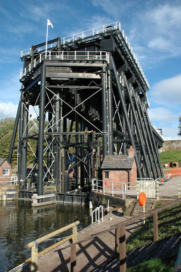
Free with trial Victorian mechanical boat lift in Anderton, Cheshire, UK, used to raising and lowering boats between two canal systems. Image is from the lower river area and includes small buildings and a blue sky. River systems stock images, royalty-free photos and pictures Victorian boat lift. Victorian mechanical boat lift in Anderton, Cheshire, UK, used to raising and lowering boats between two canal systems. Image is from the lower river area and includes small buildings and a blue sky.
Free with trial The Woodrow Wilson Bridge is a seven and a half mile corridor beginning in Maryland and connecting to Virginia over the Potomac River. This bascule bridge is one of a handful of drawbridges in the United States Interstate Highway Systems. River systems stock images, royalty-free photos and pictures Woodrow Wilson Bridge Night Light Trails. The Woodrow Wilson Bridge is a seven and a half mile corridor beginning in Maryland and connecting to Virginia over the Potomac River. This bascule bridge is one of a handful of drawbridges in the United States Interstate Highway Systems.
Free with trial Huge canyon systems compose Canyonlands National Park. This is the confluence of the Green and Colorado rivers In Easter Utah. River systems stock images, royalty-free photos and pictures Looking Across Canyonlands National Park. Huge canyon systems compose Canyonlands National Park. This is the confluence of the Green and Colorado rivers In Easter Utah.
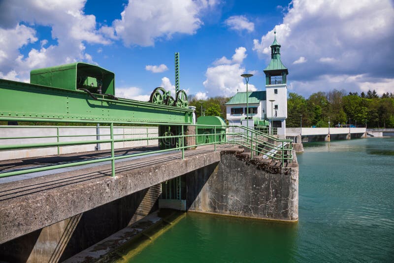
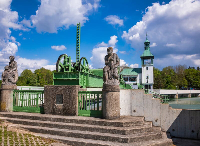
Free with trial Hochablass High Drain Dam on Lech river south of Augsburg, Swabia, Bavaria, Germany, a part of UNESCO World Heritage Site Water Management System of Augsburg. River systems stock images, royalty-free photos and pictures Hochablass Dam Lech Canal Augsburg Swabia Bavaria Germany. Hochablass High Drain Dam on Lech river south of Augsburg, Swabia, Bavaria, Germany, a part of UNESCO World Heritage Site Water Management System of Augsburg
Free with trial Huge canyon systems compose Canyonlands National Park. This is the confluence of the Green and Colorado rivers In Easter Utah. River systems stock images, royalty-free photos and pictures Looking Across Canyonlands National Park. Huge canyon systems compose Canyonlands National Park. This is the confluence of the Green and Colorado rivers In Easter Utah.
Free with trial Hochablass High Drain Dam on Lech river south of Augsburg, Swabia, Bavaria, Germany, a part of UNESCO World Heritage Site Water Management System of Augsburg. River systems stock images, royalty-free photos and pictures Hochablass Dam Lech Canal Augsburg Swabia Bavaria Germany. Hochablass High Drain Dam on Lech river south of Augsburg, Swabia, Bavaria, Germany, a part of UNESCO World Heritage Site Water Management System of Augsburg
Free with trial Hochablass High Drain Dam on Lech river south of Augsburg, Swabia, Bavaria, Germany, a part of UNESCO World Heritage Site Water Management System of Augsburg. River systems stock images, royalty-free photos and pictures Hochablass Dam Lech Canal Augsburg Swabia Bavaria Germany. Hochablass High Drain Dam on Lech river south of Augsburg, Swabia, Bavaria, Germany, a part of UNESCO World Heritage Site Water Management System of Augsburg
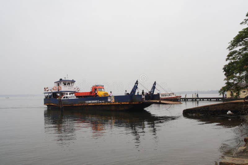
Free with trial A ferry (ferry boat) reaching jetty with a Car and truck at Vaikom Boat jetty, Kerala, India. Government of Kerala, India regulates the inland navigation systems in the Indian state of Kerala and provides inland water transport facilities. It stands for catering to the passenger and cargo traffic needs of the inhabitants of the waterlogged areas of the Districts of Alappuzha, Kottayam, Kollam, Ernakulam, Kannur and Kasargode. SWTD ferry service is also one of the most affordable modes to enjoy the beauty of the scenic Kerala backwaters. River systems stock images, royalty-free photos and pictures Ferry (ferry boat)
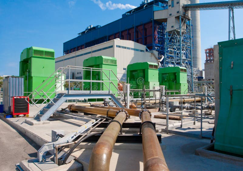
Free with trial Giant electric water pumps to pumping water from river or pools into the cooling systems in the generator power plant. River systems stock images, royalty-free photos and pictures Giant electric water pumps
Free with trial View at Gileppe dam with artificial lake in Belgium Ardennes with two drinking water supply systems. River systems stock images, royalty-free photos and pictures Gileppe dam in Belgium with two drinking water supply systems. View at Gileppe dam with artificial lake in Belgium Ardennes with two drinking water supply systems
Free with trial A tranquil village nestled in lush green hills overlooks a serene lake. Traditional houses with thatched roofs and unique water storage systems are scattered across the landscape. The scene evokes a sense of peaceful, remote living in harmony with nature. River systems stock images, royalty-free photos and pictures Remote Village by Lake. A tranquil village nestled in lush green hills overlooks a serene lake. Traditional houses with thatched roofs and unique water storage systems are scattered across the landscape. The scene evokes a sense of peaceful, remote living in harmony with nature.
Free with trial Geographic information systems concept, woman scientist working with futuristic interface in GIS software on a transparent screen. River systems stock images, royalty-free photos and pictures Geographic information systems concept, woman scientist working with futuristic GIS interface on a transparent screen. Geographic information systems concept, woman scientist working with futuristic interface in GIS software on a transparent screen.
Free with trial Geographic information systems concept, woman scientist working with futuristic interface in GIS software on a transparent screen. River systems stock images, royalty-free photos and pictures Geographic information systems concept, woman scientist working with futuristic GIS interface on a transparent screen. Geographic information systems concept, woman scientist working with futuristic interface in GIS software on a transparent screen.
Free with trial A hydraulic dredging vessel operates on the Danube River using floating pipelines for sediment removal, channel maintenance, and environmental monitoring to ensure safe and sustainable navigation. River systems stock images, royalty-free photos and pictures Hydraulic Dredging Vessel Operating with Floating Pipelines. A hydraulic dredging vessel operates on the Danube River using floating pipelines for sediment removal, channel maintenance, and environmental monitoring to ensure safe and sustainable navigation
Free with trial Geographic information systems concept, woman scientist working with futuristic interface in GIS software on a transparent screen. River systems stock images, royalty-free photos and pictures Geographic information systems concept, woman scientist working with futuristic GIS interface on a transparent screen. Geographic information systems concept, woman scientist working with futuristic interface in GIS software on a transparent screen.
Free with trial Geographic information systems concept, woman scientist working with futuristic interface in GIS software on a transparent screen. River systems stock images, royalty-free photos and pictures Geographic information systems concept, woman scientist working with futuristic GIS interface on a transparent screen. Geographic information systems concept, woman scientist working with futuristic interface in GIS software on a transparent screen.
Free with trial Paddlesteamers docked together in flooding river heights. The Paddlesteamers were safe in this part of the river. The Murray River was flowing quickly which made it more difficult to manoeuvre the boats easily. Riding on the P. S. Alexander Arbuthnot and P. Pevensey will give you the experience of Echuca’s heyday, from about 1860 to the early 1900’s, Echuca was a bustling, pioneering outpost. Paddlesteamers ferried people and goods from all through the Murray, Darling and Murrumbidgee River systems, to Echuca – the closet point to Melbourne on the Murray. Echuca flourished. Pubs, breweries and brothels boomed as the township revelled in its success. Legend has it that it wasn’t uncommon for horse races to stir up the dust down High Street where boutiques boasted the finest in European fashion and finery, bare knuckle fights lasted hours down on the river banks and you could catch cod fish as big as a man. River systems stock images, royalty-free photos and pictures Paddlesteamers at Echuca Moama on The Murray. Paddlesteamers docked together in flooding river heights. The Paddlesteamers were safe in this part of the river. The Murray River was flowing quickly which made it more difficult to manoeuvre the boats easily. Riding on the P.S. Alexander Arbuthnot and P.S. Pevensey will give you the experience of Echuca’s heyday, from about 1860 to the early 1900’s, Echuca was a bustling, pioneering outpost. Paddlesteamers ferried people and goods from all through the Murray, Darling and Murrumbidgee River systems, to Echuca – the closet point to Melbourne on the Murray. Echuca flourished. Pubs, breweries and brothels boomed as the township revelled in its success. Legend has it that it wasn’t uncommon for horse races to stir up the dust down High Street where boutiques boasted the finest in European fashion and finery, bare knuckle fights lasted hours down on the river banks and you could catch cod fish as big as a man.
Free with trial Katherine Gorge located in Nitmiluk National Park. Beautiful river systems and spectacular sandstone valleys. Nitmiluk Gorge is a deep gorge created from millions of years of extreme wet season water flows from the Katherine River. You can discover it on foot, by canoe, boat or helicopter. River systems stock images, royalty-free photos and pictures Katherine Gorge. Nitmiluk National Park. Outback Australia. Katherine Gorge located in Nitmiluk National Park. Beautiful river systems and spectacular sandstone valleys. Nitmiluk Gorge is a deep gorge created from millions of years of extreme wet season water flows from the Katherine River. You can discover it on foot, by canoe, boat or helicopter.
Free with trial Geographic information systems concept, woman scientist working with futuristic interface in GIS software on a transparent screen. River systems stock images, royalty-free photos and pictures Geographic information systems concept, woman scientist working with futuristic GIS interface on a transparent screen. Geographic information systems concept, woman scientist working with futuristic interface in GIS software on a transparent screen.
Free with trial Geographic information systems concept, woman scientist working with futuristic interface in GIS software on a transparent screen. River systems stock images, royalty-free photos and pictures Geographic information systems concept, woman scientist working with futuristic GIS interface on a transparent screen. Geographic information systems concept, woman scientist working with futuristic interface in GIS software on a transparent screen.
Free with trial Geographic information systems concept, woman scientist working with futuristic interface in GIS software on a transparent screen. River systems stock images, royalty-free photos and pictures Geographic information systems concept, woman scientist working with futuristic GIS interface on a transparent screen. Geographic information systems concept, woman scientist working with futuristic interface in GIS software on a transparent screen.
Free with trial Geographic information systems concept, woman scientist working with futuristic interface in GIS software on a transparent screen. River systems stock images, royalty-free photos and pictures Geographic information systems concept, woman scientist working with futuristic GIS interface on a transparent screen. Geographic information systems concept, woman scientist working with futuristic interface in GIS software on a transparent screen.
Free with trial Rusty valves control water flow in an old treatment plant, showcasing the essential process of water purification along the riverbank. River systems stock images, royalty-free photos and pictures Old water treatment plant valves manage flow during water purification process by the river. Rusty valves control water flow in an old treatment plant, showcasing the essential process of water purification along the riverbank
Free with trial Mangrove forest in Langkawi, Malaysian Island, features dense greenery and tall, slender mangrove trees (Rhizophoraceae family) with visible root systems emerging from the water. The scene is serene, with calm, shallow water reflecting the lush foliage. Sunlight filters through the canopy, highlighting the vibrant green leaves and creating a tranquil, shaded environment typical of tropical mangrove ecosystems. Mangroves play a crucial role in coastal protection and biodiversity. River systems stock images, royalty-free photos and pictures Mangrove forest at Langkawi, Malaysian Island, Malaysia. Mangrove forest in Langkawi, Malaysian Island, features dense greenery and tall, slender mangrove trees. Mangrove forest in Langkawi, Malaysian Island, features dense greenery and tall, slender mangrove trees (Rhizophoraceae family) with visible root systems emerging from the water. The scene is serene, with calm, shallow water reflecting the lush foliage. Sunlight filters through the canopy, highlighting the vibrant green leaves and creating a tranquil, shaded environment typical of tropical mangrove ecosystems. Mangroves play a crucial role in coastal protection and biodiversity.
Free with trial The Himalayas, or Himalaya, is a mountain range in Asia, separating the plains of the Indian subcontinent from the Tibetan Plateau. The range has many of the Earth`s highest peaks, including the highest, Mount Everest. Among the world’s popular mountain areas, India contains the largest, highest, and most populated Himalayan mountain systems. River systems stock images, royalty-free photos and pictures Ganga river flows through snow peak Himalayas in India. The Himalayas, or Himalaya, is a mountain range in Asia, separating the plains of the Indian subcontinent from the Tibetan Plateau. The range has many of the Earth`s highest peaks, including the highest, Mount Everest. Among the world’s popular mountain areas, India contains the largest, highest, and most populated Himalayan mountain systems.
Free with trial Katherine Gorge located in Nitmiluk National Park. Beautiful river systems and spectacular sandstone valleys. Nitmiluk Gorge is a deep gorge created from millions of years of extreme wet season water flows from the Katherine River. You can discover it on foot, by canoe, boat or helicopter. River systems stock images, royalty-free photos and pictures Katherine Gorge. Nitmiluk National Park. Outback Australia. Katherine Gorge located in Nitmiluk National Park. Beautiful river systems and spectacular sandstone valleys. Nitmiluk Gorge is a deep gorge created from millions of years of extreme wet season water flows from the Katherine River. You can discover it on foot, by canoe, boat or helicopter.
Free with trial The Natural Park of the Southwest Alentejo and Costa Vicentina is located on the southwest coast of Portugal, with a length of 110 km with a total area of 89,595 hectares. The Park includes various unique species of animal and plant life. In the area of the park there are several types of natural and semi-natural landscapes and habitats, such as abrupt cliffs, beaches, the estuary of the Mira river, dune systems, heathlands, marshes, salt-lined steppes, temporary lagoons, ravines, etc. In the area behind the coastal cliffs all along the Natural Park coast, there is a large amount of weathering caused by the sea’s abrasive action when the whole area was submerged at the end of the Cenozoic period 2 milion years ago. On this platform, seen all over the western coast, fossilized dunes can be found. This formation stands on consolidated orange sands as well as directly on Paleozoic rocks which are darker in colour and have faulted and folded strata. River systems stock images, royalty-free photos and pictures Cliffs at the Costa Vicentina Natural Park, Southwestern Portugal. The Natural Park of the Southwest Alentejo and Costa Vicentina is located on the southwest coast of Portugal, with a length of 110 km with a total area of 89,595 hectares. The Park includes various unique species of animal and plant life. In the area of the park there are several types of natural and semi-natural landscapes and habitats, such as abrupt cliffs, beaches, the estuary of the Mira river, dune systems, heathlands, marshes, salt-lined steppes, temporary lagoons, ravines, etc. In the area behind the coastal cliffs all along the Natural Park coast, there is a large amount of weathering caused by the sea’s abrasive action when the whole area was submerged at the end of the Cenozoic period 2 milion years ago. On this platform, seen all over the western coast, fossilized dunes can be found. This formation stands on consolidated orange sands as well as directly on Paleozoic rocks which are darker in colour and have faulted and folded strata.
Free with trial Discover the modernity of an industrial water treatment facility that seamlessly combines sleek design with cutting-edge technology. automation and efficiency define this plant, optimizing the chemical treatment process for wastewater. marvel at the state-of-the-art filtration and purification systems ensuring top-notch water quality. generative ai. River systems stock images, royalty-free photos and pictures Modern industrial water treatment facility. ai generated. discover the modernity of an industrial water treatment facility that seamlessly combines sleek design with cutting-edge technology. automation and efficiency define this plant, optimizing the chemical treatment process for wastewater. marvel at the state-of-the-art filtration and purification systems ensuring top-notch water quality. generative ai
Free with trial Katherine Gorge located in Nitmiluk National Park. Beautiful river systems and spectacular sandstone valleys. Nitmiluk Gorge is a deep gorge created from millions of years of extreme wet season water flows from the Katherine River. You can discover it on foot, by canoe, boat or helicopter. River systems stock images, royalty-free photos and pictures Katherine Gorge. Nitmiluk National Park. Outback Australia. Katherine Gorge located in Nitmiluk National Park. Beautiful river systems and spectacular sandstone valleys. Nitmiluk Gorge is a deep gorge created from millions of years of extreme wet season water flows from the Katherine River. You can discover it on foot, by canoe, boat or helicopter.
Free with trial Katherine Gorge located in Nitmiluk National Park. Beautiful river systems and spectacular sandstone valleys. Nitmiluk Gorge is a deep gorge created from millions of years of extreme wet season water flows from the Katherine River. You can discover it on foot, by canoe, boat or helicopter. River systems stock images, royalty-free photos and pictures Katherine Gorge. Nitmiluk National Park. Outback Australia. Katherine Gorge located in Nitmiluk National Park. Beautiful river systems and spectacular sandstone valleys. Nitmiluk Gorge is a deep gorge created from millions of years of extreme wet season water flows from the Katherine River. You can discover it on foot, by canoe, boat or helicopter.
Free with trial The Natural Park of the Southwest Alentejo and Costa Vicentina is located on the southwest coast of Portugal, with a length of 110 km with a total area of 89,595 hectares. The Park includes various unique species of animal and plant life. In the area of the park there are several types of natural and semi-natural landscapes and habitats, such as abrupt cliffs, beaches, the estuary of the Mira river, dune systems, heathlands, marshes, salt-lined steppes, temporary lagoons, ravines, etc. In the area behind the coastal cliffs all along the Natural Park coast, there is a large amount of weathering caused by the sea’s abrasive action when the whole area was submerged at the end of the Cenozoic period 2 milion years ago. On this platform, seen all over the western coast, fossilized dunes can be found. This formation stands on consolidated orange sands as well as directly on Paleozoic rocks which are darker in colour and have faulted and folded strata. River systems stock images, royalty-free photos and pictures Cliffs at the Costa Vicentina Natural Park, Southwestern Portugal. The Natural Park of the Southwest Alentejo and Costa Vicentina is located on the southwest coast of Portugal, with a length of 110 km with a total area of 89,595 hectares. The Park includes various unique species of animal and plant life. In the area of the park there are several types of natural and semi-natural landscapes and habitats, such as abrupt cliffs, beaches, the estuary of the Mira river, dune systems, heathlands, marshes, salt-lined steppes, temporary lagoons, ravines, etc. In the area behind the coastal cliffs all along the Natural Park coast, there is a large amount of weathering caused by the sea’s abrasive action when the whole area was submerged at the end of the Cenozoic period 2 milion years ago. On this platform, seen all over the western coast, fossilized dunes can be found. This formation stands on consolidated orange sands as well as directly on Paleozoic rocks which are darker in colour and have faulted and folded strata.