Free with trial Highly detailed vector map of Saudi Arabia with administrative regions, main cities and roads. Aden vectors Saudi Arabia map. Highly detailed vector map of Saudi Arabia with administrative regions, main cities and roads. Highly detailed vector map of Saudi Arabia with administrative regions, main cities and roads.
Free with trial Yemen map designed in illustration with the regions colored in bright colors and with the main cities. Aden vectors Yemen map. Designed in illustration with the regions colored in bright colors and with the main cities
Free with trial Political map of Arabian Peninsula with capitals, national borders, rivers and lakes. Vector illustration with english labeling and scale. Aden vectors Arabian Peninsula Political Map. Political map of Arabian Peninsula with capitals, national borders, rivers and lakes. Vector illustration with english labeling. Political map of Arabian Peninsula with capitals, national borders, rivers and lakes. Vector illustration with english labeling and scale.
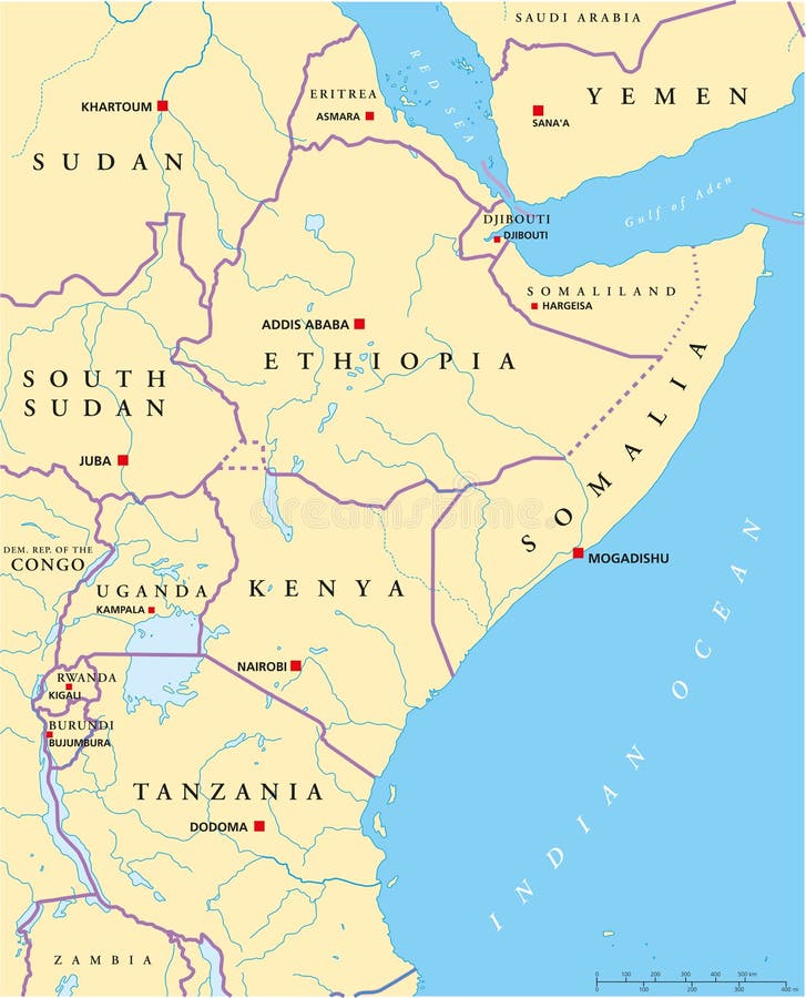
Free with trial Political map of East Africa with capitals, national borders, rivers and lakes. With english labeling and scale. Aden vectors East Africa Political Map. Political map of East Africa with capitals, national borders, rivers and lakes. With english labeling and scale. Political map of East Africa with capitals, national borders, rivers and lakes. With english labeling and scale.
Free with trial A Yemen map with boundaries. Aden vectors Yemen map. A Yemen map with boundaries. A Yemen map with boundaries.
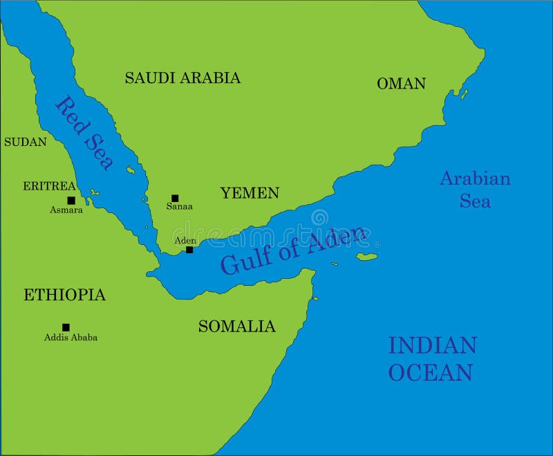
Free with trial Gulf of Aden map. Map of the gulf of Aden area, beetwen Africa and Arabia with indication of the main geographical landmarks. Aden vectors Gulf of Aden map. Map of the gulf of Aden area, beetwen Africa and Arabia with indication of the main geographical landmarks
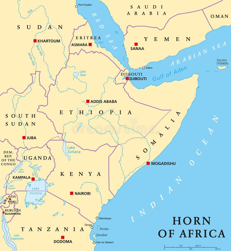
Free with trial Horn of Africa peninsula political map with capitals, national borders, important cities, rivers and lakes. In ancient times called Land of the Berbers. English labeling and scaling. Illustration. Aden vectors Horn of Africa Political Map. Horn of Africa peninsula political map with capitals, national borders, important cities, rivers and lakes. In ancient times called. Horn of Africa peninsula political map with capitals, national borders, important cities, rivers and lakes. In ancient times called Land of the Berbers. English labeling and scaling. Illustration.
Free with trial Political map of Ethiopia with capital Addis Ababa, national borders, most important cities, rivers and lakes. Illustration with English labeling and scaling. Aden vectors Ethiopia Political Map. Political map of Ethiopia with capital Addis Ababa, national borders, most important cities, rivers and lakes. Illustration with English. Political map of Ethiopia with capital Addis Ababa, national borders, most important cities, rivers and lakes. Illustration with English labeling and scaling.
Free with trial Yemen political map with capital Sanaa, national borders and most important cities. English labeling and scaling. Illustration. Aden vectors Yemen Political Map. With capital Sanaa, national borders and most important cities. English labeling and scaling. Illustration
Free with trial Gulf of Aden area, political map. Deepwater gulf between Yemen, Djibouti, the Guardafui Channel, Socotra and Somalia, connecting the Arabian Sea through the Bab-el-Mandeb strait with the Red Sea. Aden vectors Gulf of Aden area, connecting Red Sea and Arabian Sea, political map. Gulf of Aden area, political map. Deepwater gulf between Yemen, Djibouti, the Guardafui. Gulf of Aden area, political map. Deepwater gulf between Yemen, Djibouti, the Guardafui Channel, Socotra and Somalia, connecting the Arabian Sea through the Bab-el-Mandeb strait with the Red Sea.
Free with trial Satellite map of Aden, it is a port city of Yemen, located by the eastern approach to the Red Sea, Aden`s natural harbour lies in the crater of a dormant volcano. Map of streets and buildings of the town center. Aden vectors Satellite map of Aden, it is a port city of Yemen, located by the eastern approach to the Red Sea. Aden`s natural harbour lies in the crater of a dormant. Satellite map of Aden, it is a port city of Yemen, located by the eastern approach to the Red Sea, Aden`s natural harbour lies in the crater of a dormant volcano. Map of streets and buildings of the town center
Free with trial Bab el Mandeb political map. Strait between Yemen on Arabian Peninsula and Djibouti and Eritrea on Horn of Africa. Connects the Red Sea and the Gulf of Aden. Illustration. English labeling. Vector. Aden vectors Bab el Mandeb Strait political map. Bab el Mandeb political map. Strait between Yemen on Arabian Peninsula and Djibouti and Eritrea on Horn of Africa. Connects. Bab el Mandeb political map. Strait between Yemen on Arabian Peninsula and Djibouti and Eritrea on Horn of Africa. Connects the Red Sea and the Gulf of Aden. Illustration. English labeling. Vector.
Free with trial North Indian Ocean, gray political map with countries, international borders, and capitals. Tropical marine region, comprising Arabian Sea to the west of India and Bay of Bengal to the east. Vector. Aden vectors North Indian Ocean, gray political map. With countries, international borders, and capitals. Tropical marine region, comprising Arabian Sea to the west of India. North Indian Ocean, gray political map with countries, international borders, and capitals. Tropical marine region, comprising Arabian Sea to the west of India and Bay of Bengal to the east. Vector
Free with trial Djibouti map. Administrative division of the Republic of Djibouti. Aden vectors Djibouti map. Administrative division of the Republic of Djibouti
Free with trial Map of Yemen. Yemen map designed in illustration with the regions colored in green and with the main cities. Aden vectors Map of Yemen. Yemen map designed in illustration with the regions colored in green and with the main cities
Free with trial Horn of Africa peninsula countries political map with national borders and the biggest lakes. East Africa, in ancient times Land of the the Berbers. English labeling and scaling. Illustration on white. Aden vectors Horn of Africa countries political map. Horn of Africa peninsula countries political map with national borders and the biggest lakes. East Africa, in ancient. Horn of Africa peninsula countries political map with national borders and the biggest lakes. East Africa, in ancient times Land of the the Berbers. English labeling and scaling. Illustration on white
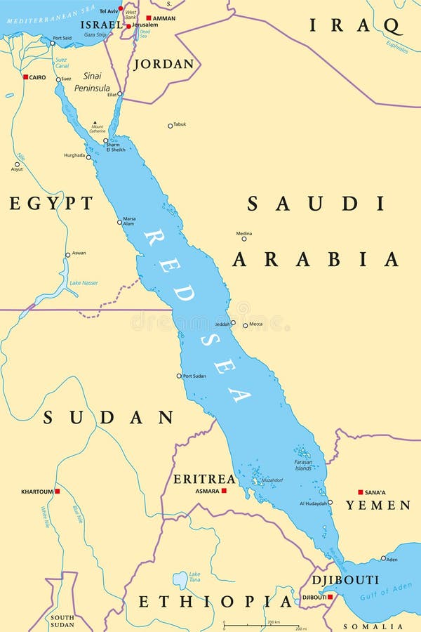
Free with trial Red Sea region political map with capitals, borders, important cities, rivers and lakes. Erythraean Sea, seawater inlet of Indian Ocean between Africa and Asia. Illustration. English labeling. Vector. Aden vectors Red Sea region political map. With capitals, borders, important cities, rivers and lakes. Erythraean Sea, seawater inlet of Indian Ocean between Africa and Asia. Red Sea region political map with capitals, borders, important cities, rivers and lakes. Erythraean Sea, seawater inlet of Indian Ocean between Africa and Asia. Illustration. English labeling. Vector.
Free with trial Yemen highly detailed physical map. Highly detailed physical map of Yemen in vector format,with all the relief forms,regions and big cities. Aden vectors Yemen highly detailed physical map. Highly detailed physical map of Yemen in vector format,with all the relief forms,regions and big cities
Free with trial Yemen political map with capital Sanaa. Republic and Arab country in Western Asia and Middle East on the Arabian Peninsula. Gray illustration isolated on white background. English labeling. Vector. Aden vectors Yemen Political Map. With capital Sanaa. Republic and Arab country in Western Asia and Middle East on the Arabian Peninsula. Gray illustration isolated on white. Yemen political map with capital Sanaa. Republic and Arab country in Western Asia and Middle East on the Arabian Peninsula. Gray illustration isolated on white background. English labeling. Vector.
Free with trial Yemen landmarks. Retro styled image. Vector illustration. Aden vectors Yemen landmarks. Retro styled image. Vector illustration
Free with trial Map of the East African state of Ethiopia. Aden vectors Map of the East African state of Ethiopia.
Free with trial Ethiopia administrative and political map. Aden vectors Ethiopia administrative and political map.
Free with trial Vector map Ethiopia and its neighboring countries. Aden vectors Vector map Ethiopia and its neighboring countries.
Free with trial City buildings graphic template. Al Saleh mosque. Yemen. Vector illustration. Aden vectors City buildings graphic template. Al Saleh mosque. Yemen. Vector illustration
Free with trial Vector road map of east african republic of Djibouti. Aden vectors Vector road map of east african republic of Djibouti.
Free with trial Hawker Siddeley Sea Harrier FRS1. Vector drawing of navy VSTOL fighter aircraft. Side view. Image for illustration and infographics. Aden vectors Hawker Siddeley Sea Harrier FRS1. Vector drawing of navy VSTOL fighter aircraft. Side view. Image for illustration and infographics
Free with trial Hawker Siddeley Harrier GR. 1, AV-8A, Matador. Vector drawing of VSTOL attack aircraft. Side view. Image for illustration and infographics. Aden vectors Hawker Siddeley Harrier GR.1, AV-8A, Matador. Vector drawing of VSTOL attack aircraft. Side view. Image for illustration and infographics
Free with trial Hawker Siddeley Harrier GR. 3. Vector drawing of VSTOL attack aircraft. Side view. Image for illustration and infographics. Aden vectors Hawker Siddeley Harrier GR.3. Vector drawing of VSTOL attack aircraft. Side view. Image for illustration and infographics
Free with trial New In Malta rubber stamp. Grunge design with dust scratches. Effects can be easily removed for a clean, crisp look. Color is easily changed. Aden vectors New In Malta rubber stamp. Grunge design with dust scratches. Effects can be easily removed for a clean, crisp look. Color is easily changed
Free with trial Hawker Hunter F. 6. Vector drawing of fighter-bomber aircraft. Side view. Image for illustration and infographics. Aden vectors Hawker Hunter F.6. Vector drawing of fighter-bomber aircraft. Side view. Image for illustration and infographics
Free with trial Ethiopia map icon vector trendy. Ethiopia map travel icon education vector signage design illustration template trendy. Aden vectors Ethiopia map icon vector trendy. Ethiopia map travel icon education vector signage design illustration template trendy
Free with trial Yemen grey dot outline vector triangle map. Yemen grey vector polygonal map. Aden vectors Yemen grey dot outline vector triangle map. Yemen grey vector polygonal map
Free with trial Yemen map. Yemen map on white background. Aden vectors Yemen map. Yemen map on white background
Free with trial Middle east map, graphic elaboration. Illustration, middle east map and flags. Aden vectors Middle east map, graphic elaboration. Illustration, middle east map and flags
Free with trial Somalia national flag. Vector illustration. Mogadishu. Vector flag of Somalia. Eps 10 Vector illustration. Aden vectors Somalia national flag. Vector illustration. Mogadishu. Vector flag of Somalia. Eps 10 Vector illustration. Mogadishu
Free with trial Gulf of Aden, gray political map. Deepwater gulf of the Indian Ocean between Yemen, the Arabian Sea, Djibouti, Guardafui Channel, the Socotra Archipelago, Somaliland, and Puntland in Somalia. Vector. Aden vectors Gulf of Aden, deepwater gulf of the Indian Ocean, gray political map. Gulf of Aden, gray political map. Deepwater gulf of the Indian Ocean between Yemen, the. Gulf of Aden, gray political map. Deepwater gulf of the Indian Ocean between Yemen, the Arabian Sea, Djibouti, Guardafui Channel, the Socotra Archipelago, Somaliland, and Puntland in Somalia. Vector
Free with trial Red Sea, political map. Indian Ocean inlet between Africa and Asia connected in the south by Bab-el-Mandeb Strait and Gulf of Aden. To the north Sinai Peninsula, Gulf of Suez and Gulf of Aqaba. Vector. Aden vectors Red Sea, Sinai Peninsula, Bab-al-Mandeb, and Gulf of Aden, political map. Red Sea, political map. Indian Ocean inlet between Africa and Asia connected in the. Red Sea, political map. Indian Ocean inlet between Africa and Asia connected in the south by Bab-el-Mandeb Strait and Gulf of Aden. To the north Sinai Peninsula, Gulf of Suez and Gulf of Aqaba. Vector
Free with trial Gulf of Aden, political map. Deepwater gulf of the Indian Ocean between Yemen, the Arabian Sea, Djibouti, the Guardafui Channel, the Socotra Archipelago, Somaliland, and Puntland in Somalia. Vector. Aden vectors Gulf of Aden, deepwater gulf of the Indian Ocean, political map. Gulf of Aden, political map. Deepwater gulf of the Indian Ocean between Yemen, the Arabian Sea. Gulf of Aden, political map. Deepwater gulf of the Indian Ocean between Yemen, the Arabian Sea, Djibouti, the Guardafui Channel, the Socotra Archipelago, Somaliland, and Puntland in Somalia. Vector
Free with trial I love Aden, city of Yemen. Hand drawn letters with red heart. Vector illustration lettering, modern design for print t shirt, banner, poster, sticker or label. Aden vectors I love Aden, city of Yemen. Hand drawn letters with red heart. Vector illustration lettering, modern design. For print t shirt, banner, poster, sticker or label
Free with trial Bab al-Mandeb Strait Map Vector. Strategic maritime shipping route between Red Sea and Gulf of Aden with yellow arrows. Geography and trade concept for Middle East and Africa logistics. Aden vectors Bab al-Mandeb Strait Map Vector. Strategic maritime shipping route between Red Sea and Gulf of Aden with yellow arrows. Geography. And trade concept for Middle. Bab al-Mandeb Strait Map Vector. Strategic maritime shipping route between Red Sea and Gulf of Aden with yellow arrows. Geography and trade concept for Middle East and Africa logistics
Free with trial Collection of hanoi sanaa and aden skylines featuring temples pagodas bridges middle eastern domes and mountain landscapes. Aden vectors Black silhouettes set of hanoi sanaa and aden city skylines with famous monuments and landmarks. Collection of hanoi sanaa and aden skylines featuring temples. Collection of hanoi sanaa and aden skylines featuring temples pagodas bridges middle eastern domes and mountain landscapes
Free with trial Vector silhouettes of Aden, Baku, Dubrovnik, and Istanbul city skylines with iconic landmarks and architecture. Aden vectors Aden Baku Dubrovnik Istanbul city skylines vector silhouettes collection with landmarks. Vector silhouettes of Aden, Baku, Dubrovnik, and Istanbul city skylines. Vector silhouettes of Aden, Baku, Dubrovnik, and Istanbul city skylines with iconic landmarks and architecture
Free with trial Aden outline map. Aden governorate blank outline map. Aden vectors Aden outline map. Aden governorate blank outline map
Free with trial Aden outline map. Aden governorate outline map set. Aden vectors Aden outline map. Aden governorate outline map set
Free with trial Flag of The Federal Region of Aden (Republic of Yemen,. Aden vectors Flag of The Federal Region of Aden (Republic of Yemen.
Free with trial Strait of Bab-el-Mandeb, political map. Translated to Gate of Tears, a major global choke point between Yemen and Djibouti as well as Eritrea, connecting the Red Sea and the Gulf of Aden. Vector. Aden vectors Strait of Bab-el-Mandeb, the Gate of Tears, political map. Strait of Bab-el-Mandeb, political map. Translated to Gate of Tears, a major global choke point. Strait of Bab-el-Mandeb, political map. Translated to Gate of Tears, a major global choke point between Yemen and Djibouti as well as Eritrea, connecting the Red Sea and the Gulf of Aden. Vector
Free with trial Strait of Bab-el-Mandeb, gray political map. Translated to Gate of Tears, a major global choke point between Yemen and Djibouti as well as Eritrea, connecting the Red Sea and the Gulf of Aden. Vector. Aden vectors Strait of Bab-el-Mandeb, the Gate of Tears, gray political map. Strait of Bab-el-Mandeb, gray political map. Translated to Gate of Tears, a major global choke. Strait of Bab-el-Mandeb, gray political map. Translated to Gate of Tears, a major global choke point between Yemen and Djibouti as well as Eritrea, connecting the Red Sea and the Gulf of Aden. Vector
Free with trial Yemen, political map with capital Sanaa. Country in West Asia and Middle East on the Arabian Peninsula, bordered by Saudi Arabia, Oman, Gulf of Aden, and Red Sea, including Socotra Archipelago. Vector. Aden vectors Yemen, country in West Asia, political map with capital Sanaa. Yemen, political map with capital Sanaa. Country in West Asia and Middle East on the Arabian. Yemen, political map with capital Sanaa. Country in West Asia and Middle East on the Arabian Peninsula, bordered by Saudi Arabia, Oman, Gulf of Aden, and Red Sea, including Socotra Archipelago. Vector
Free with trial Bab-el-Mandeb, and surroundings, gray political map. Strait of Mandeb, strait between Yemen on Arabian Peninsula and Djibouti and Eritrea on Horn of Africa, connecting Red Sea to Gulf of Aden. Vector. Aden vectors Bab-el-Mandeb or also Strait of Mandeb, gray political map. Bab-el-Mandeb, and surroundings, gray political map. Strait of Mandeb, strait between Yemen on. Bab-el-Mandeb, and surroundings, gray political map. Strait of Mandeb, strait between Yemen on Arabian Peninsula and Djibouti and Eritrea on Horn of Africa, connecting Red Sea to Gulf of Aden. Vector
Free with trial Bab El Mandeb Strait Strategic Map Dashboard with Red Sea Yemen Ethiopia Somalia Saudi Arabia Gulf of Aden Geopolitical Data. Visualization. Aden vectors Bab El Mandeb Strait Strategic Map Dashboard with Red Sea Yemen Ethiopia Somalia Saudi Arabia Gulf of Aden Geopolitical Data. Visualization
Free with trial Bab-el-Mandeb or also Strait of Mandeb and surroundings, political map. Strait between Yemen on Arabian Peninsula and Djibouti and Eritrea in Horn of Africa, connecting Red Sea to Gulf of Aden. Vector. Aden vectors Bab-el-Mandeb or also Strait of Mandeb, political map. Bab-el-Mandeb or also Strait of Mandeb and surroundings, political map. Strait between Yemen on Arabian. Bab-el-Mandeb or also Strait of Mandeb and surroundings, political map. Strait between Yemen on Arabian Peninsula and Djibouti and Eritrea in Horn of Africa, connecting Red Sea to Gulf of Aden. Vector
Free with trial A map of the middle east highlighting yemen and the bab-el-mandeb strait. it shows the strategic location and maritime routes between the red sea and gulf of aden near the arabian peninsula. Aden vectors Strategic map of the Middle East highlighting Yemen and navigation routes through Bab el Mandeb. A map of the middle east highlighting yemen and the bab-el. a map of the middle east highlighting yemen and the bab-el-mandeb strait. it shows the strategic location and maritime routes between the red sea and gulf of aden near the arabian peninsula
Free with trial North Indian Ocean, NIO, political map with countries, international borders and capitals. Tropical marine region, comprising the Arabian Sea to the west of India and Bay of Bengal to the east. Vector. Aden vectors North Indian Ocean, NIO, political map. With countries, international borders and capitals. Tropical marine region, comprising the Arabian Sea to the west of. North Indian Ocean, NIO, political map with countries, international borders and capitals. Tropical marine region, comprising the Arabian Sea to the west of India and Bay of Bengal to the east. Vector
Free with trial Houthi controlled Yemen, political map. Green highlighted the territory controlled by Houthis as of January 2026, maintaining a de facto governance over portions of northern and western Yemen. Vector. Aden vectors Houthi controlled Yemen, political map. Green highlighted the territory controlled by Houthis as of January 2026, maintaining a de facto governance over
Free with trial North Indian Ocean, multi colored political map with countries and international borders. Tropical marine region, comprising the Arabian Sea to the west of India and Bay of Bengal to the east. Vector. Aden vectors North Indian Ocean, multi colored political map. With countries and international borders. Tropical marine region, comprising the Arabian Sea to the west of. North Indian Ocean, multi colored political map with countries and international borders. Tropical marine region, comprising the Arabian Sea to the west of India and Bay of Bengal to the east. Vector
Free with trial Map of Bab al-Mandab Strait, Djibouti, Yemen, Eritrea. Aden vectors Map of Bab al-Mandab Strait, Djibouti, Yemen, Eritrea.
Free with trial An aerial digital visualization showcases the Gulf of Aden, bordered by the Arabian Peninsula to the north and the Horn of Africa to the south. A prominent red marker with an exclamation point hovers over the body of water, indicating a critical location. White, curving lines extend from this point across the landscape and sea, possibly symbolizing data flow or movement. The surrounding terrain appears arid, and the ocean reflects a subtle sheen, contrasting with the highlighted red area at the center. Aden vectors Aerial View of Vibrant Red Pollution Spreading Over Industrial Landscape at Dusk. An aerial digital visualization showcases the Gulf of Aden, bordered by the. An aerial digital visualization showcases the Gulf of Aden, bordered by the Arabian Peninsula to the north and the Horn of Africa to the south. A prominent red marker with an exclamation point hovers over the body of water, indicating a critical location. White, curving lines extend from this point across the landscape and sea, possibly symbolizing data flow or movement. The surrounding terrain appears arid, and the ocean reflects a subtle sheen, contrasting with the highlighted red area at the center.
Free with trial Yemen political map of administrative divisions - governorates and municipality of Sanaa. Grey blank vector editable map EPS. Aden vectors Yemen editable vector political map EPS. Yemen political map of administrative divisions - governorates and municipality of Sanaa. Grey blank vector editable map. Yemen political map of administrative divisions - governorates and municipality of Sanaa. Grey blank vector editable map EPS.
Free with trial This image shows the black silhouette of Djibouti map, emphasizing its geographical shape and borders. Vector clipart illustration design using ai tool. Aden vectors Djibouti silhouette. This image shows the black silhouette of Djibouti map, emphasizing its geographical shape and borders. Vector clipart illustration design. This image shows the black silhouette of Djibouti map, emphasizing its geographical shape and borders. Vector clipart illustration design using ai tool.
Free with trial Solid green map outline showing the geographic shape of Yemen, without labels or internal borders. Aden vectors Yemen Map Boundary. Solid green map outline showing the geographic shape of Yemen, without labels or internal borders. Solid green map outline showing the geographic shape of Yemen, without labels or internal borders.
Free with trial Minimalist black and white map highlighting the connection between Somalia and Yemen with a dotted line, ideal for geopolitical, trade, migration, or regional analysis in business and educational materials. Aden vectors Dotted line connecting somalia and yemen on minimalist map for geopolitical or trade concept. Minimalist black and white map highlighting the connection between. Minimalist black and white map highlighting the connection between Somalia and Yemen with a dotted line, ideal for geopolitical, trade, migration, or regional analysis in business and educational materials
Free with trial Detailed vector road map of the Middle Eastern state of Yemen. Aden vectors Detailed vector road map of the Middle Eastern state of Yemen.
Free with trial Yemen swoosh silhouette rainbow map template. Map in rainbow style drawing. Aden vectors Yemen swoosh silhouette rainbow map. Template. Map in rainbow style drawing
Free with trial Overview map of the Gulf Cooperation Council. Aden vectors Overview map of the Gulf Cooperation Council.
Free with trial Detailed administrative map of Eritrea. Aden vectors Detailed administrative map of Eritrea.
Free with trial A high-quality 3D digital rendering of the national flag of Yemen, featuring three equal horizontal tricolor stripes of red (top), white (middle), and black (bottom). The red stripe symbolizes the bloodshed of martyrs and unity, white represents a bright future, and black stands for the dark past. The flag waves realistically with fluid fabric ripples on a metallic golden flagpole, completely. Aden vectors Yemen flag waving on a golden pole isolated on Transparent Background. A high-quality 3D digital rendering of the national flag of Yemen, featuring three equal. A high-quality 3D digital rendering of the national flag of Yemen, featuring three equal horizontal tricolor stripes of red (top), white (middle), and black (bottom). The red stripe symbolizes the bloodshed of martyrs and unity, white represents a bright future, and black stands for the dark past. The flag waves realistically with fluid fabric ripples on a metallic golden flagpole, completely
Free with trial Vector map of Yemen with infographic elements: regions, cities, charts, icons. Blue color scheme, flat modern style. Ideal for reports, presentations, and educational use. Aden vectors Yemen Infographic Map with Data Visualization Elements - Vector Map of Yemen. Vector map of Yemen with infographic elements: regions, cities, charts, icons. Blue. Vector map of Yemen with infographic elements: regions, cities, charts, icons. Blue color scheme, flat modern style. Ideal for reports, presentations, and educational use
Free with trial Made in Yemen stamp, sticker. Vector illustration. Aden vectors Made in Yemen stamp, sticker. Vector illustration.
Free with trial Djibouti Obock Seal Map Design. Aden vectors Djibouti Obock Seal Map Design. Djibouti Obock Round Seal Map Design
Free with trial This image showcases the flag of Yemen, a tricolor of red, white, and black horizontal bands. It symbolizes the nation's identity, unity, and rich cultural heritage. Aden vectors Vector art of flag of yemen featuring horizontal red, white, and black bands, a symbol of national identity and unity. This image showcases the flag of Yemen, a. This image showcases the flag of Yemen, a tricolor of red, white, and black horizontal bands. It symbolizes the nation's identity, unity, and rich cultural heritage
Free with trial A diverse set of Djibouti maps, including a black silhouette, detailed outline, political division map with regions, and a flag-themed version, ideal for educational and design purposes. Aden vectors Detailed Djibouti Map Collection with Outline, Silhouette, Regions, and Flag Overlay Variations. A diverse set of Djibouti maps, including a black silhouette. A diverse set of Djibouti maps, including a black silhouette, detailed outline, political division map with regions, and a flag-themed version, ideal for educational and design purposes
Free with trial Silhouette of Djibouti map filled with the Djiboutian flag design, symbolizing national pride, cultural heritage, and geographic significance. Aden vectors Djibouti Map Silhouette with National Flag Design. Silhouette of Djibouti map filled with the Djiboutian flag design, symbolizing national pride, cultural. Silhouette of Djibouti map filled with the Djiboutian flag design, symbolizing national pride, cultural heritage, and geographic significance
Free with trial Gulf of Aden area, gray political map. Deepwater gulf between Yemen, Djibouti, the Guardafui Channel, Socotra and Somalia, connecting the Arabian Sea through the Bab-el-Mandeb strait with the Red Sea. Aden vectors Gulf of Aden area, connecting Red Sea and Arabian Sea, gray political map. Gulf of Aden area, gray political map. Deepwater gulf between Yemen, Djibouti, the. Gulf of Aden area, gray political map. Deepwater gulf between Yemen, Djibouti, the Guardafui Channel, Socotra and Somalia, connecting the Arabian Sea through the Bab-el-Mandeb strait with the Red Sea.
Free with trial Satellite map of Aden, it is a port city of Yemen, located by the eastern approach to the Red Sea, Aden`s natural harbour lies in the crater of a dormant volcano. Map of streets and buildings of the town center. Aden vectors Satellite map of Aden, it is a port city of Yemen, located by the eastern approach to the Red Sea. Aden`s natural harbour lies in the crater of a dormant. Satellite map of Aden, it is a port city of Yemen, located by the eastern approach to the Red Sea, Aden`s natural harbour lies in the crater of a dormant volcano. Map of streets and buildings of the town center
Free with trial Aden Governorate map vector. Aden Governorate Governorates of Yemen, Republic of Yemen map vector illustration, scribble sketch Aden map. Aden vectors Aden Governorate map vector. Aden Governorate Governorates of Yemen, Republic of Yemen map vector illustration, scribble sketch Aden map
Free with trial Aden City Republic of Yemen map vector illustration, scribble sketch City of Aden map,. Aden vectors Aden City Republic of Yemen map vector illustration, scribble sketch City of Aden map.
Free with trial Aden City Republic of Yemen map vector illustration, scribble sketch City of Aden map,. Aden vectors Aden City Republic of Yemen map vector illustration, scribble sketch City of Aden map.
Free with trial Aden Governorate Governorates of Yemen, Republic of Yemen map vector illustration, scribble sketch Aden map,. Aden vectors Aden Governorate Governorates of Yemen, Republic of Yemen map vector illustration, scribble sketch Aden map.
 Sign in