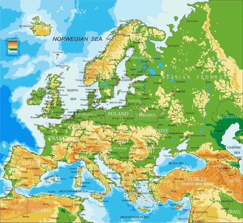
Free with trial Highly detailed physical map of Europe, in vector format, with all the relief forms, countries and big cities. Balkans vectors Europe - physical map. Highly detailed physical map of Europe, in vector format, with all the relief forms, countries and big cities. Highly detailed physical map of Europe, in vector format, with all the relief forms, countries and big cities.
Free with trial Vector set of ceast european cities. Balkans vectors Vector set of ceast european cities. Vector set of ceast europe cities
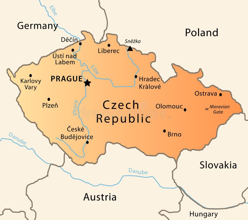
Free with trial Illustration of a detailed political map of Czech Republic. The X indicates the most important gate of the Moravian mountains. Balkans vectors Czech Republic political map. Illustration of a detailed political map of Czech Republic. The X indicates the most important gate of the Moravian mountains. Illustration of a detailed political map of Czech Republic. The X indicates the most important gate of the Moravian mountains.
Free with trial Illustration of a detailed political map of Montenegro. Balkans vectors Montenegro map. Illustration of a detailed political map of Montenegro. Illustration of a detailed political map of Montenegro.
Free with trial Illustration of a detailed political map of Bosnia. Balkans vectors Bosnia map. Illustration of a detailed political map of Bosnia. Illustration of a detailed political map of Bosnia.
Free with trial Illustration of a detailed political map of Belarus. Balkans vectors Belarus map. Illustration of a detailed political map of Belarus. Illustration of a detailed political map of Belarus.
Free with trial Highly detailed physical map of Europe, in vector format, with all the relief forms, countries and big cities. Balkans vectors Europe - physical map. Highly detailed physical map of Europe, in vector format, with all the relief forms, countries and big cities. Highly detailed physical map of Europe, in vector format, with all the relief forms, countries and big cities.
Free with trial Romania. Traveling series: Romania - Collection of an hand drawn illustrations. Description: Full sized hand drawn illustrations drawing on white background. Balkans vectors Romania. Traveling series: Romania - Collection of an hand drawn illustrations. Description: Full sized hand drawn illustrations drawing on white background
Free with trial Europe political map. With country names. Balkans vectors Europe political map. With country names
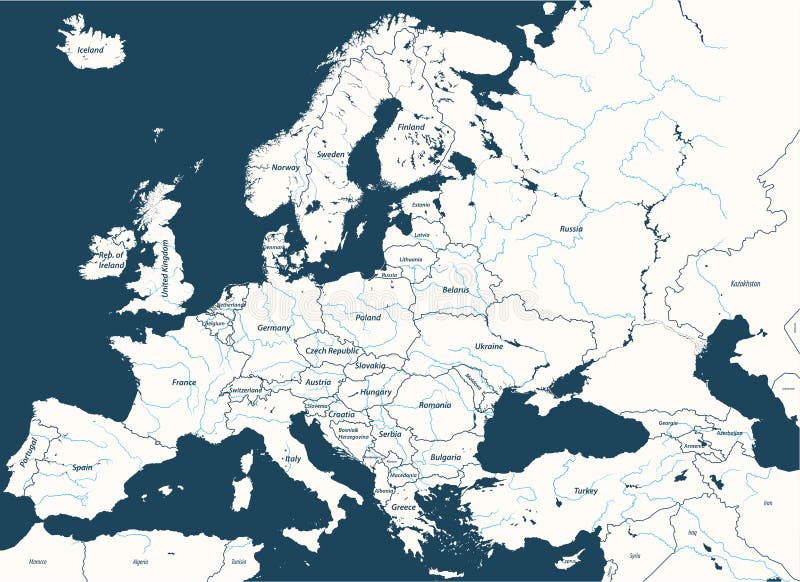
Free with trial High detailed vector map of Europe main rivers. Balkans vectors High detailed vector map of Europe main rivers. High detailed map of Europe main rivers
Free with trial High detailed Europe countries regions map. Vector high detailed map of European regins. Balkans vectors High detailed Europe countries regions map. Vector high detailed map of European regins
Free with trial Israeli and Balkan Folk Dance. Men and women dancing traditional folk dances of Israeli and Balkan origins. Balkans vectors Israeli and Balkan Folk Dance. Men and women dancing traditional folk dances of Israeli and Balkan origins
Free with trial High detailed Europe map. Vector. High detailed Europe vector map. Balkans vectors High detailed Europe map. Vector. High detailed Europe vector map
Free with trial Europe isolated high detailed vector political map. All elements separated in detachable and labeled layers. Balkans vectors Europe high detailed vector political map. All elements separated in detachable and labeled layers. Europe isolated high detailed vector political map. All. Europe isolated high detailed vector political map. All elements separated in detachable and labeled layers
Free with trial Vector beautiful illustration of Europe cities lights map. Balkans vectors Vector beautiful illustration of Europe cities lights map. Beautiful illustration of Europe cities lights map
Free with trial Europe high detailed political map with main rivers. All elements separated in detachable layers. Balkans vectors Europe high detailed political map with main rivers. All elements separated in detachable layers.
Free with trial Serbia, car license plate template, illustration. Serbia, car license plate template with numbers, characters and symbols, vector illustration. Balkans vectors Serbia, car license plate template, illustration. Serbia, car license plate template with numbers, characters and symbols, vector illustration
Free with trial Greece map vector. Illustration, scribble sketch Greece map. Balkans vectors Greece map vector. Illustration, scribble sketch Greece map
Free with trial Europe Political Map. Europe Map with country lines concept. Balkans vectors Europe Political Map. Europe Map with country lines concept
Free with trial Illustration of a detailed Kosovo flag, in his real dimensions. Balkans vectors Kosovo flag Official. Illustration of a detailed Kosovo flag, in his real dimensions. Illustration of a detailed Kosovo flag, in his real dimensions.
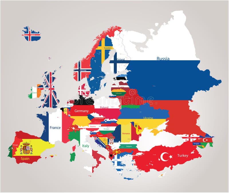
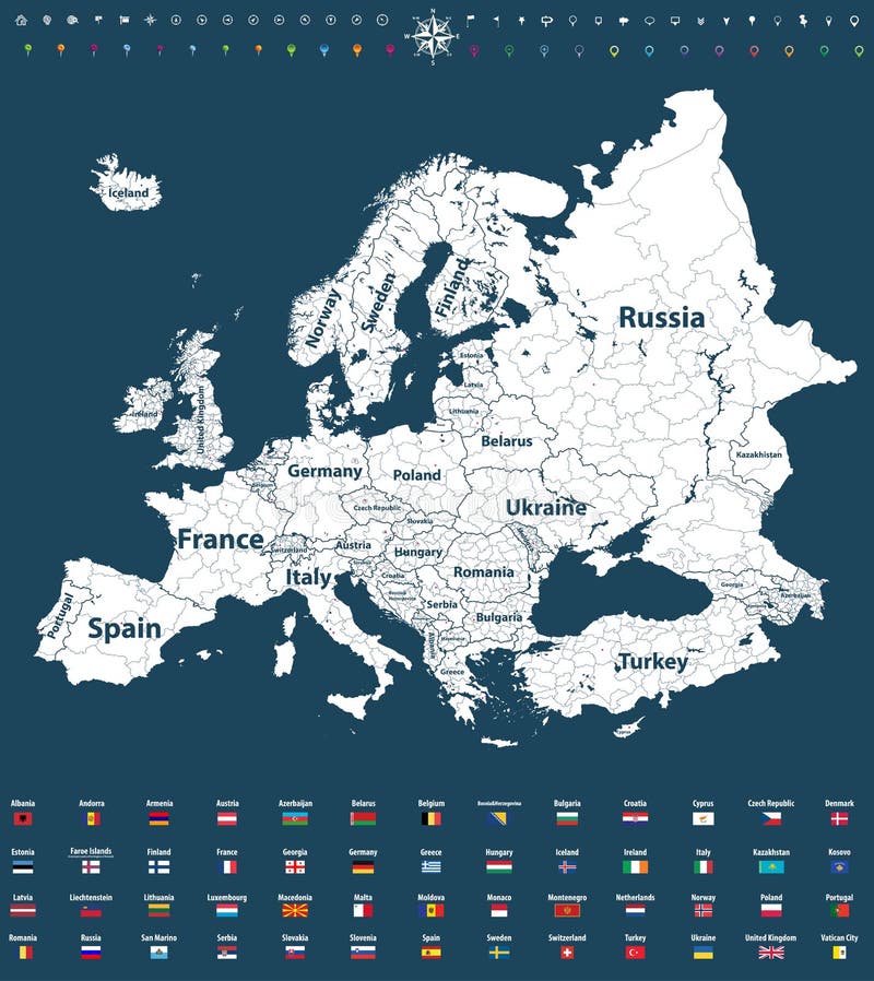
Free with trial Europe map cominated with flags. Vector europe political map jointed with flags. Balkans vectors Europe map cominated with flags. Vector europe political map jointed with flags
Free with trial Europe vector high detailed political map with regions borders. All elements separated in detachable layers. Europe vector high detailed political map with. Balkans vectors Europe vector high detailed political map with regions borders. All elements separated in detachable layers. Europe vector high detailed political map with
Free with trial Europe Political Map. Europe Map with country lines concept. Balkans vectors Europe Political Map. Europe Map with country lines concept
Free with trial World Map of MEDITERRANEAN REGION: South Europe (Spain, French Riviera, Côte d’Azur, Provence, Italy, Balkans, Greece), Asia Minor (Turkey, Black Sea), Near East (Levant, Syria), North Africa (Lower Egypt, Libya, Tunisia, Morocco). Detailed Geographic Chart with coastline, islands, main rivers. Balkans vectors World Map of MEDITERRANEAN REGION: Southern Europe, Middle East, North Africa. (Geographic chart). World Map of MEDITERRANEAN REGION: South Europe &#. World Map of MEDITERRANEAN REGION: South Europe (Spain, French Riviera, Côte d’Azur, Provence, Italy, Balkans, Greece), Asia Minor (Turkey, Black Sea), Near East (Levant, Syria), North Africa (Lower Egypt, Libya, Tunisia, Morocco). Detailed Geographic Chart with coastline, islands, main rivers.
Free with trial Croatia map. Highly detailed vector map of Croatia with administrative regions,main cities and roads. Balkans vectors Croatia map. Highly detailed vector map of Croatia with administrative regions,main cities and roads
Free with trial Detailed vector poster city map Zagreb. Design of a poster for interior decoration. Balkans vectors Detailed vector poster city map Zagreb. Design of a poster for interior decoration
Free with trial Highly detailed physical map of the Serbia, in vector format,with all the relief forms,regions and big cities. Balkans vectors Serbia physical map. Highly detailed physical map of the Serbia, in vector format,with all the relief forms,regions and big cities. Highly detailed physical map of the Serbia, in vector format,with all the relief forms,regions and big cities.
Free with trial Illustration of Europe city and communication lights map. Balkans vectors Illustration of Europe city and communication lights map. Vector illustration of Europe city and communication lights map
Free with trial High detailed colored political map of Europe with countries` regions. Vector. Balkans vectors High detailed colored political map of Europe with countries` regions. Vector. High detailed colored political map of Europe with countries` regions
Free with trial Illustration of Europe city and communication lights map. Balkans vectors Illustration of Europe city and communication lights map. Vector illustration of Europe city and communication lights map
Free with trial Original sepia sketch drawing of Church of Saint Tryphon in Koto. R Montenegro,world heritage site of UNESCO, travel postcard vector illustration. Balkans vectors Original sepia sketch drawing of Church of Saint Tryphon in Koto. R Montenegro,world heritage site of UNESCO, travel postcard vector illustration
Free with trial Old city Dubrovnik, Croatia. Sketch. Isolated on white background. Balkans vectors Old city Dubrovnik, Croatia. Sketch. Isolated on white background
Free with trial The aircraft dropped bombs over the destroyed city. Vector illustration. Balkans vectors Bombing of the city. The aircraft dropped bombs over the destroyed city. Vector illustration. The aircraft dropped bombs over the destroyed city. Vector illustration.
Free with trial Dogs by country of origin. Croatian dog breeds. Infographic temp. Late. Vector illustration. Balkans vectors Dogs by country of origin. Croatian dog breeds. Infographic temp. Late. Vector illustration
Free with trial Original sepia ink sketch drawing of ancient fort in Petrovac Montenegro, Balkans, Adriatic sea, Europe, vintage touristic postcard, travel vector illustration. Balkans vectors Sepia ink sketch drawing of ancient fort in Petrovac Montenegro. Original sepia ink sketch drawing of ancient fort in Petrovac Montenegro, Balkans, Adriatic sea. Original sepia ink sketch drawing of ancient fort in Petrovac Montenegro, Balkans, Adriatic sea, Europe, vintage touristic postcard, travel vector illustration
Free with trial Colorful detailed political world map with names of countries, oceans, bays and islands, on an isolated background. Blank for design template for your design. Balkans vectors Colorful detailed political world map with names of countries, oceans, bays and islands, on an isolated background. Blank for design template for your design
Free with trial Outline Skyline panorama of City of Belgrade, Serbia - vector illustration. Balkans vectors Outline Skyline panorama of City of Belgrade, Serbia. Vector illustration
Free with trial Europe Map. With shadow on with background. Balkans vectors Europe Map. With shadow on with background
Free with trial Europe Political Map. Europe Map with country lines concept. Balkans vectors Europe Political Map. Europe Map with country lines concept
Free with trial Europe Political Map. Europe Map with country lines concept. Balkans vectors Europe Political Map. Europe Map with country lines concept
Free with trial Europe Political Map. With EU stars. Balkans vectors Europe Political Map. With EU stars
Free with trial High detailed Europe map with coutries names and region borders. High detailed coloured Europe map. Balkans vectors High detailed Europe map with coutries names and region borders. High detailed coloured Europe map
Free with trial Europe vector high detailed political map with regions borders and all european flags. Balkans vectors Europe vector high detailed political map with regions borders and all european flags. Europe vector political map with regions borders and all european flags
Free with trial Detailed vector political map of Europe. Colored vector illustration of a detailed political map of Europe. Balkans vectors Detailed vector political map of Europe. Colored vector illustration of a detailed political map of Europe
Free with trial Yugoslavia map vector, Yugoslavia flag vector, Yugoslavia isolated white background. Balkans vectors Yugoslavia map vector, Yugoslavia flag vector, Yugoslavia isolated white background.
Free with trial Slovenian flag in the form of a large circle. Vector illustration on white background. Brush strokes drawn by hand. Independence and Unity Day of Slovenia. Balkans vectors Slovenian flag in the form of a large circle. Vector illustration on white background. Brush strokes drawn by hand. Independence and Unity Day of Slovenia
Free with trial The Balkans and the Balkan Peninsula, multi colored political map, with country borders and capitals. Geographical area in southeastern Europe, bordered by the Adriatic, Ionian, Aegean, and Black Sea. Balkans vectors The Balkans and the Balkan Peninsula, multi colored political map. With country borders and capitals. Geographical area in southeastern Europe, bordered by the. The Balkans and the Balkan Peninsula, multi colored political map, with country borders and capitals. Geographical area in southeastern Europe, bordered by the Adriatic, Ionian, Aegean, and Black Sea.
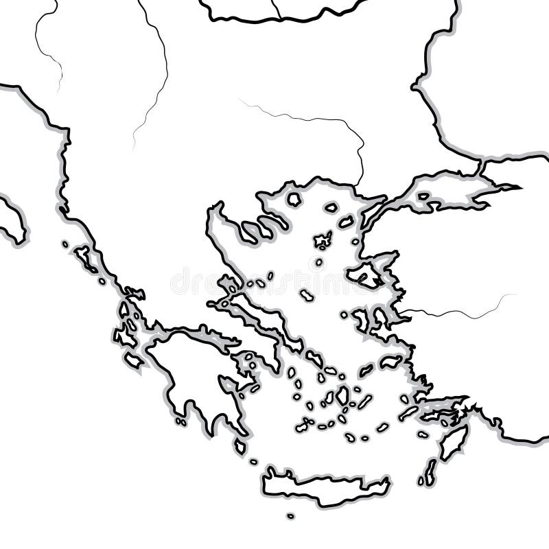
Free with trial Map of The BALKAN/GREEK Lands: Greece (Hellas), Balkans, Peloponnese, Thessalia, Thracia, Macedonia, Albania, Illyria, Ionia, Anatolia, The Aegean Sea & Archipelago. Geographic chart with sea coastline and isles. Balkans vectors Map of The GREEK Lands: Greece, Peloponnese, Thrace, Macedonia, Balkans, Aegean Sea. Geographic chart. Map of The BALKAN/GREEK Lands: Greece (Hellas). Map of The BALKAN/GREEK Lands: Greece (Hellas), Balkans, Peloponnese, Thessalia, Thracia, Macedonia, Albania, Illyria, Ionia, Anatolia, The Aegean Sea & Archipelago. Geographic chart with sea coastline and isles.
Free with trial Map of the Western Balkans and World Map with navigation icons. Vector illustration. Balkans vectors Map of the Western Balkans and World Map with navigation icons. Vector illustration
Free with trial Dogs by country of origin. Balkans dog breeds: Macedonian, Bosnian, Montenegrin, Serbian, Slovenian. Infographic template. Vector illustration. Balkans vectors Dogs by country of origin. Balkans dog breeds: Macedonian, Bosnian, Montenegrin, Serbian, Slovenian. Infographic template. Vector illustration
Free with trial Southeast Europe map. Balkans map Serbia,Croatia,Bulgaria,North Macedonia,Romania,Albania maps with regions. Europe map isolated on white background. High detailed. Vector illustration. Balkans vectors Southeast Europe map. Balkans map Serbia, Croatia, Bulgaria, North Macedonia, Romania, Albania maps with regions. Southeast Europe map. Balkans map Serbia. Southeast Europe map. Balkans map Serbia,Croatia,Bulgaria,North Macedonia,Romania,Albania maps with regions. Europe map isolated on white background. High detailed. Vector illustration
Free with trial Color political map of Balkans with borders of the countries. Balkans vectors Map of Balkans with borders of the countries. Color political map of Balkans with borders of the countries. Color political map of Balkans with borders of the countries.
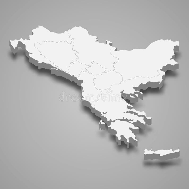
Free with trial 3d isometric map of Balkans region, isolated with shadow. Vector illustration. Balkans vectors 3d isometric map of Balkans region, isolated with shadow. Vector illustration
Free with trial Vector postcard of Ulcinj, Montenegro, Balkans, Europe. Houses in a narrow alley. Line art travel sketch. Hand drawn artistic postcard, poster template, Touristic illustration background. Vector EPS10. Balkans vectors Vector postcard of Ulcinj, Montenegro, Balkans, Europe. Houses in a narrow alley. Line art travel sketch. Hand drawn artistic. Postcard, poster template. Vector postcard of Ulcinj, Montenegro, Balkans, Europe. Houses in a narrow alley. Line art travel sketch. Hand drawn artistic postcard, poster template, Touristic illustration background. Vector EPS10
Free with trial Perast waterfront, Montenegro, Balkans. Houses, water, mountains. Line art travel sketch. Hand drawn artistic postcard, poster. Template illustration background. Balkans vectors Perast waterfront, Montenegro, Balkans. Houses, water, mountains. Line art travel sketch. Hand drawn artistic postcard, poster. Template illustration background
Free with trial Southern Europe, colored political map of Mediterranean Europe with the major countries Portugal, Spain, Italy, and Greece, as well as the Central Balkans, Andorra, Malta, San Marino and Vatican City. Balkans vectors Southern Europe, colored political map of Mediterranean Europe. With the major countries Portugal, Spain, Italy, and Greece, as well as the Central Balkans. Southern Europe, colored political map of Mediterranean Europe with the major countries Portugal, Spain, Italy, and Greece, as well as the Central Balkans, Andorra, Malta, San Marino and Vatican City.
Free with trial West Balkan countries political map with national borders. Western Balkans, formed by Slovenia, Croatia and Bosnia And Herzegovina. English labeling and scaling. Gray illustration on white background. Balkans vectors West Balkan countries political map. With national borders. Western Balkans, formed by Slovenia, Croatia and Bosnia And Herzegovina. English labeling and. West Balkan countries political map with national borders. Western Balkans, formed by Slovenia, Croatia and Bosnia And Herzegovina. English labeling and scaling. Gray illustration on white background.
Free with trial 20 themed EPS images of ice cream. The number of vector nodes is absolute minimum. The images are very easy to use and edit and are extremely smooth even when highly enlarged. Balkans vectors Balkans. 20 themed EPS images of ice cream. The number of vector nodes is absolute minimum. The images are very easy to use and edit and are extremely smooth. 20 themed EPS images of ice cream. The number of vector nodes is absolute minimum. The images are very easy to use and edit and are extremely smooth even when highly enlarged.
Free with trial Original sepia ink sketch drawing of ancient fort in Petrovac Mo. Ntenegro, Balkans, Adriatic sea, Europe, vintage touristic postcard, travel vector illustration. Balkans vectors Original sepia ink sketch drawing of ancient fort in Petrovac Mo. Ntenegro, Balkans, Adriatic sea, Europe, vintage touristic postcard, travel vector illustration
Free with trial Aegean Sea region,with Aegean Islands,gray political map. An elongated embayment of the Mediterranean Sea,located between Europe and Asia,between the Balkans and Anatolia,and Greece and Turkey. Balkans vectors Aegean Sea region, with Aegean Islands, gray political map. Aegean Sea region,with Aegean Islands,gray political map. An elongated embayment of the Mediterranean. Aegean Sea region,with Aegean Islands,gray political map. An elongated embayment of the Mediterranean Sea,located between Europe and Asia,between the Balkans and Anatolia,and Greece and Turkey.
Free with trial Bosnia and Herzegovina famous landmarks. Sacred heart cathedral at Sarajevo and Tvrdos Monastery, National library and country house of balkans. Sightseeing and travel, architecture theme. Balkans vectors Landmarks of Bosnia and Herzegovina. Bosnia and Herzegovina famous landmarks. Sacred heart cathedral at Sarajevo and Tvrdos Monastery, National library and. Bosnia and Herzegovina famous landmarks. Sacred heart cathedral at Sarajevo and Tvrdos Monastery, National library and country house of balkans. Sightseeing and travel, architecture theme
Free with trial Original black and white ink sketch drawing of ancient fort. In Petrovac Montenegro, Balkans, Adriatic sea, Europe, travel vector illustration. Balkans vectors Original black and white ink sketch drawing of ancient fort. In Petrovac Montenegro, Balkans, Adriatic sea, Europe, travel vector illustration
Free with trial Original black and white ink sketch drawing of ancient fort in Petrovac Montenegro, Balkans, Adriatic sea, Europe, vintage touristic postcard, travel vector illustration. Balkans vectors Ink sketch drawing of ancient fort in Petrovac Montenegro. Original black and white ink sketch drawing of ancient fort in Petrovac Montenegro, Balkans, Adriatic. Original black and white ink sketch drawing of ancient fort in Petrovac Montenegro, Balkans, Adriatic sea, Europe, vintage touristic postcard, travel vector illustration
Free with trial Original sepia sketch drawing of Sveti Stefan island in Monteneg. Ro, Balkans, Adriatic sea, Europe, travel postcard vector illustration. Balkans vectors Original sepia sketch drawing of Sveti Stefan island in Monteneg. Ro, Balkans, Adriatic sea, Europe, travel postcard vector illustration
Free with trial Original sepia ink sketch drawing of ancient fort in Petrovac Mo. Ntenegro, Balkans, Adriatic sea, Europe, vintage touristic postcard, travel vector illustration. Balkans vectors Original sepia ink sketch drawing of ancient fort in Petrovac Mo. Ntenegro, Balkans, Adriatic sea, Europe, vintage touristic postcard, travel vector illustration
Free with trial Aegean Sea region with Aegean Islands,political map. An elongated embayment of the Mediterranean Sea,located between Europe and Asia,and between the Balkans and Anatolia,Greece and Turkey. Vector. Balkans vectors Aegean Sea region, with Aegean Islands, political map. Aegean Sea region with Aegean Islands,political map. An elongated embayment of the Mediterranean Sea. Aegean Sea region with Aegean Islands,political map. An elongated embayment of the Mediterranean Sea,located between Europe and Asia,and between the Balkans and Anatolia,Greece and Turkey. Vector.
Free with trial Original sepia sketch drawing of Sveti Stefan island. In Montenegro, Balkans, Adriatic sea, Europe, travel vector illustration. Balkans vectors Original sepia sketch drawing of Sveti Stefan island. In Montenegro, Balkans, Adriatic sea, Europe, travel vector illustration
Free with trial Original sepia ink sketch drawing of ancient fort in Petrovac Montenegro, Balkans, Adriatic sea, Europe, travel vector illustration. Balkans vectors Original ink sketch drawing of ancient fort in Petrovac. Original sepia ink sketch drawing of ancient fort in Petrovac Montenegro, Balkans, Adriatic sea, Europe. Original sepia ink sketch drawing of ancient fort in Petrovac Montenegro, Balkans, Adriatic sea, Europe, travel vector illustration
Free with trial Original sepia sketch drawing of Sveti Stefan island in Monteneg. Ro, Balkans, Adriatic sea, Europe, travel postcard vector illustration. Balkans vectors Original sepia sketch drawing of Sveti Stefan island in Monteneg. Ro, Balkans, Adriatic sea, Europe, travel postcard vector illustration
Free with trial Original sepia ink sketch drawing of ancient fort in Petrovac Mo. Ntenegro, Balkans, Adriatic sea, Europe, vintage touristic postcard, travel vector illustration. Balkans vectors Original sepia ink sketch drawing of ancient fort in Petrovac Mo. Ntenegro, Balkans, Adriatic sea, Europe, vintage touristic postcard, travel vector illustration
Free with trial Original black and white sketch drawing of Sveti Stefan island. In Montenegro, Balkans, Adriatic sea, Europe, travel vector illustration. Balkans vectors Original black and white sketch drawing of Sveti Stefan island. In Montenegro, Balkans, Adriatic sea, Europe, travel vector illustration
Free with trial Group of small houses in a mountains with white walls and red tiled roofs. Serbia, Balkans. Vector repeated seamless border. Balkans vectors Group of small houses in a mountains with white walls and red tiled roofs. Serbia, Balkans. Vector repeated seamless border
Free with trial Croatia. Republic of Croatia isolated map and official flag icons. vector Croatian political maps illustration. Balkans country geographic banner template. Balkans vectors Croatia. Republic of Croatia isolated map and official flag icons. vector Croatian political maps illustration. Balkans country geographic banner template
Free with trial Serbia, Croatia, Bosnia and Montenegro. Set of Balkans rubber stamps - serbia, montenegro, croatia and bosnia. Balkans vectors Serbia, Croatia, Bosnia and Montenegro. Set of Balkans rubber stamps - serbia, montenegro, croatia and bosnia
Free with trial Travel: CROATIA (set no. 2) - Collection of an hand drawn vector illustrations. Each drawing comprise three layers of lines, the colored background is. Easy editable in layers and groups. Balkans vectors Croatia. Hand drawn vector pack. Travel: CROATIA (set no.2) - Collection of an hand drawn vector illustrations. Each drawing comprise three layers of lines, the. Travel: CROATIA (set no.2) - Collection of an hand drawn vector illustrations. Each drawing comprise three layers of lines, the colored background is . Easy editable in layers and groups.
Free with trial Kosovo region silhouettes set and blank map of the country isolated on white background. Vector illustration design. National region silhouettes set Series. Balkans vectors Kosovo region silhouettes set and blank map of the country isolated on white background. Vector illustration design. National region silhouettes set Series
Free with trial Modern folk balkanic carpet template illustration. Balkans vectors Modern carpet template. Modern folk balkanic carpet template illustration. Modern folk balkanic carpet template illustration.
Free with trial West Balkan Political Map formed by Slovenia, Croatia and Bosnia And Herzegovina. With capitals, national borders, important cities, rivers and lakes. English labeling and scaling. Balkans vectors West Balkan Political Map. Formed by Slovenia, Croatia and Bosnia And Herzegovina. With capitals, national borders, important cities, rivers and lakes. English
Free with trial Europe time zones high detailed map with location and clock icons. All layers detachable and labeled. Balkans vectors Europe time zones high detailed map with location and clock icons. All layers detachable and labeled
Free with trial Perast city in Kotor bay with mountains and boat floating in Montenegro. Balkans vectors City in Montenegro. Perast city in Kotor bay with mountains and boat floating in Montenegro. Perast city in Kotor bay with mountains and boat floating in Montenegro.
 Sign in