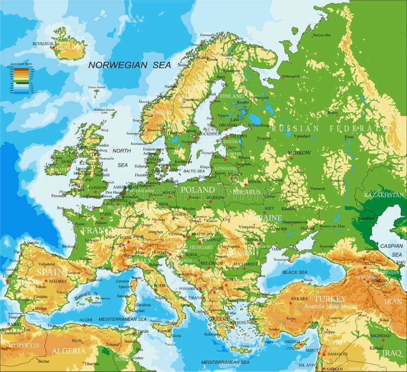
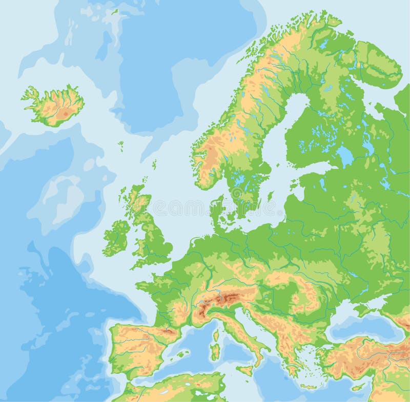
Free with trial Highly detailed physical map of Europe, in vector format, with all the relief forms, countries and big cities. Baltic sea vectors Europe - physical map. Highly detailed physical map of Europe, in vector format, with all the relief forms, countries and big cities. Highly detailed physical map of Europe, in vector format, with all the relief forms, countries and big cities.
Free with trial Nordic countries of Scandinavies. Scandinavian Peninsula. Baltic sea vectors Scandinavia. Nordic countries of Scandinavies.Scandinavian Peninsula. Nordic countries of Scandinavies.Scandinavian Peninsula.
Free with trial Europe Physical Map. Detailed illustration of Europe Physical Map. Baltic sea vectors Europe Physical Map. Detailed illustration of
Free with trial Passport travel grunge stamps / prints. Baltic sea vectors Travel Stamps. Passport travel grunge stamps / prints. Passport travel grunge stamps / prints.
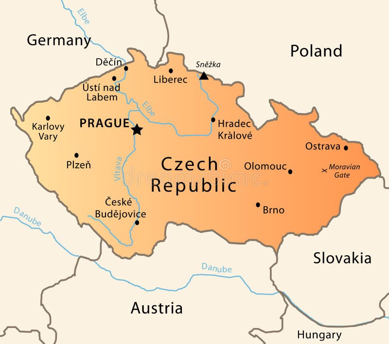
Free with trial Illustration of a detailed political map of Czech Republic. The X indicates the most important gate of the Moravian mountains. Baltic sea vectors Czech Republic political map. Illustration of a detailed political map of Czech Republic. The X indicates the most important gate of the Moravian mountains. Illustration of a detailed political map of Czech Republic. The X indicates the most important gate of the Moravian mountains.
Free with trial Helsinki skyline vector silhouette. Vectored illustration of the skyline of finnish capital helsinki with most famous landmarks. Baltic sea vectors Helsinki skyline vector silhouette. Vectored illustration of the skyline of finnish capital helsinki with most famous landmarks
Free with trial Saint Petersburg, Russia, Bronze Horseman. Saint Petersburg, Russia, Peter the Great, Bronze Horseman, Russian landmark, White Nights, Saint Isaac's Cathedral. Baltic sea vectors Saint Petersburg, Russia, Bronze Horseman. Saint Petersburg, Russia, Peter the Great, Bronze Horseman, Russian landmark, White Nights, Saint Isaac's Cathedral
Free with trial Norway and Sweden. Abstract vector color map of Norway and Sweden country. Baltic sea vectors Norway and Sweden. Abstract vector color map of Norway and Sweden country
Free with trial Baltic Sea area countries political map with national borders. Nations and states of Scandinavia. English labeling and scaling. Gray illustration on white background. Baltic sea vectors Baltic Sea area countries political map. With national borders. Nations and states of Scandinavia. English labeling and scaling. Gray illustration on white
Free with trial Baltic States Political Map. Estonia, Latvia and Lithuania with capitals Tallinn, Riga and Vilnius. With national borders, important cities, rivers and lakes. English labeling and scaling. Baltic sea vectors Baltic States Political Map. Estonia, Latvia and Lithuania with capitals Tallinn, Riga and Vilnius. With national borders, important cities, rivers and lakes
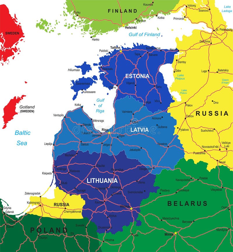
Free with trial Highly detailed vector map of the Baltic states with administrative regions,main cities and roads. Baltic sea vectors Baltic states map. Highly detailed vector map of the Baltic states with administrative regions,main cities and roads. Highly detailed vector map of the Baltic states with administrative regions,main cities and roads.
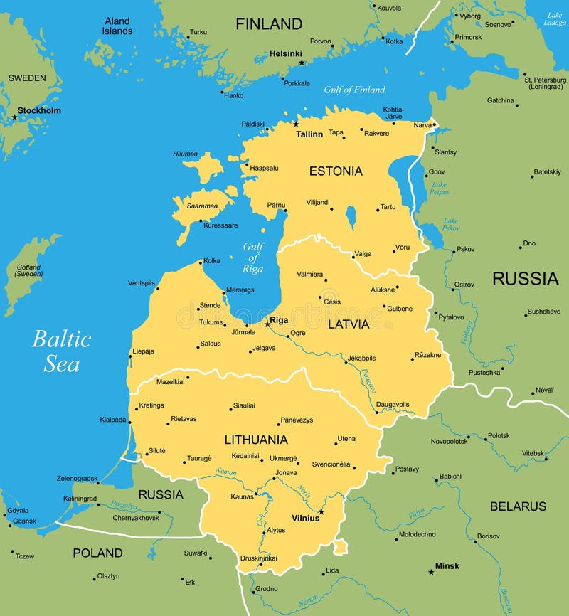
Free with trial Vector map of Baltic. Vector color map of Baltic states. Baltic sea vectors Vector map of Baltic. Vector color map of Baltic states
Free with trial Map of North Europe. With Baltic sea. Baltic sea vectors Map of North Europe. With Baltic sea
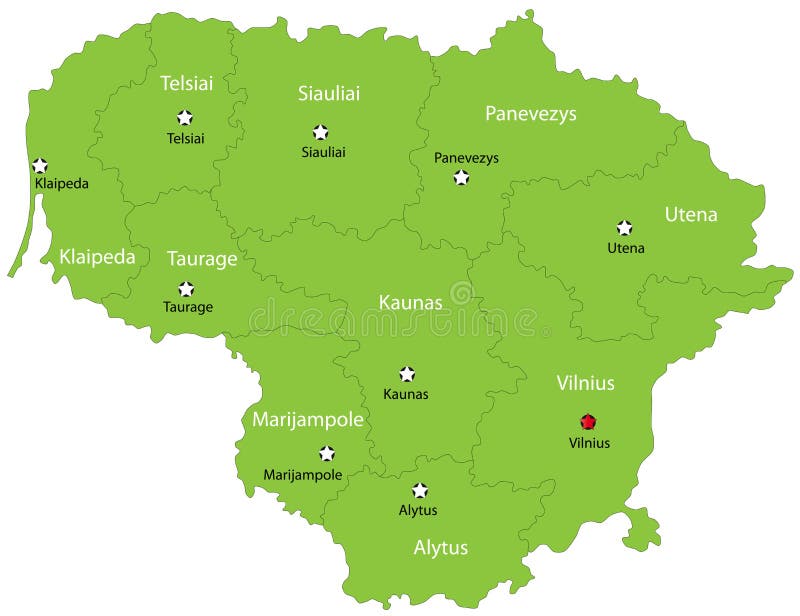
Free with trial Lithuania map designed in illustration with the 10 counties colored in green colors and with the main cities. Neighbouring countries are in an additional format (. AI) in the latent layer. Baltic sea vectors Vector Lithuania map. Lithuania map designed in illustration with the 10 counties colored in green colors and with the main cities. Neighbouring countries are in. Lithuania map designed in illustration with the 10 counties colored in green colors and with the main cities. Neighbouring countries are in an additional format (.AI) in the latent layer.
Free with trial Germany Political Map with capital Berlin, national borders, most important cities, rivers and lakes. English labeling and scaling. Illustration. Baltic sea vectors Germany Political Map. With capital Berlin, national borders, most important cities, rivers and lakes. English labeling and scaling. Illustration
Free with trial Europe Physical Map. No text. Detailed illustration of Europe Physical Map. Baltic sea vectors Europe Physical Map. No text. Detailed illustration of Europe Physical Map
Free with trial Illustration of a detailed political map of Belarus. Baltic sea vectors Belarus map. Illustration of a detailed political map of Belarus. Illustration of a detailed political map of Belarus.
Free with trial Europe Physical Map. Retro Colors. Detailed illustration of Europe Physical Map. Baltic sea vectors Europe Physical Map. Retro Colors. Detailed illustration of Europe Physical Map
Free with trial Highly detailed physical map of Europe, in vector format, with all the relief forms, countries and big cities. Baltic sea vectors Europe - physical map. Highly detailed physical map of Europe, in vector format, with all the relief forms, countries and big cities. Highly detailed physical map of Europe, in vector format, with all the relief forms, countries and big cities.
Free with trial Lighthouse. Hillside black striped lighthouse vector illustration. Baltic sea vectors Lighthouse. Hillside black striped lighthouse vector illustration
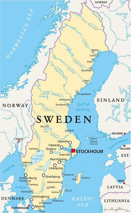
Free with trial Sweden Political Map with capital Stockholm, national borders, important cities, rivers and lakes. English labeling and scaling. Illustration. Baltic sea vectors Sweden Political Map. With capital Stockholm, national borders, important cities, rivers and lakes. English labeling and scaling. Illustration
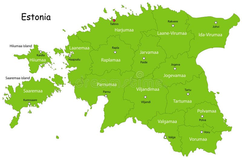
Free with trial Estonia map designed in illustration with states colored in green colors and with the main cities. Neighbouring countries are in an additional format (. AI) in the latent layer. Baltic sea vectors Vector Estonia map. Estonia map designed in illustration with states colored in green colors and with the main cities. Neighbouring countries are in an. Estonia map designed in illustration with states colored in green colors and with the main cities. Neighbouring countries are in an additional format (.AI) in the latent layer.
Free with trial Poland Political Map with capital Warsaw, national borders, most important cities, rivers and lakes. English labeling and scaling. Illustration. Baltic sea vectors Poland Political Map. With capital Warsaw, national borders, most important cities, rivers and lakes. English labeling and scaling. Illustration
Free with trial Atlantic cod, popular food fish realistic vector illustration. Baltic sea vectors Atlantic cod. Popular food fish realistic vector illustration
Free with trial Europe Physical Map. No bathymetry. Detailed illustration of Europe Physical Map. Baltic sea vectors Europe Physical Map. No bathymetry. Detailed illustration of Europe Physical Map
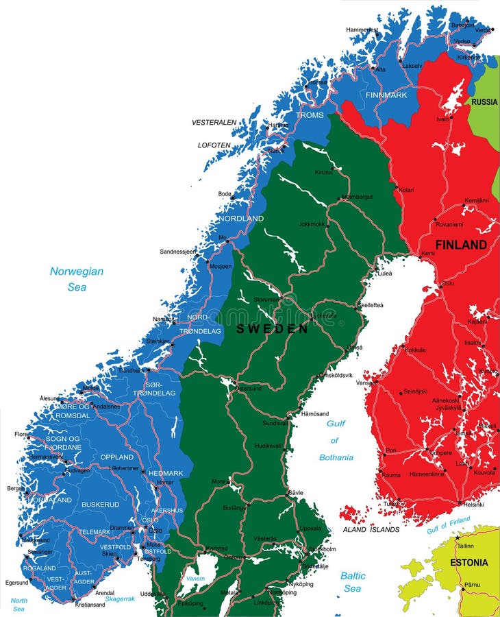
Free with trial Sweden map. Highly detailed vector map of Sweden with administrative regions, main cities and roads. Baltic sea vectors Sweden map. Highly detailed vector map of Sweden with administrative regions, main cities and roads
Free with trial Norway map. Highly detailed vector map of Norway with administrative regions, main cities and roads. Baltic sea vectors Norway map. Highly detailed vector map of Norway with administrative regions, main cities and roads
Free with trial Finland. Abstract vector color map of Finland country. Baltic sea vectors Finland. Abstract vector color map of Finland country
Free with trial Estonia. Abstract vector color map of Estonia country. Baltic sea vectors Estonia. Abstract vector color map of Estonia country
Free with trial High detailed Europe physical map with rivers and surface elements. Vector illustration. Baltic sea vectors High detailed Europe physical map with labeling. High detailed Europe physical map with rivers and surface elements. Vector illustration. High detailed Europe physical map with rivers and surface elements. Vector illustration.
Free with trial Latvia map. Illustration of a detailed political map of Latvia, with the most important cities, rivers and peaks. Baltic sea vectors Latvia map. Illustration of a detailed political map of Latvia, with the most important cities, rivers and peaks
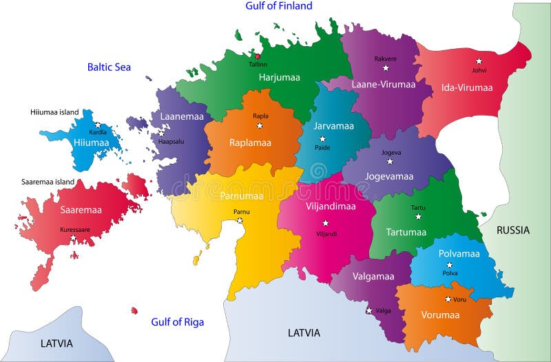
Free with trial Estonia map designed in illustration with the regions colored in bright colors and with the main cities. On an illustration neighbouring countries are shown too. Baltic sea vectors Estonia map. Designed in illustration with the regions colored in bright colors and with the main cities. On an illustration neighbouring countries are shown
Free with trial Map and flags of North Europe. A set of flags and map of 8 north Europe countries on a white background. Baltic sea vectors Map and flags of North Europe. A set of flags and map of 8 north Europe countries on a white background
Free with trial Map and flags of North Europe. A set of flags and map of 8 north Europe countries on a blue background. Baltic sea vectors Map and flags of North Europe. A set of flags and map of 8 north Europe countries on a blue background
Free with trial Denmark maps with markers. Set of the political Denmark maps, markers and symbols for infographic. Baltic sea vectors Denmark maps with markers. Set of the political Denmark maps, markers and symbols for infographic
Free with trial West Russia region. Vector color map of West Russia region. Baltic sea vectors West Russia region. Vector color map of West Russia region
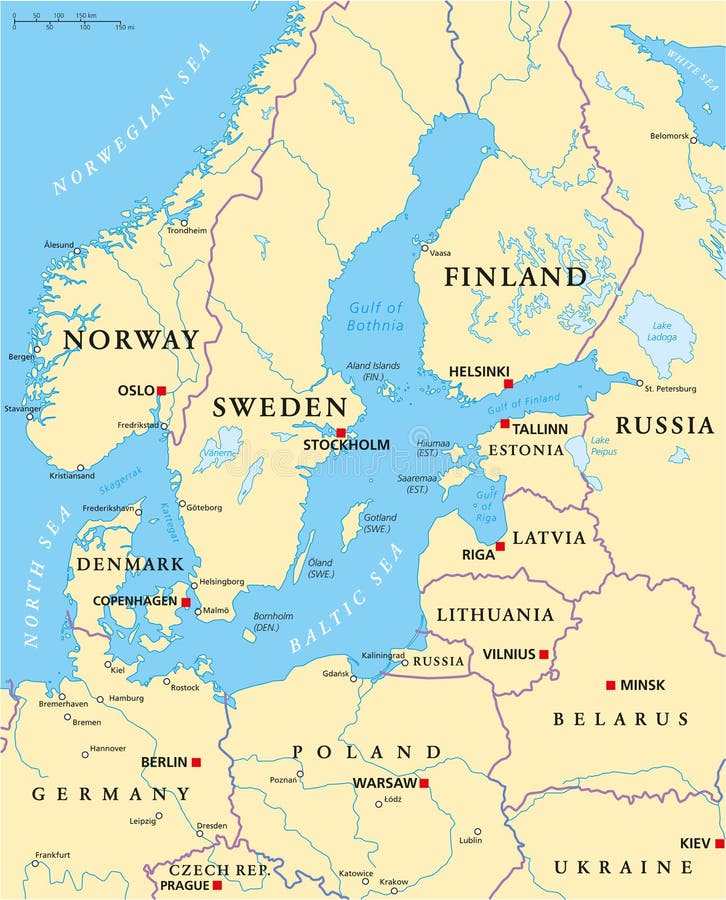
Free with trial Baltic Sea Area Political Map with capitals, national borders, important cities, rivers and lakes. English labeling and scaling. Illustration. Baltic sea vectors Baltic Sea Area Political Map. With capitals, national borders, important cities, rivers and lakes. English labeling and scaling. Illustration
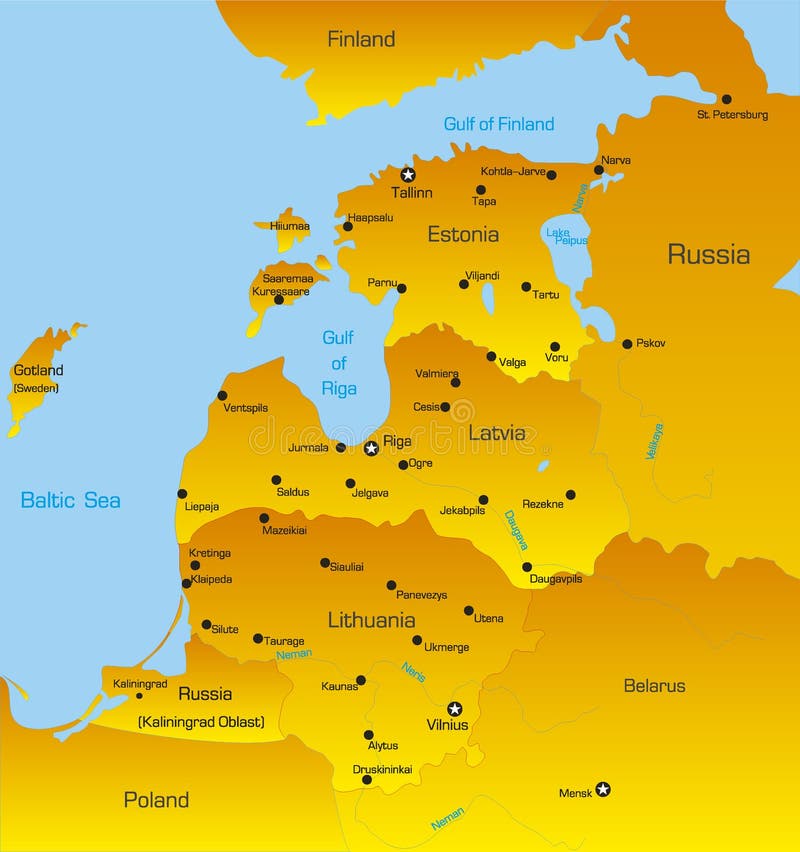
Free with trial Baltic region countries. Map of Baltic region countries. Baltic sea vectors Baltic region countries. Map of Baltic region countries
Free with trial Old map of Europe. With Mediterranean Sea. Baltic sea vectors Old map of Europe. With Mediterranean Sea
Free with trial Lithuania map designed in illustration with the 10 counties colored in bright colors and with the main cities. On an illustration neighbouring countries are shown too. Baltic sea vectors Lithuania map. Designed in illustration with the 10 counties colored in bright colors and with the main cities. On an illustration neighbouring countries are
Free with trial Finland Political Map with capital Helsinki, national borders, important cities, rivers and lakes. English labeling and scaling. Illustration. Baltic sea vectors Finland Political Map. With capital Helsinki, national borders, important cities, rivers and lakes. English labeling and scaling. Illustration
Free with trial Poland map designed in illustration with the 26 districts colored in green colors and with the main cities. Neighbouring countries are in an additional format (. AI) in the latent layer. Baltic sea vectors Latvia map. Poland map designed in illustration with the 26 districts colored in green colors and with the main cities. Neighbouring countries are in an. Poland map designed in illustration with the 26 districts colored in green colors and with the main cities. Neighbouring countries are in an additional format (.AI) in the latent layer.
Free with trial Latvia map designed in illustration with the 26 districts colored in bright colors and with the main cities. On an illustration neighbouring countries are shown too. Baltic sea vectors Latvia map. Designed in illustration with the 26 districts colored in bright colors and with the main cities. On an illustration neighbouring countries are
Free with trial Lithuania. Blind map of Lithuania with regions borders and names of the 10 counties. Baltic sea vectors Lithuania. Blind map of Lithuania with regions borders and names of the 10 counties
Free with trial Europe Physical Map. Retro Colors. No text. Detailed illustration of Europe Physical Map. Baltic sea vectors Europe Physical Map. Retro Colors. No text. Detailed illustration of Europe Physical Map
Free with trial Europe Physical Map Isolated on Retro White. No text. Detailed illustration of Europe Physical Map. Baltic sea vectors Europe Physical Map Isolated on Retro White. No text. Detailed illustration of Europe Physical Map
Free with trial Denmark Political Map with capital Copenhagen, national borders, important cities and rivers. English labeling and scaling. Illustration. Baltic sea vectors Denmark Political Map. With capital Copenhagen, national borders, important cities and rivers. English labeling and scaling. Illustration
Free with trial European Union countries. Political map with borders. All 28 EU members colored in blue. Political and economic union in Europe. Isolated illustration on white background. Vector. Baltic sea vectors European Union countries political map. European Union countries. Political map with borders. All 28 EU members colored in blue. Political and economic union in. European Union countries. Political map with borders. All 28 EU members colored in blue. Political and economic union in Europe. Isolated illustration on white background. Vector.
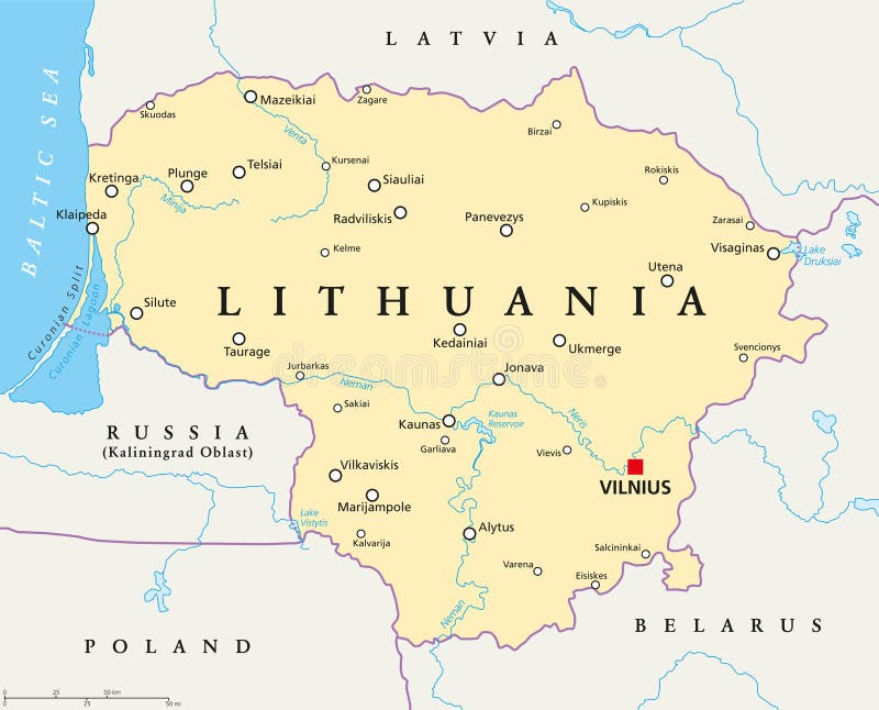
Free with trial Lithuania political map with capital Vilnius, national borders, important cities, rivers and lakes. English labeling and scaling. Illustration. Baltic sea vectors Lithuania Political Map. With capital Vilnius, national borders, important cities, rivers and lakes. English labeling and scaling. Illustration
Free with trial Norway map. Highly detailed vector map of Norway with administrative regions,main cities and roads. Baltic sea vectors Norway map. Highly detailed vector map of Norway with administrative regions,main cities and roads
Free with trial Norway Political Map with capital Oslo, national borders, important cities, rivers and lakes. English labeling and scaling. Illustration. Baltic sea vectors Norway Political Map. With capital Oslo, national borders, important cities, rivers and lakes. English labeling and scaling. Illustration
Free with trial Europe Physical Map. White and Gray. Detailed illustration of Europe Physical Map. Baltic sea vectors Europe Physical Map. White and Gray. Detailed illustration of Europe Physical Map
Free with trial Europe Physical Map. Retro Colors. No bathymetry. Detailed illustration of Europe Physical Map. Baltic sea vectors Europe Physical Map. Retro Colors. No bathymetry. Detailed illustration of Europe Physical Map
Free with trial Sapmi,Lapland,gray political map. Cultural region in Northern and Eastern Europe,including the northern parts of Fennoscandia,stretching over the four countries Norway,Sweden,Finland and Russia. Baltic sea vectors Sapmi, Lapland, cultural region in Europe, gray political map. Sapmi,Lapland,gray political map. Cultural region in Northern and Eastern Europe,including the. Sapmi,Lapland,gray political map. Cultural region in Northern and Eastern Europe,including the northern parts of Fennoscandia,stretching over the four countries Norway,Sweden,Finland and Russia.
Free with trial High detailed Germany physical map with labeling. Vector illustration. Baltic sea vectors High detailed Germany physical map with labeling. Vector illustration
Free with trial High detailed Europe physical map with rivers and surface elements. Vector illustration. Baltic sea vectors High detailed Europe physical map. High detailed Europe physical map with rivers and surface elements. Vector illustration. High detailed Europe physical map with rivers and surface elements. Vector illustration.
Free with trial Lithuania. Abstract vector color map of Lithuania country. Baltic sea vectors Lithuania. Abstract vector color map of Lithuania country
Free with trial Denmark. Abstract vector color map of Denmark country. Baltic sea vectors Denmark. Abstract vector color map of Denmark country
Free with trial Latvia. Abstract vector color map of Latvia country. Baltic sea vectors Latvia. Abstract vector color map of Latvia country
Free with trial Illustration strong winds push the tree to collapse. Wind Blowing Leaves Off Tree. Baltic sea vectors Illustration strong winds collapse the tree . Wind Blowing Leaves Off Tree. Illustration strong winds push the tree to collapse. Wind Blowing Leaves Off Tree. Illustration strong winds push the tree to collapse. Wind Blowing Leaves Off Tree.
Free with trial Copenhagen skyline. Main city from denmark. Baltic sea vectors Copenhagen skyline. Main city from denmark
Free with trial Norway and Sweden. Abstract vector color map of Norway and Sweden country coloured by national flag. Baltic sea vectors Norway and Sweden. Abstract vector color map of Norway and Sweden country coloured by national flag
Free with trial Denmark. Abstract vector color map of Denmark country coloured by national flag. Baltic sea vectors Denmark. Abstract vector color map of Denmark country coloured by national flag
Free with trial Estonia. Abstract vector color map of Estonia country coloured by national flag. Baltic sea vectors Estonia. Abstract vector color map of Estonia country coloured by national flag
Free with trial Vector map of the Baltic Sea island of Usedom, Germany, Poland. Baltic sea vectors Vector map of the Baltic Sea island of Usedom, Germany, Poland.
Free with trial Silhouette map of the baltic sea in Northern europe. Baltic sea vectors Silhouette map of the baltic sea in Northern europe.
Free with trial Black and white vector illustration of sea buckthorn branch with berries and leaves painted by inks. Baltic sallow thorn berry line art for organic cosmetics, healthy food label, vitamin supplement. Baltic sea vectors Black and white vector illustration of sea buckthorn branch with berries and leaves painted by inks. Baltic sallow thorn berry. Line art for organic cosmetics. Black and white vector illustration of sea buckthorn branch with berries and leaves painted by inks. Baltic sallow thorn berry line art for organic cosmetics, healthy food label, vitamin supplement
Free with trial Blue outline map of Baltic Sea, Isolated vector siilhouette. Sea on white background. Baltic sea vectors Blue outline map of Baltic Sea, Isolated vector siilhouette. Sea on white background
Free with trial Usedom island Baltic Sea, Germany, Poland map vector illustration, scribble sketch Uznam, Sunny Island map,. Baltic sea vectors Usedom island Baltic Sea, Germany, Poland map vector illustration, scribble sketch Uznam, Sunny Island map.
Free with trial Rugen island Baltic Sea, Federal Republic of Germany map vector illustration, scribble sketch Rugia or Ruegen map,. Baltic sea vectors Rugen island Baltic Sea, Federal Republic of Germany map vector illustration, scribble sketch Rugia or Ruegen map.
Free with trial Baltic Sea States Waving Flag Set. The set includes the flags of Russia, Estonia, Lithuania, Latvia, Finland, Sweden, Poland, Germany and Denmark. Vector Icons all elements neatly on Layers and Groups. Baltic sea vectors Baltic Sea States Waving Flag Set. The set includes the flags of Russia, Estonia, Lithuania, Latvia, Finland, Sweden, Poland, Germany and Denmark. Vector Icons
Free with trial Council of the Baltic Sea States. Vector map of Council of the Baltic Sea States CBSS with buttons and flags on white background. Baltic sea vectors Council of the Baltic Sea States. Vector map of Council of the Baltic Sea States CBSS with buttons and flags on white background
Free with trial Vector file of Baltic countries map - Baltic states, Baltic republics, sovereign states in Northern Europe on the eastern coast of the Baltic Sea: Estonia, Latvia, and Lithuania. Baltic sea vectors Baltic countries map - Baltic states, Baltic republics, Baltic nations or simply the Baltics. Vector file of Baltic countries map - Baltic states, Baltic. Vector file of Baltic countries map - Baltic states, Baltic republics, sovereign states in Northern Europe on the eastern coast of the Baltic Sea: Estonia, Latvia, and Lithuania
Free with trial Vector file of Baltic countries map - Baltic states, Baltic republics, sovereign states in Northern Europe on the eastern coast of the Baltic Sea: Estonia, Latvia, and Lithuania. Baltic sea vectors Baltic countries map - Baltic states, Baltic republics, Baltic nations or simply the Baltics. Vector file of Baltic countries map - Baltic states, Baltic. Vector file of Baltic countries map - Baltic states, Baltic republics, sovereign states in Northern Europe on the eastern coast of the Baltic Sea: Estonia, Latvia, and Lithuania
Free with trial Postcard Seaside. Postcard of Seaside at Baltic Sea, Darss Coast, editable vector illustration - EPS8. Baltic sea vectors Postcard Seaside. Postcard of Seaside at Baltic Sea, Darss Coast, editable vector illustration - EPS8
Free with trial Map of the Danish Baltic island of Bornholm. Baltic sea vectors Map of the Danish Baltic island of Bornholm.
Free with trial Political Map of the Baltic States with roads. Vector illustration. Baltic sea vectors Political Map of the Baltic States with roads. Vector illustration
Free with trial Baltic countries physical map. Highly detailed physical map of the Baltic States region,in vector format,with all the relief forms,countries and big cities. Baltic sea vectors Baltic countries physical map. Highly detailed physical map of the Baltic States region,in vector format,with all the relief forms,countries and big cities
Free with trial Old map of North Europe. With Baltic sea. Baltic sea vectors Old map of North Europe. With Baltic sea
 Sign in