Free with trial Europe Physical Map. Detailed illustration of Europe Physical Map. Bathymetry vectors Europe Physical Map. Detailed illustration of
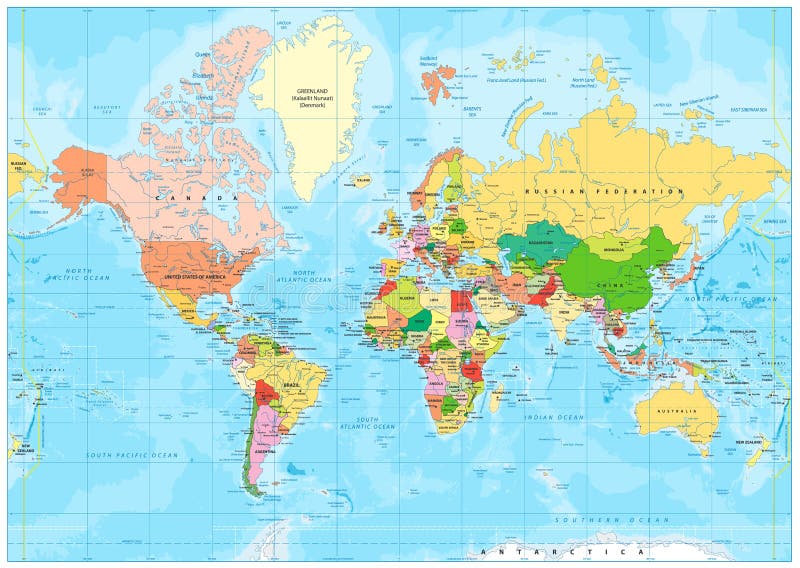
Free with trial Highly detailed political World map with labeling. Vector illustration. Bathymetry vectors Highly detailed political World map with labeling. Vector illustration
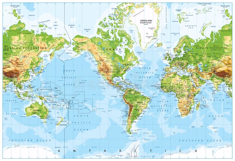
Free with trial Physical World Map America Centered and Bathymetry. Highly detailed illustration. Bathymetry vectors Physical World Map America Centered and Bathymetry. Highly detailed illustration
Free with trial Europe Political Map and Bathymetry. Detailed illustration of Europe Map. Bathymetry vectors Europe Political Map and Bathymetry. Detailed illustration of Europe Map
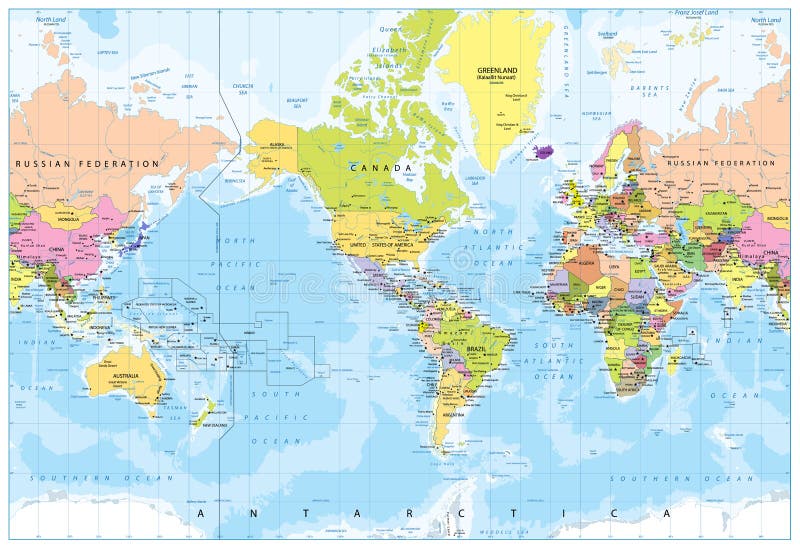
Free with trial World Map - America in center - Bathymetry. Highly detailed illustration of World Map. Bathymetry vectors World Map - America in center - Bathymetry. Highly detailed illustration of World Map
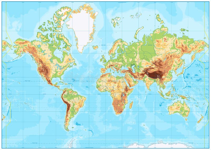
Free with trial Detailed Physical World Map Retro Colors. No bathymetry. Vector illustration. Bathymetry vectors Detailed Physical World Map Retro Colors. No bathymetry. Vector illustration
Free with trial Political World Map Vintage Colors and Bathymetry - borders, countries, roads and cities - Detailed World Map vector illustration - All elements are separated in editable layers clearly labeled - Vector. Bathymetry vectors Political World Map Vintage Colors and Bathymetry. Borders, countries, roads and cities - Detailed World Map vector illustration - All elements are separated. Political World Map Vintage Colors and Bathymetry - borders, countries, roads and cities - Detailed World Map vector illustration - All elements are separated in editable layers clearly labeled - Vector
Free with trial Europe Physical Map. No bathymetry. Detailed illustration of Europe Physical Map. Bathymetry vectors Europe Physical Map. No bathymetry. Detailed illustration of Europe Physical Map
Free with trial Blank Physical World Map and bathymetry. Vector illustration. Bathymetry vectors Blank Physical World Map and bathymetry. Vector illustration
Free with trial Europe Physical Map. Retro Colors. Detailed illustration of Europe Physical Map. Bathymetry vectors Europe Physical Map. Retro Colors. Detailed illustration of Europe Physical Map
Free with trial Pacific Centred World Political Map. Countries and capitals, cities, borders and water objects, state outline. Detailed World Map vector illustration. Bathymetry vectors Pacific Centred World Political Map. Countries and capitals, cities, borders and water objects, state outline. Detailed World Map vector illustration
Free with trial America Centered Physical World Map. Highly detailed vector illustration of Physical World Map. Bathymetry vectors America Centered Physical World Map. Highly detailed vector illustration of Physical World Map
Free with trial A series of maps about the 8. 8 magnitude earthquake from Chile (27 february 2010), from Maule offshore (near Concepcion city). The earthquake was one of the most powerfull from the last 100 years. Bathymetry vectors Chile Earthquake 2010 Map. A series of maps about the 8.8 magnitude earthquake from Chile (27 february 2010), from Maule offshore (near Concepcion city). The. A series of maps about the 8.8 magnitude earthquake from Chile (27 february 2010), from Maule offshore (near Concepcion city). The earthquake was one of the most powerfull from the last 100 years.
Free with trial Detailed Physical World Map with labeling. No bathymetry. Vector illustration. Bathymetry vectors Detailed Physical World Map with labeling. No bathymetry. Vector illustration
Free with trial Pacific Ocean Physical Map. No bathymetry. Detailed Pacific Ocean Physical Map. Vector illustration. Bathymetry vectors Pacific Ocean Physical Map. No bathymetry. Detailed Pacific Ocean Physical Map. Vector illustration
Free with trial The Caribbean Physical Map. No bathymetry. Highly detailed vector illustration. Bathymetry vectors The Caribbean Physical Map. No bathymetry. Highly detailed vector illustration
Free with trial Europe Physical Map. Retro Colors. No bathymetry. Detailed illustration of Europe Physical Map. Bathymetry vectors Europe Physical Map. Retro Colors. No bathymetry. Detailed illustration of Europe Physical Map
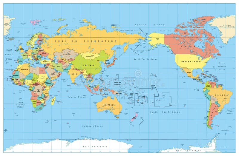
Free with trial Pacific Centred World Colored Map. No Bathymetry. Countries and capitals, cities, borders and water objects, state outline. Detailed World Map vector illustration. Bathymetry vectors Pacific Centred World Colored Map. No Bathymetry. Countries and capitals, cities, borders and water objects, state outline. Detailed World Map vector
Free with trial Political World Map vintage color with lakes and rivers and labeling. Vector illustration. Bathymetry vectors Political World Map vintage color with lakes and rivers. And labeling. Vector illustration
Free with trial Political World Map retro color with lakes and rivers and labeling. Vector illustration. Bathymetry vectors Political World Map retro color with lakes and rivers. And labeling. Vector illustration
Free with trial Europe Physical Map. Retro Colors. No text. Detailed illustration of Europe Physical Map. Bathymetry vectors Europe Physical Map. Retro Colors. No text. Detailed illustration of Europe Physical Map
Free with trial Blank World Map retro color with lakes and rivers. Vector illustration. Bathymetry vectors Blank World Map retro color with lakes and rivers. Vector illustration
Free with trial Europe Physical Map. White and Gray. Detailed illustration of Europe Physical Map. Bathymetry vectors Europe Physical Map. White and Gray. Detailed illustration of Europe Physical Map
Free with trial Political World map and bathymetry. No text. Vector illustration. Bathymetry vectors Political World map and bathymetry. No text. Vector illustration
Free with trial Arctic Ocean Political Map. No bathymetry. Highly detailed vector illustration. Bathymetry vectors Arctic Ocean Political Map. No bathymetry. Highly detailed vector illustration
Free with trial Europe Political Map and Bathymetry. No text. Detailed illustration of Europe Map. Bathymetry vectors Europe Political Map and Bathymetry. No text. Detailed illustration of Europe Map
Free with trial Pacific Centered World Colored Map and Water Bathymetry with names. Water borders and water objects, states outline, basin names, water objects names. No cities, capitals and countries names. Detailed World Map vector illustration. Bathymetry vectors Pacific Centered World Colored Map and Water Bathymetry with nam. Es. Water borders and water objects, states outline, basin names, water objects names. No. Pacific Centered World Colored Map and Water Bathymetry with names. Water borders and water objects, states outline, basin names, water objects names. No cities, capitals and countries names. Detailed World Map vector illustration.
Free with trial Pacific Centred World Colored Map and Bathymetry. No text. Water borders and water objects, state outline. Detailed World Map vector illustration. Bathymetry vectors Pacific Centred World Colored Map and Bathymetry. No text. Water borders and water objects, state outline. Detailed World Map vector illustration
Free with trial Pacific Ocean Political Map and bathymetry. Detailed Pacific Ocean Vector Map. Vector illustration. Bathymetry vectors Pacific Ocean Political Map and bathymetry. Detailed Pacific Ocean Vector Map. Vector illustration
Free with trial Old retro map of Asia and bathymetry with rivers, lakes and elevations. Bathymetry vectors Old retro map of Asia and bathymetry. With rivers, lakes and elevations
Free with trial Pacific Ocean Political Map. No bathymetry. No text. Detailed Pacific Ocean Vector Map. Vector illustration. Bathymetry vectors Pacific Ocean Political Map. No bathymetry. No text. Detailed Pacific Ocean Vector Map. Vector illustration
Free with trial Europe Political Map. Retro Colors and Bathymetry. Detailed illustration of Europe Map. Bathymetry vectors Europe Political Map. Retro Colors and Bathymetry. Detailed illustration of Europe Map
Free with trial Europe Political Map. Vintage Colors and Bathymetry. Detailed illustration of Europe Map. Bathymetry vectors Europe Political Map. Vintage Colors and Bathymetry. Detailed illustration of Europe Map
Free with trial Political map of Southeast Asia. Colorful hand-drawn cartoon style illustrated map with bathymetry. Handwritten labels of country, capital city, sea and ocean names. Simple flat vector map. Bathymetry vectors Southeast Asia map - hand-drawn cartoon style. Political map of Southeast Asia. Colorful hand-drawn cartoon style illustrated map with bathymetry. Handwritten. Political map of Southeast Asia. Colorful hand-drawn cartoon style illustrated map with bathymetry. Handwritten labels of country, capital city, sea and ocean names. Simple flat vector map.
Free with trial Political map of World. Colorful hand-drawn cartoon style illustrated map with bathymetry. Handwritten labels of country, capital city, sea and ocean names. Simple flat vector map. Bathymetry vectors World map - hand-drawn cartoon style. Political map of World. Colorful hand-drawn cartoon style illustrated map with bathymetry. Handwritten labels of country. Political map of World. Colorful hand-drawn cartoon style illustrated map with bathymetry. Handwritten labels of country, capital city, sea and ocean names. Simple flat vector map.
Free with trial Political map of Asia. Colorful hand-drawn cartoon style illustrated map with bathymetry. Handwritten labels of country, capital city, sea and ocean names. Simple flat vector map. Bathymetry vectors Asia map - hand-drawn cartoon style. Political map of Asia. Colorful hand-drawn cartoon style illustrated map with bathymetry. Handwritten labels of country. Political map of Asia. Colorful hand-drawn cartoon style illustrated map with bathymetry. Handwritten labels of country, capital city, sea and ocean names. Simple flat vector map.
Free with trial Political map of Central America and Caribbean. Colorful hand-drawn cartoon style illustrated map with bathymetry. Handwritten labels of country, capital city, sea and ocean names. Simple flat vector map. Bathymetry vectors Central America map - hand-drawn cartoon style. Political map of Central America and Caribbean. Colorful hand-drawn cartoon style illustrated map with bathymetry. Political map of Central America and Caribbean. Colorful hand-drawn cartoon style illustrated map with bathymetry. Handwritten labels of country, capital city, sea and ocean names. Simple flat vector map.
Free with trial Political map of Australia and Oceania. Colorful hand-drawn cartoon style illustrated map with bathymetry. Handwritten labels of country, capital city, sea and ocean names. Simple flat vector map. Bathymetry vectors Australia map - hand-drawn cartoon style. Political map of Australia and Oceania. Colorful hand-drawn cartoon style illustrated map with bathymetry. Handwritten. Political map of Australia and Oceania. Colorful hand-drawn cartoon style illustrated map with bathymetry. Handwritten labels of country, capital city, sea and ocean names. Simple flat vector map.
Free with trial Political map of South America. Colorful hand-drawn cartoon style illustrated map with bathymetry. Handwritten labels of country, capital city, sea and ocean names. Simple flat vector map. Bathymetry vectors South America map - hand-drawn cartoon style. Political map of South America. Colorful hand-drawn cartoon style illustrated map with bathymetry. Handwritten. Political map of South America. Colorful hand-drawn cartoon style illustrated map with bathymetry. Handwritten labels of country, capital city, sea and ocean names. Simple flat vector map.
Free with trial World Map - Political - American View - America in Center - Green Colors Water Bathymetry. Vector Detailed illustration of World Map. Bathymetry vectors World Map - Political - American View - America in Center - Green Colors Water Bathymetry. Vector Detailed illustration of World Map
Free with trial Europe Physical Map. White and Gray. No text. Detailed illustration of Europe Physical Map. Bathymetry vectors Europe Physical Map. White and Gray. No text. Detailed illustration of Europe Physical Map
Free with trial Pacific Ocean Physical Map Old Colors. Detailed Pacific Ocean Physical Map. Vector illustration. Bathymetry vectors Pacific Ocean Physical Map Old Colors. Detailed Pacific Ocean Physical Map. Vector illustration
Free with trial Pacific Ocean Physical Map White and Grey. Detailed Pacific Ocean Physical Map. Vector illustration. Bathymetry vectors Pacific Ocean Physical Map White and Grey. Detailed Pacific Ocean Physical Map. Vector illustration
Free with trial Blank Political World Map vintage color with lakes and rivers. Vector illustration. Bathymetry vectors Blank Political World Map vintage color with lakes and rivers. Vector illustration
Free with trial Map of Europe eps file. Europe map background red eps file For education. Bathymetry vectors Map of Europe eps file. Europe map background red eps file For education
Free with trial Pacific Ocean Physical Map. Detailed Pacific Ocean Physical Map. Vector illustration. Bathymetry vectors Pacific Ocean Physical Map. Detailed . Vector illustration. Pacific Ocean Physical Map. Detailed Pacific Ocean Physical Map. Vector illustration
Free with trial Political World Map isolated on vintage blue color and labeling. Vector illustration. Bathymetry vectors Political World Map isolated on vintage blue color. And labeling. Vector illustration
Free with trial Detailed Canada physical map. Vector illustration. Bathymetry vectors Detailed Canada physical map. Vector illustration
Free with trial Wave signal radio sonar effect vector lines or antenna radiation vibration sonic rings ways clip art radial strokes icon, angular frequency airwave broadcast, microwave emission clipart editable. Bathymetry vectors Wave signal radio sonar effect vector lines or antenna radiation vibration sonic rings ways clip art radial strokes icon, angular. Frequency airwave broadcast. Wave signal radio sonar effect vector lines or antenna radiation vibration sonic rings ways clip art radial strokes icon, angular frequency airwave broadcast, microwave emission clipart editable
Free with trial A sophisticated collection of vector line icons representing marine geotechnical sensors, subsea exploration tools, and underwater technical equipment for oceanographic research. Bathymetry vectors Deep Sea Geotechnical Sensor Outline Symbols. A sophisticated collection of vector line icons representing marine geotechnical sensors, subsea exploration tools. A sophisticated collection of vector line icons representing marine geotechnical sensors, subsea exploration tools, and underwater technical equipment for oceanographic research.
Free with trial America Centered Physical World Map. No text and borders. Highly detailed illustration of Physical World Map. Bathymetry vectors America Centered Physical World Map. No text and borders. Highly detailed illustration of Physical World Map
Free with trial America Centered Physical World Map isolated on white. Highly detailed illustration of Physical World Map. Bathymetry vectors America Centered Physical World Map isolated on white. Highly detailed illustration of Physical World Map
Free with trial Sea nautical map cartoon. coastline compass, latitude longitude, bearings routes sea nautical map sign. isolated symbol vector illustration. Bathymetry vectors Sea nautical map cartoon vector illustration. Sea nautical map cartoon. coastline compass, latitude longitude, bearings routes sea nautical map sign. isolated. sea nautical map cartoon. coastline compass, latitude longitude, bearings routes sea nautical map sign. isolated symbol vector illustration
Free with trial Centered America Political World Map and All World Country Flags-Bathymetry. Highly detailed vector illustration of World Map and All World Country Flags. Bathymetry vectors Centered America Political World Map and All World Country Flags. Bathymetry. Highly detailed vector illustration of World Map and All World Country Flags
Free with trial Pattern bathymetry sea topogrphic cartoon. abyssal trench, ridge shelf, slope plain bathymetry sea topogrphic sign vector. Bathymetry vectors Pattern bathymetry sea topogrphic cartoon vector. Pattern bathymetry sea topogrphic cartoon. abyssal trench, ridge shelf, slope plain bathymetry sea topogrphic. pattern bathymetry sea topogrphic cartoon. abyssal trench, ridge shelf, slope plain bathymetry sea topogrphic sign vector
Free with trial Seamless pattern bathymetry sea topogrphic cartoon. abyssal trench, ridge shelf, slope plain bathymetry sea topogrphic sign vector. Bathymetry vectors Seamless pattern bathymetry sea topogrphic cartoon vector. Seamless pattern bathymetry sea topogrphic cartoon. abyssal trench, ridge shelf, slope plain. seamless pattern bathymetry sea topogrphic cartoon. abyssal trench, ridge shelf, slope plain bathymetry sea topogrphic sign vector
Free with trial Bathymetry sea topogrphic cartoon. abyssal trench, ridge shelf, slope plain bathymetry sea topogrphic sign colorful illustration. Bathymetry vectors Bathymetry sea topogrphic cartoon vector graphic. Bathymetry sea topogrphic cartoon. abyssal trench, ridge shelf, slope plain bathymetry sea topogrphic sign. bathymetry sea topogrphic cartoon. abyssal trench, ridge shelf, slope plain bathymetry sea topogrphic sign colorful illustration
Free with trial Bathymetry sea topogrphic cartoon. abyssal trench, ridge shelf, slope plain bathymetry sea topogrphic sign. isolated symbol vector illustration. Bathymetry vectors Bathymetry sea topogrphic cartoon vector illustration. Bathymetry sea topogrphic cartoon. abyssal trench, ridge shelf, slope plain bathymetry sea topogrphic sign. bathymetry sea topogrphic cartoon. abyssal trench, ridge shelf, slope plain bathymetry sea topogrphic sign. isolated symbol vector illustration
Free with trial Abstract blue background showing a detailed contour map of the ocean floor, illustrating bathymetry and depth variations. Bathymetry vectors Blue contour map showing underwater ocean topography. Abstract blue background showing a detailed contour map of the ocean floor, illustrating bathymetry and. Abstract blue background showing a detailed contour map of the ocean floor, illustrating bathymetry and depth variations
Free with trial Floor sea topogrphic cartoon. bathymetry abyssal, trench ridge, shelf slope floor sea topogrphic sign colorful illustration. Bathymetry vectors Floor sea topogrphic cartoon vector graphic. Floor sea topogrphic cartoon. bathymetry abyssal, trench ridge, shelf slope floor sea topogrphic sign colorful. floor sea topogrphic cartoon. bathymetry abyssal, trench ridge, shelf slope floor sea topogrphic sign colorful illustration
Free with trial Seamless pattern floor sea topogrphic cartoon. bathymetry abyssal, trench ridge, shelf slope floor sea topogrphic sign vector. Bathymetry vectors Seamless pattern floor sea topogrphic cartoon vector. Seamless pattern floor sea topogrphic cartoon. bathymetry abyssal, trench ridge, shelf slope floor sea. seamless pattern floor sea topogrphic cartoon. bathymetry abyssal, trench ridge, shelf slope floor sea topogrphic sign vector
Free with trial Marine oceanography survey diagram illustrating research vessel multibeam sonar acoustic fan mapping bathymetric seafloor contours. Bathymetry vectors Multibeam Bathymetry Swath Sonar Seabed Mapping Vector. Marine oceanography survey diagram illustrating research vessel multibeam sonar acoustic fan mapping. Marine oceanography survey diagram illustrating research vessel multibeam sonar acoustic fan mapping bathymetric seafloor contours
Free with trial Area-based management multi color concept icon. Oceanographic map, bathymetry. Round shape line illustration. Abstract idea. Graphic design. Easy to use in infographic, presentation. Bathymetry vectors Area-based management multi color concept icon. Oceanographic map, bathymetry. Round shape line illustration. Abstract idea. Graphic design. Easy to use in
Free with trial Area-based management blue gradient concept icon. Oceanographic map, bathymetry. Round shape line illustration. Abstract idea. Graphic design. Easy to use in infographic, presentation. Bathymetry vectors Area-based management blue gradient concept icon. Oceanographic map, bathymetry. Round shape line illustration. Abstract idea. Graphic design. Easy to use in
Free with trial Floor sea topogrphic cartoon. bathymetry abyssal, trench ridge, shelf slope floor sea topogrphic sign. isolated symbol vector illustration. Bathymetry vectors Floor sea topogrphic cartoon vector illustration. Floor sea topogrphic cartoon. bathymetry abyssal, trench ridge, shelf slope floor sea topogrphic sign. isolated. floor sea topogrphic cartoon. bathymetry abyssal, trench ridge, shelf slope floor sea topogrphic sign. isolated symbol vector illustration
Free with trial Fishing areas RGB color icon. Oceanographic map, bathymetry. Location points, cartography. Topographic geography. Isolated vector illustration. Simple filled line drawing. Editable stroke. Bathymetry vectors Fishing areas RGB color icon. Oceanographic map, bathymetry. Location points, cartography. Topographic geography. Isolated vector illustration. Simple filled
Free with trial Area-based management RGB color icon. Marine protected locations. Oceanographic map, bathymetry. Topographic geolocation. Isolated vector illustration. Simple filled line drawing. Editable stroke. Bathymetry vectors Area-based management RGB color icon. Marine protected locations. Oceanographic map, bathymetry. Topographic geolocation. Isolated vector illustration. Simple
Free with trial Map ocean sea chart line background pattern radar nautical sonar. Digital marine depth grid topology GPS 3D wireframe submarine. Scientific bathymetry oceanography data analysis elevation. Bathymetry vectors 3d ocean map nautical sea chart line background pattern. Radar sonar digital marine depth grid topology GPS 3D wireframe submarine. Map ocean sea chart line. Map ocean sea chart line background pattern radar nautical sonar. Digital marine depth grid topology GPS 3D wireframe submarine. Scientific bathymetry oceanography data analysis elevation.
Free with trial Ocean depth layers illustrated, an infographic maps sunlight to hadal zones, from shelf to trench, key objects are whale, shipwreck, and trench, conveying scale and exploration. Bathymetry vectors Ocean depth layers illustrated, an infographic maps sunlight to hadal ... Ocean depth layers illustrated, an infographic maps sunlight to hadal zones, from. Ocean depth layers illustrated, an infographic maps sunlight to hadal zones, from shelf to trench, key objects are whale, shipwreck, and trench, conveying scale and exploration.
Free with trial Dark blue background with concentric circular geometric lines and smooth halftone radial gradient transition, minimal wavy ripple design with semi-circle stripe lines and bright cream ring accent. Bathymetry vectors Dark blue background with concentric circular geometric lines and smooth halftone radial gradient transition, minimal wavy ripple. Design with semi-circle. Dark blue background with concentric circular geometric lines and smooth halftone radial gradient transition, minimal wavy ripple design with semi-circle stripe lines and bright cream ring accent
Free with trial High-resolution Gerstner wave vector pattern with electric violet isobaths for seamless backgrounds and technical visualizations. Bathymetry vectors Gerstner Wave Isobaths Violet Vector. High-resolution Gerstner wave vector pattern with electric violet isobaths for seamless backgrounds and technical. High-resolution Gerstner wave vector pattern with electric violet isobaths for seamless backgrounds and technical visualizations
Free with trial Sea nautical map cartoon. coastline compass, latitude longitude, bearings routes sea nautical map sign colorful illustration. Bathymetry vectors Sea nautical map cartoon vector graphic. Sea nautical map cartoon. coastline compass, latitude longitude, bearings routes sea nautical map sign colorful. sea nautical map cartoon. coastline compass, latitude longitude, bearings routes sea nautical map sign colorful illustration
Free with trial Ridge sea topogrphic cartoon. shelf slope, plain canyon, mount plateau ridge sea topogrphic sign colorful illustration. Bathymetry vectors Ridge sea topogrphic cartoon vector graphic. Ridge sea topogrphic cartoon. shelf slope, plain canyon, mount plateau ridge sea topogrphic sign colorful. ridge sea topogrphic cartoon. shelf slope, plain canyon, mount plateau ridge sea topogrphic sign colorful illustration
Free with trial Pattern ocean nautical map cartoon vector. sea coastline, compass latitude, longitude bearings ocean nautical map sign vector. Bathymetry vectors Pattern ocean nautical map cartoon vector. Pattern ocean nautical map cartoon. sea coastline, compass latitude, longitude bearings ocean nautical map sign vector
Free with trial Pattern plain sea topogrphic cartoon vector. canyon mount, plateau rise, escarpment rift plain sea topogrphic sign vector. Bathymetry vectors Pattern plain sea topogrphic cartoon vector. Pattern plain sea topogrphic cartoon. canyon mount, plateau rise, escarpment rift plain sea topogrphic sign vector
Free with trial Maritime nautical map cartoon. ocean sea, coastline compass, latitude longitude maritime nautical map sign colorful illustration. Bathymetry vectors Maritime nautical map cartoon vector graphic. Maritime nautical map cartoon. ocean sea, coastline compass, latitude longitude maritime nautical map sign colorful. maritime nautical map cartoon. ocean sea, coastline compass, latitude longitude maritime nautical map sign colorful illustration
Free with trial Pattern ridge sea topogrphic cartoon vector. shelf slope, plain canyon, mount plateau ridge sea topogrphic sign vector. Bathymetry vectors Pattern ridge sea topogrphic cartoon vector. Pattern ridge sea topogrphic cartoon. shelf slope, plain canyon, mount plateau ridge sea topogrphic sign vector
Free with trial Compass nautical map cartoon. latitude longitude, bearings routes, tides currents compass nautical map sign colorful illustration. Bathymetry vectors Compass nautical map cartoon vector graphic. Compass nautical map cartoon. latitude longitude, bearings routes, tides currents compass nautical map sign colorful. compass nautical map cartoon. latitude longitude, bearings routes, tides currents compass nautical map sign colorful illustration
Free with trial Pattern maritime nautical map cartoon. ocean sea, coastline compass, latitude longitude maritime nautical map sign vector. Bathymetry vectors Pattern maritime nautical map cartoon vector. Pattern maritime nautical map cartoon. ocean sea, coastline compass, latitude longitude maritime nautical map sign. pattern maritime nautical map cartoon. ocean sea, coastline compass, latitude longitude maritime nautical map sign vector
Free with trial Trench sea topogrphic cartoon. ridge shelf, slope plain, canyon mount trench sea topogrphic sign colorful illustration. Bathymetry vectors Trench sea topogrphic cartoon vector graphic. Trench sea topogrphic cartoon. ridge shelf, slope plain, canyon mount trench sea topogrphic sign colorful. trench sea topogrphic cartoon. ridge shelf, slope plain, canyon mount trench sea topogrphic sign colorful illustration
 Sign in