Free with trial A clip art background illustration featuring half a Christmas tree set against a blue background. Bordered vectors Christmas Tree Background. A clip art background illustration featuring half a Christmas tree set against a blue background. A clip art background illustration featuring half a Christmas tree set against a blue background.
Free with trial Floral frame. Simple, elegant floral frame with space for you text. Bordered vectors Floral frame. Simple, elegant floral frame with space for you text
Free with trial Flower Bordered Background. White background with folk border of flowers. Bordered vectors Flower Bordered Background. White background with folk border of flowers
Free with trial A peaceful vector illustration of a winding rural road bordered by power lines and a lone tree, set against a calm landscape. This image evokes tranquility, rustic charm, and quiet journeys through the countryside. Ideal for travel themes, agricultural content, or designs celebrating natural serenity. It offers a calm, expansive view. vector design Generative AI. Bordered vectors Rural road with power lines, tranquil country landscape. vector design Generative AI. A peaceful vector illustration of a winding rural road bordered by power. A peaceful vector illustration of a winding rural road bordered by power lines and a lone tree, set against a calm landscape. This image evokes tranquility, rustic charm, and quiet journeys through the countryside. Ideal for travel themes, agricultural content, or designs celebrating natural serenity. It offers a calm, expansive view. vector design Generative AI
Free with trial A clean outline sketch of a serene mountain lake, bordered by tall pine trees. This versatile design is ideal for minimalist nature themes, outdoor recreation, and peaceful landscape visuals, vector design Generative AI. Bordered vectors Outline Mountain Lake with Pine Trees, Nature Sketch, vector design Generative AI. A clean outline sketch of a serene mountain lake, bordered by tall pine trees. A clean outline sketch of a serene mountain lake, bordered by tall pine trees. This versatile design is ideal for minimalist nature themes, outdoor recreation, and peaceful landscape visuals, vector design Generative AI
Free with trial Danger keep out! Warning sign with hand gesture and text bordered by striped hazard tape. Bordered vectors Danger keep out! Warning sign with hand gesture and text. Bordered by striped hazard tape
Free with trial Bordered Background with beads and roses. Vertical A4. Bordered vectors Framed backdrop. Bordered Background with beads and roses. Vertical A4. Bordered Background with beads and roses. Vertical A4.
Free with trial Bordered Background with patch and roses. Style country and western. Vertical A4. Bordered vectors Bordered background in country and western style. Bordered Background with patch and roses. Style country and western. Vertical A4. Bordered Background with patch and roses. Style country and western. Vertical A4.
Free with trial Bordered Background. Nautical style. Vertical A4. Bordered vectors Sea backdrop. Bordered Background. Nautical style. Vertical A4. Bordered Background. Nautical style. Vertical A4.
Free with trial Temporarily out of order, do not use. Information sign with text, cross mark symbol and bordered with black and yellow tape. Horizontal shape. Bordered vectors Temporarily out of order, do not use. Information sign with text, symbol and yellow tape. Horizontal shape. Temporarily out of order, do not use. Information. Temporarily out of order, do not use. Information sign with text, cross mark symbol and bordered with black and yellow tape. Horizontal shape.
Free with trial Bordered background with patchwork, vertical A4. Bordered vectors Bordered background with patchwork. Vertical A4
Free with trial Pink golden glitter made of hearts. Bordered frame on pale_pink valentine background. Vector illustration. Bordered vectors Pink golden glitter made of hearts. Bordered frame on pale_pink valentine background. Vector illustration
Free with trial Red stitched paper hearts. Bordered frame with red stitched paper hearts on light pink background. Vector illustration. Bordered vectors Red stitched paper hearts. Bordered frame with red stitched paper hearts on light pink background. Vector illustration
Free with trial A soothing illustration depicting a calm body of water, bordered by lush reeds and scattered rocks. This scene offers a sense of peace and natural harmony, suitable for environmental or outdoor themes, vector design Generative AI. Bordered vectors Calm Pond Environment, Water with Reeds and Rocks, Natural Habitat, vector design Generative AI. A soothing illustration depicting a calm body of water, bordered. A soothing illustration depicting a calm body of water, bordered by lush reeds and scattered rocks. This scene offers a sense of peace and natural harmony, suitable for environmental or outdoor themes, vector design Generative AI
Free with trial Random falling white dots. Bordered frame with random falling white dots on black background. Vector illustration. Bordered vectors Random falling white dots. Bordered frame with random falling white dots on black background. Vector illustration
Free with trial Hand drawn colorful watercolor background with splashes of blue paint on white paper and gold bordered flowers. Bordered vectors Photo blue watercolor texture with gold decorative flowers and border background. Hand drawn colorful watercolor background with splashes of blue paint on white. Hand drawn colorful watercolor background with splashes of blue paint on white paper and gold bordered flowers
Free with trial A captivating vector illustration of a deep forest river, bordered by towering pine trees and rugged, rocky shores. The scene conveys a sense of wildness and natural majesty. Perfect for outdoor adventure themes, wilderness exploration, or robust nature illustrations, vector design Generative AI. Bordered vectors Deep Forest River with Towering Pines and Rocky Shores, vector design Generative AI. A captivating vector illustration of a deep forest river, bordered by. A captivating vector illustration of a deep forest river, bordered by towering pine trees and rugged, rocky shores. The scene conveys a sense of wildness and natural majesty. Perfect for outdoor adventure themes, wilderness exploration, or robust nature illustrations, vector design Generative AI
Free with trial A simple outline icon of a rounded red rectangle, typically representing a bordered button, input field, or interactive element in a user interface design, highlighting a clickable area, , vector design Generative AI. Bordered vectors Red rectangular outline button, border for interactive element , vector design Generative AI. A simple outline icon of a rounded red rectangle, typically. A simple outline icon of a rounded red rectangle, typically representing a bordered button, input field, or interactive element in a user interface design, highlighting a clickable area, , vector design Generative AI
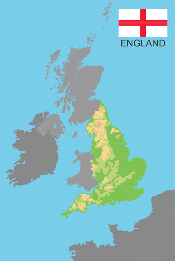
Free with trial England. England is part of the UK bordered by Ireland and France. Detailed physical map of country colored according to elevation, with rivers, lakes, mountains. Vector map with national flag. Bordered vectors England. England is part of the UK bordered by Ireland and France. Detailed physical map of country colored according to. Elevation, with rivers, lakes. England. England is part of the UK bordered by Ireland and France. Detailed physical map of country colored according to elevation, with rivers, lakes, mountains. Vector map with national flag
Free with trial QR code set color of Soviet Union flag. a plain red flag with a golden hammer and sickle and a gold-bordered red star in its upper canton with text Soviet Union. Bordered vectors QR code set color of Soviet Union flag. a plain red flag with a golden hammer and sickle and a gold-bordered red star in its upper. Canton with text Soviet
Free with trial Barcode set the color of Soviet Union flag, a plain red flag with a golden hammer and sickle and a gold-bordered red star in its upper canton with text Made from Soviet Union. Bordered vectors Barcode set the color of Soviet Union flag, a plain red flag with a golden hammer and sickle and a gold-bordered red star in its. Upper canton with text Made
Free with trial Jigsaw puzzle of Soviet Union flag, a plain red flag with a golden hammer and sickle and a gold-bordered red star in its upper canton. Concept of Fulfillment or perfection. Bordered vectors Jigsaw puzzle of Soviet Union flag, a plain red flag with a golden hammer and sickle and a gold-bordered red star. Jigsaw puzzle of Soviet Union flag, a plain. Jigsaw puzzle of Soviet Union flag, a plain red flag with a golden hammer and sickle and a gold-bordered red star in its upper canton. Concept of Fulfillment or perfection
Free with trial An abstract flower background with black background and gold border. Bordered vectors Retro Floral Pattern Print. An abstract flower background with black background and gold border. An abstract flower background with black background and gold border.
Free with trial The Balkans and the Balkan Peninsula, multi colored political map, with country borders and capitals. Geographical area in southeastern Europe, bordered by the Adriatic, Ionian, Aegean, and Black Sea. Bordered vectors The Balkans and the Balkan Peninsula, multi colored political map. With country borders and capitals. Geographical area in southeastern Europe, bordered by the. The Balkans and the Balkan Peninsula, multi colored political map, with country borders and capitals. Geographical area in southeastern Europe, bordered by the Adriatic, Ionian, Aegean, and Black Sea.
Free with trial Cornwall, United Kingdom, political map, with the county town Truro, and the Isles of Scilly. Ceremonial county in South West England, bordered by Devon, Atlantic Ocean, and English Channel. Vector. Bordered vectors Cornwall, with Isles of Scilly, UK, political map. Cornwall, United Kingdom, political map, with the county town Truro, and the Isles of Scilly. Ceremonial. Cornwall, United Kingdom, political map, with the county town Truro, and the Isles of Scilly. Ceremonial county in South West England, bordered by Devon, Atlantic Ocean, and English Channel. Vector
Free with trial Red and Blue figures divided by a gray line. Bordered vectors Division. Red and Blue figures divided by a gray line. Red and Blue figures divided by a gray line.
Free with trial Happy Valentines Day Card with lace heart. Happy Valentines Day Card vith script text on a pink lace bordered heart. Bordered vectors Happy Valentines Day Card with lace heart. Happy Valentines Day Card vith script text on a pink lace bordered heart
Free with trial Children's animal pictures, great for scrapbooking, ads and so on..... Great for any anything that involves children. Bordered vectors Children's pictures. Children's animal pictures, great for scrapbooking, ads and so on..... Great for any anything that involves children. Children's animal pictures, great for scrapbooking, ads and so on..... Great for any anything that involves children...
Free with trial Orange. Slice of orange on a white background. Vector illustration of citrus fruit. Bordered vectors Orange. Slice of orange on a white background. Vector illustration of citrus fruit
Free with trial Orange_background. Slices of orange on a white background. Vector illustration of citrus fruits. Bordered vectors Orange_background. Slices of orange on a white background. Vector illustration of citrus fruits
Free with trial Ice expance. Illustrated ice scene with a range of mountains bordered by evergreen trees. Bordered vectors Ice expance. Illustrated ice scene with a range of mountains bordered by evergreen trees
Free with trial Green marker. Isolated green marker with bordered place for text. Bordered vectors Green marker. Isolated green marker with bordered place for text
Free with trial Music background. Musical background, notes and clef - musical lines as tapes and music notes sticked behind tape. Bordered vectors Music background. Musical background, notes and clef - musical lines as tapes and music notes sticked behind tape
Free with trial Seamless butterflies. Seamless pattern with blue and purple butterflies. Bordered vectors Seamless butterflies. Seamless pattern with blue and purple butterflies
Free with trial The Carolinas or Carolina, the U. S. states North Carolina and South Carolina, political map, with borders and capitals Raleigh and Columbia. Bordered by Virginia, Tennessee, Georgia, and the Atlantic. Bordered vectors The Carolinas, or Carolina, the U.S. states North and South Carolina, political map. The Carolinas or Carolina, the U.S. states North Carolina and South Carolina. The Carolinas or Carolina, the U.S. states North Carolina and South Carolina, political map, with borders and capitals Raleigh and Columbia. Bordered by Virginia, Tennessee, Georgia, and the Atlantic.
Free with trial Shells background (vector). Abstract background made to the computer. Bordered vectors Shells background (vector). Abstract background made to the computer
Free with trial Set of four golden crests or shields with copyspace for your words. Bordered vectors Set of Ornate Gold Shields. Set of four golden crests or shields with copyspace for your words. Set of four golden crests or shields with copyspace for your words.
Free with trial Orange. Slice of orange on a white background. Vector illustration of citrus fruit. Bordered vectors Orange. Slice of orange on a white background. Vector illustration of citrus fruit
Free with trial Seamless red apple cut. Seamless pattern with red apple halves and leaves. Bordered vectors Seamless red apple cut. Seamless pattern with red apple halves and leaves
Free with trial Brown old fashioned bordered b. Brown old fashioned border on a wood-like background. Bordered vectors Brown old fashioned bordered b. Brown old fashioned border on a wood-like background
Free with trial Festive party or event poster with a colorful balloon and ribbon border. Bordered vectors Party poster with balloons. Festive party or event poster with a colorful balloon and ribbon border. Festive party or event poster with a colorful balloon and ribbon border.
Free with trial Oregon Coast, political map. Coastal region of U. S. state of Oregon, bordered by Pacific Ocean to the west and Oregon Coast Range to the east, stretching from Columbia River to the California border. Bordered vectors Oregon Coast, coastal region of U.S. state of Oregon, political map. Oregon Coast, political map. Coastal region of U.S. state of Oregon, bordered by Pacific. Oregon Coast, political map. Coastal region of U.S. state of Oregon, bordered by Pacific Ocean to the west and Oregon Coast Range to the east, stretching from Columbia River to the California border.
Free with trial Vector sheet of paper. Vector blank lined sheet of paper from writing book. Bordered vectors Vector sheet of paper. Vector blank lined sheet of paper from writing book
Free with trial Ivy frame. Vector illustration of Green ivy isolated on white background with space for your text or picture. Bordered vectors Ivy frame. Vector illustration of Green ivy isolated on white background with space for your text or picture
Free with trial Shells background (vector). Abstract background made to the computer. Bordered vectors Shells background (vector). Abstract background made to the computer
Free with trial Oregon Coast, gray political map. Coastal region of U. S. state of Oregon, bordered by Pacific Ocean to the west and Oregon Coast Range to the east, stretching from Columbia River to California border. Bordered vectors Oregon Coast, coastal region of U.S. state of Oregon, gray political map. Oregon Coast, gray political map. Coastal region of U.S. state of Oregon, bordered by. Oregon Coast, gray political map. Coastal region of U.S. state of Oregon, bordered by Pacific Ocean to the west and Oregon Coast Range to the east, stretching from Columbia River to California border.
Free with trial A collection of nine unique, hand-drawn grunge style vector frames or display cards with splatters and various artistic grunge buttons. Bordered vectors Unique Grunge Splatter Cards Set. A collection of nine unique, hand-drawn grunge style vector frames or display cards with splatters and various artistic grunge. A collection of nine unique, hand-drawn grunge style vector frames or display cards with splatters and various artistic grunge buttons.
Free with trial Citrus_frame. Slices of orange on a white background. Vector illustration of citrus fruits. Bordered vectors Citrus_frame. Slices of orange on a white background. Vector illustration of citrus fruits
Free with trial North America, gray political map with borders of the states, provinces and territories of Canada, USA and Mexico. Continent bordered by South America, Caribbean Sea, Arctic, Atlantic and the Pacific. Bordered vectors North America, states, provinces, and territories, gray political map. North America, gray political map with borders of the states, provinces and territories of. North America, gray political map with borders of the states, provinces and territories of Canada, USA and Mexico. Continent bordered by South America, Caribbean Sea, Arctic, Atlantic and the Pacific.
Free with trial Decorative green ivy wall climbing plant vector frame. Foliage decoration wall, branch frame green leaf illustration. Bordered vectors Decorative green ivy wall climbing plant vector frame. Foliage decoration wall, branch frame green leaf illustration
Free with trial Mongolia political map with capital Ulaanbaatar, national borders, important cities, rivers and lakes. Landlocked sovereign state in East Asia, bordered to China and Russia. English labeling. Bordered vectors Mongolia Political Map. With capital Ulaanbaatar, national borders, important cities, rivers and lakes. Landlocked sovereign state in East Asia, bordered to. Mongolia political map with capital Ulaanbaatar, national borders, important cities, rivers and lakes. Landlocked sovereign state in East Asia, bordered to China and Russia. English labeling.
Free with trial East Timor political map with capital Dili, national borders, important cities and rivers. Also known as Timor Leste, a sovereign state in Southeast Asia bordered to Indonesia. English labeling. Bordered vectors East Timor Political Map. With capital Dili, national borders, important cities and rivers. Also known as Timor Leste, a sovereign state in Southeast Asia. East Timor political map with capital Dili, national borders, important cities and rivers. Also known as Timor Leste, a sovereign state in Southeast Asia bordered to Indonesia. English labeling.
Free with trial Velvet curtain wide. Gold bordered royal velvet curtain in black background. Bordered vectors Velvet curtain wide. Gold bordered royal velvet curtain in black background
Free with trial Christmas bell. Vintage Christmas card vector. Christmas bell with a ribbon on bordered decorative paper. Bordered vectors Christmas bell ornament card. Christmas bell. Vintage Christmas card vector. Christmas bell with a ribbon on bordered decorative paper. Christmas bell. Vintage Christmas card vector. Christmas bell with a ribbon on bordered decorative paper.
Free with trial The Carolinas or simply Carolina, U. S. states North and South Carolina, gray political map, with borders and capitals Raleigh and Columbia. Bordered by Virginia, Tennessee, Georgia, and the Atlantic. Bordered vectors The Carolinas, the U.S. states North and South Carolina, gray political map. The Carolinas or simply Carolina, U.S. states North and South Carolina, gray. The Carolinas or simply Carolina, U.S. states North and South Carolina, gray political map, with borders and capitals Raleigh and Columbia. Bordered by Virginia, Tennessee, Georgia, and the Atlantic.
Free with trial Butterfly. Vector illustration of a small colored butterfly. Bordered vectors Butterfly. Vector illustration of a small colored butterfly
Free with trial Illustration of seven hand-drawn vintage labels against a weathered, cream-colored background, bordered with a vintage design. Bordered vectors Hand drawn vintage framed label templates. Illustration of seven hand-drawn vintage labels against a weathered, cream-colored background, bordered with a vintage. Illustration of seven hand-drawn vintage labels against a weathered, cream-colored background, bordered with a vintage design
Free with trial Citrus_frame. Slices of orange on a white background. Vector illustration of citrus fruits. Bordered vectors Citrus_frame. Slices of orange on a white background. Vector illustration of citrus fruits
Free with trial Swirl Frame - vector. Nice bordered Frame best uses by your background, vector. Bordered vectors Swirl Frame - vector. Nice bordered Frame best uses by your background, vector
Free with trial Shells background (vector). Abstract background made to the computer. Bordered vectors Shells background (vector). Abstract background made to the computer
Free with trial Vector Lightbulb and Bevelled Arrow Signs Isolated on White. Two illuminated arrow signs, one with a lit-up border and a plain version. Bordered vectors Vector Lightbulb and Bevelled Arrow Signs Isolated on White. Two illuminated arrow signs, one with a lit-up border and a plain version
Free with trial Blue diamond cross with bordered diamond. Bordered vectors Blue Diamond Cross. With bordered diamond. Blue diamond cross with bordered diamond
Free with trial South America, multi colored political map with international borders and capitals. Continent, bordered by the Pacific and Atlantic Ocean, North America and the Caribbean Sea. Isolated illustration. Bordered vectors South America, multi colored political map with borders and capitals. South America, multi colored political map with international borders and capitals. South America, multi colored political map with international borders and capitals. Continent, bordered by the Pacific and Atlantic Ocean, North America and the Caribbean Sea. Isolated illustration.
Free with trial Dear Santa letter on lined sheet of paper bordered in red and blue with Santa Claus letterhead. Bordered vectors Dear Santa letter on letterhead. Dear Santa letter on lined sheet of paper bordered in red and blue with Santa Claus letterhead. Dear Santa letter on lined sheet of paper bordered in red and blue with Santa Claus letterhead.
Free with trial A collection of four unique, hand-drawn grunge style vector banners with splatters and various artistic grunge buttons. Bordered vectors Unique Grunge Splatter Banner Set. A collection of four unique, hand-drawn grunge style vector banners with splatters and various artistic grunge buttons. A collection of four unique, hand-drawn grunge style vector banners with splatters and various artistic grunge buttons.
Free with trial A black and white bordered label illustration. Bordered vectors Floral Banner Label. A black and white bordered label illustration. A black and white bordered label illustration.
Free with trial Clover leaf background. Clover leaf bordered background green gradient. Bordered vectors Clover leaf background. Clover leaf bordered background green gradient
Free with trial Twilight near hills next to ocean. Grunge bordered sunset with moon, hill and coastline. Bordered vectors Twilight near hills next to ocean. Grunge bordered sunset with moon, hill and coastline
Free with trial Christian illustration. Church logo. The cross of Jesus and the nails of the crucifix are framed with a crown of thorns. Bordered vectors The cross of Jesus and the nails of the crucifix are framed with a crown of thorns. Christian illustration. Church logo. The cross of Jesus and the nails of the. Christian illustration. Church logo. The cross of Jesus and the nails of the crucifix are framed with a crown of thorns.
Free with trial Grunge winter text boxes with cracked icing texture. Blue and white background with snowflakes. Suitable for christmas or new year or winter seasonal text content. Vector isolated on white or blue background. Bordered vectors Vector grunge winter text boxes. Grunge winter text boxes with cracked icing texture. Blue and white background with snowflakes. Suitable for christmas or new. Grunge winter text boxes with cracked icing texture. Blue and white background with snowflakes. Suitable for christmas or new year or winter seasonal text content. Vector isolated on white or blue background.
Free with trial North America countries, political map. Continent bordered by South America, Caribbean Sea, and by Arctic, Atlantic and Pacific Ocean. Canada, United States, Mexico, etc. Multi colored illustration. Bordered vectors North America continent countries, multi colored political map. North America countries, political map. Continent bordered by South America, Caribbean Sea, and. North America countries, political map. Continent bordered by South America, Caribbean Sea, and by Arctic, Atlantic and Pacific Ocean. Canada, United States, Mexico, etc. Multi colored illustration.
Free with trial North America is a continent that bordered to the north by the Arctic Ocean, to the east by the Atlantic Ocean, to the west and south by the Pacific Ocean, and to the southeast by South America and the Caribbean Sea. Bordered vectors North America map. North America is a continent that bordered to the north by the Arctic Ocean, to the east by the Atlantic Ocean, to the west and south by the. North America is a continent that bordered to the north by the Arctic Ocean, to the east by the Atlantic Ocean, to the west and south by the Pacific Ocean, and to the southeast by South America and the Caribbean Sea.
Free with trial Eswatini, formerly named Swaziland, political map, with the capitals Mbabane executive and Lobamba legislative. Landlocked country in Southern Africa, bordered by Mozambique and and South Africa. Bordered vectors Eswatini, formerly named Swaziland, political map. With the capitals Mbabane executive and Lobamba legislative. Landlocked country in Southern Africa, bordered. Eswatini, formerly named Swaziland, political map, with the capitals Mbabane executive and Lobamba legislative. Landlocked country in Southern Africa, bordered by Mozambique and and South Africa.
Free with trial Southeast Asia countries, political map. Geographical region of Asia, bordered by East and South Asia, by the Bay of Bengal, Oceania, the Pacific Ocean, and bordered by Australia and the Indian Ocean. Bordered vectors Southeast Asia countries, a geographical region of Asia, political map. Southeast Asia countries, political map. Geographical region of Asia, bordered by East. Southeast Asia countries, political map. Geographical region of Asia, bordered by East and South Asia, by the Bay of Bengal, Oceania, the Pacific Ocean, and bordered by Australia and the Indian Ocean.
Free with trial Dark reddish brown folk style background with tulips and lace borders. Additional vector format (EPS). Bordered vectors Folk tulip bordered background. Dark reddish brown folk style background with tulips and lace borders. Additional vector format (EPS. Dark reddish brown folk style background with tulips and lace borders. Additional vector format (EPS).
Free with trial Autumn background with witch hat for Halloween. Vector illustration. Bordered vectors Witch Hat. Autumn background with witch hat for Halloween. Vector illustration. Autumn background with witch hat for Halloween. Vector illustration.
Free with trial Isolated raster version of vector set of red bordered emblems in the form of a shields and other geometrical figure with gold ribbons against a dark red background (contain the Clipping Path). There is in addition a vector format (EPS 8). Bordered vectors Emblems with ribbons. Isolated raster version of vector set of red bordered emblems in the form of a shields and other geometrical figure with gold ribbons. Isolated raster version of vector set of red bordered emblems in the form of a shields and other geometrical figure with gold ribbons against a dark red background (contain the Clipping Path). There is in addition a vector format (EPS 8)
Free with trial Velvet curtain. Gold bordered royal velvet curtain in black background. Bordered vectors Velvet curtain. Gold bordered royal velvet curtain in black background
Free with trial Golden bordered typeface. File contains graphic styles available in the Illustrator 10 + You can apply the styles to any of you own fonts or objects. Bordered vectors Golden bordered typeface. File contains graphic styles available in the Illustrator 10 + You can apply the styles to any of you own fonts or objects. File contains graphic styles available in the Illustrator 10 + You can apply the styles to any of you own fonts or objects
Free with trial Mozambique political map with capital Maputo. Republic and country in Southeast Africa bordered by the Indian Ocean. Gray illustration isolated on white background. English labeling. Vector. Bordered vectors Mozambique political map. With capital Maputo. Republic and country in Southeast Africa bordered by the Indian Ocean. Gray illustration isolated on white. Mozambique political map with capital Maputo. Republic and country in Southeast Africa bordered by the Indian Ocean. Gray illustration isolated on white background. English labeling. Vector.
 Sign in