Free with trial Some illustrative text with shadow, celebrating Thanksgiving. Colony vectors Happy Thanksgiving. Some illustrative text with shadow, celebrating Thanksgiving. Some illustrative text with shadow, celebrating Thanksgiving.
Free with trial Soldiers. Abstract silhouette vector illustration of several soldiers against a sunset. Colony vectors Soldiers. Abstract silhouette vector illustration of several soldiers against a sunset
Free with trial Cartoon ants colony and ant hill. Illustration of Cartoon ants colony and ant hill. Colony vectors Cartoon ants colony and ant hill. Illustration of Cartoon ants colony and ant hill
Free with trial Vector and illustration: Virus icon set. Included icons as Colony of Bacteria, Bacteria, microbiology, biohazard, disease and more. Colony vectors Virus icon set. Included icons as Colony of Bacteria, Bacteria, microbiology, biohazard, disease and more. Vector and illustration: Virus icon set. Included. Vector and illustration: Virus icon set. Included icons as Colony of Bacteria, Bacteria, microbiology, biohazard, disease and more.
Free with trial Colorful Happy Thanksgiving banner with customized text. Colony vectors Happy Thanksgiving Banner. Colorful Happy Thanksgiving banner with customized text. Colorful Happy Thanksgiving banner with customized text.
Free with trial Vector underwater coral reef horizontal seamless pattern. Undersea bottom texture illustratioin. Colony vectors Vector underwater coral reef horizontal seamless pattern. Undersea bottom texture. Vector underwater coral reef horizontal seamless pattern. Undersea bottom. Vector underwater coral reef horizontal seamless pattern. Undersea bottom texture illustratioin
Free with trial A map of the African continent with each country on the continent colored in bright colors. Names of the countries and their capital are shown on a map too. Continent isolated on a white background. Colony vectors Map of Africa. A map of the African continent with each country on the continent colored in bright colors. Names of the countries and their capital are shown on. A map of the African continent with each country on the continent colored in bright colors. Names of the countries and their capital are shown on a map too. Continent isolated on a white background.
Free with trial Africa blind map. Blind map of Africa with country borders. Names of the countries and their capital are in an additional format (. AI) in the latent layer. Colony vectors Africa blind map. Blind map of Africa with country borders. Names of the countries and their capital are in an additional format (.AI) in the latent layer
Free with trial An illustration of an old pilgrim hat and pumpkin with the text Happy Thanksgiving. Shadow placed on separate layer. Colony vectors Happy Thanksgiving. An illustration of an old pilgrim hat and pumpkin with the text Happy Thanksgiving. Shadow placed on separate layer. An illustration of an old pilgrim hat and pumpkin with the text Happy Thanksgiving. Shadow placed on separate layer.
Free with trial Lots of birds vector silhouettes for ornament, design and decoration. Colony vectors Silhouette of birds. Lots of birds vector silhouettes for ornament, design and decoration. Lots of birds vector silhouettes for ornament, design and decoration.
Free with trial Bees. Vector illustration of life cycle of a bee. Colony vectors Bees. Vector illustration of life cycle of a bee
Free with trial Line of worker ants marching in search of food – vector. Colony vectors Line of worker ants marching in search of food – vector. Line of worker ants marching in search of food – stock vector
Free with trial Set of vintage space elements. Monochrome style. Colony vectors Set of vintage space elements. Monochrome style
Free with trial An illustration of an of a cute Thanksgiving turkey. Colony vectors Happy Thanksgiving. An illustration of an of a cute Thanksgiving turkey. An illustration of an of a cute Thanksgiving turkey.
Free with trial Bee theme maze - vector illustration. Colony vectors Bee theme maze. Vector illustration. Bee theme maze - vector illustration.
Free with trial Common bacteria infecting human. Accurate description of most common pathogenic bacteria, eps8, gradient and mesh printing compatible. Colony vectors Common bacteria infecting human. Accurate description of most common pathogenic bacteria, eps8, gradient and mesh printing compatible
Free with trial Galleon. Mayflower in heavy sea on the way to America. Colony vectors Galleon. Mayflower in heavy sea on the way to America
Free with trial Soldiers. Abstract silhouette vector illustration of soldiers at sundown. Colony vectors Soldiers. Abstract silhouette vector illustration of soldiers at sundown
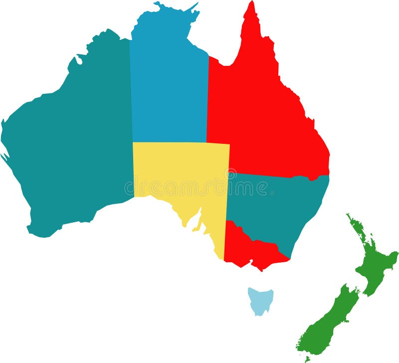
Free with trial Australia. Vector map of australia counties. Colony vectors Australia. Vector map of australia counties
Free with trial Space view. Near a big purple planet with several moons. Colony vectors Space view. Near a big purple planet with several moons
Free with trial Cartoon bee. Cartoon illustration of a bee flying. Colony vectors Cartoon bee. Cartoon illustration of a bee flying
Free with trial Space adventure. Astronaut makes selfie with an Alien on Mars. Shows peace sign. Find 15 objects in a picture. Interplanetary friendship. Intergalactic world. Puzzle Hidden Items. Cartoon illustration. Colony vectors Space adventure. Find 15 objects in a picture. Space adventure. Astronaut makes selfie with an Alien on Mars. Shows peace sign. Find 15 objects in a picture. Space adventure. Astronaut makes selfie with an Alien on Mars. Shows peace sign. Find 15 objects in a picture. Interplanetary friendship. Intergalactic world. Puzzle Hidden Items. Cartoon illustration
Free with trial Honey bee theme collection - vector illustration. Colony vectors Honey bee theme collection. Vector illustration
Free with trial Concept tree of company employees working together as a team. The vector graphic represents the structure of a company with people, relationship between close circle of family members. Colony vectors Concept tree of company employees working together as a team. The vector graphic represents the structure of a company with people, relationship between close
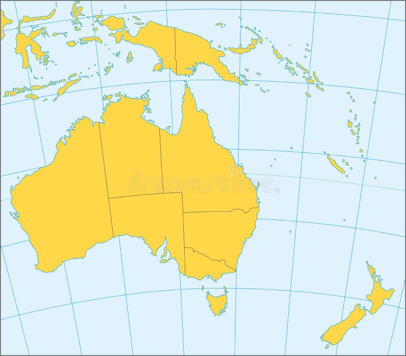
Free with trial Political map of Australia and Oceania with coordinates, present states borders, detailed vector map. Colony vectors Australia and Oceania political map. Political map of Australia and Oceania with coordinates, present states borders, detailed vector map. Political map of Australia and Oceania with coordinates, present states borders, detailed vector map.
Free with trial Vector ant. A close up view of a vector ant isolated on white. Colony vectors Vector ant. A close up view of a vector ant isolated on white
Free with trial Stamp - Australia. Vector stamp with kangaroo inside - Australia. Colony vectors Stamp - Australia. Vector stamp with kangaroo inside - Australia
Free with trial Vector mayan and inca tribal symbols. Eps 8. Colony vectors Vector mayan and inca tribal symbols. Eps 8
Free with trial The Join, or Die cartoon, by Benjamin Franklin. It was printed, and used in flags and banners to encourage the former colonies to unite against British rule. Colony vectors Join or Die Flag. The Join, or Die cartoon, by Benjamin Franklin. It was printed, and used in flags and banners to encourage the former colonies to unite against. The Join, or Die cartoon, by Benjamin Franklin. It was printed, and used in flags and banners to encourage the former colonies to unite against British rule
Free with trial Australia map and flag. Art illustration: australia map and flag. Colony vectors Australia map and flag. Art illustration: australia map and flag
Free with trial Original American flag design. Original vintage American flag design with 13 stars. Colony vectors Original American flag design. Original vintage American flag design with 13 stars
Free with trial George Washington crossing the Delaware River. Cartoon illustration of George Washington crossing the Delaware River. Colony vectors George Washington crossing the Delaware River. Cartoon illustration of George Washington crossing the Delaware River
Free with trial Vector collection of all national flags of the world including Europe union flag and some nonindependent countries - Basque, Greenland, Wales, Scotland and more. Colony vectors 204 flags of the world. Vector collection of all national flags of the world including Europe union flag and some nonindependent countries - Basque, Greenland. Vector collection of all national flags of the world including Europe union flag and some nonindependent countries - Basque, Greenland, Wales, Scotland and more...
Free with trial Mold Fungus Colony Set. Set of isolated mold fungus bacteria colony spots realistic images on transparent background with editable text vector illustration. Colony vectors Mold Fungus Colony Set. Set of isolated mold fungus bacteria colony spots realistic images on transparent background with editable text vector illustration
Free with trial Cartoon ants colony with anthill. Illustration of Cartoon ants colony with anthill. Colony vectors Cartoon ants colony with anthill. Illustration of Cartoon ants colony with anthill
Free with trial Vector illustration of a cartoon colony of ants carrying berries and walking on the pile of soil to the nest. Colony vectors A cartoon colony of ants carrying berries and walking on the pile of soil to the nest. Vector illustration of a cartoon colony of ants carrying berries and. Vector illustration of a cartoon colony of ants carrying berries and walking on the pile of soil to the nest
Free with trial Vector illustration of astronaut standing at Mars colony and looking at flying spaceship. Vector illustration of astronaut standing at Mars colony and looking. Colony vectors Vector illustration of astronaut standing at Mars colony and looking at flying spaceship. Vector illustration of astronaut standing at Mars colony and looking
Free with trial Cartoon ants colony and ant hill. Illustration of Cartoon ants colony and ant hill. Colony vectors Cartoon ants colony and ant hill. Illustration of Cartoon ants colony and ant hill
Free with trial Bee hive on tree branch in cartoon style isolated on white background. Wild, hanging construction. Bee colony home. . Vector illustration. Colony vectors Bee hive on tree branch in cartoon style isolated on white background. Wild, hanging construction. Bee colony home. Vector illustration
Free with trial Bacteria icons set. Human intestinal and lungs inflammatory diseases bacteria colony icons set of salmonella tuberculosis abstract isolated vector illustration. Colony vectors Bacteria icons set. Human intestinal and lungs inflammatory diseases bacteria colony icons set of salmonella tuberculosis abstract isolated vector illustration
Free with trial Set silhouettes of groups of sea fishes. Colony of small fish. Icon. Colony vectors Set silhouettes of groups of sea fishes. Colony of small fish. Icon with river taxers. Set silhouettes of groups of sea fishes. Colony of small fish. Icon. Set silhouettes of groups of sea fishes. Colony of small fish. Icon.
Free with trial Colored silhouettes of groups of sea fishes. Colony of small fish. Icon with river taxers. Logo fish. Colony of. Colony vectors Colored silhouettes of groups of sea fishes. Colony of small fish. Icon with river taxers. Logo fish. Colored silhouettes of groups of sea fishes. Colony of
Free with trial Lice Invasion Inside Hairy Landscape. Illustration of a close up of funny cartoon louse insect colony hanging inside hair and skin landscape. Colony vectors Lice Invasion Inside Hairy Landscape. Illustration of a close up of funny cartoon louse insect colony hanging inside hair and skin landscape
Free with trial Colored silhouettes of groups of sea fishes. Colony of small fish. Icon with river taxers. Logo fish. Colony of. Colony vectors Colored silhouettes of groups of sea fishes. Colony of small fish. Icon with river taxers. Logo fish. Colored silhouettes of groups of sea fishes. Colony of
Free with trial An illustration of an old pilgrim hat and pumpkin placed in front of an old piece of parchment paper for use as a template. Colony vectors Thanksgiving Invitation. An illustration of an old pilgrim hat and pumpkin placed in front of an old piece of parchment paper for use as a template. An illustration of an old pilgrim hat and pumpkin placed in front of an old piece of parchment paper for use as a template.
Free with trial Ants. Black vector ants. Insects background. Colony vectors Ants. Black vector ants.Insects background
Free with trial Alien base on a dark lifeless planet (other landscapes are in my gallery). Colony vectors Alien base. On a dark lifeless planet (other landscapes are in my gallery
Free with trial Big set of hand drawn space doodles. Vector illustration. Colony vectors Space doodles. Big set of hand drawn space doodles. Vector illustration. Big set of hand drawn space doodles. Vector illustration.
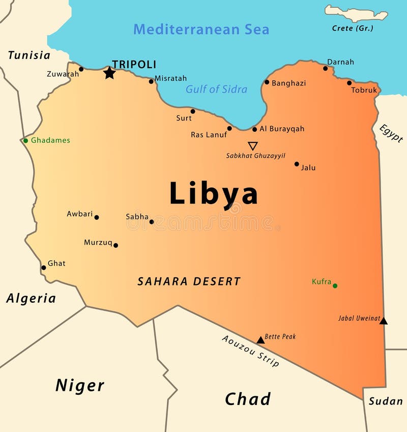
Free with trial Libya map. Illustration of a detailed political map of Libya, with its cities, mountains, oasis and desert. Colony vectors Libya map. Illustration of a detailed political map of Libya, with its cities, mountains, oasis and desert
Free with trial Ants builders with tools - vector illustration, eps. Colony vectors Ants builders with tools. Vector illustration, eps
Free with trial Illustration of a detailed political map of Cape Verde, with its islands, mountains and volcanos. Colony vectors Cape Verde map. Illustration of a detailed political map of Cape Verde, with its islands, mountains and volcanos. Illustration of a detailed political map of Cape Verde, with its islands, mountains and volcanos.
Free with trial Hand drawn underwater natural elements. Coral reef horizontal border. Vivid line seamless pattern on white background. Undersea bottom texture. Colony vectors Coral Reef Line Horizontal Pattern. Hand drawn underwater natural elements. Coral reef horizontal border. Vivid line seamless pattern on white background. Hand drawn underwater natural elements. Coral reef horizontal border. Vivid line seamless pattern on white background. Undersea bottom texture.
Free with trial Ant. Vector illustration for insect creature - Ant. Colony vectors Ant. Vector illustration for insect creature - Ant
Free with trial Ant. A little happy ant coloring book graphic / lineart isolated on white background. Colony vectors Ant. A little happy ant coloring book graphic / lineart isolated on white background
Free with trial Bat cave. Editable vector illustration of a man at the mouth of a bat cave with all figures as separate objects. Colony vectors Bat cave. Editable vector illustration of a man at the mouth of a bat cave with all figures as separate objects
Free with trial Two ants. Two black vector ants on white background. Colony vectors Two ants. Two black vector ants on white background
Free with trial Mayflower. Galleon Mayflower in heavy sea under the rainbow. Colony vectors Mayflower. Galleon Mayflower in heavy sea under the rainbow
Free with trial Inca Peruvian warrior mask with hand-drawn border. Colony vectors Inca Mask. Inca Peruvian warrior mask with hand-drawn border. Inca Peruvian warrior mask with hand-drawn border.
Free with trial Farm card. Vector illustration of a cute farm card. Colony vectors Farm card. Vector illustration of a cute farm card
Free with trial Aztec mask with hand-drawn border. Colony vectors Aztec Mask. With hand-drawn border. Aztec mask with hand-drawn border.
Free with trial Space view. With a big white star rising over a planet. Colony vectors Space view. With a big white star rising over a planet
Free with trial Vector illustration of sad ladybug. Colony vectors Sad ladybug. Vector illustration of sad ladybug. Vector illustration of sad ladybug.
Free with trial Working ants. A vector illustration of a colony of ants working together, can be used for teamwork concept. Colony vectors Working ants. A vector illustration of a colony of ants working together, can be used for teamwork concept
Free with trial Cartoon stop virus. Illustration of Cartoon stop virus. Colony vectors Cartoon stop virus. Illustration of Cartoon stop virus
Free with trial Ant a silhouette in. Vector with the image of a beautiful ant, a tattoo. Colony vectors Ant a silhouette in. Vector with the image of a beautiful ant, a tattoo
Free with trial Butterfly and flower. Cute happy butterfly and flower illustration isolated on white background. Colony vectors Butterfly and flower. Cute happy butterfly and flower illustration isolated on white background
Free with trial Vector silhouette ant. On white background. Colony vectors Vector silhouette ant. On white background
Free with trial Hong Kong and vicinity political map. English labeling. Hong Kong Special Administrative Region of the Peoples Republic of China. Autonomous territory on Pearl River Delta. Gray illustration. Vector. Colony vectors Hong Kong political map. Hong Kong and vicinity political map. English labeling. Hong Kong Special Administrative Region of the Peoples Republic of China. Hong Kong and vicinity political map. English labeling. Hong Kong Special Administrative Region of the Peoples Republic of China. Autonomous territory on Pearl River Delta. Gray illustration. Vector.
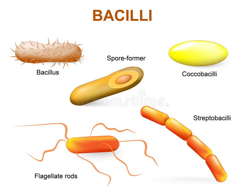
Free with trial Bacillii. Common bacteria infecting human. Colony vectors Types of bacteria. bacilli. Bacillii. Common bacteria infecting human. Bacillii. Common bacteria infecting human.
Free with trial Collection of Petri Dishes. Vector illustration of six Petri dishes with bacterial colonies of different colors. Colony vectors Collection of Petri Dishes. Vector illustration of six Petri dishes with bacterial colonies of different colors
Free with trial Emperor Penguin With Chick. An adult Emperor Penguin with its chick. Colony vectors Emperor Penguin With Chick. An adult Emperor Penguin with its chick
Free with trial Beekeeper with hive and bees - vector illustration. Colony vectors Beekeeper with hive and bees. Vector illustration
Free with trial Coloring book with beekeeper - eps10 vector illustration. Colony vectors Coloring book with beekeeper. Eps10 vector illustration
Free with trial Massachusetts, political map with capital Boston. Commonwealth of Massachusetts, MA. Most populous state in the New England region of the United States. The Bay State. English. Illustration. Vector. Colony vectors Massachusetts, political map, Commonwealth of Massachusetts, MA. Massachusetts, political map with capital Boston. Commonwealth of Massachusetts, MA. Most. Massachusetts, political map with capital Boston. Commonwealth of Massachusetts, MA. Most populous state in the New England region of the United States. The Bay State. English. Illustration. Vector.
Free with trial Mars Landscape Game Background. Martian day landscape background tileable horizontally, sand hills with stones on a deserted planet. Colony vectors Mars Landscape Game Background. Martian day landscape background tileable horizontally, sand hills with stones on a deserted planet
Free with trial THE STRUCTURE OF THE BACTERIAL CELL. ILLUSTRATION OF THE STRUCTURE OF THE BACTERIAL CELL. Colony vectors THE STRUCTURE OF THE BACTERIAL CELL. ILLUSTRATION OF THE STRUCTURE OF THE BACTERIAL CELL
Free with trial Cartoon Anthill in the forest land. Illustration of Cartoon Anthill in the forest land. Colony vectors Cartoon Anthill in the forest land. Illustration of Cartoon Anthill in the forest land
Free with trial Seamless background with tropical fish - vector illustration. Colony vectors Seamless background with tropical fish. Vector illustration
Free with trial A microorganism or microbe is a microscopic organism, which may exist in its single-celled form, or in a colony of cells. Colony vectors Microorganisms illustration vector set. A microorganism or microbe is a microscopic organism, which may exist in its single-celled form, or in a colony of cells. A microorganism or microbe is a microscopic organism, which may exist in its single-celled form, or in a colony of cells.
 Sign in