Free with trial Flag of Israel overlaid on map with second map showing the disputed Palestinian territories of the West Bank and the Gaza Strip with the Palestinian flag isolated on white background. Disputed vectors Israel Map Flag. Flag of Israel overlaid on map with second map showing the disputed Palestinian territories of the West Bank and the Gaza Strip with the. Flag of Israel overlaid on map with second map showing the disputed Palestinian territories of the West Bank and the Gaza Strip with the Palestinian flag isolated on white background
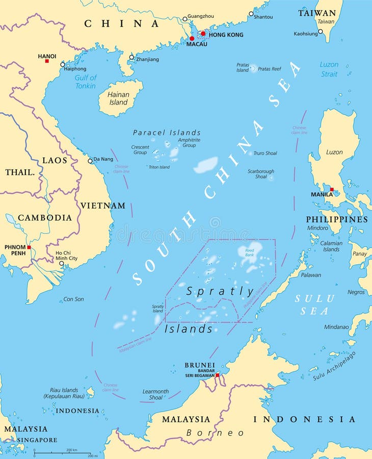
Free with trial South China Sea Islands, political map. Islands, atolls, cays, shoals, reefs and sandbars. Partially claimed by China and other neighboring states. Paracel and Spratly Islands. Illustration. Vector. Disputed vectors South China Sea Islands, political map. Islands, atolls, cays, shoals, reefs and sandbars. Partially claimed by China and other neighboring states. Paracel and
Free with trial China Usa 01 Infographic Isometric. Isometric Militar Confrontation Usa vs China in South Sea. Wargame Set Collection NEW bright palette 3d Flat Vector Set. Disputed vectors China Usa 01 Infographic Isometric. Isometric Militar Confrontation Usa vs China in South Sea. Wargame Set Collection NEW bright palette 3d Flat Vector Set
Free with trial Map of the disputed Donbass region between Ukraine and Russia. Disputed vectors Map of the disputed Donbass region between Ukraine and Russia.
Free with trial Circle flags of the world, dependencies, provinces, islands, territories, disputed territories, regions, non recognized by UN, self proclaimed, collection, eps 10. Disputed vectors Circle flags of the world. Dependencies, provinces, islands, territories, disputed territories, regions, non recognized by UN, self proclaimed, collection, eps
Free with trial The Caucasus, Caucasia, colored political map. Region between the Black Sea and the Caspian Sea, mainly occupied by Armenia, Azerbaijan, Georgia, and parts of Southern Russia. Map with disputed areas. Disputed vectors The Caucasus region, Caucasia, colored political map with disputed areas. The Caucasus, Caucasia, colored political map. Region between the Black Sea and the. The Caucasus, Caucasia, colored political map. Region between the Black Sea and the Caspian Sea, mainly occupied by Armenia, Azerbaijan, Georgia, and parts of Southern Russia. Map with disputed areas.
Free with trial Tibet administrative and political vector map with disputed border areas. Disputed vectors Tibet administrative and political vector map with disputed border areas.
Free with trial Guyana, Suriname, and French Guiana, colorful political map. Two countries and an overseas department of France on the South American coast. With international recognized borders and disputed areas. Disputed vectors Guyana, Suriname, and French Guiana, colorful political map. Two countries and an overseas department of France on the South American coast. With international
Free with trial The Caucasus, or Caucasia, political map. A region between the Black Sea and the Caspian Sea, mainly occupied by Armenia, Azerbaijan, Georgia, and parts of Southern Russia, with disputed areas. Vector. Disputed vectors The Caucasus, or Caucasia, political map. A region between the Black Sea and the Caspian Sea, mainly occupied by Armenia, Azerbaijan, Georgia, and parts of
Free with trial Crimea gray political map. Peninsula in Eastern Europe on northern coast of the Black Sea with disputed status. Controlled and governed by Russia, internationally recognized as part of Ukraine. Vector. Disputed vectors Crimea, peninsula in Eastern Europe, gray political map. Crimea gray political map. Peninsula in Eastern Europe on northern coast of the Black Sea with disputed. Crimea gray political map. Peninsula in Eastern Europe on northern coast of the Black Sea with disputed status. Controlled and governed by Russia, internationally recognized as part of Ukraine. Vector
Free with trial Eastern Ukraine political map. The Crimea, a peninsula on the coast of Black Sea, and the Donbass, formed by Donetsk and Luhansk region, disputed areas between Ukraine and Russia. Illustration. Vector. Disputed vectors Eastern Ukraine, Crimea and Donbass, political map. Eastern Ukraine political map. The Crimea, a peninsula on the coast of Black Sea, and the Donbass, formed by. Eastern Ukraine political map. The Crimea, a peninsula on the coast of Black Sea, and the Donbass, formed by Donetsk and Luhansk region, disputed areas between Ukraine and Russia. Illustration. Vector
Free with trial Crimea political map. Peninsula in Eastern Europe on the northern coast of the Black Sea, with disputed status. Controlled and governed by Russia, internationally recognized as part of Ukraine. Vector. Disputed vectors Crimea, peninsula in Eastern Europe, political map. Crimea political map. Peninsula in Eastern Europe on the northern coast of the Black Sea, with disputed. Crimea political map. Peninsula in Eastern Europe on the northern coast of the Black Sea, with disputed status. Controlled and governed by Russia, internationally recognized as part of Ukraine. Vector
Free with trial Liberland,political map. Free Republic of Liberland,unrecognized micronation in Europe,claiming Siga,an uninhabited parcel of disputed land on western bank of Danube,between Croatia and Serbia. Disputed vectors Free Republic of Liberland, unrecognised micronation, political map. Liberland,political map. Free Republic of Liberland,unrecognized micronation in Europe. Liberland,political map. Free Republic of Liberland,unrecognized micronation in Europe,claiming Siga,an uninhabited parcel of disputed land on western bank of Danube,between Croatia and Serbia.
Free with trial The Caucasus, or Caucasia, gray political map. Region between the Black Sea and the Caspian Sea, mainly occupied by Armenia, Azerbaijan, Georgia, and parts of Southern Russia. Map with disputed areas. Disputed vectors The Caucasus, gray political map, region between Black and Caspian Sea. The Caucasus, or Caucasia, gray political map. Region between the Black Sea and the. The Caucasus, or Caucasia, gray political map. Region between the Black Sea and the Caspian Sea, mainly occupied by Armenia, Azerbaijan, Georgia, and parts of Southern Russia. Map with disputed areas.
Free with trial Business Man Talking disputed issues. Disputed vectors Business Man Talking disputed issues.
Free with trial Tokelau, dependant territory of New Zealand, gray political map. South Pacific archipelago consisting of the tropical coral atolls Atafu, Nukunonu and Fakaofo. Swains Island is territorial disputed. Disputed vectors Tokelau, dependant territory of New Zealand, gray political map. South Pacific archipelago consisting of the tropical coral atolls Atafu, Nukunonu and Fakaofo
Free with trial Moldova and Transnistria, political map. Republic of Moldova, with capital Chisinau, and the Pridnestrovian Moldavian Republic, PMR, a disputed and unrecognized breakaway state, with capital Tiraspol. Disputed vectors Moldova and breakaway state Transnistria, political map. Moldova and Transnistria, political map. Republic of Moldova, with capital Chisinau, and the. Moldova and Transnistria, political map. Republic of Moldova, with capital Chisinau, and the Pridnestrovian Moldavian Republic, PMR, a disputed and unrecognized breakaway state, with capital Tiraspol.
Free with trial Tokelau,dependant territory of New Zealand,political map. Archipelago in the South Pacific consisting of tropical coral atolls Atafu,Nukunonu and Fakaofo. The Swains Island is territorial disputed. Disputed vectors Tokelau, dependant territory of New Zealand, political map. Tokelau,dependant territory of New Zealand,political map. Archipelago in the South Pacific consisting. Tokelau,dependant territory of New Zealand,political map. Archipelago in the South Pacific consisting of tropical coral atolls Atafu,Nukunonu and Fakaofo. The Swains Island is territorial disputed.
Free with trial The detailed map of the Moldova with regions or states and cities, capital. Administrative division. Transnistria is marked as a d. Isputed territory. Disputed vectors The detailed map of the Moldova with regions or states and cities, capital. Administrative division. Transnistria is marked as a d. Isputed territory
Free with trial Samuel Tilden, 1814-1886, he was the 25th governor of New York and the democratic candidate for president in the disputed election of 1876, vintage line drawing or engraving illustration. Disputed vectors Samuel Tilden, vintage illustration. Samuel Tilden, 1814-1886, he was the 25th governor of New York and the democratic candidate for president in the disputed. Samuel Tilden, 1814-1886, he was the 25th governor of New York and the democratic candidate for president in the disputed election of 1876, vintage line drawing or engraving illustration
Free with trial Georgia with capital Tbilisi, political map. Country in Eastern Europe and West Asia, part of Caucasus region. With autonomous republics of Abkhazia and Adjara, and independent region South Ossetia. Disputed vectors Georgia, a country in the Caucasus region, political map. Georgia with capital Tbilisi, political map. Country in Eastern Europe and West Asia, part of Caucasus. Georgia with capital Tbilisi, political map. Country in Eastern Europe and West Asia, part of Caucasus region. With autonomous republics of Abkhazia and Adjara, and independent region South Ossetia.
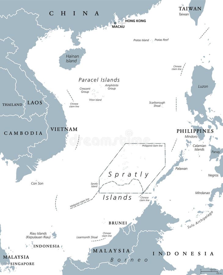
Free with trial South China Sea Islands, political map. Paracel and Spratly Islands, atolls, cays and reefs. Partially claimed by China and other neighboring states. Gray illustration on white background. Vector. Disputed vectors South China Sea Islands political map. South China Sea Islands, political map. Paracel and Spratly Islands, atolls, cays and reefs. Partially claimed by China. South China Sea Islands, political map. Paracel and Spratly Islands, atolls, cays and reefs. Partially claimed by China and other neighboring states. Gray illustration on white background. Vector.
Free with trial Group of people men women protesters standing together and protesting for freedom against government. Opposition opponents activists holding blank banner boards. People taking part in parade or rally. Disputed vectors Group of People Protesters Protesting in Strike with Banner Boards. Group of people men women protesters standing together and protesting for freedom against. Group of people men women protesters standing together and protesting for freedom against government. Opposition opponents activists holding blank banner boards. People taking part in parade or rally
Free with trial Ukraine, country subdivision, gray political map. Administrative divisions of the Ukraine with administrative centers, a unitary state in Eastern Europe with capital Kyiv Kiev. Illustration. Vector. Disputed vectors Ukraine, country subdivision, gray political map, administrative divisions. Ukraine, country subdivision, gray political map. Administrative divisions of the. Ukraine, country subdivision, gray political map. Administrative divisions of the Ukraine with administrative centers, a unitary state in Eastern Europe with capital Kyiv Kiev. Illustration. Vector.
Free with trial Ukraine, administrative divisions, gray political map. Country and unitary state in Eastern Europe, with capital Kyiv Kiev. Country subdivision, with administrative centers. Illustration over white. Disputed vectors Ukraine, administrative divisions and centers, gray political map. Ukraine, administrative divisions, gray political map. Country and unitary state in Eastern. Ukraine, administrative divisions, gray political map. Country and unitary state in Eastern Europe, with capital Kyiv Kiev. Country subdivision, with administrative centers. Illustration over white.
Free with trial Detailed map of the Tibet Autonomous Region, China. Disputed vectors Detailed map of the Tibet Autonomous Region, China.
Free with trial Map of the Mexican drug cartels and their spheres of influence. Disputed vectors Map of the Mexican drug cartels and their spheres of influence.
Free with trial Taiwan Strait,gray political map. Important waterway and disputed international waters,separating the island of Taiwan and continental Asia,which connects the East China Sea and South China Sea. Disputed vectors Taiwan Strait, separating Taiwan and continental Asia, gray political map. Taiwan Strait,gray political map. Important waterway and disputed international waters. Taiwan Strait,gray political map. Important waterway and disputed international waters,separating the island of Taiwan and continental Asia,which connects the East China Sea and South China Sea.
Free with trial Serbia and Kosovo,landlocked countries in Southeast Europe,political map. The Republic of Serbia,with capital Belgrade,and Republic of Kosovo,partially recognized country,with capital Pristina. Disputed vectors Serbia and Kosovo, landlocked countries in Southeast Europe, political map. Serbia and Kosovo,landlocked countries in Southeast Europe,political map. The. Serbia and Kosovo,landlocked countries in Southeast Europe,political map. The Republic of Serbia,with capital Belgrade,and Republic of Kosovo,partially recognized country,with capital Pristina.
Free with trial Tibet region with important cities and roads vector map. Disputed vectors Tibet region with important cities and roads vector map.
Free with trial Blank map of Ukraine with regions, administrative divisions and territories claimed by Russia. Editable and clearly labeled layers. Disputed vectors Blank map of Ukraine with regions, administrative divisions and territories claimed by Russia. Editable and clearly labeled layers
Free with trial Croatia-Serbia border dispute,political map. Yellow marked Danube area under Serbian control,but claimed by Croatia. Two areas of no mans land are claimed by the micronations Liberland and Verdis. Disputed vectors Croatia-Serbia border dispute, with Liberland and Verdis, political map. Croatia-Serbia border dispute,political map. Yellow marked Danube area under Serbian. Croatia-Serbia border dispute,political map. Yellow marked Danube area under Serbian control,but claimed by Croatia. Two areas of no mans land are claimed by the micronations Liberland and Verdis.
Free with trial Kuril Islands political map. A volcanic archipelago part of Sakhalin Oblast in the Russian Far East. It stretches from Hokkaido in Japan to Kamchatka Peninsula in Russia. Under Russian administration. Disputed vectors Kuril Islands, from Hokkaido to Kamchatka Peninsula, political map. Kuril Islands political map. A volcanic archipelago part of Sakhalin Oblast in the Russian. Kuril Islands political map. A volcanic archipelago part of Sakhalin Oblast in the Russian Far East. It stretches from Hokkaido in Japan to Kamchatka Peninsula in Russia. Under Russian administration.
Free with trial Kuril Islands, gray political map. A volcanic archipelago part of Sakhalin Oblast in Russian Far East. Stretches from Hokkaido in Japan to Kamchatka Peninsula in Russia. Under Russian administration. Disputed vectors Kuril Islands, from Hokkaido to Kamchatka Peninsula, gray political map. Kuril Islands, gray political map. A volcanic archipelago part of Sakhalin Oblast in. Kuril Islands, gray political map. A volcanic archipelago part of Sakhalin Oblast in Russian Far East. Stretches from Hokkaido in Japan to Kamchatka Peninsula in Russia. Under Russian administration.
Free with trial Georgia, gray political map, with capital Tbilisi, and international borders. Republic and transcontinental country in Eurasia, located south of North Caucasus Federal District of Russia. Illustration. Disputed vectors Georgia, gray political map, with capital Tbilisi, and international borders. Republic and transcontinental country in Eurasia, located south of North Caucasus
Free with trial Kra or Okro, Abelmoschus esculentus, known in many English-speaking countries as ladies` fingers or ochro, is a flowering plant in the mallow family. It is valued for its edible green seed pods. The geographical origin of okra is disputed, with supporters of West African, Ethiopian, and South Asian origins. Disputed vectors Fresh vegetable Ladies finger or Okra isolated vector in white background. Kra or Okro, Abelmoschus esculentus, known in many English-speaking countries as. kra or Okro, Abelmoschus esculentus, known in many English-speaking countries as ladies` fingers or ochro, is a flowering plant in the mallow family. It is valued for its edible green seed pods. The geographical origin of okra is disputed, with supporters of West African, Ethiopian, and South Asian origins.
Free with trial Senkaku islands map. Japan and China territorial disputes. Disputed vectors Japan and China map. Senkaku islands map. Japan and China territorial disputes. Senkaku islands map. Japan and China territorial disputes.
Free with trial Senkaku islands map. Japan and China territorial disputes. Disputed vectors Senkaku map. Senkaku islands map. Japan and China territorial disputes. Senkaku islands map. Japan and China territorial disputes.
Free with trial Flags of the world, dependencies, provinces, islands, territories, disputed territories, regions, non recognized by UN, self proclaimed, collection, eps 10. Disputed vectors Flags of the world, collection, part 2. Flags of the world, dependencies, provinces, islands, territories, disputed territories, regions, non recognized by UN. Flags of the world, dependencies, provinces, islands, territories, disputed territories, regions, non recognized by UN, self proclaimed, collection, eps 10
Free with trial Vector illustration - China and USA conflict. Chinese vs american flag about economical export trade relationship sanctions. Global pressure, government competition and finance crisis symbol. Disputed vectors Vector illustration - China and USA conflict. Chinese vs american flag about economical export trade sanctions. Pressure symbol. Vector illustration - China and. Vector illustration - China and USA conflict. Chinese vs american flag about economical export trade relationship sanctions. Global pressure, government competition and finance crisis symbol.
Free with trial Tibet region with important cities and roads vector map and flag. Disputed vectors Tibet region with important cities and roads vector map and flag.
Free with trial Map of Ukraine in National flag colors with bomb. Disputed vectors Map of Ukraine in National flag colors with bomb. Vector map of Ukraine in National flag colors with bomb
Free with trial The detailed map of the Ukraine with regions or states and cities, capital. Administrative division. Crimea, part of Donetsk and Lugansk regions is marked as a disputed territory. Vector Illustration. Disputed vectors The detailed map of the Ukraine with regions or states and cities, capital. Administrative division. Crimea, part of Donetsk and L. Ugansk regions is marked as a. The detailed map of the Ukraine with regions or states and cities, capital. Administrative division. Crimea, part of Donetsk and Lugansk regions is marked as a disputed territory. Vector Illustration
Free with trial Set of isometric 3d people with flags of some European regions. Standard bearers infographic - Catalonia, Basque Country, Scotland, Northern Ireland, Flanders, Wallonia Walloon. Disputed vectors Isometric people with flags of some European regions. Set of isometric 3d people with flags of some European regions. Standard bearers infographic - Catalonia. Set of isometric 3d people with flags of some European regions. Standard bearers infographic - Catalonia, Basque Country, Scotland, Northern Ireland, Flanders, Wallonia Walloon
Free with trial Senkaku Islands, political map. Also known as Diaoyu, Diaoyutai, and Pinnacle Islands, a group of disputed islands in the East China Sea, administered by Japan and claimed by China and Taiwan. Vector. Disputed vectors Senkaku Islands, political map of disputed islands in the East China Sea. Senkaku Islands, political map. Also known as Diaoyu, Diaoyutai, and Pinnacle Islands. Senkaku Islands, political map. Also known as Diaoyu, Diaoyutai, and Pinnacle Islands, a group of disputed islands in the East China Sea, administered by Japan and claimed by China and Taiwan. Vector
Free with trial A detailed political map of Ukraine highlighting disputed regions in red, including Crimea, Donetsk, and Luhansk. Disputed vectors Political Map of Ukraine with Disputed Territories Highlighted. A detailed political map of Ukraine highlighting disputed regions in red, including Crimea. A detailed political map of Ukraine highlighting disputed regions in red, including Crimea, Donetsk, and Luhansk
Free with trial Senkaku Islands, gray political map. Also Diaoyu, Diaoyutai, and Pinnacle Islands, a group of disputed islands in the East China Sea, administered by Japan and claimed by China and Taiwan. Vector. Disputed vectors Senkaku Islands in the East China Sea, gray political map. Senkaku Islands, gray political map. Also Diaoyu, Diaoyutai, and Pinnacle Islands, a group of disputed. Senkaku Islands, gray political map. Also Diaoyu, Diaoyutai, and Pinnacle Islands, a group of disputed islands in the East China Sea, administered by Japan and claimed by China and Taiwan. Vector
Free with trial Kashmir region in South Asia, political map. Disputed between India, Pakistan and China, encompassing Jammu and Kashmir, Ladakh, Azad Kashmir, Gilgit-Baltistan, Aksai Chin, and Trans-Karakoram Tract. Disputed vectors Kashmir, disputed region in South Asia, colored political map. Kashmir region in South Asia, political map. Disputed between India, Pakistan and China. Kashmir region in South Asia, political map. Disputed between India, Pakistan and China, encompassing Jammu and Kashmir, Ladakh, Azad Kashmir, Gilgit-Baltistan, Aksai Chin, and Trans-Karakoram Tract.
Free with trial Kashmir, region in South Asia, political map. Disputed between India, Pakistan and China, encompassing Jammu and Kashmir, Ladakh, Azad Kashmir, Gilgit-Baltistan, Aksai Chin, and Trans-Karakoram Tract. Disputed vectors Kashmir, region in South Asia, political map. Disputed between India, Pakistan and China, encompassing Jammu and Kashmir, Ladakh, Azad Kashmir, Gilgit
Free with trial Kashmir, region in South Asia, political map. Disputed between India, Pakistan and China, encompassing Jammu and Kashmir, Ladakh, Azad Kashmir, Gilgit-Baltistan, Aksai Chin, and Trans-Karakoram Tract. Disputed vectors Krypton element on the periodic table with element symbol Kr. Kashmir, region in South Asia, political map. Disputed between India, Pakistan and China. Kashmir, region in South Asia, political map. Disputed between India, Pakistan and China, encompassing Jammu and Kashmir, Ladakh, Azad Kashmir, Gilgit-Baltistan, Aksai Chin, and Trans-Karakoram Tract.
Free with trial Free Republic of Liberland, gray political map with Liberland Village near Apatin. Micronation in Europe claiming uninhabited parcel of land Gornja Siga on Danube, disputed between Croatia and Serbia. Disputed vectors Free Republic of Liberland, gray political map with Liberland Village. Near Apatin. Micronation in Europe claiming uninhabited parcel of land Gornja Siga on. Free Republic of Liberland, gray political map with Liberland Village near Apatin. Micronation in Europe claiming uninhabited parcel of land Gornja Siga on Danube, disputed between Croatia and Serbia.
Free with trial Guyana, Suriname, and French Guiana, political map. Two countries and an overseas department of France on northern coast of South America. Map with international recognized borders and disputed areas. Disputed vectors Guyana, Suriname, and French Guiana, political map. Two countries and an overseas department of France on northern coast of South America. Map with
Free with trial Guyana, Suriname, and French Guiana, gray political map. Two countries and an overseas department of France on the coast of South America. With international recognized borders and disputed areas. Disputed vectors Guyana, Suriname, and French Guiana, gray political map. Two countries and an overseas department of France on the coast of South America. With international
Free with trial Tumen river flowing on Noktundo into Sea of Japan, political map. Tripoint in the Tumen river, where borders of China, North Korea and Russia intersect near Khasan, on disputed former island Noktundo. Disputed vectors Tumen river flowing on Noktundo into Sea of Japan, political map. Tripoint in the Tumen river, where borders of China, North Korea and Russia intersect near
Free with trial Jammu and Kashmir map flag vector silhouette illustration isolated. Disputed territory border conflict between Pakistan and India. War crisis in Asia. Global politic situation. Disputed vectors Jammu and Kashmir map flag vector silhouette illustration isolated. Disputed territory border conflict. Jammu and Kashmir map flag vector silhouette. Jammu and Kashmir map flag vector silhouette illustration isolated. Disputed territory border conflict between Pakistan and India. War crisis in Asia. Global politic situation.
Free with trial Jammu and Kashmir map flag vector silhouette illustration isolated. Disputed territory border conflict between Pakistan and India. War crisis in Asia. Global politic situation. Disputed vectors Jammu and Kashmir map flag vector silhouette illustration isolated. Disputed territory border conflict. Jammu and Kashmir map flag vector silhouette. Jammu and Kashmir map flag vector silhouette illustration isolated. Disputed territory border conflict between Pakistan and India. War crisis in Asia. Global politic situation.
Free with trial Vector illustration background of the flags of India and Pakistan in contrasting green, white and orange. Symbolizing diplomatic, geopolitical or disputed relations between the two South Asian countri. Disputed vectors Vector illustration background of the flags of India and Pakistan. In contrasting green, white and orange. Symbolizing diplomatic, geopolitical or disputed. Vector illustration background of the flags of India and Pakistan in contrasting green, white and orange. Symbolizing diplomatic, geopolitical or disputed relations between the two South Asian countri
Free with trial Vector illustration background of the flags of India and Pakistan in contrasting green, white and orange. Symbolizing diplomatic, geopolitical or disputed relations between the two South Asian countri. Disputed vectors Vector illustration background of the flags of India and Pakistan. In contrasting green, white and orange. Symbolizing diplomatic, geopolitical or disputed. Vector illustration background of the flags of India and Pakistan in contrasting green, white and orange. Symbolizing diplomatic, geopolitical or disputed relations between the two South Asian countri
Free with trial Vector illustration background of the flags of India and Pakistan in contrasting green, white and orange. Symbolizing diplomatic, geopolitical or disputed relations between the two South Asian countri. Disputed vectors Vector illustration background of the flags of India and Pakistan. In contrasting green, white and orange. Symbolizing diplomatic, geopolitical or disputed. Vector illustration background of the flags of India and Pakistan in contrasting green, white and orange. Symbolizing diplomatic, geopolitical or disputed relations between the two South Asian countri
Free with trial Europe map with country borders on a flat sea, drawn to the edge of a rectangular frame that cuts Russia, Turkey and North Africa. Countries outside Europe are dimmed and the Kosovo-Serbia boundary is dashed as disputed. Lambert azimuthal equal-area projection centred on 52 N 10 E. Disputed vectors Europe map with country borders. On a flat sea, drawn to the edge of a rectangular frame that cuts Russia, Turkey and North Africa. Countries outside Europe are. Europe map with country borders on a flat sea, drawn to the edge of a rectangular frame that cuts Russia, Turkey and North Africa. Countries outside Europe are dimmed and the Kosovo-Serbia boundary is dashed as disputed. Lambert azimuthal equal-area projection centred on 52 N 10 E.
Free with trial Southern Lebanon and northern Israel, gray political map. Disputed areas in the Middle East, including the Golan Heights, and parts of Syria and Jordan, with borders and largest cities. Vector. Disputed vectors Southern Lebanon, Golan Heights, northern Israel, gray political map. Southern Lebanon and northern Israel, gray political map. Disputed areas in the Middle East. Southern Lebanon and northern Israel, gray political map. Disputed areas in the Middle East, including the Golan Heights, and parts of Syria and Jordan, with borders and largest cities. Vector
Free with trial Ceuta, exclave of Spain, political map. Autonomous city on the North African coast along the Mediterranean Sea, bordered by Morocco. Special territory of members of the European Economic Area. Vector. Disputed vectors Ceuta, exclave and autonomous city of Spain, political map. Ceuta, exclave of Spain, political map. Autonomous city on the North African coast along the. Ceuta, exclave of Spain, political map. Autonomous city on the North African coast along the Mediterranean Sea, bordered by Morocco. Special territory of members of the European Economic Area. Vector
Free with trial Melilla, exclave of Spain, political map. Autonomous city on the North African coast along the Mediterranean Sea bordered by Morocco. Special territory of members of the European Economic Area. Vector. Disputed vectors Melilla, exclave and autonomous city of Spain, political map. Melilla, exclave of Spain, political map. Autonomous city on the North African coast along the. Melilla, exclave of Spain, political map. Autonomous city on the North African coast along the Mediterranean Sea bordered by Morocco. Special territory of members of the European Economic Area. Vector
Free with trial Ceuta, exclave of Spain, gray political map. Autonomous city on North African coast along the Mediterranean Sea, bordered by Morocco. Special territory of members of the European Economic Area. Vector. Disputed vectors Ceuta, exclave and autonomous city of Spain, gray political map. Ceuta, exclave of Spain, gray political map. Autonomous city on North African coast along the. Ceuta, exclave of Spain, gray political map. Autonomous city on North African coast along the Mediterranean Sea, bordered by Morocco. Special territory of members of the European Economic Area. Vector
Free with trial Melilla, exclave of Spain, gray political map. Autonomous city on the North African coast along Mediterranean Sea bordered by Morocco. Special territory of members of European Economic Area. Vector. Disputed vectors Melilla, exclave and autonomous city of Spain, gray political map. Melilla, exclave of Spain, gray political map. Autonomous city on the North African coast. Melilla, exclave of Spain, gray political map. Autonomous city on the North African coast along Mediterranean Sea bordered by Morocco. Special territory of members of European Economic Area. Vector
Free with trial China–North Korea–Russia tripoint region, gray political map. The China–North Korea and the North Korea–Russia border intersect in the Tumen River, that flows on Noktundo into the Sea of Japan. Vector. Disputed vectors China–North Korea–Russia tripoint region, gray political map. The China–North Korea and the North Korea–Russia border intersect in the Tumen River
Free with trial Spanish territories, scattered along the Mediterranean coast of Morocco, Africa, political map. Ceuta and Melilla, autonomous cities, are the major places of the so called Plazas de Soberaniá. Vector. Disputed vectors Spanish territories along the Mediterranean coast of Morocco, political map. Spanish territories, scattered along the Mediterranean coast of Morocco, Africa. Spanish territories, scattered along the Mediterranean coast of Morocco, Africa, political map. Ceuta and Melilla, autonomous cities, are the major places of the so called Plazas de Soberaniá. Vector
Free with trial Spanish territories, scattered along Mediterranean coast of Morocco, Africa, gray political map. Ceuta and Melilla, autonomous cities, are the major places of the so called Plazas de Soberaniá. Vector. Disputed vectors Spanish territories along Mediterranean coast of Morocco, gray political map. Spanish territories, scattered along Mediterranean coast of Morocco, Africa, gray. Spanish territories, scattered along Mediterranean coast of Morocco, Africa, gray political map. Ceuta and Melilla, autonomous cities, are the major places of the so called Plazas de Soberaniá. Vector
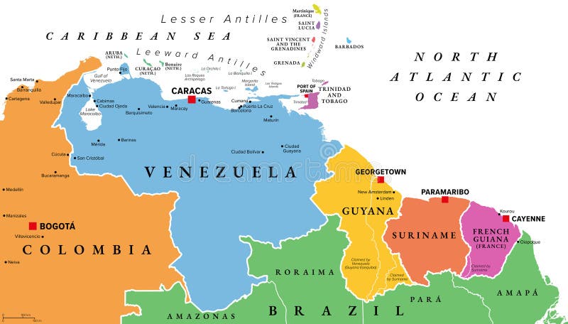
Free with trial Venezuela and The Guianas, multi colored political map. Geographical region in South America, consisting of the country Venezuela and The Guianas, which are Guyana, Suriname, and French Guiana. Vector. Disputed vectors Venezuela and The Guianas, multi colored political map. Geographical region in South America, consisting of the country Venezuela and The Guianas, which are
Free with trial Southern Lebanon and northern Israel, political map of disputed areas in the Middle East, including the Golan Heights, and western parts of Syria and Jordan, with borders and largest cities. Vector. Disputed vectors Southern Lebanon, Golan Heights, and northern Israel, political map. Southern Lebanon and northern Israel, political map of disputed areas in the Middle East. Southern Lebanon and northern Israel, political map of disputed areas in the Middle East, including the Golan Heights, and western parts of Syria and Jordan, with borders and largest cities. Vector
Free with trial Afghanistan and Pakistan, South Asia, gray political map with international borders, capitals, largest cities, with Wakhan Corridor in the Hindu Kush, Kashmir region, and other claimed regions. Vector. Disputed vectors Afghanistan and Pakistan, South Asia, gray political map. With international borders, capitals, largest cities, with Wakhan Corridor in the Hindu Kush, Kashmir. Afghanistan and Pakistan, South Asia, gray political map with international borders, capitals, largest cities, with Wakhan Corridor in the Hindu Kush, Kashmir region, and other claimed regions. Vector
Free with trial Afghanistan and Pakistan, South Asia, political map with international borders, capitals, largest cities and rivers, with the Wakhan Corridor, the Kashmir region, and other claimed regions. Vector. Disputed vectors Afghanistan and Pakistan, South Asia, political map. With international borders, capitals, largest cities and rivers, with the Wakhan Corridor, the Kashmir. Afghanistan and Pakistan, South Asia, political map with international borders, capitals, largest cities and rivers, with the Wakhan Corridor, the Kashmir region, and other claimed regions. Vector
Free with trial South Asia, political map with borders, capitals and large cities. Subregion of Asia, comprising the states India, Pakistan, Afghanistan, Nepal, Bhutan, Bangladesh, Sri Lanka, and the Maldives. Vector. Disputed vectors South Asia, political map with borders, capitals and large cities. Subregion of Asia, comprising the states India, Pakistan, Afghanistan, Nepal, Bhutan
Free with trial Venezuela and The Guianas, gray political map. Geographical region in north-eastern South America, consisting of the country Venezuela and The Guianas, which is Guyana, Suriname, and French Guiana. Disputed vectors Venezuela and The Guianas, gray political map. Geographical region in north-eastern South America, consisting of the country Venezuela and The Guianas, which
Free with trial Maghreb, multi colored political map. Also known as Arab Maghreb, and Northwest Africa, a region including Algeria, Libya, Mauritania, Morocco, Tunisia, and the disputed territory of Western Sahara. Disputed vectors Maghreb, Arab Maghreb, or Northwest Africa, colored political map. Maghreb, multi colored political map. Also known as Arab Maghreb, and Northwest Africa, a. Maghreb, multi colored political map. Also known as Arab Maghreb, and Northwest Africa, a region including Algeria, Libya, Mauritania, Morocco, Tunisia, and the disputed territory of Western Sahara.
Free with trial Vector map of Ukraine in vintage style with regions, administrative divisions and neighbouring countries. Editable and clearly labeled layers. National Maps Series. Disputed vectors Vector map of Ukraine in vintage style with regions, administrative divisions and neightbouring countries. Vector map of Ukraine in vintage style with regions. Vector map of Ukraine in vintage style with regions, administrative divisions and neighbouring countries. Editable and clearly labeled layers. National Maps Series.
Free with trial Taiwan Strait, multi colored political map. Important waterway and disputed international waters, separating the island of Taiwan and continental Asia, connecting East China Sea and South China Sea. Disputed vectors Taiwan Strait and Taiwan, multi colored political map. Taiwan Strait, multi colored political map. Important waterway and disputed international waters. Taiwan Strait, multi colored political map. Important waterway and disputed international waters, separating the island of Taiwan and continental Asia, connecting East China Sea and South China Sea.
Free with trial Venezuela and The Guianas, multi colored political map. Geographical region in north-eastern South America, consisting of Venezuela and The three Guianas Guyana, Suriname, and French Guiana. Vector. Disputed vectors Venezuela and The Guianas, multi colored political map. Geographical region in north-eastern South America, consisting of Venezuela and The three Guianas
Free with trial Vector blank map of Ukraine in vintage style with regions, administrative divisions and territories claimed by Russia. Editable and clearly labeled layers. National Maps Series. Disputed vectors Vector blank map of Ukraine in vintage style with regions, administrative divisions and territories claimed by Russia. Editable. And clearly labeled layers
Free with trial Nakhchivan Autonomous Republic, an exclave of Azerbaijan, gray political map. With Nakhchivan, the capital of the same name. The landlocked exclave is bordering Armenia, Turkey, and Iran. Vector. Disputed vectors Nakhchivan Autonomous Republic, exclave of Azerbaijan, gray map. Nakhchivan Autonomous Republic, an exclave of Azerbaijan, gray political map. With Nakhchivan. Nakhchivan Autonomous Republic, an exclave of Azerbaijan, gray political map. With Nakhchivan, the capital of the same name. The landlocked exclave is bordering Armenia, Turkey, and Iran. Vector
 Sign in