Free with trial Set of flat design style concept icons for graphic and web design. Icons for website development, SEO, coding, e-commerce, digital marketing, app development, internet services. Domain vectors Set of flat design style icons for SEO, web development. Set of flat design style concept icons for graphic and web design. Icons for website development, SEO. Set of flat design style concept icons for graphic and web design. Icons for website development, SEO, coding, e-commerce, digital marketing, app development, internet services.
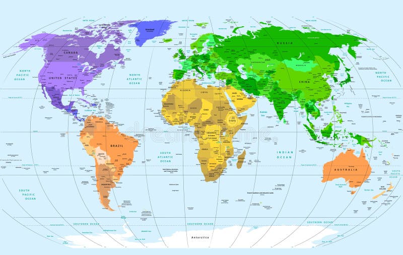
Free with trial Detailed Vector World Map. Layers objects (groups): continents, countries, names of countries, capitals, cites, water resources, meridians. Convenient editing of primary colors. ZIP: eps8 file - meridians in lines. Base map generated using map data from the public domain. - The url of the reference file is : - Software: Xara Designer Pro - Creation date: January, 2012. - Layers of Data Used: Outlines. Domain vectors Detailed World Map. Detailed Vector World Map. Layers objects (groups): continents, countries, names of countries, capitals, cites, water resources, meridians. Detailed Vector World Map. Layers objects (groups): continents, countries, names of countries, capitals, cites, water resources, meridians. Convenient editing of primary colors. ZIP: eps8 file - meridians in lines. Base map generated using map data from the public domain. - The url of the reference file is : - Software: Xara Designer Pro - Creation date: January, 2012. - Layers of Data Used: Outlines
Free with trial USA map vector. With names of states. Domain vectors USA map vector. With names of states
Free with trial Domain for sale. Sticker illustration. Domain vectors Domain for sale. Sticker illustration
Free with trial Africa - vector. Africa map outline and silhouette shadowed green vector map. Domain vectors Africa - vector. Africa map outline and silhouette shadowed green vector map
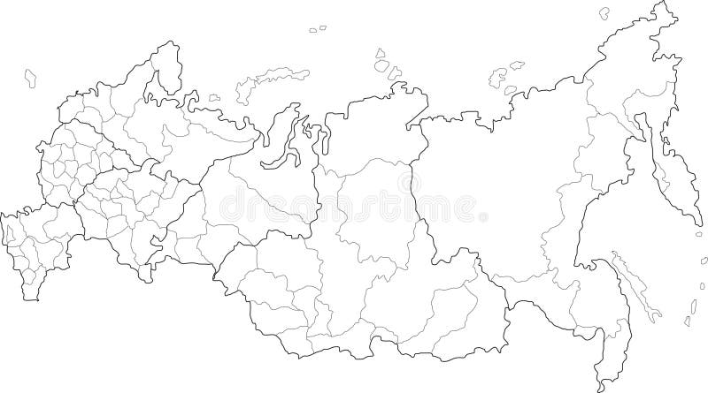
Free with trial Russia map. Vector map of Russia on white background. The Russia map has borders of areas and regions. Domain vectors Russia map. Vector map of Russia on white background. The Russia map has borders of areas and regions
Free with trial Vector China map. Green China map with regions colored in green. Vector illustration. Domain vectors Vector China map. Green China map with regions colored in green. Vector illustration
Free with trial China map. People's Republic of China map designed in illustration with regions colored in bright colors. Vector illustration. Domain vectors China map. People's Republic of China map designed in illustration with regions colored in bright colors. Vector illustration
Free with trial Detailed Map of India. A Detailed Map of India with all states, names and boundaries. Domain vectors Detailed Map of India. A Detailed Map of India with all states, names and boundaries
Free with trial Network web server vector. Vectorial illustration of a local network connected by server computer. Domain vectors Network web server vector. Vectorial illustration of a local network connected by server computer
Free with trial Detailed vector shape of the Unites States of America including Alaska and Hawaii. This illustration is based on the maps of www. cia. gov. The states borders are on the separate layer and can be easily removed. Domain vectors USA shape. Detailed vector shape of the Unites States of America including Alaska and Hawaii. This illustration is based on the maps of . The states. Detailed vector shape of the Unites States of America including Alaska and Hawaii. This illustration is based on the maps of www.cia.gov. The states borders are on the separate layer and can be easily removed.
Free with trial Pennsylvania state road map with Interstates and U. S. Highways. All elements on 4 separate layers (State Fill, State Outline, Roads, Cities) for easy editing. Source: Public domain National Planning Network ( and United States Federal Highway Administration. Domain vectors Pennsylvania Interstate Map. Pennsylvania state road map with Interstates and U.S. Highways. All elements on 4 separate layers (State Fill, State Outline. Pennsylvania state road map with Interstates and U.S. Highways. All elements on 4 separate layers (State Fill, State Outline, Roads, Cities) for easy editing. Source: Public domain National Planning Network ( and United States Federal Highway Administration
Free with trial Internet Cafe logo design. Cup of coffee with a symbol of the internet. in circle shape. Domain vectors Internet Cafe logo design. Cup of coffee with a symbol of the internet. in circle shape
Free with trial Vintage wallpaper pattern, original art by William Morris 1834-1896, vectorized seamless pattern file with birds, fruit and flowers. Domain vectors Strawberry Thief Seamless Pattern. Vintage wallpaper pattern, original art by William Morris 1834-1896, vectorized seamless pattern file with birds, fruit and. Vintage wallpaper pattern, original art by William Morris 1834-1896, vectorized seamless pattern file with birds, fruit and flowers
Free with trial Dot world map with countries, vector. Political dot world map with countries, vector illustration map source NASA Public Domain. Domain vectors Dot world map with countries, vector. Political dot world map with countries, vector illustration map source NASA Public Domain
Free with trial Houses - The image of a rural small house in a sunny day. Domain vectors Houses. The image of a rural small house in a sunny day
Free with trial Internet. Word cloud with internet related terms. Domain vectors Internet. Word cloud with internet related terms
Free with trial Recycling Earth. Map of the world traced from public domain map. This is the raster of a vector illustration. EPS file also available. Domain vectors Recycling Earth. Map of the world traced from public domain map. This is the raster of a vector illustration. EPS file also available
Free with trial Green Earth simbol, vector illustration. Base map generated using map data from the public domain. (www. diva-gis. org). Domain vectors Green Earth Simbol. Vector illustration. Base map generated using map data from the public domain. (. Green Earth simbol, vector illustration. Base map generated using map data from the public domain. (www.diva-gis.org)
Free with trial Very elaborate network computer server, with digital background. Domain vectors Server in cyberspace. Very elaborate network computer server, with digital background. Very elaborate network computer server, with digital background.
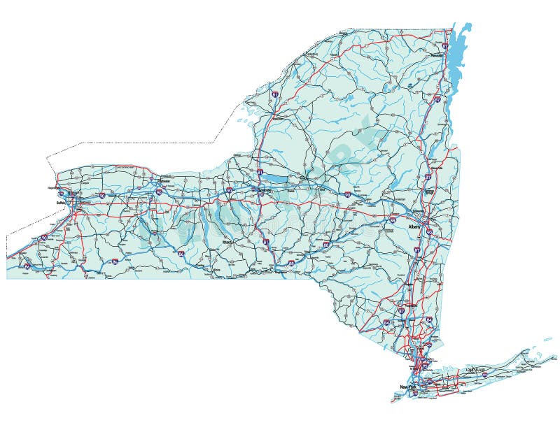
Free with trial New York state road map with Interstates and U. S. Highways. All elements on 5 separate layers (State Fill, State Outline, Water, Roads, Cities) for easy editing. Source: Public domain National Planning Network ( and United S. Domain vectors New York State Road Map. With Interstates and U.S. Highways. All elements on 5 separate layers (State Fill, State Outline, Water, Roads, Cities) for. New York state road map with Interstates and U.S. Highways. All elements on 5 separate layers (State Fill, State Outline, Water, Roads, Cities) for easy editing. Source: Public domain National Planning Network ( and United S
Free with trial India map. Color India map with regions over white. Domain vectors India map. Color India map with regions over white
Free with trial Texas icon under spotlight. Texas lonestar state icon under spotlight. Domain vectors Texas icon under spotlight. Texas lonestar state icon under spotlight
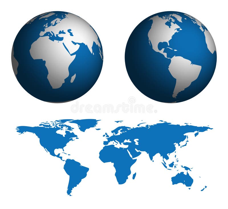
Free with trial Globe and Map of the World. Map was manually traced in illustrator from public domain world map. No transparency. EPS file also available. Domain vectors Globe and Map of the World. Map was manually traced in illustrator from public domain world map. No transparency. EPS file also available
Free with trial Internet web browser slider. Blank internet browser with navigation arrows and slider. Domain vectors Internet web browser slider. Blank internet browser with navigation arrows and slider
Free with trial Internet, world wide web design. Abstract internet, world wide web design / background. Domain vectors Internet, world wide web design. Abstract internet, world wide web design / background
Free with trial Highly Detailed World Map with. Gradient, manually traced from public domain map. No Transparency. EPS file also available. Domain vectors Highly Detailed World Map with. Gradient, manually traced from public domain map. No Transparency. EPS file also available
Free with trial A magnifying glass is searching the internet for a web page and there is an arrow cursor over the url address. A globe is in the background. Domain vectors Search the Web Internet on Globe. A magnifying glass is searching the internet for a web page and there is an arrow cursor over the url address. A globe is in. A magnifying glass is searching the internet for a web page and there is an arrow cursor over the url address. A globe is in the background.
Free with trial Server administration icons. Part 1. Set of the website or server administration icons. Domain vectors Server administration icons. Part 1. Set of the website or server administration icons
Free with trial Server administration icons. Part 2. Set of the website or server administration icons. Domain vectors Server administration icons. Part 2. Set of the website or server administration icons
Free with trial Vector website development icon set. Set of web-page development related icons in gray and yellow colours. Domain vectors Vector website development icon set. Set of web-page development related icons in gray and yellow colours
Free with trial Vector web site development icon set. Set of icons about website development. Domain vectors Vector web site development icon set. Set of icons about website development
Free with trial Texas icon in red and blue star frame. American red and blue star outline with a red texas icon. Domain vectors Texas icon in red and blue star frame. American red and blue star outline with a red texas icon
Free with trial Set of modern flat design SEO and website development icons for graphic and web designers. Domain vectors Flat design SEO and website development icons for graphic and web designers. Set of modern flat design SEO and website development icons for graphic and web. Set of modern flat design SEO and website development icons for graphic and web designers
Free with trial Internet web browser blue slider. Internet web browser concept with room to add page. Domain vectors Internet web browser blue slider. Internet web browser concept with room to add page
Free with trial Set of flat design icons for SEO and website development. Domain vectors Set of flat design icons for SEO and website development. Set of flat design vector icons for SEO and website development
Free with trial Black Website www Icon with wireframe globe on white background. Domain vectors Black Website www Icon with wireframe globe on white background. Black Website www vector Icon with wireframe globe on white background
Free with trial WWW flat icon. Vector concept illustration for design. World Wide Web icon. Domain vectors WWW flat icon. Vector concept illustration for design. World Wide Web icon.
Free with trial Go to website icon vector. Internet icon vector. Go to website icon vector design template. Domain vectors Go to website icon vector.Internet icon vector. Go to website icon vector design template.Internet icon vector
Free with trial Go to web icon. Internet flat vector illustration for website on white background with shadow. Domain vectors Go to web icon. Internet flat vector illustration for website on. White background with shadow
Free with trial World with arrow world click concept website icon black color vector illustration flat style simple image. Domain vectors World with arrow world click concept website icon black color illustration. World with arrow world click concept website icon black color vector illustration. World with arrow world click concept website icon black color vector illustration flat style simple image
Free with trial China. Map of China and chinese flag illustration. Domain vectors China. Map of China and chinese flag illustration
Free with trial World map - vector. World map outline and silhouette shadowed green vector map. Domain vectors World map - vector. World map outline and silhouette shadowed green vector map
Free with trial Detailed Asian flags and map. Manually traced from public domain map. EPS file available. Domain vectors Detailed Asian flags and map. Manually traced from public domain map. EPS file available
Free with trial Detailed North American flags. And map manually traced from public domain data. EPS file available. Domain vectors Detailed North American flags. And map manually traced from public domain data. EPS file available
Free with trial Detailed South American flags. And map manually traced from public domain data. EPS file available. Domain vectors Detailed South American flags. And map manually traced from public domain data. EPS file available
Free with trial Detailed European flags and ma. P manually traced from public domain map. EPS file available. Domain vectors Detailed European flags and ma. P manually traced from public domain map. EPS file available
Free with trial Detailed African flags and map. Manually traced from public domain map. Available in EPS file. Domain vectors Detailed African flags and map. Manually traced from public domain map. Available in EPS file
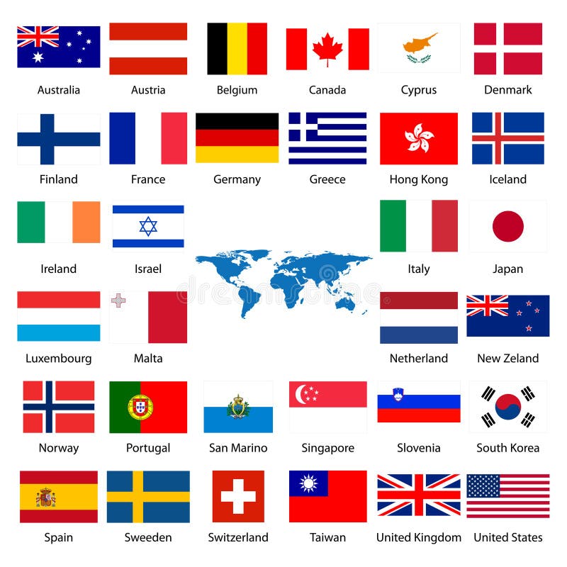
Free with trial 32 Industrialized country flag. Detailed industrialized country flags and world map manually traced from public domain map. EPS file available. Domain vectors 32 Industrialized country flag. Detailed industrialized country flags and world map manually traced from public domain map. EPS file available
Free with trial 32 Industrialized country flags. Detailed industrialized country flags and world map manually traced from public domain map. Domain vectors 32 Industrialized country flags. Detailed industrialized country flags and world map manually traced from public domain map
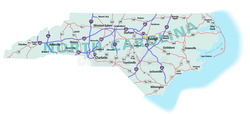
Free with trial North Carolina state road map with Interstates, U. S. Highways and state roads. All elements on separate layers (Fill, Roads, Cities, Outline) for easy editing. Map created December 3, 2009. ZIP File contains EPS-8 Adobe Illustrator file, Illustrator CS3 file, and large JPG file, 6806x3120. Source: Public domain National Planning Network ( and United States. Domain vectors North Carolina State Interstate Map. North Carolina state road map with Interstates, U.S. Highways and state roads. All elements on separate layers (Fill. North Carolina state road map with Interstates, U.S. Highways and state roads. All elements on separate layers (Fill, Roads, Cities, Outline) for easy editing. Map created December 3, 2009. ZIP File contains EPS-8 Adobe Illustrator file, Illustrator CS3 file, and large JPG file, 6806x3120. Source: Public domain National Planning Network ( and United States
Free with trial California state road map with Interstates and U. S. Highways. All elements on 5 separate layers (State Fill, State Outline, Water, Roads, Cities) for easy editing. Map created January 9, 2009. Source: Public domain National Planning Network ( and United. Domain vectors California Interstate Highway Map. California state road map with Interstates and U.S. Highways. All elements on 5 separate layers (State Fill, State. California state road map with Interstates and U.S. Highways. All elements on 5 separate layers (State Fill, State Outline, Water, Roads, Cities) for easy editing. Map created January 9, 2009. Source: Public domain National Planning Network ( and United
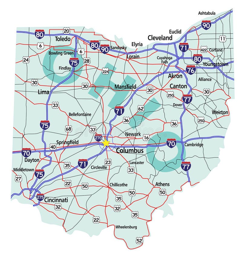
Free with trial Ohio state road map with Interstates, U. S. Highways and state roads. All elements on separate layers for easy editing. Map created November 26, 2009. ZIP File contains EPS-8 Adobefile,CS3 file, and large JPG file, 4469x4640. Source: Public domain National Planning Network ( and United States Federal Highway Administration (http:/. Domain vectors Ohio State Interstate Map. Ohio state road map with Interstates, U.S. Highways and state roads. All elements on separate layers for easy editing. Map created. Ohio state road map with Interstates, U.S. Highways and state roads. All elements on separate layers for easy editing. Map created November 26, 2009. ZIP File contains EPS-8 Adobefile,CS3 file, and large JPG file, 4469x4640. Source: Public domain National Planning Network ( and United States Federal Highway Administration (http:/
Free with trial Florida state road map with Interstates, U. S. Highways and state roads. All elements on 5 separate layers (State Fill, State Outline, Water, Roads, Cities) for easy editing. Map created January 15, 2009. ZIP File contains EPS-8 Adobe Illustrator file, Illustrator CS3 file, and large JPG file, 4350x4162. Source: Public domain National Planning Network ( and. Domain vectors Florida State Interstate Map. Florida state road map with Interstates, U.S. Highways and state roads. All elements on 5 separate layers (State Fill, State. Florida state road map with Interstates, U.S. Highways and state roads. All elements on 5 separate layers (State Fill, State Outline, Water, Roads, Cities) for easy editing. Map created January 15, 2009. ZIP File contains EPS-8 Adobe Illustrator file, Illustrator CS3 file, and large JPG file, 4350x4162. Source: Public domain National Planning Network ( and
Free with trial Domain sign icons. Collection of domain sign icons isolated on white. Domain vectors Domain sign icons. Collection of domain sign icons isolated on white
Free with trial Domain name rubber stamps. Domain name rubber stamp illustrations. Domain vectors Domain name rubber stamps. Domain name rubber stamp illustrations
Free with trial Domain name web business internet concept url. Vector. Domain vectors Domain name web business internet concept url. Vector
Free with trial DNS Domain Name System Server. Vector illustration. Domain vectors DNS Domain Name System Server. Vector illustration
Free with trial DNS Domain Name System Server. Vector illustration technology. Domain vectors DNS Domain Name System Server. Vector illustration technology
Free with trial Classification of living things as biological hierarchy outline diagram. Labeled educational scheme and wildlife organisms order from species to domain vector illustration. Zoology animal arrangement. Domain vectors Classification of living things with biological hierarchy outline diagram. Classification of living things as biological hierarchy outline diagram. Labeled. Classification of living things as biological hierarchy outline diagram. Labeled educational scheme and wildlife organisms order from species to domain vector illustration. Zoology animal arrangement
Free with trial Build website. Six steps for build website. Domain vectors Build website. Six steps for build website
Free with trial Shopping cart. Web shopping - buying cart - isolated vector. Domain vectors Shopping cart. Web shopping - buying cart - isolated vector
Free with trial A Blue Server Hosting, ready to serve your need. surrounding by white background for you. Domain vectors Blue Server Hosting. A Blue Server Hosting, ready to serve your need. surrounding by white background for you. A Blue Server Hosting, ready to serve your need. surrounding by white background for you.
Free with trial Social Network World Map. Words from social netwoking and computers create a world map. Domain vectors Social Network World Map. Words from social netwoking and computers create a world map
Free with trial Illustration of a mobile phone displaying a shopping cart with SALE word inside. Domain vectors Mobile phone with shopping cart. Illustration of a mobile phone displaying a shopping cart with SALE word inside. Illustration of a mobile phone displaying a shopping cart with SALE word inside.
Free with trial Landscape. Illustration of landscape with tree, grass and flowers. Domain vectors Landscape. Illustration of landscape with tree, grass and flowers
Free with trial Detailed Map of Kerala. A Detailed Map of Kerala with all districts, names and boundaries. Domain vectors Detailed Map of Kerala. A Detailed Map of Kerala with all districts, names and boundaries
Free with trial Word cloud - best practice. A word cloud of best practice related items. Domain vectors Word cloud - best practice. A word cloud of best practice related items
Free with trial Vector set of pixel perfect based on 64 px grid colorful flat line web icons on SEO and web optimization theme. Domain vectors SEO and Web Optimization. Vector set of pixel perfect based on 64 px grid colorful flat line web icons on SEO and web optimization theme. Vector set of pixel perfect based on 64 px grid colorful flat line web icons on SEO and web optimization theme.
Free with trial Three Servers - Server in Cabinets. Three Data Storage Systems - Information technology. Domain vectors Three Servers - Server in Cabinets. Three Data Storage Systems - Information technology
Free with trial Internet logo. Illustration art of a sex internet logo with isolated background. Domain vectors Internet logo. Illustration art of a sex internet logo with isolated background
Free with trial China map. Black map of China with regions, borders and names. Domain vectors China map. Black map of China with regions, borders and names
Free with trial Very elaborate network computer servers. Domain vectors Server. Very elaborate network computer servers. Very elaborate network computer servers.
Free with trial Internet. Abstract internet concept vector illustration. Domain vectors Internet. Abstract internet concept vector illustration
Free with trial Landscape. Illustration of landscape with tree, grass, flowers and Cows. Domain vectors Landscape. Illustration of landscape with tree, grass, flowers and Cows
Free with trial Login box. Illustration of login box on white background. Domain vectors Login box. Illustration of login box on white background
Free with trial Human figures of various size take control of their territory. Domain vectors Territory. Human figures of various size take control of their territory. Human figures of various size take control of their territory.
Free with trial Networking. Vector illustration of global networking concept. Domain vectors Networking. Vector illustration of global networking concept
Free with trial Green Earth background, vector illustration. Base map generated using map data from the public domain. (www. diva-gis. org). Domain vectors Green Earth. Background, vector illustration. Base map generated using map data from the public domain. (. Green Earth background, vector illustration. Base map generated using map data from the public domain. (www.diva-gis.org)
Free with trial System rack, data storage vector image. Domain vectors System rack. Data storage vector image
 Sign in