Free with trial The flag is accurate and detailed with beveled stars. The American Flag vector is in easy edit layers and AI-EPS8 format. Format vectors Accurate American Flag. The flag is accurate and detailed with beveled stars. The American Flag vector is in easy edit layers and AI-EPS8 format. The flag is accurate and detailed with beveled stars. The American Flag vector is in easy edit layers and AI-EPS8 format.
Free with trial Isolated raster version of vector set of world flags 1 (contain the Clipping Path of all objects) There is in addition a vector format (EPS 8). Format vectors Set of world flags 1. Isolated raster version of vector set of world flags 1 (contain the Clipping Path of all objects) There is in addition a vector format (EPS. Isolated raster version of vector set of world flags 1 (contain the Clipping Path of all objects) There is in addition a vector format (EPS 8)
Free with trial Illustration of the United States of America (the American flag) waving flowing. Colors are editable in addition vector format. Format vectors US Flag (American Flag) flowing waving. Illustration of the United States of America (the American flag) waving flowing. Colors are editable in addition vector. Illustration of the United States of America (the American flag) waving flowing. Colors are editable in addition vector format.
Free with trial Icon for towing companies. Eps10 format. Format vectors Icon for towing companies. Eps10 format
Free with trial Abstract Background Design with Blurred Image. Abstract Colorful Blurry Background Template - Creative Design Illustration in Editable Vector Format. Format vectors Abstract Background Design with Blurred Image. Abstract Colorful Blurry Background Template - Creative Design Illustration in Editable Vector Format
Free with trial Set of Stroke Round Food Icons. Isolated on White Background. Clipping paths included in additional jpg format. Format vectors Set of Stroke Round Food Icons. Isolated on White Background. Clipping paths included in additional jpg format
Free with trial Christmas hat (AI format available). Christmas hat on white background. Format vectors Christmas hat (AI format available). Christmas hat on white background
Free with trial Line halftone pattern with gradient effect. Gorizontal lines. Template for backgrounds and stylized textures. Design element. Vector illustration in EPS8 format. Format vectors Line halftone pattern. With gradient effect. Gorizontal lines. Template for backgrounds and stylized textures. Design element. Vector illustration in EPS8
Free with trial Web Design Elements. Colorful website design templates - illustration in freely scalable and editable vector format. Format vectors Web Design Elements. Colorful website design templates - illustration in freely scalable and editable vector format
Free with trial Abstract Aboriginal dot painting in vector format. Format vectors Abstract Aboriginal Art. Abstract Aboriginal dot painting in vector format. Abstract Aboriginal dot painting in vector format.
Free with trial Abstract Aboriginal map dot painting in vector format. Format vectors Abstract Aboriginal Art. Abstract Aboriginal map dot painting in vector format. Abstract Aboriginal map dot painting in vector format.
Free with trial Modern displays. generic design, proportional to the HD format. EPS 8 vector file included. Format vectors Screens Collection - Smart Phone, Laptop, Tablet,. Modern displays. generic design, proportional to the HD format. EPS 8 vector file included. Modern displays. generic design, proportional to the HD format. EPS 8 vector file included.
Free with trial Flyer or Cover Design. Blue Abstract Flyer or Cover Design with Waves - Illustration in Editable Vector Format. Format vectors Flyer or Cover Design. Blue Abstract Flyer or Cover Design with Waves - Illustration in Editable Vector Format
Free with trial Flyer or Cover Design. Abstract Grey Flyer or Cover Design with Earth Globe for Business or Technology - Illustration in Editable Vector Format. Format vectors Flyer or Cover Design. Abstract Grey Flyer or Cover Design with Earth Globe for Business or Technology - Illustration in Editable Vector Format
Free with trial Garnet red abstract background polygon. This is file of EPS8 format. Format vectors Garnet red abstract background polygon. This is file of EPS8 format
Free with trial Working on a date (EPS format available). Working on a dinner table. Format vectors Working on a date (EPS format available). Working on a dinner table
Free with trial Napoleon Bonaparte cartoon character. Illustration, Napoleon Bonaparte cartoon character, format EPS 8. Format vectors Napoleon Bonaparte cartoon character. Illustration, Napoleon Bonaparte cartoon character, format EPS 8
Free with trial Gray grid paper - technical engineering line scale measurement 100mm patch, vector. Format vectors Gray grid paper. Technical engineering line scale measurement 100mm patch, vector
Free with trial Journey to the west character set Vector Illustration. Cartoon Characters EPS10 File Format. Format vectors Journey to the west character set Vector Illustration. Cartoon Characters EPS10 File Format
Free with trial Abstract Modern Colorful Poster, Brochure, Flyer, Booklet, Pamphlet, Leaflet or Book Cover Design Template - Illustration in Editable EPS10 Vector Format. Format vectors Flyer or Cover Design with Squares Pattern. Abstract Modern Colorful Poster, Brochure, Flyer, Booklet, Pamphlet, Leaflet or Book Cover Design Template. Abstract Modern Colorful Poster, Brochure, Flyer, Booklet, Pamphlet, Leaflet or Book Cover Design Template - Illustration in Editable EPS10 Vector Format
Free with trial Molecular, Global or Business Network Connections. Network Connections Concept Design Illustration in Editable Vector Format. Format vectors Molecular, Global or Business Network Connections. Network Connections Concept Design Illustration in Editable Vector Format
Free with trial Web Design Elements - Header Designs. Blue Header or Banner Template Designs in Freely Scalable & Editable Vector Format. Format vectors Web Design Elements - Header Designs. Blue Header or Banner Template Designs in Freely Scalable & Editable Vector Format
Free with trial Hockey emblem ferocious lion with stick. Illustration, hockey emblem ferocious lion with stick, format EPS 8. Format vectors Hockey emblem ferocious lion with stick. Illustration, hockey emblem ferocious lion with stick, format EPS 8
Free with trial People in line (EPS format available). Silhouette - people standing in line. Format vectors People in line (EPS format available). Silhouette - people standing in line
Free with trial VECTOR: LasVegas sign at night (EPS format available). Welcome to Fabulous Las Vegas Nevada sign at night. Format vectors VECTOR: LasVegas sign at night (EPS format available). Welcome to Fabulous Las Vegas Nevada sign at night
Free with trial Bike crash sign (AI format available). Illustration of a bike crash sign. Format vectors Bike crash sign (AI format available). Illustration of a bike crash sign
Free with trial Christmas hat (AI format available). Christmas hat on black background. Format vectors Christmas hat (AI format available). Christmas hat on black background
Free with trial Soap bubble. Set of multicolored transparent bubbles with glares, highlights and gradient. Transparency only in vector format. Can be used with any background. Format vectors Soap bubble. Set of multicolored transparent bubbles with glares. Highlights and gradient. Transparency only in vector format. Can be used with any background
Free with trial Cowboy hat. vector illustration. This is file of EPS8 format. Format vectors Cowboy hat. vector illustration. This is file of EPS8 format
Free with trial Set of flowing blue wave lines. This is file of EPS10 format. Format vectors Set of flowing blue wave lines. This is file of EPS10 format
Free with trial Silver Grey Cloud Computing and Network Connections Concept Design with Transparent Geometric Mesh - Illustration in Editable Vector Format. Format vectors Connections - Molecular, Global Business Network Design - Abstract Mesh Background. Silver Grey Cloud Computing and Network Connections Concept Design with. Silver Grey Cloud Computing and Network Connections Concept Design with Transparent Geometric Mesh - Illustration in Editable Vector Format
Free with trial Database and Table Formatting Icons - Vector Icon Set. Format vectors Database and Table Formatting Icons. Vector Icon Set
Free with trial Seamless pattern of hand drawn books and papers. Fully editable EPS file format. Format vectors Seamless Doodle Pattern - Books. Seamless pattern of hand drawn books and papers. Fully editable EPS file format. Seamless pattern of hand drawn books and papers. Fully editable EPS file format.
Free with trial Straight lines abstract vector background. This is file of EPS10 format. Format vectors Straight lines abstract vector background. This is file of EPS10 format
Free with trial Timeline infographic business template vector illustration. This is file of EPS10 format. Format vectors Timeline infographic business template vector. Illustration. This is file of EPS10 format
Free with trial Abstract black and white background of polygonal. This is file of EPS8 format. Format vectors Abstract black and white background of polygonal. This is file of EPS8 format
Free with trial Vector Red and Green Check Mark Icons. This is file of EPS10 format. Format vectors Vector Red and Green Check Mark Icons. This is file of EPS10 format
Free with trial Vector Red and Green Check Mark Icons. This is file of EPS10 format. Format vectors Vector Red and Green Check Mark Icons. This is file of EPS10 format
Free with trial Set of Silhouette Walking People and Children. Vector Illustration. This is file of EPS10 format. Format vectors Set of Silhouette Walking People and Children. Vector Illustration. This is file of EPS10 format
Free with trial Mexico is highly detailed hand drawn artwork. The Vector file is in AI-EPS8 format. Format vectors Mexico. Is highly detailed hand drawn artwork. The Vector file is in AI-EPS8 format
Free with trial USA flag. USA,US waving flag vector realistic. This is file of EPS10 format. Format vectors USA flag. USA,US waving flag vector realistic. This is file of EPS10 format
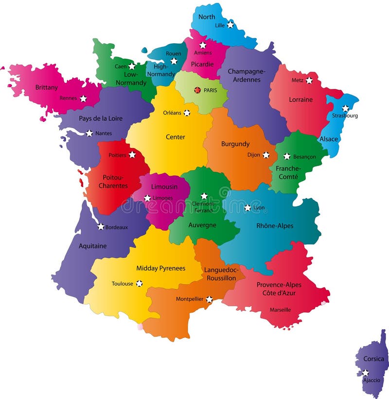
Free with trial France map designed in illustration with the regions colored in bright colors and with the main cities. Neighbouring countries are in an additional format (. AI) in the latent layer. Format vectors Map of France. France map designed in illustration with the regions colored in bright colors and with the main cities. Neighbouring countries are in an. France map designed in illustration with the regions colored in bright colors and with the main cities. Neighbouring countries are in an additional format (. AI) in the latent layer.
Free with trial Mexico map designed in illustration with states colored in green colors and with the main cities. Neighbouring countries are in an additional format (. AI) in the latent layer. Format vectors Vector Mexico map. Mexico map designed in illustration with states colored in green colors and with the main cities. Neighbouring countries are in an additional. Mexico map designed in illustration with states colored in green colors and with the main cities. Neighbouring countries are in an additional format (. AI) in the latent layer.
Free with trial Blind map of Spain with regions borders. Names of the regions, main cities, and neighbouring countries are in an additional format (. AI) in the latent layer. Format vectors Spain map. Blind map of Spain with regions borders. Names of the regions, main cities, and neighbouring countries are in an additional format (. AI) in the
Free with trial Blind map of Denmark with regions borders. Names of the regions, main cities, and neighbouring countries are in an additional format (. AI) in the latent layer. Format vectors Denmark map. Blind map of Denmark with regions borders. Names of the regions, main cities, and neighbouring countries are in an additional format (.AI) in the. Blind map of Denmark with regions borders. Names of the regions, main cities, and neighbouring countries are in an additional format (.AI) in the latent layer.
Free with trial Argentina map designed in illustration with states colored in bright colors and with the main cities. Neighbouring countries are in an additional format (. AI) in the latent layer. Format vectors Argentina map. Designed in illustration with states colored in bright colors and with the main cities. Neighbouring countries are in an additional format (. AI
Free with trial Greece map designed in illustration with the regions colored in green colors and with the main cities. Neighbouring countries are in an additional format (. AI) in the latent layer. Format vectors Map of Greece. Greece map designed in illustration with the regions colored in green colors and with the main cities. Neighbouring countries are in an additional. Greece map designed in illustration with the regions colored in green colors and with the main cities. Neighbouring countries are in an additional format (.AI) in the latent layer.
Free with trial Netherlands map designed in illustration with the regions colored in bright colors and with the main cities. Neighbouring countries are in an additional format (. AI) in the latent layer. Format vectors Netherlands map. Designed in illustration with the regions colored in bright colors and with the main cities. Neighbouring countries are in an additional format. Netherlands map designed in illustration with the regions colored in bright colors and with the main cities. Neighbouring countries are in an additional format (. AI) in the latent layer.
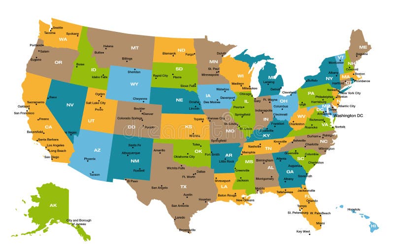
Free with trial Detailed illustration of all fifty states of United States of America with major cities and state abbreviations. All states are in separate layers and can be easily changed in Adobe Illustrator additional format. Format vectors Map of all US states. Detailed illustration of all fifty states of United States of America with major cities and state abbreviations. All states are in separate. Detailed illustration of all fifty states of United States of America with major cities and state abbreviations. All states are in separate layers and can be easily changed in Adobe Illustrator additional format.
Free with trial Set of american flags FLAG. Full set in colours of american flags, in vectorial format. Format vectors Set of american flags FLAG. Full set in colours of american flags, in vectorial format
Free with trial Belgium map designed in illustration with the regions colored in grey colors and with the main cities. Neighbouring countries are in an additional format (. AI) in the latent layer. Format vectors Belgium map. Designed in illustration with the regions colored in grey colors and with the main cities. Neighbouring countries are in an additional format (.AI
Free with trial USA flag. USA wavy flag with additional format isolated on white background. Format vectors USA flag. USA wavy flag with additional format isolated on white background
Free with trial Set of flags. Glossy buttons. Raster version of vector illustration + EPS additional format. Format vectors Set of flags. Glossy buttons. Raster version of vector illustration + EPS additional format
Free with trial World flag icons. Isolated raster version of vector zoom world flag icons with a globe There is in addition a vector format (EPS 8. Format vectors World flag icons. Isolated raster version of vector zoom world flag icons with a globe There is in addition a vector format (EPS 8
Free with trial Raster version of vector set world flag icons 1 There is in addition a vector format (EPS 8). Format vectors World flag icons 1. Raster version of vector set world flag icons 1 There is in addition a vector format (EPS 8. Raster version of vector set world flag icons 1 There is in addition a vector format (EPS 8)
Free with trial Raster version of vector set world flag icons 4 here is in addition a vector format (EPS 8). Format vectors World flag icons 4. Raster version of vector set world flag icons 4 here is in addition a vector format (EPS 8. Raster version of vector set world flag icons 4 here is in addition a vector format (EPS 8)
Free with trial Raster version of vector set world flag icons 2 There is in addition a vector format (EPS 8). Format vectors World flag icons 2. Raster version of vector set world flag icons 2 There is in addition a vector format (EPS 8. Raster version of vector set world flag icons 2 There is in addition a vector format (EPS 8)
Free with trial Raster version of vector set world flag icons 3 There is in addition a vector format (EPS 8). Format vectors World flag icons 3. Raster version of vector set world flag icons 3 There is in addition a vector format (EPS 8. Raster version of vector set world flag icons 3 There is in addition a vector format (EPS 8)
Free with trial Canada map designed in illustration with states colored in green colors and with the main cities. Neighbouring countries are in an additional format (. AI) in the latent layer. Format vectors Canada. Map designed in illustration with states colored in green colors and with the main cities. Neighbouring countries are in an additional format (.AI) in
Free with trial Spain map designed in illustration with the regions colored in bright colors and with the main cities. Neighbouring countries are in an additional format (. AI) in the latent layer. Format vectors Spain map. Designed in illustration with the regions colored in bright colors and with the main cities. Neighbouring countries are in an additional format (. AI
Free with trial India map designed in illustration with regions colored in bright colors and with the main cities. Neighbouring countries are in an additional format (. AI) in the latent layer. Format vectors India map. Designed in illustration with regions colored in bright colors and with the main cities. Neighbouring countries are in an additional format (.AI) in
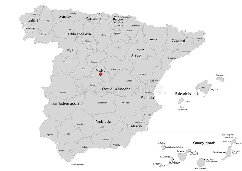
Free with trial Spain map designed in illustration with the regions colored in grey colors and with the main cities. Neighbouring countries are in an additional format (. AI) in the latent layer. Format vectors Map of Spain. Spain map designed in illustration with the regions colored in grey colors and with the main cities. Neighbouring countries are in an additional. Spain map designed in illustration with the regions colored in grey colors and with the main cities. Neighbouring countries are in an additional format (.AI) in the latent layer.
Free with trial American Flag Illustration. United States of America USA Flag waving, vector format available. Format vectors American Flag Illustration. United States of America USA Flag waving, vector format available
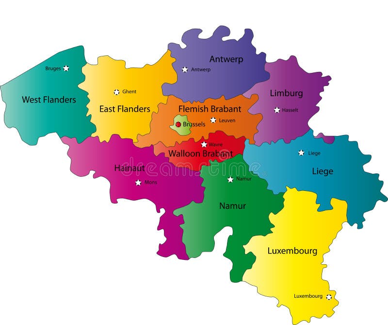
Free with trial Belgium map designed in illustration with the regions colored in bright colors and with the main cities. Neighbouring countries are in an additional format (. AI) in the latent layer. Format vectors Map of Belgium. Belgium map designed in illustration with the regions colored in bright colors and with the main cities. Neighbouring countries are in an. Belgium map designed in illustration with the regions colored in bright colors and with the main cities. Neighbouring countries are in an additional format (. AI) in the latent layer.
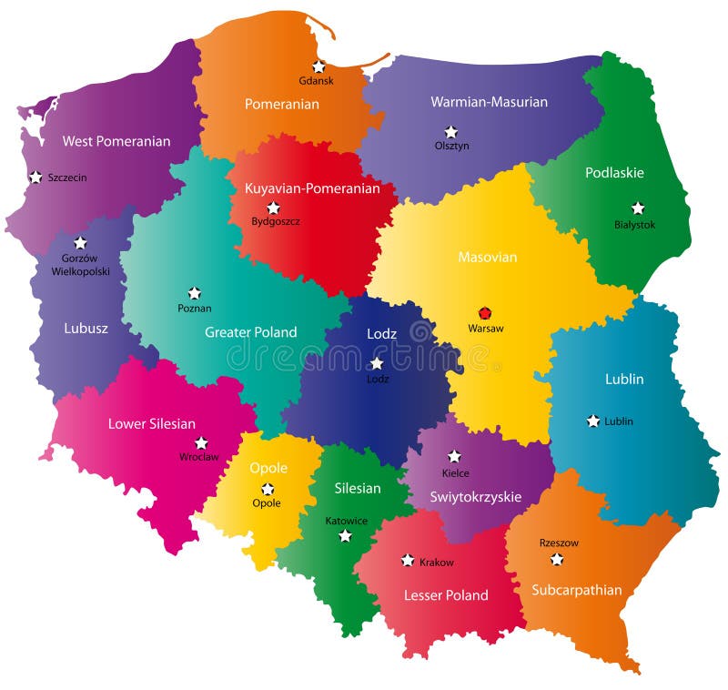
Free with trial Poland map designed in illustration with the 16 provinces colored in bright colors and with the main cities. Neighbouring countries are in an additional format (. AI) in the latent layer. Format vectors Color Poland map. Poland map designed in illustration with the 16 provinces colored in bright colors and with the main cities. Neighbouring countries are in an. Poland map designed in illustration with the 16 provinces colored in bright colors and with the main cities. Neighbouring countries are in an additional format (.AI) in the latent layer.
Free with trial An illustration of the US flag and text celebrating Labor Day. Available in vector EPS format. Format vectors Happy Labor Day. An illustration of the US flag and text celebrating Labor Day. Available in vector EPS format. An illustration of the US flag and text celebrating Labor Day. Available in vector EPS format.
Free with trial Switzerland map designed in illustration with the regions colored in bright colors and with the main cities. Neighbouring countries are in an additional format (. AI) in the latent layer. Format vectors Switzerland map. Designed in illustration with the regions colored in bright colors and with the main cities. Neighbouring countries are in an additional format. Switzerland map designed in illustration with the regions colored in bright colors and with the main cities. Neighbouring countries are in an additional format (. AI) in the latent layer.
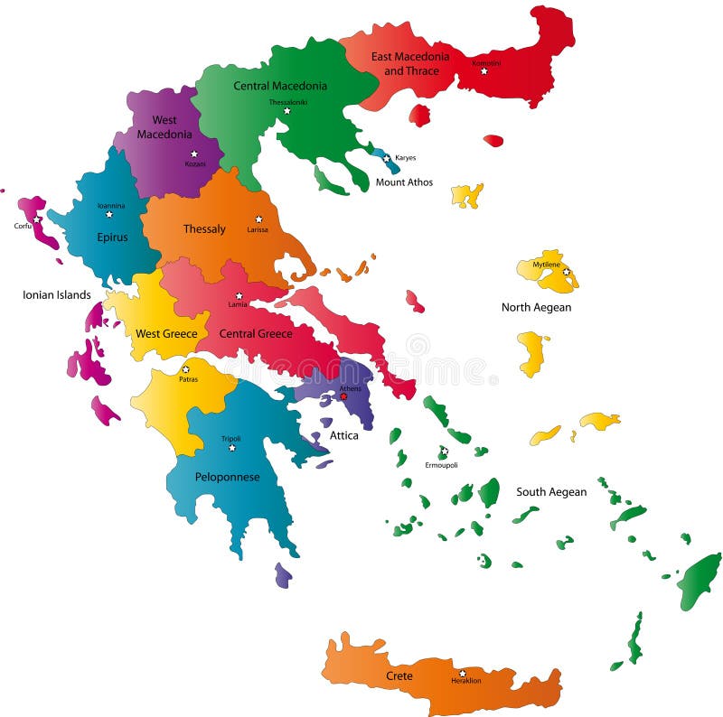
Free with trial Greece map designed in illustration with the regions colored in bright colors and with the main cities. Neighbouring countries are in an additional format (. AI) in the latent layer. Format vectors Vector Greece map. Greece map designed in illustration with the regions colored in bright colors and with the main cities. Neighbouring countries are in an. Greece map designed in illustration with the regions colored in bright colors and with the main cities. Neighbouring countries are in an additional format (.AI) in the latent layer.
Free with trial Almost all national flags collection in format, with legend and divided by continent. Format vectors National flags collection. Almost all national flags collection in format, with legend and divided by continent. Almost all national flags collection in format, with legend and divided by continent.
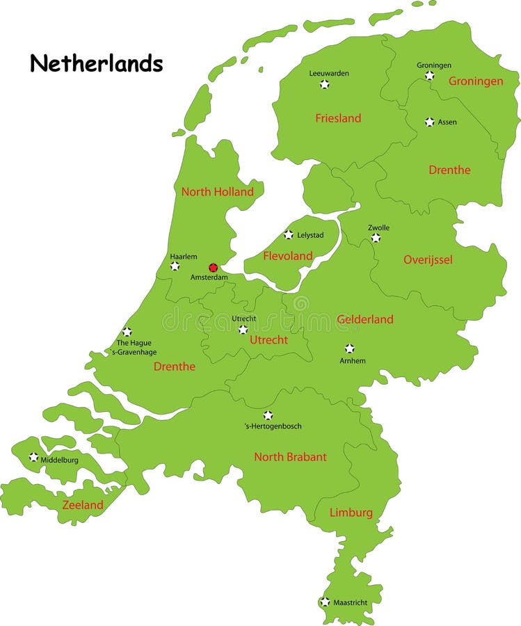
Free with trial Netherlands map designed in illustration with the regions colored in green colors and with the main cities. Neighbouring countries are in an additional format (. AI) in the latent layer. Format vectors Vector Netherlands map. Netherlands map designed in illustration with the regions colored in green colors and with the main cities. Neighbouring countries are in. Netherlands map designed in illustration with the regions colored in green colors and with the main cities. Neighbouring countries are in an additional format (.AI) in the latent layer.
Free with trial An illustration of a ribbon shaped American flag. Shadow placed on separate layer for ease of use. Available in vector EPS format. Format vectors American Flag Ribbon EPS. An illustration of a ribbon shaped American flag. Shadow placed on separate layer for ease of use. Available in vector EPS format. An illustration of a ribbon shaped American flag. Shadow placed on separate layer for ease of use. Available in vector EPS format.
Free with trial Vector illustration of flying eagle or sea hawk with the colors of united states of america flag and stars, to be used as symbol or logo and available in additional format. Format vectors American eagle vector symbol. Vector illustration of flying eagle or sea hawk with the colors of united states of america flag and stars, to be used as symbol or. Vector illustration of flying eagle or sea hawk with the colors of united states of america flag and stars, to be used as symbol or logo and available in additional format
Free with trial Black ship. Black beautiful old ship isolated on white. Additional vector format in EPS (v. 8. Format vectors Black ship. Black beautiful old ship isolated on white. Additional vector format in EPS (v. 8
Free with trial Black old ship and waves isolated on white. Additional vector format in EPS (v. 8). Format vectors Black ship. Black old ship and waves isolated on white. Additional vector format in EPS (v.8. Black old ship and waves isolated on white. Additional vector format in EPS (v.8).
Free with trial Air message - illustration. additional format Eps8. Format vectors Air message. Illustration. additional format Eps8
Free with trial Golf course. Beautiful golf course. Available in vector EPS format. Format vectors Golf course. Beautiful golf course. Available in vector EPS format
Free with trial Switzerland map designed in illustration with the regions colored in green colors and with the main cities. Neighbouring countries are in an additional format (. AI) in the latent layer. Format vectors Switzerland map,. Switzerland map designed in illustration with the regions colored in green colors and with the main cities. Neighbouring countries are in an. Switzerland map designed in illustration with the regions colored in green colors and with the main cities. Neighbouring countries are in an additional format (. AI) in the latent layer.
Free with trial Banner. Yellow banner isolated on white in vector format. Format vectors Banner. Yellow banner isolated on white in vector format
Free with trial Accurate American Flag vector. flat original color illustration isolated on white background. With eps files. Format vectors Accurate American Flag vector. flat original color illustration isolated on white background. With eps files
Free with trial Isolated raster version of vector set of world flags 2 (contain the Clipping Path of all objects) There is in addition a vector format (EPS 8). Format vectors Set of world flags 2. Isolated raster version of vector set of world flags 2 (contain the Clipping Path of all objects) There is in addition a vector format (EPS. Isolated raster version of vector set of world flags 2 (contain the Clipping Path of all objects) There is in addition a vector format (EPS 8)
 Sign in