Free with trial Green Earth simbol, vector illustration. Base map generated using map data from the public domain. (www. diva-gis. org). Gis vectors Green Earth Simbol. Vector illustration. Base map generated using map data from the public domain. (. Green Earth simbol, vector illustration. Base map generated using map data from the public domain. (www.diva-gis.org)
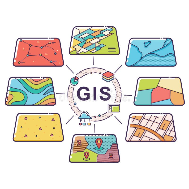
Free with trial Vector Illustration of GIS Spatial Data Layers Concept for Business Analysis, Geographic Information System, Icons Design, Liner Style. Gis vectors GIS Concept Data Layers for Infographic. Vector Illustration of GIS Spatial Data Layers Concept for Business Analysis, Geographic Information System, Icons. Vector Illustration of GIS Spatial Data Layers Concept for Business Analysis, Geographic Information System, Icons Design, Liner Style
Free with trial Green Earth background, vector illustration. Base map generated using map data from the public domain. (www. diva-gis. org). Gis vectors Green Earth. Background, vector illustration. Base map generated using map data from the public domain. (. Green Earth background, vector illustration. Base map generated using map data from the public domain. (www.diva-gis.org)
Free with trial Vector Illustration of GIS Spatial Data Layers Concept for Infographic, Geographic Information System, Icons Design, Liner Style. Gis vectors GIS Concept Data Layers for Infographic. Vector Illustration of GIS Spatial Data Layers Concept for Infographic, Geographic Information System, Icons Design. Vector Illustration of GIS Spatial Data Layers Concept for Infographic, Geographic Information System, Icons Design, Liner Style
Free with trial Vector Illustration of GIS Spatial Data Layers Concept for Infographic, Geographic Information System, Icons Design, Liner Style. Gis vectors GIS Concept Data Layers for Infographic. Vector Illustration of GIS Spatial Data Layers Concept for Infographic, Geographic Information System, Icons Design. Vector Illustration of GIS Spatial Data Layers Concept for Infographic, Geographic Information System, Icons Design, Liner Style
Free with trial Vector Illustration of GIS Spatial Data Layers Concept for Business Analysis, Geographic Information System, Icons Design, Liner Style. Gis vectors GIS Concept Data Layers for Infographic. Vector Illustration of GIS Spatial Data Layers Concept for Business Analysis, Geographic Information System, Icons. Vector Illustration of GIS Spatial Data Layers Concept for Business Analysis, Geographic Information System, Icons Design, Liner Style
Free with trial Vector Illustration of GIS Spatial Data Layers Concept for Business Analysis, Geographic Information System, Icons Design, Liner Style. Gis vectors GIS Concept Data Layers for Infographic. Vector Illustration of GIS Spatial Data Layers Concept for Business Analysis, Geographic Information System, Icons. Vector Illustration of GIS Spatial Data Layers Concept for Business Analysis, Geographic Information System, Icons Design, Liner Style
Free with trial Vector Illustration of GIS Spatial Data Layers Concept for Business Analysis, Geographic Information System, Icons Design, Liner Style. Gis vectors GIS Concept Data Layers for Infographic. Vector Illustration of GIS Spatial Data Layers Concept for Business Analysis, Geographic Information System, Icons. Vector Illustration of GIS Spatial Data Layers Concept for Business Analysis, Geographic Information System, Icons Design, Liner Style
Free with trial Set with clobal series and map background, vector illustration. Base map generated using map data from the public domain. (www. diva-gis. org). Gis vectors Set with Clobal Series and Map Background. Vector illustration. Base map generated using map data from the public domain. (. Set with clobal series and map background, vector illustration. Base map generated using map data from the public domain. (www.diva-gis.org)
Free with trial China country map with flag. China map in southeast Asia. Gis vectors China country map with flag. China map in southeast Asia
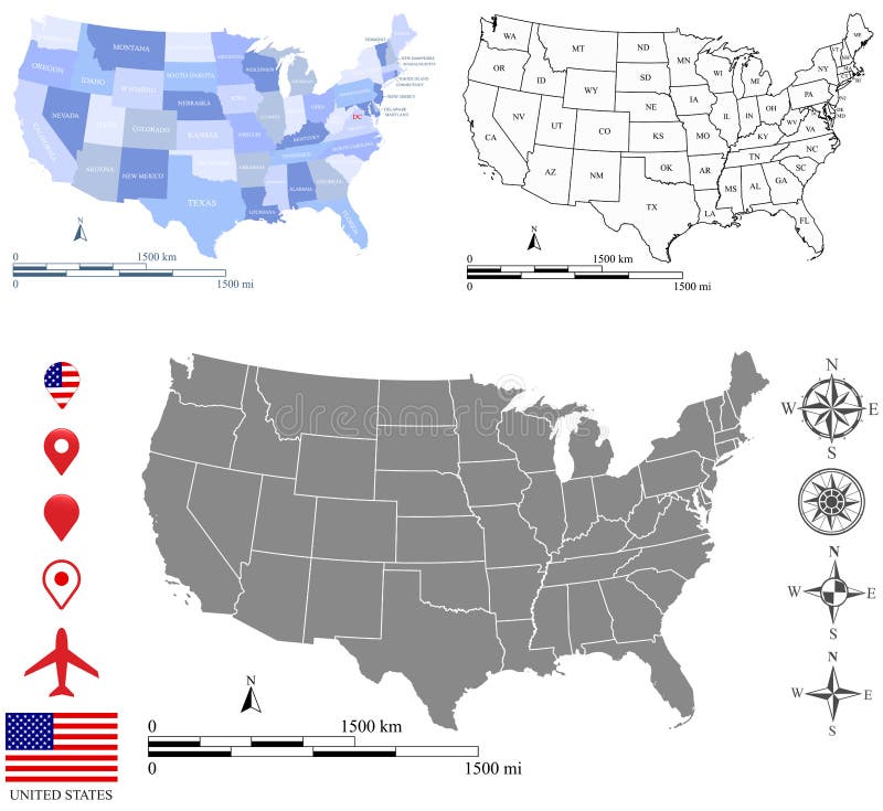
Free with trial These vector maps of USA include a high quality image file (jpg) and a vector file (eps) that can be scaled to any size. The maps and scales are accurately prepared by a GIS expert. The blank map has the names of US states in abbreviation and all maps have the boundary of US capital, Washington D. C. Additionally, two vector sets of geographic direction and placemark symbols are provided. Gis vectors USA map vector outline with scales of miles and kilometers in different designs. These vector maps of USA include a high quality image file (jpg) and a vector. These vector maps of USA include a high quality image file (jpg) and a vector file (eps) that can be scaled to any size. The maps and scales are accurately prepared by a GIS expert. The blank map has the names of US states in abbreviation and all maps have the boundary of US capital, Washington D.C. Additionally, two vector sets of geographic direction and placemark symbols are provided.
Free with trial Vector Illustration of GIS Spatial Data Layers Concept for Business Analysis, Geographic Information System, Icons Design, Liner Style. Gis vectors GIS Concept Data Layers for Infographic. Vector Illustration of GIS Spatial Data Layers Concept for Business Analysis, Geographic Information System, Icons. Vector Illustration of GIS Spatial Data Layers Concept for Business Analysis, Geographic Information System, Icons Design, Liner Style
Free with trial Vector Illustration of GIS Spatial Data Layers Concept for Business Analysis, Geographic Information System, Icons Design, Liner Stylen. Gis vectors GIS Concept Data Layers for Infographic. Vector Illustration of GIS Spatial Data Layers Concept for Business Analysis, Geographic Information System, Icons. Vector Illustration of GIS Spatial Data Layers Concept for Business Analysis, Geographic Information System, Icons Design, Liner Stylen
Free with trial Vector Illustration of GIS Spatial Data Layers Concept for Infographic, Geographic Information System, Icons Design, Liner Style. Gis vectors GIS Concept Data Layers for Infographic. Vector Illustration of GIS Spatial Data Layers Concept for Infographic, Geographic Information System, Icons Design. Vector Illustration of GIS Spatial Data Layers Concept for Infographic, Geographic Information System, Icons Design, Liner Style
Free with trial Vector Illustration of GIS Spatial Data Layers Concept for Info Graphic, Vertical Data Organization, Geographic Information System. Gis vectors GIS Concept Data Layers for Infographic. Vector Illustration of GIS Spatial Data Layers Concept for Info Graphic, Vertical Data Organization, Geographic. Vector Illustration of GIS Spatial Data Layers Concept for Info Graphic, Vertical Data Organization, Geographic Information System
Free with trial GIS abstract isolated on white abstract waves flowing squares geographic information system background design art template set vector illustration. Gis vectors GIS abstract isolated on white abstract waves flowing squares geographic information system background art design. GIS abstract isolated on white abstract waves. GIS abstract isolated on white abstract waves flowing squares geographic information system background design art template set vector illustration
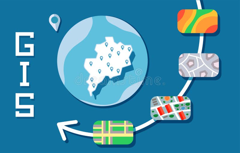
Free with trial Geographic Information System, GIS explained. Infographic flat vector illustration. Horizontal. Gis vectors Geographic Information System, GIS flat line concept. Vector illustration on blue background. Horizontal. Geographic Information System, GIS explained. Geographic Information System, GIS explained. Infographic flat vector illustration. Horizontal
Free with trial Green Earth symbol glossy buttons. Base map generated using map data from the public domain. (www. diva-gis. org) All elements and textures are individual objects. Vector illustration scale to any size. Gis vectors Green Earth Symbol glossy buttons. Base map generated using map data from the public domain. () All elements and textures are individual. Green Earth symbol glossy buttons. Base map generated using map data from the public domain. (www.diva-gis.org) All elements and textures are individual objects. Vector illustration scale to any size.
Free with trial Logo House neighborhood. In streets blocks. Gis vectors Logo House neighborhood. In streets blocks
Free with trial Vector Illustration of GIS Spatial Data Layers Concept for Infographic, Cloud Data Storage, Geographic Information System, Icons Design, Liner Style. Gis vectors GIS Data Layers Cloud Concept. Vector Illustration of GIS Spatial Data Layers Concept for Infographic, Cloud Data Storage, Geographic Information System, Icons. Vector Illustration of GIS Spatial Data Layers Concept for Infographic, Cloud Data Storage, Geographic Information System, Icons Design, Liner Style
Free with trial Vector Illustration of GIS Spatial Data Layers Concept for Info Graphic, Vertical Data Organization, Geographic Information System. Gis vectors GIS Concept Data Layers for Infographic. Vector Illustration of GIS Spatial Data Layers Concept for Info Graphic, Vertical Data Organization, Geographic. Vector Illustration of GIS Spatial Data Layers Concept for Info Graphic, Vertical Data Organization, Geographic Information System
Free with trial Vector Illustration of GIS Spatial Data Layers Concept for Info Graphic, Vertical Data Organization, Geographic Information System. Gis vectors GIS Concept Data Layers for Infographic. Vector Illustration of GIS Spatial Data Layers Concept for Info Graphic, Vertical Data Organization, Geographic. Vector Illustration of GIS Spatial Data Layers Concept for Info Graphic, Vertical Data Organization, Geographic Information System
Free with trial Vector Illustration of GIS Spatial Data Layers Concept for Info Graphic, Vertical Data Organization, Geographic Information System. Gis vectors GIS Concept Data Layers for Infographic. Vector Illustration of GIS Spatial Data Layers Concept for Info Graphic, Vertical Data Organization, Geographic. Vector Illustration of GIS Spatial Data Layers Concept for Info Graphic, Vertical Data Organization, Geographic Information System
Free with trial GIS Software Concept, Geographic Information System. Vector illustration on blue background. Gis vectors GIS Software Concept, Geographic Information System. Vector illustration. GIS Software Concept, Geographic Information System. Vector illustration on blue. GIS Software Concept, Geographic Information System. Vector illustration on blue background.
Free with trial GIS Software Concept, Geographic Information System. Vector illustration on blue background. Gis vectors GIS Software Concept, Geographic Information System. Vector illustration. GIS Software Concept, Geographic Information System. Vector illustration on blue. GIS Software Concept, Geographic Information System. Vector illustration on blue background.
Free with trial GIS, geographic information system. Concept with people, letters and icons. Colored flat vector illustration. Isolated on white background. Gis vectors GIS, geographic information system. Concept with people, letters and icons. Flat vector illustration. Isolated on white. GIS, geographic information system. GIS, geographic information system. Concept with people, letters and icons. Colored flat vector illustration. Isolated on white background.
Free with trial Analytics, processing, AI, ML and data science in GIS. Spatial data, geospatial data, geographic coordinate system. Vector concept. Analytics, processing, AI, ML. Gis vectors Analytics, processing, AI, ML and data science in GIS. Spatial data, geospatial data, geographic coordinate system. Vector concept. Analytics, processing, AI, ML
Free with trial Analytics, processing, AI, ML and data science in GIS. Spatial data, geospatial data, geographic coordinate system. Vector concept. Analytics, processing, AI, ML. Gis vectors Analytics, processing, AI, ML and data science in GIS. Spatial data, geospatial data, geographic coordinate system. Vector concept. Analytics, processing, AI, ML
Free with trial GIS letter logo design on white background. GIS creative initials circle logo concept. GIS letter designGIS letter logo design on white background. GIS letter design. Gis vectors GIS letter logo design on white background. GIS creative initials circle logo concept. GIS letter design. GIS letter logo design on white background. GIS creative initials circle logo concept. GIS letter designGIS letter logo design on white background. GIS creative initials circle logo concept. GIS letter design
Free with trial GIS letter logo design in six style. GIS polygon, circle, triangle, hexagon, flat and simple style with black and white color variation letter logo set in one artboard. GIS minimalist and classic logo. Gis vectors GIS letter logo design in six style. GIS polygon, circle, triangle, hexagon, flat and simple style with black and white color. Variation letter logo set in one. GIS letter logo design in six style. GIS polygon, circle, triangle, hexagon, flat and simple style with black and white color variation letter logo set in one artboard. GIS minimalist and classic logo
Free with trial Geospatial analysis outline icons collection. Cartography, GIS, Spatial, Mapping, Location, Geographic, Topography. Gis vectors Geospatial analysis line icons collection. Cartography, GIS, Spatial, Mapping, Location, Geographic, Topography vector. Geospatial analysis outline icons. Geospatial analysis outline icons collection. Cartography, GIS, Spatial, Mapping, Location, Geographic, Topography
Free with trial A surveyor operates a theodolite against a city backdrop, highlighting measurement and mapping tasks. Useful for surveying firms, GIS services, infrastructure planning, and real estate development. Gis vectors Land Surveyor with Theodolite, Mapping and Planning. A surveyor operates a theodolite against a city backdrop, highlighting measurement and mapping tasks. Useful. A surveyor operates a theodolite against a city backdrop, highlighting measurement and mapping tasks. Useful for surveying firms, GIS services, infrastructure planning, and real estate development.
Free with trial USA map. Detailed vector editable layers with state abbreviations, generated using GIS in USA Contiguous Equidistant Conic projection. Gis vectors United States Vector Map With Detailed Outlines. USA map. Detailed vector editable layers with state abbreviations, generated using GIS in USA Contiguous. USA map. Detailed vector editable layers with state abbreviations, generated using GIS in USA Contiguous Equidistant Conic projection
Free with trial Geographic Information System. GIS Spatial Data Layers Concept for Business Analysis. Vector illustration. Gis vectors Geographic Information System. GIS Spatial Data Layers Concept for Business Analysis. Vector illustration
Free with trial Postcard GIS day. Post card for event november day Geographic Information System Day. Gis vectors Postcard GIS day. Post card for event november day Geographic Information System Day
Free with trial Geographic information systems logotype in blue color. GIS day. Web mapping and cartography. Logotype in bright colors. Gis vectors Geographic information systems logotype in blue color. GIS day. Web mapping and cartography. Logotype in bright colors
Free with trial Geographic information systems, gis, cartography and mapping. Web mapping. Geographic information systems logo in dark colors. Gis vectors Geographic information systems, gis, cartography and mapping. Web mapping. Geographic information systems logo in dark colors
Free with trial Green Earth glossy buttons. Base map generated using map data from the public domain. (www. diva-gis. org) All elements and textures are individual objects. Vector illustration scale to any size. Gis vectors Green Earth glossy buttons. Base map generated using map data from the public domain. () All elements and textures are individual objects. Green Earth glossy buttons. Base map generated using map data from the public domain. (www.diva-gis.org) All elements and textures are individual objects. Vector illustration scale to any size.
Free with trial Blocks and streets. Real estate neighborhood. Gis vectors Blocks and streets. Real estate neighborhood
Free with trial Geodata layers example with map info structure elements outline diagram. Topography information with street, buildings, vegetation and integrated data instruments vector illustration. Satellite view. Gis vectors Geodata layers example with map info structure elements outline diagram. Topography information with street, buildings, vegetation and integrated data
Free with trial Am is ha ud sl vsis sjsmms. Jsbskkjsjsodn djsnsks jsjsb. Gis vectors Am is ha ud sl vsis sjsmms. Jsbskkjsjsodn djsnsks jsjsb
Free with trial Word cloud - geographic information system. A word cloud of geographic information system related items. Gis vectors Word cloud - geographic information system. A word cloud of geographic information system related items
Free with trial Minimal Green Parcels on Cream Planning Map. Vegetation patches and pathways for real estate zoning, land ownership and urban planning concept. Gis vectors Cartography with Textured Land and Winding Roads for Rural District Overview. Minimal Green Parcels on Cream Planning Map. Vegetation patches and pathways for. Minimal Green Parcels on Cream Planning Map. Vegetation patches and pathways for real estate zoning, land ownership and urban planning concept
Free with trial A detailed world map infographic displaying global data distribution. The map features various shades of blue across continents and countries, indicating different levels or categories of data, complemented by a color legend. Multiple pie charts are strategically placed over key regions like the USA, Brazil, China, Russia, Australia, Africa, and Europe, illustrating specific statistical breakdowns. This vector illustration is ideal for presentations, business reports, educational materials, and any project requiring a clear and engaging visualization of international statistics, market analysis, or demographic trends across the globe. Gis vectors Global Data Distribution World Map Infographic with Pie Charts. A detailed world map infographic displaying global data distribution. The map features various. A detailed world map infographic displaying global data distribution. The map features various shades of blue across continents and countries, indicating different levels or categories of data, complemented by a color legend. Multiple pie charts are strategically placed over key regions like the USA, Brazil, China, Russia, Australia, Africa, and Europe, illustrating specific statistical breakdowns. This vector illustration is ideal for presentations, business reports, educational materials, and any project requiring a clear and engaging visualization of international statistics, market analysis, or demographic trends across the globe.
Free with trial Screaming boss. Cartoon illustration of screaming boss at gis worker with megaphone. boss is red color and worker is grey color. Gis vectors Screaming boss. Cartoon illustration of screaming boss at gis worker with megaphone. boss is red color and worker is grey color
Free with trial Complete Set of 50 U. S. State Satellite Maps Vector. Realistic Editable Maps for Infographics, Education, and Design. Gis vectors Complete Set of 50 U.S. State Satellite Maps Vector - Realistic Editable Maps for Infographics, Education, and Design. Complete Set of 50 U.S. State Satellite. Complete Set of 50 U.S. State Satellite Maps Vector. Realistic Editable Maps for Infographics, Education, and Design
Free with trial Map Layer linear icon. Modern outline Map Layer logo concept on white background from Maps and Locations collection. Suitable for use on web apps, mobile apps and print media. Gis vectors Map Layer linear icon. Modern outline Map Layer logo concept on. White background from Maps and Locations collection. Suitable for use on web apps, mobile apps
Free with trial Vector isolated thin line icon of internet data and information searching with magnifier on blue background. Linear web pictogram. Gis vectors Linear icon - internet data information searching. Vector isolated thin line icon of internet data and information searching with magnifier on blue background. Vector isolated thin line icon of internet data and information searching with magnifier on blue background. Linear web pictogram
Free with trial Geographic information system banner with topographic background. Vector abstract topographic map concept. Gis vectors Geographic information system banner with topographic 3d background. Vector abstract topographic map concept. Geographic information system banner with. Geographic information system banner with topographic background. Vector abstract topographic map concept
Free with trial Land location icon. localisation pin symbol. area on map sign. vector illustration. Gis vectors Land location icon. localisation pin symbol. area on map sign. vector illustration. Land location icon. localisation pin symbol. area on map sign
Free with trial Los Angeles outline map California city shape. Vector illustration. Gis vectors Los Angeles outline map California city shape. Vector illustration
Free with trial Map Layer icon. Trendy Map Layer logo concept on white background from Maps and Locations collection. Suitable for use on web apps, mobile apps and print media. Gis vectors Map Layer icon. Trendy Map Layer logo concept on white background from Maps and Locations collection. Suitable for use on web apps, mobile apps and print media
Free with trial Iraq country and Baghdad capital city map on the world background. The republic country locates in West Asia and in the geopolitical region known as Middle East. It used to have long wars. Gis vectors Iraq country and Baghdad capital city map on the world background. The republic country locates in West Asia and in the geopolitical region known as Middle
Free with trial 25 icons on map and navigation. 25 icons on map, navigation and related topic. Gis vectors 25 icons on map and navigation. 25 icons on map, navigation and related topic
Free with trial Digital science vector line icons set. Digital, Science, Technology, Data, Network, Modeling, Algorithms illustration. Outline concept signs and symbols. Gis vectors Digital science vector line icons set. Digital, Science, Technology, Data, Network, Modeling, Algorithms illustration. Outline concept signs and symbols
Free with trial China map in southeast Asia. Gis vectors China country map with flag. China map in southeast Asia. China map in southeast Asia.
Free with trial GIS Smart Icons Pack. GIS smart line icons with maps layers location markers data grids and geographic tools vector illustration. Gis vectors GIS Smart Icons Pack. GIS smart line icons with maps layers location markers data grids and geographic tools vector illustration
Free with trial GIS mapping and navigation app concept featuring a smartphone and car with GPS route display and mobile location tracking. This vector illustration is suitable for transportation systems, smart travel solutions, navigation applications, location-based services, logistics, mobility platforms, ride sharing, map interfaces, presentations, websites, and digital marketing materials related to modern navigation technology and intelligent travel. Gis vectors GIS Mapping and Navigation App Concept with Smartphone and Car, GPS Route and Location Tracking. GIS mapping and navigation app concept featuring a smartphone. GIS mapping and navigation app concept featuring a smartphone and car with GPS route display and mobile location tracking. This vector illustration is suitable for transportation systems, smart travel solutions, navigation applications, location-based services, logistics, mobility platforms, ride sharing, map interfaces, presentations, websites, and digital marketing materials related to modern navigation technology and intelligent travel.
Free with trial Martial arts figures set with men and women in traditional gis and belts, illustrating. Various stances and styles for combat sports. Gis vectors Martial arts figures set with men and women in traditional gis and belts, illustrating. Various stances and styles for combat sports
Free with trial Drone Mapping logo provides a technical identity for aerial surveying and GIS companies, and this Drone Mapping logo ensures precise geographic branding. As a dedicated Drone Mapping logo, the emblem effectively conveys spatial data collection to firms seeking remote sensing symbols. Every Drone Mapping logo features an advanced topographical aesthetic suitable for cartography enterprises needing a professional, clean, and strong visual mark. Gis vectors Drone Mapping logo aerial survey geography cartography technology quadcopter GIS logo. Drone Mapping logo provides a technical identity for aerial surveying and. Drone Mapping logo provides a technical identity for aerial surveying and GIS companies, and this Drone Mapping logo ensures precise geographic branding. As a dedicated Drone Mapping logo, the emblem effectively conveys spatial data collection to firms seeking remote sensing symbols. Every Drone Mapping logo features an advanced topographical aesthetic suitable for cartography enterprises needing a professional, clean, and strong visual mark.
Free with trial GIS abstract letter logo design. This logo is designed by three abstract letters. Gis vectors GIS abstract letter logo design. This logo is designed by three abstract letters
Free with trial A circular red grunge style stamp featuring the text GIS mapping for geographic information systems and spatial data analysis concepts. Gis vectors Red round rubber stamp showing the text GIS mapping on a white surface for geography. A circular red grunge style stamp featuring the text GIS mapping for. A circular red grunge style stamp featuring the text GIS mapping for geographic information systems and spatial data analysis concepts
Free with trial A vector illustration featuring five cute stylized martial arts characters wearing traditional gis and belts. They are shown in various poses, conveying streng. Gis vectors Five strong cartoon martial arts characters wearing gis and belts in a variety of action poses. A vector illustration featuring five cute stylized martial arts. A vector illustration featuring five cute stylized martial arts characters wearing traditional gis and belts. They are shown in various poses, conveying streng
Free with trial GIS triangle letter logo design with triangle shape. GIS triangle logo design monogram. GIS triangle vector logo template with red color. GIS triangular logo Simple, Elegant, and Luxurious Logo. GIS. Gis vectors GIS triangle letter logo design with triangle shape. GIS triangle logo design monogram. GIS triangle vector logo template with red. Color. GIS triangular logo. GIS triangle letter logo design with triangle shape. GIS triangle logo design monogram. GIS triangle vector logo template with red color. GIS triangular logo Simple, Elegant, and Luxurious Logo. GIS
Free with trial Nine stylized figures in martial arts poses, wearing dark gis with white or dark belts. Figures are in various stances and arm positions, depicted in shades of grey, dark blue, and black against a white background. Gis vectors Nine martial arts figures in various poses wearing gis and belts karate kung fu. Nine stylized figures in martial arts poses, wearing dark gis with white or dark. Nine stylized figures in martial arts poses, wearing dark gis with white or dark belts. Figures are in various stances and arm positions, depicted in shades of grey, dark blue, and black against a white background
Free with trial Hands Holding the Word GIS with Technology Icons. High quality photo AI generated. Gis vectors Hands Holding the Word GIS with Technology Icons. High quality photo AI generated
Free with trial A bold, modern GIS monogram logo design. This clean, high-energy vector mark works seamlessly across all media, backgrounds, and sizes. Perfect for sports brands, gyms, fitness centers, e-sports, and automotive industries like racing, mechanics, and logistics. This strong, dynamic emblem also suits modern tech, gaming, and transportation businesses needing a professional, scalable identity. Gis vectors Bold GIS Monogram Logo Design. A bold, modern GIS monogram logo design. This clean, high-energy vector mark works seamlessly across all media, backgrounds, and. A bold, modern GIS monogram logo design. This clean, high-energy vector mark works seamlessly across all media, backgrounds, and sizes. Perfect for sports brands, gyms, fitness centers, e-sports, and automotive industries like racing, mechanics, and logistics. This strong, dynamic emblem also suits modern tech, gaming, and transportation businesses needing a professional, scalable identity.
Free with trial An illustration of two women in white gis (uniforms). jpg practicing martial arts. This image is perfect for promoting self defense classes, dojos, and content about martial arts like karate, judo, or aikido for women, vector design Generative AI. Gis vectors Two women practicing martial arts in their gis vector design Generative AI. An illustration of two women in white gis (uniforms).jpg practicing martial arts. An illustration of two women in white gis (uniforms).jpg practicing martial arts. This image is perfect for promoting self defense classes, dojos, and content about martial arts like karate, judo, or aikido for women, vector design Generative AI
Free with trial A focused vector illustration of a man working with digital maps and global data on a computer, indicating GIS or cartography. This image represents geographical information systems, data analysis, urban planning, and digital exploration. Ideal for tech companies, educational institutions, mapping services, and environmental studies. It highlights the intersection of technology and spatial. Gis vectors Man working with digital maps and global data on a computer, GIS expert, vector design Generative AI. A focused vector illustration of a man working with digital. A focused vector illustration of a man working with digital maps and global data on a computer, indicating GIS or cartography. This image represents geographical information systems, data analysis, urban planning, and digital exploration. Ideal for tech companies, educational institutions, mapping services, and environmental studies. It highlights the intersection of technology and spatial
Free with trial Flat vector HV bushing passing through wall of transformer or GIS, concentric view, isolated. On white generative ai. Gis vectors Flat vector HV bushing passing through wall of transformer or GIS, concentric view, isolated. On white generative ai
Free with trial GIS day isometric concept featuring layered topographic maps satellite connectivity location pins and navigation tools for geospatial analysis. Gis vectors Gis Day Isometric Concept with Map Layers and Satellite Technology. GIS day isometric concept featuring layered topographic maps satellite connectivity location. GIS day isometric concept featuring layered topographic maps satellite connectivity location pins and navigation tools for geospatial analysis
Free with trial GIS letter logo design with polygon shape. GIS polygon and cube shape logo design. GIS hexagon vector logo template white and black colors. GIS monogram, business and real estate logo. Gis vectors GIS letter logo design with polygon shape. GIS polygon and cube shape logo design. GIS hexagon vector logo template white and. Black colors. GIS monogram. GIS letter logo design with polygon shape. GIS polygon and cube shape logo design. GIS hexagon vector logo template white and black colors. GIS monogram, business and real estate logo
Free with trial GIS letter logo design with polygon shape. GIS polygon and cube shape logo design. GIS hexagon vector logo template white and black colors. GIS monogram, business and real estate logo. Gis vectors GIS letter logo design with polygon shape. GIS polygon and cube shape logo design. GIS hexagon vector logo template white and. Black colors. GIS monogram. GIS letter logo design with polygon shape. GIS polygon and cube shape logo design. GIS hexagon vector logo template white and black colors. GIS monogram, business and real estate logo
Free with trial Precise and professional GIS TL double supply pump room vector icons designed for technical mapping, engineering blueprints, and facility management systems. Ideal for GIS software, architectural designs, and infrastructure planning. Available in vector, PNG, and SVG formats for seamless integration. Gis vectors GIS TL Double Supply Pump Room Vector Icons - Technical Symbols for Mapping and Engineering. Precise and professional GIS TL double supply pump room vector icons. Precise and professional GIS TL double supply pump room vector icons designed for technical mapping, engineering blueprints, and facility management systems. Ideal for GIS software, architectural designs, and infrastructure planning. Available in vector, PNG, and SVG formats for seamless integration.
Free with trial A group of five lions, including an adult and four cubs, are depicted in a simple line art style, all wearing martial arts gis and striking karate poses agains. Gis vectors Five lions in martial arts gis practicing karate poses in outline style for cubs and group. A group of five lions, including an adult and four cubs, are depicted. A group of five lions, including an adult and four cubs, are depicted in a simple line art style, all wearing martial arts gis and striking karate poses agains
Free with trial This illustration features a group of five cartoon bulls dressed in karate gis and belts. They are depicted in various martial arts poses, suggesting a team or. Gis vectors Group of five cartoon bulls in karate gis, some in fighting stances for martial arts and team. This illustration features a group of five cartoon bulls dressed. This illustration features a group of five cartoon bulls dressed in karate gis and belts. They are depicted in various martial arts poses, suggesting a team or
Free with trial Flat vector HV bushing passing through wall of transformer or GIS, concentric view, isolated. On white generative ai. Gis vectors Flat vector HV bushing passing through wall of transformer or GIS, concentric view, isolated. On white generative ai
Free with trial Flat vector HV bushing passing through wall of transformer or GIS, concentric view, isolated. On white generative ai. Gis vectors Flat vector HV bushing passing through wall of transformer or GIS, concentric view, isolated. On white generative ai
Free with trial Letters SGI and ZGI Hexagon Logo, for SGI, SIG, GIS, GSI, ISG, IGS, ZGI, ZIG, GIZ, GZI, IZG, IGZ initials. Gis vectors Letters SGI and ZGI Hexagon Logo, for SGI, SIG, GIS, GSI, ISG, IGS, ZGI, ZIG, GIZ, GZI, IZG, IGZ initials
Free with trial GIS logo. GIS letter. GIS letter logo design. Initials GIS logo linked with circle and uppercase monogram logo. GIS typography for technology, business and real estate brand. Gis vectors GIS logo. GIS letter. GIS letter logo design. Initials GIS logo linked with circle and uppercase monogram logo. GIS typography for. Technology, business and
 Sign in