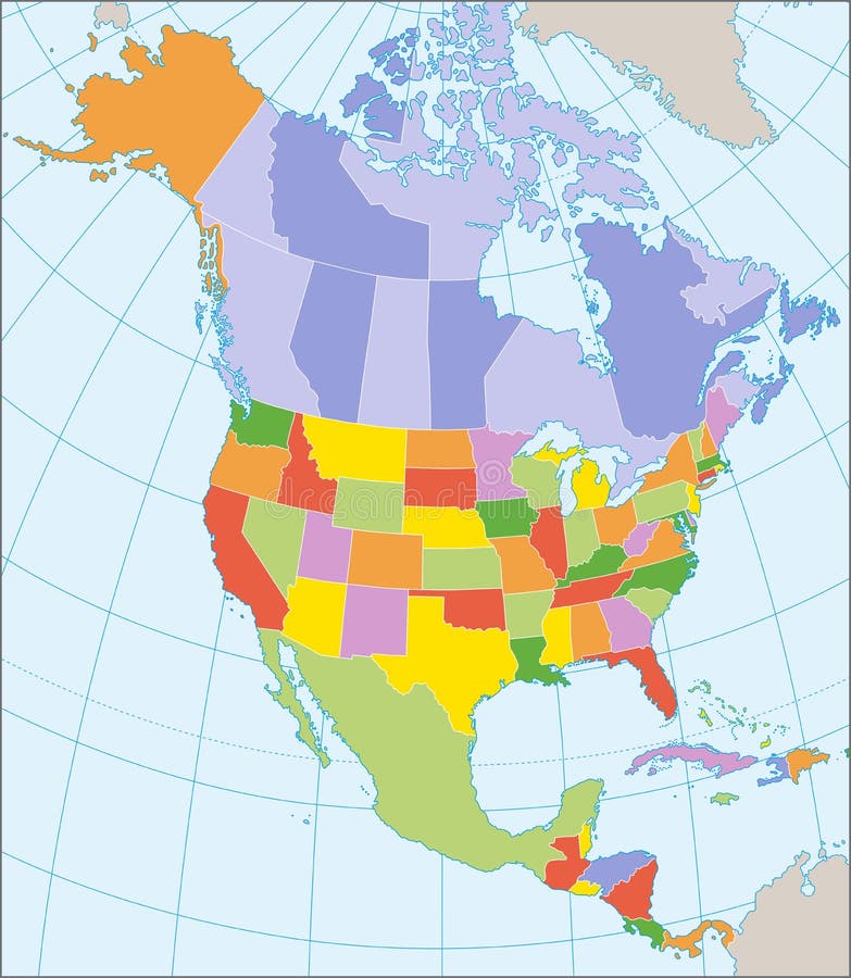
Free with trial Political map of North America with coordinates, present states borders, detailed vector map. Grenadines vectors North America political map. Political map of North America with coordinates, present states borders, detailed vector map. Political map of North America with coordinates, present states borders, detailed vector map.
Free with trial Complete set of 25 Caribbean Flags. Complete set of 25 Caribbean Countries Flags. Grenadines vectors Complete set of 25 Caribbean Flags. Complete set of 25 Caribbean Countries Flags
Free with trial Political map of the Caribbean - Large and Lesser Antilles - with their capitals, national borders, rivers and lakes. Vector illustration with english labeling and scale. Grenadines vectors Large And Lesser Antilles Political Map. Political map of the Caribbean - Large and Lesser Antilles - with their capitals, national borders, rivers and lakes. Political map of the Caribbean - Large and Lesser Antilles - with their capitals, national borders, rivers and lakes. Vector illustration with english labeling and scale.
Free with trial Illustrations showing all the North and South America countries flags (Antigua and Barbuda, Argentina, Bahamas, Barbados, Belize, Bolivia, Brazil, Canada, Chile, Colombia, Costa Rica, Cuba, Dominica, Dominican Republic, Ecuador, El Salvador, Grenada, Guatemala, Guyana, Haiti, Honduras, Jamaica, Mexico, Nicaragua, Panama, Paraguay, Peru, Saint Kitts and Nevis, Saint Lucia, Saint Vincent and the Grenadines, Suriname, Trinidad and Tobago, United States, Uruguay, Venezuela) and the flags of Greenland and Puerto Rico. Each flag is 750x500 pixels and thoroughly drawn. Eps file available. Grenadines vectors American Countries Flags. Illustrations showing all the North and South America countries flags (Antigua and Barbuda, Argentina, Bahamas, Barbados, Belize. Illustrations showing all the North and South America countries flags (Antigua and Barbuda, Argentina, Bahamas, Barbados, Belize, Bolivia, Brazil, Canada, Chile, Colombia, Costa Rica, Cuba, Dominica, Dominican Republic, Ecuador, El Salvador, Grenada, Guatemala, Guyana, Haiti, Honduras, Jamaica, Mexico, Nicaragua, Panama, Paraguay, Peru, Saint Kitts and Nevis, Saint Lucia, Saint Vincent and the Grenadines, Suriname, Trinidad and Tobago, United States, Uruguay, Venezuela) and the flags of Greenland and Puerto Rico. Each flag is 750x500 pixels and thoroughly drawn. Eps file available.
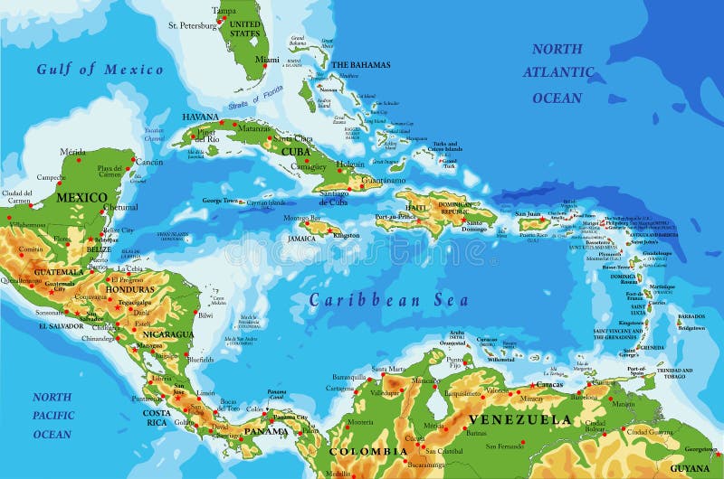
Free with trial Highly detailed physical map of Central America and Caribbean Islands,in vector format,with all the relief forms,regions and big cities. Grenadines vectors Central America and Caribbean Islands physical map. Highly detailed physical map of Central America and Caribbean Islands,in vector format,with all the relief. Highly detailed physical map of Central America and Caribbean Islands,in vector format,with all the relief forms,regions and big cities.
Free with trial Isolated raster version of vector set of world flags 10 There is in addition a vector format (EPS 8). Grenadines vectors Set of world flags 10. Isolated raster version of vector set of world flags 10 There is in addition a vector format (EPS 8. Isolated raster version of vector set of world flags 10 There is in addition a vector format (EPS 8)
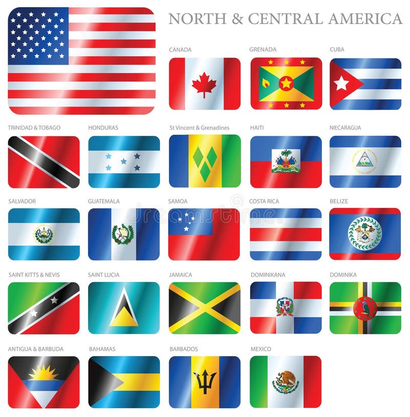
Free with trial Design Waves & No Borders. Vector file with 21 waving flags of North and Central American Countries. It contains flags of North and Central American nations in alphabetical order starting from Antigua & Barbuda and ending with USA. Designed with shadows (waving design) but it can be easily removed from vector file if needed. Included: EPS (saved as an AI8-compatible) and JPEG. Grenadines vectors Waving Flags of North & Central American Countries. Design Waves & No Borders. Vector file with 21 waving flags of North and Central American Countries. It. Design Waves & No Borders. Vector file with 21 waving flags of North and Central American Countries. It contains flags of North and Central American nations in alphabetical order starting from Antigua & Barbuda and ending with USA. Designed with shadows (waving design) but it can be easily removed from vector file if needed. Included: EPS (saved as an AI8-compatible) and JPEG.
Free with trial Political map of Lesser Antilles, Haiti and Dominican Republic with the capitals, national borders, rivers and lakes. Vector illustration with english labeling and scale. Grenadines vectors Lesser Antilles, Haiti, Dominican Republic. Political map of Lesser Antilles, Haiti and Dominican Republic with the capitals, national borders, rivers and lakes. Political map of Lesser Antilles, Haiti and Dominican Republic with the capitals, national borders, rivers and lakes. Vector illustration with english labeling and scale.
Free with trial Latin, Caribbean, North and South American country regions' vector maps. Grenadines vectors Latin, Caribbean, North and South American country regions' vector maps. Latin, Caribbean, North and South American country regions' maps
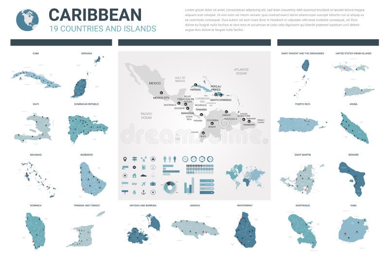
Free with trial Vector maps set. High detailed 19 maps of Caribbean countries with administrative division and cities. Political map, map of Caribbean region, world map, globe, infographic elements. Grenadines vectors Vector maps set. High detailed 19 maps of Caribbean countries with administrative division and cities. Political map, map of. Caribbean region, world map. Vector maps set. High detailed 19 maps of Caribbean countries with administrative division and cities. Political map, map of Caribbean region, world map, globe, infographic elements
Free with trial America flag b. Round North American flags set with shadow on white background. Grenadines vectors America flag b. Round North American flags set with shadow on white background
Free with trial Flag Icons Set - Design Elements 56i, it's a high resolution image with CLIPPING PATH for easy remove unwanted shadows underneath. Grenadines vectors Flag Icons Set - Design Elements 56i. It's a high resolution image with CLIPPING PATH for easy remove unwanted shadows underneath
Free with trial Vector stamp collection. Colored collection of vector stamp. Grenadines vectors Vector stamp collection. Colored collection of vector stamp
Free with trial Buttons with American countries flags. Set of round buttons with American countries flags. Grenadines vectors Buttons with American countries flags. Set of round buttons with American countries flags
Free with trial Foreign language school concept. Lips, open mouth, flag of Saint Vincent and the Grenadines. Sovereign state in North America. Grenadines vectors Flag of Saint Vincent and the Grenadines. Foreign language school concept. Lips, open mouth, flag of Saint Vincent and the Grenadines. Sovereign state in North. Foreign language school concept. Lips, open mouth, flag of Saint Vincent and the Grenadines. Sovereign state in North America.
Free with trial Flag of Saint Vincent and Grenadines, national country symbol illustration Vector illustration available for download. Click here for more vectors. Grenadines vectors Saint Vincent and Grenadines. Flag of Saint Vincent and Grenadines, national country symbol illustration Vector illustration available for download. Click here. Flag of Saint Vincent and Grenadines, national country symbol illustration Vector illustration available for download. Click here for more vectors
Free with trial World flags of Rwanda, Saint Barthelemy, Saint Helena, Saint Kitts and Nevis, Saint Lucia, Saint Martin, Saint Pierre and Miquelon and Saint Vincent and the Grenadines, with capitals, geographic coordinates and coat of arms, vector art illustration. Grenadines vectors World flags and capitals set 20. World flags of Rwanda, Saint Barthelemy, Saint Helena, Saint Kitts and Nevis, Saint Lucia, Saint Martin, Saint Pierre and. World flags of Rwanda, Saint Barthelemy, Saint Helena, Saint Kitts and Nevis, Saint Lucia, Saint Martin, Saint Pierre and Miquelon and Saint Vincent and the Grenadines, with capitals, geographic coordinates and coat of arms, vector art illustration
Free with trial Lesser Antilles political map. The Caribbees with Haiti, the Dominican Republic and Puerto Rico in the Caribbean Sea. With capitals and national borders. English labeling. Illustration. Vector. Grenadines vectors Lesser Antilles political map. The Caribbees with Haiti, the Dominican Republic and Puerto Rico in the Caribbean Sea. With capitals and national borders
Free with trial Pomegranate Fruit vector. Illustration Pomegranate Fruit on White background vector. Grenadines vectors Pomegranate Fruit vector. Illustration Pomegranate Fruit on White background vector
Free with trial South America Global World Planet Earth Icon. South America Vector Map Icon of the World Globe Symbol. Grenadines vectors South America Global World Planet Earth Icon. South America Vector Map Icon of the World Globe Symbol
Free with trial Highly detailed vector map of Venezuela with administrative regions,main cities and roads. Grenadines vectors Venezuela map. Highly detailed vector map of Venezuela with administrative regions,main cities and roads. Highly detailed vector map of Venezuela with administrative regions,main cities and roads.
Free with trial Lesser Antilles political map. Caribbees with Haiti, Dominican Republic and Puerto Rico in the Caribbean Sea. Gray illustration with English labeling on white background. Vector. Grenadines vectors Lesser Antilles political map. Caribbees with Haiti, Dominican Republic and Puerto Rico in the Caribbean Sea. Gray illustration with English labeling on white
Free with trial Realistic balloons. Golden 3d transparent party balloons, silver white birthday decoration. Vector flying party ballon set. Grenadines vectors Realistic balloons. Golden 3d transparent party balloons, silver white birthday decoration. Vector party ballon set. Realistic balloons. Golden 3d transparent. Realistic balloons. Golden 3d transparent party balloons, silver white birthday decoration. Vector flying party ballon set
Free with trial Caribbean. Passport stamp of the Windward Islands of the Caribbean in vector format. Grenadines vectors Caribbean. Passport stamp of the Windward Islands of the Caribbean in vector format
Free with trial A set of flags of South America isolated on a background. Grenadines vectors Flags North & Central America. A set of flags of South America isolated on a background. A set of flags of South America isolated on a background.
Free with trial Flags of the world, m-s, 3d isometric flat icon d. Isolated world flags in flat colour on a white background. Grenadines vectors Flags of the world, m-s, 3d isometric flat icon d. Isolated world flags in flat colour on a white background
Free with trial North America map and flags. Vector illustration. Grenadines vectors North America map and flags. Vector illustration
Free with trial North America map and flags. Vector illustration. Grenadines vectors North America map and flags. Vector illustration
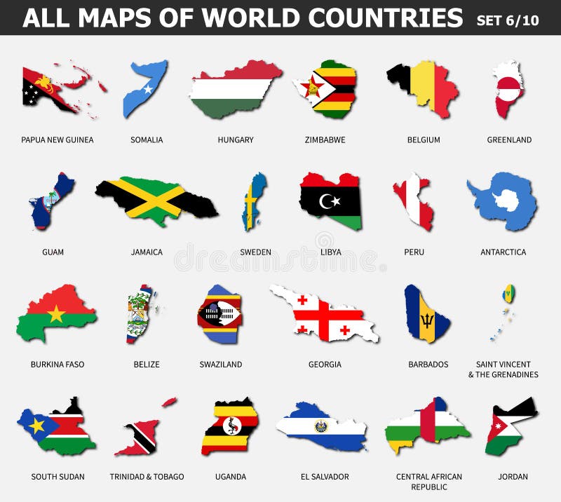
Free with trial All maps of world countries and flags. Set 6 of 10. Collection of outline shape of international country map with shadow. Flat. Design. Vector. Grenadines vectors All maps of world countries and flags . Set 6 of 10 . Collection of outline shape of international country map with shadow . Flat. Design . Vector
Free with trial Vector isolated flags of North Americainclude Central America and Caribbean countries. Vector isolated flags of North America continent. Grenadines vectors Vector isolated flags of North Americainclude Central America and Caribbean countries. Vector isolated flags of North America continent
Free with trial Wavy flags of independent Caribbean countries and dependent territories. Officially recognized flag of state on flagpole. Realistic national and political identity. Patriotic vector illustration. Grenadines vectors Wavy flags of Caribbean countries. Wavy flags of independent Caribbean countries and dependent territories. Officially recognized flag of state on flagpole. Wavy flags of independent Caribbean countries and dependent territories. Officially recognized flag of state on flagpole. Realistic national and political identity. Patriotic vector illustration.
Free with trial Saint Vincent and the Grenadines political map with capital Kingstown. Island country in the Lesser Antilles Island arc. English labeling and scaling. Illustration. Grenadines vectors Saint Vincent and the Grenadines Political Map. With capital Kingstown. Island country in the Lesser Antilles Island arc. English labeling and scaling
Free with trial Highly detailed physical map of St Vincent and the Grenadines islands, in vector format, with all the relief forms, regions and big cities. Grenadines vectors St. Vincent and the Grenadines islands highly detailed physical map. Highly detailed physical map of St Vincent and the Grenadines islands, in vector format. Highly detailed physical map of St Vincent and the Grenadines islands, in vector format, with all the relief forms, regions and big cities
Free with trial Saint Vincent and the Grenadines national symbols. Amazona guild. Ingii parrot. Retro styled image. Vector illustration. Grenadines vectors Saint Vincent and the Grenadines national symbols. Amazona guild. Ingii parrot. Retro styled image. Vector illustration
Free with trial Saint Vincent and the Grenadines Map. Black silhouette country map isolated on white background. Black outline on white background. EPS Vector based. Grenadines vectors Saint Vincent and the Grenadines Map. Black silhouette country map isolated on white background. Black outline on white background. EPS Vector based
Free with trial Saint Vincent and the Grenadines map vector. Illustration, scribble sketch Saint Vincent and the Grenadines Islands. Grenadines vectors Saint Vincent and the Grenadines map vector. Illustration, scribble sketch Saint Vincent and the Grenadines Islands
Free with trial Mosaic boat icon and rubber stamp seal with Grenadines text. Mosaic vector is formed with boat icon and with random spheric spots. Grenadines stamp seal uses blue color, and distress design. Grenadines vectors Mosaic Boat Icon with Scratched Grenadines Stamp. Mosaic boat icon and rubber stamp seal with Grenadines text. Mosaic vector is formed with boat icon and with. Mosaic boat icon and rubber stamp seal with Grenadines text. Mosaic vector is formed with boat icon and with random spheric spots. Grenadines stamp seal uses blue color, and distress design.
Free with trial Saint Vincent and the Grenadines map, Caribbean island country. Grenadines vectors Saint Vincent and the Grenadines map. Caribbean island country
Free with trial Saint Vincent`s & Grenadines map outline vector illustration. Isolated on white background. Grenadines vectors Saint Vincent`s & Grenadines map outline vector illustration. Isolated on white background
Free with trial Saint Vincent`s & Grenadines map silhouette vector illustration. Isolated on white background. Grenadines vectors Saint Vincent`s & Grenadines map silhouette vector illustration. Isolated on white background
Free with trial Set of world flags rectangle buttons East Timor. Marshall Islands. Laos. Georgia. Saint Vincent and the Grenadines. Somalia. Yemen. China. Togo. Grenadines vectors Set of world flags rectangle buttons East Timor . Marshall Islands . Laos . Georgia . Saint Vincent and the Grenadines . Somalia. Yemen . China . Togo
Free with trial Saint Vincent and the Grenadines Flag - Vector Illustration. Grenadines vectors Saint Vincent and the Grenadines Flag. Vector Illustration
Free with trial Congratulatory design for October 27, Saint Vincent and the Grenadines Independence Day. Text made of bended ribbons with national flag colors. Vector illustration. Grenadines vectors October 27, Saint Vincent and the Grenadines Independence Day congratulatory design with national flag colors. Vector illustration. Congratulatory design for. Congratulatory design for October 27, Saint Vincent and the Grenadines Independence Day. Text made of bended ribbons with national flag colors. Vector illustration
Free with trial Saint Vincent and the Grenadines waving flag on flagpole vector illustration. Yellow green blue stripes of Saint Vincent and the Grenadines wavy realistic flag as a symbol of country. Grenadines vectors Saint Vincent and the Grenadines waving flag on flagpole vector illustration. Yellow green blue stripes of Saint Vincent and the Grenadines wavy realistic flag
Free with trial Flag of Saint Vincent and the Grenadines. Vector illustration on white background. Beautiful brush strokes. Abstract concept. Elements for design. Grenadines vectors Flag of Saint Vincent and the Grenadines. Vector illustration on white background. Beautiful brush strokes. Abstract concept. Elements for design
Free with trial National Flag St. Vincent and the Grenadines. Detailed Illustration National Flag St. Grenadines vectors National Flag St. Vincent and the Grenadines. Detailed Illustration National Flag St. Vincent and the Grenadines
Free with trial Saint Vincent and Grenadines national flag. Vector illustration. Kingstown. Vector flag of Saint Vincent and Grenadines. Eps 10 Vector illustration. Grenadines vectors Saint Vincent and Grenadines national flag. Vector illustration. Kingstown. Vector flag of Saint Vincent and Grenadines. Eps 10 Vector illustration. Kingstown
Free with trial Saint Vincent the Grenadines map infographic elements with separate of heading is total areas, Currency, All populations, Language and the capital city in this country. Vector illustration. Grenadines vectors Saint Vincent the Grenadines map infographic elements with separate of heading is total areas, Currency, All populations, Language. And the capital city in this. Saint Vincent the Grenadines map infographic elements with separate of heading is total areas, Currency, All populations, Language and the capital city in this country. Vector illustration
Free with trial High detailed vector flag of st vincent and the grenadines. In vector. Grenadines vectors High detailed vector flag of st vincent and the grenadines. In vector
Free with trial Saint Vincent and the Grenadines Flag Vector Illustration on White Background. Saint Vincent and the Grenadines National Flag. Grenadines vectors Saint Vincent and the Grenadines Flag Vector Illustration on White Background. National Flag. Saint Vincent and the Grenadines Flag Vector Illustration on White. Saint Vincent and the Grenadines Flag Vector Illustration on White Background. Saint Vincent and the Grenadines National Flag
Free with trial Vector sketch map of Saint Vincent and the Grenadines with flag, hand drawn chalk illustration. Grunge design. Grenadines vectors Saint Vincent and the Grenadines vector map with flag inside isolated on a white background. Sketch chalk hand drawn illustration. Vector sketch map of Saint. Vector sketch map of Saint Vincent and the Grenadines with flag, hand drawn chalk illustration. Grunge design
Free with trial Saint Vincent And The Grenadines flag patriotic seamless pattern. National flag in the shape of heart. Vector illustration. Grenadines vectors Saint Vincent And The Grenadines flag patriotic. Saint Vincent And The Grenadines flag patriotic seamless pattern. National flag in the shape of heart. Vector. Saint Vincent And The Grenadines flag patriotic seamless pattern. National flag in the shape of heart. Vector illustration.
Free with trial National flag of the Saint Vincent and the Grenadines in the shape of a heart and the inscription I love Saint Vincent and the Grenadines. Vector illustration. Grenadines vectors National flag of the Saint Vincent and the Grenadines in the shape of a heart and the inscription I love Saint Vincent. And the Grenadines. Vector illustration
Free with trial National flag of the Saint Vincent and the Grenadines in the shape of a heart and the inscription I love Saint Vincent and the Grenadines. Vector illustration. Grenadines vectors National flag of the Saint Vincent and the Grenadines in the shape of a heart and the inscription I love Saint Vincent. And the Grenadines. Vector illustration
Free with trial National flag of the Saint Vincent and the Grenadines in the shape of a heart and the inscription I love Saint Vincent and the Grenadines. Vector illustration. Grenadines vectors National flag of the Saint Vincent and the Grenadines in the shape of a heart and the inscription I love Saint Vincent. And the Grenadines. Vector illustration
Free with trial Windward Islands, gray political map. Islands of Lesser Antilles, south of Leeward Islands in the Caribbean Sea. From Dominica, Martinique, Saint Lucia, Saint Vincent and the Grenadines, to Grenada. Grenadines vectors Windward Islands, gray political map, islands in the Caribbean Sea. Windward Islands, gray political map. Islands of Lesser Antilles, south of Leeward Islands in. Windward Islands, gray political map. Islands of Lesser Antilles, south of Leeward Islands in the Caribbean Sea. From Dominica, Martinique, Saint Lucia, Saint Vincent and the Grenadines, to Grenada.
Free with trial Hurricane free Caribbean islands, political map. The Leeward Antilles and Windward Islands are safest from Hurricanes. Aruba, Barbados, Bonaire, Curacao, Grenada, The Grenadines, Trinidad and Tobago. Grenadines vectors Hurricane free Caribbean islands, map of Leeward Antilles and Windward Islands. Hurricane free Caribbean islands, political map. The Leeward Antilles and. Hurricane free Caribbean islands, political map. The Leeward Antilles and Windward Islands are safest from Hurricanes. Aruba, Barbados, Bonaire, Curacao, Grenada, The Grenadines, Trinidad and Tobago.
Free with trial Hurricane free Caribbean islands, gray political map. Leeward Antilles and Windward Islands are safest from hurricanes. Aruba, Barbados, Bonaire, Curacao, Grenada, The Grenadines, Trinidad and Tobago. Grenadines vectors Hurricane free Caribbean islands, gray map of Leeward Antilles and Windward Islands. Hurricane free Caribbean islands, gray political map. Leeward Antilles and. Hurricane free Caribbean islands, gray political map. Leeward Antilles and Windward Islands are safest from hurricanes. Aruba, Barbados, Bonaire, Curacao, Grenada, The Grenadines, Trinidad and Tobago.
Free with trial Barbados, Grenada, Saint Lucia, Saint Vincent and the Grenadines political map. Caribbean islands, part of Lesser Antilles and Windward Islands. Gray illustration over white. English labeling. Vector. Grenadines vectors Barbados, Grenada, Saint Lucia, Saint Vincent political map. Barbados, Grenada, Saint Lucia, Saint Vincent and the Grenadines political map. Caribbean islands. Barbados, Grenada, Saint Lucia, Saint Vincent and the Grenadines political map. Caribbean islands, part of Lesser Antilles and Windward Islands. Gray illustration over white. English labeling. Vector.
Free with trial Windward Islands political map. Islands of the Lesser Antilles, south of the Leeward Islands in the Caribbean Sea. From Dominica, Martinique, Saint Lucia, Saint Vincent and the Grenadines, to Grenada. Grenadines vectors Windward Islands, political map, islands of Lesser Antilles in the Caribbean. Windward Islands political map. Islands of the Lesser Antilles, south of the. Windward Islands political map. Islands of the Lesser Antilles, south of the Leeward Islands in the Caribbean Sea. From Dominica, Martinique, Saint Lucia, Saint Vincent and the Grenadines, to Grenada.
Free with trial National emblem or symbol. Symbol ofSaint Vincent and the Grenadines. National emblem. Grenadines vectors National emblem or symbol. Symbol ofSaint Vincent and the Grenadines . National emblem
Free with trial Saint Vincent and the Grenadines flag and outline of the country on a white background. Grenadines vectors Saint Vincent and the Grenadines flag and contour of the country. Saint Vincent and the Grenadines flag and outline of the country on a white background. Saint Vincent and the Grenadines flag and outline of the country on a white background.
Free with trial ALBA, member countries info map. Bolivarian Alliance for the Peoples of Our America, an intergovernmental organization and integration platform for the countries of Latin America and the Caribbean. Grenadines vectors ALBA, member countries info map. Bolivarian Alliance for the Peoples of Our America, an intergovernmental organization and integration platform for the
Free with trial South America Background with Globe Icon 3D illustration, Glossy, Shiny Sphere with Global Map in Subtle Blues giving a transparent feel. Grenadines vectors South America Background with Globe Icon 3D illustration, Glossy. Shiny Sphere with Global Map in Subtle Blues giving a transparent feel
Free with trial Grenada political map with capital St George`s. Caribbean islands country and part of the Lesser Antilles and Windward Islands. Gray illustration isolated on white background. English labeling. Vector. Grenadines vectors Grenada political map. With capital St George`s. Caribbean islands country and part of the Lesser Antilles and Windward Islands. Gray illustration isolated on. Grenada political map with capital St George`s. Caribbean islands country and part of the Lesser Antilles and Windward Islands. Gray illustration isolated on white background. English labeling. Vector
Free with trial South America Global World, Planet Earth with Africa. Vector Map Icon of the World Globe South America Global World, Planet Earth. Grenadines vectors South America Global World, Planet Earth with Africa. Vector Map Icon of the World Globe South America Global World, Planet Earth
Free with trial Eastern Caribbean islands, gray political map. Puerto Rico, Virgin Islands, Leeward and Windward Islands, and part of the Leeward Antilles north the coast of Venezuela, located in the Caribbean Sea. Grenadines vectors Eastern Caribbean islands, Leeward and Windward Islands, gray political map. Eastern Caribbean islands, gray political map. Puerto Rico, Virgin Islands, Leeward. Eastern Caribbean islands, gray political map. Puerto Rico, Virgin Islands, Leeward and Windward Islands, and part of the Leeward Antilles north the coast of Venezuela, located in the Caribbean Sea.
Free with trial Cosmetic product background. Night skin care beauty brand cream realistic 3D lotion container. Vector cosmetic promotion. 3D poster template. Grenadines vectors Cosmetic product background. Night skin care beauty brand cream realistic 3D lotion container. Vector cosmetic promotion. 3D poster template
Free with trial Realistic balloons. 3D holiday party elements for invitation cards and banners, decoration design templates. Vector birthday set red blue gold white on transparent background. Grenadines vectors Realistic balloons. 3D holiday party elements for invitation cards and banners, decoration design templates. Vector. Birthday set red blue gold white on
Free with trial Association of Caribbean States map. Grenadines vectors Association of Caribbean States map.
Free with trial Fresh pomegranate. Isolated on white. EPS10 vector. Grenadines vectors Fresh pomegranate. Isolated on white. EPS10 vector
Free with trial Saint Vincent map in gray on a white background. Grenadines vectors Saint Vincent map in gray on a white background
Free with trial Pomegranate. Background with pomegranate. Pomegranate with ribbon. EPS10 vector. Grenadines vectors Pomegranate. Background with pomegranate. Pomegranate with ribbon. EPS10 vector
Free with trial Mustique map. Island silhouette icon. Isolated Mustique black map outline. Vector illustration. Grenadines vectors Mustique map. Island silhouette icon. Isolated Mustique black map outline. Vector illustration
Free with trial Bequia map. Map of the island with beautiful geometric waves in red blue colors. Vivid Bequia shape. Vector illustration. Grenadines vectors Bequia map. Map of the island with beautiful geometric waves in red blue colors. Vivid Bequia shape. Vector illustration
Free with trial Hand drawing. Illustration of fruits and fruit fairy. Seamless pattern. Grenadines vectors Hand drawing. Illustration of fruits and fruit fairy. Seamless pattern. Hand drawing. Illustration of fruits and fruit fairy. Seamless pattern
Free with trial Bequia map. Island silhouette icon. Isolated Bequia black map outline. Vector illustration. Grenadines vectors Bequia map. Island silhouette icon. Isolated Bequia black map outline. Vector illustration
Free with trial Union Island map. Island silhouette icon. Isolated Union Island black map outline. Vector illustration. Grenadines vectors Union Island map. Island silhouette icon. Isolated Union Island black map outline. Vector illustration
Free with trial Fresh pomegranate. Isolated on white. EPS10 vector. Grenadines vectors Fresh pomegranate. Isolated on white. EPS10 vector
Free with trial Vector illustration of map of Caribbean Sea with part of USA, Mexico and islands of Cuba, Puerto Rico and Antilles. Grenadines vectors Vector illustration of map of Caribbean Sea with part of USA, Mexico and Cuba, Puerto Rico and Antilles islands. Vector illustration of map of Caribbean Sea with. Vector illustration of map of Caribbean Sea with part of USA, Mexico and islands of Cuba, Puerto Rico and Antilles
 Sign in