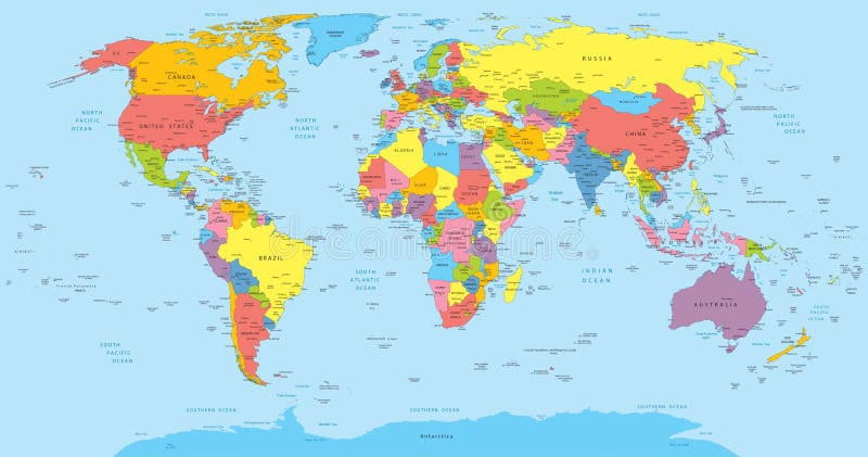
Free with trial Continents World map - colorful. Colorful continents world map illustration. Africa , Australia ,America , Asia. Islands vectors Continents World map - colorful. Colorful continents world map illustration. Africa , Australia ,America , Asia
Free with trial Highly detailed physical map of the world,in vector format,with all the relief forms,countries and big cities. Islands vectors Physical map of the world. Highly detailed physical map of the world,in vector format,with all the relief forms,countries and big cities. Highly detailed physical map of the world,in vector format,with all the relief forms,countries and big cities.
Free with trial Vector illustration of a High Detail Political Map of the world with different colors for each country. Each country has its capital and major cities. All seas and major lakes are named. Global colors used. All elements are separated in editable layers. Islands vectors World map with countries, country and city names. Vector illustration of a High Detail Political Map of the world with different colors for each country. Each. Vector illustration of a High Detail Political Map of the world with different colors for each country. Each country has its capital and major cities. All seas and major lakes are named. Global colors used. All elements are separated in editable layers.
Free with trial Canary islands vector map. Vector illustration of map of canary islands in the atlantic ocean, with all the names of the islands. Islands vectors Canary islands vector map. Vector illustration of map of canary islands in the atlantic ocean, with all the names of the islands
Free with trial Galapagos islands map vector. Vector illustration of map of galapagos islands in ecuador. Islands vectors Galapagos islands map vector. Vector illustration of map of galapagos islands in ecuador
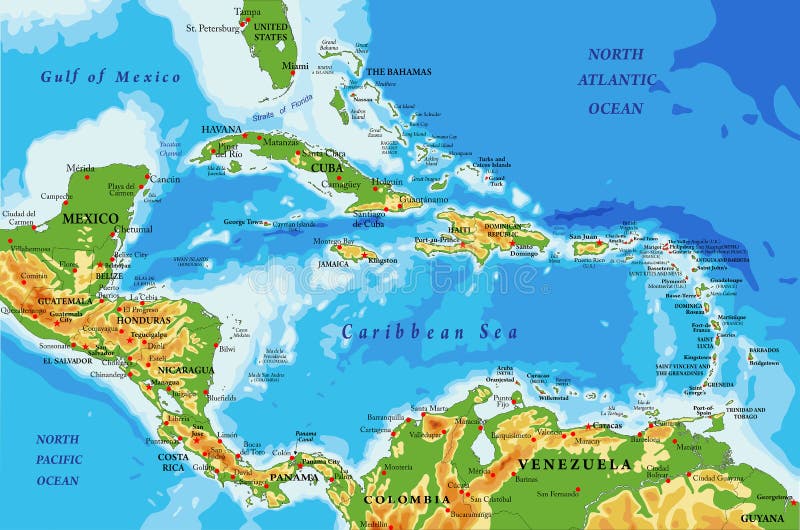
Free with trial Highly detailed physical map of Central America and Caribbean Islands,in vector format,with all the relief forms,regions and big cities. Islands vectors Central America and Caribbean Islands physical map. Highly detailed physical map of Central America and Caribbean Islands,in vector format,with all the relief. Highly detailed physical map of Central America and Caribbean Islands,in vector format,with all the relief forms,regions and big cities.
Free with trial Ecuador and Galapagos Islands political map with capital Quito, with national borders, most important cities, rivers and lakes. Illustration with English labeling and scaling. Vector. Islands vectors Ecuador and Galapagos Islands Political Map. With capital Quito, with national borders, most important cities, rivers and lakes. Illustration with English. Ecuador and Galapagos Islands political map with capital Quito, with national borders, most important cities, rivers and lakes. Illustration with English labeling and scaling. Vector.
Free with trial Detailed Physical World Map with all names of countries, cities and capitals, river, lake, oceans, seas, islands, South Pole and North Pole. Islands vectors World Map Detailed Physical Map. Detailed Physical World Map with all names of countries, cities and capitals, river, lake, oceans, seas, islands, South Pole and. Detailed Physical World Map with all names of countries, cities and capitals, river, lake, oceans, seas, islands, South Pole and North Pole
Free with trial Hawaii grunge rubber stamp. Black grunge rubber stamp with the name of Hawaii islands written inside the stamp. Islands vectors Hawaii grunge rubber stamp. Black grunge rubber stamp with the name of Hawaii islands written inside the stamp
Free with trial Vectored illustration of standing penguin, a symbolic animal for many countries and territories as antarctica, falkland islands and southern chile. Islands vectors Penguin vector silhouette. Vectored illustration of standing penguin, a symbolic animal for many countries and territories as antarctica, falkland islands and. Vectored illustration of standing penguin, a symbolic animal for many countries and territories as antarctica, falkland islands and southern chile.
Free with trial Hawaii State map. Hawaii state vector map all islands. Islands vectors Hawaii State map. Hawaii state vector map all islands
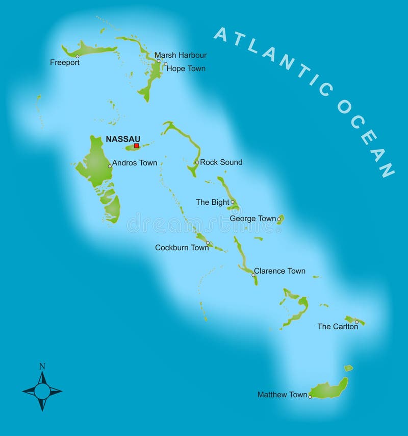
Free with trial A stylized map showing the islands of Bahamas as well as severel cities. Islands vectors Map of the Bahamas. A stylized map showing the islands of Bahamas as well as severel cities. A stylized map showing the islands of Bahamas as well as severel cities.
Free with trial Tropical sea landscape, black silhouettes islands with palm trees and flowers, clouds, sky with clouds, sun and birds gulls. Eps10, contains transparencies. Vector. Islands vectors Tropical islands, palms, sky and birds. Tropical sea landscape, black silhouettes islands with palm trees and flowers, clouds, sky with clouds, sun and birds. Tropical sea landscape, black silhouettes islands with palm trees and flowers, clouds, sky with clouds, sun and birds gulls. Eps10, contains transparencies. Vector
Free with trial Hawaii stamp. Blue grunge rubber stamp with the palms shape and the name of Hawaii islands written inside the stamp. Islands vectors Hawaii stamp. Blue grunge rubber stamp with the palms shape and the name of Hawaii islands written inside the stamp
Free with trial Mexico map designed in illustration with states colored in bright colors and with the main cities. Neighbouring countries are in an additional format (. AI) in the latent layer. Islands vectors Mexico map. Designed in illustration with states colored in bright colors and with the main cities. Neighbouring countries are in an additional format (.AI) in
Free with trial South America. Vector map of america and illustration. Islands vectors South America. Vector map of america and illustration
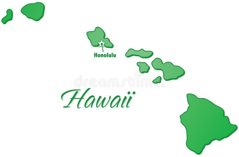
Free with trial An outlined illustration of the state of Hawaii. Islands vectors State of Hawaii Outline. An outlined illustration of the state of Hawaii. An outlined illustration of the state of Hawaii.
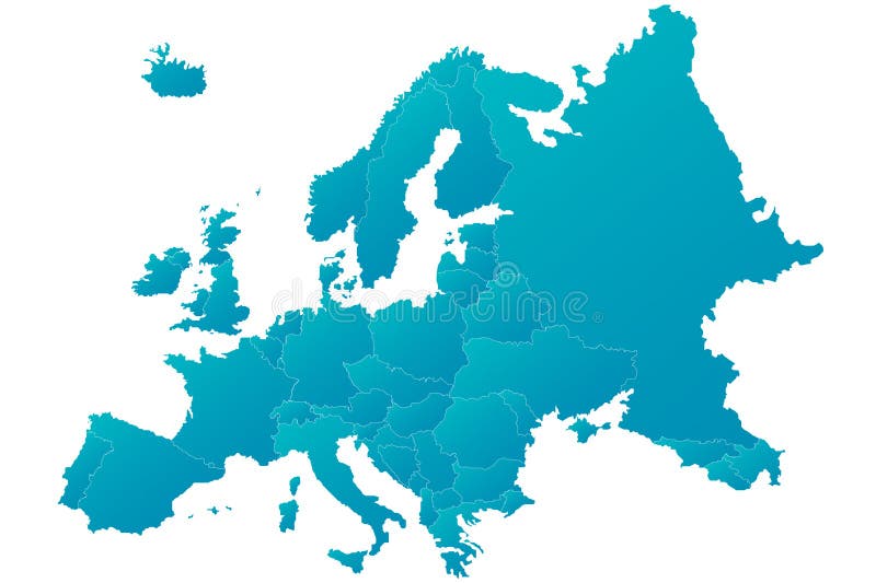
Free with trial Europe map highly detailed blue vector. Highly detailed blue Europe map with separated countries. Blue gradient with isolated background. Islands vectors Europe map highly detailed blue vector. Highly detailed blue Europe map with separated countries. Blue gradient with isolated background
Free with trial World Map. With all the continents Asia, Africa, America, Australia, Europe. Islands vectors World Map. With all the continents Asia, Africa, America, Australia, Europe
Free with trial Sicily map. Illustration of the map of Sicily with its main cities, rivers, mountains and archaeological sites. Islands vectors Sicily map. Illustration of the map of Sicily with its main cities, rivers, mountains and archaeological sites
Free with trial Jamaica map. Illustration of a detailed political map of Jamaica, with its main cities, mountains and rivers. Islands vectors Jamaica map. Illustration of a detailed political map of Jamaica, with its main cities, mountains and rivers
Free with trial An illustration of the state of Hawaii. Islands vectors State of Hawaii. An illustration of the state of Hawaii. An illustration of the state of Hawaii.
Free with trial Illustration of a detailed political map of New Zealand. Islands vectors New Zealand map. Illustration of a detailed political map of New Zealand. Illustration of a detailed political map of New Zealand.
Free with trial Oceania outline map. Vector illustration of oceania as blank map with borders of states. Islands vectors Oceania outline map. Vector illustration of oceania as blank map with borders of states
Free with trial Summer sunrise with palms. Illustration of sunrise on the beach with palms and birds, could be also sunset. Vector file available. Islands vectors Summer sunrise with palms. Illustration of sunrise on the beach with palms and birds, could be also sunset. Vector file available
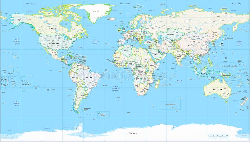
Free with trial Detailed Political World Map with all names of countries, cities and capitals, river, lake, oceans, seas, islands, South Pole and North Pole. Islands vectors World Map Detailed Political Map. Detailed Political World Map with all names of countries, cities and capitals, river, lake, oceans, seas, islands, South Pole. Detailed Political World Map with all names of countries, cities and capitals, river, lake, oceans, seas, islands, South Pole and North Pole
Free with trial Frangipani. Element for design illustration. Islands vectors Frangipani. Element for design illustration
Free with trial Vector illustration of typical exotic beach at sunset in summer, with palms and sea, perfect for tropical and seaside generic holiday destinations. Islands vectors Exotic beach travel destination. Vector illustration of typical exotic beach at sunset in summer, with palms and sea, perfect for tropical and seaside generic. Vector illustration of typical exotic beach at sunset in summer, with palms and sea, perfect for tropical and seaside generic holiday destinations
Free with trial Hibiscus flower. Contains transparent objects. EPS10. Islands vectors Hibiscus flower. Contains transparent objects. EPS10
Free with trial Surfer on a beach - vector illustration. Islands vectors Surfer on a beach. Vector illustration
Free with trial Green earth globe. Green planet earth showing a green globe with drop shadow. Islands vectors Green earth globe. Green planet earth showing a green globe with drop shadow
Free with trial Vector map of Africa with present political borders. Islands vectors Africa vector map. Vector map of Africa with present political borders. Vector map of Africa with present political borders.
Free with trial World map highly detailed green vector. Highly detailed world map with green gradient isolated background. Islands vectors World map highly detailed green vector. Highly detailed world map with green gradient isolated background
Free with trial World Map. With all the continents Asia, Africa, America, Australia, Europe. Islands vectors World Map. With all the continents Asia, Africa, America, Australia, Europe
Free with trial World logo. Business vector,illustration. Islands vectors World logo. Business vector,illustration
Free with trial Antarctica Political Map with south pole, scientific research stations and ice shelfs. English labeling and scaling. Illustration. Islands vectors Antarctica Political Map. With south pole, scientific research stations and ice shelfs. English labeling and scaling. Illustration
Free with trial Vector map of North and Central America Continent with Countries, Capitals, Main Cities and Seas and islands names in strong brilliant colors. Islands vectors Colorful Vector map of North and Central America. Vector map of North and Central America Continent with Countries, Capitals, Main Cities and Seas and islands. Vector map of North and Central America Continent with Countries, Capitals, Main Cities and Seas and islands names in strong brilliant colors.
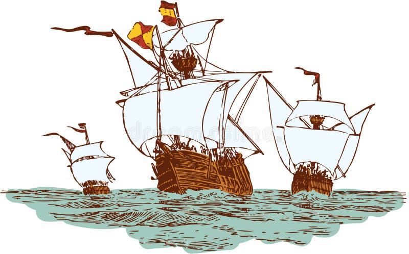
Free with trial Christopher Columbus ships. Three ship of Christopher Columbus float to America. Islands vectors Christopher Columbus ships. Three ship of Christopher Columbus float to America
Free with trial Vector Illustration of a Seamless Hawaiian Wedding Pattern. Tile can be dragged and dropped into Illustrator's swatches palette. Islands vectors Seamless Hawaiian Wedding Pattern. Vector Illustration of a Seamless Hawaiian Wedding Pattern. Tile can be dragged and dropped into Illustrator's swatches. Vector Illustration of a Seamless Hawaiian Wedding Pattern. Tile can be dragged and dropped into Illustrator's swatches palette.
Free with trial Set of four summer tropical banners isolated on white background. These banners depict different times of day: dawn, day, evening and night. EPS file available. Islands vectors Summer tropical banners. Set of four summer tropical banners isolated on white background.These banners depict different times of day: dawn, day, evening and. Set of four summer tropical banners isolated on white background.These banners depict different times of day: dawn, day, evening and night.EPS file available
Free with trial Hawaiian Floral seamless. Texture pattern. Islands vectors Hawaiian Floral seamless. Texture pattern
Free with trial Detailed vector shape of the Unites States of America including Alaska and Hawaii. This illustration is based on the maps of www. cia. gov. The states borders are on the separate layer and can be easily removed. Islands vectors USA shape. Detailed vector shape of the Unites States of America including Alaska and Hawaii. This illustration is based on the maps of . The states. Detailed vector shape of the Unites States of America including Alaska and Hawaii. This illustration is based on the maps of www.cia.gov. The states borders are on the separate layer and can be easily removed.
Free with trial Map of uk. Detailed map of the united kingdom. Islands vectors Map of uk. Detailed map of the united kingdom
Free with trial Beach bar. Cocktail bar with glass and bottles on the beach. Islands vectors Beach bar. Cocktail bar with glass and bottles on the beach
Free with trial Frangipani. Element for design illustration. Islands vectors Frangipani. Element for design illustration
Free with trial Colorful Surfing icons with integrated palm trees. Islands vectors Surf Icons. Colorful Surfing icons with integrated palm trees. Colorful Surfing icons with integrated palm trees.
Free with trial Highly detailed vector map of Oceania with countries and main cities. Islands vectors Oceania map. Highly detailed vector map of Oceania with countries and main cities. Highly detailed vector map of Oceania with countries and main cities.
Free with trial Surf boards. With colorful landscapes. Islands vectors Surf boards. With colorful landscapes
Free with trial Globe. This image is a vector illustration Globe. Islands vectors Globe. This image is a vector illustration Globe
Free with trial Detailed Scotland illustrated geographical map. Islands vectors Scotland map. Detailed Scotland illustrated geographical map. Detailed Scotland illustrated geographical map.
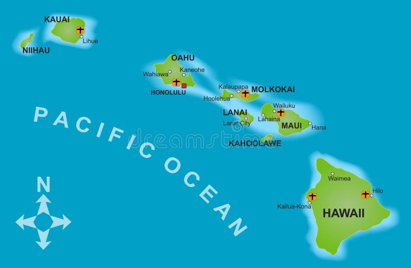
Free with trial A stylized map of the island of Hawaii and all adjacent islands. Islands vectors Map of Hawaii. A stylized map of the island of Hawaii and all adjacent islands. A stylized map of the island of Hawaii and all adjacent islands.
Free with trial Map and globe. Colored globe, map and dot map kit. Additional format Eps8 (very easy editable separate layers. Islands vectors Map and globe. Colored globe, map and dot map kit. Additional format Eps8 (very easy editable separate layers
Free with trial South america 01. A full color map of south america with the country names called out. Islands vectors South america 01. A full color map of south america with the country names called out
Free with trial World map vector. Vector illustration. Islands vectors World map vector. Vector illustration
Free with trial World map highly detailed blue vector. Highly detailed world map with blue gradient isolated background goes with. ai file. Islands vectors World map highly detailed blue vector. Highly detailed world map with blue gradient isolated background goes with . ai file
Free with trial Brazilmap designed in illustration with states colored in green colors and with the main cities. Neighbouring countries are in an additional format (. AI) in the latent layer. Islands vectors Brazil. Map designed in illustration with states colored in green colors and with the main cities. Neighbouring countries are in an additional format (. AI) in
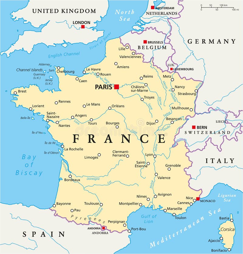
Free with trial France Political Map with capital Paris, national borders, most important cities and rivers. English labeling and scaling. Illustration. Islands vectors France Political Map. With capital Paris, national borders, most important cities and rivers. English labeling and scaling. Illustration
Free with trial Tropical ocean coast. Vector illustration - Sunrise on the tropical ocean coast. Grunge style. Islands vectors Tropical ocean coast. Vector illustration - Sunrise on the tropical ocean coast. Grunge style
Free with trial Vector passport stamp. Nice collection of different vector passport stamp. Islands vectors Vector passport stamp. Nice collection of different vector passport stamp
Free with trial Vecrot globe icon set. On white background. Islands vectors Vecrot globe icon set. On white background
Free with trial Tropical surfing emblem. Painting on a wood board. Islands vectors Tropical surfing emblem. Painting on a wood board
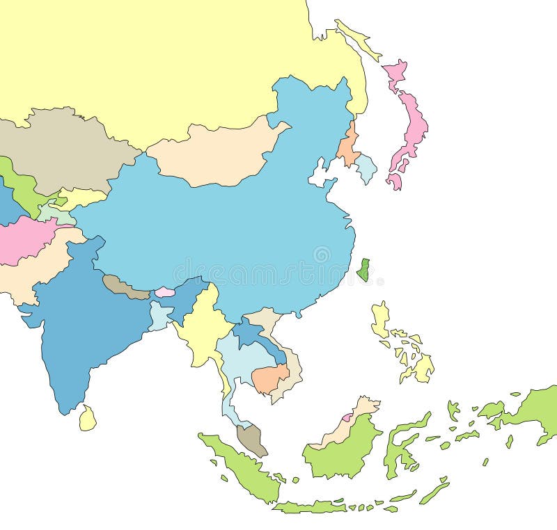
Free with trial Illustrated Map of Asia. Illustration of map of Asia with borders. Islands vectors Illustrated Map of Asia. Illustration of map of Asia with borders
Free with trial Hawaiian necklace flowers. Frangipani (Plumeria). Hawaii, Bali (Indonesia), Shri-Lanka tropical necklace flowers. Vector Illustration. Islands vectors Hawaiian necklace flowers. Frangipani (Plumeria). Hawaii, Bali (Indonesia), Shri-Lanka tropical necklace flowers. Vector Illustration
Free with trial Vector tropical background with hand drawn beach slippers. Islands vectors Vector tropical background. With hand drawn beach slippers
Free with trial Vector tropical surfing vintage emblem painting on a wood board. Islands vectors Tropical surf vintage emblem. Vector tropical surfing vintage emblem painting on a wood board. Vector tropical surfing vintage emblem painting on a wood board.
Free with trial Colorful continents world map illustration. Abstract background. [America, Europe, asia, Africa, Australia]. Islands vectors World map - colorful continents. Colorful continents world map illustration. Abstract background. [America, Europe, asia, Africa, Australia. Colorful continents world map illustration. Abstract background. [America, Europe, asia, Africa, Australia]
Free with trial Frangipani flowers, surfboards and banner on a wooden wall. Islands vectors Flowers, surfboards and banner. Frangipani flowers, surfboards and banner on a wooden wall. Frangipani flowers, surfboards and banner on a wooden wall.
Free with trial Travel stamps set Caribbean Sea. Theme. Islands vectors Travel stamps set Caribbean Sea. Theme
Free with trial Tropical flowers seamless pattern. Frangipani (Plumeria) tropical flowers. Seamless pattern background. Vector illustration. Islands vectors Tropical flowers seamless pattern. Frangipani (Plumeria) tropical flowers. Seamless pattern background. Vector illustration
Free with trial Vector red map of Canada with state boundaries, isolated on white background. Islands vectors Canada Map (separable by province). Vector red map of Canada with state boundaries, isolated on white background. Vector red map of Canada with state boundaries, isolated on white background.
Free with trial Beach scene graphic. Palms on an island. Islands vectors Tropical logo (Beach scene graphic.). Beach scene graphic. Palms on an island. Beach scene graphic. Palms on an island.
Free with trial Region of lands around the Mediterranean Sea. South Europe, North Africa and Near East with capitals, national borders, rivers and lakes. English labeling and scaling. Illustration. Islands vectors Mediterranean Sea Region Political Map. Region of lands around the Mediterranean Sea. South Europe, North Africa and Near East with capitals, national borders. Region of lands around the Mediterranean Sea. South Europe, North Africa and Near East with capitals, national borders, rivers and lakes. English labeling and scaling. Illustration.
Free with trial Illustration of a seamless Hibiscus Royale pattern tile. Tile can be dragged and dropped into Illustrator's swatches palette. Islands vectors Seamless Hawaiian Royale Border/Pattern. Illustration of a seamless Hibiscus Royale pattern tile. Tile can be dragged and dropped into Illustrator's swatches. Illustration of a seamless Hibiscus Royale pattern tile. Tile can be dragged and dropped into Illustrator's swatches palette.
Free with trial Political map of the Caribbean - Large and Lesser Antilles - with their capitals, national borders, rivers and lakes. Vector illustration with english labeling and scale. Islands vectors Large And Lesser Antilles Political Map. Political map of the Caribbean - Large and Lesser Antilles - with their capitals, national borders, rivers and lakes. Political map of the Caribbean - Large and Lesser Antilles - with their capitals, national borders, rivers and lakes. Vector illustration with english labeling and scale.
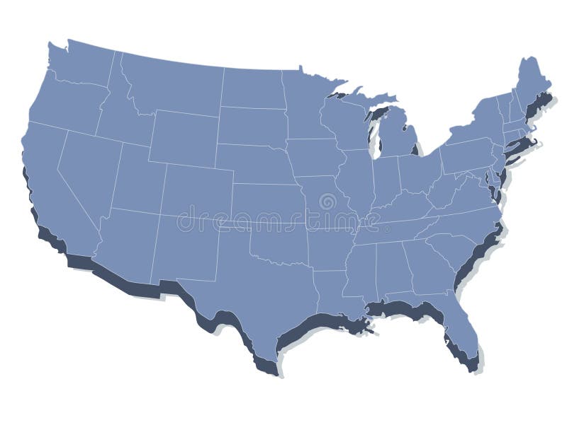
Free with trial Vector map of the united states of america. In 3d view. Islands vectors Vector map of the united states of america. In 3d view
Free with trial Surfboards - two surfboards in tropical flora. Islands vectors Surfboards. Two in tropical flora. Surfboards - two surfboards in tropical flora.
Free with trial Palm trees. 3 different palm trees - top and front view. Islands vectors Palm trees. 3 different palm trees - top and front view
Free with trial United States, Hawaii sunset, ocean and palm trees. Islands vectors Retro style travel poster or sticker. Hawaii. United States, Hawaii sunset, ocean and palm trees. United States, Hawaii sunset, ocean and palm trees.
Free with trial World globe as blue glass ball. Islands vectors World Globe. As blue glass ball. World globe as blue glass ball
 Sign in