Free with trial An illustration of a seal for food packaging offering all natural ingredients. Labeling vectors All Natural Food Seal. An illustration of a seal for food packaging offering all natural ingredients. An illustration of a seal for food packaging offering all natural ingredients.
Free with trial Nutrition Facts Table. Vector Nutrition Facts Table on White. Labeling vectors Nutrition Facts Table. Vector Nutrition Facts Table on White
Free with trial Vertebral column reflexology chart with accurate description of the corresponding internal organs and body parts, and with names and numbers of the vertebras. Labeling vectors Vertebral Column Reflexology Chart. With accurate description of the corresponding internal organs and body parts, and with names and numbers of the vertebras
Free with trial High detailed Australia physical map with labeling. clearly labeled, separated layers, vector illustration. Labeling vectors High detailed Australia physical map with labeling. Clearly labeled, separated layers, vector illustration
Free with trial A set of 24 different colored stickers for special diets and general labeling. Labeling vectors Food Labels. A set of 24 different colored stickers for special diets and general labeling. A set of 24 different colored stickers for special diets and general labeling.
Free with trial Cargo transportation flat line icons. Trucking, express delivery, logistics, shipping, customs clearance, cargoes package, tracking and labeling symbols. Transport thin signs for freight services. Labeling vectors Cargo transportation flat line icons. Trucking, express delivery, logistics, shipping, customs clearance, cargoes. Package, tracking and labeling symbols. Cargo transportation flat line icons. Trucking, express delivery, logistics, shipping, customs clearance, cargoes package, tracking and labeling symbols. Transport thin signs for freight services.
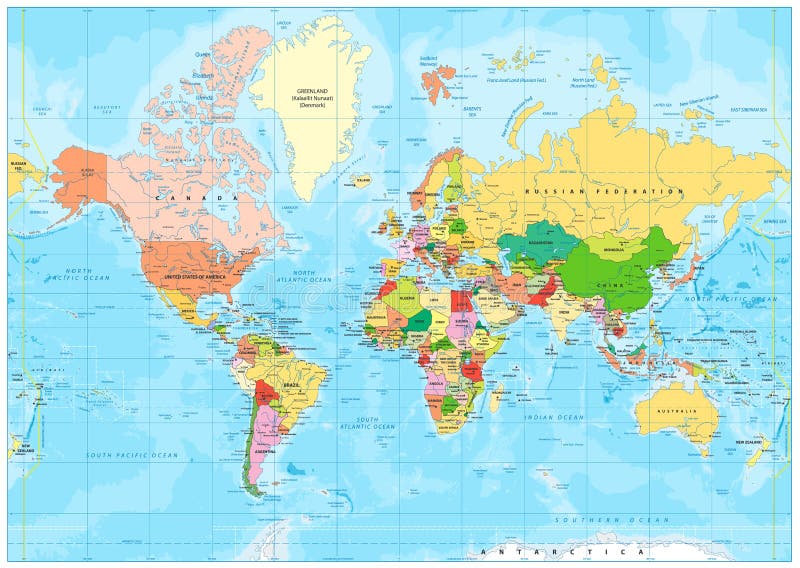
Free with trial Highly detailed political World map with labeling. Vector illustration. Labeling vectors Highly detailed political World map with labeling. Vector illustration
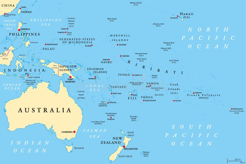
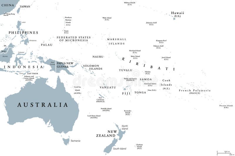
Free with trial Oceania political map. Region, centered on central Pacific Ocean islands. With Melanesia, Micronesia and Polynesia, including Australasia and Malay Archipelago. Illustration. English labeling. Vector. Labeling vectors Oceania political map. Region, centered on central Pacific Ocean islands. With Melanesia, Micronesia and Polynesia, including Australasia and Malay Archipelago
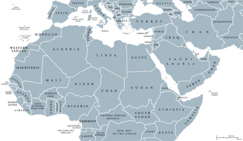
Free with trial North Africa and Middle East political map with countries and borders. English labeling. Maghreb, Mediterranean, West and Central Asian countries. Gray illustration on white background. Vector. Labeling vectors North Africa and Middle East political map. With countries and borders. English labeling. Maghreb, Mediterranean, West and Central Asian countries. Gray. North Africa and Middle East political map with countries and borders. English labeling. Maghreb, Mediterranean, West and Central Asian countries. Gray illustration on white background. Vector.
Free with trial Florida political map with capital Tallahassee, borders, important places, rivers and lakes. State, located in the southeastern region of the United States. Illustration with English labeling. Vector. Labeling vectors Florida political map. With capital Tallahassee, borders, important places, rivers and lakes. State, located in the southeastern region of the United States. Florida political map with capital Tallahassee, borders, important places, rivers and lakes. State, located in the southeastern region of the United States. Illustration with English labeling. Vector.
Free with trial High detailed Africa physical map with labeling, separated layers. Vector illustration. Labeling vectors High detailed Africa physical map with labeling. High detailed Africa physical map with labeling, separated layers. Vector illustration. High detailed Africa physical map with labeling, separated layers. Vector illustration.
Free with trial Europe single states political map. All countries in different colors, with national borders and country names. English labeling and scaling. Illustration on white background. Labeling vectors Europe single states political map. All countries in different colors, with national borders and country names. English labeling and scaling. Illustration on
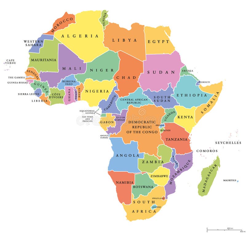
Free with trial Africa single states political map. Each country with its own color area. With national borders on white background. Continent including Madagascar and island nations. English labeling. Labeling vectors Africa single states political map. Each country with its own color area. With national borders on white background. Continent including Madagascar and island
Free with trial A set of three shipping labels for fragile goods. Labeling vectors Fragile Shipping Labels. A set of three shipping labels for fragile goods. A set of three shipping labels for fragile goods.
Free with trial Set of 10 tags with cord. Labeling vectors Tags. Set of 10 tags with cord. Set of 10 tags with cord.
Free with trial Wine label vector illustration. For weddings and parties bottles - also ideal for tags or stickers as well. Labeling vectors Wine label vector illustration. For weddings and parties bottles - also ideal for tags or stickers as well
Free with trial China political map with capital Beijing, national borders, important cities, rivers and lakes. English labeling and scaling. Illustration. Labeling vectors China Political Map. With capital Beijing, national borders, important cities, rivers and lakes. English labeling and scaling. Illustration
Free with trial Antarctica Political Map with south pole, scientific research stations and ice shelfs. English labeling and scaling. Illustration. Labeling vectors Antarctica Political Map. With south pole, scientific research stations and ice shelfs. English labeling and scaling. Illustration
Free with trial Vector symbols set of packing, shipping icons. Labeling vectors Packing symbols. Vector symbols set of packing, shipping icons. Vector symbols set of packing, shipping icons.
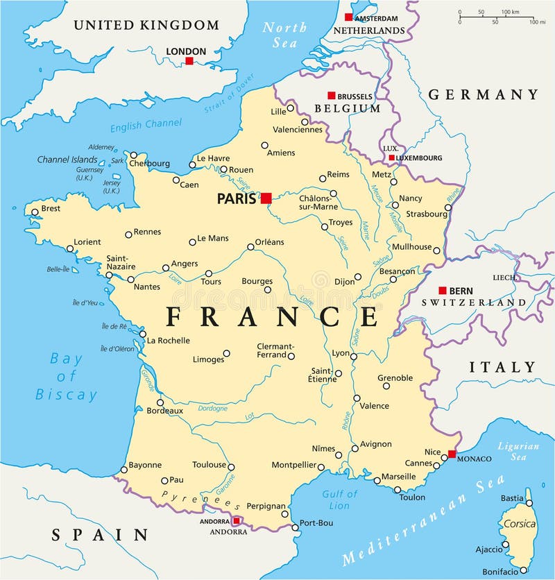
Free with trial France Political Map with capital Paris, national borders, most important cities and rivers. English labeling and scaling. Illustration. Labeling vectors France Political Map. With capital Paris, national borders, most important cities and rivers. English labeling and scaling. Illustration
Free with trial Israel political map with capital Jerusalem, national borders, important cities, rivers and lakes. English labeling and scaling. Illustration. Labeling vectors Israel Political Map. With capital Jerusalem, national borders, important cities, rivers and lakes. English labeling and scaling. Illustration
Free with trial Vertebral column with names and numbers of the vertebras - lateral view - fiery colors. Isolated vector illustration on white background. Labeling vectors Vertebral Column Names Spine. Vertebral column with names and numbers of the vertebras - lateral view - fiery colors. Isolated vector illustration on white. Vertebral column with names and numbers of the vertebras - lateral view - fiery colors. Isolated vector illustration on white background.
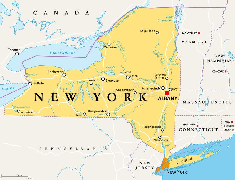
Free with trial New York State NYS, political map, with capital Albany, borders, important cities, rivers and lakes. State in the Northeastern United States of America. English labeling. Illustration. Vector. Labeling vectors New York State NYS, political map. With capital Albany, borders, important cities, rivers and lakes. State in the Northeastern United States of America. New York State NYS, political map, with capital Albany, borders, important cities, rivers and lakes. State in the Northeastern United States of America. English labeling. Illustration. Vector.
Free with trial Seven main chakras beaded along the corresponding body regions of a meditating woman. Vector illustration over white background. English labeling. Labeling vectors Chakras Woman Description English. Seven main chakras beaded along the corresponding body regions of a meditating woman. Vector illustration over white. Seven main chakras beaded along the corresponding body regions of a meditating woman. Vector illustration over white background. English labeling.
Free with trial Region of lands around the Mediterranean Sea. South Europe, North Africa and Near East with capitals, national borders, rivers and lakes. English labeling and scaling. Illustration. Labeling vectors Mediterranean Sea Region Political Map. Region of lands around the Mediterranean Sea. South Europe, North Africa and Near East with capitals, national borders. Region of lands around the Mediterranean Sea. South Europe, North Africa and Near East with capitals, national borders, rivers and lakes. English labeling and scaling. Illustration.
Free with trial Political map of the Caribbean - Large and Lesser Antilles - with their capitals, national borders, rivers and lakes. Vector illustration with english labeling and scale. Labeling vectors Large And Lesser Antilles Political Map. Political map of the Caribbean - Large and Lesser Antilles - with their capitals, national borders, rivers and lakes. Political map of the Caribbean - Large and Lesser Antilles - with their capitals, national borders, rivers and lakes. Vector illustration with english labeling and scale.
Free with trial Infographic Elements. Big chart set icon. ,cartoon vector illustration. Labeling vectors Infographic Elements.Big chart set icon. Cartoon vector illustration
Free with trial Real Estate Icons. Set of 16 real estate icons great for presentations, web design, web apps, mobile applications or any type of design projects. Labeling vectors Real Estate Icons. Set of 16 real estate icons great for presentations, web design, web apps, mobile applications or any type of design projects
Free with trial Hispaniola Political Map with Haiti and Dominican Republic, located in the Caribbean island group, the Greater Antilles. With capitals, national borders, important cities, rivers and lakes. English labeling and scaling. Illustration. Labeling vectors Hispaniola Political Map with Haiti and Dominican Republic. Located in the Caribbean island group, the Greater Antilles. With capitals, national borders. Hispaniola Political Map with Haiti and Dominican Republic, located in the Caribbean island group, the Greater Antilles. With capitals, national borders, important cities, rivers and lakes. English labeling and scaling. Illustration.
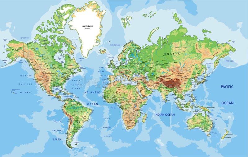
Free with trial Detailed Physical World Map with labeling. Vector illustration. Labeling vectors Detailed Physical World Map. With labeling. Vector illustration
Free with trial Political map of Central America with capitals, national borders, most important rivers and lakes. Vector illustration with english labeling and scale. Labeling vectors Central America Political Map. Political map of Central America with capitals, national borders, most important rivers and lakes. Vector illustration with. Political map of Central America with capitals, national borders, most important rivers and lakes. Vector illustration with english labeling and scale.
Free with trial Globally Harmonized System of Classification and Labeling of Chemicals. Hazard pictograms which are for workplace hazard warnings including the labeling of containers and for the transport of dangerous goods. Labeling vectors Hazardous pictograms - goods signs. Globally Harmonized System of Classification and Labeling of Chemicals. Hazard pictograms which are for workplace hazard. Globally Harmonized System of Classification and Labeling of Chemicals. Hazard pictograms which are for workplace hazard warnings including the labeling of containers and for the transport of dangerous goods.
Free with trial This set contains manufacturing engineering icons that can be used for designing and developing websites, as well as printed materials and presentations. Labeling vectors Manufacturing Engineering Icons - Outline Series. This set contains manufacturing engineering icons that can be used for designing and developing websites, as. This set contains manufacturing engineering icons that can be used for designing and developing websites, as well as printed materials and presentations.
Free with trial Business infographic elements, pie charts, timeline, growing graphs. Labeling vectors Business infographic elements, pie charts, timeline, growing graphs
Free with trial Eco line badge. Natural organic logos, paraben free not tested on animals, cruelty free labels, face skincare vector. Line emblems set. Labeling vectors Eco line badge. Natural organic logos, paraben free not tested on animals, cruelty free labels, face skincare vector. Line emblems set
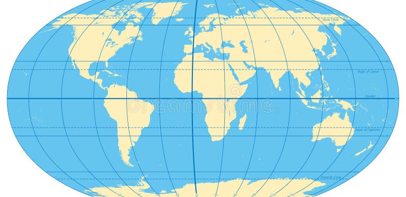
Free with trial World map with most important circles of latitudes and longitudes, showing Equator, Greenwich meridian, Arctic and Antarctic Circle, Tropic of Cancer and Capricorn. English. Illustration. Vector. Labeling vectors World map with most important circles of latitudes and longitudes. Showing Equator, Greenwich meridian, Arctic and Antarctic Circle, Tropic of Cancer and. World map with most important circles of latitudes and longitudes, showing Equator, Greenwich meridian, Arctic and Antarctic Circle, Tropic of Cancer and Capricorn. English. Illustration. Vector.
Free with trial Ecuador and Galapagos Islands political map with capital Quito, with national borders, most important cities, rivers and lakes. Illustration with English labeling and scaling. Vector. Labeling vectors Ecuador and Galapagos Islands Political Map. With capital Quito, with national borders, most important cities, rivers and lakes. Illustration with English. Ecuador and Galapagos Islands political map with capital Quito, with national borders, most important cities, rivers and lakes. Illustration with English labeling and scaling. Vector.
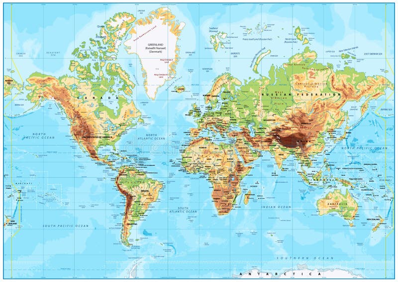
Free with trial Physical World map in Mercator projection with clearly labeled, separated layers. Vector illustration. Labeling vectors Highly detailed physical World map with labeling. Vector illustration. Physical World map in Mercator projection with clearly labeled, separated layers. Vector. Physical World map in Mercator projection with clearly labeled, separated layers. Vector illustration.
Free with trial Button with Banner 100% Original. Colored button with banner 100 % Original. Labeling vectors Button with Banner 100% Original. Colored button with banner 100 % Original
Free with trial IT Industry Infographic Elements. Opportunity to Highlight any Country. Vector Illustration EPS 10. Labeling vectors IT Industry Infographic Elements. Opportunity to Highlight any Country. Vector Illustration EPS 10
Free with trial Cloud Service Infographic Elements. Opportunity to Highlight any Country. Vector Illustration EPS 10. Labeling vectors Cloud Service Infographic Elements. Opportunity to Highlight any Country. Vector Illustration EPS 10
Free with trial Map of World. Political map divided to six continents - North America, South America, Africa, Europe, Asia and Australia. Vector illustration in shades of grey with country name labels. Labeling vectors Map of World. Political map divided to six continents - North America, South America, Africa, Europe, Asia and Australia. Vector illustration in shades of grey
Free with trial Human spine with names and numbers of the vertebras - GERMAN LABELING! Isolated vector illustration on white background. Labeling vectors Spine German Labeling. Human spine with names and numbers of the vertebras - GERMAN LABELING! Isolated vector illustration on white background. Human spine with names and numbers of the vertebras - GERMAN LABELING! Isolated vector illustration on white background.
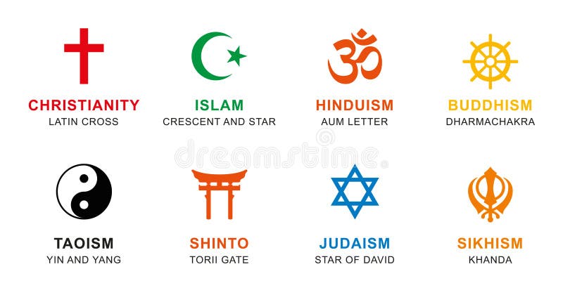
Free with trial World religion symbols colored. Signs of major religious groups and religions. Christianity, Islam, Hinduism, Buddhism, Taoism, Shinto, Sikhism and Judaism, with English labeling. Illustration. Vector. Labeling vectors World religion symbols colored with English labeling. World religion symbols colored. Signs of major religious groups and religions. Christianity, Islam. World religion symbols colored. Signs of major religious groups and religions. Christianity, Islam, Hinduism, Buddhism, Taoism, Shinto, Sikhism and Judaism, with English labeling. Illustration. Vector
Free with trial The Globally Harmonized System of Classification and Labeling of Chemicals vector on white background. Illustration. Labeling vectors The Globally Harmonized System of Classification and Labeling of Chemicals vector on white background. Illustration
Free with trial High detailed Hungary physical map with labeling. Vector illustration. Labeling vectors High detailed Hungary physical map with labeling. Vector illustration
Free with trial High detailed France physical map with labeling. Vector illustration. Labeling vectors High detailed France physical map with labeling. Vector illustration
Free with trial High detailed Romania physical map with labeling. Vector illustration. Labeling vectors High detailed Romania physical map with labeling. Vector illustration
Free with trial High detailed United States of America physical map with labeling. Vector illustration. Labeling vectors High detailed United States of America physical map with labeling. Vector illustration
Free with trial High detailed Ukraine physical map with labeling. Vector illustration. Labeling vectors High detailed Ukraine physical map with labeling. Vector illustration
Free with trial High detailed Turkey physical map with labeling. Vector illustration. Labeling vectors High detailed Turkey physical map with labeling. Vector illustration
Free with trial Florida political map with capital Tallahassee. State in the southeastern region of the United States, bordered by the Gulf of Mexico. Gray illustration on white background. English labeling. Vector. Labeling vectors Florida United States political map. Florida political map with capital Tallahassee. State in the southeastern region of the United States, bordered by the Gulf. Florida political map with capital Tallahassee. State in the southeastern region of the United States, bordered by the Gulf of Mexico. Gray illustration on white background. English labeling. Vector.
Free with trial Denmark political map with capital Copenhagen and neighbor countries. Kingdom, Scandinavian and Nordic country in Europe. Gray illustration with English labeling on white background. Vector. Labeling vectors Denmark political map. With capital Copenhagen and neighbor countries. Kingdom, Scandinavian and Nordic country in Europe. Gray illustration with English. Denmark political map with capital Copenhagen and neighbor countries. Kingdom, Scandinavian and Nordic country in Europe. Gray illustration with English labeling on white background. Vector.
Free with trial Hong Kong and vicinity political map. English labeling. Hong Kong Special Administrative Region of the Peoples Republic of China. Autonomous territory on Pearl River Delta. Gray illustration. Vector. Labeling vectors Hong Kong political map. Hong Kong and vicinity political map. English labeling. Hong Kong Special Administrative Region of the Peoples Republic of China. Hong Kong and vicinity political map. English labeling. Hong Kong Special Administrative Region of the Peoples Republic of China. Autonomous territory on Pearl River Delta. Gray illustration. Vector.
Free with trial Greater Antilles political map. Caribbean islands. Cuba, Jamaica, Haiti, Dominican Republic, Puerto Rico, Cayman Islands, The Bahamas, Turks And Caicos Islands. Illustration. English labeling. Vector. Labeling vectors Greater Antilles political map. Caribbean islands. Cuba, Jamaica, Haiti, Dominican Republic, Puerto Rico, Cayman Islands, The Bahamas, Turks And Caicos Islands
Free with trial Ancient Egypt map with important sights, Sinai peninsula, Nile river and delta. Northeastern Africa. Kush, Upper and Lower Egypt and capitals Memphis and Thebes. English labeling. Illustration. Vector. Labeling vectors Ancient Egypt map gray colored. Ancient Egypt map with important sights, Sinai peninsula, Nile river and delta. Northeastern Africa. Kush, Upper and Lower Egypt. Ancient Egypt map with important sights, Sinai peninsula, Nile river and delta. Northeastern Africa. Kush, Upper and Lower Egypt and capitals Memphis and Thebes. English labeling. Illustration. Vector
Free with trial East Asia political map with countries and borders. Eastern subregion of the Asian continent with China, Japan, Mongolia and Indonesia. English labeling. Gray illustration on white background. Vector. Labeling vectors East Asia political map. With countries and borders. Eastern subregion of the Asian continent with China, Japan, Mongolia and Indonesia. English labeling. Gray. East Asia political map with countries and borders. Eastern subregion of the Asian continent with China, Japan, Mongolia and Indonesia. English labeling. Gray illustration on white background. Vector.
Free with trial Periodic Table of the Elements, ENGLISH labeling. Tabular arrangement of chemical elements with their atomic numbers, organized in groups and families. Isolated on black background. Labeling vectors Periodic Table of the Elements ENGLISH Labeling. Periodic Table of the Elements, ENGLISH labeling. Tabular arrangement of chemical elements with their atomic. Periodic Table of the Elements, ENGLISH labeling. Tabular arrangement of chemical elements with their atomic numbers, organized in groups and families. Isolated on black background.
Free with trial Six continents world, political map. America, Africa, Antarctica, Asia, Australia and Europe, with shorelines and borders. Robinson projection. English labeling. Isolated on white background. Vector. Labeling vectors Six continents world, political map. America, Africa, Antarctica, Asia, Australia and Europe, with shorelines and borders. Robinson projection. English
Free with trial The Americas, North and South America, political map with countries and international borders of two continents. New World and western hemisphere. The Caribbean. Illustration. English labeling. Vector. Labeling vectors The Americas, North and South America, political map. With countries and international borders of two continents. New World and western hemisphere. The. The Americas, North and South America, political map with countries and international borders of two continents. New World and western hemisphere. The Caribbean. Illustration. English labeling. Vector
Free with trial Oceania political map with countries. English labeling. Region, comprising Australia and the Pacific islands with the regions Melanesia, Micronesia and Polynesia. Gray illustration over white. Vector. Labeling vectors Oceania political map. With countries. English labeling. Region, comprising Australia and the Pacific islands with the regions Melanesia, Micronesia and. Oceania political map with countries. English labeling. Region, comprising Australia and the Pacific islands with the regions Melanesia, Micronesia and Polynesia. Gray illustration over white. Vector.
Free with trial Recycling codes infographic for packaging labeling, waste disposal and industrial reprocessing, environmental care concept. Labeling vectors Industrial recycling codes infographic. Recycling codes infographic for packaging labeling, waste disposal and industrial reprocessing, environmental care. Recycling codes infographic for packaging labeling, waste disposal and industrial reprocessing, environmental care concept
Free with trial Indonesia political map with capital Jakarta, islands, neighbor countries Malaysia, Singapore, Brunei, East Timor and capitals. Gray illustration with English labeling on white background. Vector. Labeling vectors Indonesia political map. With capital Jakarta, islands, neighbor countries Malaysia, Singapore, Brunei, East Timor and capitals. Gray illustration with English. Indonesia political map with capital Jakarta, islands, neighbor countries Malaysia, Singapore, Brunei, East Timor and capitals. Gray illustration with English labeling on white background. Vector.
Free with trial North Africa and Middle East political map with most important capitals and international borders. Maghreb, Mediterranean, West and Central Asian countries. Illustration with English labeling. Vector. Labeling vectors North Africa and Middle East political map. With most important capitals and international borders. Maghreb, Mediterranean, West and Central Asian countries. North Africa and Middle East political map with most important capitals and international borders. Maghreb, Mediterranean, West and Central Asian countries. Illustration with English labeling. Vector
Free with trial Middle America political map with capitals and borders. Mid-latitudes of the Americas region. Mexico, Central America, the Caribbean and northern South America. Illustration. English labeling. Vector. Labeling vectors Middle America political map. With capitals and borders. Mid-latitudes of the Americas region. Mexico, Central America, the Caribbean and northern South America. Middle America political map with capitals and borders. Mid-latitudes of the Americas region. Mexico, Central America, the Caribbean and northern South America. Illustration. English labeling. Vector.
Free with trial Southern Africa political map with borders of the countries and English labeling. The southernmost region of the African continent. Gray illustration on white background. Vector. Labeling vectors Southern Africa political map. With borders of the countries and English labeling. The southernmost region of the African continent. Gray illustration on white
Free with trial Kurdish areas in the Middle East, political map. Countries with their capitals, national borders and important cities. Kurdish areas in orange color. Illustration with English labeling. Vector. Labeling vectors Kurdish areas in the Middle East, political map. Countries with their capitals, national borders and important cities. Kurdish areas in orange color
Free with trial Nordic-Baltic Eight NB8 member states political map. Regional co-operation format of Denmark, Estonia, Finland, Iceland, Latvia, Lithuania, Norway and Sweden. English labeling. Illustration. Vector. Labeling vectors Nordic-Baltic Eight NB8 member states political map. Regional co-operation format of Denmark, Estonia, Finland, Iceland, Latvia, Lithuania, Norway and Sweden
Free with trial Turkey political map with capital Ankara, national borders and neighbor countries. Republic in Eurasia. Gray illustration with English labeling on white background. Vector. Labeling vectors Turkey political map. With capital Ankara, national borders and neighbor countries. Republic in Eurasia. Gray illustration with English labeling on white
Free with trial Mediterranean Basin political map. Mediterranean region, also Mediterranea. Lands around Mediterranean Sea. South Europe, North Africa and Near East. Gray illustration with English labeling. Vector. Labeling vectors Mediterranean Basin political map. Mediterranean region, also Mediterranea. Lands around Mediterranean Sea. South Europe, North Africa and Near East. Gray
Free with trial Regions of Europe, political map, with single countries. Northern, Western, Southeastern, Eastern, Central, Southern and Southwestern Europe in different colors. English labeling. Illustration. Vector. Labeling vectors Regions of Europe, political map, with single countries. Northern, Western, Southeastern, Eastern, Central, Southern and Southwestern Europe in different
Free with trial Vector High detailed accurate, exact United States of America, american road, motorway map with labeling. Geographic pastel administrative. Editable cartography illustration. Labeling vectors Vector High detailed accurate, exact United States of America. American road, motorway map with labeling. Geographic pastel administrative. Editable. Vector High detailed accurate, exact United States of America, american road, motorway map with labeling. Geographic pastel administrative. Editable cartography illustration
Free with trial Set of four round stickers or labels with peeling corners in vibrant colors including yellow, purple, red, and green on white background. Perfect for promotional materials, marketing campaigns, product labeling, web design elements, and graphic design projects. Modern vector illustration with realistic shadow effects and glossy appearance ideal for badges, buttons, tags, and decorative elements. Clean professional design suitable for branding, advertising, and commercial applications with eye-catching appeal media button, shining. Labeling vectors Promotion sticker blank round labels colorful set vector icons design elements yellow purple red green peeling corners. Set of four round stickers or labels with. Set of four round stickers or labels with peeling corners in vibrant colors including yellow, purple, red, and green on white background. Perfect for promotional materials, marketing campaigns, product labeling, web design elements, and graphic design projects. Modern vector illustration with realistic shadow effects and glossy appearance ideal for badges, buttons, tags, and decorative elements. Clean professional design suitable for branding, advertising, and commercial applications with eye-catching appeal media button, shining.
Free with trial Cargo transportation flat line icons Trucking, express delivery, logistics, shipping, customs clearance, package, tracking labeling symbols. Transport thin signs freight services. Pixel perfect 64x64. Labeling vectors Cargo transportation flat line icons Trucking, express delivery, logistics, shipping, customs clearance, package. Tracking labeling symbols. Transport thin. Cargo transportation flat line icons Trucking, express delivery, logistics, shipping, customs clearance, package, tracking labeling symbols. Transport thin signs freight services. Pixel perfect 64x64.
Free with trial High detailed North America physical map with labeling. Vector illustration. Labeling vectors High detailed North America physical map with labeling. Vector illustration
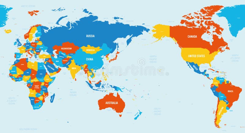
Free with trial World map - Asia, Australia and Pacific Ocean centered. 4 bright color scheme. High detailed political map of World with country, ocean and sea names labeling. Labeling vectors World map - Asia, Australia and Pacific Ocean centered. 4 bright color scheme. High detailed political map of World with. Country, ocean and sea names labeling
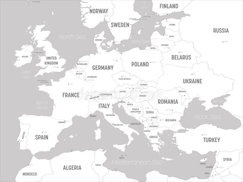
Free with trial Europe map - white lands and grey water. High detailed political map of european continent with country, capital, ocean and sea names labeling. Labeling vectors Europe map - white lands and grey water. High detailed political map of european continent with country, capital, ocean. And sea names labeling
Free with trial Germany Political Map with capital Berlin, national borders, most important cities, rivers and lakes. English labeling and scaling. Illustration. Labeling vectors Germany Political Map. With capital Berlin, national borders, most important cities, rivers and lakes. English labeling and scaling. Illustration
Free with trial World political map. Detailed map of the world with shorelines, national borders and country names. Robinson projection, english labeling, grey illustration on white background. Labeling vectors World Political Map. Detailed map of the world with shorelines, national borders and country names. Robinson projection, english labeling, grey illustration on
Free with trial North Korea and South Korea political map with capitals Pyongyang and Seoul. Korean peninsula, national borders, important cities, rivers and lakes. English labeling and scaling. Illustration. Labeling vectors North Korea and South Korea Political Map. With capitals Pyongyang and Seoul. Korean peninsula, national borders, important cities, rivers and lakes. English. North Korea and South Korea political map with capitals Pyongyang and Seoul. Korean peninsula, national borders, important cities, rivers and lakes. English labeling and scaling. Illustration.
 Sign in