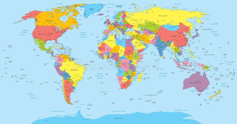
Free with trial Vector illustration of a High Detail Political Map of the world with different colors for each country. Each country has its capital and major cities. All seas and major lakes are named. Global colors used. All elements are separated in editable layers. Lakes vectors World map with countries, country and city names. Vector illustration of a High Detail Political Map of the world with different colors for each country. Each. Vector illustration of a High Detail Political Map of the world with different colors for each country. Each country has its capital and major cities. All seas and major lakes are named. Global colors used. All elements are separated in editable layers.
Free with trial The skyline of downtown Chicago. Lakes vectors Chicago skyline. The skyline of downtown Chicago. The skyline of downtown Chicago.
Free with trial Detailed political world map with capitals, rivers and lakes. Vector illustration. Lakes vectors Detailed political world map with capitals, rivers and lakes. Vector illustration
Free with trial Large detailed vintage color political World Map with lakes and rivers. Highly detailed vector illustration of World Map. Lakes vectors Large detailed vintage color political World Map with lakes and. Rivers. Highly detailed vector illustration of World Map
Free with trial Great Lakes silhouettes. USA vector. Lakes vectors Great Lakes silhouettes. USA vector
Free with trial Landscape minimal poster. Abstract geometric banners with mountains lakes and waves. Vector illustration postcard travel and adventure flyers with curve nature shapes. Lakes vectors Landscape minimal poster. Abstract geometric banners with mountains lakes and waves. Vector travel and adventure flyers. Landscape minimal poster. Abstract. Landscape minimal poster. Abstract geometric banners with mountains lakes and waves. Vector illustration postcard travel and adventure flyers with curve nature shapes
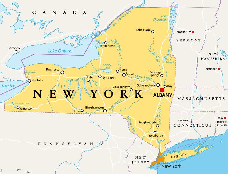
Free with trial New York State NYS, political map, with capital Albany, borders, important cities, rivers and lakes. State in the Northeastern United States of America. English labeling. Illustration. Vector. Lakes vectors New York State NYS, political map. With capital Albany, borders, important cities, rivers and lakes. State in the Northeastern United States of America. New York State NYS, political map, with capital Albany, borders, important cities, rivers and lakes. State in the Northeastern United States of America. English labeling. Illustration. Vector.
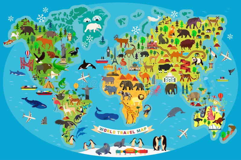
Free with trial Animal Map of the World for Children and Kids. Vector Illustration. Lakes vectors Animal Map of the World for Children and Kids. Vector. Animal Map of the World for Children and Kids. Vector Illustration. Animal Map of the World for Children and Kids. Vector Illustration.
Free with trial World map. Animal map of the world for children and kids. Lakes vectors World map. Animal map of the world for children and kids
Free with trial World map. Animal map of the world for children and kids. Lakes vectors World map. Animal map of the world for children and kids
Free with trial Map of Egypt with national borders, cities rivers and lakes. Lakes vectors Map of Egypt. With national borders, cities rivers and lakes
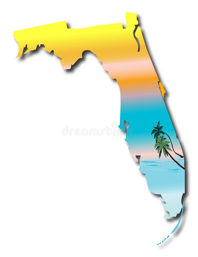
Free with trial Map of Florida. Florida State Map with sunshine and palms background vector. Lakes vectors Map of Florida. Florida State Map with sunshine and palms background vector
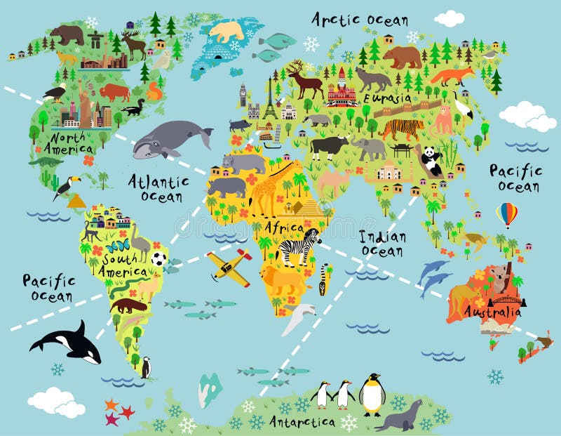
Free with trial Cartoon world map with landscape and animal. Vector illustration. Lakes vectors Cartoon world map. With landscape and animal. Vector illustration
Free with trial China political map with capital Beijing, national borders, important cities, rivers and lakes. English labeling and scaling. Illustration. Lakes vectors China Political Map. With capital Beijing, national borders, important cities, rivers and lakes. English labeling and scaling. Illustration
Free with trial Ohio Map. Illustration of the map of the Great State of Ohio, USA. Featuring its main cities, rivers, lakes and the highest peak of the state. Lakes vectors Ohio Map. Illustration of the map of the Great State of Ohio, USA. Featuring its main cities, rivers, lakes and the highest peak of the state
Free with trial Indiana Map. Illustration of the map of the Great State of Indiana, USA. Featuring rivers, lakes and the highest peak of the state. Lakes vectors Indiana Map. Illustration of the map of the Great State of Indiana, USA. Featuring rivers, lakes and the highest peak of the state
Free with trial Illustrated skyline of Chicago downtown. Lakes vectors Chicago skyline. Illustrated skyline of Chicago downtown. Illustrated skyline of Chicago downtown.
Free with trial Natural products vector logo. Vector illustration as logo brand for products and goods from natural sources or natural parks and reservoirs. Lakes vectors Natural products vector logo. Vector illustration as logo brand for products and goods from natural sources or natural parks and reservoirs
Free with trial Spain Map. Map of Spain with national borders, most important cities, rivers and lakes. Lakes vectors Spain Map. Map of Spain with national borders, most important cities, rivers and lakes
Free with trial Israel political map with capital Jerusalem, national borders, important cities, rivers and lakes. English labeling and scaling. Illustration. Lakes vectors Israel Political Map. With capital Jerusalem, national borders, important cities, rivers and lakes. English labeling and scaling. Illustration
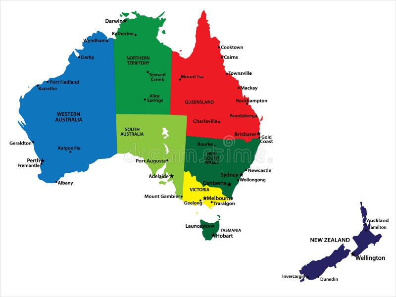
Free with trial Australia and New Zealand. Vector map of Australia and New Zealand with state borders and main cities. Lakes vectors Australia and New Zealand. Vector map of Australia and New Zealand with state borders and main cities
Free with trial World Continents(Vector). Accurate map onto a globe. Includes Antarctica, Arctic, Atlantic. Details include small island chains, lakes and seas. Lakes vectors World Continents (Vector also). World Continents(Vector). Accurate map onto a globe. Includes Antarctica, Arctic, Atlantic. Details include small island chains. World Continents(Vector). Accurate map onto a globe. Includes Antarctica, Arctic, Atlantic. Details include small island chains, lakes and seas.
Free with trial Region of lands around the Mediterranean Sea. South Europe, North Africa and Near East with capitals, national borders, rivers and lakes. English labeling and scaling. Illustration. Lakes vectors Mediterranean Sea Region Political Map. Region of lands around the Mediterranean Sea. South Europe, North Africa and Near East with capitals, national borders. Region of lands around the Mediterranean Sea. South Europe, North Africa and Near East with capitals, national borders, rivers and lakes. English labeling and scaling. Illustration.
Free with trial Political map of the Caribbean - Large and Lesser Antilles - with their capitals, national borders, rivers and lakes. Vector illustration with english labeling and scale. Lakes vectors Large And Lesser Antilles Political Map. Political map of the Caribbean - Large and Lesser Antilles - with their capitals, national borders, rivers and lakes. Political map of the Caribbean - Large and Lesser Antilles - with their capitals, national borders, rivers and lakes. Vector illustration with english labeling and scale.
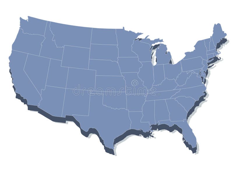
Free with trial Vector map of the united states of america. In 3d view. Lakes vectors Vector map of the united states of america. In 3d view
Free with trial Retro style travel poster United States, Minnesota. Retro style travel poster or sticker. United States, scenic lake in Minnesota. Lakes vectors Retro style travel poster United States, Minnesota. Retro style travel poster or sticker. United States, scenic lake in Minnesota
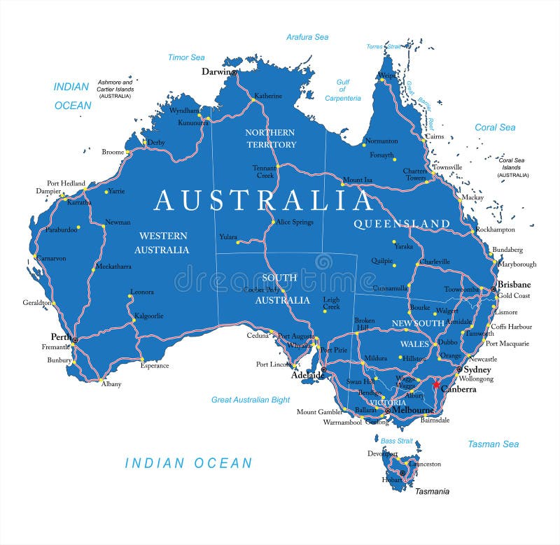
Free with trial Highly detailed vector map of Australia with administrative regions, main cities and roads. Lakes vectors Australia road map. Highly detailed vector map of Australia with administrative regions, main cities and roads. Highly detailed vector map of Australia with administrative regions, main cities and roads.
Free with trial A seamless rendition of a topographic map, with contour lines, of a mountainous area with lakes and forest, now try not to get lost. Lakes vectors Seamless Topographic Map. A seamless rendition of a topographic map, with contour lines, of a mountainous area with lakes and forest, now try not to get lost. A seamless rendition of a topographic map, with contour lines, of a mountainous area with lakes and forest, now try not to get lost.
Free with trial Illustrated Map of Africa. Illustration of map of Africa with country borders. Lakes vectors Illustrated Map of Africa. Illustration of map of Africa with country borders
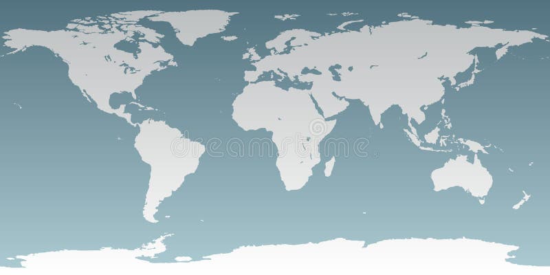
Free with trial Accurate map of the world. Includes Antarctica. Maps to a sphere to make a globe accurately to latitude and longitude. Also includes many islands - Hawaii, Aleutians, Galapagos, Maldives, Canary, etc. The largest lakes and seas included. Particular care taken to make the arctic and antarctic map correctly to a sphere. Lakes vectors Neutral World High Detail. Accurate map of the world. Includes Antarctica. Maps to a sphere to make a globe accurately to latitude and longitude. Also includes. Accurate map of the world. Includes Antarctica. Maps to a sphere to make a globe accurately to latitude and longitude. Also includes many islands - Hawaii, Aleutians, Galapagos, Maldives, Canary, etc. The largest lakes and seas included. Particular care taken to make the arctic and antarctic map correctly to a sphere.
Free with trial Vector Poland travel destinations icon set. Set of the simple icons representing popular travel destinations in Poland. Lakes vectors Vector Poland travel destinations icon set. Set of the simple icons representing popular travel destinations in Poland
Free with trial Hispaniola Political Map with Haiti and Dominican Republic, located in the Caribbean island group, the Greater Antilles. With capitals, national borders, important cities, rivers and lakes. English labeling and scaling. Illustration. Lakes vectors Hispaniola Political Map with Haiti and Dominican Republic. Located in the Caribbean island group, the Greater Antilles. With capitals, national borders. Hispaniola Political Map with Haiti and Dominican Republic, located in the Caribbean island group, the Greater Antilles. With capitals, national borders, important cities, rivers and lakes. English labeling and scaling. Illustration.
Free with trial Highly Detailed Map of United States. With cities, roads, lakes, rivers, states, Alaska and Hawaii. Lakes vectors Highly detailed road map of United States and colorful map point. Highly Detailed Map of United States. With cities, roads, lakes, rivers, states, Alaska and. Highly Detailed Map of United States. With cities, roads, lakes, rivers, states, Alaska and Hawaii.
Free with trial Political map of Central America with capitals, national borders, most important rivers and lakes. Vector illustration with english labeling and scale. Lakes vectors Central America Political Map. Political map of Central America with capitals, national borders, most important rivers and lakes. Vector illustration with. Political map of Central America with capitals, national borders, most important rivers and lakes. Vector illustration with english labeling and scale.
Free with trial Life cycle european tree frog. Metamorphose. Hyla Rana arborea. Eggs, tadpoles, frog. Vector. Lakes vectors Life cycle european tree frog. Metamorphose. Hyla Rana arborea. Eggs, tadpoles, frog. Vector
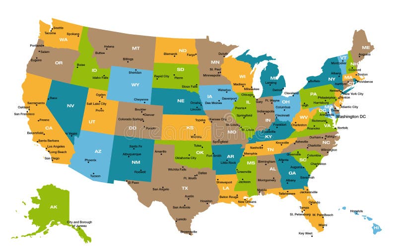
Free with trial USA 50 States with State Names. And Capital cities in vivid colors. vector eps10. Lakes vectors USA 50 States with State Names. And Capital cities in vivid colors. vector eps10
Free with trial Hand drawn Minnesota state outline and cursive text. Lakes vectors Hand Drawn Minnesota State Sketch. Hand drawn Minnesota state outline and cursive text. Hand drawn Minnesota state outline and cursive text.
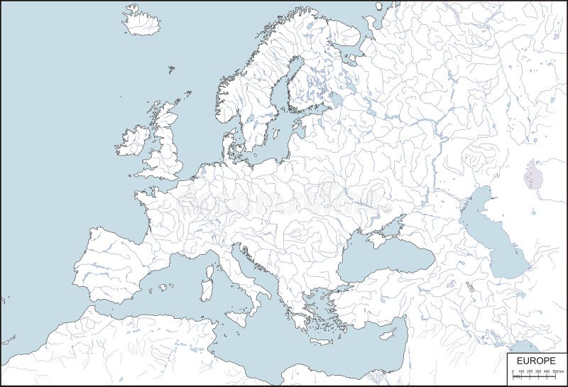
Free with trial Europe - contour map, vector illustration. Contour map of Europe with rivers and lakes. Lakes vectors Europe - contour map, vector illustration. Contour map of Europe with rivers and lakes
Free with trial Singapore map vector illustration. Singapore and its surrounding islands vector illustration and outline. Lakes vectors Singapore map vector illustration. Singapore and its surrounding islands vector illustration and outline
Free with trial Florida political map with capital Tallahassee, borders, important places, rivers and lakes. State, located in the southeastern region of the United States. Illustration with English labeling. Vector. Lakes vectors Florida political map. With capital Tallahassee, borders, important places, rivers and lakes. State, located in the southeastern region of the United States. Florida political map with capital Tallahassee, borders, important places, rivers and lakes. State, located in the southeastern region of the United States. Illustration with English labeling. Vector.
Free with trial High Detail Vector Political World Map illustration, cleverly organized with layers. With Country, Capitals, Main Cities, Seas and Lakes names all on different layers Original maps are from Cia ( for political borders and informations, NASA ( for geographical Features. Lakes vectors Hi Detail colored Vector Political World Map illustration. High Detail Vector Political World Map illustration, cleverly organized with layers. With Country. High Detail Vector Political World Map illustration, cleverly organized with layers. With Country, Capitals, Main Cities, Seas and Lakes names all on different layers Original maps are from Cia ( for political borders and informations, NASA ( for geographical Features.
Free with trial Detailed Vector illustration of map of Turkey with all 81 cities. Provinces / Cities, City and Country Borders, Lakes are on separate layers. Each city can be selected and recoloured separately. Lakes vectors Map Of Turkey. Detailed Vector illustration of map of Turkey with all 81 cities. Provinces / Cities, City and Country Borders, Lakes are on separate layers. Each. Detailed Vector illustration of map of Turkey with all 81 cities. Provinces / Cities, City and Country Borders, Lakes are on separate layers. Each city can be selected and recoloured separately.
Free with trial Ecuador and Galapagos Islands political map with capital Quito, with national borders, most important cities, rivers and lakes. Illustration with English labeling and scaling. Vector. Lakes vectors Ecuador and Galapagos Islands Political Map. With capital Quito, with national borders, most important cities, rivers and lakes. Illustration with English. Ecuador and Galapagos Islands political map with capital Quito, with national borders, most important cities, rivers and lakes. Illustration with English labeling and scaling. Vector.
Free with trial World Map Vintage Color Pacific Centred. Detailed Vector Illustration of Pacific Centered Political World Map Vintage Color. Lakes vectors World Map Vintage Color Pacific Centred. Detailed Vector Illustration of Pacific Centered Political World Map Vintage Color
Free with trial Detailed illustration of all fifty states of United States of America with major cities and state abbreviations. All states are in separate layers and can be easily changed in Adobe Illustrator additional format. Lakes vectors Map of all US states. Detailed illustration of all fifty states of United States of America with major cities and state abbreviations. All states are in separate. Detailed illustration of all fifty states of United States of America with major cities and state abbreviations. All states are in separate layers and can be easily changed in Adobe Illustrator additional format.
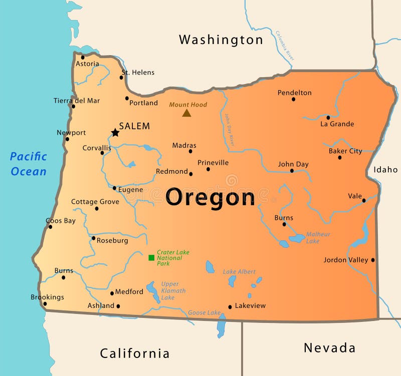
Free with trial Oregon map. Illustration of the map of Oregon, USA. The brown Triangle indicates the highest mountain, while the green square the National Park. Lakes vectors Oregon map. Illustration of the map of Oregon, USA. The brown Triangle indicates the highest mountain, while the green square the National Park
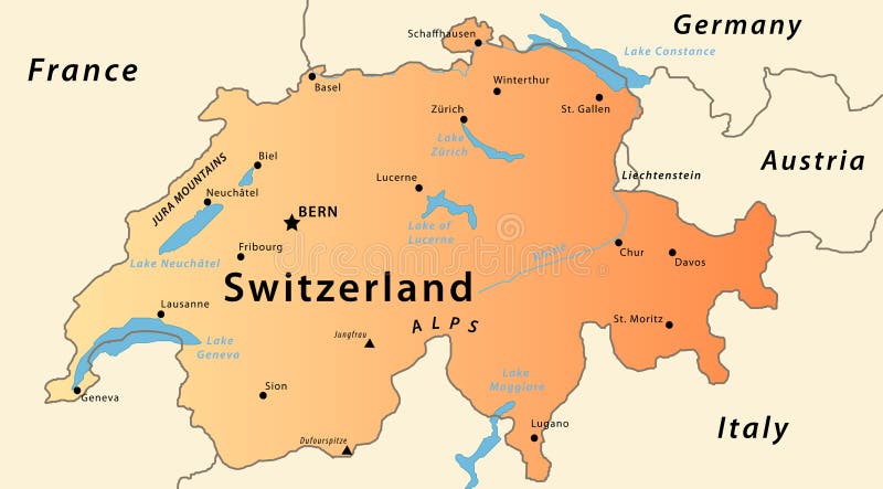
Free with trial Switzerland map. Illustration of a detailed political map of Switzlerand, with the most important cities, river, mountains and lakes. Lakes vectors Switzerland map. Illustration of a detailed political map of Switzlerand, with the most important cities, river, mountains and lakes
Free with trial Vector illustration for the continent of Africa. Over 50 countries including several small islands, rivers and lakes not visible unless zoomed in. Very editable if needed. Lakes vectors Africa Continent Flag Map. Vector illustration for the continent of Africa. Over 50 countries including several small islands, rivers and lakes not visible. Vector illustration for the continent of Africa. Over 50 countries including several small islands, rivers and lakes not visible unless zoomed in. Very editable if needed.
Free with trial Great Lakes silhouettes with names. Vector. Lakes vectors Great Lakes silhouettes with names. Vector
Free with trial Great Lakes silhouette with name. Vector. Lakes vectors Great Lakes silhouette with name. Vector
Free with trial Set of city buildings and houses, eco parks, lakes, farms, wind turbines and solar panels, ecology infographic elements. Essential elements of green city. Flat concept of ways to protect environment. Lakes vectors Set of city buildings and houses, eco parks, lakes, farms, wind turbines and solar panels, ecology infographic elements. Essential elements of green city. Flat
Free with trial Map of Great Lakes. Vector map of Great Lakes with countries, big cities and icons. Lakes vectors Map of Great Lakes. Vector map of Great Lakes with countries, big cities and icons
Free with trial Mountain abstract poster. Geometric landscape banners with hills, rivers and lakes, minimalist nature scenes. Vector illustration graphic flyers with flows and curved stream. Lakes vectors Mountain abstract poster. Geometric landscape banners with hills, rivers and lakes, minimalist nature scenes. Vector. Illustration graphic flyers with flows and
Free with trial Vector map of the Great Lakes Basin. Lakes vectors Vector map of the Great Lakes Basin.
Free with trial Isometric landscapes with city buildings, village, roads, parks, plains, hills, mountains, lakes, rivers and waterfall. Set of detailed city buildings. 3d isometric map. Lakes vectors Isometric landscapes with city buildings, village, roads, parks, plains, hills, mountains, lakes, rivers and waterfall. Set of de. Tailed city buildings. 3d
Free with trial Isometric landscapes with city buildings, parks, plains, hills, mountains, lakes and rivers. Set of detailed city buildings. 3d is. Isometric landscapes with. Lakes vectors Isometric landscapes with city buildings, parks, plains, hills, mountains, lakes and rivers. Set of detailed city buildings. 3d is. Isometric landscapes with
Free with trial Graphic of the North American great lakes and their neighboring states. Lakes vectors Graphic of the North American great lakes and their neighboring states.
Free with trial Trees, stones, lakes, mountains, shrubs. A set of realistic elements of nature. Flat design, vector illustration, vector. Lakes vectors Trees, stones, lakes, mountains, shrubs. A set of realistic elements of nature. Flat design, vector illustration, vector
Free with trial Map of Great Lakes. Detailed and accurate illustration of map of Great Lakes. Lakes vectors Map of Great Lakes. Detailed and accurate illustration of map of Great Lakes
Free with trial Old retro World Map with lakes and rivers. Highly detailed vector illustration of large political World Map. Lakes vectors Old retro World Map with lakes and rivers. Highly detailed vector illustration of large political World Map
Free with trial Asia Physical Map with Rivers, Lakes and Elevations. Retro Colors. Lakes vectors Asia Physical Map with Rivers, Lakes and Elevations. Retro Colors
Free with trial Vector map elements, colorful, hand draw - water, rivers, lakes, islands. Vector colorful map hand draw stock elements for fantasy map and board games. Lakes vectors Vector map elements, colorful, hand draw - water, rivers, lakes, islands. Vector colorful map hand draw stock elements for fantasy map and board games
Free with trial Flat vector map landscape; parks; buildings; seating area; sports grounds; picture of the nature of mountains and lakes; road; GPS navigation; infographic 3d isometric concept. Top view. Lakes vectors Flat vector map landscape; parks; buildings; seating area;. Sports grounds; picture of the nature of mountains and lakes; road; GPS navigation; infographic 3d. Flat vector map landscape; parks; buildings; seating area; sports grounds; picture of the nature of mountains and lakes; road; GPS navigation; infographic 3d isometric concept. Top view.
Free with trial Flat vector landscape with a parks,buildings,seating area, sports grounds, picture of the nature and landscape of mountains and lakes, road junction GPS navigation infographic 3d isometric concept. Lakes vectors Flat vector landscape with a parks,buildings,seating area. Sports grounds, picture of the nature and landscape of mountains and lakes, road junction GPS. Flat vector landscape with a parks,buildings,seating area, sports grounds, picture of the nature and landscape of mountains and lakes, road junction GPS navigation infographic 3d isometric concept.
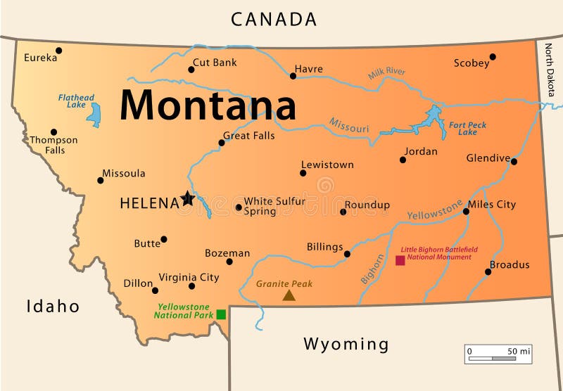
Free with trial Montana Map. Illustration of the map of the Great State of Montana, USA. Featuring its main cities, rivers, lakes and the highest peak of the state. Lakes vectors Montana Map. Illustration of the map of the Great State of Montana, USA. Featuring its main cities, rivers, lakes and the highest peak of the state
Free with trial Germany Political Map with capital Berlin, national borders, most important cities, rivers and lakes. English labeling and scaling. Illustration. Lakes vectors Germany Political Map. With capital Berlin, national borders, most important cities, rivers and lakes. English labeling and scaling. Illustration
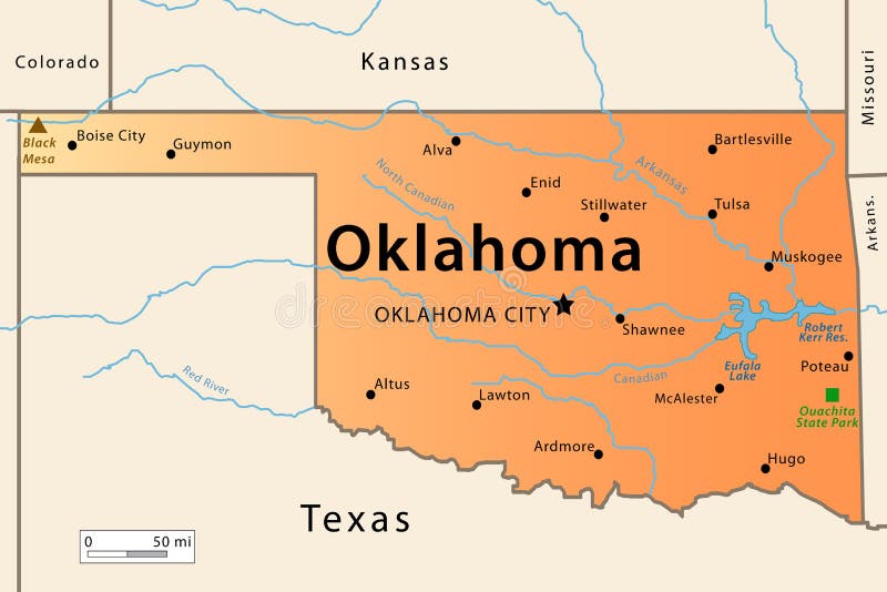
Free with trial Oklahoma Map. Illustration of the map of the Great State of Oklahoma , USA. Featuring its main cities, rivers, lakes and the highest peak of the state. Lakes vectors Oklahoma Map. Illustration of the map of the Great State of Oklahoma , USA. Featuring its main cities, rivers, lakes and the highest peak of the state
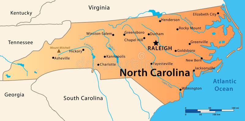
Free with trial North Carolina Map. Illustration of the map of the Great State of North Carolina, USA. Featuring its main cities, rivers, lakes and the highest peak of the state. Lakes vectors North Carolina Map. Illustration of the map of the Great State of North Carolina, USA. Featuring its main cities, rivers, lakes and the highest peak of the state
Free with trial Political World Map Retro Colors - borders, countries and cities - Detailed World Map vector illustration - All elements are separated in editable layers clearly labeled - Vector. Lakes vectors Political World Map Retro Colors. Borders, countries and cities - Detailed World Map vector illustration - All elements are separated in editable layers. Political World Map Retro Colors - borders, countries and cities - Detailed World Map vector illustration - All elements are separated in editable layers clearly labeled - Vector
Free with trial North Korea and South Korea political map with capitals Pyongyang and Seoul. Korean peninsula, national borders, important cities, rivers and lakes. English labeling and scaling. Illustration. Lakes vectors North Korea and South Korea Political Map. With capitals Pyongyang and Seoul. Korean peninsula, national borders, important cities, rivers and lakes. English. North Korea and South Korea political map with capitals Pyongyang and Seoul. Korean peninsula, national borders, important cities, rivers and lakes. English labeling and scaling. Illustration.
Free with trial Vector map (adobe illustrator format) of Russia, Ukrain, Belorussia, Georgia, Moldova, Kazakhstan, Uzbekistan, Turkmenistan, Kirghistan, Tadjikistan, Armenia Azerbaijan, Mongolia. Every country is in a separate layer. Also in separate layers all largest rivers, lakes, cities, their names. All layers can be turned off, delete. The contour of Russia includes all islands, included in territory of Russia. Lakes vectors Russia and nearest countrys map. Vector map (adobe illustrator format) of Russia, Ukrain, Belorussia, Georgia, Moldova, Kazakhstan, Uzbekistan, Turkmenistan. Vector map (adobe illustrator format) of Russia, Ukrain, Belorussia, Georgia, Moldova, Kazakhstan, Uzbekistan, Turkmenistan, Kirghistan, Tadjikistan, Armenia Azerbaijan, Mongolia. Every country is in a separate layer. Also in separate layers all largest rivers, lakes, cities, their names. All layers can be turned off, delete. The contour of Russia includes all islands, included in territory of Russia.
Free with trial ZOO Landscapes is illustration made as a collage of different ecosystems with funny cartoon animals. Illustration is in eps 10 mode!. Lakes vectors ZOO Landscapes. Is illustration made as a collage of different ecosystems with funny cartoon animals. Illustration is in eps 10 mode
Free with trial Frog. Hand drawn vector illustration. Lakes vectors Hand drawn frog. Frog. Hand drawn vector illustration. Frog. Hand drawn vector illustration.
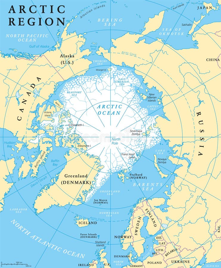
Free with trial Arctic region map with countries, capitals, national borders, rivers and lakes. Arctic Ocean with average minimum extent of sea ice. English labeling and scaling. Lakes vectors Arctic Region Map. With countries, capitals, national borders, rivers and lakes. Arctic Ocean with average minimum extent of sea ice. English labeling and
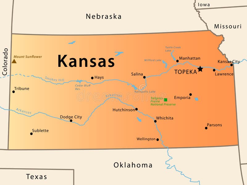
Free with trial Kansas map. Illustration of the map of Kansas, USA. The brown Triangle indicates the highest mountain, while the green square the National Park. Lakes vectors Kansas map. Illustration of the map of Kansas, USA. The brown Triangle indicates the highest mountain, while the green square the National Park
Free with trial Arctic region political map with countries, capitals, national borders, important cities, rivers and lakes. Arctic Ocean with average minimum extent of sea ice. English labeling and scaling. Lakes vectors Arctic Region Political Map. With countries, capitals, national borders, important cities, rivers and lakes. Arctic Ocean with average minimum extent of sea ice. Arctic region political map with countries, capitals, national borders, important cities, rivers and lakes. Arctic Ocean with average minimum extent of sea ice. English labeling and scaling.
Free with trial Hand drawn map of Morocco and Western Sahara with the capitals Rabat and El Aiun, with national borders, most important cities, rivers and lakes. Vector illustration with english labeling and scale. Lakes vectors Morocco And Western Sahara Map. Hand drawn map of Morocco and Western Sahara with the capitals Rabat and El Aiun, with national borders, most important cities. Hand drawn map of Morocco and Western Sahara with the capitals Rabat and El Aiun, with national borders, most important cities, rivers and lakes. Vector illustration with english labeling and scale.
Free with trial Detailed retro political World Map. Highly detailed vector illustration of World Map. Lakes vectors Detailed retro political World Map. Highly detailed vector illustration of World Map
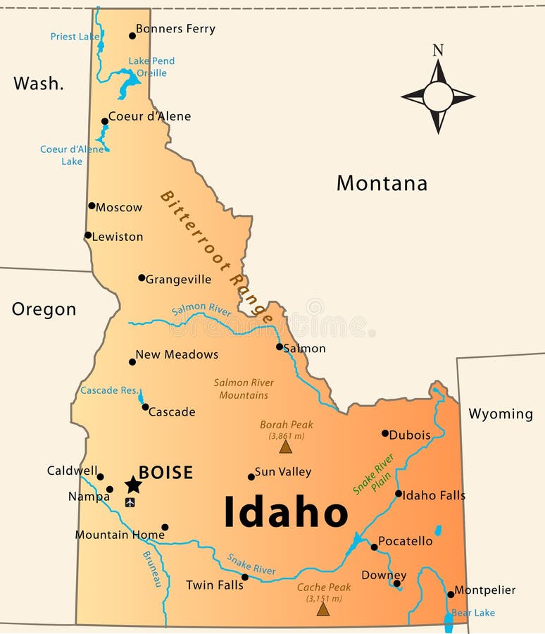
Free with trial Idaho Map. Illustration of the map of the Great State of Idaho, USA. Featuring its main cities, rivers, lakes and the highest peak of the state. Lakes vectors Idaho Map. Illustration of the map of the Great State of Idaho, USA. Featuring its main cities, rivers, lakes and the highest peak of the state
Free with trial United States of America Political Map with capital Washington, national borders, most important cities, rivers and lakes. With single states, their borders and capitals, except Hawaii and Alaska. English labeling and scaling. Lakes vectors United States of America Political Map. With capital Washington, national borders, most important cities, rivers and lakes. With single states, their borders. United States of America Political Map with capital Washington, national borders, most important cities, rivers and lakes. With single states, their borders and capitals, except Hawaii and Alaska. English labeling and scaling.
 Sign in