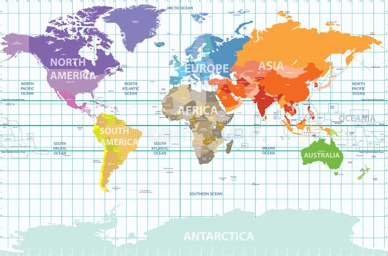
Free with trial Vector political map of the world with all continents separated by color, labeled countries and oceans, and with enumerated longitudes and latitudes on background. Longitudes vectors Political map of the world with all continents separated by color, labeled countries and oceans, and with enumerated longitudes an. Vector political map of the. Vector political map of the world with all continents separated by color, labeled countries and oceans, and with enumerated longitudes and latitudes on background
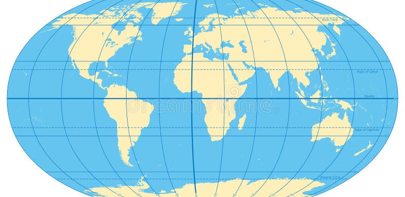
Free with trial World map with most important circles of latitudes and longitudes, showing Equator, Greenwich meridian, Arctic and Antarctic Circle, Tropic of Cancer and Capricorn. English. Illustration. Vector. Longitudes vectors World map with most important circles of latitudes and longitudes. Showing Equator, Greenwich meridian, Arctic and Antarctic Circle, Tropic of Cancer and. World map with most important circles of latitudes and longitudes, showing Equator, Greenwich meridian, Arctic and Antarctic Circle, Tropic of Cancer and Capricorn. English. Illustration. Vector.
Free with trial Earth icons with latitudes longitudes lines. Earth vector with latitudes longitudes earth axis and equater line. Longitudes vectors Earth icons with latitudes longitudes lines. Earth vector with latitudes longitudes earth axis and equater line
Free with trial World Map - Van der Grinten Projection. A colored vector world map in Van der Grintens projection, showing longitudes and latitudes. Longitudes vectors World Map - Van der Grinten Projection. A colored vector world map in Van der Grintens projection, showing longitudes and latitudes
Free with trial A 3d illustrated background of a blue digital globe with an ecliptic around it. Longitudes vectors 3D Blue Globe. A 3d illustrated background of a blue digital globe with an ecliptic around it. A 3d illustrated background of a blue digital globe with an ecliptic around it.
Free with trial A colored vector map of the northern hemisphere in Polar Stereographic projection, showing longitudes and latitudes. Longitudes vectors Map of Northern Hemisphere - Polar Stereographic. A colored vector map of the northern hemisphere in Polar Stereographic projection, showing longitudes and. A colored vector map of the northern hemisphere in Polar Stereographic projection, showing longitudes and latitudes
Free with trial The skyline of Gemany's capital Berlin sits on one side of an earth-globe. White lines of latitudes and longitudes are drawn onto the black globe. The whole globe stands on letters forming the name Berlin. This vector-illustration is black and white and isolated. Longitudes vectors Berlin City on a Globe. The skyline of Gemany's capital Berlin sits on one side of an earth-globe. White lines of latitudes and longitudes are drawn onto the. The skyline of Gemany's capital Berlin sits on one side of an earth-globe. White lines of latitudes and longitudes are drawn onto the black globe. The whole globe stands on letters forming the name Berlin. This vector-illustration is black and white and isolated.
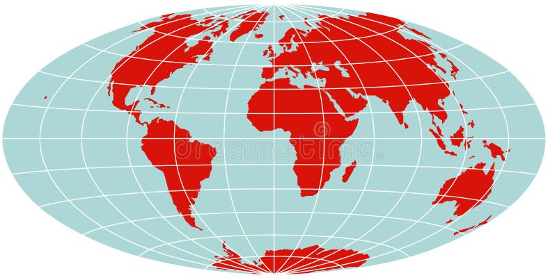
Free with trial World Map - Hammer Projection. A colored vector world map in Hammer projection, showing longitudes and latitudes. Longitudes vectors World Map - Hammer Projection. A colored vector world map in Hammer projection, showing longitudes and latitudes
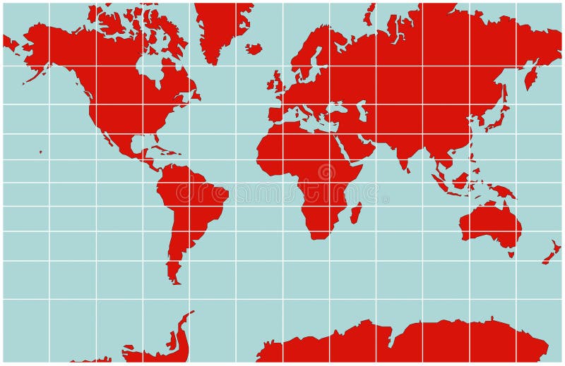
Free with trial World Map - Mercator Projection. A colored vector world map in Mercator projection, showing longitudes and latitudes. Longitudes vectors World Map - Mercator Projection. A colored vector world map in Mercator projection, showing longitudes and latitudes
Free with trial World Map - Mollweide Projection. A colored vector world map in Mollweide projection, showing longitudes and latitudes. Longitudes vectors World Map - Mollweide Projection. A colored vector world map in Mollweide projection, showing longitudes and latitudes
Free with trial A colored vector world map in Interrupted Goode projection, showing longitudes and latitudes. The projection splits the world in continental units. Longitudes vectors World Map - Interrupted Goode Projection. A colored vector world map in Interrupted Goode projection, showing longitudes and latitudes. The projection splits the. A colored vector world map in Interrupted Goode projection, showing longitudes and latitudes. The projection splits the world in continental units.
Free with trial World Map - Equirectangular grid. A colored vector world map with an equirectangular grid, showing longitudes and latitudes. Longitudes vectors World Map - Equirectangular grid. A colored vector world map with an equirectangular grid, showing longitudes and latitudes
Free with trial Map of Northern Hemisphere - Albers projection. A colored vector map of the northern hemisphere in Albers projection, showing longitudes and latitudes. Longitudes vectors Map of Northern Hemisphere - Albers projection. A colored vector map of the northern hemisphere in Albers projection, showing longitudes and latitudes
Free with trial World Map - Mercator Projection. A black and white vector world map in Mercator projection, showing longitudes and latitudes. Longitudes vectors World Map - Mercator Projection. A black and white vector world map in Mercator projection, showing longitudes and latitudes
Free with trial World map blue. Vector illustration of a High Detail Political Map in blue and white. Earth, longitudes and latitudes and are on separate layers. Longitudes vectors World map blue. Vector illustration of a High Detail Political Map in blue and white. Earth, longitudes and latitudes and are on separate layers
Free with trial Transparent world globe. 3D realistic sphere with USA Asia Europe, circle glass planet and world map. Vector blue earth isolated set, view from space. Longitudes vectors Transparent world globe. 3D realistic sphere with USA Asia Europe, circle glass planet and world map. Vector isolated. Transparent world globe. 3D realistic. Transparent world globe. 3D realistic sphere with USA Asia Europe, circle glass planet and world map. Vector blue earth isolated set, view from space
Free with trial The Arctic Ocean region, Geographic position of the North Pole of the Earth, Colored political map with countries and capitals included in the Arctic Circle, Vector map with latitudes and longitudes. Longitudes vectors The Arctic Ocean region, Geographic position of the North Pole of the Earth, Colored political map with countries and capitals. Included in the Arctic Circle. The Arctic Ocean region, Geographic position of the North Pole of the Earth, Colored political map with countries and capitals included in the Arctic Circle, Vector map with latitudes and longitudes
Free with trial The world with most important circles of latitudes and longitudes, gray political map. Equator, Greenwich meridian, Arctic and Antarctic Circle, Tropic of Cancer and Capricorn. Illustration. Vector. Longitudes vectors World most important circles of latitudes and longitudes, gray map. The world with most important circles of latitudes and longitudes, gray political map. The world with most important circles of latitudes and longitudes, gray political map. Equator, Greenwich meridian, Arctic and Antarctic Circle, Tropic of Cancer and Capricorn. Illustration. Vector.
Free with trial The World, important circles of latitudes and longitudes, blue colored political map. Equator, Greenwich meridian, Arctic and Antarctic Circle, Tropic of Cancer and Capricorn. Illustration. Vector. Longitudes vectors The World, important circles of latitudes and longitudes, political map. The World, important circles of latitudes and longitudes, blue colored political map. The World, important circles of latitudes and longitudes, blue colored political map. Equator, Greenwich meridian, Arctic and Antarctic Circle, Tropic of Cancer and Capricorn. Illustration. Vector.
Free with trial A vector illustration of a blue globe with white grid lines representing latitudes and longitudes or global connections. This clean design is ideal for themes of travel international business geography and global communication networks. vector design Generative AI. Longitudes vectors Globe with Grid Lines Global Connections Map, vector design Generative AI. A vector illustration of a blue globe with white grid lines representing latitudes and. A vector illustration of a blue globe with white grid lines representing latitudes and longitudes or global connections. This clean design is ideal for themes of travel international business geography and global communication networks. vector design Generative AI
Free with trial A black line art outline of a sphere with grid lines representing latitudes and longitudes, depicting a stylized globe of the Earth, on an oval grey. Represents the world, global reach, geography, networks, or international themes. Universal Earth symbol outline, vector design Generative AI. Longitudes vectors Abstract Globe World Sphere Outline, Geography Earth Network Planet Global, vector design Generative AI. A black line art outline of a sphere with grid lines. A black line art outline of a sphere with grid lines representing latitudes and longitudes, depicting a stylized globe of the Earth, on an oval grey. Represents the world, global reach, geography, networks, or international themes. Universal Earth symbol outline, vector design Generative AI
Free with trial A simple black line drawing of a world globe with visible longitudes and latitudes. Ideal for geography, education, travel, global connections, and mapping themes. Longitudes vectors World globe with longitudes and latitudes in simple black lines. A simple black line drawing of a world globe with visible longitudes and latitudes. Ideal for. A simple black line drawing of a world globe with visible longitudes and latitudes. Ideal for geography, education, travel, global connections, and mapping themes.
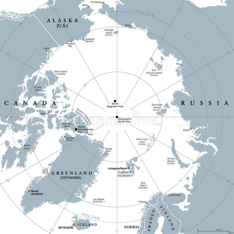
Free with trial Arctic region, gray political map. Polar region around North Pole of Earth. The Arctic Ocean region, with North Magnetic Pole and North Geomagnetic Pole, longitudes and latitudes. Illustration. Vector. Longitudes vectors Arctic region, polar region around North Pole, gray political map. Arctic region, gray political map. Polar region around North Pole of Earth. The Arctic Ocean. Arctic region, gray political map. Polar region around North Pole of Earth. The Arctic Ocean region, with North Magnetic Pole and North Geomagnetic Pole, longitudes and latitudes. Illustration. Vector
Free with trial Colored political map of the Arctic Ocean region with countries and capitals within the Arctic Circle, geographic location of the Earth North Pole, vector map with latitude and longitude. Longitudes vectors Colored political map of the Arctic Ocean region with countries and capitals within the Arctic Circle, geographic location of the. Earth North Pole, vector map. Colored political map of the Arctic Ocean region with countries and capitals within the Arctic Circle, geographic location of the Earth North Pole, vector map with latitude and longitude
Free with trial Geographic position of the North Pole of the Earth, political map. Magnetic, Geomagnetic and Geographic North Pole. Map of the Arctic Ocean and the Arctic Circle with latitudes and longitudes. Vector. Longitudes vectors Geographic position of the North Pole of the Earth, political map. Magnetic, Geomagnetic and Geographic North Pole. Map of the Arctic Ocean and the Arctic
Free with trial Diagram of an ancient astronomical instrument astrolabe for measuring horizontal angles and determining latitudes and longitudes of celestial bodies. Object isolated on beige background. Longitudes vectors Instrument astrolabe on beige background. Diagram of an ancient astronomical instrument astrolabe for measuring horizontal angles and determining latitudes and. Diagram of an ancient astronomical instrument astrolabe for measuring horizontal angles and determining latitudes and longitudes of celestial bodies. Object isolated on beige background
Free with trial Eco-Friendly Globe with Radiant Green Aura. A vibrant illustration of the planet Earth with an energetic green glow symbolizing environmental. Longitudes vectors Eco-Friendly Globe with Radiant Green Aura. A vibrant illustration of the planet Earth with an energetic green glow symbolizing environmental
Free with trial Globe with latitudes and longitudes, downward arrow pointing at an open box, and a coin. Ideal for global commerce, shipping, logistics, international trade, transactions, e-commerce. Longitudes vectors Global Trade Concept Featuring Globe, Packaging Box, Downward Arrow, and Coin Icon. Globe with latitudes and longitudes, downward arrow pointing at an open box. Globe with latitudes and longitudes, downward arrow pointing at an open box, and a coin. Ideal for global commerce, shipping, logistics, international trade, transactions, e-commerce
Free with trial Simplified Globe Icon Vector Illustration Earth with Continent Outlines. AI generated. Longitudes vectors Simplified Globe Icon Vector Illustration Earth with Continent Outlines. AI generated
Free with trial Globe with latitudes and longitudes, arrows symbolizing growth, and a woman profile icon. Ideal for connection, global reach, growth, leadership, innovation networking progress. Simple flat. Longitudes vectors Global Communication Concept with Globe Lines, Rising Arrows, and Woman Silhouette. Globe with latitudes and longitudes, arrows symbolizing growth, and a woman. Globe with latitudes and longitudes, arrows symbolizing growth, and a woman profile icon. Ideal for connection, global reach, growth, leadership, innovation networking progress. Simple flat
Free with trial A collection of black and white vector icons featuring various representations of the globe, earth, and world map with location, search, and navigation symbols. content. Longitudes vectors Set of globe and earth icons AI generated. A collection of black and white vector icons featuring various representations of the globe, earth, and world map with. A collection of black and white vector icons featuring various representations of the globe, earth, and world map with location, search, and navigation symbols. content.
Free with trial A stylized illustration of planet Earth, featuring green continents and blue oceans, with a grid of white latitude and longitude lines. Isolated on a white background. Longitudes vectors Stylized Globe of Earth with Continents. A stylized illustration of planet Earth, featuring green continents and blue oceans, with a grid of white latitude and. A stylized illustration of planet Earth, featuring green continents and blue oceans, with a grid of white latitude and longitude lines. Isolated on a white background.
Free with trial A collection of fifteen black and white vector icons featuring globes, world maps, and related symbols like airplanes, shields, and location pins. content. Longitudes vectors Set of globe and world map icons AI generated. A collection of fifteen black and white vector icons featuring globes, world maps, and related symbols like. A collection of fifteen black and white vector icons featuring globes, world maps, and related symbols like airplanes, shields, and location pins. content.
Free with trial This image was created using Generative AI. Simple black and white icon of a wireframe globe with a computer mouse cursor. Ideal for web design, digital marketing, and internet connectivity concepts. Longitudes vectors Black Globe Icon With Mouse Pointer Cursor On White Background. This image was created using Generative AI. Simple black and white icon of a wireframe globe with. This image was created using Generative AI. Simple black and white icon of a wireframe globe with a computer mouse cursor. Ideal for web design, digital marketing, and internet connectivity concepts
Free with trial This image was created using Generative AI. Flat style passport icon featuring a green globe and white lines. Clean blue design on white background, ideal for travel, business, and international identity concepts. Longitudes vectors Blue Passport Icon With Green Globe Symbol And White Lines On White Background. This image was created using Generative AI. Flat style passport icon featuring a. This image was created using Generative AI. Flat style passport icon featuring a green globe and white lines. Clean blue design on white background, ideal for travel, business, and international identity concepts
Free with trial This image was created using Generative AI. Minimalist teal globe icon with continents and flowing connection lines, representing global network, international communication, and worldwide connectivity. Longitudes vectors Globe Earth Map With Connected Lines And Circles, Global Network Connectivity Concept. This image was created using Generative AI. Minimalist teal globe icon. This image was created using Generative AI. Minimalist teal globe icon with continents and flowing connection lines, representing global network, international communication, and worldwide connectivity
Free with trial This image features a minimalist globe on a sleek stand, highlighted in soft pastel colors. The continents are shown in muted beige and lavender, with delicate lines marking the latitudes and longitudes. The design is modern and elegant, perfect for inspiring curiosity about the world. Longitudes vectors Discovering the World: A Minimalist Globe. This image features a minimalist globe on a sleek stand, highlighted in soft pastel colors. The continents are shown. This image features a minimalist globe on a sleek stand, highlighted in soft pastel colors. The continents are shown in muted beige and lavender, with delicate lines marking the latitudes and longitudes. The design is modern and elegant, perfect for inspiring curiosity about the world.
Free with trial This image was created using Generative AI. Collection of globe icons in various styles including outline and solid versions. Perfect for representing global concepts, travel, international business, and world connectivity. Longitudes vectors Set of globe icons in different styles, globe symbol, world icon, earth logo, international symbol, travel sign, global network. This image was created using. This image was created using Generative AI. Collection of globe icons in various styles including outline and solid versions. Perfect for representing global concepts, travel, international business, and world connectivity
 Sign in