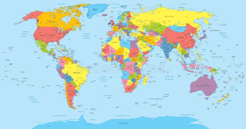
Free with trial Vector illustration of a High Detail Political Map of the world with different colors for each country. Each country has its capital and major cities. All seas and major lakes are named. Global colors used. All elements are separated in editable layers. Major cities vectors World map with countries, country and city names. Vector illustration of a High Detail Political Map of the world with different colors for each country. Each. Vector illustration of a High Detail Political Map of the world with different colors for each country. Each country has its capital and major cities. All seas and major lakes are named. Global colors used. All elements are separated in editable layers.
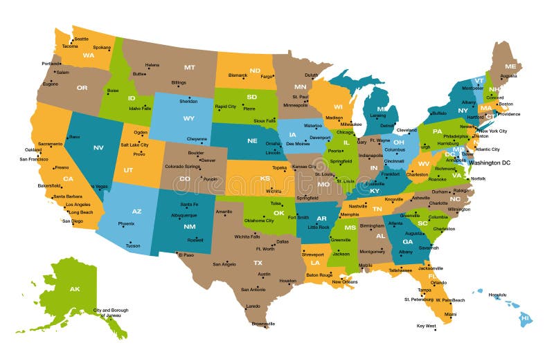
Free with trial Detailed illustration of all fifty states of United States of America with major cities and state abbreviations. All states are in separate layers and can be easily changed in Adobe Illustrator additional format. Major cities vectors Map of all US states. Detailed illustration of all fifty states of United States of America with major cities and state abbreviations. All states are in separate. Detailed illustration of all fifty states of United States of America with major cities and state abbreviations. All states are in separate layers and can be easily changed in Adobe Illustrator additional format.
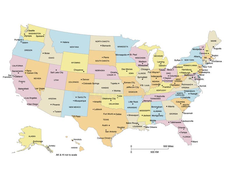
Free with trial USA map showing states, capital cities and major cities. States and cities are labeled. Clipped to US border. Major cities vectors USA Map. Showing states, capital cities and major cities. States and cities are labeled. Clipped to US border
Free with trial Japan map and cities. Map of Japan and text design with major cities. Major cities vectors Japan map and cities. Map of Japan and text design with major cities
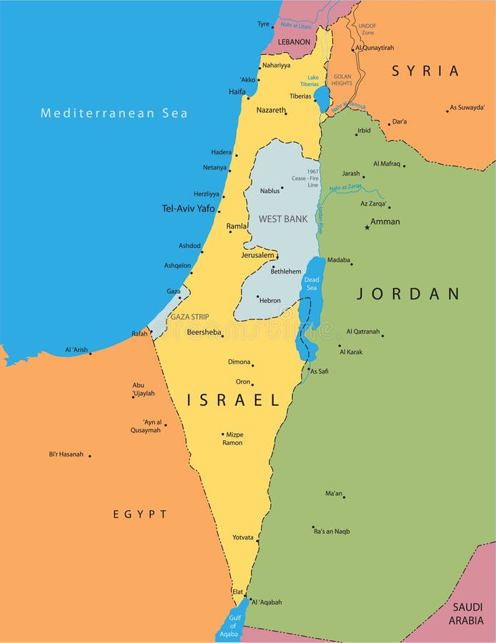
Free with trial Israel map and cities. Map of Israel and text design with major cities. Major cities vectors Israel map and cities. Map of Israel and text design with major cities
Free with trial Clock showing time of four major cities. Major cities vectors World Clock. Clock showing time of four major cities. Clock showing time of four major cities.
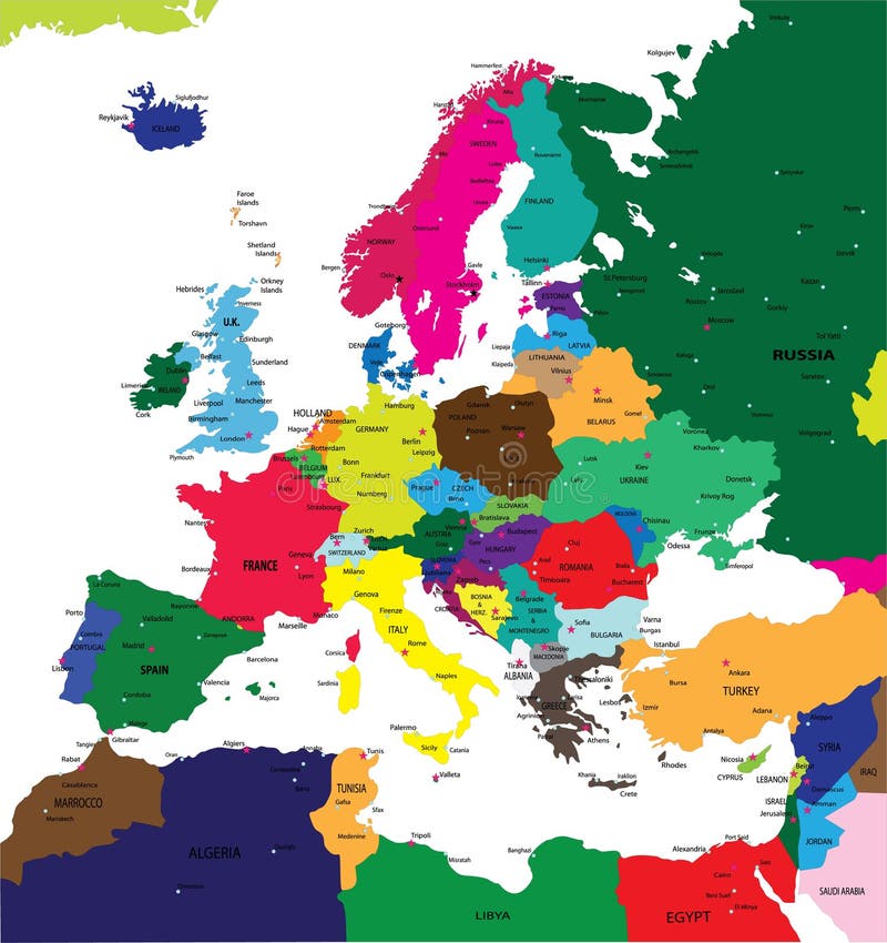
Free with trial Political map of Europe. In vector format, with all the major cities. Major cities vectors Political map of Europe. In vector format, with all the major cities
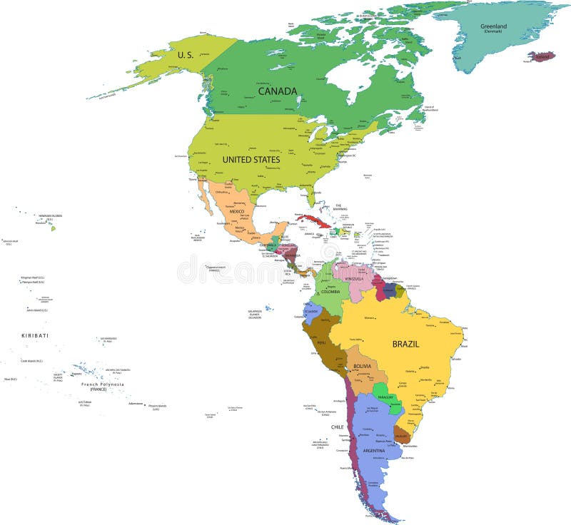
Free with trial Map of south and north america with countries, capitals and major cities. Major cities vectors Map of south and north america with countries. Capitals and major cities
Free with trial Vector map of France. With major cities. Major cities vectors Vector map of France. With major cities
Free with trial Vector map of Israel. With major cities. Major cities vectors Vector map of Israel. With major cities
Free with trial Exodus of Israel from Egypt and entry into Canaan. Vector art. Major cities vectors Exodus of Israel from Egypt and entry into Canaan. Vector art
Free with trial The United States of America. Capital states and major cities vector map. Alaska and Hawaï. Major cities vectors The United States of America. Capital states and major cities map. The United States of America. Capital states and major cities vector map. Alaska and Hawa. The United States of America. Capital states and major cities vector map. Alaska and Hawaï.
Free with trial States capitals and major cities of the United States of America. Beautiful modern graphic USA map. Alaska and Hawaï. Major cities vectors States capitals and major cities of the United States of America. Beautiful modern graphic USA map. Alaska and Hawa
Free with trial Icons Chinese major cities flat style. Shanghai and china, Beijing and Guangzhou, Hong Kong and Dalian, Tianjin and Harbin, Chongqing and Hangzhou illustration. Major cities vectors Icons Chinese Major Cities Flat Style. Shanghai and china, Beijing and Guangzhou, Hong Kong and Dalian, Tianjin and Harbin, Chongqing and Hangzhou illustration
Free with trial Kenya map and cities. Map of Kenya and text design with major cities. Major cities vectors Kenya map and cities. Map of Kenya and text design with major cities
Free with trial Ohio counties map also showing major cities. Counties and cities are labeled. Major cities vectors Ohio Counties Map. Also showing major cities. Counties and cities are labeled
Free with trial Cities in Canada. Famous places of major cities in Canada. Major cities vectors Cities in Canada. Famous places of major cities in Canada
Free with trial A detailed map of Australia on a white background. The layers in the associated adobe illustrator file allow you to select, deselect or edit the outline, fill colour, states, cities, seas and major land features. This Vector illustration may be edited and re-sized without loosing quality. Major cities vectors Australia Orange Map Vector Illustration. A detailed map of Australia on a white background. The layers in the associated adobe illustrator file allow you to. A detailed map of Australia on a white background. The layers in the associated adobe illustrator file allow you to select, deselect or edit the outline, fill colour, states, cities, seas and major land features. This Vector illustration may be edited and re-sized without loosing quality.
Free with trial A High Detail vector Map of United Kingdom Regions, Administrative Regions and major cities and a vector globe with UK highlighted. Major cities vectors Uk Administrative Green Map Set. A High Detail vector Map of United Kingdom Regions, Administrative Regions and major cities and a vector globe with UK. A High Detail vector Map of United Kingdom Regions, Administrative Regions and major cities and a vector globe with UK highlighted.
Free with trial Division of the 12 Tribes of Israel. Vector art. Major cities vectors Division of the 12 Tribes of Israel. Vector art
Free with trial Physical Map of the Holy Land. Vector art. Major cities vectors Physical Map of the Holy Land. Vector art
Free with trial Brazil. 3D map of Brazil in 3 versions. Flat map of Brazil as well as the Brazilian flag are included as a bonus. Major cities vectors Brazil. 3D map of Brazil in 3 versions. Flat map of Brazil as well as the Brazilian flag are included as a bonus
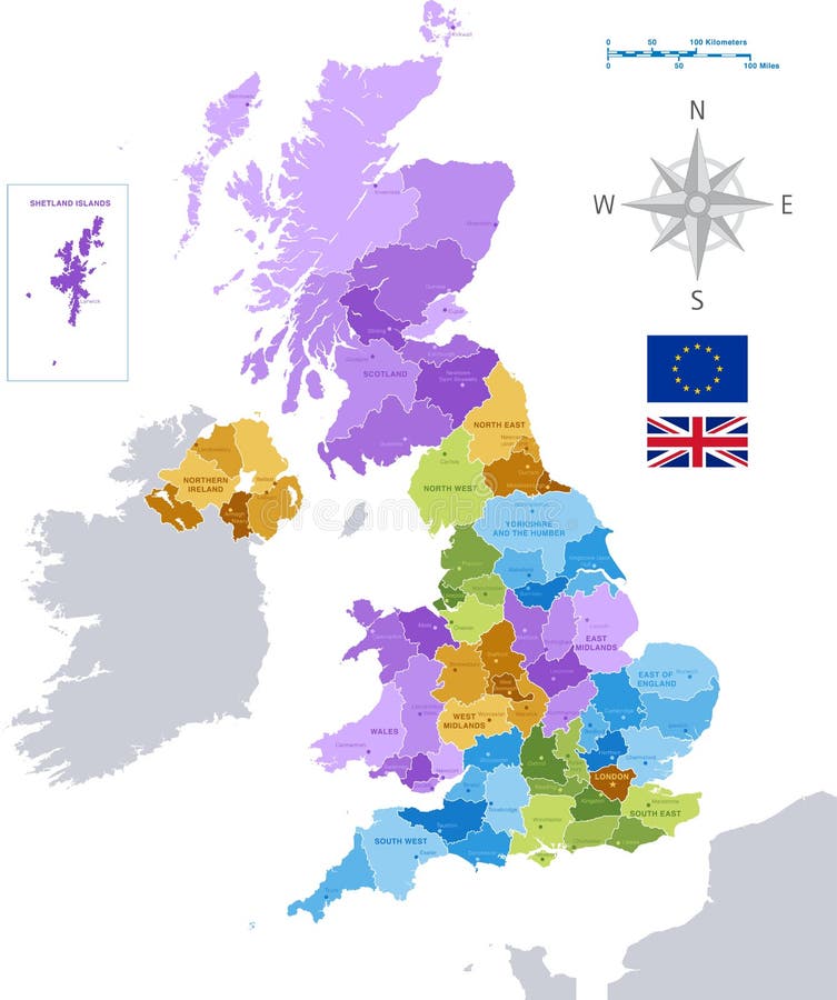
Free with trial High Detail Colorful vector Map of United Kingdom Regions, Administrative divisions and major cities. All elements are separated in editable layers clearly labeled as shown in the image. Major cities vectors Vector UK administrative map. High Detail Colorful vector Map of United Kingdom Regions, Administrative divisions and major cities. All elements are separated in. High Detail Colorful vector Map of United Kingdom Regions, Administrative divisions and major cities. All elements are separated in editable layers clearly labeled as shown in the image.
Free with trial High Detail Colorful vector Map of United Kingdom Regions, Administrative divisions and major cities, with also a 3D globe centered on UK. All elements are separated in editable layers clearly labeled as shown in the image. Major cities vectors Vector Map Set of United Kingdom. High Detail Colorful vector Map of United Kingdom Regions, Administrative divisions and major cities, with also a 3D globe. High Detail Colorful vector Map of United Kingdom Regions, Administrative divisions and major cities, with also a 3D globe centered on UK. All elements are separated in editable layers clearly labeled as shown in the image.
Free with trial England major cities abstract skylines silhouettes icons. Map of England with all major cities and administrative divisions border. England major cities abstract. Major cities vectors England major cities abstract skylines silhouettes icons. Map of England with all major cities and administrative divisions border. England major cities abstract
Free with trial Map of the great lakes and st lawrence river with major cities. Major cities vectors Map of the great lakes and st lawrence river with major cities.
Free with trial Sweden map with major cities. and flag. Major cities vectors Sweden map with major cities. And flag
Free with trial California`s vector high detailed map showing counties formations. Skylines of major cities of California. State. Major cities vectors California`s vector high detailed map showing counties formations. Skylines of major cities of California. State
Free with trial Detailed map of Ireland with administrative divisions into provinces and counties, major cities of the country, vector illustration onwhite background, for your design. Major cities vectors Detailed map of Ireland with administrative divisions into provinces and counties, major cities of the country, vector. Illustration onwhite background, for
Free with trial Portugal vector map with major cities and rivers. Major cities vectors Portugal vector map with major cities and rivers.
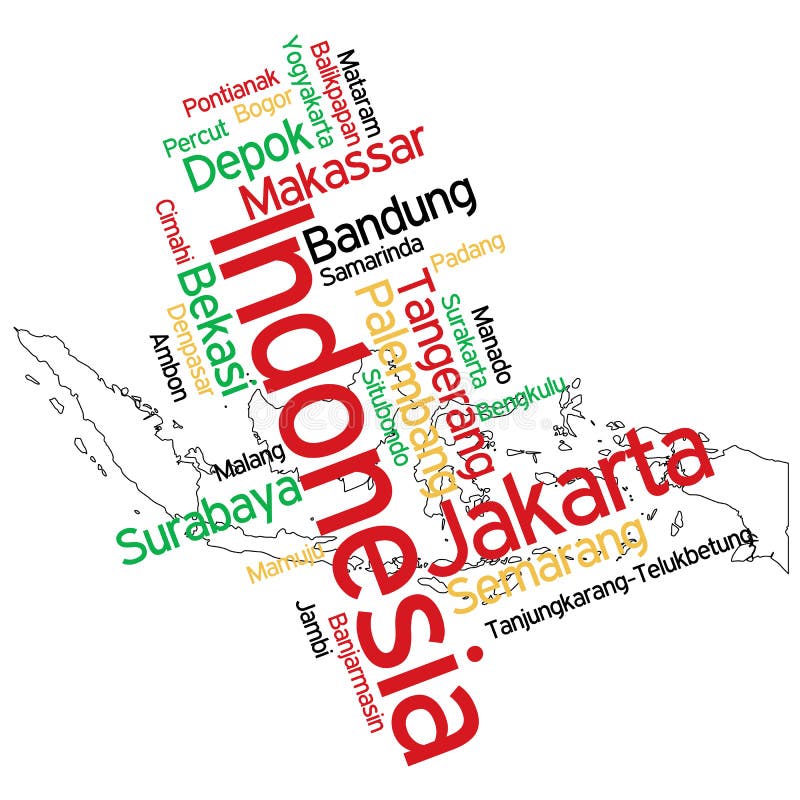
Free with trial Indonesia map and cities. Map of Indonesia and text design with major cities. Major cities vectors Indonesia map and cities. Map of Indonesia and text design with major cities
Free with trial Swiss map with major cities and boundaries. Major cities vectors Swiss map with major cities. Swiss map with major cities and boundaries. Swiss map with major cities and boundaries.
Free with trial Shanghai and the Yangtze River Delta, political map with major cities. Megalopolis of China, located where the Yangtze River drains into the East China Sea, with Hangzhou Bay and Zhoushan Archipelago. Major cities vectors Shanghai and the Yangtze River Delta, political map with major cities. Megalopolis of China, located where the Yangtze River drains into the East China Sea
Free with trial Florida congressional disctricts vector map with cityscapes of capital and major cities of Florida. Major cities vectors Florida`s congressional disctricts vector map with cityscapes of capital and major cities of Florida. Florida congressional disctricts vector map with cityscapes. Florida congressional disctricts vector map with cityscapes of capital and major cities of Florida
Free with trial Austria map and cities. Map of Austria and text design with major cities. Major cities vectors Austria map and cities. Map of Austria and text design with major cities
Free with trial Argentina map and cities. Map of Argentina and text design with major cities. Major cities vectors Argentina map and cities. Map of Argentina and text design with major cities
Free with trial Iraq map and cities. Map of Iraq and text design with major cities. Major cities vectors Iraq map and cities. Map of Iraq and text design with major cities
Free with trial Iran map and cities. Map of Iran and text design with major cities. Major cities vectors Iran map and cities. Map of Iran and text design with major cities
Free with trial A detailed green map of New Zealand on a white background. Includes driving distances and driving times for all major towns and cities. Vector illustration may be edited and re-sized without loosing quality. Major cities vectors New Zealand Green Vector Map - Driving Distances. A detailed green map of New Zealand on a white background. Includes driving distances and driving times for all. A detailed green map of New Zealand on a white background. Includes driving distances and driving times for all major towns and cities. Vector illustration may be edited and re-sized without loosing quality.
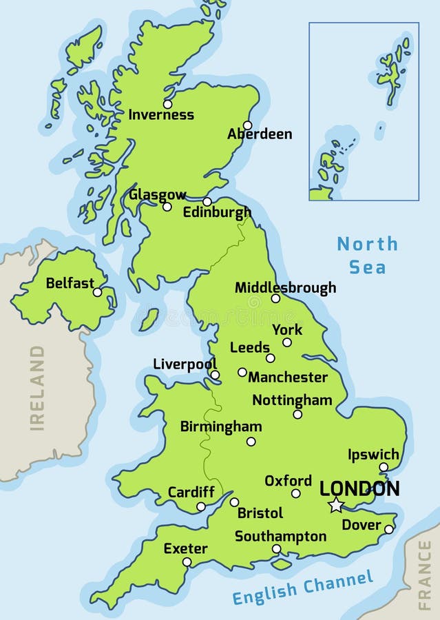
Free with trial United Kingdom map. UK map vector - major cities marked on map of the United Kingdom. Major cities vectors United Kingdom map. UK map vector - major cities marked on map of the United Kingdom
Free with trial India. Map of India. Outline illustration country map with major cities (state capitals. Major cities vectors India. Map of India. Outline illustration country map with major cities (state capitals
Free with trial Cities in South Korea. Major korean cities famous places. Major cities vectors Cities in South Korea. Major korean cities famous places
Free with trial North Korea map designed in illustration with the regions and provinces with the main cities. (Map is in high resolution). Major cities vectors Map of North Korea. North Korea map designed in illustration with the regions and provinces with the main cities. (Map is in high resolution. North Korea map designed in illustration with the regions and provinces with the main cities. (Map is in high resolution)
Free with trial North Korea map designed in illustration with the provinces and the main cities. (Map is hight resolution). Major cities vectors North Korea map. Designed in illustration with the provinces and the main cities. (Map is hight resolution
Free with trial Louisiana state political map. Detailed map of Louisiana state,in. vector format,with county borders and major. cities. Major cities vectors Louisiana state political map. Detailed map of Louisiana state,in .vector format,with county borders and major .cities
Free with trial World travel background with major tourist destinations in aircraft tail smoke. Major cities vectors World travel. Background with major tourist destinations in aircraft tail smoke
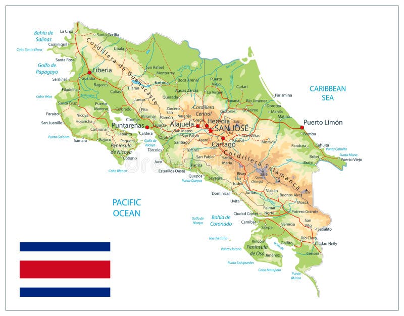
Free with trial Costa Rica Physical Map Isolated On White. Detailed map of Costa Rica with shaded relief map, major cities, roads and water objects. Major cities vectors Costa Rica Physical Map Isolated On White. Detailed map of Costa Rica with shaded relief map, major cities, roads and water objects
Free with trial E. U. political map. Political map of Europe in vector format,with all the major cities with distinction between members and non-members. Major cities vectors E.U. political map. Political map of Europe in vector format,with all the major cities with distinction between members and non-members
Free with trial Detailed map of Mississippi state,in. vector format,with county borders and major. cities. Major cities vectors Mississippi road map. Detailed map of Mississippi state,in .vector format,with county borders and major .cities. Detailed map of Mississippi state,in .vector format,with county borders and major .cities
Free with trial Indiana state political map. Detailed map of Indiana state,in. vector format,with county borders,roads and major. cities. Major cities vectors Indiana state political map. Detailed map of Indiana state,in .vector format,with county borders,roads and major .cities
Free with trial Detailed map of New Mexico state,in vector format,with county borders,roads and major cities. Major cities vectors New Mexico state political map. Detailed map of New Mexico state,in vector format,with county borders,roads and major cities. Detailed map of New Mexico state,in vector format,with county borders,roads and major cities
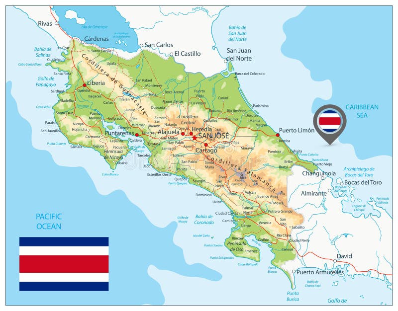
Free with trial Costa Rica Physical Map. Detailed map of Costa Rica with shaded relief map, major cities, roads and water objects. Major cities vectors Costa Rica Physical Map. Detailed map of Costa Rica with shaded relief map, major cities, roads and water objects
Free with trial Lisbon Cathedral and tram. The Patriarchal Cathedral of St. Mary Major or Lisbon Cathedral and tram. on white background. Major cities vectors Lisbon Cathedral and tram. The Patriarchal Cathedral of St. Mary Major or Lisbon Cathedral and tram. on white background
Free with trial Jerusalem at the time of Jesus. Vector art. Major cities vectors Jerusalem at the time of Jesus. Vector art
Free with trial Denmark map with major cities, flag and coat of arm. Major cities vectors Denmark map. Denmark map with major cities, flag and coat of arm. Denmark map with major cities, flag and coat of arm.
Free with trial A High Detail vector set including a Map of the United States of America States, with capitals and major cities, and the USA flag. Major cities vectors High Detail USA Blue shaded Map. A High Detail vector set including a Map of the United States of America States, with capitals and major cities, and the USA. A High Detail vector set including a Map of the United States of America States, with capitals and major cities, and the USA flag.
Free with trial A High Detail vector Map of Canada, with capitals and major cities, a 3D globe centered on North America with canada Highlighted, and Canada flag. Also all seas and major lakes are named. Major cities vectors Canada High Detail Classic Map set. A High Detail vector Map of Canada, with capitals and major cities, a 3D globe centered on North America with canada. A High Detail vector Map of Canada, with capitals and major cities, a 3D globe centered on North America with canada Highlighted, and Canada flag. Also all seas and major lakes are named.
Free with trial A High Detail vector Map of Germany States and major cities, with a 3D Globe centered on Germany and both Eu and Germany flags. Major cities vectors Vector Colorful Map of Germany. A High Detail vector Map of Germany States and major cities, with a 3D Globe centered on Germany and both Eu and Germany flags. A High Detail vector Map of Germany States and major cities, with a 3D Globe centered on Germany and both Eu and Germany flags.
Free with trial America. With the flags of the major cities. Major cities vectors America. With the flags of the major cities
Free with trial Vector graphic map of France;with major cities, blue isolated on white. Major cities vectors Vector Map of France isolated with Major Cities. Vector graphic map of France;with major cities, blue isolated on white. Vector graphic map of France;with major cities, blue isolated on white.
Free with trial England major cities abstract skylines outline icons. Map of England with all major cities and administrative divisions borders. England major cities abstract. Major cities vectors England major cities abstract skylines outline icons. Map of England with all major cities and administrative divisions borders. England major cities abstract
Free with trial Vector map of the state of Bavaria with major cities, Germany. Major cities vectors Vector map of the state of Bavaria with major cities, Germany.
Free with trial Crimea road and major cities vector map. Major cities vectors Crimea road and major cities vector map.
Free with trial Republic of the Union of Myanmar vector map with major cities. Major cities vectors Republic of the Union of Myanmar vector map with major cities.
Free with trial Vector map of the state of Baden wuerttemberg with major cities, Germany. Major cities vectors Vector map of the state of Baden wuerttemberg with major cities, Germany.
Free with trial Simplified map of Australia in orange with major cities labeled: Sydney, Brisbane, Canberra, Melbourne, Adelaide, Perth, and Darwin. Key geographic locations include Tasmania, Kangaroo Island, King Island, Flinders Island, Granville Island, and Melville Island. The map highlights the country's outline with minimal detail. Major cities vectors Simplified map of Australia in orange with major cities,ghlights the country\'s outline with minimal detail. Simplified map of Australia in orange with major. Simplified map of Australia in orange with major cities labeled: Sydney, Brisbane, Canberra, Melbourne, Adelaide, Perth, and Darwin. Key geographic locations include Tasmania, Kangaroo Island, King Island, Flinders Island, Granville Island, and Melville Island. The map highlights the country's outline with minimal detail.
Free with trial Vector map of northern europe with major cities and bodies of water. Major cities vectors Vector map of northern europe with major cities and bodies of water.
Free with trial Vector congressional districts map and major cities abstract skylines of Tennessee state. Vector congressional districts map and major cities abstract skylines. Major cities vectors Vector congressional districts map and major cities abstract skylines of Tennessee state. Vector congressional districts map and major cities abstract skylines
Free with trial Vector graphic map of China with major cities and provincial boundaries. Major cities vectors Map of China with Provinces and Major Cities. Vector graphic map of China with major cities and provincial boundaries. Vector graphic map of China with major cities and provincial boundaries.
Free with trial Detailed map of Turkey with administrative divisions into Districts and Provinces, major cities of the country, vector illustration onwhite background, for your design. Major cities vectors Detailed map of Turkey with administrative divisions into Districts and Provinces, major cities of the country, vector. Illustration onwhite background, for
Free with trial Detailed blue map of Serbia with administrative divisions, major cities on a white background, vector illustration, for your design. Major cities vectors Detailed blue map of Serbia with administrative divisions, major cities on a white background, vector illustration. For your design
Free with trial Detailed map of Hungary with administrative divisions into counties and districts, major cities of the country, vector illustration onwhite background, for your design. Major cities vectors Detailed map of Hungary with administrative divisions into counties and districts, major cities of the country, vector. Illustration onwhite background, for
Free with trial Major cities of India in the Map. Major Cities in India Pinned in the Indian Map Vector illustration. Major cities vectors Major cities of India in the Map. Major Cities in India Pinned in the Indian Map Vector illustration
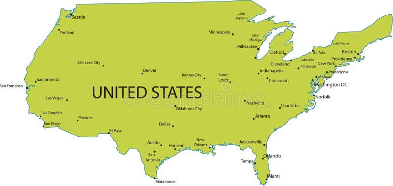
Free with trial Map of USA with major cities. Map of United states of America with major cities, vector. Major cities vectors Map of USA with major cities. Map of United states of America with major cities, vector
Free with trial England major cities abstract skylines silhouettes icons. Map of England with all major cities. Map of. Major cities vectors England major cities abstract skylines silhouettes icons. Map of England with all major cities. England major cities abstract skylines silhouettes icons. Map of
Free with trial Iran, political map with provinces, borders, capital Tehran and major cities. The Islamic Republic of Iran, IRI, also known as Persia, a country in West Asia, divided into 31 provinces. Illustration. Major cities vectors Iran, political map with provinces, borders, capital Tehran and major cities. The Islamic Republic of Iran, IRI, also known as Persia, a country in West Asia
Free with trial Bolivia vector map with major cities and roads. Major cities vectors Bolivia vector map with major cities and roads.
Free with trial Alaska State Word Cloud. State map shape with the text ALASKA and the names of the major texas cities over a white background. Major cities vectors Alaska State Word Cloud. State map shape with the text ALASKA and the names of the major texas cities over a white background
Free with trial A detailed editable vector map of the U. S. state of Arkansas. The map highlights state boundaries, major cities, highways, rivers, and geographic features. Ideal for design and presentations. Major cities vectors Vector map of Arkansas, USA. A detailed editable vector map of the U.S. state of Arkansas. The map highlights state boundaries, major cities, highways, rivers. A detailed editable vector map of the U.S. state of Arkansas. The map highlights state boundaries, major cities, highways, rivers, and geographic features. Ideal for design and presentations.
Free with trial Map Of Australia with major Towns and Cities, vector illustration. Major cities vectors Map Of Australia with major Towns and Cities, vector illustration.
 Sign in