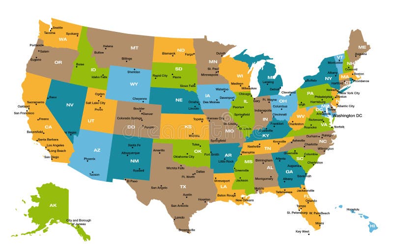
Free with trial Detailed illustration of all fifty states of United States of America with major cities and state abbreviations. All states are in separate layers and can be easily changed in Adobe Illustrator additional format. Major states vectors Map of all US states. Detailed illustration of all fifty states of United States of America with major cities and state abbreviations. All states are in separate. Detailed illustration of all fifty states of United States of America with major cities and state abbreviations. All states are in separate layers and can be easily changed in Adobe Illustrator additional format.
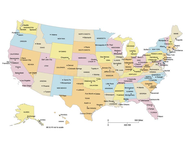
Free with trial USA map showing states, capital cities and major cities. States and cities are labeled. Clipped to US border. Major states vectors USA Map. Showing states, capital cities and major cities. States and cities are labeled. Clipped to US border
Free with trial Route 66. USA map with names of major towns. Major states vectors Route 66. USA map with names of major towns
Free with trial Vector high quality official logo collection of the Major League Soccer MLS teams. Best quality and highly detailed vector eps file is available. Major states vectors Major League Soccer teams logos. Vector high quality official logo collection of the Major League Soccer MLS teams. Best quality and highly detailed vector eps. Vector high quality official logo collection of the Major League Soccer MLS teams. Best quality and highly detailed vector eps file is available.
Free with trial Vector complete collection of army enlisted rank insignia isolated on white background, with descriptions. Eps file available. Major states vectors Army enlisted rank insignia. Vector complete collection of army enlisted rank insignia isolated on white background, with descriptions. Eps file available. Vector complete collection of army enlisted rank insignia isolated on white background, with descriptions. Eps file available.
Free with trial Army Military Rank Insignia. Set of military American enlisted army ranks insignia badges icons. Major states vectors Army Military Rank Insignia. Set of military American enlisted army ranks insignia badges icons
Free with trial Labor day. Rubber stamp with red and white stripes. Major states vectors Labor day. Rubber stamp with red and white stripes
Free with trial Vector scalable file of G-20 flags. G-20 is an economic forum consisting of 19 of the world's largest national economies, plus the European Union. Shadows (waving design) can be easily removed from vector file if needed. Included: EPS (saved as an AI8-compatible) and JPEG. Major states vectors Waving flags of G-20 countries. Vector scalable file of G-20 flags. G-20 is an economic forum consisting of 19 of the world's largest national economies, plus. Vector scalable file of G-20 flags. G-20 is an economic forum consisting of 19 of the world's largest national economies, plus the European Union. Shadows (waving design) can be easily removed from vector file if needed. Included: EPS (saved as an AI8-compatible) and JPEG.
Free with trial The United States of America. Capital states and major cities vector map. Alaska and Hawaï. Major states vectors The United States of America. Capital states and major cities map. The United States of America. Capital states and major cities vector map. Alaska and Hawa. The United States of America. Capital states and major cities vector map. Alaska and Hawaï.
Free with trial States capitals and major cities of the United States of America. Beautiful modern graphic USA map. Alaska and Hawaï. Major states vectors States capitals and major cities of the United States of America. Beautiful modern graphic USA map. Alaska and Hawa
Free with trial The United States of America USA, commonly known as the United States U. S. or America, is a federal republic composed of 50 states, a federal district, five major self-governing territories, and various possessions. At 3. 8 million square miles 9. 8 million km2, the United States is the world`s third- or fourth-largest country by total area. Major states vectors Map of The United States of America USA Divided States Maps Silhouette Illustration on White Background. The United States of America USA, commonly known as the. The United States of America USA, commonly known as the United States U.S. or America, is a federal republic composed of 50 states, a federal district, five major self-governing territories, and various possessions. At 3.8 million square miles 9.8 million km2, the United States is the world`s third- or fourth-largest country by total area.
Free with trial Badge USA Election 2020. Vector illustration of a badge about the Presidential election of 2020 in the United States of America. Major states vectors Badge USA Election 2020. Vector illustration of a badge about the Presidential election of 2020 in the United States of America
Free with trial Military Army Officer Rank Insignia. Set of American military army officer ranks insignia badges icons. Major states vectors Military Army Officer Rank Insignia. Set of American military army officer ranks insignia badges icons
Free with trial A detailed map of Australia on a white background. The layers in the associated adobe illustrator file allow you to select, deselect or edit the outline, fill colour, states, cities, seas and major land features. This Vector illustration may be edited and re-sized without loosing quality. Major states vectors Australia Orange Map Vector Illustration. A detailed map of Australia on a white background. The layers in the associated adobe illustrator file allow you to. A detailed map of Australia on a white background. The layers in the associated adobe illustrator file allow you to select, deselect or edit the outline, fill colour, states, cities, seas and major land features. This Vector illustration may be edited and re-sized without loosing quality.
Free with trial Non-governmental organizations logos. Vector logos of the major non-governmental organizations. Additional Vector file available for single elements usage. Major states vectors Non-governmental organizations logos. Vector logos of the major non-governmental organizations. Additional Vector file available for single elements usage
Free with trial Military Army Insignia Ranks. Set of military American army officer ranks insignia badges icons. Major states vectors Military Army Insignia Ranks. Set of military American army officer ranks insignia badges icons
Free with trial Military Army Enlisted Rank Insignia. Set of army military American enlisted ranks insignia badges icons. Major states vectors Military Army Enlisted Rank Insignia. Set of army military American enlisted ranks insignia badges icons
Free with trial Alaska. Outline and state flag illustation. Major states vectors Alaska. Outline and state flag illustation
Free with trial Vectored illustration as silhouette of american football player with national flag of united states of america behind as background. Major states vectors American baseball player vector. Vectored illustration as silhouette of american football player with national flag of united states of america behind as. Vectored illustration as silhouette of american football player with national flag of united states of america behind as background
Free with trial Brazil. 3D map of Brazil in 3 versions. Flat map of Brazil as well as the Brazilian flag are included as a bonus. Major states vectors Brazil. 3D map of Brazil in 3 versions. Flat map of Brazil as well as the Brazilian flag are included as a bonus
Free with trial Font vector team usa 2023 - 2024 kit sport style. United States soccer font. football style font with dynamic lines. messi, inter miami. major league. sports style letters and numbers for soccer team. Major states vectors Font vector team usa 2023 - 2024 kit sport style. United States soccer font. Football style font with dynamic lines. messi, inter miami. major league. sports
Free with trial Map of the great lakes and st lawrence river with major cities. Major states vectors Map of the great lakes and st lawrence river with major cities.
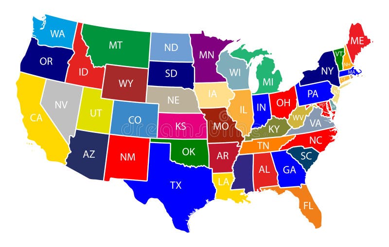
Free with trial The United States of America USA, commonly known as the United States U. S. or America, is a federal republic composed of 50 states, a federal district, five major self-governing territories, and various possessions. At 3. 8 million square miles 9. 8 million km2, the United States is the world`s third- or fourth-largest country by total area. Major states vectors Map of The United States of America USA with Colorful States with Name Illustration on White Background. The United States of America USA, commonly known as the. The United States of America USA, commonly known as the United States U.S. or America, is a federal republic composed of 50 states, a federal district, five major self-governing territories, and various possessions. At 3.8 million square miles 9.8 million km2, the United States is the world`s third- or fourth-largest country by total area.
Free with trial The United States of America USA, commonly known as the United States U. S. or America, is a federal republic composed of 50 states, a federal district, five major self-governing territories, and various possessions. At 3. 8 million square miles 9. 8 million km2, the United States is the world`s third- or fourth-largest country by total area. Major states vectors Map of The United States of America USA Divided States Maps Outline Illustration on White Background. The United States of America USA, commonly known as the. The United States of America USA, commonly known as the United States U.S. or America, is a federal republic composed of 50 states, a federal district, five major self-governing territories, and various possessions. At 3.8 million square miles 9.8 million km2, the United States is the world`s third- or fourth-largest country by total area.
Free with trial California`s vector high detailed map showing counties formations. Skylines of major cities of California. State. Major states vectors California`s vector high detailed map showing counties formations. Skylines of major cities of California. State
Free with trial USA army insignia, us army military chevrons for general, lieutenant, major and brigadier. Colonel, captain, chief warrant officer and command or master sergeant, staff, specialist and private ranks. Major states vectors USA army insignia, us army military chevrons set. USA army insignia, us army military chevrons for general, lieutenant, major and brigadier. Colonel, captain. USA army insignia, us army military chevrons for general, lieutenant, major and brigadier. Colonel, captain, chief warrant officer and command or master sergeant, staff, specialist and private ranks
Free with trial Countries silhouettes. Silhouettes of several major countries on white background. Major states vectors Countries silhouettes. Silhouettes of several major countries on white background
Free with trial Florida congressional disctricts vector map with cityscapes of capital and major cities of Florida. Major states vectors Florida`s congressional disctricts vector map with cityscapes of capital and major cities of Florida. Florida congressional disctricts vector map with cityscapes. Florida congressional disctricts vector map with cityscapes of capital and major cities of Florida
Free with trial Baseball American. Baseballer Silhouette with United States of America Background. Major states vectors Baseball American. Baseballer Silhouette with United States of America Background
Free with trial Baseball American. Baseballer Silhouette with United States of America Background. Major states vectors Baseball American. Baseballer Silhouette with United States of America Background
Free with trial Military Army Enlisted Ranks Insignia. Military American army enlisted ranks insignia badges icons. Major states vectors Military Army Enlisted Ranks Insignia. Military American army enlisted ranks insignia badges icons
Free with trial India. Map of India. Outline illustration country map with major cities (state capitals. Major states vectors India. Map of India. Outline illustration country map with major cities (state capitals
Free with trial G-20 flags. High quality vector collection set of G20 flags. Original size and colors - official international version. Full editable eps file available. Part 1. Major states vectors G-20 flags. High quality vector collection set of G20 flags. Original size and colors - official international version. Full editable eps file available. Part 1
Free with trial A High Detail vector set including a Map of the United States of America States, with capitals and major cities, and the USA flag. Major states vectors High Detail USA Blue shaded Map. A High Detail vector set including a Map of the United States of America States, with capitals and major cities, and the USA. A High Detail vector set including a Map of the United States of America States, with capitals and major cities, and the USA flag.
Free with trial A High Detail vector Map of Germany States and major cities, with a 3D Globe centered on Germany and both Eu and Germany flags. Major states vectors Vector Colorful Map of Germany. A High Detail vector Map of Germany States and major cities, with a 3D Globe centered on Germany and both Eu and Germany flags. A High Detail vector Map of Germany States and major cities, with a 3D Globe centered on Germany and both Eu and Germany flags.
Free with trial America. With the flags of the major cities. Major states vectors America. With the flags of the major cities
Free with trial League Soccer MLS. NY City, Inter Miami CF Toronto Charlotte CF Montreal NY Red Bulls Orlando City SC, Chicago Fire, Real Salt Lake, Seattle Sounders, San Jose Earthquakes, Colorado Rapids etc. Major states vectors League Soccer MLS. NY City, Inter Miami CF, Toronto, Charlotte, CF Montreal, NY Red Bulls, Orlando City SC, Chicago Fire, Real. League Soccer MLS. NY City, Inter. League Soccer MLS. NY City, Inter Miami CF Toronto Charlotte CF Montreal NY Red Bulls Orlando City SC, Chicago Fire, Real Salt Lake, Seattle Sounders, San Jose Earthquakes, Colorado Rapids etc
Free with trial This 20 flags updated at 2011. Major states vectors National Flags of G20. This 20 flags updated at 2011. This 20 flags updated at 2011.
Free with trial United States major river basins, political map. Nineteen major river basins, highlighted in different colors. Map with the silhouette of the USA, also showing the borders of the individual states. Major states vectors United States major river basins, political map. Nineteen major river basins, highlighted in different colors. Map with the silhouette of the USA, also showing
Free with trial Major League Soccer cup trophy cartoon icon design isolated on white background. Premier professional soccer league in the United States and Canada. Creative soccer, champions cup concepts. Major states vectors Major League Soccer cup trophy cartoon icon design isolated on white background. Premier professional soccer league in the United. States and Canada. Creative. Major League Soccer cup trophy cartoon icon design isolated on white background. Premier professional soccer league in the United States and Canada. Creative soccer, champions cup concepts
Free with trial G20 countries flags. Major world advanced and emerging economies states, official Group of Twenty flag labels. International financial summit forum meeting flags symbols. Isolated vector icons set. Major states vectors G20 countries flags. Major world advanced and emerging economies states, official Group of Twenty flag labels vector set. G20 countries flags. Major world. G20 countries flags. Major world advanced and emerging economies states, official Group of Twenty flag labels. International financial summit forum meeting flags symbols. Isolated vector icons set
Free with trial Map of the United States filled with the national flag design. Each state outline is visible, with the stars in a blue field occupying the upper left, representing the union states. Red and white horizontal stripes fill the remaining areas. The overall image symbolizes national unity and patriotism. Major geographical features like Alaska and Hawaii are included. Major states vectors A map of the United States of America, filled with the design of the American flag. Map of the United States filled with the national flag design. Each state. Map of the United States filled with the national flag design. Each state outline is visible, with the stars in a blue field occupying the upper left, representing the union states. Red and white horizontal stripes fill the remaining areas. The overall image symbolizes national unity and patriotism. Major geographical features like Alaska and Hawaii are included.
Free with trial Shoulder army mark insignia of US MAJOR. Shoulder army pad mark for the MAJOR insignia rank in the United States Army. Major states vectors Shoulder army mark insignia of US MAJOR. Shoulder army pad mark for the MAJOR insignia rank in the United States Army
Free with trial Shoulder pad military officer insignia of the USA MAJOR. Shoulder pad military officer insignia for the MAJOR insignia rank in the United States Army. Major states vectors Shoulder pad military officer insignia of the USA MAJOR. Shoulder pad military officer insignia for the MAJOR insignia rank in the United States Army
Free with trial Major deserts of North America, political map of the Big Four, located in the Western USA and Northern Mexico. North American Desert, formed by the Great Basin, Mojave, Sonoran, and Chihuahuan deserts. Major states vectors Major deserts of North America, political map of the Big Four. Located in the Western USA and Northern Mexico.North American Desert, formed by the Great Basin. Major deserts of North America, political map of the Big Four, located in the Western USA and Northern Mexico.North American Desert, formed by the Great Basin, Mojave, Sonoran, and Chihuahuan deserts.
Free with trial United states marine ranks on white backgrou7nd. Set of the ranks of the united states marine corps. Major states vectors United states marine ranks on white backgrou7nd. Set of the ranks of the united states marine corps
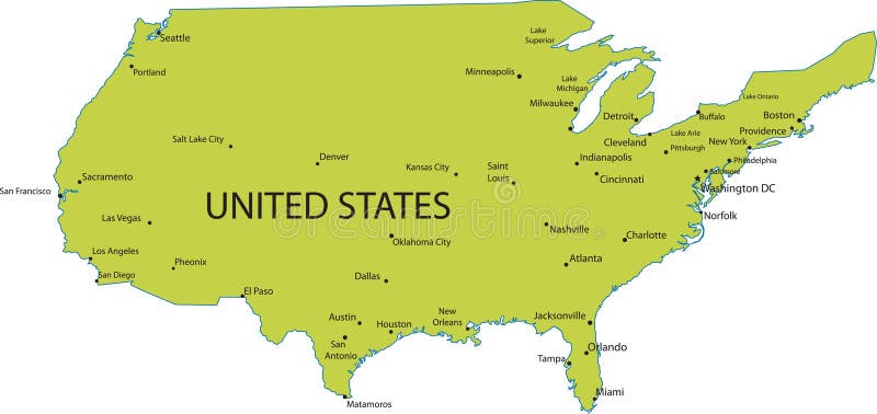
Free with trial Map of USA with major cities. Map of United states of America with major cities, vector. Major states vectors Map of USA with major cities. Map of United states of America with major cities, vector
Free with trial Vector map of the state of Baden wuerttemberg with major cities, Germany. Major states vectors Vector map of the state of Baden wuerttemberg with major cities, Germany.
Free with trial A detailed black and white vector map of North America, clearly outlining the continent's major countries: Canada, the United States of America, and Mexico. The map features distinct borders for all US states and includes text labels for Canada and Mexico. Presented as a clean silhouette against a white background, this graphic is ideal for educational materials, geographical studies, presentations, travel planning, or any project requiring a clear and accurate representation of the North American political landscape. Its minimalist design makes it versatile for various applications. Major states vectors North America Political Map with Countries and US States. A detailed black and white vector map of North America, clearly outlining the continent's major. A detailed black and white vector map of North America, clearly outlining the continent's major countries: Canada, the United States of America, and Mexico. The map features distinct borders for all US states and includes text labels for Canada and Mexico. Presented as a clean silhouette against a white background, this graphic is ideal for educational materials, geographical studies, presentations, travel planning, or any project requiring a clear and accurate representation of the North American political landscape. Its minimalist design makes it versatile for various applications.
Free with trial Vector map of northern europe with major cities and bodies of water. Major states vectors Vector map of northern europe with major cities and bodies of water.
Free with trial SGM sergeant major insignia of US army isolated icon. Vector senior non-commissioned rank, appointment officer in armed forces, police enlisted military rank stripe. United States armed forces chevron. Major states vectors Sergeant major SGM soldier military rank insignia. SGM sergeant major insignia of US army isolated icon. Vector senior non-commissioned rank, appointment officer. SGM sergeant major insignia of US army isolated icon. Vector senior non-commissioned rank, appointment officer in armed forces, police enlisted military rank stripe. United States armed forces chevron
Free with trial SMA sergeant major of army insignia of US forces isolated icon. Vector rank of non-commissioned officer armed forces, police enlisted military stripe. United States chevron, sign on uniform. Major states vectors Sergeant major of the army rank insignia SMA sign. SMA sergeant major of army insignia of US forces isolated icon. Vector rank of non-commissioned officer armed. SMA sergeant major of army insignia of US forces isolated icon. Vector rank of non-commissioned officer armed forces, police enlisted military stripe. United States chevron, sign on uniform
Free with trial Sergeant major of the army rank insignia sign isolated. Vector SMA sergeant-major, rank of non-commissioned officer armed forces. United States chevron, sign on uniform police enlisted military stripe. Major states vectors US forces SMA sergeant major of army insignia icon. Sergeant major of the army rank insignia sign isolated. Vector SMA sergeant-major, rank of non-commissioned. Sergeant major of the army rank insignia sign isolated. Vector SMA sergeant-major, rank of non-commissioned officer armed forces. United States chevron, sign on uniform police enlisted military stripe
Free with trial The United States of America USA, commonly known as the United States U. S. or America, is a federal republic composed of 50 states, a federal district, five major self-governing territories, and various possessions. At 3. 8 million square miles 9. 8 million km2, the United States is the world`s third- or fourth-largest country by total area. Major states vectors Map of The United States of America USA with Colorful States Illustration on White Background. The United States of America USA, commonly known as the United. The United States of America USA, commonly known as the United States U.S. or America, is a federal republic composed of 50 states, a federal district, five major self-governing territories, and various possessions. At 3.8 million square miles 9.8 million km2, the United States is the world`s third- or fourth-largest country by total area.
Free with trial Nine different flags of major countries. Vector. Major states vectors Nine different flags of major countries. Vector
Free with trial Venezuela, States and capitals om white. Major states vectors Venezuela, States and capitals. Venezuela, States and capitals om white. Venezuela, States and capitals om white.
Free with trial 20 of 50 states of the United States, divided into counties with territory nicknames, Detailed vector Mississippi Map with name and date admitted to the Union, travel poster and postcard for design. Major states vectors 20 of 50 states of the United States, divided into counties with territory nicknames, Detailed vector Mississippi Map with name. And date admitted to the Union. 20 of 50 states of the United States, divided into counties with territory nicknames, Detailed vector Mississippi Map with name and date admitted to the Union, travel poster and postcard for design
Free with trial 20 of 50 states of the United States with a name, nickname, and date admitted to the Union, Detailed Vector Mississippi Map for printing posters, postcards and t-shirts. Major states vectors 20 of 50 states of the United States with a name, nickname, and date admitted to the Union, Detailed Vector Mississippi Map for. Printing posters, postcards and
Free with trial Vector congressional districts map and major cities abstract skylines of Tennessee state. Vector congressional districts map and major cities abstract skylines. Major states vectors Vector congressional districts map and major cities abstract skylines of Tennessee state. Vector congressional districts map and major cities abstract skylines
Free with trial Font vector team usa 2020 kit sport style. United States soccer font. football style font with dynamic lines. messi. major league font. sports style letters and numbers for soccer team. Major states vectors Font vector team usa 2020 kit sport style. United States soccer font. Football style font with dynamic lines. messi. major league font. sports style letters
Free with trial Logo of the United States Army. Vector illustration of the official United States Army Core Logo. Major states vectors Logo of the United States Army. Vector illustration of the official United States Army Core Logo
Free with trial Major League Soccer (MLS). Real Salt Lake, Seattle Sounders Earthquakes, Timbers, Kansas City, Colorado Austin, LA Galaxy. Major states vectors Major League Soccer (MLS). Real Salt Lake, Seattle , Earthquakes, Vancouver Whitecaps Timbers, Sporting. Major League Soccer (MLS). Real Salt Lake, Seattle. Major League Soccer (MLS). Real Salt Lake, Seattle Sounders Earthquakes, Timbers, Kansas City, Colorado Austin, LA Galaxy
Free with trial Major League Soccer (MLS). Cincinnati, Atlanta United, New England Revolution, Columbus Crew, Nashville, Orlando City SC, Philadelphia Union, Toronto, Inter Miami, Chicago Fire FC, Red Bulls etc. Major states vectors Major League Soccer (MLS). Cincinnati, Atlanta United, New England Revolution. Major League Soccer (MLS). Cincinnati, Atlanta United, New England Revolution. Major League Soccer (MLS). Cincinnati, Atlanta United, New England Revolution, Columbus Crew, Nashville, Orlando City SC, Philadelphia Union, Toronto, Inter Miami, Chicago Fire FC, Red Bulls etc
Free with trial Sport logos: MLS, NBA, MLB, NFL, NHL. Major League Soccer National Basketball Association Major League Baseball MLB National Football League NFL, National Hockey League NHL. Kyiv,Ukr - Mar 13, 2023. Major states vectors Sport logos: MLS, NBA, MLB, NFL, NHL. Major League Soccer, National Basketball Association, Major League Baseball MLB, National. Sport logos: MLS, NBA, MLB, NFL. Sport logos: MLS, NBA, MLB, NFL, NHL. Major League Soccer National Basketball Association Major League Baseball MLB National Football League NFL, National Hockey League NHL. Kyiv,Ukr - Mar 13, 2023
Free with trial Baseball diamond and bats under united states icon. Green united states icon with a baseball diamond and crossed bats. Major states vectors Baseball diamond and bats under united states icon. Green united states icon with a baseball diamond and crossed bats
Free with trial United states coast guard ranks on white background. Set of the ranks of the united states coast guard corps. Major states vectors United states coast guard ranks on white background. Set of the ranks of the united states coast guard corps
Free with trial United states navy ranks on white background. Set of the ranks of the united states navy corps. Major states vectors United states navy ranks on white background. Set of the ranks of the united states navy corps
Free with trial Map of the Gulf Stream and major North Atlantic Ocean currents. Sea water is circulating in clockwise direction, the warm currents highlighted in red, and the cold ones in blue. Illustration. Vector. Major states vectors Map of the Gulf Stream and major North Atlantic Ocean currents. Sea water is circulating in clockwise direction, the warm currents highlighted in red, and the
Free with trial United states air force ranks on white background. Set of the ranks of the united states air force corps. Major states vectors United states air force ranks on white background. Set of the ranks of the united states air force corps
Free with trial New York State economic regions, multi colored political map. Major economic regions of New York, a state of the Northeastern United States, and one of the Mid-Atlantic states. Illustration. Vector. Major states vectors New York State economic regions, multi colored political map. Major economic regions of New York, a state of the Northeastern United States, and one of the Mid
Free with trial Stylized vector map of Washington DC United states showing urban districts, major road networks, waterways, and surrounding landscape in a modern abstract cartographic design. Major states vectors Map of Washington DC United states. Stylized vector map of Washington DC United states showing urban districts, major road networks, waterways, and surrounding. Stylized vector map of Washington DC United states showing urban districts, major road networks, waterways, and surrounding landscape in a modern abstract cartographic design
Free with trial A striking black silhouette map of North America, showcasing its political boundaries against a pristine white background. The detailed illustration includes the outlines of Canada, the United States (with state borders), Mexico, Central American countries, and major Caribbean islands. This clean, high-contrast graphic is ideal for educational materials, presentations, infographics, or any design project requiring a clear geographical representation of the North American continent and its internal divisions. Major states vectors North America Political Map Silhouette. A striking black silhouette map of North America, showcasing its political boundaries against a pristine white background. A striking black silhouette map of North America, showcasing its political boundaries against a pristine white background. The detailed illustration includes the outlines of Canada, the United States (with state borders), Mexico, Central American countries, and major Caribbean islands. This clean, high-contrast graphic is ideal for educational materials, presentations, infographics, or any design project requiring a clear geographical representation of the North American continent and its internal divisions.
Free with trial Natural gas pipelines from Russia to Europe, political map. Existing major pipelines, shown in different colors. Nord Stream, Yamal, Brotherhood, Central Asia, Soyouz, Blue Stream and Turkstream. Major states vectors Natural gas pipelines from Russia to Europe, political map. Existing major pipelines, shown in different colors. Nord Stream, Yamal, Brotherhood, Central Asia
Free with trial Stylised Vector Passport Stamps. Passport stamps of major US airports in vector format. Major states vectors Stylised Vector Passport Stamps. Passport stamps of major US airports in vector format
Free with trial Alaska State Word Cloud. State map shape with the text ALASKA and the names of the major texas cities over a white background. Major states vectors Alaska State Word Cloud. State map shape with the text ALASKA and the names of the major texas cities over a white background
Free with trial Map of Saint Croix Island, United States Virgin Islands, contains geography outlines for land mass, water, major roads and minor roads. Major states vectors Map of Saint Croix Island. United States Virgin Islands, contains geography outlines for land mass, water, major roads and minor roads
Free with trial Philip H. Sheridan, 1831-1888, he was a career United States army officer and a union general in the American civil war, famous for his rapid rise to major general, vintage line drawing or engraving illustration. Major states vectors Philip H. Sheridan, vintage illustration. Philip H. Sheridan, 1831-1888, he was a career United States army officer and a union general in the American civil war. Philip H. Sheridan, 1831-1888, he was a career United States army officer and a union general in the American civil war, famous for his rapid rise to major general, vintage line drawing or engraving illustration
Free with trial Vector map and major cities of Ohio state. Major states vectors Vector map and major cities of Ohio state. Vector map and major cities of Ohio
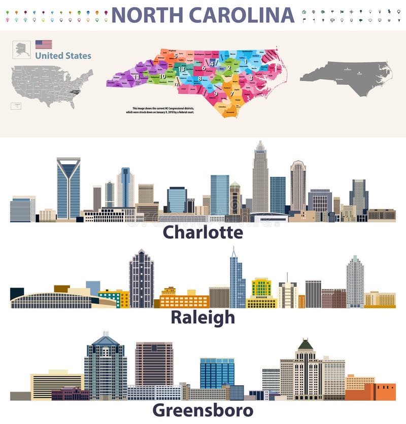
Free with trial Vector congressional districts map and major cities skylines of North Carolina. Major states vectors Vector congressional districts map and major cities skylines of North Carolina. Congressional districts map and major cities skylines of North Carolina
 Sign in