Free with trial 3D Isometric Map of the United States of America. It's a high resolution image with a CLIPPING PATH for easy remove unwanted shadows underneath. Map clipping vectors 3D Isometric Map of the United. States of America. It's a high resolution image with a CLIPPING PATH for easy remove unwanted shadows underneath
Free with trial Kazakhstan Map with National Flag Vector Illustration. With the flag clipping masked. Map clipping vectors Kazakhstan Map with National Flag Vector Illustration. With the flag clipping masked
Free with trial 3D Isometric Map of the United States of America. It's a high resolution image with a CLIPPING PATH for easy remove unwanted shadows underneath. Map clipping vectors 3D Isometric Map of the United. States of America. It's a high resolution image with a CLIPPING PATH for easy remove unwanted shadows underneath
Free with trial Globes with North and South America with borders of Sovereign states and map marker set with state flags of continents with captions in alphabet order. Contain the Clipping Path. There is in addition a vector format (EPS 10). Map clipping vectors Map marker with flags North and South America with globe set. Globes with North and South America with borders of Sovereign states and map marker set with state. Globes with North and South America with borders of Sovereign states and map marker set with state flags of continents with captions in alphabet order. Contain the Clipping Path. There is in addition a vector format (EPS 10)
Free with trial Set of Flat Map Pointers With World States Flags. Clipping paths included in additional jpg format. Map clipping vectors Set of Flat Map Pointers With World States Flags. Clipping paths included in additional jpg format
Free with trial A 3D glossy red map location pin icon with a metallic tip, presented as an isolated cutout element for navigation and map design applications. Map clipping vectors 3D Red Map Location Pin Icon Isolated on Transparent Background. A 3D glossy red map location pin icon with a metallic tip, presented as an isolated cutout. A 3D glossy red map location pin icon with a metallic tip, presented as an isolated cutout element for navigation and map design applications.
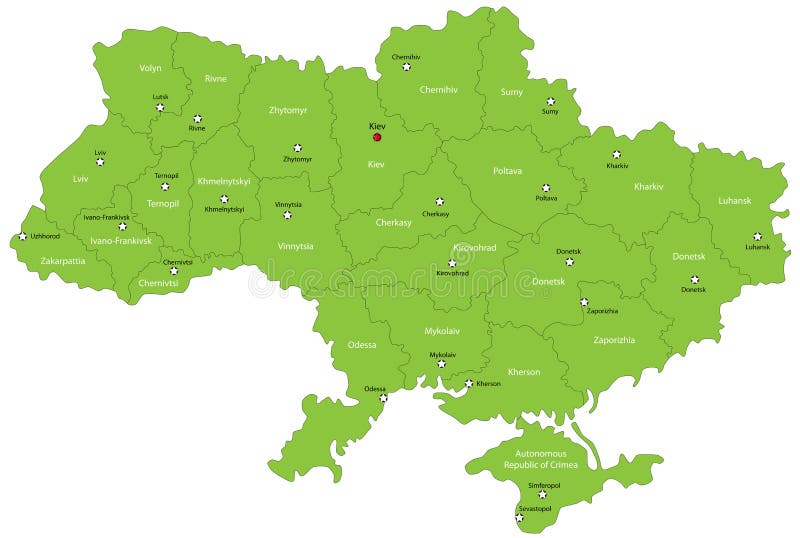
Free with trial Ukraine map designed in illustration with the oblasts colored in green colors and with the main cities. Neighbouring countries are in an additional format (. AI) in the latent layer. Map clipping vectors Ukraine map. Designed in illustration with the oblasts colored in green colors and with the main cities. Neighbouring countries are in an additional format (. Ukraine map designed in illustration with the oblasts colored in green colors and with the main cities. Neighbouring countries are in an additional format (. AI) in the latent layer.
Free with trial Lithuania map designed in illustration with the 10 counties colored in bright colors and with the main cities. On an illustration neighbouring countries are shown too. Map clipping vectors Lithuania map. Designed in illustration with the 10 counties colored in bright colors and with the main cities. On an illustration neighbouring countries are
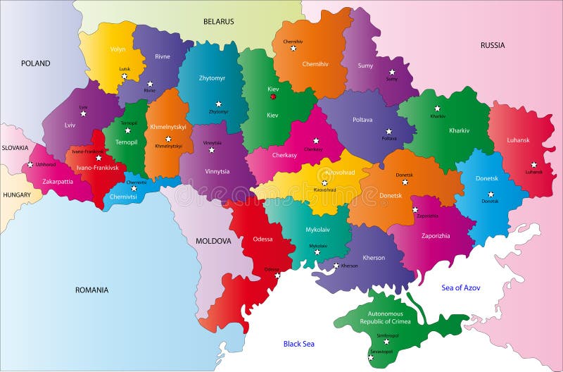
Free with trial Ukraine map designed in illustration with the region colored in bright colors and with the main cities. On an illustration neighbouring countries are shown too. Map clipping vectors Map of Ukraine. Ukraine map designed in illustration with the region colored in bright colors and with the main cities. On an illustration neighbouring countries. Ukraine map designed in illustration with the region colored in bright colors and with the main cities. On an illustration neighbouring countries are shown too
Free with trial A 3D render of a glossy red navigation map pointer pin with a metallic tip, isolated as a cutout element for digital design and location services. Map clipping vectors 3D Red Map Location Pin Marker Symbol Isolated on White Background. A 3D render of a glossy red navigation map pointer pin with a metallic tip, isolated as a. A 3D render of a glossy red navigation map pointer pin with a metallic tip, isolated as a cutout element for digital design and location services.
Free with trial Iceland map designed in illustration with provinces colored in bright colors and with the main cities. Neighbouring countries are in an additional format (. AI) in the latent layer. Map clipping vectors Map of Iceland. Iceland map designed in illustration with provinces colored in bright colors and with the main cities. Neighbouring countries are in an. Iceland map designed in illustration with provinces colored in bright colors and with the main cities. Neighbouring countries are in an additional format (.AI) in the latent layer.
Free with trial Iceland map designed in illustration with provinces colored in green colors and with the main cities. Neighbouring countries are in an additional format (. AI) in the latent layer. Map clipping vectors Map of Iceland. Iceland map designed in illustration with provinces colored in green colors and with the main cities. Neighbouring countries are in an additional. Iceland map designed in illustration with provinces colored in green colors and with the main cities. Neighbouring countries are in an additional format (.AI) in the latent layer.
Free with trial Map of Vietnam. Vietnam map designed in illustration with the regions and provinces colored in bright colors and with the main cities. (Map is hight resolution. Map clipping vectors Map of Vietnam. Vietnam map designed in illustration with the regions and provinces colored in bright colors and with the main cities. (Map is hight resolution
Free with trial A folded cartographic street map with a red pushpin marker indicating a destination point. Professional 3D illustration presented as an isolated cutout element for navigation, travel planning, and logistics design projects. Map clipping vectors Folded paper map with red location pin isolated on transparent background. A folded cartographic street map with a red pushpin marker indicating a destination. A folded cartographic street map with a red pushpin marker indicating a destination point. Professional 3D illustration presented as an isolated cutout element for navigation, travel planning, and logistics design projects.
Free with trial Colorful Map of Maryland with county. Map clipping vectors Map of Maryland. Colorful Map of Maryland with county. Colorful Map of Maryland with county.
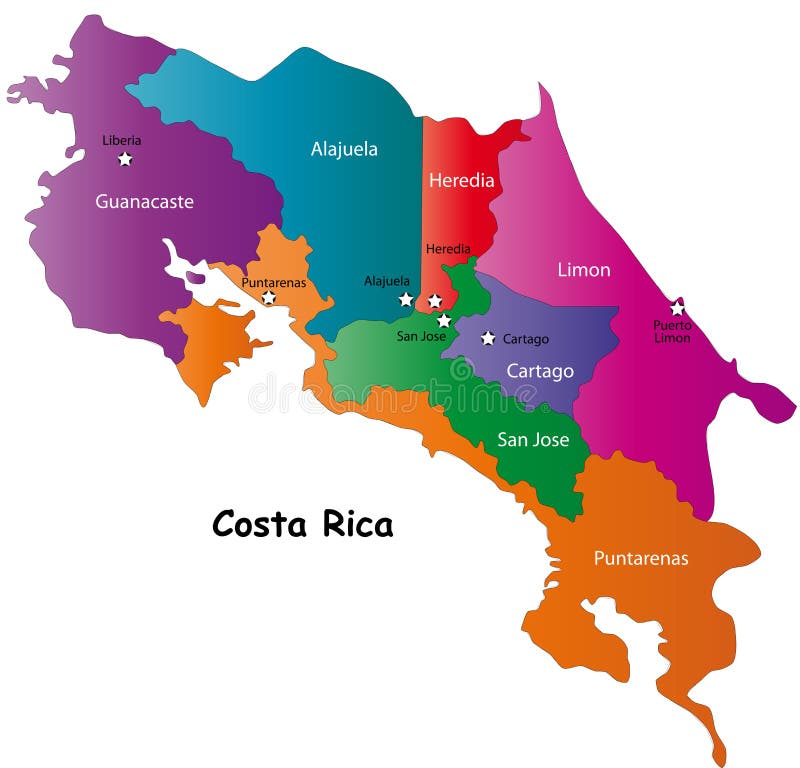
Free with trial Costa Rica map designed in illustration with 7 provinces colored in bright colors and with the main cities. Neighbouring countries are in an additional format (. AI) in the latent layer. Costa Rica map with. Map clipping vectors Map of Costa Rica. Costa Rica map designed in illustration with 7 provinces colored in bright colors and with the main cities. Neighbouring countries are in an. Costa Rica map designed in illustration with 7 provinces colored in bright colors and with the main cities. Neighbouring countries are in an additional format (.AI) in the latent layer. Costa Rica map with
Free with trial Green Map of Maryland with county and cities. Map clipping vectors Maryland map (USA). Green Map of Maryland with county and cities. Green Map of Maryland with county and cities.
Free with trial A simple black-and-white vector illustration of a traditional compass rose navigation symbol. Map clipping vectors Black and White Compass Rose Icon Design Element for Navigation and Map Projects. A simple black-and-white vector illustration of a traditional compass rose. A simple black-and-white vector illustration of a traditional compass rose navigation symbol
Free with trial Japan map. Map of Japan with Russia, China, South and the North Korea. High resolution. Vector illustration. Map clipping vectors Japan map. Map of Japan with Russia, China, South and the North Korea. High resolution. Vector illustration
Free with trial Costa Rica map designed in illustration with 7 provinces colored in green colors and with the main cities. Neighbouring countries are in an additional format (. AI) in the latent layer. Map clipping vectors Vector Costa Rica map. Costa Rica map designed in illustration with 7 provinces colored in green colors and with the main cities. Neighbouring countries are in. Costa Rica map designed in illustration with 7 provinces colored in green colors and with the main cities. Neighbouring countries are in an additional format (.AI) in the latent layer.
Free with trial Map of Japan with Russia, China, South and the North Korea. Borders of the countries are shown by red colour. High resolution. Map clipping vectors Map of Japan. With Russia, China, South and the North Korea. Borders of the countries are shown by red colour. High resolution
Free with trial Conceptual logistics featuring a small clay delivery truck loaded with cardboard parcel boxes and a large glowing glass location pin. Map clipping vectors Delivery truck with cardboard boxes and a glass map pin. Conceptual logistics featuring a small clay delivery truck loaded with cardboard parcel boxes and a. Conceptual logistics featuring a small clay delivery truck loaded with cardboard parcel boxes and a large glowing glass location pin
Free with trial Costa Rica Map. Map of the Republic of Costa Rica with the provinces colored and boudaries. Map clipping vectors Costa Rica Map. Map of the Republic of Costa Rica with the provinces colored and boudaries
Free with trial Panama map. Highly detailed vector map of Panama with administrative regions, main cities and roads. Map clipping vectors Panama map. Highly detailed vector map of Panama with administrative regions, main cities and roads
Free with trial US map pointing locations. Illustration isolated over a white background. Map clipping vectors US map pointing locations. Illustration isolated over a white background
Free with trial Black cut here line. Scissors cutting isolated. Dotted coupon border with scissors symbol icon. Dashed strip for school templates and labels. Separation outline element. Vector png. Map clipping vectors Black cut here line. Scissors cutting isolated. Dotted coupon border with. Scissors symbol icon. Dashed strip for school templates and labels. Separation. Black cut here line. Scissors cutting isolated. Dotted coupon border with scissors symbol icon. Dashed strip for school templates and labels. Separation outline element. Vector png
Free with trial Phone with navigation map. This is file of EPS10 format. Map clipping vectors Phone with map. Phone with navigation map. This is file of EPS10 format. Phone with navigation map. This is file of EPS10 format.
Free with trial Abstract Australia map with white circle. On gray. Map clipping vectors Abstract Australia map with white circle. On gray
Free with trial Map of the United States of America. USA map, blue color. Map clipping vectors Map of the United States of America. USA map, blue color
Free with trial Set of torn colored paper sheets and ripped paper strips isolated on transparent or white background. Collection of realistic paper textures with rough ripped edges, layered scraps, different shapes. Map clipping vectors Set of torn colored paper. Sheets and ripped paper strips isolated on transparent or white background. Collection of realistic paper textures with rough ripped. Set of torn colored paper sheets and ripped paper strips isolated on transparent or white background. Collection of realistic paper textures with rough ripped edges, layered scraps, different shapes
Free with trial Treasure map on roll paper. Illustration. Map clipping vectors Treasure map on roll paper. Illustration
Free with trial U. S. states - map of Minnesota. Hand made. Rivers and lakes are shown. Please look at my other images of cartographic series - they are all very detailed and carefully drawn by hand WITH RIVERS AND LAKES. Map clipping vectors Map of Minnesota with lakes and rivers. U.S. states - map of Minnesota. Hand made. Rivers and lakes are shown. Please look at my other images of cartographic. U.S. states - map of Minnesota. Hand made. Rivers and lakes are shown. Please look at my other images of cartographic series - they are all very detailed and carefully drawn by hand WITH RIVERS AND LAKES.
Free with trial Treasure map on brown paper. Illustration. Map clipping vectors Treasure map on brown paper. Illustration
Free with trial Black set of cut here lines. Scissors cutting isolated. Dotted coupon border with scissors symbol icon. Dashed strip templates, tickets. Separation outline ribbon element. Vector png. Map clipping vectors Black set of cut here lines. Scissors cutting isolated. Dotted coupon border. With scissors symbol icon. Dashed strip templates, tickets. Separation outline. Black set of cut here lines. Scissors cutting isolated. Dotted coupon border with scissors symbol icon. Dashed strip templates, tickets. Separation outline ribbon element. Vector png
Free with trial U. S. states - map of Oklahoma. Hand made. Rivers and lakes are shown. Please look at my other images of cartographic series - they are all very detailed and carefully drawn by hand WITH RIVERS AND LAKES. Map clipping vectors Map of Oklahoma with lakes and rivers. U.S. states - map of Oklahoma. Hand made. Rivers and lakes are shown. Please look at my other images of cartographic. U.S. states - map of Oklahoma. Hand made. Rivers and lakes are shown. Please look at my other images of cartographic series - they are all very detailed and carefully drawn by hand WITH RIVERS AND LAKES.
Free with trial U. S. states - map of North Carolina. Hand made. Rivers and lakes are shown. Please look at my other images of cartographic series - they are all very detailed and carefully drawn by hand WITH RIVERS AND LAKES. Map clipping vectors Map of North Carolina with lakes and rivers. U.S. states - map of North Carolina. Hand made. Rivers and lakes are shown. Please look at my other images of. U.S. states - map of North Carolina. Hand made. Rivers and lakes are shown. Please look at my other images of cartographic series - they are all very detailed and carefully drawn by hand WITH RIVERS AND LAKES.
Free with trial U. S. states - map of Alabama. Hand made. Rivers and lakes are shown. Please look at my other images of cartographic series - they are all very detailed and carefully drawn by hand WITH RIVERS AND LAKES. Map clipping vectors Map of Alabama with lakes and rivers. U.S. states - map of Alabama. Hand made. Rivers and lakes are shown. Please look at my other images of cartographic series. U.S. states - map of Alabama. Hand made. Rivers and lakes are shown. Please look at my other images of cartographic series - they are all very detailed and carefully drawn by hand WITH RIVERS AND LAKES.
Free with trial A dark green abstract isolated on transparent background. Map clipping vectors Abstract Green Shape Isolated. A dark green abstract isolated on transparent background. A dark green abstract isolated on transparent background.
Free with trial U. S. states - map of Idaho. Hand made. Rivers and lakes are shown. Please look at my other images of cartographic series - they are all very detailed and carefully drawn by hand WITH RIVERS AND LAKES. Map clipping vectors Map of Idaho with lakes and rivers. U.S. states - map of Idaho. Hand made. Rivers and lakes are shown. Please look at my other images of cartographic series. U.S. states - map of Idaho. Hand made. Rivers and lakes are shown. Please look at my other images of cartographic series - they are all very detailed and carefully drawn by hand WITH RIVERS AND LAKES.
Free with trial U. S. states - map of New York. Hand made. Rivers and lakes are shown. Please look at my other images of cartographic series - they are all very detailed and carefully drawn by hand WITH RIVERS AND LAKES. Map clipping vectors Map of New York with lakes and rivers. U.S. states - map of New York. Hand made. Rivers and lakes are shown. Please look at my other images of cartographic. U.S. states - map of New York. Hand made. Rivers and lakes are shown. Please look at my other images of cartographic series - they are all very detailed and carefully drawn by hand WITH RIVERS AND LAKES.
Free with trial U. S. states - map of Missouri. Hand made. Rivers and lakes are shown. Please look at my other images of cartographic series - they are all very detailed and carefully drawn by hand WITH RIVERS AND LAKES. Map clipping vectors Map of Missouri with lakes and rivers. U.S. states - map of Missouri. Hand made. Rivers and lakes are shown. Please look at my other images of cartographic. U.S. states - map of Missouri. Hand made. Rivers and lakes are shown. Please look at my other images of cartographic series - they are all very detailed and carefully drawn by hand WITH RIVERS AND LAKES.
Free with trial Flat style classic black modern mobile phone with navigator program isolated on. Transparent background. Vector PNG. Map clipping vectors Flat style classic black modern mobile phone with navigator program isolated on. Transparent background. Vector PNG
Free with trial U. S. states - Northeastern United States - New York - hand made map. Rivers and lakes are shown. Please look at my other images of cartographic series - they are all very detailed and carefully drawn by hand WITH RIVERS AND LAKES. Map clipping vectors Northeastern United States - New York - map with lakes and river. U.S. states - Northeastern United States - New York - hand made map. Rivers and lakes are shown. U.S. states - Northeastern United States - New York - hand made map. Rivers and lakes are shown. Please look at my other images of cartographic series - they are all very detailed and carefully drawn by hand WITH RIVERS AND LAKES.
Free with trial U. S. states - map of Michigan. Hand made. Rivers and lakes are shown. Please look at my other images of cartographic series - they are all very detailed and carefully drawn by hand WITH RIVERS AND LAKES. Map clipping vectors Map of Michigan with lakes and rivers. U.S. states - map of Michigan. Hand made. Rivers and lakes are shown. Please look at my other images of cartographic. U.S. states - map of Michigan. Hand made. Rivers and lakes are shown. Please look at my other images of cartographic series - they are all very detailed and carefully drawn by hand WITH RIVERS AND LAKES.
Free with trial Treasure map on brown paper. Illustration. Map clipping vectors Treasure map on brown paper. Illustration
Free with trial A stylized black-and-white vector silhouette of a village or small town featuring houses and roads. Map clipping vectors Black and white silhouette illustration of a small town with houses and. A stylized black-and-white vector silhouette of a village or small town featuring houses. A stylized black-and-white vector silhouette of a village or small town featuring houses and roads
Free with trial United States of America with the State of Georgia selected. Map of the USA. Vector illustration. Map clipping vectors United States of America with the State of Georgia selected. Map of the USA. Vector illustration
Free with trial United States of America with the State of Kansas selected. Map of the USA. Vector illustration. Map clipping vectors United States of America with the State of Kansas selected. Map of the USA. Vector illustration
Free with trial U. S. states - map of Illinois state with paper cut effect. Hand made. Rivers and lakes are shown. Please look at my other images of cartographic series - they are all very detailed and carefully drawn by hand WITH RIVERS AND LAKES. Map clipping vectors Map of Illinois state with lakes and rivers. U.S. states - map of Illinois state with paper cut effect. Hand made. Rivers and lakes are shown. Please look at my. U.S. states - map of Illinois state with paper cut effect. Hand made. Rivers and lakes are shown. Please look at my other images of cartographic series - they are all very detailed and carefully drawn by hand WITH RIVERS AND LAKES.
Free with trial Five milk cartons are arranged in a row, each with a different color indicating various flavors. The colors are blue, orange, pink, yellow, and green. Each carton has the word "MILK" prominently displayed, along with a simple design of a pouring milk glass. The cartons have a rectangular shape with a typical folded spout found on milk packaging. The design is minimalist, featuring a blend of pastel shades to represent a collection of flavored milk packaging. Map clipping vectors Milk Carton Packaging Set. Milk Packaging with different flavor. Milk clip art. Collection of Packaging Dairy Milk. Five milk cartons are arranged in a row. Five milk cartons are arranged in a row, each with a different color indicating various flavors. The colors are blue, orange, pink, yellow, and green. Each carton has the word "MILK" prominently displayed, along with a simple design of a pouring milk glass. The cartons have a rectangular shape with a typical folded spout found on milk packaging. The design is minimalist, featuring a blend of pastel shades to represent a collection of flavored milk packaging.
Free with trial U. S. states - map of Georgia. Hand made. Rivers and lakes are shown. Please look at my other images of cartographic series - they are all very detailed and carefully drawn by hand WITH RIVERS AND LAKES. Map clipping vectors Map of Georgia state with lakes and rivers. U.S. states - map of Georgia. Hand made. Rivers and lakes are shown. Please look at my other images of cartographic. U.S. states - map of Georgia. Hand made. Rivers and lakes are shown. Please look at my other images of cartographic series - they are all very detailed and carefully drawn by hand WITH RIVERS AND LAKES.
Free with trial U. S. states - map of Florida. Hand made. Rivers and lakes are shown. Please look at my other images of cartographic series - they are all very detailed and carefully drawn by hand WITH RIVERS AND LAKES. Map clipping vectors Map of Florida with lakes and rivers. U.S. states - map of Florida. Hand made. Rivers and lakes are shown. Please look at my other images of cartographic series. U.S. states - map of Florida. Hand made. Rivers and lakes are shown. Please look at my other images of cartographic series - they are all very detailed and carefully drawn by hand WITH RIVERS AND LAKES.
Free with trial U. S. states - map of Maryland. Hand made. Rivers and lakes are shown. Please look at my other images of cartographic series - they are all very detailed and carefully drawn by hand WITH RIVERS AND LAKES. Map clipping vectors Map of Maryland with lakes and rivers. U.S. states - map of Maryland. Hand made. Rivers and lakes are shown. Please look at my other images of cartographic. U.S. states - map of Maryland. Hand made. Rivers and lakes are shown. Please look at my other images of cartographic series - they are all very detailed and carefully drawn by hand WITH RIVERS AND LAKES.
Free with trial A collection of three unique, travel-themed decorative frames designed in a clean, vector illustration style. Each frame features iconic elements related to exploration and tourism, such as vintage suitcases, compasses, airplanes, globes, and passports. The frames vary in shape, including square, ornate, and circular designs, providing versatile options for framing travel photos, vacation memories, or tourism-related graphic design projects. The aesthetic is playful yet professional, making these frames perfect for scrapbooking, travel blogs, social media posts, or promotional materials for travel agencies and tour operators. Map clipping vectors Set of Decorative Travel Themed Photo Frames. A collection of three unique, travel-themed decorative frames designed in a clean, vector illustration style. Each. A collection of three unique, travel-themed decorative frames designed in a clean, vector illustration style. Each frame features iconic elements related to exploration and tourism, such as vintage suitcases, compasses, airplanes, globes, and passports. The frames vary in shape, including square, ornate, and circular designs, providing versatile options for framing travel photos, vacation memories, or tourism-related graphic design projects. The aesthetic is playful yet professional, making these frames perfect for scrapbooking, travel blogs, social media posts, or promotional materials for travel agencies and tour operators.
Free with trial Vector Iran map. Iran map designed in illustration with regions colored in bright colors. Vector illustration. Map clipping vectors Vector Iran map. Iran map designed in illustration with regions colored in bright colors. Vector illustration
Free with trial USA map cut-out, highly detailed on the edge, with waving stars & stripes underneath. Settle thickness carefully shaded following the inner shadow light source. EPS v. 10 file with neatly organised and named layers and a 24 Mpxl Q12 JPEG preview. On and off combinations on the flags 5 shading layers can produce different styles and outcomes. Transparency is used on the shading layers. Map clipping vectors US Flag-Map Inner Shadow. USA map cut-out, highly detailed on the edge, with waving stars & stripes underneath. Settle thickness carefully shaded following the. USA map cut-out, highly detailed on the edge, with waving stars & stripes underneath. Settle thickness carefully shaded following the inner shadow light source. EPS v.10 file with neatly organised and named layers and a 24 Mpxl Q12 JPEG preview. On and off combinations on the flags 5 shading layers can produce different styles and outcomes. Transparency is used on the shading layers.
Free with trial Florida map showing capital , whit gps pin icons. Map clipping vectors Florida Map. Showing capital , whit gps pin icons
Free with trial Abstract global concept featuring a stylized clay planet Earth with North and South America continents surrounded by a sparkling clear glass ring. Map clipping vectors Clay planet Earth globe with a glowing glass ring. Abstract global concept featuring a stylized clay planet Earth with North and South America continents. Abstract global concept featuring a stylized clay planet Earth with North and South America continents surrounded by a sparkling clear glass ring
Free with trial Map mexico 3d. Map of mexico in 3d. Map clipping vectors Map mexico 3d. Map of mexico in 3d
Free with trial Turkey Map with Turkish Flag 3D, isolated on white background. Map clipping vectors Turkey Map with Turkish Flag 3D. Isolated on white background
Free with trial Venezuela Map Flag, Vector Venezuela Map Flag, Venezuela Map Flag illustration, Venezuela Map Flag picture, Venezuela Map with Flag Vector. Map clipping vectors Venezuela Map Flag,Venezuela Map with Flag Vector. Venezuela Map Flag, Vector Venezuela Map Flag, Venezuela Map Flag illustration, Venezuela Map Flag picture. Venezuela Map Flag, Vector Venezuela Map Flag, Venezuela Map Flag illustration, Venezuela Map Flag picture, Venezuela Map with Flag Vector
Free with trial Global success concept with glass globe and clay arrow. Abstract business featuring a glass planet Earth globe with blue clay continents and a green growth arrow. Map clipping vectors Global success concept with glass globe and clay arrow. Abstract business featuring a glass planet Earth globe with blue clay continents and a green growth arrow
Free with trial Georgia map. Vector illustration of georgia map. Map clipping vectors Georgia map. Vector illustration of georgia map
Free with trial Ecuador map vector, Ecuador flag vector, isolated Ecuador. Map clipping vectors Ecuador map vector, Ecuador flag vector, isolated Ecuador.
Free with trial A minimalist black four-way directional arrow icon isolated on a white background, perfect for navigation, web design, flowcharts, and user interface elements. Map clipping vectors Four Way Directional Arrows Symbol Isolated on White Background. A minimalist black four-way directional arrow icon isolated on a white background, perfect for. A minimalist black four-way directional arrow icon isolated on a white background, perfect for navigation, web design, flowcharts, and user interface elements.
Free with trial India map, background flag country. Map clipping vectors India map. Background flag country
Free with trial Map of India with rivers and lakes, national flag of India, world map as background. Map consists of separate maps of federal states and union territories that can be used separately. Please look at my other images of cartographic series - they are all very detailed and carefully drawn by hand WITH RIVERS AND LAKES. Map clipping vectors Map of India with rivers and lakes. Map of India with rivers and lakes, national flag of India, world map as background. Map consists of separate maps of. Map of India with rivers and lakes, national flag of India, world map as background. Map consists of separate maps of federal states and union territories that can be used separately. Please look at my other images of cartographic series - they are all very detailed and carefully drawn by hand WITH RIVERS AND LAKES.
Free with trial World physical map. Robinson projection, centered on Africa, colored according to elevation, with contour lines, rivers and ocean depths. Isolated on white with clipping path. Fully editable vector version with 22 layers available. Map clipping vectors Globe centered on Africa. World physical map. Robinson projection, centered on Africa, colored according to elevation, with contour lines, rivers and ocean. World physical map. Robinson projection, centered on Africa, colored according to elevation, with contour lines, rivers and ocean depths. Isolated on white with clipping path. Fully editable vector version with 22 layers available.
Free with trial Isolated raster version of vector image of a business woman on the world map background(contain the Clipping Path of the girl)There is in addition a vector format (EPS 8). Map clipping vectors Business woman. Isolated raster version of vector image of a business woman on the world map background(contain the Clipping Path of the girl)There is in. Isolated raster version of vector image of a business woman on the world map background(contain the Clipping Path of the girl)There is in addition a vector format (EPS 8)
Free with trial South Holland - province of the Netherlands. Administrative division of the Netherlands. Map of South Holland with municipalities. Map clipping vectors South Holland - province of the Netherlands. Administrative division of the Netherlands. Map of South Holland with municipalities
Free with trial Map of Alabama state designed in illustration with the counties and the county seats. Map clipping vectors Alabama state. Map of Alabama state designed in illustration with the counties and the county seats. Map of Alabama state designed in illustration with the counties and the county seats.
Free with trial Map of Alabama state designed in illustration with the counties and the county seats. Map clipping vectors State of Alabama. Map of Alabama state designed in illustration with the counties and the county seats. Map of Alabama state designed in illustration with the counties and the county seats.
Free with trial Maryland. Map of Maryland with county. Vector illustration. Map clipping vectors Maryland. Map of Maryland with county. Vector illustration
Free with trial Costa Rica. Blind map of Costa Rica with provinces borders. Map clipping vectors Costa Rica. Blind map of Costa Rica with provinces borders
Free with trial Singapore map. Administrative division of the Republic of Singapore. Map clipping vectors Singapore map. Administrative division of the Republic of Singapore
Free with trial New Jersey state designed in illustration with the counties and the county seats. (Map is hight resolution). Map clipping vectors New Jersey state. Designed in illustration with the counties and the county seats. (Map is hight resolution
Free with trial New Jersey state designed in illustration with the counties and the county seats. (Map is hight resolution). Map clipping vectors State of New Jersey. New Jersey state designed in illustration with the counties and the county seats. (Map is hight resolution. New Jersey state designed in illustration with the counties and the county seats. (Map is hight resolution)
Free with trial Ipad. Apple ipad with world map on screen. Map clipping vectors Ipad. Apple ipad with world map on screen
Free with trial New Jersey state designed in illustration with the counties. (Map is hight resolution). Map clipping vectors New Jersey state. Designed in illustration with the counties. (Map is hight resolution
 Sign in