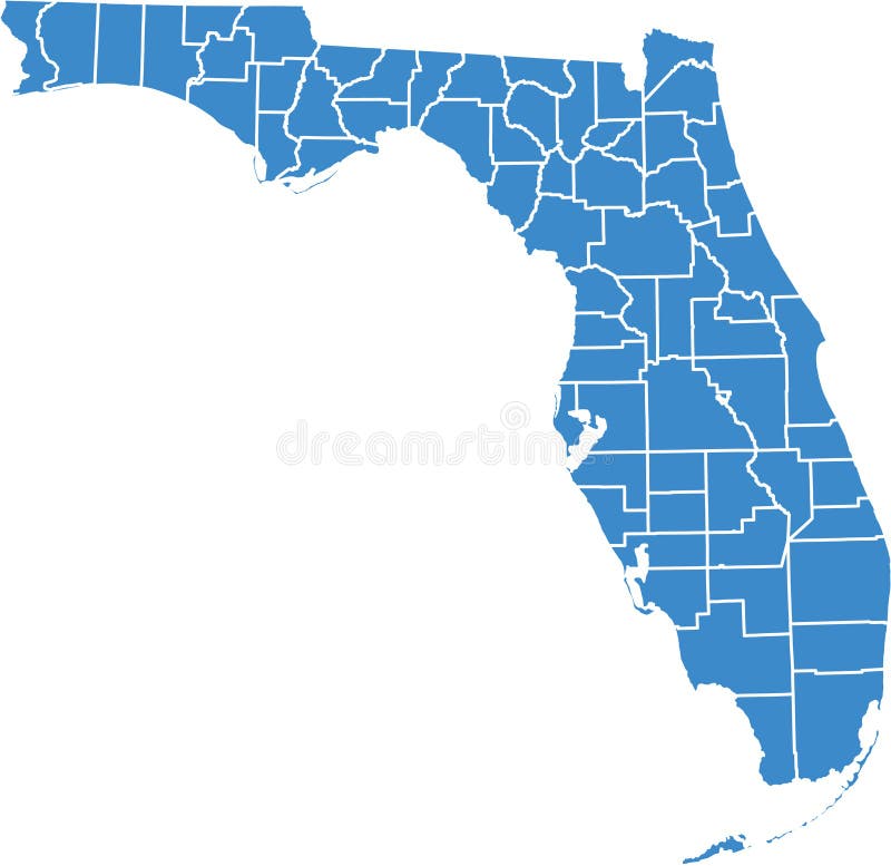
Free with trial Florida by counties. County by county florida, vector option, to monitor state activity in different areas, can be used in flash and web. Marion vectors Florida by counties. County by county florida, vector option, to monitor state activity in different areas, can be used in flash and web
Free with trial Ohio Map. Illustration of the map of the Great State of Ohio, USA. Featuring its main cities, rivers, lakes and the highest peak of the state. Marion vectors Ohio Map. Illustration of the map of the Great State of Ohio, USA. Featuring its main cities, rivers, lakes and the highest peak of the state
Free with trial Indiana Map. Illustration of the map of the Great State of Indiana, USA. Featuring rivers, lakes and the highest peak of the state. Marion vectors Indiana Map. Illustration of the map of the Great State of Indiana, USA. Featuring rivers, lakes and the highest peak of the state
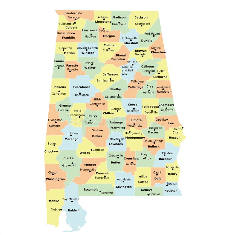
Free with trial Alabama county map. With 67 counties, county seats, and neighboring states. Marion vectors Alabama county map. With 67 counties, county seats, and neighboring states
Free with trial WPA poster art of Caddo Lake State Park with bald cypress trees on lake and bayou in Harrison and Marion County East Texas, United States of America USA done in works project administration style. Marion vectors Caddo Lake State Park with Bald Cypress Trees in Harrison and Marion County East Texas USA WPA Poster Art. WPA poster art of Caddo Lake State Park with bald. WPA poster art of Caddo Lake State Park with bald cypress trees on lake and bayou in Harrison and Marion County East Texas, United States of America USA done in works project administration style
Free with trial WPA poster art of Bull Shoals-White River State Park with the best trout fishing stream in Baxter and Marion Counties in Arkansas United States done in works project administration style. Marion vectors Bull Shoals-White River State Park with the Best Trout Fishing Stream in Baxter and Marion Counties in Arkansas WPA Poster Art. WPA poster art of Bull Shoals. WPA poster art of Bull Shoals-White River State Park with the best trout fishing stream in Baxter and Marion Counties in Arkansas United States done in works project administration style
Free with trial Francis Marion who was a military officer in the American Revolutionary War ambushing the enemy,vintage line drawing or engraving illustration. Marion vectors Marion Ambush,vintage illustration. Francis Marion who was a military officer in the American Revolutionary War ambushing the enemy,vintage line drawing or. Francis Marion who was a military officer in the American Revolutionary War ambushing the enemy,vintage line drawing or engraving illustration
Free with trial Streets of Indianapolis, city map, capital city, Indiana. Streets and urban area. Usa. The city is the capital and most populous city of the U. S. state of Indiana and the seat of Marion County. Marion vectors Streets of Indianapolis, city map, capital city, Indiana. Streets and urban area. Usa. The city is the capital and most populous city of the U.S. state of
Free with trial Western Cape Province Provinces of South Africa, Republic of South Africa, Administrative divisions, RSA map vector illustration, scribble sketch Prince Edward Islands Marion, Prince Edward Island map. Marion vectors Western Cape Province map vector. Western Cape Province Provinces of South Africa, Republic of South Africa, Administrative divisions, RSA map vector. Western Cape Province Provinces of South Africa, Republic of South Africa, Administrative divisions, RSA map vector illustration, scribble sketch Prince Edward Islands Marion, Prince Edward Island map
Free with trial Valentine's Day of Robin Hood. At Valentine's Day for Marion to be entertained Robin Hood shoots a heart on head of a little boy. Marion vectors Valentine's Day of Robin Hood. At Valentine's Day for Marion to be entertained Robin Hood shoots a heart on head of a little boy
Free with trial Indiana counties, gray political map. State in the Midwestern region of the United States, subdivided into 92 counties. Nicknamed The Hoosier State. Map with borders and county names. Illustration. Marion vectors Indiana, U.S. state, subdivided into 92 counties, gray political map. Indiana counties, gray political map. State in the Midwestern region of the United States. Indiana counties, gray political map. State in the Midwestern region of the United States, subdivided into 92 counties. Nicknamed The Hoosier State. Map with borders and county names. Illustration
Free with trial City map Indianapolis, monochrome detailed plan, vector illustration, wall art tourist decorations. Marion vectors City map Indianapolis, monochrome detailed plan, vector illustration. Wall art tourist decorations
Free with trial Oregon, U. S. state, subdivided into 36 counties, multi colored political map with capital Salem, borders and county names. State in the Pacific Northwest region of the United States. The Beaver State. Marion vectors Oregon, U.S. state, subdivided into 36 counties, multi colored map. Oregon, U.S. state, subdivided into 36 counties, multi colored political map with capital. Oregon, U.S. state, subdivided into 36 counties, multi colored political map with capital Salem, borders and county names. State in the Pacific Northwest region of the United States. The Beaver State.
Free with trial U. S. states - map of South Carolina. Hand made. Rivers and lakes are shown. Please look at my other images of cartographic series - they are all very detailed and carefully drawn by hand WITH RIVERS AND LAKES. Marion vectors Map of South Carolina with lakes and rivers. U.S. states - map of South Carolina. Hand made. Rivers and lakes are shown. Please look at my other images of. U.S. states - map of South Carolina. Hand made. Rivers and lakes are shown. Please look at my other images of cartographic series - they are all very detailed and carefully drawn by hand WITH RIVERS AND LAKES.
Free with trial US Georgia State Map with 159 counties and county seats. Each county is an individual object. Marion vectors Georgia County Map with 159 counties. US Georgia State Map with 159 counties and county seats. Each county is an individual object. US Georgia State Map with 159 counties and county seats. Each county is an individual object.
Free with trial Arkansas Map. Political map of Arkansas in white color. Vector. Marion vectors Arkansas Map. Political map of Arkansas in white color. Vector
Free with trial Mario icon in trendy design style. mario icon isolated on white background. mario vector icon simple and modern flat symbol for. Web site, mobile, logo, app, UI. Marion vectors Mario icon in trendy design style. mario icon isolated on white background. mario vector icon simple and modern flat symbol for. Web site, mobile, logo, app, UI
Free with trial Usa, Charleston, Rainbow Row travel landmark vector illustration. Marion vectors Usa, Charleston, Rainbow Row travel landmark vector illustration. Usa, Charleston, Rainbow Row travel landmark line vector illustration
Free with trial Florida map icon vector trendy. Florida map travel icon education vector signage design illustration template trendy. Marion vectors Florida map icon vector trendy. Florida map travel icon education vector signage design illustration template trendy
Free with trial Hancock, Hamilton and Grant County, Indiana U. S. county, United States of America, USA, U. , US map vector illustration, scribble sketch Hancock, Hamilton and Grant map,. Marion vectors Hancock, Hamilton and Grant County, Indiana U.S. county, United States of America, USA, U.S., US map vector illustration,. Scribble sketch Hancock, Hamilton and
Free with trial 19 of 50 states of the United States with a name, nickname, and date admitted to the Union, Detailed Vector Indiana Map for printing posters, postcards and t-shirts. Marion vectors 19 of 50 states of the United States with a name, nickname, and date admitted to the Union, Detailed Vector Indiana Map for. Printing posters, postcards and t
Free with trial 19 of 50 states of the United States, divided into counties with territory nicknames, Detailed vector Indiana Map with name and date admitted to the Union, travel poster and postcard for design. Marion vectors 19 of 50 states of the United States, divided into counties with territory nicknames, Detailed vector Indiana Map with name and. Date admitted to the Union. 19 of 50 states of the United States, divided into counties with territory nicknames, Detailed vector Indiana Map with name and date admitted to the Union, travel poster and postcard for design
Free with trial Indianapolis official flag, Indiana state. United States of America. Indy, Circle City, Naptown, Railroad City, Crossroads of America. Marion vectors Flag of Indianapolis, Indiana. United States of America. Indianapolis official flag, Indiana state. United States of America. Indy, Circle City, Naptown. Indianapolis official flag, Indiana state. United States of America. Indy, Circle City, Naptown, Railroad City, Crossroads of America
Free with trial Set of vector icons. Flags and seals of Iowa state, USA. 3D illustration. Marion vectors Set of vector icons. Flags and seals of Iowa state, USA. 3D illustration
Free with trial Set of vector icons. Flags and seals of Florida state, USA. 3D illustration. Marion vectors Set of vector icons. Flags and seals of Florida state, USA. 3D illustration
Free with trial Marion City Map, Texas, USA. Modern flat vector map of Marion, Texas, United States. Detailed city boundary silhouette in grey on a white background. Marion vectors Marion City Map, Texas, USA. Modern flat vector map of Marion, Texas, United States. Detailed city boundary silhouette in grey on a white background
Free with trial Marion County Map, Texas, USA. Modern flat vector map of Marion County, Texas, United States. Detailed county boundary silhouette in grey on a white background. Marion vectors Marion County Map, Texas, USA. Modern flat vector map of Marion County, Texas, United States. Detailed county boundary silhouette in grey on a white background
Free with trial Modern flat vector map of Marion Independent School District, Texas, United States. Detailed district boundary silhouette in grey on a white background. Marion vectors Marion Independent School District Map, Texas, USA. Modern flat vector map of Marion Independent School District, Texas, United States. Detailed district. Modern flat vector map of Marion Independent School District, Texas, United States. Detailed district boundary silhouette in grey on a white background
Free with trial Marion outline map. Marion (New York) blank outline map. Marion vectors Marion outline map. Marion (New York) blank outline map. Marion (New York) blank outline map
Free with trial Marion Oaks outline map. Marion Oaks (Florida) blank outline map. Marion vectors Marion Oaks outline map. Marion Oaks (Florida) blank outline map. Marion Oaks (Florida) blank outline map
Free with trial Four views of Marion County Alabama map. Outline, solid black silhouette, and pixelated versions. Clean graphic for geographic presentations. Marion vectors Marion county alabama map silhouette outline black solid dots graphic for design. Four views of Marion County Alabama map. Outline, solid black silhouette, and. Four views of Marion County Alabama map. Outline, solid black silhouette, and pixelated versions. Clean graphic for geographic presentations
Free with trial Marion outline map. Marion (Kansas) blank outline map. Marion vectors Marion outline map. Marion (Kansas) blank outline map. Marion (Kansas) blank outline map
Free with trial Marion outline map. Marion (Kentucky) blank outline map. Marion vectors Marion outline map. Marion (Kentucky) blank outline map. Marion (Kentucky) blank outline map
Free with trial Marion outline map. Marion (Montana) blank outline map. Marion vectors Marion outline map. Marion (Montana) blank outline map. Marion (Montana) blank outline map
Free with trial Marion outline map. Marion (North Carolina) blank outline map. Marion vectors Marion outline map. Marion (North Carolina) blank outline map. Marion (North Carolina) blank outline map
Free with trial Map of Marion County in Georgia, USA. Arranged in a circle. Marion vectors Map of Marion County in Georgia, USA. Arranged in a circle
Free with trial Large and detailed map of Marion County in Georgia, USA. Marion vectors Large and detailed map of Marion County in Georgia. USA
Free with trial Map of Marion County in Georgia USA. Detailed infographic and map of Marion County in Georgia USA. Marion vectors Map of Marion County in Georgia USA. Detailed infographic and map of Marion County in Georgia USA
Free with trial Map of the County Marion (Indiana, United States). Symbol Map Of the County Marion (Indiana, US) showing the County with a few black dots. Marion vectors Map of the County Marion (Indiana, United States). Symbol Map Of the County Marion (Indiana, US) showing the County with a few black dots
Free with trial Map of the County Marion (Illinois, United States). Symbol Map Of the County Marion (Illinois, US) showing the County with a few black dots. Marion vectors Map of the County Marion (Illinois, United States). Symbol Map Of the County Marion (Illinois, US) showing the County with a few black dots
Free with trial Marion outline map. Marion (Arkansas) blank outline map. Marion vectors Marion outline map. Marion (Arkansas) blank outline map. Marion (Arkansas) blank outline map
Free with trial Marion outline map. Marion (Illinois) blank outline map. Marion vectors Marion outline map. Marion (Illinois) blank outline map. Marion (Illinois) blank outline map
Free with trial Marion outline map. Marion County (Florida) blank outline map. Marion vectors Marion outline map. Marion County (Florida) blank outline map. Marion County (Florida) blank outline map
Free with trial Marion outline map. Marion County (Illinois) blank outline map. Marion vectors Marion outline map. Marion County (Illinois) blank outline map. Marion County (Illinois) blank outline map
Free with trial Marion outline map. Marion County (Mississippi) blank outline map. Marion vectors Marion outline map. Marion County (Mississippi) blank outline map. Marion County (Mississippi) blank outline map
Free with trial Marion outline map. Marion County (South Carolina) blank outline map. Marion vectors Marion outline map. Marion County (South Carolina) blank outline map. Marion County (South Carolina) blank outline map
Free with trial Map of the County Marion (Kentucky, United States). Symbol Map of the County Marion (Kentucky, US) showing the County with a few black horizontal lines. Marion vectors Map of the County Marion (Kentucky, United States). Symbol Map of the County Marion (Kentucky, US) showing the County with a few black horizontal lines
Free with trial Marion outline map. Marion (Alabama) blank outline map. Marion vectors Marion outline map. Marion (Alabama) blank outline map. Marion (Alabama) blank outline map
Free with trial Map of the County Marion (Alabama, United States). Symbol Map of the County Marion (Alabama, US) showing the County with a few black horizontal lines. Marion vectors Map of the County Marion (Alabama, United States). Symbol Map of the County Marion (Alabama, US) showing the County with a few black horizontal lines
Free with trial Map of the County Marion (Arkansas, United States). Symbol Map of the County Marion (Arkansas, US) showing the County with a few black horizontal lines. Marion vectors Map of the County Marion (Arkansas, United States). Symbol Map of the County Marion (Arkansas, US) showing the County with a few black horizontal lines
Free with trial Map of the County Marion (Illinois, United States). Symbol Map of the County Marion (Illinois, US) showing the County with a few black horizontal lines. Marion vectors Map of the County Marion (Illinois, United States). Symbol Map of the County Marion (Illinois, US) showing the County with a few black horizontal lines
Free with trial Map of the County Marion (Iowa, United States). Symbol Map Of the County Marion (Iowa, US) showing the County with a few black dots. Marion vectors Map of the County Marion (Iowa, United States). Symbol Map Of the County Marion (Iowa, US) showing the County with a few black dots
Free with trial Map of the County Marion (Iowa, United States). Symbol Map Of the County Marion (Iowa, US) showing the County with a few black dots. Marion vectors Map of the County Marion (Iowa, United States). Symbol Map Of the County Marion (Iowa, US) showing the County with a few black dots
Free with trial Map of the County Marion (Georgia, United States). Symbol Map Of the County Marion (Georgia, US) showing the County with a few black dots. Marion vectors Map of the County Marion (Georgia, United States). Symbol Map Of the County Marion (Georgia, US) showing the County with a few black dots
Free with trial Map of the County Marion (Indiana, United States). Symbol Map Of the County Marion (Indiana, US) showing the County with a few black dots. Marion vectors Map of the County Marion (Indiana, United States). Symbol Map Of the County Marion (Indiana, US) showing the County with a few black dots
Free with trial Map of the County Marion (Alabama, United States). Symbol Map Of the County Marion (Alabama, US) showing the County with a few black dots. Marion vectors Map of the County Marion (Alabama, United States). Symbol Map Of the County Marion (Alabama, US) showing the County with a few black dots
Free with trial Map of the County Marion (Florida, United States). Symbol Map Of the County Marion (Florida, US) showing the County with a few black dots. Marion vectors Map of the County Marion (Florida, United States). Symbol Map Of the County Marion (Florida, US) showing the County with a few black dots
Free with trial Map of the County Marion (Alabama, United States). Symbol Map Of the County Marion (Alabama, US) showing the County with a few black dots. Marion vectors Map of the County Marion (Alabama, United States). Symbol Map Of the County Marion (Alabama, US) showing the County with a few black dots
Free with trial Map of the County Marion (Georgia, United States). Symbol Map Of the County Marion (Georgia, US) showing the County with a few black dots. Marion vectors Map of the County Marion (Georgia, United States). Symbol Map Of the County Marion (Georgia, US) showing the County with a few black dots
Free with trial Map of the County Marion (Florida, United States). Symbol Map Of the County Marion (Florida, US) showing the County with a few black dots. Marion vectors Map of the County Marion (Florida, United States). Symbol Map Of the County Marion (Florida, US) showing the County with a few black dots
Free with trial Map of the County Marion (Arkansas, United States). Symbol Map Of the County Marion (Arkansas, US) showing the County with a few black dots. Marion vectors Map of the County Marion (Arkansas, United States). Symbol Map Of the County Marion (Arkansas, US) showing the County with a few black dots
Free with trial Map of the County Marion (Illinois, United States). Symbol Map Of the County Marion (Illinois, US) showing the County with a few black dots. Marion vectors Map of the County Marion (Illinois, United States). Symbol Map Of the County Marion (Illinois, US) showing the County with a few black dots
Free with trial Map of Marion County in Florida, USA arranged in a circle. Marion vectors Map of Marion County in Florida, USA. Map of Marion County in Florida, USA arranged in a circle. Map of Marion County in Florida, USA arranged in a circle.
Free with trial Marion outline map. Marion County (Missouri) blank outline map. Marion vectors Marion outline map. Marion County (Missouri) blank outline map. Marion County (Missouri) blank outline map
Free with trial Large and detailed map of Marion County in Florida. USA. Marion vectors Large and detailed map of Marion County in Florida. USA
Free with trial Marion outline map. Marion County (Illinois) blank outline map. Marion vectors Marion outline map. Marion County (Illinois) blank outline map. Marion County (Illinois) blank outline map
Free with trial Marion outline map. Marion County (Iowa) blank outline map. Marion vectors Marion outline map. Marion County (Iowa) blank outline map. Marion County (Iowa) blank outline map
Free with trial Marion outline map. Marion County (Missouri) blank outline map. Marion vectors Marion outline map. Marion County (Missouri) blank outline map. Marion County (Missouri) blank outline map
Free with trial Marion outline map. Marion County (Tennessee) blank outline map. Marion vectors Marion outline map. Marion County (Tennessee) blank outline map. Marion County (Tennessee) blank outline map
Free with trial Marion outline map. Marion County (Oregon) blank outline map. Marion vectors Marion outline map. Marion County (Oregon) blank outline map. Marion County (Oregon) blank outline map
Free with trial Marion outline map. Marion County (Ohio) blank outline map. Marion vectors Marion outline map. Marion County (Ohio) blank outline map. Marion County (Ohio) blank outline map
Free with trial Marion outline map. Marion County (Texas) blank outline map. Marion vectors Marion outline map. Marion County (Texas) blank outline map. Marion County (Texas) blank outline map
Free with trial Map of the County Marion (Texas, United States). Symbol Map of the County Marion (Texas, US) showing the County with a few black horizontal lines. Marion vectors Map of the County Marion (Texas, United States). Symbol Map of the County Marion (Texas, US) showing the County with a few black horizontal lines
Free with trial Map of the County Marion (Oregon, United States). Symbol Map of the County Marion (Oregon, US) showing the County with a few black horizontal lines. Marion vectors Map of the County Marion (Oregon, United States). Symbol Map of the County Marion (Oregon, US) showing the County with a few black horizontal lines
Free with trial Map of the County Marion (Kansas, United States). Symbol Map of the County Marion (Kansas, US) showing the County with a few black horizontal lines. Marion vectors Map of the County Marion (Kansas, United States). Symbol Map of the County Marion (Kansas, US) showing the County with a few black horizontal lines
Free with trial Marion outline map. Marion County (Arkansas) outline map set. Marion vectors Marion outline map. Marion County (Arkansas) outline map set. Marion County (Arkansas) outline map set
Free with trial Map of the County Marion (Missouri, United States). Symbol Map of the County Marion (Missouri, US) showing the County with a few black horizontal lines. Marion vectors Map of the County Marion (Missouri, United States). Symbol Map of the County Marion (Missouri, US) showing the County with a few black horizontal lines
Free with trial Symbol Map of the County Marion (South Carolina, US) showing the County with a few black horizontal lines. Marion vectors Map of the County Marion (South Carolina, United States). Symbol Map of the County Marion (South Carolina, US) showing the County with a few black horizontal. Symbol Map of the County Marion (South Carolina, US) showing the County with a few black horizontal lines
Free with trial Marion outline map. Marion (South Australia) outline map set. Marion vectors Marion outline map. Marion (South Australia) outline map set. Marion (South Australia) outline map set
Free with trial Map of the County Marion (Mississippi, United States). Symbol Map of the County Marion (Mississippi, US) showing the County with a few black horizontal lines. Marion vectors Map of the County Marion (Mississippi, United States). Symbol Map of the County Marion (Mississippi, US) showing the County with a few black horizontal lines
 Sign in