Free with trial Cartoon Garbage Truck. Isolated on white background. Available EPS-10 vector format separated by groups and layers for easy edit. Municipalities vectors Cartoon Garbage Truck. Isolated on white background. Available EPS-10 vector format separated by groups and layers for easy edit
Free with trial Limburg - province of the Netherlands. Administrative division of the Netherlands. Map of Limburg with municipalities. Municipalities vectors Limburg - province of the Netherlands. Administrative division of the Netherlands. Map of Limburg with municipalities
Free with trial South Holland - province of the Netherlands. Administrative division of the Netherlands. Map of South Holland with municipalities. Municipalities vectors South Holland - province of the Netherlands. Administrative division of the Netherlands. Map of South Holland with municipalities
Free with trial North Brabant - province of the Netherlands. Administrative division of the Netherlands. Map of North Brabant with municipalities. Municipalities vectors North Brabant - province of the Netherlands. Administrative division of the Netherlands. Map of North Brabant with municipalities
Free with trial Gelderland - province of the Netherlands. Administrative division of the Netherlands. Map of Gelderland with municipalities. Municipalities vectors Gelderland - province of the Netherlands. Administrative division of the Netherlands. Map of Gelderland with municipalities
Free with trial Overijssel - province of the Netherlands. Administrative division of the Netherlands. Map of Overijssel with municipalities. Municipalities vectors Overijssel - province of the Netherlands. Administrative division of the Netherlands. Map of Overijssel with municipalities
Free with trial North Holland - province of the Netherlands. Administrative division of the Netherlands. Map of North Holland with municipalities. Municipalities vectors North Holland - province of the Netherlands. Administrative division of the Netherlands. Map of North Holland with municipalities
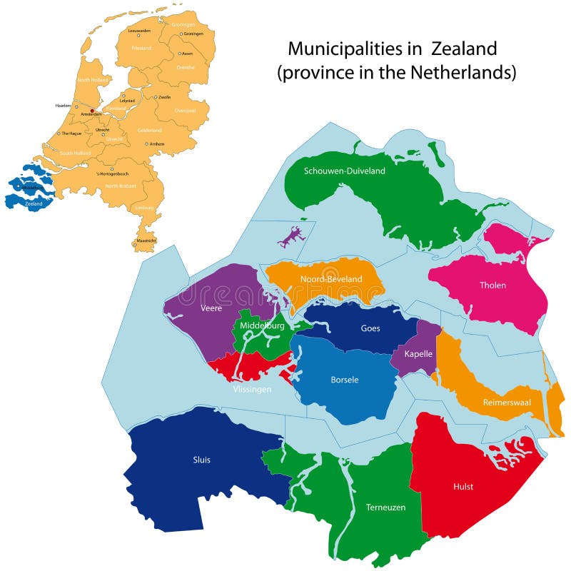
Free with trial Zealand - province of the Netherlands. Administrative division of the Netherlands. Map of Zealand with municipalities. Municipalities vectors Zealand - province of the Netherlands. Administrative division of the Netherlands. Map of Zealand with municipalities
Free with trial Drenthe - province of the Netherlands. Administrative division of the Netherlands. Map of Drenthe with municipalities. Municipalities vectors Drenthe - province of the Netherlands. Administrative division of the Netherlands. Map of Drenthe with municipalities
Free with trial Friesland - province of the Netherlands. Administrative division of the Netherlands. Map of Friesland with municipalities. Municipalities vectors Friesland - province of the Netherlands. Administrative division of the Netherlands. Map of Friesland with municipalities
Free with trial Groningen - province of the Netherlands. Administrative division of the Netherlands. Map of Groningen with municipalities. Municipalities vectors Groningen - province of the Netherlands. Administrative division of the Netherlands. Map of Groningen with municipalities
Free with trial Puerto Rico map. Puerto Rico, officially the Commonwealth of Puerto Rico is a United States territory located in the northeastern Caribbean. Municipalities vectors Puerto Rico map. Puerto Rico, officially the Commonwealth of Puerto Rico is a United States territory located in the northeastern Caribbean
Free with trial Vector map of People's Republic of China (PRC). Municipalities vectors Vector map of People's Republic of China (PRC). Vector map of People's Republic of China PRC
Free with trial India map. Outline illustration country map with state names and their capital cities. Municipalities vectors India map. Outline illustration country map with state names and their capital cities
Free with trial Map of Belgium. Belgium map with administrative division into provinces. Brussels is the capital city, other cities are capitals of provinces. Municipalities vectors Map of Belgium. Belgium map with administrative division into provinces. Brussels is the capital city, other cities are capitals of provinces
Free with trial Map of Australia. With all important cities and administrative division into states. Municipalities vectors Map of Australia. With all important cities and administrative division into states
Free with trial Spain maps with markers. Set of the political Spain maps, markers and symbols for infographic. Municipalities vectors Spain maps with markers. Set of the political Spain maps, markers and symbols for infographic
Free with trial Canada maps with markers. Set of the political Canada maps, markers and symbols for infographic. Municipalities vectors Canada maps with markers. Set of the political Canada maps, markers and symbols for infographic
Free with trial Portugal maps with markers. Set of the political Portugal maps, markers and symbols for infographic. Municipalities vectors Portugal maps with markers. Set of the political Portugal maps, markers and symbols for infographic
Free with trial United Mexican States maps with markers. Set of the political Mexico maps, markers and symbols for infographic. Municipalities vectors United Mexican States maps with markers. Set of the political Mexico maps, markers and symbols for infographic
Free with trial Federative Republic of Brazil maps with markers. Set of the political Brazil maps, markers and symbols for infographic. Municipalities vectors Federative Republic of Brazil maps with markers. Set of the political Brazil maps, markers and symbols for infographic
Free with trial Italy map division by zones regions provinces and municipalities. Closed and perfectly editable polygons polygon fill and color paths editable at will. Levels. Political geographic map. Municipalities vectors Italy map division by zones regions provinces and municipalities. Closed and perfectly editable polygons. Polygon fill and color paths editable at will. Levels. Italy map division by zones regions provinces and municipalities. Closed and perfectly editable polygons polygon fill and color paths editable at will. Levels. Political geographic map
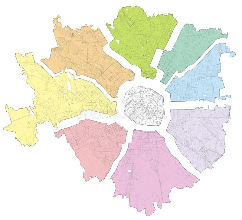
Free with trial Satellite map of Milan divided into zones and municipalities. Streets of the Lombard capital. Lombardy. Italy. Municipalities vectors Satellite map of Milan divided into zones and municipalities. Streets. Lombardy. Italy. Satellite map of Milan divided into zones and municipalities. Streets of. Satellite map of Milan divided into zones and municipalities. Streets of the Lombard capital. Lombardy. Italy
Free with trial Lombardy map division by provinces and municipalities. Closed and perfectly editable polygons polygon fill and color paths editable at will. Levels. Political geographic map. Italy. Municipalities vectors Lombardy map division by provinces and municipalities. Closed and perfectly editable polygons polygon fill and color paths editabl. E at will. Levels. Political
Free with trial Vector map of Mexico City with named Municipalities and travel icons. Municipalities vectors Map of Mexico City with Municipalities. Vector map of Mexico City with named Municipalities and travel icons. Vector map of Mexico City with named Municipalities and travel icons.
Free with trial Vector map of Portugal districts and autonomous regions, subdivided into municipalities. Each region have own color palette. Flag of Portugal. Municipalities vectors Vector map of Portugal districts and autonomous regions, subdivided into municipalities. Each region have own color palette. Flag. Of Portugal
Free with trial Utrecht - province of the Netherlands. Administrative division of the Netherlands. Map of Utrecht with municipalities. Municipalities vectors Utrecht - province of the Netherlands. Administrative division of the Netherlands. Map of Utrecht with municipalities
Free with trial Greater Vancouver map and municipalities, simple map. British Columbia, Canada. Tourist map or guide of Metro Vancouver BC. A simple grey scale map without text. Municipalities vectors Greater Vancouver map and municipalities, simple map. British Columbia, Canada. Tourist map or guide of Metro Vancouver BC. A simple grey scale map without text
Free with trial Vector map of Italy. On blue color tones. Municipalities vectors Vector map of Italy. On blue color tones
Free with trial Cartoon Garbage Truck. Isolated on white background. Available EPS-10 vector format separated by groups and layers for easy edit. Municipalities vectors Cartoon Garbage Truck. Isolated on white background. Available EPS-10 vector format separated by groups and layers for easy edit
Free with trial Iraq. Map of Iraq with provinces (governorates) in various colours and cities: Baghdad, Mosul, Karbala, Najaf and others. Municipalities vectors Iraq. Map of Iraq with provinces (governorates) in various colours and cities: Baghdad, Mosul, Karbala, Najaf and others
Free with trial Australia. Map of Australia with all important cities and administrative division into states. Municipalities vectors Australia. Map of Australia with all important cities and administrative division into states
Free with trial India. Map of India. Outline illustration country map with major cities (state capitals. Municipalities vectors India. Map of India. Outline illustration country map with major cities (state capitals
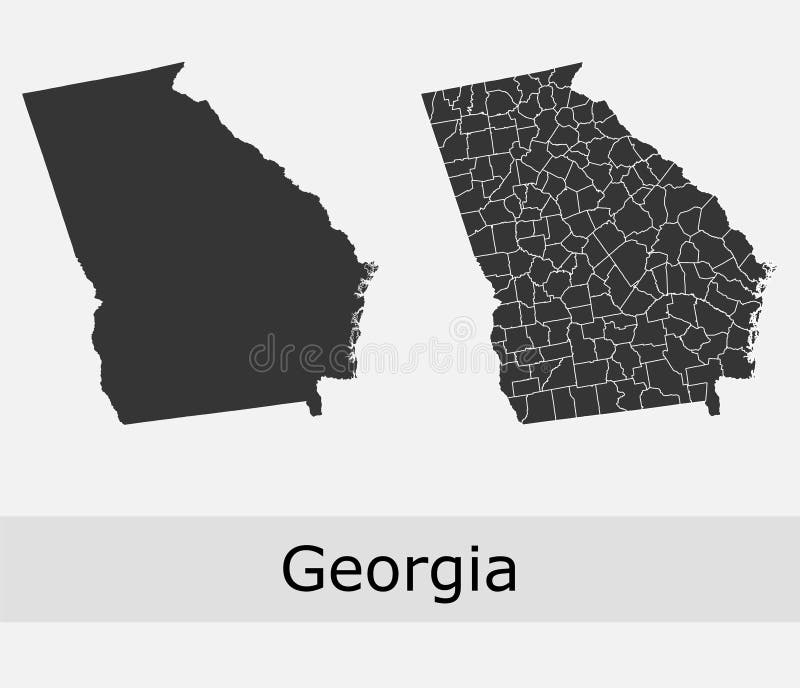
Free with trial Georgia counties vector map. Georgia vector maps of counties, its townships and regions, administrative borders. Municipalities vectors Georgia counties vector map. Georgia vector maps of counties, its townships and regions, administrative borders
Free with trial Regions in poland. Administration map of polish voivodeships in colors. Municipalities vectors Regions in poland. Administration map of polish voivodeships in colors
Free with trial Colombia maps with markers. Set of the political Colombia maps, markers and symbols for infographic. Municipalities vectors Colombia maps with markers. Set of the political Colombia maps, markers and symbols for infographic
Free with trial Belgrade municipalities - vector. Belgrade map - municipalities in vector format. Municipalities vectors Belgrade municipalities - vector. Belgrade map - municipalities in vector format
Free with trial Swiss map showing cantons, districts and municipalities borders. Municipalities vectors Swiss vector map showing cantons, districts and municipalities borders. Swiss map showing cantons, districts and municipalities borders. Swiss map showing cantons, districts and municipalities borders.
Free with trial Vector colorful map of Sweden municipalities colored by counties. Municipalities vectors Vector colorful map of Sweden municipalities colored by counties.
Free with trial Denmark municipalities vector map colored by regions, surrounded by neighbouring countries and territories. Municipalities vectors Denmark municipalities vector map colored by regions. Surrounded by neighbouring countries and territories
Free with trial Municipalities of Madrid administrative and political vector map. Municipalities vectors Municipalities of Madrid administrative and political vector map.
Free with trial Blank map of Presov Region. High quality map Presov Region with municipalities on transparent background for your web site design, logo, app, UI. Slovakia. EPS10. Municipalities vectors Blank map of Presov Region. High quality map Presov Region with municipalities on transparent background. For your web site design, logo, app, UI. Slovakia
Free with trial Municipalities of North Macedonia colored by regions with neighbouring countries and territories vector map. Municipalities vectors Municipalities of North Macedonia colored by regions with neighbouring countries and territories vector map.
Free with trial Municipalities of Slovenia colored by statistical regions vector map with neighbouring countries and territories. Municipalities vectors Municipalities of Slovenia colored by statistical regions vector map with neighbouring countries and territories.
Free with trial Map of botswana with the most important cities and municipalities. Map of the african state of botswana with the most important cities and municipalities. Municipalities vectors Map of botswana with the most important cities and municipalities. Map of the african state of botswana with the most important cities and municipalities
Free with trial Vector regional blank map of Montenegro with municipalities and administrative divisions, and neighbouring countries and territories. Editable and clearly labeled layers. Municipalities vectors Vector regional blank map of Montenegro with municipalities and administrative divisions, and neighbouring countries. And territories. Editable and clearly
Free with trial Blank map Province Zeeland of Netherlands. High quality map Zeeland with municipalities on transparent background for your web site design, logo, app, UI. EPS10. Municipalities vectors Blank map Province Zeeland of Netherlands. High quality map Zeeland with municipalities. On transparent background for your web site design, logo, app, UI
Free with trial Satellite map of Milan, streets and building of area number 1, municipalities number one. Lombardy. Italy. Municipalities vectors Satellite map of Milan, streets and building of area number 1, municipalities number one. Italy. Satellite map of Milan, streets and building of area number 1. Satellite map of Milan, streets and building of area number 1, municipalities number one. Lombardy. Italy
Free with trial Brazil state Parana administrative map showing municipalities colored by state regions mesoregions. Brazil state Parana administrative map showing municipalities. Municipalities vectors Brazil state Parana administrative map showing municipalities colored by state regions mesoregions. Brazil state Parana administrative map showing municipalities
Free with trial Italy municipalities isometric map colored by administrative regions with neighbouring countries. Vector illustration. Municipalities vectors Italy municipalities isometric map colored by administrative regions with neighbouring countries. Vector illustration
Free with trial Brazil state Rio Grande do Sul administrative map showing municipalities colored by state regions mesoregions. Brazil state Rio Grande do Sul administrative map. Municipalities vectors Brazil state Rio Grande do Sul administrative map showing municipalities colored by state regions mesoregions. Brazil state Rio Grande do Sul administrative map
Free with trial Italy map, division by zones, regions, provinces and municipalities. Closed and perfectly editable polygons, polygon fill and color paths editable at will. Levels. Political geographic map. Municipalities vectors Italy map, division by zones, regions, provinces and municipalities. Closed and perfectly editable polygons, polygon fill and color paths editable at will
Free with trial Satellite map of Milan zones and municipalities. Streets of the Lombard capital. Lombardy. Italy. Municipalities vectors Satellite map of Milan, zones and municipalities. Streets. Lombardy. Italy. Satellite map of Milan zones and municipalities. Streets of the Lombard capital. Satellite map of Milan zones and municipalities. Streets of the Lombard capital. Lombardy. Italy
Free with trial Satellite map of Milan, streets and building of area number 6, municipalities number six. Lombardy. Italy. Municipalities vectors Satellite map of Milan, streets and building of area number 6, municipalities number six. Italy. Satellite map of Milan, streets and building of area number 6. Satellite map of Milan, streets and building of area number 6, municipalities number six. Lombardy. Italy
Free with trial Lazio map, division by provinces and municipalities. Closed and perfectly editable polygons, polygon fill and color paths editable at will. Levels. Political geographic map. Italy. Municipalities vectors Lazio map, division by provinces and municipalities. Closed and perfectly editable polygons. italy. Lazio map, division by provinces and municipalities. Closed. Lazio map, division by provinces and municipalities. Closed and perfectly editable polygons, polygon fill and color paths editable at will. Levels. Political geographic map. Italy
Free with trial Blank map Province East Flanders of Belgium. High quality map East Flanders with municipalities on transparent background for your web site design, logo, app, UI. EPS10. Municipalities vectors Blank map Province East Flanders of Belgium. High quality map East Flanders with municipalities on transparent background. For your web site design, logo, app
Free with trial Piedmont map, division by provinces and municipalities. Closed and perfectly editable polygons, polygon fill and color paths editable at will. Levels. Political geographic map. Italy. Municipalities vectors Piedmont map, division by provinces and municipalities. Italy. Piedmont map, division by provinces and municipalities. Closed and perfectly editable polygons. Piedmont map, division by provinces and municipalities. Closed and perfectly editable polygons, polygon fill and color paths editable at will. Levels. Political geographic map. Italy
Free with trial Blank map Guayas Province of Ecuador. High quality map Guayas with municipalities on transparent background for your web site design, logo, app, UI. Ecuador. EPS10. Municipalities vectors Blank map Guayas Province of Ecuador. High quality map Guayas with municipalities on transparent background. For your web site design, logo, app, UI. Ecuador
Free with trial Satellite view of the Municipalities in the province of Monza e Brianza, map. Lombardy, Italy. Municipalities vectors Satellite view of the Municipalities, Monza e Brianza, map. Lombardy, Italy. Satellite view of the Municipalities in the province of Monza e Brianza, map. Satellite view of the Municipalities in the province of Monza e Brianza, map. Lombardy, Italy
Free with trial Blank map Lazio of Italy. High quality map Region Lazio with municipalities on transparent background. For your web site design, logo, app, UI. EPS10. Municipalities vectors Blank map Lazio of Italy. High quality map Region Lazio with municipalities on transparent background. For your web site design, logo, app, UI. EPS10
Free with trial Satellite map of Rome divided into areas and municipalities. Streets of the capital. Lazio. Italy. Municipalities vectors Satellite map of Rome divided into areas and municipalities. Streets. Italy. Satellite map of Rome divided into areas and municipalities. Streets of the capital. Satellite map of Rome divided into areas and municipalities. Streets of the capital. Lazio. Italy
Free with trial Valencian Community map, autonomous community in Spain. Spanish administrative division, regions, boroughs and municipalities. Municipalities vectors Valencian Community map, autonomous community in Spain. Spanish administrative regions and municipalities. Valencian Community map, autonomous community in Spain. Valencian Community map, autonomous community in Spain. Spanish administrative division, regions, boroughs and municipalities
Free with trial Satellite map of Milan, streets and building of area number 2, municipalities number two. Lombardy. Italy. Municipalities vectors Satellite map of Milan, streets and building of area number 2, municipalities number two. Lombardy. Italy
Free with trial Blank map Marche of Italy. High quality map Region Marche with municipalities. On transparent background for your web site design, logo, app, UI. EPS10. Municipalities vectors Blank map Marche of Italy. High quality map Region Marche with municipalities. On transparent background for your web site design, logo, app, UI. EPS10
Free with trial Satellite map of Milan, streets and building of area number 4, municipalities number four. Lombardy. Italy. Municipalities vectors Satellite map of Milan, streets and building of area number 4, municipalities number four. Italy. Satellite map of Milan, streets and building of area number 4. Satellite map of Milan, streets and building of area number 4, municipalities number four. Lombardy. Italy
Free with trial Satellite map of Milan, streets and building of area number 5, municipalities number five. Lombardy. Italy. Municipalities vectors Satellite map of Milan, streets and building of area number 5, municipalities number five. Italy. Satellite map of Milan, streets and building of area number 5. Satellite map of Milan, streets and building of area number 5, municipalities number five. Lombardy. Italy
Free with trial Satellite map of Milan, streets and building of area number 7, municipalities number seven. Lombardy. Italy. Municipalities vectors Satellite map of Milan, streets and building of area number 7, municipalities number seven. Italy. Satellite map of Milan, streets and building of area number 7. Satellite map of Milan, streets and building of area number 7, municipalities number seven. Lombardy. Italy
Free with trial Satellite map of Milan, streets and building of area number 3, municipalities number three. Lombardy. Italy. Municipalities vectors Satellite map of Milan, streets and building of area number 3, municipalities number three. Italy. Satellite map of Milan, streets and building of area number 3. Satellite map of Milan, streets and building of area number 3, municipalities number three. Lombardy. Italy
Free with trial Satellite map of Milan, streets and building of area number 8, municipalities number eight. Lombardy. Italy. Municipalities vectors Satellite map of Milan, streets and building of area number 8, municipalities number eight. Italy. Satellite map of Milan, streets and building of area number 8. Satellite map of Milan, streets and building of area number 8, municipalities number eight. Lombardy. Italy
Free with trial Liguria map, division by provinces and municipalities. Closed and perfectly editable polygons, polygon fill and color paths editable at will. Levels. Political geographic map. Italy. Municipalities vectors Liguria map, division by provinces and municipalities. Italy. Liguria map, division by provinces and municipalities. Closed and perfectly editable polygons. Liguria map, division by provinces and municipalities. Closed and perfectly editable polygons, polygon fill and color paths editable at will. Levels. Political geographic map. Italy
Free with trial Blank map State Selangor of Malaysia. High quality map Selangor with municipalities on transparent background for your web site design, logo, app, UI. Malaysia. EPS10. Municipalities vectors Blank map State Selangor of Malaysia. High quality map Selangor with municipalities on transparent background for your web site d. Esign, logo, app, UI
Free with trial Valle d’Aosta map, division by provinces and municipalities. Closed and perfectly editable polygons, polygon fill and color paths editable at will. Levels. Political geographic map. Italy. Municipalities vectors Valle d’Aosta map, division by provinces and municipalities. Italy. Valle d’Aosta map, division by provinces and municipalities. Closed and perfectly. Valle d’Aosta map, division by provinces and municipalities. Closed and perfectly editable polygons, polygon fill and color paths editable at will. Levels. Political geographic map. Italy
Free with trial Trentino-Alto Adige map, division by provinces and municipalities. Closed and perfectly editable polygons, polygon fill and color paths editable at will. Levels. Political geographic map. Italy. Municipalities vectors Trentino-Alto Adige map, division by provinces and municipalities. Italy. Trentino-Alto Adige map, division by provinces and municipalities. Closed and perfectly. Trentino-Alto Adige map, division by provinces and municipalities. Closed and perfectly editable polygons, polygon fill and color paths editable at will. Levels. Political geographic map. Italy
Free with trial Galicia map, autonomous community in Spain. Spanish administrative division, regions, boroughs and municipalities. Municipalities vectors Galicia map, autonomous community in Spain. Spanish administrative regions and municipalities. Galicia map, autonomous community in Spain. Spanish administrative. Galicia map, autonomous community in Spain. Spanish administrative division, regions, boroughs and municipalities
Free with trial Blank map Province Walloon Brabant of Belgium. High quality map Walloon Brabant with municipalities on transparent background for your web site design, logo, app, UI. EPS10. Municipalities vectors Blank map Province Walloon Brabant of Belgium. High quality map Walloon Brabant with municipalities. On transparent background for your web site design, logo
Free with trial Baden-Wurttemberg map, German state. Germany administrative division, regions and boroughs, amt and municipalities. Municipalities vectors Baden-Wurttemberg map, German state. Germany administrative regions and boroughs, amt, municipalities. Baden-Wurttemberg map, German state. Germany. Baden-Wurttemberg map, German state. Germany administrative division, regions and boroughs, amt and municipalities
Free with trial Blank map Tungurahua Province of Ecuador. High quality map Tungurahua with municipalities on transparent background for your web site design, logo, app, UI. Ecuador. EPS10. Municipalities vectors Blank map Tungurahua Province of Ecuador. High quality map Tungurahua with municipalities. On transparent background for your web site design, logo, app, UI
Free with trial Region of Murcia map, autonomous community in Spain. Spanish administrative division, regions, boroughs and municipalities. Municipalities vectors Region of Murcia map, autonomous community in Spain. Spanish administrative regions and municipalities. Region of Murcia map, autonomous community in Spain. Region of Murcia map, autonomous community in Spain. Spanish administrative division, regions, boroughs and municipalities
Free with trial Blank map Amazonas of Brazil. High quality map Amazonas with municipalities on transparent background for your web site design, lo. Go, app, UI. Brazil. EPS10. Municipalities vectors Blank map Amazonas of Brazil. High quality map Amazonas with municipalities on transparent background for your web site design, lo. Go, app, UI. Brazil. EPS10
Free with trial Sicily map, division by provinces and municipalities. Closed and perfectly editable polygons, polygon fill and color paths editable at will. Levels. Political geographic map. Italy. Municipalities vectors Sicily map, division by provinces and municipalities. Closed and perfectly editable polygons, Italy. Sicily map, division by provinces and municipalities. Closed. Sicily map, division by provinces and municipalities. Closed and perfectly editable polygons, polygon fill and color paths editable at will. Levels. Political geographic map. Italy
 Sign in